 Block
From the record
One of 663 National Register listings published here for St. Louis County · listed in 2010 · category: District.
Sources: the case file at the National Archives · the National Register database, National Park Service
Listed on the National Register of Historic Places in 2010.
One of 663 National Register listings published here for St. Louis County · listed in 2010 · category: District.
Sources: the case file at the National Archives · the National Register database, National Park Service
Regional context, not property-specific evidence. The federal mineral resources record lists 20 workings within 5 miles of Ladue Estates: 19 past producers, 1 producer. 1 still produces. What was taken out: Stone, Crushed/Broken, Clay. Distance is straight-line from the map coordinates, so a quarry counted here may appear on a neighbouring settlement's page as well.
| Where | Site | Commodity | Status | Recorded |
|---|---|---|---|---|
| Alton Brick Co Pit & Plant | Clay | Producer | ||
| Unknown - Clay | Clay | Past Producer | ||
| Creve Coeur Quarry | Stone, Crushed/Broken | Past Producer | ||
| Fern Ridge Quarry | Stone, Crushed/Broken | Past Producer | ||
| Kempf Quarry | Stone, Crushed/Broken | Past Producer | ||
| Rock Hill Quarry | Stone, Crushed/Broken | Past Producer | ||
| Unknown - Ls | Stone, Crushed/Broken | Past Producer | ||
| Unknown - Ls | Stone, Crushed/Broken | Past Producer | ||
| Unknown - Ls | Stone, Crushed/Broken | Past Producer | ||
| Unknown - Ls | Stone, Crushed/Broken | Past Producer |
Regional context, not property-specific evidence. The National Weather Service names Creve Coeur, the town this property stands in, in 31 storm reports between 1998 and 2019: 17 hail, 12 thunderstorm wind, 1 lightning, 1 tornado. No death or injury is recorded in these reports. Each account below is quoted exactly as the forecast office filed it, from the NOAA Storm Events Database, and each date opens the federal record of that event.
| When | Event | Place named | Harm | What the report says |
|---|---|---|---|---|
| May 2004 | Thunderstorm Wind | Creve Coeur | $150,000 | no account filed |
| October 2001 | Hail | Creve Coeur | $100,000 | no account filed |
| May 2013 | Thunderstorm Wind | Creve Coeur | - | Thunderstorm winds snapped off a tree. Also, there was minor roof and gutter damage to one house. |
| June 2013 | Thunderstorm Wind | Creve Coeur | - | Thunderstorm winds blew down a bradford pear tree as well as several large limbs from another tree. |
| May 2008 | Hail | Creve Coeur | - | Storm spotters reported hail up to 1.5 inch at Olive Blvd and I-270. |
| June 2007 | Thunderstorm Wind | Creve Coeur | - | Storm spotters reported large tree limbs down in the Whispering Hills Subdivision. Half inch hail also fell. |
| June 2007 | Hail | Creve Coeur | - | A storm spotter reported 3/4 inch hail at Olive Blvd and I-270. |
| January 2006 | Tornado (F1) | Creve Coeur | - | A small tornado first caused damage about 5:25 am in Creve Coeur west of Warson Road and south of Olive Boulevard. One home suffered minor roof damage while another had windows blown in. The remainder of the 1 mile path consisted of tree and power line damage. |
| July 2006 | Thunderstorm Wind | Creve Coeur | - | A large tree was blown down on Craig Road. |
| July 2006 | Thunderstorm Wind | Creve Coeur | - | Numerous large tree limbs were blown down. |
| July 2004 | Thunderstorm Wind | Creve Coeur | - | Amateur radio spotters reported a large tree down on a home in Creve Coeur. |
| April 2003 | Hail | Creve Coeur | - | Storm spotters reported 3/4 inch hail. |
| April 2003 | Thunderstorm Wind | Creve Coeur | - | The St. Louis County Police reported power lines downed by broken tree limbs. |
| August 2003 | Lightning | Creve Coeur | - | A lightning strike started a fire that destroyed the roof of a building in the Charter Oaks Apartment complex. There were no injuries as the residents were all quickly evacuated. |
| April 1998 | Hail | Creve Coeur | - | A local meteorology company reported 1 inch hail covering their parking lot. |
| August 2019 | Hail | Creve Coeur | - | no account filed |
| March 2012 | Hail | Creve Coeur | - | no account filed |
| April 2011 | Hail | Creve Coeur | - | no account filed |
| June 2005 | Hail | Creve Coeur | - | no account filed |
| June 2005 | Hail | Creve Coeur | - | no account filed |
| August 2005 | Thunderstorm Wind | Creve Coeur | - | no account filed |
| September 2005 | Thunderstorm Wind | Creve Coeur | - | no account filed |
| May 2004 | Thunderstorm Wind | Creve Coeur | - | no account filed |
| May 2004 | Hail | Creve Coeur | - | no account filed |
| May 2004 | Hail | Creve Coeur | - | no account filed |
| May 2004 | Hail | Creve Coeur | - | no account filed |
| July 2004 | Thunderstorm Wind | Creve Coeur | - | no account filed |
| July 2004 | Hail | Creve Coeur | - | no account filed |
| July 2004 | Hail | Creve Coeur | - | no account filed |
| May 2003 | Hail | Creve Coeur | - | no account filed |
| May 1998 | Hail | Creve Coeur | - | no account filed |
No historic map-sheet match is published for this property yet. That does not mean no map exists. This record needs a coordinate-quality review before it can be joined to a sheet boundary. Browse the county's mapped places while that work is pending.
Other National Register properties close enough to walk or drive between, ordered by distance from this one. Both positions come from the same geocoding pass that matched these properties to their map sheets.
| Photograph | Property | Distance | Listed |
|---|---|---|---|
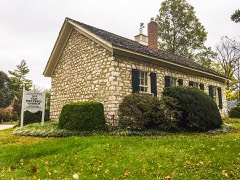 | Des Peres Presbyterian Church | 2.2 miles | 1978 |
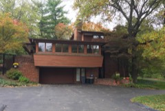 | Rudolph and Dorothy C. Czufin House | 2.8 miles | 2002 |
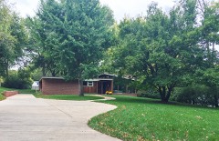 | Harry Hammerman House | 2.9 miles | 2008 |
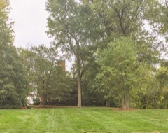 | Samuel Plant House | 3.0 miles | 1984 |
| Price School | 3.1 miles | 1985 | |
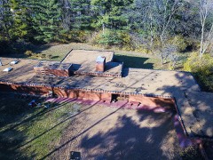 | Pappas, Theodore, A., House | 3.3 miles | 1979 |
| National Archives record | The nomination case file for reference 09000901 in Record Group 79. |
| St. Louis County | All 663 listed properties in this county. |