 Block
From the record
One of 22 National Register listings published here for Johnson County · listed in 2017 · category: District.
Sources: the National Register database, National Park Service
Listed on the National Register of Historic Places in 2017.
One of 22 National Register listings published here for Johnson County · listed in 2017 · category: District.
Sources: the National Register database, National Park Service
The chapter on Warrensburg Township in The History of Johnson County, Missouri : Including a Reliable History of the Townships, Cities, and Towns, Together with a Map of the County; a Condensed History of Missouri; the State Constitution; an Abstract of the Most Important Laws; the Physical Features of the County; the Early Settlers and Pioneers; the Political and War History; the Religious and Educational History...statistics and Miscellaneous Matters, Etc., Etc, published 1881 names Warrensburg. This is what it says, exactly as the scans read.
Warrensburg township is so intimately connected with the city of the same name, which stands near its center, that the history of the former is blended with that of the latter, and much equally applicable to the town¬ ship will also apply to Warrensburg City. The township derived its name and geographical position from the county seat, and is one of the oldest in the county, Jackson, Jefferson, Madison and Washington being only eighteen months older.
Warrensburg township, as at present constituted, is bounded on the north by Hazel Hill and Simpson townships, on the east by Washington, on the south by Post Oak and Chilhowee townships, and on the west by Center View township. It is more centrally located than any other town¬ ship except Center View. It is exactly midway in the county, north and south, but a little east of the geographical center. Technically defined its limits are as follows; beginning at the northeast corner of section 4, township 46, range 26; thence south to the southwest corner of section 16, township 45, range 26; thence east to the southeast corner of section 16, township 45, range 25 ; thence north to the place of beginning. Its length north and south, is nine miles, width east and west, seven miles, and con¬ tains 63 square miles, or 40,320 acres.
Machine-read from a century-old scan, so expect the errors a machine makes: misspelled names, dropped words, stray characters.
Read the whole chapter on Warrensburg Township - 5,328 words on its settlement, mills, schools and churches.
Regional context, not property-specific evidence. The federal wildfire occurrence database lists 58 fires within 5 miles of Holden and Pine Streets Commercial Historic District between 2003 and 2020, burning about 137 acres in total. 4 started naturally. 1 was recorded as arson. Distance is straight-line from the map coordinates, so a fire counted here may appear on a neighbouring settlement's page as well.
| Reported cause | Fires |
|---|---|
| Missing data/not specified/undetermined | 31 |
| Debris and open burning | 14 |
| Natural | 4 |
| Recreation and ceremony | 3 |
| Equipment and vehicle use | 3 |
| Other causes | 2 |
| Arson/incendiarism | 1 |
The most recent of them, most recent first, with the day each was reported and the service that recorded it.
| Date | Cause | Size | Reported by | Name on the report |
|---|---|---|---|---|
| 9 September 2003 | Equipment and vehicle use | 1.0 acres | Missouri State Fire Marshal's Office | not named |
| 5 September 2003 | Missing data/not specified/undetermined | under an acre | Missouri State Fire Marshal's Office | not named |
| 5 September 2003 | Missing data/not specified/undetermined | under an acre | Missouri State Fire Marshal's Office | not named |
| 23 September 2018 | Missing data/not specified/undetermined | under an acre | Missouri Department of Conservation | 177674-05130-09232018-1600 |
| 19 September 2003 | Missing data/not specified/undetermined | under an acre | Missouri State Fire Marshal's Office | not named |
| 3 August 2003 | Recreation and ceremony | 1.0 acres | Missouri State Fire Marshal's Office | not named |
| 26 August 2003 | Missing data/not specified/undetermined | under an acre | Missouri State Fire Marshal's Office | not named |
| 26 August 2003 | Debris and open burning | under an acre | Missouri State Fire Marshal's Office | not named |
Regional context, not property-specific evidence. The federal mineral resources record lists 9 workings within 5 miles of Holden and Pine Streets Commercial Historic District: 9 past producers. None of them still produces. What was taken out: Stone, Crushed/Broken. Distance is straight-line from the map coordinates, so a quarry counted here may appear on a neighbouring settlement's page as well.
| Where | Site | Commodity | Status | Recorded |
|---|---|---|---|---|
| Bruce Quarry | Stone, Crushed/Broken | Past Producer | ||
| Marr Quarry & Mill | Stone, Crushed/Broken | Past Producer | ||
| Pickel Quarry | Stone, Crushed/Broken | Past Producer | ||
| Unknown - Ls. | Stone, Crushed/Broken | Past Producer | ||
| Unknown - Ls. | Stone, Crushed/Broken | Past Producer | ||
| Unknown - Ls. | Stone, Crushed/Broken | Past Producer | ||
| Unknown - Ls. | Stone, Crushed/Broken | Past Producer | ||
| Unknown - Ls. | Stone, Crushed/Broken | Past Producer | ||
| Unknown - Ss. | Stone, Crushed/Broken | Past Producer |
Regional context, not property-specific evidence. The National Weather Service names Warrensburg, the town this property stands in, in 137 storm reports between 1993 and 2025: 71 hail, 54 thunderstorm wind, 7 flash flood, 4 tornado. No death or injury is recorded in these reports. Each account below is quoted exactly as the forecast office filed it, from the NOAA Storm Events Database, and each date opens the federal record of that event.
| When | Event | Place named | Harm | What the report says |
|---|---|---|---|---|
| April 2001 | Tornado (F1) | Warrensburg | $2,000,000 | A tornado moved across the north side of Warrensburg, damaging approximately 100 homes andbusinesses. No injuries or deaths were reported. The tornado was on the ground for 10 minutes, movingto the east. The path width ranged between 50 and 75 yards, and rear flank downdraft winds to the southof the tornado, caused minor damage to structures in downtown Warrensburg. |
| May 2003 | Tornado (F1) | Warrensburg | $25,000 | Tornado touchdown was observed one half mile northwest of the intersection of SE 401st Road and SE 300th Road, or near the city landfill. Damage of F1 intensity was noted at this location to a private business. The tornado continued northeast to near Whiteman Air Force Base before dissipating 1 mile northeast of the base. Damage along the path was rated F0 throughout this area, along the rest of the path. |
| July 2000 | Lightning | Warrensburg | $16,000 | A lightning strike killed 8 cattle at the Central Missouri State University Agricultural Research Farm. |
| April 2001 | Thunderstorm Wind | Warrensburg | $10,000 | Law enforcement reported 3/4 inch hail and power lines down. |
| March 2006 | Hail | Warrensburg | $10,000 | no account filed |
| June 2013 | Thunderstorm Wind | Warrensburg | $5,000 | Thunderstorm wind gusts were estimated up to 70 mph, with numerous power poles down in Warrensburg. |
| August 2008 | Thunderstorm Wind | Warrensburg | $5,000 | Numerous trees and power lines were reported down around Warrensburg. |
| March 2006 | Thunderstorm Wind | Warrensburg | $5,000 | Several highway signs down. |
| October 2004 | Tornado (F0) | Warrensburg | $5,000 | Tornado touchdown reported near 251 and BB Highway...2 southwest of Warrensburg. Barn partially destroyed. Tornado dissipated just south of Warrensburg. |
| October 2002 | Thunderstorm Wind | Warrensburg | $5,000 | Roof and gutter damage to mobile homes. |
| June 1995 | Thunderstorm Wind | Warrensburg | $5,000 | Severe thunderstorms moved through the area producing damaging winds. Trees were downed along Route H east of Fayetteville, and some large limbs were knocked down in Warrensburg. Some of these limbs landed on a mobile home, causing minor damage. |
| August 2004 | Hail | Warrensburg | $5,000 | no account filed |
| June 2001 | Thunderstorm Wind | Warrensburg | $5,000 | no account filed |
| June 1995 | Thunderstorm Wind | Warrensburg | $4,000 | Several power lines were downed by severe thunderstorms in the Warrensburg area. |
| May 2011 | Thunderstorm Wind | Warrensburg | $2,000 | The 100 block of Main Street, had two, three feet in diameter trees, blown down. The trees knocked down power lines. |
| June 2009 | Thunderstorm Wind | Warrensburg | $2,000 | Trees and power lines were reported down. |
| September 2013 | Thunderstorm Wind | Warrensburg | $1,000 | Trees and a power pole were reported blown down in town. Thunderstorm wind gusts were estimated up to 60 mph. |
| June 2008 | Thunderstorm Wind | Warrensburg | $1,000 | Tree and power pole were down due to high winds. |
| October 2004 | Thunderstorm Wind | Warrensburg | $1,000 | Power lines and 10 inch diameter trees downed. |
| October 2004 | Thunderstorm Wind | Warrensburg | $1,000 | Tractor trailer blown over on U.S. Highway 50 between Warrensburg and Knob Noster. |
| September 2001 | Thunderstorm Wind | Warrensburg | $1,000 | Numerous trees reported down across town. |
| August 2004 | Hail | Warrensburg | $1,000 | no account filed |
| May 2002 | Thunderstorm Wind | Warrensburg | $1,000 | no account filed |
| March 2025 | Thunderstorm Wind | Warrensburg | - | Propane station canopy blown down. |
| September 2025 | Thunderstorm Wind | Warrensburg | - | Social media report of a downed tree damaging three vehicles at the University of Central Missouri. |
| September 2025 | Thunderstorm Wind | Warrensburg | - | Utility company reports multiple trees and wires down north of Warrensburg. |
| September 2025 | Thunderstorm Wind | Warrensburg | - | Powerline down in Warrensburg. |
| September 2025 | Thunderstorm Wind | Warrensburg | - | Large tree and powerline down just NW of Warrensburg. |
| March 2024 | Hail | Warrensburg | - | Quarter sized hail was reported on the campus of the University of Central Missouri in Warrensburg. |
| March 2021 | Hail | Warrensburg | - | This report came from MPing. |
| June 2021 | Thunderstorm Wind | Warrensburg | - | NWS Employee near Warrensburg reported 60 mph wind. |
| August 2020 | Thunderstorm Wind | Warrensburg | - | A large tree limb was blown down onto a house. |
| August 2020 | Thunderstorm Wind | Warrensburg | - | A large tree was blown down along Highway 13, south of Hale Lake Road. |
| September 2020 | Thunderstorm Wind | Warrensburg | - | Public reported 60 mph winds. |
| June 2020 | Thunderstorm Wind | Warrensburg | - | Storm spotter in Warrensburg reported 67 mph wind with a stationary anemometer mounted to the vehicle. |
| June 2020 | Thunderstorm Wind | Warrensburg | - | A 75 foot tall oak tree snapped about 6 feet off the ground and fell into other nearby trees. |
| June 2019 | Thunderstorm Wind | Warrensburg | - | Storm chaser measured 73 mph wind. |
| August 2019 | Thunderstorm Wind | Warrensburg | - | Many large trees were down in Warrensburg. |
| September 2019 | Flash Flood | Warrensburg | - | Trained spotter reported several roads in and around University of Central Missouri with several inches of running water. |
| June 2018 | Thunderstorm Wind | Warrensburg | - | Several large trees were uprooted and down north of Warrensburg. |
| June 2018 | Thunderstorm Wind | Warrensburg | - | Trees and branches were down across portions of Warrensburg, along with power outages. |
| June 2018 | Thunderstorm Wind | Warrensburg | - | This wind was measured at the Johnson County Emergency Management office in Warrensburg. |
| July 2018 | Thunderstorm Wind | Warrensburg | - | There were multiple reports of several trees and tree branches down across Warrensburg. |
| May 2017 | Thunderstorm Wind | Warrensburg | - | Tree damage was reported on the University of Central Missouri campus. |
| February 2017 | Hail | Warrensburg | - | This report was received via social media. |
| July 2016 | Thunderstorm Wind | Warrensburg | - | Trees were down on the east side of town and power outages were reported in Warrensburg. |
| July 2016 | Thunderstorm Wind | Warrensburg | - | Multiple trees of unknown diameter or condition were down. This report was received via social media. |
| May 2015 | Thunderstorm Wind | Warrensburg | - | Power lines were blown down near 7th Street Terrace and Vest. |
| July 2015 | Flash Flood | Warrensburg | - | Division Rd west of Highway 13 flooded. |
| April 2014 | Flash Flood | Warrensburg | - | Several roads were flooded. |
| April 2014 | Flash Flood | Warrensburg | - | Several roads were barricaded and several homes received minor flooding. |
| April 2014 | Thunderstorm Wind | Warrensburg | - | Several trees were blown down throughout Warrensburg. |
| August 2011 | Thunderstorm Wind | Warrensburg | - | Six inch diameter tree branches were snapped off at Martin Warren Elementary School. Thunderstorm wind gusts were estimated up to 60 mph. |
| August 2011 | Thunderstorm Wind | Warrensburg | - | Thunderstorm wind gusts were estimated up to 60 mph. Tree branches up to 3 inches in diameter were snapped off. |
| August 2011 | Thunderstorm Wind | Warrensburg | - | An eighteen to twenty inch in diameter tree was blown down. Thunderstorm wind gusts were estimated up to 60 mph. |
| May 2010 | Flash Flood | Warrensburg | - | Road was closed near SW Road 200 and Road 371, due to flash flooding. |
| May 2010 | Flash Flood | Warrensburg | - | Numrous roads closed in Warrensburg, due to flash flooding. |
| June 2010 | Thunderstorm Wind | Warrensburg | - | Thunderstorm winds estimated at 60 mph, caused a large tree to fall down on a road. |
| July 2009 | Thunderstorm Wind | Warrensburg | - | Full trees were reported snapped off, in downtown Warrensburg. |
| September 2005 | Thunderstorm Wind | Warrensburg | - | Ten inch diameter tree toppled. |
No historic map-sheet match is published for this property yet. That does not mean no map exists. This record needs a coordinate-quality review before it can be joined to a sheet boundary. Browse the county's mapped places while that work is pending.
Other National Register properties close enough to walk or drive between, ordered by distance from this one. Both positions come from the same geocoding pass that matched these properties to their map sheets.
| Photograph | Property | Distance | Listed |
|---|---|---|---|
 | Johnson County Courthouse | under 500 feet | 1994 |
 | Masonic Temple | under 500 feet | 1998 |
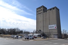 | Magnolia Mills | 0.1 miles | 1996 |
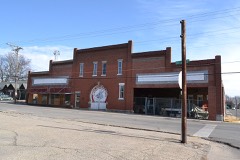 | Jones Brothers Mule Barn | 0.2 miles | 2011 |
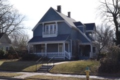 | Herbert A. and Bettie E. Cress House | 0.2 miles | 1995 |
| Lewis and Sophie Griebel House | 0.2 miles | 2012 |
| National Archives record | The nomination case file for reference 100000825 in Record Group 79. |
| Johnson County | All 22 listed properties in this county. |