BlockBefore

Johnson County, Missouri

78 topographic sheets cover 39 settlements here, and 22 properties are on the National Register of Historic Places.

Research this county

From the record

22 National Register listings published here · the county-history sources tell 2 stories and name 248 people · people the book names include Judge Daniel Adams (Washington Township, 1881) · Joseph Albin (Simpson Township, 1881) (machine-read).

Sources: the county history on the Internet Archive · the National Register database, National Park Service

Missouri within the United States
Johnson County within Missouri

What the record shows

  • 730 topographic sheet readings cover the county's settlements.
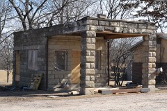
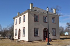
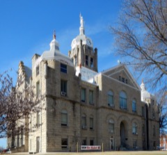
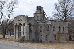
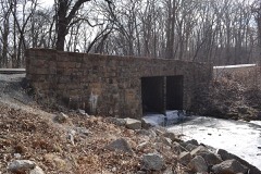
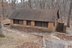
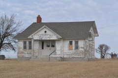
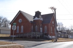
  • 22 properties here are on the National Register of Historic Places: 14 buildings, 5 districts and 3 structures.
  • 1 of the 22 listings was added during the 1970s.
  • The Geographic Names Information System records 39 populated places in this county; 39 are covered by at least one topographic sheet.
  • 2 public-domain county histories, 1881 and 1918, supply 136,398 words of narrative reproduced here.

What happened here

2 accounts

Among them: Abraham B. Whaley; Adam Carpenter. These passages come from the identified county-history source books. Each inset names its own source and opens the exact section it comes from.

From The History of Johnson County, Missouri : Including a Reliable History of the Townships, Cities, and Towns, Together with a Map of the County; a Condensed History of Missouri; the State Constitution; an Abstract of the Most Important Laws; the Physical Features of the County; the Early Settlers and Pioneers; the Political and War History; the Religious and Educational History...statistics and Miscellaneous Matters, Etc., Etc, published 1881 - Columbus Township

Abraham B. Whaley

one of the most prominent school teachers of the county; was born in Palmyra, Missouri, April 13, 1835. His father and mother lived in Marion county up to 1865. The subject of this sketch was a captain in Marmaduke's brigade, and was captured during the war in Monroe county, north Missouri, and was held as a political prisoner in Cincinnati, until the close of the war.

Read the rest of this passage

From The History of Johnson County, Missouri : Including a Reliable History of the Townships, Cities, and Towns, Together with a Map of the County; a Condensed History of Missouri; the State Constitution; an Abstract of the Most Important Laws; the Physical Features of the County; the Early Settlers and Pioneers; the Political and War History; the Religious and Educational History...statistics and Miscellaneous Matters, Etc., Etc, published 1881 - Washington Township

Adam Carpenter

P. O. Knobnoster, Missouri, was born in Kentucky, July 8, 1804. His father was a native of Virginia, and emigrated to Kentucky at an early day, where he was killed by the Indians. Mr. Carpenter was married, in 1834, to Miss Mary Jones. He remained in Kentucky until 1851, when he came to Missouri, and settled within three miles ot Knobnoster.

Read the rest of this passage

Places on the National Register

22

Every property in this county listed on the National Register of Historic Places, with the year it was listed and the federal nomination document.

Wildfire, 1994 to 2020

362 fires

Every wildfire the federal occurrence database records inside this county: 362 of them, burning about 2,153 acres. 9 started naturally and 5 were recorded as arson. Each settlement page carries the fires within five miles of it.

Reported cause Fires
Missing data/not specified/undetermined198
Debris and open burning104
Equipment and vehicle use22
Recreation and ceremony17
Natural9
Smoking5
Arson/incendiarism5
Other causes2

The five largest, by the area the report gives. One of them was set deliberately.

DateCause SizeReported by Name on the report
15 March 2015Missing data/not specified/undetermined300 acresMissouri Department of Conservation121675-05161-03152015-1400
15 March 2018Debris and open burning175 acresMissouri Department of Conservation176373-05130-03152018-1202
26 January 2018Missing data/not specified/undetermined85 acresMissouri Department of Conservation176169-05130-01262018-1353
26 January 2018Missing data/not specified/undetermined70 acresMissouri Department of Conservation176042-05130-01262018-1417
21 March 2017Arson/incendiarism55 acresMissouri Department of Conservationnot named
14 April 2003Missing data/not specified/undetermined50 acresMissouri State Fire Marshal's Officenot named
19 January 2015Recreation and ceremony40 acresMissouri Department of Conservation119438-05161-01192015-1305
5 April 2003Debris and open burning40 acresMissouri State Fire Marshal's Officenot named

Every settlement page carries the fires within five miles of it - see the settlement index below.

Storms, 1955 to 2026

60 of 644 shown

The NOAA Storm Events Database holds 644 reports for this county, causing 3 deaths, 15 injuries and about $6,873,000 in recorded property damage. Each settlement page carries the reports that name it.

Kind of event Reports
Hail292
Thunderstorm Wind241
Flash Flood47
Tornado34
Flood26
Lightning3
Funnel Cloud1

The most serious of them, by death, then injury, then recorded damage. The accounts are quoted exactly as the forecast office filed them.

WhenEvent Place namedHarm What the report says
April 1964Tornado (F2)not stated1 killed, 3 hurt, $250,000no account filed
June 2024LightningHolden1 killed, 1 hurtA 53 year old man was struck by lightning in the parking lot at the conclusion of the Holden, MO Rodeo. The lightning strike was fatal.
June 2024LightningHolden1 killedA 53 year old man was killed when struck by lightning in the parking lot outside of the Holden Chamber of Commerce Rodeo around 11 pm CDT on Friday, June 28th, 2024.
March 2006Tornado (F2)Leeton4 hurt, $2,000,000Tornado touched down at 2040 CST 2 miles northeast of Leeton...producing F0 damage along PP Highway. As it moved northeast...additional F0 to F1 damage was noted to a farmstead along SE 650th Road. The most intense F2 damage was noted along Y Highway just east of Highway 23...where several homes suffered F2 damage. The tornado crossed into Pettis county at 2057 CST...1.5 miles southeast of Whiteman Air Force Base.
June 2005Tornado (F1)Holden2 hurt, $1,100,000F1 tornado touched down 5 miles southwest of Holden and then moved northeast across Route 131 before skipping to and then lifting 3 miles west southwest of Centerview. The biggest impact was at the Miller Training Stables on Route 131. Two women received minor injuries when their house was lifted off the foundation. Six horses were killed and 42 were injured. Three barns, the residence, and 3 cars were heavily damaged or destroyed. There were also several other homes and barns damaged by the tornado before it lifted.
May 1968Tornado (F2)not stated2 hurt, $250,000no account filed
November 1998Thunderstorm WindElm2 hurt, $60,000Thunderstorm winds destroyed two mobile homes, and substantially damaged a single family residence. Two people in one of the mobile homes suffered minor injuries due to flying debris. Two automobiles were also overturned.
April 1969Tornado (F2)not stated1 hurt, $250,000no account filed
April 2001Tornado (F1)Warrensburg$2,000,000A tornado moved across the north side of Warrensburg, damaging approximately 100 homes andbusinesses. No injuries or deaths were reported. The tornado was on the ground for 10 minutes, movingto the east. The path width ranged between 50 and 75 yards, and rear flank downdraft winds to the southof the tornado, caused minor damage to structures in downtown Warrensburg.
November 1988Tornado (F1)not stated$250,000no account filed
February 2007Tornado (EF1)Holden$200,000EF1 tornado touched down 5 miles south of Holden at 5:18 PM CST and moved north-northeast 2 miles, before lifting 3 miles south of Holden at 5:21 PM CST. The tornado damaged two homes, one business, and several farm buildings. Power lines and trees were also downed.
June 1999Thunderstorm WindHolden$50,000A trailer was destroyed, and another home sustained roof damage.
March 2006HailChilhowee$50,000no account filed
April 2007Thunderstorm WindHolden$25,000Several barns destroyed and numerous trees down. Also minor damage to homes.
March 2006Thunderstorm WindLatour$25,000Damage reported to several buildings in town from thunderstorm wind gusts.
April 2006Thunderstorm WindWhiteman Afb$25,000Buildings damaged on the base.
May 2003Tornado (F1)Warrensburg$25,000Tornado touchdown was observed one half mile northwest of the intersection of SE 401st Road and SE 300th Road, or near the city landfill. Damage of F1 intensity was noted at this location to a private business. The tornado continued northeast to near Whiteman Air Force Base before dissipating 1 mile northeast of the base. Damage along the path was rated F0 throughout this area, along the rest of the path.
May 1968Tornado (F2)not stated$25,000no account filed
February 2007Tornado (EF1)Kingsville$20,000Tornado crossed from Cass county into Johnson county at 10:06 PM CST, 6 miles south southwest of Kingsville. The tornado produced damage to 2 homes and one garage as it moved northeast. The tornado lifted 1 mile south of Kingsville at 10:14 PM CST.
July 2000LightningWarrensburg$16,000A lightning strike killed 8 cattle at the Central Missouri State University Agricultural Research Farm.
April 2011Thunderstorm WindKingsville$12,000A roof was blown off a log style home, at NW 1871 RD, or just southeast of Kingsville.|Thunderstorm wind gusts were estimated up to 70 mph.
June 2021Thunderstorm WindKnob Noster$10,000A tree was blown down on a garage near McPherson.
July 2014Thunderstorm WindChilhowee$10,000Old barn, 10 to 15 years of age, was flattened, at a residence near Chilhowee. A neighbor's roof was also ripped off as strong winds came through the area.
May 2003Tornado (F0)(Szl)Whiteman Afb$10,000Tornado touched down in a fescue field just east of the intersection of Missouri route 23 and 725th St.in rural eastern Johnson county. Moved into Owsley with trees snapped off and broken. A truck was blown sideways and a playhouse was destroyed. The tornado moved into a conservation area into Pettis county.
April 2001Thunderstorm WindWarrensburg$10,000Law enforcement reported 3/4 inch hail and power lines down.
June 2000Thunderstorm WindKingsville$10,000Law enforcement officials reported wind gusts as high as 70 mph and numerous downed power lines in and around Kingsville.
May 1999Thunderstorm WindHolden$10,000A barn was severely damaged by thunderstorm winds southwest of Holden.
March 2006HailWarrensburg$10,000no account filed
June 2013Thunderstorm WindWarrensburg$5,000Thunderstorm wind gusts were estimated up to 70 mph, with numerous power poles down in Warrensburg.
August 2008Thunderstorm WindHolden$5,000Numerous reports of trees and power lines down.
August 2008Thunderstorm WindWarrensburg$5,000Numerous trees and power lines were reported down around Warrensburg.
March 2006Tornado (F0)Leeton$5,000F0 tornado touched down 6 miles east of Leeton at 2020 CST...and exited from Johnson county into Pettis county at 2024 CST. Tornado traveled northeast over rural areas of southeastern Johnson county. One barn suffered minor damage.
March 2006Thunderstorm WindWarrensburg$5,000Several highway signs down.
October 2004Tornado (F0)Warrensburg$5,000Tornado touchdown reported near 251 and BB Highway...2 southwest of Warrensburg. Barn partially destroyed. Tornado dissipated just south of Warrensburg.
October 2002Thunderstorm WindWarrensburg$5,000Roof and gutter damage to mobile homes.
April 2000Thunderstorm WindFayetteville$5,000The sheriff's office reported utility poles down along State Highway 13 near Fayetteville.
May 2000Tornado (F1)Holden$5,000A storm spotter with the Holden Fire Department observed a tornado 7 miles south of Holden that remained on the ground for two minutes, moving northeast. Several trees and power lines were downed by the storm.
August 1997Thunderstorm WindFayetteville$5,000Large trees were reported down along route 13 about 6 miles west of Fayetteville by the Johnson County sheriff's office.
June 1995Thunderstorm WindWarrensburg$5,000Severe thunderstorms moved through the area producing damaging winds. Trees were downed along Route H east of Fayetteville, and some large limbs were knocked down in Warrensburg. Some of these limbs landed on a mobile home, causing minor damage.
August 1993Thunderstorm WindPittsville$5,000Several sheds were knocked down.
August 2004HailWarrensburg$5,000no account filed
June 2001Thunderstorm WindWarrensburg$5,000no account filed
June 1995Thunderstorm WindWarrensburg$4,000Several power lines were downed by severe thunderstorms in the Warrensburg area.
April 2011Thunderstorm WindPittsville$3,000Thunderstorm winds were estimated up to 60 mph, and caused downed powerlines.
September 2001Thunderstorm WindKnob Noster$3,000Many power lines reported down and several cars blown off road.
June 1995Thunderstorm WindKnob Noster$3,000Severe thunderstorms moved through Johnson County knocking down trees in Knob Noster and producing 64 mph winds at Whiteman Air Force Base.
June 1971Tornado (F1)not stated$2,500no account filed
April 1961Tornado (F1)not stated$2,500no account filed
May 1960Tornado (F1)not stated$2,500no account filed
May 2013Thunderstorm WindKnob Noster$2,000A supercell thunderstorm intensified as it moved into eastern Johnson County, near Knob Noster. Strong, straight-line winds estimated up to 60 mph, caused some minor damage to a house and mobile home.
May 2011Thunderstorm WindWarrensburg$2,000The 100 block of Main Street, had two, three feet in diameter trees, blown down. The trees knocked down power lines.
June 2009Thunderstorm WindWarrensburg$2,000Trees and power lines were reported down.
October 2004Thunderstorm WindHolden$2,000Damage to several buildings.
April 2001Thunderstorm WindKnob Noster$2,000Trained spotter estimated wind gusts to 80 mph with cars blown off road.
June 1995Thunderstorm WindKnob Noster$2,000Severe thunderstorm winds knocked down a few trees two miles east of Knob Noster.
July 1995Thunderstorm WindHolden$2,000A severe thunderstorm moved through Central Johnson County producing wind gusts up to 60 mph three miles north of Centerview knocking down large tree limbs. Numerous trees and power lines were reported down in Holden.
July 1995Thunderstorm WindCenterview$2,000A severe thunderstorm moved through Central Johnson County producing wind gusts up to 60 mph three miles north of Centerview knocking down large tree limbs. Numerous trees and power lines were reported down in Holden.
September 2013Thunderstorm WindWarrensburg$1,000Trees and a power pole were reported blown down in town. Thunderstorm wind gusts were estimated up to 60 mph.

Mines and quarries

57 recorded

The Survey's mineral resources record lists 57 workings inside this county. 3 still produce and 54 are closed or unrecorded. Each settlement page carries the workings within five miles of it.

Commodity Workings
Stone, Crushed/Broken52
Coal, Stone, Crushed/Broken3
Clay1
Iron1

The least common of them first, because a county's hundredth gravel pit says nothing its first ten did not.

Where SiteCommodity StatusRecorded
Boyd Shale PitClayPast Producer
Unknown - IronIronPast Producer
Cooper MineCoal, Stone, Crushed/BrokenPast Producer
Unknown - Coal / Ls.Coal, Stone, Crushed/BrokenPast Producer
Unknown - Ls./CoalCoal, Stone, Crushed/BrokenPast Producer
Bates City QuarryStone, Crushed/BrokenPast Producer
Bruce QuarryStone, Crushed/BrokenPast Producer
Centerview QuarryStone, Crushed/BrokenPast Producer
Fayetteville QuarryStone, Crushed/BrokenPast Producer
Leeton QsuarryStone, Crushed/BrokenUnknown
Marr Quarry & MillStone, Crushed/BrokenPast Producer
Montserrat QuarryStone, Crushed/BrokenProducer
Pickel QuarryStone, Crushed/BrokenPast Producer
Porter QuarryStone, Crushed/BrokenPast Producer
Unknown - LsStone, Crushed/BrokenPast Producer
Unknown - Ls.Stone, Crushed/BrokenPast Producer
Unknown - Ss.Stone, Crushed/BrokenPast Producer
Warrensburg QuarryStone, Crushed/BrokenProducer
Warrensburg Quarry - PlantStone, Crushed/BrokenProducer

The townships, in 1918

136,398 words

History of Johnson County, Missouri devotes a chapter to each township: its boundaries and streams, who settled it and when, the mills, the schools and the churches. All 15 are reproduced here in full. Each row shows the township's own shape and where it lies in the county, drawn from the Census Bureau's boundary. Which settlements belong to which township is computed from that same boundary, not taken from the book.

The county's history books

693,291 words

2 books written about this county, cut here where the book itself is cut, at its printed chapters: 88 chapters in all. Every chapter is public domain, machine-read from the scan and reproduced complete. A chapter already given under one of the county's towns is not repeated in this list.

The History of Johnson County, Missouri : Including a Reliable History of the Townships, Cities, and Towns, Together with a Map of the County; a Condensed History of Missouri; the State Constitution; an Abstract of the Most Important Laws; the Physical Features of the County; the Early Settlers and Pioneers; the Political and War History; the Religious and Educational History...statistics and Miscellaneous Matters, Etc., Etc (1881)

ChapterLength
Chapter 1: - Introduction2,116 words
Chapter 32,236 words
Chapter 42,764 words
Chapter 5 (1 of 2 so headed)1,602 words
Chapter 62,309 words
Chapter 72,038 words
Chapter 92,285 words
Chapter 101,720 words
Chapter 111,866 words
Chapter 122,889 words
Chapter 133,425 words
Chapter 142,710 words
Chapter 156,332 words
Chapter 166,110 words
Chapter 172,942 words
Chapter 183,301 words
Chapter 193,984 words
Chapter 204,145 words
Chapter 212,683 words
Chapter 224,588 words
Chapter 237,333 words
Chapter 246,145 words
Chapter 1: The Introduction and Name2,199 words
Chapter 3: - Natural History5,498 words
Chapter 4: - Early Settlements and Pioneers5,636 words
Chapter 5 (2 of 2 so headed)1,604 words
Chapter 6: Political History7,645 words
Chapter 7: - Judges and Sheriffs4,946 words
Chapter 8: Finances2,347 words
Chapter 9: - Agriculture7,208 words
Chapter 10: - Railroads2,517 words
Chapter 11: - Educational2,944 words
Chapter 12: - ' Warrensburg Normal School13,901 words
Chapter 13: - Typography in Johnson County3,966 words
Chapter 14: - Religious History19,080 words in 2 parts
Chapter 15: - the Reign of Terror7,816 words
Chapter 1: - History of Warrensburg25,202 words in 2 parts
Chapter 2: - Holden16,701 words in 2 parts
Chapter 3: - Washington Township9,575 words
Chapter 4: - Kingsville Township13,429 words
Chapter 6: - Rose Hill Township7,277 words
Chapter 7: - Chilhowee Township7,685 words
Chapter 8: - Post Oak Township6,762 words
Chapter 9: - Jefferson Township6,055 words
Chapter 10: - Grover Township9,281 words
Chapter 11: - Simpson Township7,100 words
Chapter 12: - Hazel Hill Township8,286 words
Chapter 13: - Columbus Township6,528 words

History of Johnson County, Missouri (1918)

ChapterLength
Chapter 1: - Geology2,068 words
Chapter 2: - Indians1,259 words
Chapter 3: - Trails and Roads2,706 words
Chapter 4: - Early Settlements2,374 words
Chapter 5: - Organization and Officers1,272 words
Chapter 6: - Railroads1,517 words
Chapter 7: - Military4,387 words
- Reign of Terror2,944 words
Chapter 9: - Public Schools2,773 words
Chapter 10: - State Normal School2,933 words
Chapter 12: - Washington Township2,031 words
Chapter 13: - Jefferson Township1,582 words
Chapter 14: - Madison Township1,364 words
Chapter 15: - Holden1,908 words
Chapter 16: - Jackson Township2,023 words
- Warrensburg Township1,962 words
Chapter 18: - Warrensburg5,847 words
Chapter 19: - Post Oak Township1,952 words
Chapter 20: - Hazel Hill Township1,877 words
Chapter 21: - Chilhowee Township2,108 words
Chapter 22: - Grover Township1,969 words
Chapter 23: - Rose Hill Township2,977 words
Chapter 24: - Columbus Township2,224 words
Chapter 25: - Kingsville Township1,579 words
Chapter 26: - Centerview Township1,910 words
Chapter 27: - Simpson Township2,114 words
Chapter 28: - Montserrat Township1,619 words
Chapter 29: - Political1,101 words
Chapter 30: - Medicine3,139 words
Chapter 31: - Bench and Bar5,254 words
Chapter 32: - Banks and Banking3,418 words
Chapter 33: - Johnson County Newspapers1,939 words
Chapter 34: - Agriculture3,240 words
Chapter 35: - Live Stock1,859 words
Chapter 36: - Soils3,657 words
- Churches14,518 words
Chapter 38: - Lodges and Other Organizations3,511 words
Chapter 39: - Miscellaneous Organizations1,688 words
Chapter 40: - the World War2,481 words
- Biographical299,496 words in 19 parts

The people it describes

248 named

Everyone History of Johnson County, Missouri stops to write about, with the section that describes them. Among them are the men who founded the place and governed the Territory. Each name opens the passage itself, in the words of 1918.

Every populated place in the county

39

Named settlements recorded in the Geographic Names Information System, each with the topographic sheets covering it. Villages, hamlets and abandoned places alike. Each is shown with the nearest named watercourse or landform and the survey quadrangle it falls on.

The vanished settlements of Johnson County: the places named above that are no longer on the map.

Provenance

  • Topographic sheets. USGS Historical Topographic Map Collection, county index, measured from the bulk metadata.
  • Fire insurance maps. Library of Congress Sanborn collection, faceted to this county.
  • Photographs. Each place queried individually against the Library of Congress Prints and Photographs search.
  • Wildfire. Short, Karen C. 2022. Spatial wildfire occurrence data for the United States, 1992-2020 [FPA_FOD_20221014]. 6th Edition. Fort Collins, CO: Forest Service Research Data Archive. https://doi.org/10.2737/RDS-2013-0009.6 Collected with United States Government funding and usable without additional permissions or fees.
  • Mines and quarries. USGS Mineral Resources Data System (MRDS) https://mrdata.usgs.gov/mrds/ A work of the United States government, no copyright under 17 U.S.C. 105.
  • Storms. NOAA National Centers for Environmental Information, Storm Events Database https://www.ncei.noaa.gov/stormevents/ A work of the United States government, no copyright under 17 U.S.C. 105. Narratives are quoted verbatim from the National Weather Service report and are not edited or summarised.