 Block
From the record
One of 9 National Register listings published here for Phelps County · listed in 2017 · category: Building.
Sources: the National Register database, National Park Service
Listed on the National Register of Historic Places in 2017.
One of 9 National Register listings published here for Phelps County · listed in 2017 · category: Building.
Sources: the National Register database, National Park Service
Regional context, not property-specific evidence. The federal wildfire occurrence database lists 138 fires within 5 miles of Headquarters, Rolla Division of the Bureau of Mines between 1992 and 2020, burning about 275 acres in total. None started naturally. 4 were recorded as arson. Distance is straight-line from the map coordinates, so a fire counted here may appear on a neighbouring settlement's page as well.
| Reported cause | Fires |
|---|---|
| Missing data/not specified/undetermined | 63 |
| Debris and open burning | 56 |
| Smoking | 4 |
| Arson/incendiarism | 4 |
| Recreation and ceremony | 4 |
| Equipment and vehicle use | 4 |
| Misuse of fire by a minor | 2 |
| Railroad operations and maintenance | 1 |
The most recent of them, most recent first, with the day each was reported and the service that recorded it.
| Date | Cause | Size | Reported by | Name on the report |
|---|---|---|---|---|
| 28 September 1999 | Debris and open burning | 3.0 acres | Missouri Department of Conservation | not named |
| 18 September 1995 | Debris and open burning | 2.0 acres | Missouri Department of Conservation | not named |
| 17 September 2006 | Arson/incendiarism | under an acre | Missouri State Fire Marshal's Office | not named |
| 16 September 2019 | Missing data/not specified/undetermined | under an acre | Missouri Department of Conservation | 179467-08102-09162019-1600 |
| 9 August 2018 | Debris and open burning | under an acre | Missouri Department of Conservation | 178675-08102-08092018-1546 |
| 8 August 2018 | Missing data/not specified/undetermined | under an acre | Missouri Department of Conservation | 178691-08102-08082018-1148 |
| 6 August 2006 | Missing data/not specified/undetermined | 3.0 acres | Missouri State Fire Marshal's Office | not named |
| 5 August 2006 | Missing data/not specified/undetermined | under an acre | Missouri State Fire Marshal's Office | not named |
Regional context, not property-specific evidence. The federal mineral resources record lists 50 workings within 5 miles of Headquarters, Rolla Division of the Bureau of Mines: 40 past producers, 9 producers, 1 prospect. 9 still produce. What was taken out: Fire Clay (Refractory), Stone, Crushed/Broken, Iron, Sand and Gravel, Construction. Distance is straight-line from the map coordinates, so a quarry counted here may appear on a neighbouring settlement's page as well.
| Where | Site | Commodity | Status | Recorded |
|---|---|---|---|---|
| Unk | Limestone, Dimension | Past Producer | ||
| Unk | Limestone, Dimension | Past Producer | ||
| Portable Gravel Plant | Sand and Gravel, Construction | Producer | ||
| Roving Screen Plant | Sand and Gravel, Construction | Producer | ||
| Unk | Fire Clay (Refractory), Sand and Gravel, Construction | Past Producer | ||
| Unk | Sand and Gravel, Construction | Producer | ||
| Buckland Mine | Iron | Past Producer | Hematite, Marcasite | |
| Buckland Mine | Iron | Past Producer | ||
| Gus Storr Prospect | Iron | Past Producer | ||
| Kelly Mine # 2 | Iron | Past Producer |
Regional context, not property-specific evidence. The National Weather Service names Rolla, the town this property stands in, in 155 storm reports between 1994 and 2026: 61 thunderstorm wind, 61 hail, 15 flash flood, 9 heavy rain. No death or injury is recorded in these reports. Each account below is quoted exactly as the forecast office filed it, from the NOAA Storm Events Database, and each date opens the federal record of that event.
| When | Event | Place named | Harm | What the report says |
|---|---|---|---|---|
| September 2001 | Lightning | Rolla | $150,000 | no account filed |
| August 2022 | Thunderstorm Wind | Rolla | $100,000 | Extensive wind damage occurred to five homes, multiple power lines and poles, and trees. | A barn was also destroyed. |
| May 2001 | Thunderstorm Wind | Rolla | $100,000 | no account filed |
| July 2016 | Thunderstorm Wind | Rolla | $50,000 | Numerous trees and power lines were blown down across the county. A few trees were blown on to cars. One tree was blown down on to a house causing structural damage. |
| April 2011 | Thunderstorm Wind | Rolla | $50,000 | Numerous power polls down were reported down 2 miles south of Rolla along State Highway O, near and just east the intersection of Highway 72. |
| June 2009 | Thunderstorm Wind | Rolla | $50,000 | Severe thunderstorm wind gusts removed a roof from a home and overturned a shed. Power lines were also blown down from large trees falling onto them. |
| April 1994 | Thunderstorm Wind | Rolla | $50,000 | Ham radio operators reported an overturned tractor-semitrailer along Interstate 44 from high wind. A section of the interstate was closed for a short time. Homes received minor damage and numerous trees were blown down in Rolla. |
| May 2002 | Lightning | Rolla | $50,000 | no account filed |
| April 2024 | Thunderstorm Wind | Rolla | $25,000 | Multiple power lines were reported with some downed trees causing damage. A 42 mph gust was recorded on a home weather station north of town. |
| April 2024 | Thunderstorm Wind | Rolla | $25,000 | Shingles and some roof decking was removed from the roof of a motel by high wind gusts. |
| May 2021 | Thunderstorm Wind | Rolla | $25,000 | High winds downed tree limbs damaging street lights and power lines causing power outages. |
| August 2020 | Thunderstorm Wind | Rolla | $25,000 | Several power lines were reported down in town. |
| June 2008 | Thunderstorm Wind | Rolla | $25,000 | A warehouse on the north side of Rolla sustained roof damage from severe thunderstorm wind gusts. |
| August 2008 | Thunderstorm Wind | Rolla | $20,000 | Thunderstorm wind gusts knocked over several trees and power poles in Rolla. Power failures resulted from the damage for several hours. |
| April 2001 | Thunderstorm Wind | Rolla | $20,000 | no account filed |
| July 2011 | Thunderstorm Wind | Rolla | $15,000 | Several trees and power lines were blown down. Shingles were blown off several roofs and windows were broken due to downed trees. A few sheds were blow over. |
| July 2002 | Thunderstorm Wind | Rolla | $15,000 | no account filed |
| November 1998 | Thunderstorm Wind | Rolla | $15,000 | no account filed |
| August 2019 | Thunderstorm Wind | Rolla | $10,000 | Several trees were reported down across Rolla. One tree was on a residence Faulkner Road with minor damage reported. |
| July 2016 | Thunderstorm Wind | Rolla | $10,000 | Several power lines and large tree limbs were blown down across the county. |
| August 2008 | Thunderstorm Wind | Rolla | $10,000 | Severe thunderstorm wind gusts damaged several power poles and trees. |
| May 2002 | Thunderstorm Wind | Rolla | $10,000 | no account filed |
| April 2000 | Thunderstorm Wind | Rolla | $6,000 | no account filed |
| September 2014 | Thunderstorm Wind | Rolla | $5,000 | A tree was blown down onto a house causing minor damage. |
| July 2011 | Thunderstorm Wind | Rolla | $5,000 | A few power poles were blown down. |
| July 2010 | Lightning | Rolla | $5,000 | Lightning damaged a vehicle and caused it's air bags to deploy. |
| December 2008 | Flash Flood | Rolla | $5,000 | Urban flooding in Rolla led to water running in a few homes. |
| August 2000 | Thunderstorm Wind | Rolla | $5,000 | no account filed |
| June 1999 | Thunderstorm Wind | Rolla | $5,000 | no account filed |
| November 1998 | Thunderstorm Wind | Rolla | $5,000 | no account filed |
| May 1995 | Hail | Rolla | $4,200 | The Missouri Highway Patrol and Rolla Police Department reported golf ball-size hail in and around the Rolla area between 1830 and 1845CST. Damage was mainly confined to dents in automobiles. |
| May 2019 | Thunderstorm Wind | Rolla | $2,000 | Minor roof damage occurred to a home in eastern Rolla. |
| August 2013 | Lightning | Rolla | $2,000 | A tree struck by lightning fell on power lines at 805 Oaklane Drive. |
| August 2011 | Thunderstorm Wind | Rolla | $2,000 | Several trees were blown down onto power lines. |
| May 1995 | Hail | Rolla | $1,700 | The Missouri Highway Patrol and Rolla Police Department reported golf ball-size hail in and around the Rolla area between 1830 and 1845CST. Damage was mainly confined to dents in automobiles. |
| March 2017 | Thunderstorm Wind | Rolla | $1,000 | There was minor damage to roofing and siding to an apartment complex in Rolla. A picture of this damage was on social media. |
| February 2009 | Thunderstorm Wind | Rolla | $1,000 | Several road signs were downed from severe thunderstorm wind gusts. |
| May 1995 | Thunderstorm Wind | Rolla | $500 | Several trees and power lines were knocked down north of Rolla. |
| June 1995 | Thunderstorm Wind | Rolla | $400 | Large trees and power lines were blown down in and west of Rolla. |
| March 2026 | Flood | Rolla | - | Highway 63 was closed due to flooding just north of Highway 72 underneath a railroad bridge in Rolla. |
| April 2026 | Thunderstorm Wind | Rolla | - | A tree was reported down and blocking a road in town. |
| April 2026 | Flash Flood | Rolla | - | County Road 5120 was closed at a low water crossing. |
| April 2026 | Thunderstorm Wind | Rolla | - | A large tree was reported down. |
| April 2026 | Hail | Rolla | - | Hail up to quarters in size were reported. |
| April 2026 | Hail | Rolla | - | Hail up to half dollars in size were reported. |
| June 2025 | Flash Flood | Rolla | - | Flash flooding occurred near Winchester Drive and Newcastle Drive. Water was over the road and impassable. |
| June 2025 | Flash Flood | Rolla | - | Street flooding was reported on the east side of Rolla from heavy rainfall. |
| May 2024 | Hail | Rolla | - | Report of quarter size hail. |
| May 2024 | Hail | Rolla | - | Report of quarter size hail. |
| April 2024 | Hail | Rolla | - | Hail up to half dollars in size was reported. |
| November 2024 | Heavy Rain | Rolla | - | The CoCoRaHS station MO-PH-64 located 2.2 miles south of Rolla measured a 2-day rainfall total of 8.19 inches. |
| November 2024 | Heavy Rain | Rolla | - | The CoCoRaHS station MO-PH-56 located 2.8 miles south of Rolla measured a 2-day rainfall total of 8.18 inches. |
| May 2023 | Hail | Rolla | - | Penny sized hail was reported. |
| May 2023 | Hail | Rolla | - | Nickle sized hail was reported. |
| May 2022 | Thunderstorm Wind | Rolla | - | A large tree was down on Greentree Road. |
| August 2022 | Thunderstorm Wind | Rolla | - | A few large limbs were snapped. |
| May 2021 | Thunderstorm Wind | Rolla | - | Multiple large limbs and several trees were reported down near the Phelps County Regional Center and 10th Street. |
| July 2019 | Heavy Rain | Rolla | - | A 24 hour rainfall of 1.85 inches was measured. |
| May 2019 | Heavy Rain | Rolla | - | A co-op observer reported a 24-hr rainfall accumulation of 3.07 inches. |
| August 2019 | Thunderstorm Wind | Rolla | - | Part of a fence was blown down along with small tree branches. |
No historic map-sheet match is published for this property yet. That does not mean no map exists. This record needs a coordinate-quality review before it can be joined to a sheet boundary. Browse the county's mapped places while that work is pending.
Other National Register properties close enough to walk or drive between, ordered by distance from this one. Both positions come from the same geocoding pass that matched these properties to their map sheets.
| Photograph | Property | Distance | Listed |
|---|---|---|---|
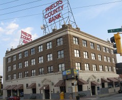 | National Bank of Rolla Building | 0.4 miles | 2001 |
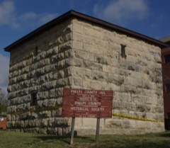 | Phelps County Jail | 0.6 miles | 1990 |
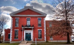 | Phelps County Courthouse | 0.6 miles | 1993 |
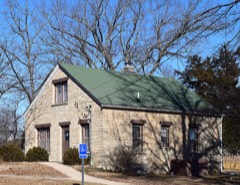 | Rolla Ranger Station Historic District | 1.0 miles | 2003 |
| Community Theater | 7.3 miles | 2006 |
| National Archives record | The nomination case file for reference 100000910 in Record Group 79. |
| Phelps County | All 9 listed properties in this county. |