 Block
From the record
One of 8 National Register listings published here for Laclede County · listed in 2019 · category: Building.
Sources: the National Register database, National Park Service
Listed on the National Register of Historic Places in 2019.
One of 8 National Register listings published here for Laclede County · listed in 2019 · category: Building.
Sources: the National Register database, National Park Service
Regional context, not property-specific evidence. The federal wildfire occurrence database lists 65 fires within 5 miles of Rice-Stix Building, The between 1992 and 2017, burning about 1,086 acres in total. 1 started naturally. 10 were recorded as arson. Distance is straight-line from the map coordinates, so a fire counted here may appear on a neighbouring settlement's page as well.
| Reported cause | Fires |
|---|---|
| Debris and open burning | 44 |
| Arson/incendiarism | 10 |
| Missing data/not specified/undetermined | 5 |
| Equipment and vehicle use | 3 |
| Misuse of fire by a minor | 1 |
| Natural | 1 |
| Recreation and ceremony | 1 |
The most recent of them, most recent first, with the day each was reported and the service that recorded it.
| Date | Cause | Size | Reported by | Name on the report |
|---|---|---|---|---|
| 9 September 1999 | Debris and open burning | 1.0 acres | Missouri Department of Conservation | not named |
| 30 September 1999 | Missing data/not specified/undetermined | 1.0 acres | Missouri Department of Conservation | not named |
| 19 September 2000 | Debris and open burning | 1.0 acres | Missouri Department of Conservation | not named |
| 14 September 2000 | Misuse of fire by a minor | 5.0 acres | Missouri Department of Conservation | not named |
| 26 August 2014 | Natural | 21 acres | Missouri Department of Conservation | not named |
| 25 July 2012 | Missing data/not specified/undetermined | 267 acres | Missouri Department of Conservation | JEWELL RD |
| 4 April 1995 | Arson/incendiarism | 5.0 acres | Missouri Department of Conservation | not named |
| 4 April 1994 | Debris and open burning | 3.0 acres | Missouri Department of Conservation | not named |
Regional context, not property-specific evidence. The federal mineral resources record lists 10 workings within 5 miles of Rice-Stix Building, The: 8 past producers, 1 producer, 1 unknown. 1 still produces. What was taken out: Stone, Crushed/Broken. Distance is straight-line from the map coordinates, so a quarry counted here may appear on a neighbouring settlement's page as well.
| Where | Site | Commodity | Status | Recorded |
|---|---|---|---|---|
| Lebanon Qsuarry | Stone, Crushed/Broken | Unknown | ||
| Mayfields Quarry | Stone, Crushed/Broken | Past Producer | ||
| Unknown - Ls | Stone, Crushed/Broken | Past Producer | ||
| Unknown - Ls | Stone, Crushed/Broken | Past Producer | ||
| Unknown - Ss | Stone, Crushed/Broken | Past Producer | ||
| Unknown - Ss | Stone, Crushed/Broken | Past Producer | ||
| Unknown - Ss | Stone, Crushed/Broken | Past Producer | ||
| Unknown - Ss | Stone, Crushed/Broken | Past Producer | ||
| Unknown - Ss | Stone, Crushed/Broken | Past Producer | ||
| Willard Quarry & Plant | Stone, Crushed/Broken | Producer |
Regional context, not property-specific evidence. The National Weather Service names Lebanon, the town this property stands in, in 159 storm reports between 1994 and 2026: 68 thunderstorm wind, 63 hail, 16 flash flood, 7 heavy rain. The reports record 1 death. Each account below is quoted exactly as the forecast office filed it, from the NOAA Storm Events Database, and each date opens the federal record of that event.
| When | Event | Place named | Harm | What the report says |
|---|---|---|---|---|
| August 2007 | Flash Flood | Lebanon | 1 killed, $5,500,000 | Tropical Storm Erin remnants impacted areas of Laclede County. Flash flooding occurred county wide causing road closures to a section of Highway 32 near Pinetree Road, West Elm Road between Drury Road and Springfield Road, a section of Route BB northwest of Sleeper and north of Route F, the intersection of Highway 32 and Highway K, the intersection of Route BB and Highway F, the intersection of Route T and Highway FF, the outer road of interstate 44 at Route N, and a section of a secondary road near Sleeper. A United State Postal employee delivering rural mail drove into a washed out bridge and was swept away by flood water. |
| December 2010 | Lightning | Lebanon | $500,000 | A lightning strike struck a large two story home just north of Lebanon. The resultant fire burned down the home and was a complete lost. |
| March 2008 | Tornado (EF2) | Lebanon | $500,000 | A National Weather Service storm survey revealed that an EF-2 tornado caused damage to several homes and businesses on the north side of Lebanon. A bus was also overturned at Esther Elemetary School. |
| May 2024 | Hail | Lebanon | $50,000 | A swath of baseball to 3 inch size hail fell north of Lebanon. |
| May 2018 | Thunderstorm Wind | Lebanon | $50,000 | There was three commercial structures with significant sign damage. There was roof damage at several businesses including the mall. There were several homes with roof or shingle damage. There were at least two power poles blown down. |
| June 2015 | Flash Flood | Lebanon | $50,000 | There was a high water rescue at Omega Street and Dove KOA Campground. This storm report will contain the overall storm damage estimates across the entire Laclede County for this storm event. Several roads, bridges, and low water crossings were damaged. |
| April 1994 | Tornado (F1) | Lebanon | $50,000 | The Sheriff's office reported signs blown down, flags ripped from poles, and power lines down. Also, an airplane was flipped over at a nearby airport. |
| April 2000 | Thunderstorm Wind | Lebanon | $35,000 | no account filed |
| July 1999 | Thunderstorm Wind | Lebanon | $30,000 | no account filed |
| May 2024 | Hail | Lebanon | $25,000 | Report of baseball size hail. |
| August 2022 | Thunderstorm Wind | Lebanon | $25,000 | Thunderstorm winds caused significant damage to a barn and moderate damage to the roof of a home. |
| September 2020 | Thunderstorm Wind | Lebanon | $20,000 | Several power lines were reported down in town. Scattered power outages occurred. |
| April 1998 | Hail | Lebanon | $20,000 | Hail, up to tennis ball size, fell in areas northwest of Lebanon denting cars and breaking a car windshield. |
| August 2005 | Thunderstorm Wind | Lebanon | $15,000 | Straight line wind gusts lifted a boat from a trailer. The boat was completely destroyed. |
| July 2024 | Thunderstorm Wind | Lebanon | $10,000 | Multiple large trees were reported blown over. Several larger branches were also broken at the old Junior High School. |
| July 2023 | Thunderstorm Wind | Lebanon | $10,000 | A large tree fell on a power line causing power outages. |
| July 2015 | Thunderstorm Wind | Lebanon | $10,000 | There were numerous pictures from social media of large trees blown down around Lebanon. A couple trees fell on to outbuildings and fences causing damage. |
| May 2013 | Thunderstorm Wind | Lebanon | $10,000 | Portions of the roof from a mobile home were blown onto power lines near the intersection of Highways 438 and MM. |
| September 2012 | Thunderstorm Wind | Lebanon | $10,000 | At Highway KK and Finch Street, a large tree was blown down onto a home. |
| May 2006 | Thunderstorm Wind | Lebanon | $10,000 | Several power poles were snapped from severe thunderstorm wind gusts. |
| May 2006 | Thunderstorm Wind | Lebanon | $10,000 | Severe thunderstorm wind gusts blew a roof off of a house north of Lebanon. |
| November 2005 | Thunderstorm Wind | Lebanon | $10,000 | Severe thunderstorm wind gusts downed trees and powerlines. |
| August 2005 | Thunderstorm Wind | Lebanon | $10,000 | Severe thunderstorm wind gusts downed a large tree that destroyed a garage. |
| May 2004 | Tornado (F1) | Lebanon | $10,000 | A National Weather Service storm survey revealed that an F-1 tornado touched down southeast of Lebanon. The tornado remained on the ground for a mile...severely damaging one barn and a pick up truck. |
| May 2002 | Thunderstorm Wind | Lebanon | $10,000 | no account filed |
| May 1999 | Thunderstorm Wind | Lebanon | $10,000 | no account filed |
| June 1998 | Thunderstorm Wind | Lebanon | $10,000 | no account filed |
| July 2024 | Thunderstorm Wind | Lebanon | $5,000 | Multiple large tree branches were reported down with power outages reported as well. |
| July 2015 | Thunderstorm Wind | Lebanon | $5,000 | Several trees and power lines were blown down. |
| July 2013 | Thunderstorm Wind | Lebanon | $5,000 | Several large limbs were blown down. A trampoline was blown about 100 yards away. Time was estimated by radar. There were pictures of the damage on social media outlets. |
| January 2012 | Thunderstorm Wind | Lebanon | $5,000 | The rubberized roof on the junior high school auditorium was rolled up and damaged. There was shingle damage to the roof of a house across the street from the school. |
| September 2012 | Thunderstorm Wind | Lebanon | $5,000 | A tree fell on a house. |
| September 2010 | Thunderstorm Wind | Lebanon | $5,000 | Thunderstorm winds downed trees and damaged several roof top air conditioner units on the south side of Lebanon. |
| October 2007 | Thunderstorm Wind | Lebanon | $5,000 | A few power poles were blown down. |
| May 2002 | Thunderstorm Wind | Lebanon | $5,000 | no account filed |
| May 2002 | Thunderstorm Wind | Lebanon | $5,000 | no account filed |
| June 2001 | Thunderstorm Wind | Lebanon | $5,000 | no account filed |
| September 2000 | Thunderstorm Wind | Lebanon | $5,000 | no account filed |
| August 1996 | Flash Flood | Lebanon | $5,000 | no account filed |
| July 1996 | Thunderstorm Wind | Lebanon | $5,000 | no account filed |
| May 2013 | Thunderstorm Wind | Lebanon | $4,000 | A large tree and several power lines were reported down at the intersection of Green Hills Drive and Tower Road. |
| July 2024 | Thunderstorm Wind | Lebanon | $3,000 | Report of trees uprooted and large tree limbs damaged. |
| August 1999 | Thunderstorm Wind | Lebanon | $3,000 | no account filed |
| November 1998 | Thunderstorm Wind | Lebanon | $3,000 | no account filed |
| March 2017 | Thunderstorm Wind | Lebanon | $2,000 | There was minor wind damage to a wooden fence, a barn, and travel trailers one mile north of Lebanon. Time was estimated by radar. |
| July 2015 | Thunderstorm Wind | Lebanon | $2,000 | Several large tree limbs were down on to power lines at Rafe Road in Lebanon. |
| March 1998 | Thunderstorm Wind | Lebanon | $2,000 | Thunderstorm wind downed trees in Lebanon and surrounding communities. |
| August 2009 | Thunderstorm Wind | Lebanon | $1,000 | The emergency manager reported that a downed tree from a thunderstorm wind gust resulted in a propane tank leak. |
| March 1994 | Hail | Lebanon | $500 | no account filed |
| April 2026 | Thunderstorm Wind | Lebanon | - | Multiple large branches were reported down. |
| March 2025 | Hail | Lebanon | - | Numerous pictures and reports of hail in Lebanon with maximum size hail at 1 inch in diameter. The hail accumulated several inches deep in Lebanon. |
| July 2023 | Hail | Lebanon | - | Hail up to quarters in size was reported lasting around 10 minutes. |
| August 2022 | Heavy Rain | Lebanon | - | Heavy rainfall recorded over 24 hours occurred across the Ozarks on the 4th, 9th, 26th and 29th. Locations recorded rainfall via Mesonet, manual and automated gauges. Rainfall reading were as little as 1 inch to as much as 5.23 inches in a 24 hour period. |
| January 2020 | Hail | Lebanon | - | Quarter sized hail was reported. |
| January 2020 | Heavy Rain | Lebanon | - | A storm total measurement of 4.47 inches or rain was reported. |
| January 2020 | Flash Flood | Lebanon | - | Flooding causing road closures at Bennett and Jefferson Roads in Town. |
| May 2020 | Heavy Rain | Lebanon | - | Rain totaling 1.44 inches was measured over a 90 minute period. |
| May 2020 | Hail | Lebanon | - | Quarter sized hail was reported via MPing. |
| June 2020 | Heavy Rain | Lebanon | - | The Mesonet station FW2552 reported 2.71 inches or rainfall. |
| May 2019 | Thunderstorm Wind | Lebanon | - | Numerous reports of trees down and power outages were reported across Lebanon. |
No historic map-sheet match is published for this property yet. That does not mean no map exists. This record needs a coordinate-quality review before it can be joined to a sheet boundary. Browse the county's mapped places while that work is pending.
Other National Register properties close enough to walk or drive between, ordered by distance from this one. Both positions come from the same geocoding pass that matched these properties to their map sheets.
| Photograph | Property | Distance | Listed |
|---|---|---|---|
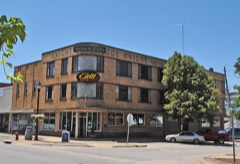 | Joe Knight Building | 0.2 miles | 2005 |
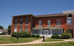 | Laclede County Jail | 0.2 miles | 1980 |
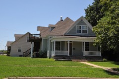 | Ralph E. Burley House | 0.2 miles | 1994 |
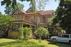 | Wallace House | 0.2 miles | 1984 |
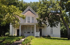 | Ploger-Moneymaker Place | 0.3 miles | 1982 |
| Missouri Farmers Association - Producers Creamery Company Dairy Plant | 0.9 miles | 2025 |
| National Archives record | The nomination case file for reference 100004220 in Record Group 79. |
| Laclede County | All 8 listed properties in this county. |