| January 1999 | Thunderstorm Wind | Charleston | 3 hurt, $100,000 | Thunderstorm winds overturned a mobile home and blew down a barn. The roof was removed from the Farm Bureau building in Charleston. At the Charleston Inn, windows were blown out and the roof was damaged. A large sign was snapped off, and a steel light post was snapped. Lots of trees were down in Charleston. The three occupants of the overturned mobile home were transported to a hospital. |
| March 1997 | Flash Flood | Charleston | 1 hurt, $40,000 | no account filed |
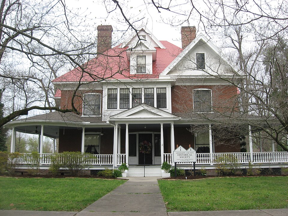
| July 2009 | Thunderstorm Wind | Charleston | $100,000 | In Charleston, numerous tree limbs were down, especially north of Highway 62. The historical society building suffered roof damage and a broken chimney. A few houses had minor roof damage. Trees were blown down. Power outages occurred. A bowling alley just south of Charleston on Highway 105 suffered window damage. A nearby church steeple was toppled. In Samos, a large pole barn was partially destroyed along Highway J. |
| January 2013 | Thunderstorm Wind | Charleston | $80,000 | At exit 10 along Interstate 57, an irrigation rig was turned over. A barn was destroyed and strewn across Highway 60 between Charleston and Wyatt. |
| April 2011 | Thunderstorm Wind | Charleston | $80,000 | On the west side of Charleston, two power poles were blown down. There was minor roof damage. A couple of trees were down. On Highway UU south of Charleston, a grain bin was heavily damaged. |
| April 2002 | Tornado (F1) | Charleston | $68,000 | The tornado path extended from Interstate 57 on the east side of Charleston to about 1.8 miles southeast of Charleston. Peak wind speeds in the tornado were estimated at 100 MPH. An anchored mobile home was lifted and rolled, destroying it. The residents of the mobile home escaped injury by abandoning it moments before the tornado struck. Stationary automobiles were moved about. Several mature hardwood trees were snapped off or uprooted. Minor damage occurred to outbuildings and metal pole-framed structures on the southeast edge of Charleston. |
| January 2012 | Thunderstorm Wind | Charleston | $50,000 | Damage was reported at the agricultural warehouse of a growers' association. The farm store and seed warehouse were totally destroyed. Both structures were large wood and metal storage sheds that were not of sturdy construction. The oil warehouse was damaged, but there were no leaks or ruptures. |
| May 2011 | Thunderstorm Wind | Charleston | $40,000 | The roof of a commercial building was heavily damaged. Wind-blown debris damaged numerous vehicles. Windows were broken in a couple of buildings. |
| April 2009 | Thunderstorm Wind | Charleston | $40,000 | A car wash was destroyed. A gas station canopy was blown down. |
| May 1999 | Thunderstorm Wind | Charleston | $20,000 | At Birds Point, an empty trailer was damaged. Scattered trees and limbs were blown down at East Prairie and Charleston. |
| February 1999 | Thunderstorm Wind | Charleston | $10,000 | A utility pole was blown over. |
| July 2004 | Thunderstorm Wind | Charleston | $7,000 | Numerous trees and power poles were downed, and road sign poles were snapped. A utility company reported 15 different power outages in Charleston, most caused by trees falling on lines. A large tree fell over three vehicles. Numerous trees and limbs fell across roadways. |
| June 2019 | Thunderstorm Wind | Charleston | $5,000 | Trees and wires were blown down from Charleston to East Prairie. At least one large tree was uprooted. A street was blocked. |
| April 2010 | Thunderstorm Wind | Charleston | $5,000 | About 20 percent of the metal was blown off a barn roof on Highway 105 south of Charleston. An interstate highway sign supported by two poles was blown down along Interstate 57 at exit 12, which is the U.S. Highway 60 exit. |
| August 2005 | Thunderstorm Wind | Charleston | $5,000 | Windows were broken at a downtown business, and shingles were blown off another structure. A church and several homes sustained roof and window damage. |
| July 2007 | Thunderstorm Wind | Charleston | $4,000 | Trees were down on County Road 220. |
| April 1995 | Thunderstorm Wind | Charleston | $2,000 | A roof was blown off a barn near the intersection of highways 75 and 105. This was the first report of damage associated with this cluster of thunderstorms. These storms produced extensive damage and a couple of injuries after crossing the Mississippi River into western Kentucky. |
| April 1997 | Thunderstorm Wind | Charleston | $2,000 | no account filed |
| June 2019 | Thunderstorm Wind | Charleston | - | One-inch limbs were down between Charleston and Wyatt. |
| May 2018 | Flood | Charleston | - | There was widespread standing water on roadways throughout the county. No roads were blocked. |
| June 2018 | Flash Flood | Charleston | - | Several roads in Charleston were nearly impassable due to flowing water. |
| June 2010 | Heavy Rain | Charleston | - | Local streets were flooded. A motorist stalled in the floodwaters. The car was pushed out of the water. |
| October 2010 | Dust Devil | Charleston | - | An off-duty meteorologist observed three or four dust devils on U.S. Highway 60 between Wyatt and Charleston in Mississippi County. The funnels were visible up to 20 feet above ground level. |
| August 2009 | Heavy Rain | Charleston | - | Water was over several roadways throughout the community. |
| May 2008 | Heavy Rain | Charleston | - | Street flooding occurred in Charleston. On a few streets, the water was over the curbs on both sides of the streets. |
| November 2005 | Thunderstorm Wind | Charleston | - | Windows were blown out of two houses. |
| November 2004 | Flash Flood | Charleston | - | Water covered roads in the city. This was the result of a broad area of rain producing 3/4 to 1 inch of rain per hour. |
| April 2003 | Funnel Cloud | Charleston | - | A narrow rope-like funnel was observed in the Charleston area. The funnel cloud was photographed from the city. It was reportedly snaking in and out of the parent cloud, and extended as much as 60 percent of the way to the ground. No thunderstorms were occurring in the vicinity of the funnel cloud, which formed beneath very cold air aloft associated with an upper level low. |
| June 2003 | Thunderstorm Wind | Charleston | - | A farm building was destroyed. A car wash was partially unroofed. Some trees and large limbs were blown down. |
| July 2003 | Thunderstorm Wind | Charleston | - | Several marquee signs were blown down on State Route 105 between Charleston and the airport. In downtown Charleston, a couple of trees were blown down. |
| February 2001 | Thunderstorm Wind | Charleston | - | Winds were estimated around 60 MPH. |
| June 2001 | Hail | Charleston | - | A slow-moving thunderstorm produced dime to nickel size hail over the Charleston area. The hail totally covered the ground. Numerous small tree limbs were down in the area. |
| October 2000 | Thunderstorm Wind | Charleston | - | A co-operative observer for the National Weather Service reported trees down. |
| April 1998 | Hail | Charleston | - | Quarter size hail fell on U.S. Highway 62. |
| April 2020 | Hail | Charleston | - | no account filed |
| March 2006 | Hail | Charleston | - | no account filed |
| May 2006 | Hail | Charleston | - | no account filed |
| March 2005 | Hail | Charleston | - | no account filed |
| October 2004 | Hail | Charleston | - | no account filed |
| March 2003 | Hail | Charleston | - | no account filed |
| April 2002 | Hail | Charleston | - | no account filed |
| February 2001 | Hail | Charleston | - | no account filed |
| May 2000 | Hail | Charleston | - | no account filed |
| August 2000 | Hail | Charleston | - | no account filed |
| May 1998 | Hail | Charleston | - | no account filed |
| May 1995 | Thunderstorm Wind | Charleston | - | no account filed |
 Block