 Block
From the record
One of 663 National Register listings published here for St. Louis County · listed in 1980 · category: District.
Sources: the case file at the National Archives · the National Register database, National Park Service
Listed on the National Register of Historic Places in 1980.
One of 663 National Register listings published here for St. Louis County · listed in 1980 · category: District.
Sources: the case file at the National Archives · the National Register database, National Park Service
Regional context, not property-specific evidence. The federal wildfire occurrence database lists 2 fires within 5 miles of University Heights Subdivision Number One between 2006 and 2014, burning about 1 acre in total. None started naturally. None was recorded as arson. Distance is straight-line from the map coordinates, so a fire counted here may appear on a neighbouring settlement's page as well.
| Reported cause | Fires |
|---|---|
| Missing data/not specified/undetermined | 2 |
The most recent of them, most recent first, with the day each was reported and the service that recorded it.
| Date | Cause | Size | Reported by | Name on the report |
|---|---|---|---|---|
| 18 April 2014 | Missing data/not specified/undetermined | 1.0 acres | Missouri Department of Conservation | not named |
| 27 February 2006 | Missing data/not specified/undetermined | under an acre | Missouri State Fire Marshal's Office | not named |
Regional context, not property-specific evidence. The federal mineral resources record lists 74 workings within 5 miles of University Heights Subdivision Number One: 71 past producers, 3 producers. 3 still produce. What was taken out: Stone, Crushed/Broken, Clay, Fire Clay (Refractory), Perlite. Distance is straight-line from the map coordinates, so a quarry counted here may appear on a neighbouring settlement's page as well.
| Where | Site | Commodity | Status | Recorded |
|---|---|---|---|---|
| Bambrick-Bates Constr. Co. Quarry 1 | Clay, Stone, Crushed/Broken | Past Producer | ||
| Delore Barite Mill | Barium-Barite | Producer | ||
| Krummel and Buchner Mine | Coal, Fire Clay (Refractory) | Past Producer | ||
| St Louis Perlite Plant | Perlite | Producer | ||
| Tole and Thorp Fireclay Mine | Fire Clay (Refractory), Coal | Past Producer | ||
| Coffin Mine | Fire Clay (Refractory) | Past Producer | ||
| Evans and Howard Fireclay Mine No 7 | Fire Clay (Refractory) | Past Producer | ||
| Evans and Howard Fireclay Mine No.6 | Fire Clay (Refractory) | Past Producer | ||
| Gilker Fireclay Mine | Fire Clay (Refractory) | Past Producer | ||
| Grandview Fireclay Mine | Fire Clay (Refractory) | Past Producer |
Regional context, not property-specific evidence. The National Weather Service names University City, the town this property stands in, in 24 storm reports between 1994 and 2026: 12 hail, 9 thunderstorm wind, 1 lightning, 1 flash flood. The reports record 1 death. Each account below is quoted exactly as the forecast office filed it, from the NOAA Storm Events Database, and each date opens the federal record of that event.
| When | Event | Place named | Harm | What the report says |
|---|---|---|---|---|
| April 2007 | Lightning | University City | 1 killed | A 25 year old man was struck by lightning near the intersection of Columbia and Radcliffe Avenues in University City. He died from the lightning strike 5 days later on April 29th. |
| April 2024 | Thunderstorm Wind | University City | $10,000 | Small tree limbs of up to 1 inch in diameter were broken in University City. Shingles were also blown off at least 1 home. |
| April 2026 | Hail | University City | - | Photo of hailstone received on X. |
| April 2026 | Hail | University City | - | Estimated ping pong sized hail with photo and US quarter. |
| May 2017 | Thunderstorm Wind | University City | - | Several large tree limbs were blown down around University City. |
| August 2014 | Thunderstorm Wind | University City | - | Thunderstorm winds blew down several large tree limbs. |
| April 2012 | Hail | University City | - | Golfball sized hail was reported in University City and on the Washington University campus. |
| September 2011 | Thunderstorm Wind | University City | - | Thunderstorm winds blew down numerous large trees onto Midland Boulevard, with some of them blocking the road. Also, the winds blew gravel off of a roof on Delmar Boulevard damaging several vehicles in a parking lot. A couple of cars had several windows broken on them due to the gravel. |
| April 2010 | Tornado (EF0) | University City | - | The tornado initially touched down near the intersection of Duke Drive and Blackberry Avenue in University City. The tornado traveled northwest producing intermittent damage for approximately 0.6 of a mile. The damage became more continuous for the next 2.4 miles from just southeast of Olive Boulevard to near Dawes Place just southeast of Lackland Road. Intermittent damage continued beyond Lackland Road to the northwest for an additional 1.4 miles. The last discernible damage was located near St. Ann Lane. The vast majority of the damage along the path consisted of varying degrees of tree damage which included numerous tree branches broken, trees uprooted, and tree trunks snapped well above their base. The most significant structural damage occurred on Wallis Avenue just north of Trescott Avenue where a three foot diameter tree caved in the corner of a home. The tornado reached a maximum width of 325 yards as it crossed Trescott Avenue. This is also where the damage was most intense with wind speeds estimated at 85 mph. Other notable damage was located near the intersection of Woodson Road and Harney Road where there was roof damage to a storage facility. Minor structural damage was noted at other locations along the path caused by tree limbs or trees falling on homes. Any direct tornadic damage to homes and businesses was minor superficial damage which consisted of siding, soffit and shingles. No injuries were reported. |
| May 2009 | Flash Flood | University City | - | Up to three inches of rain fell in a short amount of time causing flash flooding. The River Des Peres as well as smaller creeks were out of their banks flooding some roads and homes in the area, especially along Wilson Avenue. |
| June 2009 | Thunderstorm Wind | University City | - | Two large sycamores were uprooted. Both were at least 2 and a half feet in diameter. Also, a three foot diameter oak tree was uprooted and fell onto a house causing moderate damage. |
| July 2006 | Thunderstorm Wind | University City | - | Numerous large trees were blown down. |
| August 2000 | Thunderstorm Wind | University City | - | Amateur radio spotters reported trees down. |
| April 1994 | Hail | University City | - | The public reported 0.75-inch-diameter hail in numerous other suburbs of St. Louis. |
| April 2026 | Hail | University City | - | no account filed |
| May 2025 | Hail | University City | - | no account filed |
| April 2018 | Hail | University City | - | no account filed |
| May 2017 | Hail | University City | - | no account filed |
| April 2016 | Hail | University City | - | no account filed |
| May 2016 | Hail | University City | - | no account filed |
| April 2014 | Thunderstorm Wind | University City | - | no account filed |
| May 2014 | Hail | University City | - | no account filed |
| May 2004 | Hail | University City | - | no account filed |
| May 2004 | Thunderstorm Wind | University City | - | no account filed |
No historic map-sheet match is published for this property yet. That does not mean no map exists. This record needs a coordinate-quality review before it can be joined to a sheet boundary. Browse the county's mapped places while that work is pending.
Other National Register properties close enough to walk or drive between, ordered by distance from this one. Both positions come from the same geocoding pass that matched these properties to their map sheets.
| Photograph | Property | Distance | Listed |
|---|---|---|---|
| University City Plaza | 0.1 miles | 1975 | |
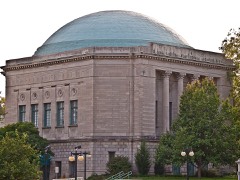 | Assumption Greek Orthodox Church | 0.3 miles | 1980 |
| Parkview Towers | 0.3 miles | 2024 | |
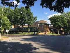 | B'Nai Amoona Synogogue | 0.3 miles | 1984 |
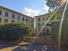 | Donaldson Court Apartments | 0.3 miles | 1983 |
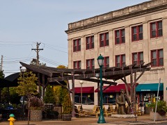 | Delmar Loop-Parkview Gardens Historic District | 0.3 miles | 1984 |
| National Archives record | The nomination case file for reference 80004391 in Record Group 79. |
| St. Louis County | All 663 listed properties in this county. |