 Block
From the record
One of 8 National Register listings published here for Shannon County · listed in 1981 · category: District.
Sources: the case file at the National Archives · the National Register database, National Park Service
Listed on the National Register of Historic Places in 1981.
One of 8 National Register listings published here for Shannon County · listed in 1981 · category: District.
Sources: the case file at the National Archives · the National Register database, National Park Service
Regional context, not property-specific evidence. The federal wildfire occurrence database lists 57 fires within 5 miles of Chilton-Williams Farm Complex between 1992 and 2020, burning about 1,007 acres in total. 2 started naturally. 36 were recorded as arson. Distance is straight-line from the map coordinates, so a fire counted here may appear on a neighbouring settlement's page as well.
| Reported cause | Fires |
|---|---|
| Arson/incendiarism | 36 |
| Missing data/not specified/undetermined | 7 |
| Debris and open burning | 6 |
| Equipment and vehicle use | 3 |
| Recreation and ceremony | 3 |
| Natural | 2 |
The most recent of them, most recent first, with the day each was reported and the service that recorded it.
| Date | Cause | Size | Reported by | Name on the report |
|---|---|---|---|---|
| 4 September 1995 | Equipment and vehicle use | under an acre | Ozark National Scenic River | MACY |
| 22 September 2000 | Arson/incendiarism | 3.0 acres | Missouri Department of Conservation | not named |
| 13 August 2012 | Missing data/not specified/undetermined | under an acre | Ozark National Scenic River | WEST BLUE SPRING |
| 13 August 2012 | Missing data/not specified/undetermined | under an acre | Ozark National Scenic River | MARTIN BLUFF |
| 2 July 2012 | Natural | under an acre | Ozark National Scenic River | KLEPZIG MILL |
| 25 June 1996 | Equipment and vehicle use | under an acre | Ozark National Scenic River | ROBERTS |
| 3 May 2014 | Arson/incendiarism | 2.2 acres | Missouri Department of Conservation | not named |
| 3 May 2014 | Arson/incendiarism | 1.0 acres | Missouri Department of Conservation | not named |
Regional context, not property-specific evidence. The federal mineral resources record lists 6 workings within 5 miles of Chilton-Williams Farm Complex: 6 prospects. None of them still produces. What was taken out: Copper, Iron, Manganese, Lead. Distance is straight-line from the map coordinates, so a quarry counted here may appear on a neighbouring settlement's page as well.
| Where | Site | Commodity | Status | Recorded |
|---|---|---|---|---|
| Blair Creek Prospect | Lead | Prospect | 1962 | |
| Bonanza Prospect | Copper | Prospect | ||
| Freeman Land | Copper | Prospect | ||
| Jacks Fork Mine | Iron | Prospect | ||
| James Jones Land | Iron, Manganese | Prospect | ||
| Unknown Manganese | Manganese | Prospect |
Regional context, not property-specific evidence. The National Weather Service names Eminence, the town this property stands in, in 55 storm reports between 1995 and 2025: 27 thunderstorm wind, 17 hail, 7 flash flood, 3 heavy rain. No death or injury is recorded in these reports. Each account below is quoted exactly as the forecast office filed it, from the NOAA Storm Events Database, and each date opens the federal record of that event.
| When | Event | Place named | Harm | What the report says |
|---|---|---|---|---|
| April 2017 | Flash Flood | Eminence | $5,000,000 | Numerous campgrounds and river access areas were severely damaged across Shannon County and in the Ozark National Scenic Riverways Park. Numerous homes and businesses were severely damage or washed away along the Jack Fork River and Current River. This report will contain the total dollar estimate for flood damage to infrastructure, businesses, and homes across Shannon County. |
| April 2011 | Flash Flood | Eminence | $1,000,000 | Numerous rural roads and low water crossings were flooded throughout the county.||The total cost estimate for flooding damages for Shannon County for this entire episode has been included. This includes roads, bridges, and structures which were affected. |
| July 2025 | Thunderstorm Wind | Eminence | $50,000 | A few power poles were reported down or broken from high winds. Multiple reports of power outages occurred in the Eminence area. |
| April 2020 | Thunderstorm Wind | Eminence | $20,000 | The Electric Co-op reported at least 3 powers poles were snapped near the base in Eminence. |
| May 2024 | Thunderstorm Wind | Eminence | $10,000 | Report of trees uprooted or snapped and a roof blown off. |
| August 2006 | Thunderstorm Wind | Eminence | $5,000 | Thunderstorm winds downed power lines near Eminence. |
| May 1996 | Flash Flood | Eminence | $5,000 | no account filed |
| April 2019 | Heavy Rain | Eminence | - | The Mesonet Station at EMCM7 reported a 24 hour rainfall total of 2.23 inches on the Jacks Fork River at Eminence. |
| October 2019 | Thunderstorm Wind | Eminence | - | Numerous small to large trees were reported down or uprooted in Eminence. |
| May 2018 | Flash Flood | Eminence | - | Several low water crossings were flooded around the Eminence area. |
| June 2018 | Thunderstorm Wind | Eminence | - | Several trees were reported down by the public. |
| June 2018 | Thunderstorm Wind | West Eminence | - | Several trees were reported down. No damage occurred. |
| May 2016 | Heavy Rain | Eminence | - | A 24 hour storm total rainfall of 2.41 inches was reported. |
| August 2016 | Heavy Rain | Eminence | - | A twenty four hour rainfall total of 3.33 inches was measured at a CO-OP station about 1 mile north of Eminence. |
| June 2012 | Thunderstorm Wind | Eminence | - | Wind gusts up to 60 mph were estimated. |
| December 2008 | Thunderstorm Wind | Eminence | - | Several trees were knocked over from thunderstorm wind gusts. |
| May 2008 | Thunderstorm Wind | Eminence | - | Thunderstorm wind gusts downed large trees across a section of Highway 19. |
| January 2008 | Thunderstorm Wind | Eminence | - | A few trees were reported down in the Eminence area. |
| April 2008 | Thunderstorm Wind | Eminence | - | Severe thunderstorm wind gusts downed several large trees. |
| March 2006 | Thunderstorm Wind | Eminence | - | Trees were damaged from thunderstorm wind gusts. |
| July 2006 | Thunderstorm Wind | Eminence | - | Severe thunderstorm wind gusts downed a few trees and power lines within the city of Eminence. |
| July 2006 | Thunderstorm Wind | Eminence | - | Severe thunderstorm wind gusts downed a couple of trees north of Eminence along Highway 19. |
| September 2006 | Thunderstorm Wind | Eminence | - | Thunderstorm wind gusts downed several trees across Shannon County. |
| June 2005 | Thunderstorm Wind | Eminence | - | Northern and central section of the county sustained tree damage from severe thunderstorm wind gusts. |
| November 2005 | Flash Flood | Eminence | - | Water covered low water bridges in Eminence while roadways were impassable. |
| November 2005 | Thunderstorm Wind | Eminence | - | Severe thunderstorm wind gusts downed several large tree limbs north of Eminence. |
| May 2004 | Tornado (F0) | Eminence | - | A small tornado briefly touched down in a wooded area southwest of Eminence. Numerous trees were downed...however...no structure damage occurred. Straight line winds also downed trees from Summersville through Alley Springs and then to the east of Eminence. |
| July 1997 | Thunderstorm Wind | Eminence | - | Thunderstorm winds downed a few trees near the Powder Mill Ferry Ranger Station. |
| August 1997 | Thunderstorm Wind | Eminence | - | Thunderstorm winds downed several large tree limbs. |
| May 2018 | Hail | Eminence | - | no account filed |
| April 2007 | Hail | Eminence | - | no account filed |
| February 2006 | Hail | Eminence | - | no account filed |
| February 2006 | Hail | Eminence | - | no account filed |
| April 2006 | Hail | Eminence | - | no account filed |
| November 2006 | Hail | Eminence | - | no account filed |
| April 2005 | Hail | Eminence | - | no account filed |
| June 2005 | Thunderstorm Wind | Eminence | - | no account filed |
| November 2003 | Hail | Eminence | - | no account filed |
| April 2003 | Hail | Eminence | - | no account filed |
| July 2003 | Hail | West Eminence | - | no account filed |
| March 2002 | Thunderstorm Wind | Eminence | - | no account filed |
| May 2001 | Hail | Eminence | - | no account filed |
| May 2001 | Thunderstorm Wind | Eminence | - | no account filed |
| May 2000 | Hail | Eminence | - | no account filed |
| May 2000 | Hail | Eminence | - | no account filed |
| September 2000 | Thunderstorm Wind | Eminence | - | no account filed |
| August 2000 | Thunderstorm Wind | Eminence | - | no account filed |
| June 1999 | Thunderstorm Wind | Eminence | - | no account filed |
| June 1998 | Hail | Eminence | - | no account filed |
| July 1997 | Hail | Eminence | - | no account filed |
| March 1997 | Flash Flood | Eminence | - | no account filed |
| May 1996 | Thunderstorm Wind | Eminence | - | no account filed |
| September 1996 | Flash Flood | Eminence | - | no account filed |
| June 1995 | Hail | Eminence | - | no account filed |
| July 1995 | Hail | Eminence | - | no account filed |
No historic map-sheet match is published for this property yet. That does not mean no map exists. This record needs a coordinate-quality review before it can be joined to a sheet boundary. Browse the county's mapped places while that work is pending.
Other National Register properties close enough to walk or drive between, ordered by distance from this one. Both positions come from the same geocoding pass that matched these properties to their map sheets.
| Photograph | Property | Distance | Listed |
|---|---|---|---|
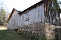 | Reed Log House | 2.5 miles | 1991 |
| Buttin Rock School | 2.9 miles | 1991 | |
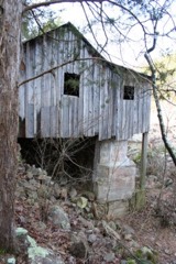 | Walter Klepzig Mill and Farm | 4.1 miles | 1990 |
| National Archives record | The nomination case file for reference 81000696 in Record Group 79. |
| Shannon County | All 8 listed properties in this county. |