 Block
From the record
8 National Register listings published here.
Sources: the National Register database, National Park Service
110 topographic sheets cover 40 settlements here, and 8 properties are on the National Register of Historic Places.
8 National Register listings published here.
Sources: the National Register database, National Park Service
Every property in this county listed on the National Register of Historic Places, with the year it was listed and the federal nomination document.
| Photograph | Property | Type | Listed | Reference |
|---|---|---|---|---|
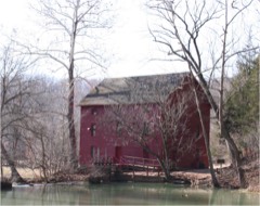 | Alley Spring Roller Mill | building | 1981 | 81000336 |
 | Alton Club | district | 2005 | 05001162 |
| Buttin Rock School | district | 1991 | 91000605 | |
| Chilton-Williams Farm Complex | district | 1981 | 81000696 | |
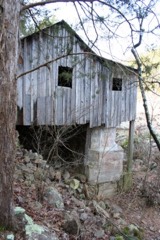 | Walter Klepzig Mill and Farm | district | 1990 | 90000001 |
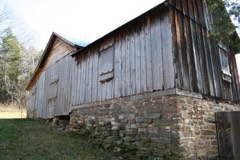 | Reed Log House | building | 1991 | 91000456 |
| Rhinehart Ranch | building | 1980 | 80002395 | |
| Winona Ranger Station Historic District | district | 2003 | 03000715 |
Every wildfire the federal occurrence database records inside this county: 1,171 of them, burning about 42,997 acres. 13 started naturally and 684 were recorded as arson. Each settlement page carries the fires within five miles of it.
| Reported cause | Fires |
|---|---|
| Arson/incendiarism | 684 |
| Debris and open burning | 260 |
| Missing data/not specified/undetermined | 144 |
| Recreation and ceremony | 25 |
| Equipment and vehicle use | 19 |
| Natural | 13 |
| Power generation/transmission/distribution | 9 |
| Smoking | 9 |
| Other causes | 4 |
| Misuse of fire by a minor | 3 |
| Fireworks | 1 |
The five largest, by the area the report gives. 7 of them were set deliberately.
| Date | Cause | Size | Reported by | Name on the report |
|---|---|---|---|---|
| 3 April 2011 | Arson/incendiarism | 3,521 acres | Mark Twain National Forest | MUD POND |
| 12 April 2018 | Arson/incendiarism | 1,366 acres | Missouri Department of Conservation | 176639-00000-04122018-1130 |
| 25 February 1995 | Arson/incendiarism | 1,200 acres | Mark Twain National Forest | YOUNG HOLLOW |
| 18 November 2020 | Missing data/not specified/undetermined | 956 acres | Missouri Department of Conservation | 251202-10163-11182020-2120 |
| 6 April 2011 | Arson/incendiarism | 911 acres | Mark Twain National Forest | MARTIN 2 |
| 26 November 2017 | Arson/incendiarism | 876 acres | Missouri Department of Conservation | not named |
| 25 March 1995 | Arson/incendiarism | 707 acres | Missouri Department of Conservation | not named |
| 20 February 2011 | Arson/incendiarism | 624 acres | Mark Twain National Forest | BUCKHART SPRINGS |
Every settlement page carries the fires within five miles of it - see the settlement index below.
The NOAA Storm Events Database holds 481 reports for this county, causing 7 deaths, 1 injury and about $22,535,700 in recorded property damage. Each settlement page carries the reports that name it.
| Kind of event | Reports |
|---|---|
| Hail | 153 |
| Thunderstorm Wind | 144 |
| Flash Flood | 75 |
| Flood | 72 |
| Tornado | 22 |
| Heavy Rain | 14 |
| Funnel Cloud | 1 |
The most serious of them, by death, then injury, then recorded damage. The accounts are quoted exactly as the forecast office filed them.
| When | Event | Place named | Harm | What the report says |
|---|---|---|---|---|
| November 1973 | Tornado (F2) | not stated | 3 killed, 1 hurt, $250,000 | no account filed |
| October 1984 | Tornado (F3) | not stated | 1 killed, $2,500,000 | no account filed |
| July 2011 | Flash Flood | Bartlett | 1 killed, $2,000 | A Shannon County resident was swept off a low water bridge during the early morning hours of July 5th after isolated thunderstorms produced heavy rainfall causing a small stream to become swollen and overflow its banks. The driver attempted to drive over the flooded low water bridge and was swept nearly 150 yards down stream where his car and body were found on July 13th. |
| August 2011 | Thunderstorm Wind | Winona | 1 killed | A man was killed from a tree that fell on his car while driving. This occurred on County Road 440 one tenth of a mile west of Highway 19 about 3 miles north of Winona. |
| April 2008 | Flash Flood | Cedargrove | 1 killed | One to three inches of rain fell over Shannon County. All low areas that typically flood during periods of excessive rainfall were flooded. A 14 year old male attempted to cross a flooded creek in extreme northeast Shannon County near the community of Bunker. He lost grip of a cable he was using to keep stable in the swift flowing water. He was swept downstream where he drowned. |
| November 2024 | Flash Flood | Rat | $8,800,000 | Route P at Big Creek was closed due to flooding. Additional county property damages were reported throughout the entire county, primarily to dirt roads and bridges, with many facilities, campgrounds, and river access points sustained damage to the Scenic Riverway parks. Damage cost estimates are a reflection of the county as a whole. Unprecedented river levels caused devastating impacts to facilities at Akers and Pulltite. The Akers Ranger Station, which also houses Akers Ferry Canoe Rental, had approximately two feet of water throughout. The old Akers Ferry Canoe Rental store was almost fully submerged, sustaining significant damage.| |At Pulltite Campground, water reached the roof of the Pulltite Ranger Station and adjoining shower house, causing tremendous destruction. Approximately two feet of water entered the Current River Canoe Rental Store. The Pulltite picnic pavilion was swept away and destroyed. The campground amphitheater was toppled off its foundation. Floodwater lifted thick chunks of asphalt from the campground roads, undercut the roadway in multiple places, scoured campsites, and mangled or relocated posts, picnic tables, fire rings, and other structures. Large trees were toppled throughout the area and tangled with flood debris. ||Additionally, Park Rangers carried out several river rescues on Monday and Tuesday for visitors caught off guard. |
| April 2017 | Flash Flood | Eminence | $5,000,000 | Numerous campgrounds and river access areas were severely damaged across Shannon County and in the Ozark National Scenic Riverways Park. Numerous homes and businesses were severely damage or washed away along the Jack Fork River and Current River. This report will contain the total dollar estimate for flood damage to infrastructure, businesses, and homes across Shannon County. |
| May 2009 | Thunderstorm Wind | Angeline | $3,000,000 | Sixty to 85 mph winds caused intense damage to trees, power poles, and structures over much of Shannon County. This damage was widespread, and impacted almost all communities within the county. The Missouri Department of Conservation estimated that nearly 13 million dollars of damage occurred to forest land, some of which was due to tornadoes. Hundreds if not thousands of structures sustained some type of damage. A sawmill was destroyed with only one wall left standing near the intersection of Highway 19 and Highway D. |
| April 2011 | Flash Flood | Eminence | $1,000,000 | Numerous rural roads and low water crossings were flooded throughout the county.||The total cost estimate for flooding damages for Shannon County for this entire episode has been included. This includes roads, bridges, and structures which were affected. |
| December 2015 | Flash Flood | Alley Spg | $500,000 | Flash flooding caused damage to several Ozarks Scenic Riverways campgrounds including along the Jack Fork River and Alley Spring campground. There were several roads and structures that were damage by flood water. This storm report will contain the damage estimates for the entire county for this event. |
| October 1984 | Tornado (F1) | not stated | $250,000 | no account filed |
| March 2025 | Tornado (EF3) | Low Wassie | $100,000 | This is the continuation of the tornado out of Oregon County that moved into far southeastern Shannon County. This tornado uprooted hundreds of trees before moving northeast into Carter County and intensifying. |
| July 2016 | Flash Flood | Powder Mill Ferry | $100,000 | Rapid water rises and flooding along the Current River near Powder Mill Spring forced about 50 campers to move quickly to higher ground. One truck and several camping trailers were washed down stream. There were no injuries reported. |
| January 2005 | Tornado (F0) | Winona | $100,000 | This tornado is a continuation of the Howell County tornado. The tornado crossed the Howell and Shannon County line northeast of Mountain View and remained on the ground for two miles into Shannon County. One structure and several trees were damaged in it's path. |
| May 2024 | Tornado (EF2) | Bartlett | $75,000 | NWS storm survey concluded an EF2 tornado with peak winds near 125 mph started 2 miles northeast of Birch Tree and travelled east southeast for just over 3 miles before lifting 4 miles east of Birch Tree. The tornado crossed Highway 60 just east of County Road 421. This tornado removed the roof of one home and destroyed a saw mill. Numerous trees were also uprooted or snapped along the path of the tornado. |
| January 2008 | Tornado (EF1) | Munsett | $75,000 | A National Weather Service storm survey revealed that an EF-1 tornado impacted forested areas of eastern Shannon County. Two barns and a garage were destroyed while numerous trees were snapped or uprooted. |
| July 2025 | Thunderstorm Wind | Eminence | $50,000 | A few power poles were reported down or broken from high winds. Multiple reports of power outages occurred in the Eminence area. |
| May 2024 | Tornado (EF3) | Teresita | $50,000 | NWS Storm Survey concluded that a low end EF-3 tornado with peak wind speeds near 140 mph caused damage to homes and businesses in Howell County before moving into Shannon County and lifting north of Montier in Shannon County. The tornado in Shannon County uprooted or snapped numerous trees and damaged several outbuildings. |
| May 2020 | Thunderstorm Wind | Teresita | $50,000 | Thunderstorm winds resulted in 600 power outages in the Mountain View, Birch Tree and Winona areas from downed power lines and poles. |
| May 2009 | Tornado (EF2) | Blue Spgs | $50,000 | This tornado is a continuation of the southeastern Texas County tornado. A National Weather Service storm survey revealed that an EF-2 tornado entered rural west central Shannon County from southeastern Texas County. This tornado tracked across forested areas of west central and central Shannon County, uprooting and snapping numerous trees. The Missouri Department of Conservation announced that the tornado and other high winds from this event resulted in $13M of damage to trees. The tornado also damaged a sawmill along its path. |
| March 2026 | Tornado (EF1) | Akers | $40,000 | An EF-1 tornado briefly touched down approximately 5 miles southwest of Akers in Shannon County. Strong winds caused the roof of a single wide home to be torn off as well as the windows to be blown in. Other damage included large trees uprooted and healthy trees snapped. |
| August 2011 | Thunderstorm Wind | Winona | $40,000 | Numerous trees were blown down on homes and cars. One tree fell on the bed of a parked Forest Service truck in town. A few rescues were conducted for people trapped in homes from fallen trees. |
| April 2019 | Thunderstorm Wind | Montier | $25,000 | Several power lines were reported down. |
| August 2011 | Thunderstorm Wind | Blue Spgs | $25,000 | The police department and city hall suffered roof damage. Numerous trees were down in the area. |
| March 2006 | Thunderstorm Wind | Winona | $25,000 | Severe thunderstorm wind gusts damaged a few roofs and knocked down power poles in a rural area southwest of Winona. |
| November 1984 | Tornado (F1) | not stated | $25,000 | no account filed |
| December 1982 | Tornado (F1) | not stated | $25,000 | no account filed |
| May 2024 | Tornado (EF0) | Bartlett | $20,000 | A NWS Storm Survey concluded that a brief EF-0 tornado with peak winds near 80 mph tracked east just to the north of Highway 60 between Birch Tree and Winona. The tornado travelled east just to the north of Highway 60 for less than a mile, uprooting or snapping several trees. |
| March 2022 | Thunderstorm Wind | Teresita | $20,000 | Several trees were reported down on power lines. |
| April 2020 | Thunderstorm Wind | Eminence | $20,000 | The Electric Co-op reported at least 3 powers poles were snapped near the base in Eminence. |
| May 2019 | Flash Flood | Round Spg | $20,000 | Flash flooding occurred at Echo Bluff State Park and Sinking Creek flooded out of its banks. The swift moving high water destroyed a concrete driveway at a residence approximately 7 miles north northeast of Round Spring. A few county roadways were significantly damaged, and a large area of fencing was damaged as 4.50 inches of rain was measured at this location. |
| January 2008 | Thunderstorm Wind | Blue Spgs | $20,000 | A National Weather Service storm survey determined that a barn was destroyed by straight line winds south of Summersville. |
| May 2020 | Flash Flood | Angeline | $15,000 | A vehicle was washed of the road. The occupants self rescued with no injuries. |
| June 2018 | Thunderstorm Wind | Angeline | $15,000 | Numerous trees were reported uprooted and siding was ripped off a home near the intersection of State Highway N and State Highway D. A second residence on State Highway N had several trees uprooted and roof damage to an outbuilding. |
| April 2011 | Thunderstorm Wind | Delaware | $15,000 | Numerous trees were reported down and blocking Highway 19 and State Highway F. Trees and power lines were reported down on Highway E between Highways 160 and 60. |
| November 2024 | Flood | Akers | $11,500 | The Current River reached Moderate to Major flood stage, with extensive damage reported at both Current River State Park and Echo Bluff State Park. Damage cost estimates are reflective of both State Parks. |
| March 2026 | Tornado (EF0) | Blue Spgs | $10,000 | This is a continuation of the tornado out of Texas County. A NWS survey team found EF-0 damage with maximum winds of 85 mph south of Summersville in Texas County that later tracked into Shannon County. Multiple trees and limbs along the path were uprooted and/or snapped. Additionally, several roofs were damaged, including a barn roof that was partially removed, a metal roof that was removed from its building and blown away, and other buildings that suffered shingle damage. |
| May 2024 | Thunderstorm Wind | Alley Spg | $10,000 | Report of trees uprooted or snapped and a roof blown off. |
| May 2024 | Thunderstorm Wind | Round Spg | $10,000 | Many trees and limbs were down, making roads impassable. |
| May 2024 | Thunderstorm Wind | Eminence | $10,000 | Report of trees uprooted or snapped and a roof blown off. |
| July 2024 | Thunderstorm Wind | Timber | $10,000 | Several trees and limbs were reported down at Pulltite Campground and along EE Highway in Shannon County. |
| March 2017 | Hail | Alley Spg | $10,000 | Alley Spring Park Ranger reported damage from golf ball size hail. |
| March 2017 | Hail | Birch Tree | $10,000 | This report was from social media with a picture. There was some damage to cars and windows in the Birch Tree area. |
| May 2011 | Thunderstorm Wind | Birch Tree | $10,000 | A large tree fell on a police car. |
| March 2006 | Thunderstorm Wind | Winona | $10,000 | Severe thunderstorm down burst winds downed a few power poles and destroyed a roof off of a pavillion in a city park. A roof off of bleachers next to a baseball diamond was also destroyed. |
| April 2002 | Thunderstorm Wind | Winona | $10,000 | no account filed |
| August 2000 | Thunderstorm Wind | Round Spg | $10,000 | no account filed |
| June 1998 | Flash Flood | Countywide | $10,000 | no account filed |
| June 1998 | Thunderstorm Wind | Alley Spg | $8,000 | no account filed |
| May 2025 | Hail | Bartlett | $5,000 | Report of two inch size hail. |
| May 2024 | Thunderstorm Wind | Round Spg | $5,000 | Some trees were reported down in the Timber area. |
| July 2024 | Thunderstorm Wind | Shannondale | $5,000 | Multiple large trees were blown down across Highways 19 and KK. |
| August 2022 | Thunderstorm Wind | Timber | $5,000 | A tree fell on a power line along Highway A near Christo Cemetery. |
| March 2017 | Thunderstorm Wind | Montier | $5,000 | A tree was blown down and struck a house off State Highway T. |
| April 2014 | Thunderstorm Wind | Timber | $5,000 | A picture of minor damage was received via social media showing fencing blown down and minor damage to a barn and an outbuilding with the roof peeled off. A few large tree branches were also blown down. |
| June 2013 | Thunderstorm Wind | Winona | $5,000 | There were scattered outages due to trees and limbs blown down onto power lines in the Winona and Birch Tree areas. |
| July 2008 | Thunderstorm Wind | Winona | $5,000 | Thunderstorm wind gusts downed trees onto a fence. A car port was also damaged and blown over. |
| April 2006 | Thunderstorm Wind | Round Spg | $5,000 | Severe thunderstorm wind gusts downed large trees and powerlines across Highway 19. |
| August 2006 | Thunderstorm Wind | Teresita | $5,000 | Severe thunderstorm wind gusts downed a few power lines. |
| August 2006 | Thunderstorm Wind | Eminence | $5,000 | Thunderstorm winds downed power lines near Eminence. |
The Survey's mineral resources record lists 84 workings inside this county. 3 still produce and 81 are closed or unrecorded. Each settlement page carries the workings within five miles of it.
| Commodity | Workings |
|---|---|
| Iron | 53 |
| Copper | 15 |
| Manganese | 11 |
| Stone, Crushed/Broken | 3 |
| Clay | 2 |
| Silica | 1 |
| Copper, Manganese | 1 |
| Flagstone | 1 |
| Lead | 1 |
| Manganese, Copper | 1 |
The least common of them first, because a county's hundredth gravel pit says nothing its first ten did not.
| Where | Site | Commodity | Status | Recorded |
|---|---|---|---|---|
| Blair Creek Prospect | Lead | Prospect | 1962 | |
| Bolen Mine | Iron, Manganese, Copper | Past Producer | ||
| Daniels Prospect | Iron, Copper, Manganese | Prospect | ||
| Ozark Stone Products Quarry | Flagstone | Producer | ||
| Unknown Tripoli | Silica | Past Producer | ||
| Edmondson Pond | Clay | Past Producer | ||
| Unknown Manganese Usfs Land | Manganese, Clay | Past Producer | ||
| Crider Bros. Limestone Quarry/Mill | Stone, Crushed/Broken | Producer | ||
| Unknown Ls | Stone, Crushed/Broken | Past Producer | ||
| Unknown Ls | Stone, Crushed/Broken | Past Producer | ||
| Culpepper Prospect | Manganese | Prospect | ||
| Elliot Prospect | Manganese | Prospect | ||
| Horner Mountain Mine | Manganese | Past Producer | 1954 | |
| James Jones Land | Iron, Manganese | Prospect | ||
| Reeves Prospect | Iron, Manganese | Prospect | ||
| Ross Prospect | Manganese | Prospect | ||
| Thorny Mountain Mine | Manganese | Prospect | 1916, 1942 | |
| Unknown Manganese | Manganese | Prospect | ||
| Unknown Manganese | Manganese | Prospect | ||
| White Prospect | Manganese | Prospect | ||
| Bonanza Prospect | Copper | Prospect | ||
| Casey Mine | Copper | Occurrence | Chalcocite, Malachite | |
| Casey Mine | Copper | Past Producer | ||
| Freeman Land | Copper | Prospect | ||
| Jerktail Prospect | Copper | Occurrence | Chalcocite, Chalcopyrite, Cuprite, Malachite | |
| Jerktall Mine | Copper | Past Producer | ||
| Johnson Shaft | Copper | Past Producer | ||
| McKinney Mine | Copper | Past Producer | ||
| Slater Mine | Copper | Past Producer | 1837 | |
| Slater Mine | Copper | Past Producer | ||
| Stegall Mine | Copper | Past Producer | ||
| Sutton Mine | Copper | Past Producer | Chalcocite, Cuprite, Malachite | |
| Sutton Mine | Copper | Past Producer | ||
| Unknown Copper | Copper | Past Producer | ||
| Unknown Copper Usfs Land | Copper | Past Producer | ||
| Bryson Bank | Iron | Past Producer | Goethite, Limonite | |
| Bryson Bank | Iron | Prospect | ||
| Carr Land | Iron | Occurrence | ||
| Chilton Bank | Iron | Producer | Surface | |
| Chilton Bank | Iron | Prospect | ||
| Chrisco Land | Iron | Occurrence | ||
| Clarence Ballance Land | Iron | Past Producer | 1914 | |
| Cordz-Fischer Mine | Iron | Past Producer | 1952 | |
| Cutler Land | Iron | Past Producer | ||
| Dean J.H. Land | Iron | Past Producer | ||
| Dean Land | Iron | Prospect | ||
| Embree Land | Iron | Occurrence | ||
| Esther B. Detwiler Land | Iron | Occurrence | Surface | |
| Fisher-Melton Mine | Iron | Past Producer | 1954 | |
| Government Land # 5 | Iron | Occurrence | ||
| Government Land No. 5 | Iron | Occurrence | ||
| Grandin Bank | Iron | Occurrence | ||
| Hearst Mine | Iron | Past Producer | 1902 | |
| Hearst Mine | Iron | Past Producer | ||
| Hurt Bank | Iron | Past Producer | Underground | |
| Hurt Bank | Iron | Prospect | ||
| Iron Hill Mine | Iron | Past Producer | ||
| Iron Hill Mine | Iron | Past Producer | ||
| Jacks Fork Mine | Iron | Prospect | ||
| Ledgerwood Mine | Iron | Past Producer | ||
| Lola Farrar Prospect | Iron | Prospect | Surface | |
| Melton Mine | Iron | Past Producer | ||
| Miley Noble Land | Iron | Past Producer | 1904 | |
| Missouri Lumber and Mining Co., Mine No. 15 | Iron | Past Producer | Surface | |
| Missouri Lumber and Mining Co., No 32 | Iron | Occurrence | ||
| Missouri Lumber and Mining Co., No. 33 | Iron | Occurrence | Surface | |
| Missouri Lumber and Mining Co., No. 34 | Iron | Occurrence | Surface | |
| Missouri Mining & Lumber Co # 15 | Iron | Past Producer | ||
| Missouri Mining & Lumber Co # 33 | Iron | Prospect | ||
| Missouri Mining & Lumber Co # 34 | Iron | Prospect | ||
| Noble Mine | Iron | Prospect | ||
| Ozark Land & Lumber Co Land # 1 | Iron | Past Producer | ||
| Piatt Land | Iron | Occurrence | ||
| Ray Bowman Prospect | Iron | Past Producer | 1936 | |
| Talkington Bank | Iron | Prospect | ||
| Tripp G.W. Land | Iron | Occurrence | ||
| Unknown Iron | Iron | Past Producer | ||
| Unknown Iron | Iron | Past Producer | ||
| West Eminence Bank | Iron | Past Producer | Surface | |
| West Eminence Bank | Iron | Prospect | ||
| Willis Mine | Iron | Past Producer | 1902 | |
| Willis Mine | Iron | Past Producer | ||
| Woods Mine | Iron | Past Producer | ||
| Woodside-Chrisco Bank | Iron | Occurrence |
Named settlements recorded in the Geographic Names Information System, each with the topographic sheets covering it. Villages, hamlets and abandoned places alike. Each is shown with the nearest named watercourse or landform and the survey quadrangle it falls on.
Spring Valley township · 65479 · On Gladden Creek · Cedargrove quadrangle
22 sheets, 1932 to 1989
Eminence township · 65466 · Near Lawrence Hollow · Alley Spring quadrangle
22 sheets, 1915 to 1989
Eminence township · 63638 · Near Stillhouse Hollow · Van Buren North quadrangle
20 sheets, 1928 to 1997
Moore township · 63629 · Near Turkey Roost Hollow · The Sinks quadrangle
20 sheets, 1945 to 1989
No longer a settlement
Delaware township · 65438 · Near Turnback Hollow · Bartlett quadrangle
22 sheets, 1915 to 1997
No longer a settlement
Spring Valley township · 65479 · On Big Creek · Cedargrove quadrangle
22 sheets, 1932 to 1989
Spring Creek township · 65438 · Montier quadrangle
12 sheets, 1945 to 1986
No longer a settlement
Eminence township · 65466 · Near Keeling Hollow · Alley Spring quadrangle
22 sheets, 1915 to 1989
Eminence township · 63629 · On Little Blair Creek · Powder Mill Ferry quadrangle
20 sheets, 1928 to 1997
Moore township · 63629 · Near Polk Ridge · Midridge quadrangle
18 sheets, 1944 to 1989
No longer a settlement
Eminence township · 65466 · On Sinking Branch · Alley Spring quadrangle
22 sheets, 1915 to 1989
No longer a settlement
Eminence township · 63629 · Near Barn Hollow · Eminence quadrangle
22 sheets, 1915 to 1989
Winona township · 65588 · On Sycamore Creek · Low Wassie quadrangle
14 sheets, 1931 to 1997
Moore township · 63629 · Near Schoolhouse Hollow · The Sinks quadrangle
20 sheets, 1945 to 1989
Eminence township · 65588 · Near Overstreet Hollow · Winona quadrangle
22 sheets, 1915 to 1997
Eminence township · 65466 · On Bloom Creek · Powder Mill Ferry quadrangle
20 sheets, 1928 to 1997
Newton township · 65466 · Near Spring Valley · Round Spring quadrangle
20 sheets, 1945 to 1989
Newton township · 65560 · Near Woodland Hollow · Gladden quadrangle
17 sheets, 1945 to 1989
Newton township · 65560 · Near White Hollow · Gladden quadrangle
17 sheets, 1945 to 1989
No longer a settlement
Eminence township · 65466 · Alley Spring quadrangle
22 sheets, 1915 to 1989
No longer a settlement
Newton township · 65560 · Near River Hollow · Round Spring quadrangle
20 sheets, 1945 to 1989
Delaware township · 65548 · Near Sycamore Hollow · Jam Up Cave quadrangle
19 sheets, 1946 to 1989
No longer a settlement
Eminence township · 65466 · Near Spring Hollow · Alley Spring quadrangle
22 sheets, 1915 to 1989
Eminence township · 65466 · On Mahans Creek · Eminence quadrangle
22 sheets, 1915 to 1989
The vanished settlements of Shannon County: the places named above that are no longer on the map.