 Block
From the record
One of 663 National Register listings published here for St. Louis County · listed in 1982 · category: District.
Sources: the case file at the National Archives · the National Register database, National Park Service
Listed on the National Register of Historic Places in 1982.
One of 663 National Register listings published here for St. Louis County · listed in 1982 · category: District.
Sources: the case file at the National Archives · the National Register database, National Park Service
Regional context, not property-specific evidence. The federal wildfire occurrence database lists 2 fires within 5 miles of Marshall Place Historic District between 2006 and 2007, burning about 1 acre in total. None started naturally. None was recorded as arson. Distance is straight-line from the map coordinates, so a fire counted here may appear on a neighbouring settlement's page as well.
| Reported cause | Fires |
|---|---|
| Missing data/not specified/undetermined | 2 |
The most recent of them, most recent first, with the day each was reported and the service that recorded it.
| Date | Cause | Size | Reported by | Name on the report |
|---|---|---|---|---|
| 15 August 2007 | Missing data/not specified/undetermined | under an acre | Missouri State Fire Marshal's Office | not named |
| 9 October 2006 | Missing data/not specified/undetermined | 1.0 acres | Missouri State Fire Marshal's Office | not named |
Regional context, not property-specific evidence. The federal mineral resources record lists 63 workings within 5 miles of Marshall Place Historic District: 59 past producers, 4 producers. 4 still produce. What was taken out: Stone, Crushed/Broken, Clay, Fire Clay (Refractory), Perlite. Distance is straight-line from the map coordinates, so a quarry counted here may appear on a neighbouring settlement's page as well.
| Where | Site | Commodity | Status | Recorded |
|---|---|---|---|---|
| Delore Barite Mill | Barium-Barite | Producer | ||
| Krummel and Buchner Mine | Coal, Fire Clay (Refractory) | Past Producer | ||
| St Louis Perlite Plant | Perlite | Producer | ||
| Tole and Thorp Fireclay Mine | Fire Clay (Refractory), Coal | Past Producer | ||
| Coffin Mine | Fire Clay (Refractory) | Past Producer | ||
| Evans and Howard Fireclay Mine No 7 | Fire Clay (Refractory) | Past Producer | ||
| Evans and Howard Fireclay Mine No.6 | Fire Clay (Refractory) | Past Producer | ||
| Gilker Fireclay Mine | Fire Clay (Refractory) | Past Producer | ||
| Grandview Fireclay Mine | Fire Clay (Refractory) | Past Producer | ||
| Jamieson Mine | Fire Clay (Refractory) | Past Producer |
Regional context, not property-specific evidence. The National Weather Service names Webster Groves, the town this property stands in, in 22 storm reports between 1996 and 2022: 12 thunderstorm wind, 9 hail, 1 tornado. No death or injury is recorded in these reports. Each account below is quoted exactly as the forecast office filed it, from the NOAA Storm Events Database, and each date opens the federal record of that event.
| When | Event | Place named | Harm | What the report says |
|---|---|---|---|---|
| May 2022 | Tornado (EF0) | Webster Groves | $50,000 | A weak tornado formed off of East Jefferson Avenue in Kirkwood and began moving north/northeastward through the Glendale neighborhood. Here, it produced tree damage, with a tree falling on a house, causing damage to the house. The tornado continued northward, crossing Manchester Road near Bennett Avenue while producing more tree damage. The tornado crossed through Old Warson Country Club and then dissipated as it crossed Litzsinger Road. Overall, the tornado was rated EF0 with a path length of 3.01 miles and a max path width of 75 yards. No deaths or injuries were reported. |
| August 2019 | Thunderstorm Wind | Webster Groves | - | Thunderstorm winds blew down numerous large tree limbs in Glendale. |
| June 2018 | Thunderstorm Wind | Webster Groves | - | A large tree was blown down in Oakland. |
| June 2017 | Thunderstorm Wind | Webster Groves | - | Thunderstorm winds blew down a couple of trees in Oakland. One large tree caused moderate damage to a home and pulled down power lines. |
| May 2008 | Hail | Webster Groves | - | Storm spotters reported hail up to one inch at Laclede Station Road and Big Bend Blvd. |
| April 2006 | Thunderstorm Wind | Webster Groves | - | Some large trees were blown down. |
| November 2005 | Thunderstorm Wind | Webster Groves | - | Thunderstorm wind gusts caused tree damage in the Big Bend and Lockwood Road area. A couple of vehicles and homes were damaged by large tree limbs. |
| May 2004 | Thunderstorm Wind | Webster Groves | - | Storm spotters reported large tree limbs blown down. |
| July 2004 | Hail | Webster Groves | - | Storm spotters reported 1 inch hail. |
| May 2019 | Thunderstorm Wind | Webster Groves | - | no account filed |
| May 2011 | Hail | Webster Groves | - | no account filed |
| June 2010 | Thunderstorm Wind | Webster Groves | - | no account filed |
| July 2006 | Thunderstorm Wind | Webster Groves | - | no account filed |
| July 2004 | Hail | Webster Groves | - | no account filed |
| July 2004 | Thunderstorm Wind | Webster Groves | - | no account filed |
| July 2004 | Thunderstorm Wind | Webster Groves | - | no account filed |
| July 2004 | Hail | Webster Groves | - | no account filed |
| July 2004 | Thunderstorm Wind | Webster Groves | - | no account filed |
| April 2003 | Hail | Webster Groves | - | no account filed |
| May 2003 | Hail | Webster Groves | - | no account filed |
| May 2003 | Hail | Webster Groves | - | no account filed |
| April 1996 | Hail | Webster Groves | - | no account filed |
No historic map-sheet match is published for this property yet. That does not mean no map exists. This record needs a coordinate-quality review before it can be joined to a sheet boundary. Browse the county's mapped places while that work is pending.
Other National Register properties close enough to walk or drive between, ordered by distance from this one. Both positions come from the same geocoding pass that matched these properties to their map sheets.
| Photograph | Property | Distance | Listed |
|---|---|---|---|
| Old Webster Historic District | under 500 feet | 2018 | |
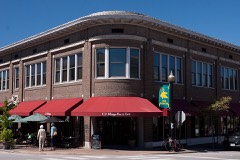 | Gorlock Building | 0.2 miles | 1984 |
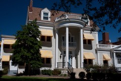 | Charles W. Ferguson House | 0.2 miles | 1984 |
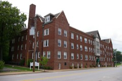 | Rockwood Court Apartments | 0.3 miles | 2006 |
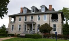 | Rock House, Edgewood Children's Center | 0.4 miles | 1982 |
| Webster Park Residential Historic District | 0.5 miles | 2008 |
| National Archives record | The nomination case file for reference 82004726 in Record Group 79. |
| St. Louis County | All 663 listed properties in this county. |