 Block
From the record
One of 22 National Register listings published here for Johnson County · listed in 1985 · category: District.
Sources: the case file at the National Archives · the National Register database, National Park Service
Listed on the National Register of Historic Places in 1985.
One of 22 National Register listings published here for Johnson County · listed in 1985 · category: District.
Sources: the case file at the National Archives · the National Register database, National Park Service
This property stands in Montserrat Township. History of Johnson County, Missouri, published 1918 gives that township a chapter of its own.
The chapter covers the township.
Machine-read from a century-old scan, so expect the errors a machine makes: misspelled names, dropped words, stray characters.
Read the whole chapter on Montserrat Township - 297 words on its settlement, mills, schools and churches.
Regional context, not property-specific evidence. The federal wildfire occurrence database lists 42 fires within 5 miles of Camp Shawnee Historic District between 2003 and 2020, burning about 246 acres in total. None started naturally. 1 was recorded as arson. Distance is straight-line from the map coordinates, so a fire counted here may appear on a neighbouring settlement's page as well.
| Reported cause | Fires |
|---|---|
| Missing data/not specified/undetermined | 23 |
| Debris and open burning | 9 |
| Equipment and vehicle use | 4 |
| Recreation and ceremony | 2 |
| Other causes | 2 |
| Arson/incendiarism | 1 |
| Smoking | 1 |
The most recent of them, most recent first, with the day each was reported and the service that recorded it.
| Date | Cause | Size | Reported by | Name on the report |
|---|---|---|---|---|
| 9 September 2003 | Equipment and vehicle use | 1.0 acres | Missouri State Fire Marshal's Office | not named |
| 8 September 2003 | Missing data/not specified/undetermined | 21 acres | Missouri State Fire Marshal's Office | not named |
| 5 September 2003 | Missing data/not specified/undetermined | under an acre | Missouri State Fire Marshal's Office | not named |
| 5 September 2003 | Missing data/not specified/undetermined | under an acre | Missouri State Fire Marshal's Office | not named |
| 25 September 2018 | Missing data/not specified/undetermined | 2.1 acres | Missouri Department of Conservation | 177832-05130-09252018-1508 |
| 2 September 2018 | Missing data/not specified/undetermined | under an acre | Missouri Department of Conservation | 177643-05130-09022018-1203 |
| 10 September 2018 | Missing data/not specified/undetermined | under an acre | Missouri Department of Conservation | 177655-05130-09102018-1345 |
| 9 August 2018 | Smoking | under an acre | Missouri Department of Conservation | 177511-05130-08092018-1447 |
Regional context, not property-specific evidence. The federal mineral resources record lists 7 workings within 5 miles of Camp Shawnee Historic District: 6 past producers, 1 producer. 1 still produces. What was taken out: Stone, Crushed/Broken, Clay. Distance is straight-line from the map coordinates, so a quarry counted here may appear on a neighbouring settlement's page as well.
| Where | Site | Commodity | Status | Recorded |
|---|---|---|---|---|
| Boyd Shale Pit | Clay | Past Producer | ||
| Montserrat Quarry | Stone, Crushed/Broken | Producer | ||
| Unknown - Ls. | Stone, Crushed/Broken | Past Producer | ||
| Unknown - Ls. | Stone, Crushed/Broken | Past Producer | ||
| Unknown - Ls. | Stone, Crushed/Broken | Past Producer | ||
| Unknown - Ls. | Stone, Crushed/Broken | Past Producer | ||
| Unknown - Ls. | Stone, Crushed/Broken | Past Producer |
Regional context, not property-specific evidence. The National Weather Service names Knob Noster, the town this property stands in, in 36 storm reports between 1995 and 2025: 15 hail, 14 thunderstorm wind, 5 flash flood, 1 flood. No death or injury is recorded in these reports. Each account below is quoted exactly as the forecast office filed it, from the NOAA Storm Events Database, and each date opens the federal record of that event.
| When | Event | Place named | Harm | What the report says |
|---|---|---|---|---|
| June 2021 | Thunderstorm Wind | Knob Noster | $10,000 | A tree was blown down on a garage near McPherson. |
| September 2001 | Thunderstorm Wind | Knob Noster | $3,000 | Many power lines reported down and several cars blown off road. |
| June 1995 | Thunderstorm Wind | Knob Noster | $3,000 | Severe thunderstorms moved through Johnson County knocking down trees in Knob Noster and producing 64 mph winds at Whiteman Air Force Base. |
| May 2013 | Thunderstorm Wind | Knob Noster | $2,000 | A supercell thunderstorm intensified as it moved into eastern Johnson County, near Knob Noster. Strong, straight-line winds estimated up to 60 mph, caused some minor damage to a house and mobile home. |
| April 2001 | Thunderstorm Wind | Knob Noster | $2,000 | Trained spotter estimated wind gusts to 80 mph with cars blown off road. |
| June 1995 | Thunderstorm Wind | Knob Noster | $2,000 | Severe thunderstorm winds knocked down a few trees two miles east of Knob Noster. |
| September 2025 | Thunderstorm Wind | Knob Noster | - | Powerline down near Knob Noster. |
| April 2023 | Hail | Knob Noster | - | Ping pong sized hail was reported in Knob Noster. |
| March 2023 | Hail | Knob Noster | - | A supercell produced golf ball sized hail in Knob Noster in eastern Johnson County. |
| August 2019 | Thunderstorm Wind | Knob Noster | - | Small to medium sized tree limbs were down. Reported via MPing. |
| August 2019 | Thunderstorm Wind | Knob Noster | - | A tree of unknown conditions and unknown size landed on a mobile home. It's unknown how the mobile home fared. |
| July 2018 | Thunderstorm Wind | Knob Noster | - | A tree was blown onto a home in Knob Noster. |
| August 2017 | Flash Flood | Knob Noster | - | Water over the road in Knob Noster in the vicinity of S Washington St, between Sunset and Division St. |
| June 2008 | Flash Flood | Knob Noster | - | Northeast 461 Road off of Highway 23 was closed due to high water. |
| June 2008 | Flash Flood | Knob Noster | - | Highway DD between Warrensburg and Knob Noster and Highway 23 was closed due to flooding. |
| June 2008 | Flash Flood | Knob Noster | - | Heavy rains caused high water on several roads. |
| January 2005 | Flash Flood | Knob Noster | - | Highway 23 under water. |
| June 2005 | Thunderstorm Wind | Knob Noster | - | Large tree down. |
| October 2004 | Tornado (F1) | Knob Noster | - | Tornado touched down just inside the Johnson county line...southwest of the intersection of F/BB/NN Highway. It then tracked northeast into Pettis county. Trees were downed by the tornado. |
| August 2000 | Thunderstorm Wind | Knob Noster | - | A tree 12 to 18 inches in diameter was downed. |
| August 1999 | Thunderstorm Wind | Knob Noster | - | Thunderstorm winds downed trees 6 miles north of Knob Noster. |
| January 1999 | Hail | Knob Noster | - | Golfball-size hail a mile north of Knob Noster, one inch hail 2 miles east of Knob Noster. |
| July 1998 | Flood | Knob Noster | - | One to three inches of rain fell in less than 3 hours across much of Johnson County. This heavy rain resulted in numerous reports of flooded roadways and intersections. In Knob Nobster, Highway 23 was closed northward to the Blackwatrer River and Highway 50 to the Lafayette County line were closed due to high water. |
| April 2023 | Hail | Knob Noster | - | no account filed |
| March 2021 | Hail | Knob Noster | - | no account filed |
| March 2020 | Hail | Knob Noster | - | no account filed |
| June 2020 | Hail | Knob Noster | - | no account filed |
| August 2019 | Hail | Knob Noster | - | no account filed |
| February 2017 | Hail | Knob Noster | - | no account filed |
| August 2017 | Hail | Knob Noster | - | no account filed |
| March 2015 | Hail | Knob Noster | - | no account filed |
| October 2014 | Hail | Knob Noster | - | no account filed |
| March 2009 | Hail | Knob Noster | - | no account filed |
| May 2009 | Hail | Knob Noster | - | no account filed |
| March 2003 | Hail | Knob Noster | - | no account filed |
| July 2003 | Thunderstorm Wind | Knob Noster | - | no account filed |
No historic map-sheet match is published for this property yet. That does not mean no map exists. This record needs a coordinate-quality review before it can be joined to a sheet boundary. Browse the county's mapped places while that work is pending.
Other National Register properties close enough to walk or drive between, ordered by distance from this one. Both positions come from the same geocoding pass that matched these properties to their map sheets.
| Photograph | Property | Distance | Listed |
|---|---|---|---|
| Montserrat Recreational Demonstration Area Warehouse #2 and Workshop | 2.2 miles | 1985 | |
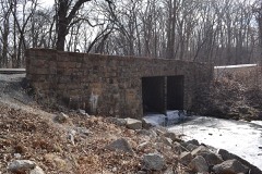 | Montserrat Recreation Demonstration Area Bridge | 2.3 miles | 1985 |
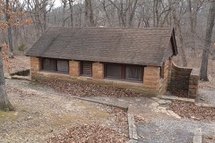 | Montserrat Recreational Demonstration Area Rock Bath House | 2.5 miles | 1985 |
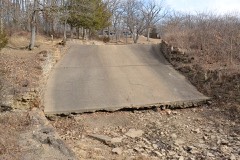 | Montserrat Recreation Demonstration Area Dam and Spillway | 2.6 miles | 1985 |
| Montserrat Recreation Demonstration Area Entrance Portal | 3.3 miles | 1985 | |
| John A. Adams Farmstead Historic District | 4.4 miles | 1994 |
| National Archives record | The nomination case file for reference 85000506 in Record Group 79. |
| Johnson County | All 22 listed properties in this county. |