 Block
From the record
One of 5 National Register listings published here for Lincoln County · listed in 1985 · category: District.
Sources: the case file at the National Archives · the National Register database, National Park Service
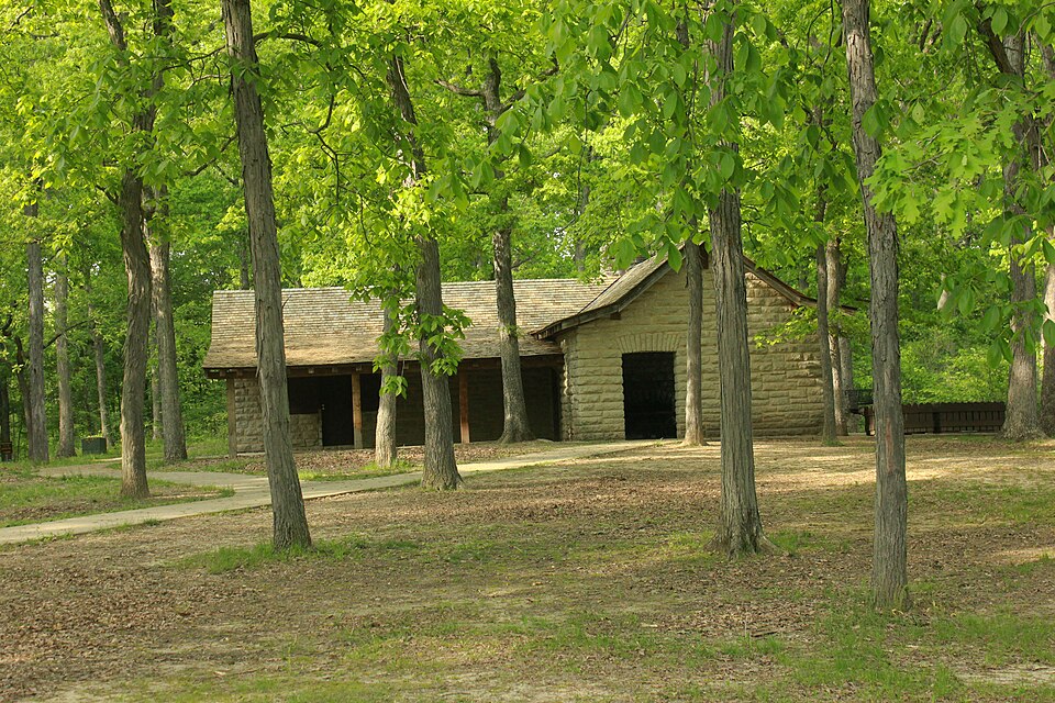
Listed on the National Register of Historic Places in 1985.
One of 5 National Register listings published here for Lincoln County · listed in 1985 · category: District.
Sources: the case file at the National Archives · the National Register database, National Park Service
This property stands in Monroe Township. History of Lincoln County, Missouri, from the Earliest Time to the Present, published 1888 gives that township a chapter of its own.
The chapter covers the township.
Machine-read from a century-old scan, so expect the errors a machine makes: misspelled names, dropped words, stray characters.
Read the whole chapter on Monroe Township - 1,290 words on its settlement, mills, schools and churches.
Regional context, not property-specific evidence. The federal wildfire occurrence database lists 5 fires within 5 miles of Cuivre River State Park Administrative Area Historic District between 1997 and 2013, burning about 8 acres in total. None started naturally. None was recorded as arson. Distance is straight-line from the map coordinates, so a fire counted here may appear on a neighbouring settlement's page as well.
| Reported cause | Fires |
|---|---|
| Debris and open burning | 2 |
| Missing data/not specified/undetermined | 2 |
| Equipment and vehicle use | 1 |
The most recent of them, most recent first, with the day each was reported and the service that recorded it.
| Date | Cause | Size | Reported by | Name on the report |
|---|---|---|---|---|
| 9 April 1997 | Debris and open burning | 1.0 acres | Missouri Department of Conservation | not named |
| 6 March 2007 | Equipment and vehicle use | 3.0 acres | Missouri State Fire Marshal's Office | not named |
| 17 March 2011 | Missing data/not specified/undetermined | 1.0 acres | Missouri Department of Conservation | not named |
| 5 February 2013 | Missing data/not specified/undetermined | 1.5 acres | Missouri Department of Conservation | not named |
| 3 January 1997 | Debris and open burning | 1.0 acres | Missouri Department of Conservation | not named |
Regional context, not property-specific evidence. The federal mineral resources record lists 11 workings within 5 miles of Cuivre River State Park Administrative Area Historic District: 9 past producers, 2 producers. 2 still produce. What was taken out: Stone, Crushed/Broken, Iron. Distance is straight-line from the map coordinates, so a quarry counted here may appear on a neighbouring settlement's page as well.
| Where | Site | Commodity | Status | Recorded |
|---|---|---|---|---|
| Morris Bank | Iron | Past Producer | ||
| Behrens Quarry | Stone, Crushed/Broken | Past Producer | ||
| Hammond Quarry | Stone, Crushed/Broken | Past Producer | ||
| Lincoln Co Hwy Dept | Stone, Crushed/Broken | Producer | ||
| Lincoln Co Hwy Dept | Stone, Crushed/Broken | Past Producer | ||
| Magruder Quarry & Plant | Stone, Crushed/Broken | Producer | ||
| Unknown Ls | Stone, Crushed/Broken | Past Producer | ||
| Unknown Ls | Stone, Crushed/Broken | Past Producer | ||
| Unknown Ls | Stone, Crushed/Broken | Past Producer | ||
| Unknown Ls | Stone, Crushed/Broken | Past Producer |
Regional context, not property-specific evidence. The National Weather Service names Elsberry, the town this property stands in, in 31 storm reports between 1994 and 2025: 15 thunderstorm wind, 9 hail, 6 flash flood, 1 flood. No death or injury is recorded in these reports. Each account below is quoted exactly as the forecast office filed it, from the NOAA Storm Events Database, and each date opens the federal record of that event.
| When | Event | Place named | Harm | What the report says |
|---|---|---|---|---|
| July 2025 | Flash Flood | Elsberry | $60,000 | Multiple roads were closed in Lincoln County due to heavy rainfall. These include Highway A outside of Hawk Point, Highway P in Elsberry, Highway B at Bryant's Creek Road, Highway C in multiple locations near Moscow Mills, Highway H near the Cuivre River due to water exceeding the river's banks, and numerous other unnamed roads. On Highway 61 near Davis, vehicles were stopped due to water on the road at multiple locations, including its intersections with County Roads K,V,B, and E. |
| July 2025 | Thunderstorm Wind | Elsberry | $5,000 | Thunderstorm winds downed a power pole near Elsberry. |
| June 2021 | Thunderstorm Wind | Elsberry | - | Thunderstorm winds blew down a number of power lines around town. |
| June 2020 | Thunderstorm Wind | Elsberry | - | Thunderstorm winds blew down a large tree onto Highway CC on north side of Elsberry. Also, power lines were blown down onto Hubbard Ct. |
| July 2019 | Thunderstorm Wind | Elsberry | - | Thunderstorm winds snapped off several large tree limbs and knocked down a couple of power lines around town. |
| June 2019 | Thunderstorm Wind | Elsberry | - | Thunderstorm winds blew down numerous trees around town, some of which were at least 12 inches in diameter. One tree snapped off and fell onto a house causing moderate damage. Also, numerous tree limbs were blown down. |
| June 2018 | Thunderstorm Wind | Elsberry | - | Thunderstorm winds blew down several trees around town. |
| May 2016 | Thunderstorm Wind | Elsberry | - | Thunderstorm winds blew down several power lines around town. |
| December 2015 | Flash Flood | Elsberry | - | Between 3 and 5 inches of rain fell causing flash flooding. Several roads were flooded including Route Y west of Foley. |
| December 2015 | Flash Flood | Elsberry | - | Another round of heavy rain, between 1 and 2 inches of rain fell across Lincoln County December 27th and 28th. This caused more flash flooding. Numerous roads and farm fields were flooded. |
| June 2015 | Flash Flood | Elsberry | - | Up to at least 8 inches of rain fell onto already saturated soils causing flash flooding across Lincoln County. Numerous roads were flooded including Highways E and H near Silex, Route B near Davis, and Routes C and MM near Moscow Mills. A number of businesses in Silex sustained flood damage due to flood waters. Over 20 people had to be rescued from their homes in and around Silex and Davis due to the flash flooding. Also, a section of railroad track near Old Monroe and Highway 79 had some of its bedding washed out. |
| July 2014 | Thunderstorm Wind | Elsberry | - | Thunderstorm winds blew down numerous trees in Elsberry. One large tree fell onto two unoccupied vehicles and a house. |
| July 2010 | Flash Flood | Elsberry | - | Up to 3 inches of rain fell in a short amount of time causing flash flooding. Numerous roads were flooded throughout the county, particularly near low water crossings. |
| October 2009 | Flash Flood | Elsberry | - | Three to four inches of rain fell in a short amount of time causing flash flooding. Numerous roads were flooded including the intersection of Highways Y and EE west of Foley. |
| July 2008 | Thunderstorm Wind | Elsberry | - | Thunderstorm winds blew down numerous trees in Elsberry, Winfield and Troy. Also, a large tree was blown down onto Highway KK near the intersection with Tuckaho Lane. |
| July 2008 | Flood | Elsberry | - | The Mississippi River crested at Winfield, MO on July 1 at 36.14 feet. It fell below flood stage on July 16. For additional information about the flooding consult the June report. |
| June 2005 | Thunderstorm Wind | Elsberry | - | Large tree limbs broke and took down a couple of power lines. |
| May 2003 | Hail | Elsberry | - | Storm spotters reported 1 1/4 inch hail. |
| April 2002 | Thunderstorm Wind | Elsberry | - | Amateur radio spotters reported small trees down. |
| May 2000 | Hail | Elsberry | - | The sheriff department reported nickel size hail. |
| May 1997 | Hail | Elsberry | - | County sheriff reported 1 inch hail. |
| April 1994 | Thunderstorm Wind | Elsberry | - | Ham radio spotters reported wind gusts to 60 mph. |
| March 2017 | Hail | Elsberry | - | no account filed |
| February 2017 | Hail | Elsberry | - | no account filed |
| May 2011 | Hail | Elsberry | - | no account filed |
| August 2008 | Thunderstorm Wind | Elsberry | - | no account filed |
| August 2008 | Hail | Elsberry | - | no account filed |
| May 2008 | Hail | Elsberry | - | no account filed |
| May 2000 | Thunderstorm Wind | Elsberry | - | no account filed |
| February 1999 | Thunderstorm Wind | Elsberry | - | no account filed |
| December 1996 | Hail | Elsberry | - | no account filed |
No historic map-sheet match is published for this property yet. That does not mean no map exists. This record needs a coordinate-quality review before it can be joined to a sheet boundary. Browse the county's mapped places while that work is pending.
Other National Register properties close enough to walk or drive between, ordered by distance from this one. Both positions come from the same geocoding pass that matched these properties to their map sheets.
| Photograph | Property | Distance | Listed |
|---|---|---|---|
| Camp Sherwood Forest Historic District | 2.6 miles | 1985 | |
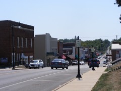 | Downtown Troy Historic District | 3.4 miles | 2013 |
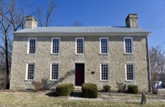 | Old Rock House | 4.0 miles | 1972 |
| National Archives record | The nomination case file for reference 85000514 in Record Group 79. |
| Lincoln County | All 5 listed properties in this county. |