 Block
From the record
5 National Register listings published here.
Sources: the county history on the Internet Archive · the National Register database, National Park Service
98 topographic sheets cover 52 settlements here, and 5 properties are on the National Register of Historic Places.
5 National Register listings published here.
Sources: the county history on the Internet Archive · the National Register database, National Park Service
Every property in this county listed on the National Register of Historic Places, with the year it was listed and the federal nomination document.
| Photograph | Property | Type | Listed | Reference |
|---|---|---|---|---|
| Camp Sherwood Forest Historic District | district | 1985 | 85000512 | |
 | Cuivre River State Park Administrative Area Historic District | district | 1985 | 85000514 |
 | Downtown Troy Historic District | district | 2013 | 13000857 |
 | Lock and Dam No. 25 Historic District | district | 2004 | 04000184 |
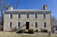 | Old Rock House | building | 1972 | 72000721 |
Every wildfire the federal occurrence database records inside this county: 47 of them, burning about 264 acres. None started naturally and 1 was recorded as arson. Each settlement page carries the fires within five miles of it.
| Reported cause | Fires |
|---|---|
| Debris and open burning | 21 |
| Missing data/not specified/undetermined | 19 |
| Equipment and vehicle use | 2 |
| Smoking | 2 |
| Recreation and ceremony | 2 |
| Arson/incendiarism | 1 |
The five largest, by the area the report gives. One of them was set deliberately.
| Date | Cause | Size | Reported by | Name on the report |
|---|---|---|---|---|
| 3 March 2006 | Missing data/not specified/undetermined | 100 acres | Missouri State Fire Marshal's Office | not named |
| 30 November 1994 | Debris and open burning | 25 acres | Missouri Department of Conservation | not named |
| 13 April 2015 | Missing data/not specified/undetermined | 25 acres | Missouri Department of Conservation | 122150-02379-04132015-1100 |
| 17 June 1997 | Debris and open burning | 10 acres | Missouri Department of Conservation | not named |
| 22 November 2016 | Arson/incendiarism | 9.0 acres | Missouri Department of Conservation | 142014-00008-11222016-1000 |
| 12 December 2019 | Smoking | 8.3 acres | Missouri Department of Conservation | 179679-08213-12122019-1245 |
| 13 April 2017 | Debris and open burning | 5.0 acres | Missouri Department of Conservation | not named |
| 2 December 1994 | Missing data/not specified/undetermined | 5.0 acres | Missouri Department of Conservation | not named |
Every settlement page carries the fires within five miles of it - see the settlement index below.
The NOAA Storm Events Database holds 390 reports for this county, causing no deaths, 9 injuries and about $18,832,060 in recorded property damage. Each settlement page carries the reports that name it.
| Kind of event | Reports |
|---|---|
| Thunderstorm Wind | 193 |
| Hail | 119 |
| Flash Flood | 38 |
| Tornado | 24 |
| Flood | 13 |
| Heavy Rain | 2 |
| Lightning | 1 |
The most serious of them, by death, then injury, then recorded damage. The accounts are quoted exactly as the forecast office filed them.
| When | Event | Place named | Harm | What the report says |
|---|---|---|---|---|
| March 2006 | Tornado (F3) | Olney | 6 hurt, $2,500,000 | The tornado that formed in Montgomery County north of Bellflower moved into Lincoln County, strengthened, and caused extensive damage along Highway E on the north side of Olney. A home was completely destroyed as the tornado reached F3 intensity and was about 300 yards wide. The family at home escaped injury as they had taken shelter in the basement. About 1:35 am CST, the tornado destroyed a home and caused damage to a home business along Highway H northwest of Silex. At this point the tornado was a strong F2 and about 200 yards wide. A man in the home that was destroyed suffered a broken leg. At the home business, the home suffered roof damage and had the north side brick wall pulled off of the house. A large machine shed suffered extensive damage and a 50 foot travel trailer and the pickup truck it was attached too were blown onto their sides. The tornado continued northeast and primarily crossed over wildlife and conservation areas south of Whiteside. The tornado crossed US Highway 61 near the intersection with Highway F about 1:40 am CST and caused minor damage at a farm and a couple of homes. An old barn was destroyed, a metal shed was destroyed, a garage had the door buckled and windows blown out. A nearly constant trail of tree damage continued as the tornado approached the Lincoln Pike County line west of Dameron about 1:46 am CST. |
| March 1973 | Tornado (F1) | not stated | 1 hurt, $25,000 | no account filed |
| December 1957 | Tornado (F1) | not stated | 1 hurt, $25,000 | no account filed |
| March 1953 | Tornado (F1) | not stated | 1 hurt, $25,000 | no account filed |
| June 2019 | Flash Flood | Winfield | $5,400,000 | The Winfield Pin Oaks Levee system was breached during the afternoon hours on Sunday, June 2nd. The breach was at least 100 feet wide. The water rose quickly and reached the houses in the area beginning around 6 pm. An estimated 150 homes were affected by the levee breach and 250 people evacuated the area. No deaths or injuries occurred due to this levee breach. |
| July 2025 | Flash Flood | Apex | $5,000,000 | Heavy rain resulted in 42 water rescues in Lincoln County. The only official report of a road closure was MO-79 at Brownsmill Road where swift moving floodwater was reported. In Elsberry, 50 homes and 20 to 30 businesses were affected by the flooding, and a state of emergency was declared. |
| May 2019 | Flood | Winfield | $2,000,000 | Portions of the Winfield Main, Foley and Cap Au Gris levees were overtopped due to the rising waters of the Mississippi River. Between 20 and 30 homes were flooded and portions of Highway 79 were flooded as well. |
| June 2008 | Flood | Dameron | $1,600,000 | Lincoln County was the area most affected by the Mississippi River flood of 2008. At Winfield, the river crested at 37.08 feet on 6/27/2008. This is the second highest crest ever recorded. All of the land east of Highway 79 was flooded. At the height of the flood, Highway 79 also went underwater near Old Monroe, Winfield, Foley, and Elsberry. Almost all of Foley went underwater. The southeast part of Winfield, about 100 homes, flooded when the Pin Oak levee failed. In Old Monroe, the waste water treatment plant was flooded by water from the Cuivre River, which was back water from the flooded Mississippi. According to damage assessments made by local emergency management officials, 814 homes were affected. 742 were destroyed, 36 suffered major damage, and 36 were affected. Damage to public infrastructure was estimated at $1,600,000. |
| June 2008 | Flash Flood | Cap Au Gris | $500,000 | The Pin Oak Levee near the Mississippi River failed causing flood waters to rush towards the town of Winfield. At least 60 homes were flooded in Winfield west of Highway 79. |
| June 2008 | Flash Flood | Apex | $500,000 | A levee break was reported near Highway M, southeast of Elsberry. It flooded areas east of Highway 79 to the Mississippi River in the Kings Lake and southern Elsberry Levee districts. The flood waters moved into Foley, flooding a couple dozen homes. Another levee broke further north a couple of hours later affecting the areas to the north of the original levee break. |
| April 1984 | Tornado (F3) | not stated | $250,000 | no account filed |
| October 1969 | Tornado (F2) | not stated | $250,000 | no account filed |
| December 2015 | Flood | Truxton | $240,000 | Between 4 and 7 inches of rain fell across Lincoln County during a 2 day period. All of this rain caused the creeks and rivers to rise. The Cuivre River went into major flood. Almost 30 structures were either damaged or destroyed from the river flooding. Damage estimates so far were around $235,000. |
| February 1999 | Tornado (F1) | Whiteside | $100,000 | no account filed |
| June 2008 | Flash Flood | Cap Au Gris | $75,000 | A 150 foot section of the Cap Au Gris Levee failed about a quarter of a mile south of the Winfield Lock and Dam on the Mississippi River. It flooded mostly farmland as well as a couple of houses and farm buildings. The secondary Winfield Levee (Pin Oak) kept the flood waters away from Winfield at this time. |
| July 2025 | Flash Flood | Elsberry | $60,000 | Multiple roads were closed in Lincoln County due to heavy rainfall. These include Highway A outside of Hawk Point, Highway P in Elsberry, Highway B at Bryant's Creek Road, Highway C in multiple locations near Moscow Mills, Highway H near the Cuivre River due to water exceeding the river's banks, and numerous other unnamed roads. On Highway 61 near Davis, vehicles were stopped due to water on the road at multiple locations, including its intersections with County Roads K,V,B, and E. |
| July 2022 | Flash Flood | Olney | $50,000 | Up to 11 inches of rain fell between a 6 to 10 hour period causing flash flooding. The heaviest rain was across the far southern portions of Lincoln County. Numerous roads were flooded including Route J south of Troy, Route C west of Old Monroe, and Route MM. Also, a culvert was washed out on Route U between Fred Norton Road and Giles road. Several water rescues were performed. One driver was northbound on Highway J just south of Big Creek in the early morning hours and could not see the flooded roadway in front of her. Before she knew it she was in the water and could not back out of it. The vehicle began to float and fill with water. She called her husband, told him where she was at and asked for him to call 911. She managed to get out of one of her back doors and slip out, grabbing a branch just before her vehicle was completely submerged. It took two and a half hours for the fire rescue to get a boat to the location and rescue her from the tree she was clinging to. She was uninjured. With the other rescues, no one was injured as well. |
| April 2013 | Flood | Dameron | $50,000 | The Mississippi River rose to major flood levels along the border with Lincoln County. The river crested on 23rd, but remained above flood stage into May. The only major damage occurred in Winfield. A levee failure resulted in the flooding of about 20 homes on the east side of Highway 79 in the Winfield Acres area. |
| July 2021 | Thunderstorm Wind | Hawk Pt | $40,000 | A swath of wind damage extended from Hawk Point to Troy. Numerous trees, tree limbs and power lines were blown down. Just southwest of Troy along Highway J, a tree was blown over onto a house causing moderate damage. |
| May 1983 | Tornado (F1) | not stated | $25,000 | no account filed |
| April 1955 | Tornado (F1) | not stated | $25,000 | no account filed |
| June 2022 | Thunderstorm Wind | Troy | $20,000 | A swath of damaging winds occurred over Lincoln County from Troy to Winfield. Several trees were blown down on to Highway KK just north of Troy. Also, numerous tree limbs, small trees and power lines were blown down. In Winfield, a small barn sustained moderate roof damage. |
| March 2026 | Thunderstorm Wind | Davis | $15,000 | Thunderstorm winds caused a barn to lose several sections of its roof. There was no other damage in the vicinity. |
| December 2021 | Thunderstorm Wind | Winfield | $7,000 | Several street lights were blown over in town. |
| July 2025 | Thunderstorm Wind | Elsberry | $5,000 | Thunderstorm winds downed a power pole near Elsberry. |
| May 2024 | Thunderstorm Wind | Argentville | $5,000 | A large tree snapped and fell onto power lines nearby. |
| March 2022 | Thunderstorm Wind | Silex | $5,000 | Thunderstorm winds blew the roof off of the front porch of a house in Silex. Also, about 3 miles north of Troy a large tree was blown down and in Old Monroe numerous large tree limbs were blown down around town. |
| July 2007 | Thunderstorm Wind | Foley | $5,000 | Amateur radio spotters reported power lines down in Foley. |
| August 2001 | Thunderstorm Wind | Troy | $5,000 | Thunderstorm wind gusts blew down the sign of a local restaurant. |
| May 1993 | Thunderstorm Wind | Troy | $5,000 | The county sheriff reported trees and power lines down with wind gusts estimated at 40 to 50 miles an hour. Golf ball-size hail was reported by spotters east of Troy a few minutes later. |
| May 1996 | Thunderstorm Wind | Troy | $5,000 | no account filed |
| April 1993 | Hail | Davis | $5,000 | no account filed |
| June 2013 | Flood | Dameron | $3,000 | The Mississippi River started June in flood and hit major flood levels cresting on the 2nd. The river fell the rest of the month but remained in flood into July. Damage was limited to some flooded roads and flooded farmland. |
| June 2009 | Thunderstorm Wind | Winfield | $3,000 | A large rotten tree was blown down onto the roof of a trailer causing moderate damage. |
| November 1994 | Thunderstorm Wind | Winfield and Old Monr | $1,200 | Numerous utility poles were blown down and wires damaged. Schools remained closed the following day due to lack of power. |
| April 2023 | Hail | South Troy | $1,000 | A wide swath of large hail fell across Lincoln County from about 3 miles south of Cave, through Troy to Foley and Winfield. One house just southwest of Foley had a window broken by the large hail. |
| April 1995 | Thunderstorm Wind | Troy | $800 | The county sheriff reported minor damage to a mobile home southeast Troy and utility poles were blown down near Winfield. |
| May 1993 | Hail | Troy | $500 | The county sheriff reported trees and power lines down with wind gusts estimated at 40 to 50 miles an hour. Golf ball-size hail was reported by spotters east of Troy a few minutes later. |
| April 1995 | Thunderstorm Wind | Winfield | $300 | The county sheriff reported minor damage to a mobile home southeast Troy and utility poles were blown down near Winfield. |
| July 1995 | Thunderstorm Wind | Troy | $200 | Large trees were blown down south of Troy. |
| June 1962 | Tornado (F0) | not stated | $30 | no account filed |
| May 1955 | Tornado (F1) | not stated | $30 | no account filed |
| March 2026 | Thunderstorm Wind | Troy | - | Thunderstorm winds downed a tree on East Cherry Street. Live powerlines were also downed on the same street. |
| April 2026 | Thunderstorm Wind | Ethlyn | - | Thunderstorm winds snapped power poles and numerous tree limbs from just north of Flint Hill northeast to Winfield. Near Old Monroe a farm outbuilding was collapsed, the siding peeled from a home, and the roof removed from a mobile home. |
| April 2026 | Tornado (EF1) | South Troy | - | A brief tornado touched down along Linns Mill Road near Coon Creek, southwest of Troy, and moved northeast. The tornado crossed Forest Acres Lane and Crooked Creek before lifting along Sugar Grove Road. Along it's path it produced tree damage, snapping some tree trunks and uprooting other trees. This damage suggests a maximum wind speed of approximately 95 mph. |
| April 2026 | Thunderstorm Wind | Moscow Mills | - | Thunderstorm winds snapped two 6 inch diameter limbs from trees just south of Troy. |
| April 2026 | Thunderstorm Wind | South Troy | - | Thunderstorm winds caused damage from near the Woodland Airstrip northeast into Winfield. Near the beginning, winds peeled back the roof of an old farm outbuilding and caused a small farm outbuilding to collapse upon itself. Winds blew down tree branches, power lines, and power poles along its path. Between Moscow Mills and Troy, a billboard was blown over onto a mobile home which sustained damage. |
| April 2026 | Thunderstorm Wind | Argentville | - | Thunderstorm winds downed power lines on Ethlyn Road. |
| March 2025 | Thunderstorm Wind | South Troy | - | Thunderstorm winds knocked down tree branches between Hawk Point and Troy just south of Highway 47. The thunderstorm then produced a 78 mph wind gust at Avery Park in Troy. |
| July 2025 | Thunderstorm Wind | Foley | - | Thunderstorm winds knocked electric lines down at Fox Run Road and Vee Valley Farms. |
| April 2024 | Hail | Corso | - | Hailstones between 1 and 1.75 inches were reported in Silex, Auburn, and New Hope. |
| November 2024 | Tornado (EF0) | Ethlyn | - | The tornado then crossed Highway 61 from St. Charles County into far southern Lincoln County doing minor and isolated tree damage before lifting. The tornado had a path length of 1.14 miles and a max path width of 25 yards in Lincoln County. No deaths or injuries were reported. |
| August 2023 | Thunderstorm Wind | Hawk Pt | - | A bowing segment merged with the primary line of storms, causing widespread wind damage across southern portion of Lincoln County. Near Hawk Point, an open sided pole barn was shifted off it's foundation with part of the end wall blown out. There were numerous reports of trees down throughout Troy and one report of downed power poles near Old Monroe. |
| July 2023 | Thunderstorm Wind | Hawk Pt | - | Widespread tree and power line damage between Hawk Point and Troy. Several trees were blown down along Highway 47 south of Hawk Point. In Troy, a 4 to 5 foot diameter tree fell onto a residence near the intersection of West Cherry and 4th Street. The residence sustained major damage. No injuries were reported. |
| July 2023 | Thunderstorm Wind | Argentville | - | In an area from about 4 miles west of Foley south to Old Monroe, widespread tree and power line damaged occurred. Also, in Old Monroe the fire department's repeater tower was blown down. |
| June 2021 | Thunderstorm Wind | Elsberry | - | Thunderstorm winds blew down a number of power lines around town. |
| June 2021 | Thunderstorm Wind | Hawk Pt | - | Several trees were blown down between Hawk Point and Troy, some of which were blocking roadways. Also, an electric pole was snapped in half. |
| June 2021 | Flash Flood | Hawk Pt | - | Up to five inches of rain fell in a short amount of time causing flash flooding. Several roads were flooded including Highway J west of Troy. Two water rescues were performed. One about 4 miles west of Winfield and another one about 4 miles west northwest of Old Monroe. No injuries were reported. |
| July 2021 | Flash Flood | Olney | - | Up to four inches of rain fell in a short amount of time causing flash flooding. Several roads were flooded including at the intersection of Highways E and O north of Olney. |
| August 2021 | Thunderstorm Wind | Troy | - | A line of severe storms moved east across Lincoln County. Numerous trees, tree limbs and power lines were blown down. In Troy, a large tree limb was blown onto a house causing minor roof damage. East of Troy along Highway 47, three power poles were snapped off. |
The Survey's mineral resources record lists 49 workings inside this county. 8 still produce and 41 are closed or unrecorded. Each settlement page carries the workings within five miles of it.
| Commodity | Workings |
|---|---|
| Stone, Crushed/Broken | 21 |
| Clay | 17 |
| Sand and Gravel, Construction | 10 |
| Iron | 1 |
The least common of them first, because a county's hundredth gravel pit says nothing its first ten did not.
| Where | Site | Commodity | Status | Recorded |
|---|---|---|---|---|
| Morris Bank | Iron | Past Producer | ||
| Glacial Sand & Gravel Pit & Plant | Sand and Gravel, Construction | Producer | ||
| Kimaterials Sand & Gravel Pit/Plant | Sand and Gravel, Construction | Producer | ||
| Unknown S&G | Sand and Gravel, Construction | Past Producer | ||
| Unknown S&G | Sand and Gravel, Construction | Past Producer | ||
| Unknown S&G | Sand and Gravel, Construction | Past Producer | ||
| Unknown S&G | Sand and Gravel, Construction | Past Producer | ||
| Unknown S&G | Sand and Gravel, Construction | Past Producer | ||
| Unknown S&G | Sand and Gravel, Construction | Past Producer | ||
| Unknown S&G | Sand and Gravel, Construction | Past Producer | ||
| Unknown S&G | Sand and Gravel, Construction | Past Producer | ||
| Unknown Clay | Clay | Past Producer | ||
| Unknown Clay | Clay | Past Producer | ||
| Unknown Clay | Clay | Past Producer | ||
| Unknown Clay | Clay | Past Producer | ||
| Unknown Clay | Clay | Past Producer | ||
| Unknown Clay | Clay | Past Producer | ||
| Unknown Clay | Clay | Past Producer | ||
| Unknown Clay | Clay | Past Producer | ||
| Unknown Clay | Clay | Past Producer | ||
| Unknown Clay | Clay | Past Producer | ||
| Unknown Clay | Clay | Past Producer | ||
| Unknown Clay | Clay | Past Producer | ||
| Unknown Clay | Clay | Past Producer | ||
| Unknown Clay | Clay | Past Producer | ||
| Unknown Clay | Clay | Past Producer | ||
| Unknown Clay | Clay | Past Producer | ||
| Unknown Clay | Clay | Past Producer | ||
| Behrens Quarry | Stone, Crushed/Broken | Past Producer | ||
| Cobb Quarry | Stone, Crushed/Broken | Past Producer | ||
| Columbia Quarries | Stone, Crushed/Broken | Past Producer | ||
| Dameron Quarry & Plant | Stone, Crushed/Broken | Producer | ||
| Gessman Quarry | Stone, Crushed/Broken | Past Producer | ||
| Hammond Quarry | Stone, Crushed/Broken | Past Producer | ||
| Lincoln Co Hwy Dept | Stone, Crushed/Broken | Producer | ||
| Lincoln Co Hwy Dept | Stone, Crushed/Broken | Past Producer | ||
| Lincoln Quarry & Plant | Stone, Crushed/Broken | Producer | ||
| Magruder Quarry & Plant | Stone, Crushed/Broken | Producer | ||
| Meyer Quarry & Plant | Stone, Crushed/Broken | Producer | ||
| Ray & Briscoe / Quarry & Plant | Stone, Crushed/Broken | Producer | ||
| Unknown Ls | Stone, Crushed/Broken | Past Producer | ||
| Unknown Ls | Stone, Crushed/Broken | Past Producer | ||
| Unknown Ls | Stone, Crushed/Broken | Past Producer | ||
| Unknown Ls | Stone, Crushed/Broken | Past Producer | ||
| Unknown Ls | Stone, Crushed/Broken | Past Producer | ||
| Unknown Ls | Stone, Crushed/Broken | Past Producer | ||
| Unknown Ls | Stone, Crushed/Broken | Past Producer | ||
| Unknown Ls | Stone, Crushed/Broken | Past Producer | ||
| Unknown Ls | Stone, Crushed/Broken | Past Producer |
History of Lincoln County, Missouri, from the Earliest Time to the Present devotes a chapter to each township: its boundaries and streams, who settled it and when, the mills, the schools and the churches. All 3 are reproduced here in full. Each row shows the township's own shape and where it lies in the county, drawn from the Census Bureau's boundary. Which settlements belong to which township is computed from that same boundary, not taken from the book.
| Shape and position in the county | Township | Settlements in it | Length | Sections |
|---|---|---|---|---|
| Hurricane Township | Dameron, Elsberry, New Hope, Okete, Old Westport Landing | 450 words | 0 | |
| Millwood Township | Davis, Mackville, Millwood | 13,059 words | 6 | |
| Monroe Township | Brevator, Cap au Gris, Chain of Rocks, Chantilly, Ethlyn, Fountain N' Lakes, Highview, Maryknoll, New Salem, Old Monroe, Winfield | 1,290 words | 1 |
One book written about this county, cut here where the book itself is cut, at its printed chapters: 14 chapters in all. Every chapter is public domain, machine-read from the scan and reproduced complete. A chapter already given under one of the county's towns is not repeated in this list.
| Chapter | Length |
|---|---|
| Chapter 6 | 58,876 words in 4 parts |
| Chapter 1: Location, Topography, Geology, Etc | 4,137 words |
| Chapter 2: Indian Affairs and War of 1812 | 6,479 words |
| Chapter 3: Early Settlement | 10,245 words |
| Chapter 4: Organization of the County, Courts, Etc | 10,692 words |
| Chapter 5: Land Gkants, Railroads, Etc | 10,125 words |
| Chapter 6: Taxation, Finances, Population, Etc | 2,420 words |
| Chapter 7: Agriculture, Horticulture and Live Stock | 2,219 words |
| Chapter 8: County Officers | 2,214 words |
| Chapter 9: Elections, Judiciary, Etc | 3,797 words |
| Chapter 10: Bench and Bar | 17,931 words in 2 parts |
| Chapter 14: Educational Interests | 4,388 words |
| Chapter 15: Ecclesiastical^ | 6,751 words |
| Chapter 16: Miscellaneous | 58,284 words in 4 parts |
Named settlements recorded in the Geographic Names Information System, each with the topographic sheets covering it. Villages, hamlets and abandoned places alike. Each is shown with the nearest named watercourse or landform and the survey quadrangle it falls on.
Burr Oak township · 63347 · On Hurricane Creek · Luckett Ridge quadrangle
12 sheets, 1934 to 1985
Snow Hill township · 63347 · On Cunningham Creek · Okete quadrangle
13 sheets, 1934 to 1985
Burr Oak township · 63347 · On Upper Sandy Creek · Luckett Ridge quadrangle
12 sheets, 1934 to 1985
No longer a settlement
Monroe township · 63369 · On Jordan Branch · Maryknoll quadrangle
22 sheets, 1903 to 1985
Monroe township · 63389 · Maryknoll quadrangle
22 sheets, 1903 to 1985
No longer a settlement
Bedford township · 63379 · On West Fork Cuivre River · Okete quadrangle
13 sheets, 1934 to 1985
Monroe township · 63369 · Maryknoll quadrangle
22 sheets, 1903 to 1985
No longer a settlement
Burr Oak township · 63347 · On Old Kings Lake Creek · Foley quadrangle
15 sheets, 1930 to 1993
Clark township · 63379 · On Casmer Branch · Warrenton NE quadrangle
20 sheets, 1890 to 1985
No longer a settlement
Hawk Point township · 63379 · On Cottonwood Branch · Silex quadrangle
16 sheets, 1890 to 1986
No longer a settlement
Hurricane township · 63343 · Near Luckett Ridge · Elsberry quadrangle
12 sheets, 1934 to 1985
Monroe township · 63389 · Luckett Ridge quadrangle
12 sheets, 1934 to 1985
No longer a settlement
Burr Oak township · 63347 · On Old Kings Lake Creek · Foley quadrangle
15 sheets, 1930 to 1993
Hurricane township · 63343 · On Kickapoo Chute · Hamburg quadrangle
15 sheets, 1930 to 1993
Clark township · 63362 · On Groshong Branch · Maryknoll quadrangle
22 sheets, 1903 to 1985
No longer a settlement
Burr Oak township · 63347 · Near Jim Crow Island · Foley quadrangle
15 sheets, 1930 to 1993
Bedford township · 63379 · On Dry Branch · Silex quadrangle
16 sheets, 1890 to 1986
Burr Oak township · 63347 · Near Stag Island · Foley quadrangle
15 sheets, 1930 to 1993
Nineveh township · On Brush Creek · Bellflower North quadrangle
16 sheets, 1890 to 1986
The vanished settlements of Lincoln County: the places named above that are no longer on the map.