 Block
From the record
One of 15 National Register listings published here for Barry County · listed in 1985 · category: Structure · built in 1933.
Sources: the case file at the National Archives · the National Register database, National Park Service

Built in 1933. Listed on the National Register of Historic Places in 1985.
One of 15 National Register listings published here for Barry County · listed in 1985 · category: Structure · built in 1933.
Sources: the case file at the National Archives · the National Register database, National Park Service
Regional context, not property-specific evidence. The federal wildfire occurrence database lists 34 fires within 5 miles of Roaring River State Park Dam/Spillway between 1992 and 2020, burning about 744 acres in total. 1 started naturally. 13 were recorded as arson. Distance is straight-line from the map coordinates, so a fire counted here may appear on a neighbouring settlement's page as well.
| Reported cause | Fires |
|---|---|
| Arson/incendiarism | 13 |
| Debris and open burning | 12 |
| Missing data/not specified/undetermined | 6 |
| Equipment and vehicle use | 1 |
| Natural | 1 |
| Recreation and ceremony | 1 |
The most recent of them, most recent first, with the day each was reported and the service that recorded it.
| Date | Cause | Size | Reported by | Name on the report |
|---|---|---|---|---|
| 1 August 2005 | Arson/incendiarism | under an acre | Mark Twain National Forest | HIGHWAY 112 |
| 27 June 1994 | Equipment and vehicle use | 4.0 acres | Missouri Department of Conservation | not named |
| 7 April 2016 | Arson/incendiarism | 15 acres | Missouri Department of Conservation | 135592-00509-04072016-2342 |
| 6 April 2016 | Debris and open burning | 1.0 acres | Missouri Department of Conservation | 135591-00509-04062016-2345 |
| 4 April 1992 | Arson/incendiarism | 2.0 acres | Mark Twain National Forest | not named |
| 3 April 1997 | Arson/incendiarism | 14 acres | Mark Twain National Forest | TWIN VISTAS |
| 23 April 1996 | Arson/incendiarism | 14 acres | Mark Twain National Forest | THREE SET |
| 23 April 1996 | Arson/incendiarism | 20 acres | Mark Twain National Forest | BEACON |
Regional context, not property-specific evidence. The federal mineral resources record lists 5 workings within 5 miles of Roaring River State Park Dam/Spillway: 5 past producers. None of them still produces. What was taken out: Stone, Crushed/Broken, Sand and Gravel, Construction. Distance is straight-line from the map coordinates, so a quarry counted here may appear on a neighbouring settlement's page as well.
| Where | Site | Commodity | Status | Recorded |
|---|---|---|---|---|
| Unknown - S+G | Sand and Gravel, Construction | Past Producer | ||
| Beydler Quarry | Stone, Crushed/Broken | Past Producer | ||
| Roaring River Ls + Marble Quarry | Stone, Crushed/Broken | Past Producer | ||
| Unknown - Ls | Stone, Crushed/Broken | Past Producer | ||
| Unknown - Ls | Stone, Crushed/Broken | Past Producer |
Regional context, not property-specific evidence. The National Weather Service names Cassville, the town this property stands in, in 113 storm reports between 1994 and 2026: 41 flash flood, 36 hail, 31 thunderstorm wind, 2 heavy rain. No death or injury is recorded in these reports. Each account below is quoted exactly as the forecast office filed it, from the NOAA Storm Events Database, and each date opens the federal record of that event.
| When | Event | Place named | Harm | What the report says |
|---|---|---|---|---|
| June 1994 | Hail | Cassville | $50,000 | Golf ball-size hail pelted numerous areas south of Cassville and areas of Table Rock Lake causing extensive damage to vehicles and docks. Trees were also stripped of their leaves with several knocked over. |
| March 2017 | Hail | Cassville | $25,000 | This report was from social media with a picture. There was damage to cars in the area. |
| December 2018 | Thunderstorm Wind | Cassville | $15,000 | Several utility poles were downed at the intersection of Highways 112 and 76. |
| April 2005 | Thunderstorm Wind | Cassville | $15,000 | Severe thunderstorm wind gusts damaged a farm store. Most of the damage occurred to the store building, however, a stock tank was blown about one quarter of a mile from where it was stored. |
| February 1997 | Thunderstorm Wind | Cassville | $15,000 | no account filed |
| May 2024 | Thunderstorm Wind | Cassville | $10,000 | Report of numerous trees that were down, with some tops off of others. Power outages were also reported. |
| April 2017 | Flash Flood | Cassville | $10,000 | A vehicle was swept off the road by flood water. |
| May 2009 | Flash Flood | Cassville | $10,000 | Excessive rainfall produced flash flooding within the community of Cassville. One vehicle was swamped by the flooding and had to be pulled out by a wrecker. Other specific locations that experienced flooding included a section of Highway 76 near its intersection with Highway 112 along with a low water crossing three miles southeast of Cassville. |
| April 2019 | Tornado (EF0) | Cassville | $8,000 | A National Weather Service survey determined than an EF-0 tornado tracked a total of 1.9 miles from two miles south southwest of Cassville to one mile west southwest of Cassville. The tornado was on the ground intermittently for approximately five minutes along its 1.9 mile total track with maximum wind speeds estimated at 75 mph. Several large trees were damaged or uprooted with one large tree falling on and damaging a house. |
| June 2021 | Thunderstorm Wind | Cassville | $5,000 | A large tree was down on a powerline on Farm Road 1107. |
| April 2017 | Thunderstorm Wind | Cassville | $5,000 | There were multiple reprots of trees and power lines blown down in the Cassville area. |
| August 2006 | Thunderstorm Wind | Cassville | $5,000 | Thunderstorm wind gusts downed a few power lines and trees. |
| July 1995 | Thunderstorm Wind | Cassville | $5,000 | Severe thunderstorms downed trees throughout the area and damaged roofs in Monett and Cassville. |
| August 2024 | Thunderstorm Wind | Cassville | $1,000 | Emergency management reported tree limbs down. |
| August 1998 | Thunderstorm Wind | Cassville | $1,000 | The county sheriff's office reported building material from a shed on Hwy 248 east of Cassville. |
| October 2007 | Thunderstorm Wind | Cassville | $500 | Large trees were blown down and caused damage to a roof. |
| March 1994 | Hail | Cassville | $500 | no account filed |
| May 1995 | Thunderstorm Wind | Cassville | $100 | Thunderstorm winds blew down a cinder block wall of a building and downed trees in Cassville. |
| March 2026 | Hail | Cassville | - | Hail to the size of quarters fell in Cassville. |
| April 2025 | Flash Flood | Cassville | - | A water rescue was performed on Farm Road 2200 east of Farm Road 1110. The occupants were rescued safely with no injuries. |
| September 2025 | Flash Flood | Cassville | - | A few road intersections had flooding in the town of Cassville due to heavy rainfall rates. |
| September 2025 | Flash Flood | Cassville | - | Water was over Highway 37 just south of Cassville and intersections that normally flood were completely impassable. |
| May 2024 | Hail | Cassville | - | Report of quarter size hail. |
| March 2023 | Flash Flood | Cassville | - | State highway MO-37 was closed due to flooding. |
| March 2023 | Flash Flood | Cassville | - | Missouri Highway 37 was closed at a low water area due to heavy rainfall and flooding. |
| April 2023 | Hail | Cassville | - | Penny sized hail was reported via MPing. |
| July 2023 | Thunderstorm Wind | Cassville | - | A large limb was reported down. |
| August 2023 | Thunderstorm Wind | Cassville | - | Numerous large limbs and trees were reported downed by high winds. |
| April 2022 | Heavy Rain | Cassville | - | The Mesonet station FW9035 in Cassville recorded a three hour precipitation total of 1.20 inches. |
| December 2022 | Flood | Cassville | - | Highway 76 at Flat Creek was flooded and impassable due to heavy rainfall. |
| August 2020 | Thunderstorm Wind | Cassville | - | Several trees were reported down in town. One tree blocked Farm Road 2180 and Farm Road 1140. |
| April 2019 | Thunderstorm Wind | Cassville | - | A large tree was uprooted. |
| June 2019 | Hail | Cassville | - | Hail up to quarter size was reported. |
| June 2019 | Hail | Cassville | - | Quarter size hail was reported. |
| June 2019 | Flash Flood | Cassville | - | Highway 37 at Business 37 was flooded and impassible. One vehicle was reported as stranded. |
| June 2019 | Flash Flood | Cassville | - | Multiple roads in Cassville were closed due to high water. |
| June 2019 | Flash Flood | Cassville | - | Several water rescues occurred due to flash flooding around Flat Creek in the area near Mill Street and 10th Street. No injuries occurred. |
| February 2018 | Flood | Cassville | - | Highway 112 near Cassville was closed due to flooding. |
| May 2017 | Thunderstorm Wind | Cassville | - | A large tree was blocking Farm Road 1100 and Farm Road 2205. |
| April 2017 | Flash Flood | Cassville | - | Excessive rainfall caused several streets to experience flash flooding in the city of Cassville. |
| April 2017 | Flash Flood | Cassville | - | Route U was impassable and closed due to flooding. |
| April 2017 | Flash Flood | Cassville | - | MODOT reported numerous county and state roads were closed throughout Barry County due to flood water. Numerous flood water rescues occurred throughout the county. |
| April 2017 | Flash Flood | Cassville | - | The Budget Inn on Highway 112 was evacuated because of flood water. |
| April 2017 | Heavy Rain | Cassville | - | The CoCoRaHS station MO-FSA-009 near Cassville measured 2.30 inches of rainfall in 24 hours. |
| July 2015 | Flash Flood | Cassville | - | A small area on Fair Street was briefly evacuated as a precaution along Flat Creek. |
| July 2015 | Flash Flood | Cassville | - | The low water crossing near Highway 76 and Highway 112 was flooded. |
| July 2015 | Flash Flood | Cassville | - | Highway Y along Flat Creek was closed due to flooding. |
| August 2015 | Thunderstorm Wind | Cassville | - | A tree was blown down and blocked Highway 248. |
| July 2015 | Flash Flood | Cassville | - | Highway 76 southeast of Cassville was flooded. |
| July 2015 | Flash Flood | Cassville | - | Water was over Highway 37 in Cassville. |
| July 2015 | Flash Flood | Cassville | - | Highway 37 was flooded and closed in Cassville. |
| December 2015 | Flash Flood | Cassville | - | Highway 37 in Cassville was closed due to flooding at Flat Creek. |
| October 2014 | Flash Flood | Cassville | - | Numerous low water crossings were flooded throughout Barry County. There were several road closures due to flooding in Cassville and Wheaton. |
| April 2011 | Flash Flood | Cassville | - | Highway Y was closed due to flooding. |
| May 2010 | Flash Flood | Cassville | - | A low water crossing was closed at 7th and Main Streets due to flooding. The water depth was estimated at 3 feet. |
| October 2009 | Flash Flood | Cassville | - | Highways 76 at the intersection of Highway 86, Highway 39 near highway EE, Route C near routes B and VV, Route U south of highway 37 and route Y near business 37 were all closed due to flood water. |
| August 2009 | Flash Flood | Cassville | - | Law enforcement reported road closures due to flooding in Cassville. |
| June 2009 | Thunderstorm Wind | Cassville | - | Thunderstorm wind gusts downed a large tree within Cassville. |
| January 2008 | Thunderstorm Wind | Cassville | - | Straight line winds associated with a severe thunderstorm snapped three cedar trees estimated to be 18 inches in diameter at the trunk. |
| May 2008 | Flash Flood | Cassville | - | Flat Creek flooded low lying areas along with several low water crossings. |
No historic map-sheet match is published for this property yet. That does not mean no map exists. This record needs a coordinate-quality review before it can be joined to a sheet boundary. Browse the county's mapped places while that work is pending.
Other National Register properties close enough to walk or drive between, ordered by distance from this one. Both positions come from the same geocoding pass that matched these properties to their map sheets.
| Photograph | Property | Distance | Listed |
|---|---|---|---|
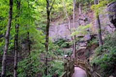 | Roaring River State Park Deer Leap Trail | under 500 feet | 1985 |
| Roaring River State Park Hotel | under 500 feet | 1985 | |
| Roaring River Camps and Hotel Summer Cottage | 0.4 miles | 2024 | |
| Roaring River State Park Shelter Kitchen No. 2 and Rest Room | 0.6 miles | 1985 | |
| Roaring River State Park Honeymoon Cabin | 0.8 miles | 1985 | |
| Roaring River State Park Bath House | 0.9 miles | 1985 |
| National Archives record | The nomination case file for reference 85000518 in Record Group 79. |
| Barry County | All 15 listed properties in this county. |