 Block
From the record
One of 9 National Register listings published here for Miller County · listed in 1985 · category: District.
Sources: the case file at the National Archives · the National Register database, National Park Service
Listed on the National Register of Historic Places in 1985.
One of 9 National Register listings published here for Miller County · listed in 1985 · category: District.
Sources: the case file at the National Archives · the National Register database, National Park Service
Regional context, not property-specific evidence. The federal wildfire occurrence database lists 58 fires within 5 miles of Lake of the Ozarks State Park Highway 134 Historic District between 1992 and 2020, burning about 1,739 acres in total. 1 started naturally. 16 were recorded as arson. Distance is straight-line from the map coordinates, so a fire counted here may appear on a neighbouring settlement's page as well.
| Reported cause | Fires |
|---|---|
| Missing data/not specified/undetermined | 22 |
| Debris and open burning | 17 |
| Arson/incendiarism | 16 |
| Equipment and vehicle use | 1 |
| Natural | 1 |
| Recreation and ceremony | 1 |
The most recent of them, most recent first, with the day each was reported and the service that recorded it.
| Date | Cause | Size | Reported by | Name on the report |
|---|---|---|---|---|
| 23 September 2017 | Missing data/not specified/undetermined | under an acre | Missouri Department of Conservation | not named |
| 30 August 1999 | Debris and open burning | 18 acres | Missouri Department of Conservation | not named |
| 24 August 2012 | Missing data/not specified/undetermined | 240 acres | Missouri Department of Conservation | ROCK QUARRY RD. BRUMLEY |
| 6 July 2014 | Missing data/not specified/undetermined | 1.0 acres | Missouri Department of Conservation | not named |
| 22 June 2020 | Arson/incendiarism | under an acre | Missouri Department of Conservation | 261585-01508-06222020-1627 |
| 31 May 2014 | Missing data/not specified/undetermined | 10 acres | Missouri Department of Conservation | not named |
| 13 May 2013 | Arson/incendiarism | 71 acres | Missouri Department of Conservation | not named |
| 6 April 1992 | Missing data/not specified/undetermined | 3.0 acres | Missouri Department of Conservation | not named |
Regional context, not property-specific evidence. The federal mineral resources record lists 16 workings within 5 miles of Lake of the Ozarks State Park Highway 134 Historic District: 14 past producers, 2 producers. 2 still produce. What was taken out: Stone, Crushed/Broken, Barium-Barite, Limestone, Dimension, Barium-Barite, Lead. Distance is straight-line from the map coordinates, so a quarry counted here may appear on a neighbouring settlement's page as well.
| Where | Site | Commodity | Status | Recorded |
|---|---|---|---|---|
| Bilyen Bank | Iron | Past Producer | ||
| C L Asa Diggings | Zinc, Lead | Past Producer | ||
| Hopkins Mine Number Five | Barium-Barite, Lead | Past Producer | ||
| Long + Ricketts Diggings | Lead, Zinc | Past Producer | ||
| Robinet Mine | Clay | Past Producer | ||
| Unknown-S&G | Sand and Gravel, Construction | Past Producer | ||
| Unknown-Ls | Limestone, Dimension | Past Producer | ||
| Unknown-Ls | Limestone, Dimension | Past Producer | ||
| Baryte Diggings | Barium-Barite | Past Producer | ||
| Bear Creek Mines | Barium-Barite | Past Producer |
Regional context, not property-specific evidence. The National Weather Service names Brumley, the town this property stands in, in 23 storm reports between 1994 and 2026: 10 hail, 8 thunderstorm wind, 4 flash flood, 1 tornado. No death or injury is recorded in these reports. Each account below is quoted exactly as the forecast office filed it, from the NOAA Storm Events Database, and each date opens the federal record of that event.
| When | Event | Place named | Harm | What the report says |
|---|---|---|---|---|
| December 2017 | Tornado (EF1) | Brumley | $50,000 | A NWS storm survey revealed that an EF-0 tornado was on the ground for about 0.4 miles. The tornado damaged a house, multiple trees, and an outbuilding. The tornado was on the ground for about a minute with maximum estimated wind speeds up to 99 mph and a maximum width of 100 yards. |
| April 1994 | Thunderstorm Wind | Brumley | $50,000 | Strong winds destroyed a mobile home and downed several large trees and power lines. The city of Brumley lost power during the storm. |
| March 2026 | Thunderstorm Wind | Brumley | $1,000 | Thunderstorm winds downed a tree at Highway U and Bentown Ridge Road. |
| April 2024 | Thunderstorm Wind | Brumley | - | Tree damage reported to several trees. |
| May 2024 | Flash Flood | Brumley | - | Highway U and Mount Union Church road was flooded over. |
| August 2013 | Flash Flood | Brumley | - | Route C, near Deane Creek was closed due to flood waters. |
| May 2010 | Flash Flood | Brumley | - | Water was reported flowing across Highway C a quarter mile north of Highway 42. |
| July 2008 | Thunderstorm Wind | Brumley | - | Thunderstorm wind gusts downed a few trees. |
| May 2007 | Flash Flood | Brumley | - | Excessive rainfall caused the Mill and Wolf creeks near Brumley to flood into low lying areas. |
| August 2006 | Thunderstorm Wind | Brumley | - | Thunderstorm wind gusts downed a few trees. |
| May 2018 | Hail | Brumley | - | no account filed |
| January 2012 | Hail | Brumley | - | no account filed |
| April 2008 | Hail | Brumley | - | no account filed |
| August 2008 | Thunderstorm Wind | Brumley | - | no account filed |
| April 2007 | Hail | Brumley | - | no account filed |
| March 2006 | Hail | Brumley | - | no account filed |
| August 2005 | Thunderstorm Wind | Brumley | - | no account filed |
| May 2004 | Hail | Brumley | - | no account filed |
| August 2003 | Hail | Brumley | - | no account filed |
| August 2001 | Hail | Brumley | - | no account filed |
| February 1999 | Thunderstorm Wind | Brumley | - | no account filed |
| December 1996 | Hail | Brumley | - | no account filed |
| September 1996 | Hail | Brumley | - | no account filed |
No historic map-sheet match is published for this property yet. That does not mean no map exists. This record needs a coordinate-quality review before it can be joined to a sheet boundary. Browse the county's mapped places while that work is pending.
Other National Register properties close enough to walk or drive between, ordered by distance from this one. Both positions come from the same geocoding pass that matched these properties to their map sheets.
| Photograph | Property | Distance | Listed |
|---|---|---|---|
| Grand Auglaize Bridge | 2.9 miles | 2020 | |
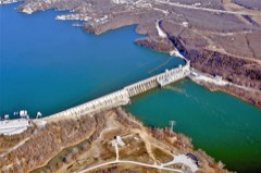 | Bagnell Dam and Osage Power Plant | 7.5 miles | 2008 |
| Union Electrict Administration Building-Lakeside | 7.9 miles | 1998 |
| National Archives record | The nomination case file for reference 85000533 in Record Group 79. |
| Miller County | All 9 listed properties in this county. |