 Block
From the record
9 National Register listings published here.
Sources: the National Register database, National Park Service
71 topographic sheets cover 33 settlements here, and 9 properties are on the National Register of Historic Places.
9 National Register listings published here.
Sources: the National Register database, National Park Service
Every property in this county listed on the National Register of Historic Places, with the year it was listed and the federal nomination document.
| Photograph | Property | Type | Listed | Reference |
|---|---|---|---|---|
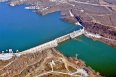 | Bagnell Dam and Osage Power Plant | site | 2008 | 08000822 |
| Boeckman Bridge | structure | 1979 | 79001382 | |
| Grand Auglaize Bridge | structure | 2020 | 100005663 | |
| Iberia Academy and Junior College | building | 1980 | 80002379 | |
| Lake of the Ozarks State Park Highway 134 Historic District | district | 1985 | 85000533 | |
| Olean Railroad Depot | building | 1993 | 93001452 | |
| P.A. Sanning Store | building | 2005 | 05000613 | |
| Union Electric Administration Building-Lakeside (Boundary Increase) | site | 2011 | 11000400 | |
| Union Electrict Administration Building-Lakeside | building | 1998 | 98000364 |
Every wildfire the federal occurrence database records inside this county: 280 of them, burning about 5,620 acres. 2 started naturally and 56 were recorded as arson. Each settlement page carries the fires within five miles of it.
| Reported cause | Fires |
|---|---|
| Debris and open burning | 126 |
| Missing data/not specified/undetermined | 75 |
| Arson/incendiarism | 56 |
| Equipment and vehicle use | 9 |
| Recreation and ceremony | 7 |
| Smoking | 4 |
| Natural | 2 |
| Misuse of fire by a minor | 1 |
The five largest, by the area the report gives. Three of them were set deliberately.
| Date | Cause | Size | Reported by | Name on the report |
|---|---|---|---|---|
| 15 April 2018 | Natural | 760 acres | Missouri Department of Conservation | 176513-80001-04152018-1530 |
| 7 March 2018 | Arson/incendiarism | 727 acres | Missouri Department of Conservation | 165988-80001-03072018-1200 |
| 30 November 1995 | Debris and open burning | 405 acres | Missouri Department of Conservation | not named |
| 23 March 1994 | Arson/incendiarism | 255 acres | Missouri Department of Conservation | not named |
| 13 November 1999 | Debris and open burning | 251 acres | Missouri Department of Conservation | not named |
| 26 March 1992 | Arson/incendiarism | 250 acres | Missouri Department of Conservation | not named |
| 24 August 2012 | Missing data/not specified/undetermined | 240 acres | Missouri Department of Conservation | ROCK QUARRY RD. BRUMLEY |
| 2 March 2008 | Missing data/not specified/undetermined | 120 acres | Missouri Department of Conservation | MARSH HOLLOW |
Every settlement page carries the fires within five miles of it - see the settlement index below.
The NOAA Storm Events Database holds 481 reports for this county, causing 3 deaths, 8 injuries and about $22,718,280 in recorded property damage. Each settlement page carries the reports that name it.
| Kind of event | Reports |
|---|---|
| Hail | 172 |
| Thunderstorm Wind | 163 |
| Flash Flood | 90 |
| Tornado | 29 |
| Flood | 14 |
| Heavy Rain | 9 |
| Funnel Cloud | 2 |
| Wildfire | 1 |
| Dust Devil | 1 |
The most serious of them, by death, then injury, then recorded damage. The accounts are quoted exactly as the forecast office filed them.
| When | Event | Place named | Harm | What the report says |
|---|---|---|---|---|
| May 1997 | Flash Flood | Tuscumbia | 2 killed | no account filed |
| May 2013 | Flash Flood | Aurora Spgs | 1 killed | A teen was near a storm drain culvert and was swept away by quickly rising water. His body was later recovered along a creek about half a mile from the original location. Thunderstorms with heavy rainfall were moving through the area at the time. |
| May 1978 | Tornado (F1) | not stated | 5 hurt, $25,000 | no account filed |
| May 2019 | Tornado (EF1) | West Aurora | 1 hurt, $4,000,000 | A National Weather Service storm survey confirmed an EF-1 tornado with maximum winds of 104 mph began southwest of Eldon and tracked through Eldon before continuing northeast. The tornado eventually crossed into Cole County where it strengthened to EF-3 strength before impacting Jefferson City. In Miller County, the tornado touched down west of the Eldon Country Club and damaged numerous homes across the southern and eastern sections of Eldon. One injury occurred in this area. The tornado then tracked northeast, crossing Highway 54 twice, and uprooted or snapped numerous trees as it moved across rural areas in northeastern Miller County before crossing Highway AA at Spring Garden and entering Cole County west of Shipman Road. |
| October 2001 | Tornado (F1) | Eldon | 1 hurt, $100,000 | no account filed |
| April 1994 | Thunderstorm Wind | Eldon | 1 hurt, $50,000 | Strong thunderstorm downbursts shattered windows on several houses and severely damaged a mobile home. In Olean winds snapped a mobile home from its moorings and pushed it 20 feet, injuring an occupant. A house near the mobile home had its garage roof and the overhead doors taken off. Five miles west of Olean strong winds broke off the upstairs porch and part of the roof and tossed it over the house into the back yard. Damage to several barns was also reported from the county. The most serious damage occured when a strong wind gust blew off the south end of a hay barn and scattered it across a field to the east. A horse in the barn was killed. |
| April 2026 | Hail | Iberia | $7,000,000 | A slow moving elevated severe thunderstorm produced hail from the size of quarters up to tennis balls, 3 inches, in size as it moved across the city of Iberia. Significant damage to roofs, vehicles, and other structures occurred. This swath of hail was nearly 3 miles in length with hail falling for as much as 25 minutes across portions of the city. |
| October 1986 | Tornado (F2) | not stated | $2,500,000 | no account filed |
| April 2017 | Flash Flood | Bagnell | $2,000,000 | Several homes and business sustained flood damage across the county. Numerous roads and bridges were severely damaged or washed away across the county. This report will contain the total dollar estimate for flood damage to infrastructure, businesses, and homes across Miller County. |
| August 2013 | Flash Flood | Tuscumbia | $2,000,000 | This storm report will include the total estimated damage for the flooding event. Several homes around Tuscumbia were flooded and some residents were rescued from high water. Several low water crossings and roadways were damaged due to the water. |
| April 2026 | Hail | Marys Home | $750,000 | Golf ball size hail was reported damaging at least 20 vehicles and breaking out windows. Roof damage to a home and business occurred. |
| April 2026 | Hail | Spring Garden | $625,000 | Tennis ball sized hail was reported. multiple homes, out buildings, vehicles and businesses received damage. |
| December 2015 | Flash Flood | Marys Home | $500,000 | Highway 17 was closed near Saline Creek. Nearly all low water crossings were flooded. Several rural roads suffered flood damage. There were several homes and properties that sustained flood water damage. This storm report will contain the damage estimates for the entire county for this event. |
| April 2026 | Hail | Etterville | $450,000 | Hail to the size of golf balls were reported by the public. Multiple reports of large hail were received. |
| March 2008 | Flash Flood | Eldon Arpt | $250,000 | Three to five inches of rain fell over Miller County. Areas that typically flood due to excessive rainfall were flooded. Several secondary roads experienced damage. |
| June 1990 | Tornado (F1) | not stated | $250,000 | no account filed |
| May 1983 | Tornado (F1) | not stated | $250,000 | no account filed |
| April 1982 | Tornado (F1) | not stated | $250,000 | no account filed |
| April 1982 | Tornado (F1) | not stated | $250,000 | no account filed |
| April 2024 | Hail | Eldon | $150,000 | Hail to ping pong balls in size occurred in the city of Eldon. Minor roof and vehicle damage occurred. |
| August 2022 | Thunderstorm Wind | Kaiser Lake Ozark Ar | $100,000 | A localized downburst downed multiple trees at Highway 42 and Bear Creek Road, as well as at Highways 42 and 134 blocking the road. Trees were also downed at the Lee C Fine Airport. Damage occurred to two planes at the airport and the AWOS went offline due to loss of power. |
| April 2002 | Flash Flood | Countywide | $100,000 | no account filed |
| April 2024 | Hail | Olean | $80,000 | Hail to the size of golf balls was reported. Minor roof and vehicle damage occurred. |
| December 2017 | Tornado (EF1) | Brumley | $50,000 | A NWS storm survey revealed that an EF-0 tornado was on the ground for about 0.4 miles. The tornado damaged a house, multiple trees, and an outbuilding. The tornado was on the ground for about a minute with maximum estimated wind speeds up to 99 mph and a maximum width of 100 yards. |
| June 2009 | Tornado (EF1) | Faith | $50,000 | A National Weather Service storm survey revealed that an EF-1 tornado impacted sections of rural Miller County. The tornado damaged several trees along with some farm trailers and fences. Estimated wind gusts from the tornado were 100 mph. |
| July 2004 | Tornado (F1) | Eldon | $50,000 | A derecho swept across Miller County during the early morning hours of July 5th. Three brief intermittent tornadoes occurred in rural areas of Northern Miller County. One barn was destroyed and moderate structural damage occurred to a frame home at the initial touchdown location. At the second location, a swath of trees were destroyed downed in a forested area. A final touchdown occurred five miles due east of Eldon where several trees were downed. |
| April 1994 | Thunderstorm Wind | Lake Ozark | $50,000 | Light poles and trees were blown down in Eldon. Some outbuildings and sheds were damaged. In Lake Ozark, several large trees were blown down damaging cars. |
| April 1994 | Thunderstorm Wind | Brumley | $50,000 | Strong winds destroyed a mobile home and downed several large trees and power lines. The city of Brumley lost power during the storm. |
| April 1994 | Thunderstorm Wind | Tuscumbia | $50,000 | Strong winds shattered several windows on the upper level of the Miller County Courthouse. Wind rushed into a broken window in one of the offices and scattered ceiling tiles and a few books onto the floor. Strong winds also downed numerous trees and damaged the roofs on several barns. |
| August 2023 | Thunderstorm Wind | Iberia | $40,000 | High winds peeled metal roofing off a few buildings and blew the roofing into a nearby field. Power was reported out in Iberia. |
| June 2025 | Hail | West Aurora | $30,000 | Photos from social media showed several hail stones between half dollar and golf ball size hail. A large volume of hail was reported within the storm, with Missouri State Highway Patrol troopers requesting MODOT assistance clearing the roadway on Highway 54. Several vehicles had damaged windshields. |
| April 2023 | Thunderstorm Wind | Iberia | $25,000 | Multiple power outages were reported with power lines down. |
| July 2023 | Thunderstorm Wind | Eldon | $25,000 | Several power lines were reported down. |
| September 2013 | Thunderstorm Wind | Bagnell | $25,000 | There were numerous reports of trees and power lines blown down across southwestern Miller County especially near the Rocky Mount area to near Kaiser. |
| July 2010 | Hail | Tuscumbia | $25,000 | Numerous windows were broken out of vehicles and homes along Highway 52. Several roofs were also damaged with holes noted in siding. |
| April 1998 | Hail | Tuscumbia | $25,000 | Hail covered the ground in north side of the city and along Highway 52 just north of Tuscumbia. Cars were dented by the large hail and minor roof damage was reported. |
| May 2002 | Thunderstorm Wind | Countywide | $25,000 | no account filed |
| May 1977 | Tornado (F0) | not stated | $25,000 | no account filed |
| June 1970 | Tornado (F1) | not stated | $25,000 | no account filed |
| October 1966 | Tornado (F2) | not stated | $25,000 | no account filed |
| October 1966 | Tornado (F2) | not stated | $25,000 | no account filed |
| December 2021 | Thunderstorm Wind | Ulman | $20,000 | Winds estimated between 60 and 70 mph caused significant damage to an outbuilding and snapped several trees. |
| December 2021 | Thunderstorm Wind | St Elizabeth | $20,000 | Several large trees were reported down or uprooted. One large tree was reported on a home causing significant damage to a porch and the roof. |
| March 2000 | Wildfire | Countywide | $20,000 | no account filed |
| April 2000 | Thunderstorm Wind | Iberia | $18,000 | no account filed |
| February 2023 | Thunderstorm Wind | Kaiser Lake Ozark Ar | $15,000 | Significant roof damage was reported with shingles and some decking peeled of a home. |
| April 2000 | Thunderstorm Wind | Marys Home | $15,000 | no account filed |
| May 2024 | Thunderstorm Wind | Etterville | $13,000 | Report of multiple trees down and damage to an outbuilding. |
| May 2024 | Thunderstorm Wind | Eldon | $12,000 | Report of a tree down on Colorado Avenue in Eldon that hit 2 vehicles and downed powerlines. |
| May 2019 | Thunderstorm Wind | Bagnell | $10,000 | A few large trees were uprooted with one falling and damaging a recreational vehicle. The report was received via social media. |
| October 2019 | Thunderstorm Wind | Bagnell | $10,000 | Power lines and trees were reported down along Jade Road. |
| June 2016 | Thunderstorm Wind | St Elizabeth | $10,000 | A microburst caused a significant amount of tree damage around the city of Saint Elizabeth. Over 600 residents lost power at one time. |
| July 2016 | Thunderstorm Wind | Ulman | $10,000 | Numerous trees and power lines were blown down around Ulman and across Miller County. There was video of this wind damage on social media. |
| May 2013 | Thunderstorm Wind | Tuscumbia | $10,000 | A picture from Facebook showed a tree on a house. |
| July 2011 | Thunderstorm Wind | Etterville | $10,000 | A NWS storm survey revealed that a microburst with winds estimated around 90 miles per hour snapped several trees. One tree fell on a house damaging the chimney and breaking a window. |
| May 2011 | Hail | Olean | $10,000 | no account filed |
| May 2011 | Hail | Olean | $10,000 | no account filed |
| July 2004 | Tornado (F1) | Eldon | $10,000 | no account filed |
| July 2004 | Tornado (F1) | Eldon | $10,000 | no account filed |
| June 2003 | Flash Flood | Lake Ozark | $10,000 | no account filed |
The Survey's mineral resources record lists 129 workings inside this county. 3 still produce and 126 are closed or unrecorded. Each settlement page carries the workings within five miles of it.
| Commodity | Workings |
|---|---|
| Stone, Crushed/Broken | 37 |
| Iron | 36 |
| Barium-Barite | 21 |
| Lead, Zinc | 11 |
| Lead | 8 |
| Sand and Gravel, Construction | 5 |
| Clay | 4 |
| Limestone, Dimension | 2 |
| Barium-Barite, Lead, Zinc | 1 |
| Sulfur-Pyrite | 1 |
| Zinc, Lead | 1 |
| Zinc, Barium-Barite, Coal, Lead | 1 |
| Zinc | 1 |
| Coal, Lead, Zinc | 1 |
The least common of them first, because a county's hundredth gravel pit says nothing its first ten did not.
| Where | Site | Commodity | Status | Recorded |
|---|---|---|---|---|
| Blackburns Diggings | Zinc, Lead | Past Producer | ||
| Coulogue Mine | Barium-Barite, Lead, Zinc | Past Producer | ||
| Grass Roots Diggings | Lead, Zinc | Past Producer | ||
| Hockney Diggings | Coal, Lead, Zinc | Past Producer | ||
| Lambert Mine | Sulfur-Pyrite | Past Producer | ||
| Ulrey Tract | Zinc, Barium-Barite, Coal, Lead | Past Producer | ||
| Unknown-Ls | Limestone, Dimension | Past Producer | ||
| Unknown-Ls | Limestone, Dimension | Past Producer | ||
| Henry Carroll Mine | Clay | Past Producer | ||
| Robinet Mine | Clay | Past Producer | ||
| Unknown-Clay | Clay | Past Producer | ||
| Wrights Prospect | Clay | Past Producer | ||
| Osage Sand and Gravel Pit | Sand and Gravel, Construction | Producer | ||
| Ozark Sand Co. Pit & Plant | Sand and Gravel, Construction | Producer | ||
| Unknown - S&G | Sand and Gravel, Construction | Past Producer | ||
| Unknown-S&G | Sand and Gravel, Construction | Past Producer | ||
| Unknown-S&G | Sand and Gravel, Construction | Past Producer | ||
| Compton's Diggings | Lead | Past Producer | ||
| Finley Diggings | Lead | Past Producer | ||
| Fox Diggings | Lead | Past Producer | ||
| Indian Grave Diggings | Lead | Past Producer | ||
| Jones Mine | Lead | Past Producer | ||
| Olean Lead Mines | Lead | Past Producer | ||
| Unknown-Lead | Lead | Past Producer | ||
| Bunker's Prospect | Lead, Zinc | Prospect | ||
| Capp Diggings | Lead, Zinc | Past Producer | ||
| Clay Diggings | Lead, Zinc | Past Producer | ||
| Coykendall Prospect | Lead, Zinc | Prospect | ||
| Crump Diggings | Lead, Zinc | Past Producer | ||
| Enon Shaft | Lead, Zinc | Past Producer | ||
| Hoff Diggings | Lead, Zinc | Past Producer | ||
| Mcmillian Diggings | Lead, Zinc | Past Producer | ||
| Rothwell Diggings | Lead, Zinc | Past Producer | ||
| Tiptons Prospect | Lead, Zinc | Past Producer | ||
| Unknown-Lead & Zinc | Lead, Zinc | Past Producer | ||
| Baryte Diggings | Barium-Barite | Past Producer | ||
| Beach Mines | Barium-Barite | Past Producer | ||
| Bear Creek Mines | Barium-Barite | Past Producer | ||
| Earl Starks Land | Barium-Barite | Past Producer | ||
| Ford and Gray Mine | Barium-Barite | Past Producer | ||
| Ford-Grey Mine | Barium-Barite | Past Producer | Surface | |
| James Hart Land | Barium-Barite | Past Producer | ||
| Kerr Mine | Barium-Barite | Past Producer | ||
| Libbert Barite Prospect | Barium-Barite | Past Producer | ||
| Lionel Libbert Mine | Barium-Barite | Past Producer | ||
| Marys Home Prospect | Barium-Barite | Unknown | ||
| Meade Mine | Barium-Barite | Past Producer | ||
| Peter Mine | Barium-Barite | Past Producer | ||
| Platter Mine | Barium-Barite | Past Producer | ||
| Russell Mine | Barium-Barite | Past Producer | ||
| Seigel-Martin Tiff Bank | Barium-Barite | Past Producer | ||
| Unknown-Ba | Barium-Barite | Past Producer | ||
| Unknown-Ba | Barium-Barite | Past Producer | ||
| Unknown-Ba | Barium-Barite | Past Producer | ||
| Unknown-Ba | Barium-Barite | Past Producer | ||
| Unknown-Ba | Barium-Barite | Prospect | ||
| Abbott Bank | Iron | Past Producer | ||
| Albertson Bank | Iron | Past Producer | ||
| Armstedt Bank | Iron | Past Producer | ||
| Bolin Creek Bank | Iron | Past Producer | ||
| Bond Iron Banks | Iron | Past Producer | ||
| Bowers Bank | Iron | Past Producer | ||
| Brown Bank | Iron | Past Producer | ||
| Burlington Bank | Iron | Past Producer | ||
| Champion Bank | Iron | Past Producer | ||
| Dobson Bank | Iron | Past Producer | ||
| Fancher Bank | Iron | Past Producer | ||
| Gardner Bank | Iron | Past Producer | ||
| Goodrich Bank | Iron | Past Producer | ||
| Goodrich Number Three | Iron | Past Producer | ||
| Goodrich Number Three Mine | Iron | Past Producer | ||
| Hancock Mine | Iron | Past Producer | ||
| Hannah Mine | Iron | Past Producer | ||
| Harlan Bank | Iron | Past Producer | ||
| J W Martin Bank | Iron | Past Producer | ||
| Laclede Bank | Iron | Past Producer | ||
| Lawson Mine Number One | Iron | Past Producer | ||
| Mcdonald Bank Number Two | Iron | Past Producer | ||
| Pierce Bank | Iron | Past Producer | ||
| Pioneer Mine Number Two | Iron | Past Producer | ||
| Short Bank | Iron | Past Producer | ||
| Stevens Bank | Iron | Past Producer | ||
| Tobin Bank | Iron | Past Producer | ||
| Tuscumbia Bank | Iron | Past Producer | ||
| Unknown - Iron | Iron | Past Producer | ||
| Unknown - Iron | Iron | Past Producer | ||
| Unknown - Iron | Iron | Past Producer | ||
| Unknown - Iron | Iron | Past Producer | ||
| Unknown-Fe | Iron | Past Producer | ||
| West Bank | Iron | Past Producer | ||
| Whipple Bank | Iron | Past Producer | ||
| William Davis Bank | Iron | Past Producer | ||
| Benco Quarry | Stone, Crushed/Broken | Past Producer | ||
| Hicks Quarry | Stone, Crushed/Broken | Producer | ||
| Howard Quarry Number Eighty-Two | Stone, Crushed/Broken | Past Producer | ||
| Jeff-Cole Plant #3 - Quarry | Stone, Crushed/Broken | Unknown | ||
| Sullen Quarry | Stone, Crushed/Broken | Past Producer | ||
| Unknown - Ls | Stone, Crushed/Broken | Past Producer | ||
| Unknown - Ls | Stone, Crushed/Broken | Past Producer | ||
| Unknown - Ls | Stone, Crushed/Broken | Past Producer | ||
| Unknown - Ls | Stone, Crushed/Broken | Past Producer | ||
| Unknown - Ls | Stone, Crushed/Broken | Past Producer | ||
| Unknown - Ls. | Stone, Crushed/Broken | Past Producer | ||
| Unknown - Ls. | Stone, Crushed/Broken | Past Producer | ||
| Unknown-Ls | Stone, Crushed/Broken | Past Producer | ||
| Unknown-Ls | Stone, Crushed/Broken | Past Producer | ||
| Unknown-Ls | Stone, Crushed/Broken | Past Producer | ||
| Unknown-Ls | Stone, Crushed/Broken | Past Producer | ||
| Unknown-Ls | Stone, Crushed/Broken | Past Producer | ||
| Unknown-Ls | Stone, Crushed/Broken | Past Producer | ||
| Unknown-Ls | Stone, Crushed/Broken | Past Producer | ||
| Unknown-Ls | Stone, Crushed/Broken | Past Producer | ||
| Unknown-Ls | Stone, Crushed/Broken | Past Producer | ||
| Unknown-Ls | Stone, Crushed/Broken | Past Producer | ||
| Unknown-Ls | Stone, Crushed/Broken | Past Producer | ||
| Unknown-Ls | Stone, Crushed/Broken | Past Producer | ||
| Unknown-Ls | Stone, Crushed/Broken | Past Producer | ||
| Unknown-Ls | Stone, Crushed/Broken | Past Producer | ||
| Unknown-Ls | Stone, Crushed/Broken | Past Producer | ||
| Unknown-Ls | Stone, Crushed/Broken | Past Producer | ||
| Unknown-Ls | Stone, Crushed/Broken | Past Producer | ||
| Unknown-Ls | Stone, Crushed/Broken | Past Producer | ||
| Unknown-Ls | Stone, Crushed/Broken | Past Producer | ||
| Unknown-Ls | Stone, Crushed/Broken | Past Producer | ||
| Unknown-Ls | Stone, Crushed/Broken | Past Producer | ||
| Unknown-Ls | Stone, Crushed/Broken | Past Producer | ||
| Unknown-Ls | Stone, Crushed/Broken | Past Producer | ||
| Unknown-Ls | Stone, Crushed/Broken | Past Producer | ||
| William Whetnall Quarry | Stone, Crushed/Broken | Past Producer |
Named settlements recorded in the Geographic Names Information System, each with the topographic sheets covering it. Villages, hamlets and abandoned places alike. Each is shown with the nearest named watercourse or landform and the survey quadrangle it falls on.
Glaze township · 65049 · Near Hudson Hollow · Lake Ozark quadrangle
25 sheets, 1888 to 1983
Glaze township · 65049 · Near Hudson Hollow · Lake Ozark quadrangle
25 sheets, 1888 to 1983
Franklin township · 65026 · On Little Gravois Creek · Bagnell quadrangle
22 sheets, 1888 to 1983
Richwoods township · 65486 · Near Pemberton Ridge · Brumley quadrangle
19 sheets, 1888 to 1987
Osage township · 65075 · Near Jones Island · Saint Elizabeth quadrangle
19 sheets, 1888 to 1987
Glaze township · 65049 · Near Wilson Hill · Lake Ozark quadrangle
25 sheets, 1888 to 1983
Glaze township · 65049 · Near Three Springs Hollow · Bagnell quadrangle
22 sheets, 1888 to 1983
Glaze township · 65049 · On East Fork Little Gravois Creek · Bagnell quadrangle
22 sheets, 1888 to 1983
Franklin township · 65026 · Near Dill Ridge · Rocky Mount quadrangle
22 sheets, 1888 to 1983
Richwoods township · 65486 · Near Heltzell Hollow · Saint Anthony quadrangle
19 sheets, 1888 to 1987
Equality township · 65082 · On Shutin Creek · Tuscumbia quadrangle
19 sheets, 1888 to 1987