 Block
From the record
One of 8 National Register listings published here for Dent County · listed in 1985 · category: Building.
Sources: the case file at the National Archives · the National Register database, National Park Service
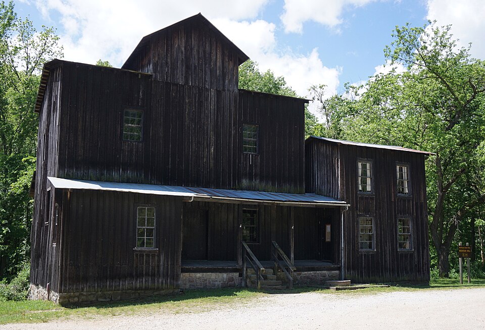
Listed on the National Register of Historic Places in 1985.
One of 8 National Register listings published here for Dent County · listed in 1985 · category: Building.
Sources: the case file at the National Archives · the National Register database, National Park Service
Regional context, not property-specific evidence. The federal wildfire occurrence database lists 30 fires within 5 miles of Old Mill at Montauk State Park between 1992 and 2017, burning about 482 acres in total. None started naturally. 8 were recorded as arson. Distance is straight-line from the map coordinates, so a fire counted here may appear on a neighbouring settlement's page as well.
| Reported cause | Fires |
|---|---|
| Debris and open burning | 13 |
| Arson/incendiarism | 8 |
| Missing data/not specified/undetermined | 5 |
| Recreation and ceremony | 2 |
| Equipment and vehicle use | 1 |
| Power generation/transmission/distribution | 1 |
The most recent of them, most recent first, with the day each was reported and the service that recorded it.
| Date | Cause | Size | Reported by | Name on the report |
|---|---|---|---|---|
| 18 September 2010 | Missing data/not specified/undetermined | under an acre | Ozark National Scenic River | CEDAR GROVE HAYBALES |
| 23 August 1995 | Debris and open burning | 1.0 acres | Missouri Department of Conservation | not named |
| 4 July 2013 | Missing data/not specified/undetermined | 3.0 acres | Missouri Department of Conservation | not named |
| 31 July 1999 | Arson/incendiarism | 275 acres | Missouri Department of Conservation | not named |
| 22 July 2017 | Debris and open burning | 4.6 acres | Missouri Department of Conservation | not named |
| 1 July 1997 | Equipment and vehicle use | under an acre | Ozark National Scenic River | BIGCREEK |
| 23 May 1997 | Missing data/not specified/undetermined | 1.0 acres | Missouri Department of Conservation | not named |
| 22 May 1994 | Debris and open burning | 1.0 acres | Missouri Department of Conservation | not named |
Regional context, not property-specific evidence. The federal mineral resources record lists 9 workings within 5 miles of Old Mill at Montauk State Park: 8 past producers, 1 prospect. None of them still produces. What was taken out: Iron, Stone, Crushed/Broken. Distance is straight-line from the map coordinates, so a quarry counted here may appear on a neighbouring settlement's page as well.
| Where | Site | Commodity | Status | Recorded |
|---|---|---|---|---|
| Unknown - Ls | Stone, Crushed/Broken | Past Producer | ||
| Unknown - Ls | Stone, Crushed/Broken | Past Producer | ||
| Montauk Mine | Iron | Past Producer | ||
| Shafer Mine | Iron | Past Producer | ||
| Unknown - Iron | Iron | Prospect | ||
| Unknown - Iron | Iron | Past Producer | ||
| Unknown - Iron | Iron | Past Producer | ||
| Unknown - Iron | Iron | Past Producer | ||
| Unknown - Iron | Iron | Past Producer |
Regional context, not property-specific evidence. The National Weather Service names Salem, the town this property stands in, in 123 storm reports between 1993 and 2025: 47 thunderstorm wind, 47 hail, 13 flash flood, 9 heavy rain. No death or injury is recorded in these reports. Each account below is quoted exactly as the forecast office filed it, from the NOAA Storm Events Database, and each date opens the federal record of that event.
| When | Event | Place named | Harm | What the report says |
|---|---|---|---|---|
| April 2017 | Flash Flood | Salem | $1,000,000 | Several homes and business sustained flood damage across Dent County. Numerous roads and bridges were severely damaged or washed away across the county. This report will contain the total dollar estimate for flood damage to infrastructure, businesses and homes across Dent County. |
| May 2025 | Tornado (EF0) | Salem | $55,000 | A NWS storm survey determined that an EF-0 tornado with maximum wind speeds of 80 mph developed just south of Salem off of State Highway Z and traveled northeast, ending east of Salem near County Road 4185. Numerous trees were uprooted and barns were damaged. |
| August 2009 | Thunderstorm Wind | Salem | $50,000 | Severe thunderstorm wind gusts uprooted several trees and snapped power poles over much of Dent County according to the emergency manager. A convenience store in Salem sustained roof damage. |
| March 2024 | Thunderstorm Wind | Salem | $30,000 | Several residences in Salem city limits had roof damage, a few duplex style residences had the majority of shingles blown off the roofs. A large section of privacy fence knocked over in the city limits of Salem. |
| May 2017 | Thunderstorm Wind | Salem | $25,000 | Numerous trees and power lines were blown down across the city along with power outages. Winds were estimated up to 80 mph. |
| August 2019 | Thunderstorm Wind | Salem | $15,000 | Numerous tree limbs and several power lines were reported down in Salem. |
| March 2024 | Thunderstorm Wind | Salem | $10,000 | A resident west of Salem suffered a collapsed gazebo and roof ripped off their hay barn, ruining all their hay. |
| April 2002 | Hail | Salem | $10,000 | no account filed |
| August 2000 | Thunderstorm Wind | Salem | $10,000 | no account filed |
| January 2000 | Thunderstorm Wind | Salem | $8,000 | no account filed |
| April 2018 | Thunderstorm Wind | Salem | $5,000 | A couple of trees and power lines were blown down in Salem. |
| April 2013 | Thunderstorm Wind | Salem | $5,000 | Several large trees were reported down across County Road 2240. Roof and deck damage were also reported to a home in that area. |
| August 2011 | Thunderstorm Wind | Salem | $5,000 | Emergency manager estimated wind gusts up to 60 mph. Several trees and power lines were blown down in the city of Salem. A tree fell on a house. |
| March 2006 | Thunderstorm Wind | Salem | $5,000 | Severe thunderstorm wind gusts blew a roof off of a large shed. |
| July 2006 | Thunderstorm Wind | Salem | $5,000 | Severe thunderstorm wind gusts downed a few power lines over central Dent County. |
| August 2006 | Thunderstorm Wind | Salem | $5,000 | Thunderstorm wind gusts downed a few power lines. |
| June 2005 | Thunderstorm Wind | Salem | $5,000 | Severe thunderstorm wind gusts downed a few power poles north of Salem. |
| June 1994 | Thunderstorm Wind | Salem | $5,000 | Wind gusts as high as 60 mph damaged some roofs and tore off shingles in the Salem area. |
| June 1994 | Hail | Salem | $5,000 | The public reported golf ball size hail along Highway 68 in extreme northern Dent County at 0335 CST. Golf ball-size hail and wind gusts to 65 mph were reported in Salem by the county sheriff, and numerous large trees were blown down near Bunkner. |
| April 1993 | Thunderstorm Wind | Salem | $5,000 | The county sheriff's office reported 1.00-inch-diameter hail at the north edge of the Montauk State Park. Power lines were also knocked down south of Salem. |
| July 1996 | Thunderstorm Wind | Salem | $5,000 | no account filed |
| July 1996 | Thunderstorm Wind | Salem | $5,000 | no account filed |
| November 1995 | Thunderstorm Wind | Salem | $5,000 | no account filed |
| June 1999 | Thunderstorm Wind | Salem | $3,000 | no account filed |
| June 2019 | Thunderstorm Wind | Salem | $1,000 | Several reports of limbs down and objects blown around were received around the town of Salem. Reports were received via social media. |
| May 2018 | Thunderstorm Wind | Salem | $1,000 | A power pole was snapped and power lines blown down on the west side of town. |
| September 2012 | Thunderstorm Wind | Salem | $1,000 | Some parts of a metal roof was blown off a building near Highway 32 and Highway 72. Two signs were blown down near Highway 72 and Highway H. |
| April 2006 | Thunderstorm Wind | Salem | $1,000 | Severe thunderstorm wind gusts destroyed a shed and downed trees and powerlines in the city of Salem. |
| November 2006 | Thunderstorm Wind | Salem | $1,000 | Severe thunderstorm wind gusts downed a power pole. |
| August 1997 | Thunderstorm Wind | Salem | $1,000 | Tree fell on house, damaging a corner of the roof. |
| November 1997 | Hail | Salem | $1,000 | State Trooper reported minor damage to car. |
| April 2012 | Thunderstorm Wind | Salem | $500 | A shed was blown over and a tree was downed across the road on County Road 2240. |
| June 1994 | Thunderstorm Wind | Salem | $500 | Several large trees were knocked down over the western parts of the county. |
| June 1994 | Hail | Salem | $500 | The county sheriff reported golf ball-size hail and wind gusts to 60 mph near the intersection of Highway 72 and County Road C. |
| June 1994 | Thunderstorm Wind | Salem | $500 | The county sheriff reported golf ball-size hail and wind gusts to 60 mph near the intersection of Highway 72 and County Road C. |
| June 1994 | Thunderstorm Wind | Salem | $500 | The public reported golf ball size hail along Highway 68 in extreme northern Dent County at 0335 CST. Golf ball-size hail and wind gusts to 65 mph were reported in Salem by the county sheriff, and numerous large trees were blown down near Bunkner. |
| November 1993 | Thunderstorm Wind | Salem | $500 | The County Sheriff reported numerous trees knocked down west of Salem along Highway 32. |
| April 1996 | Hail | Salem | $500 | no account filed |
| June 1995 | Thunderstorm Wind | Salem | $300 | Several large trees were knocked down. |
| April 2025 | Hail | Salem | - | Quarter sized hail was reported. |
| March 2025 | Hail | Salem | - | Hail to the size of quarters fell just south of Salem. |
| June 2025 | Hail | Salem | - | Hail to the size of quarters fell near Salem. |
| April 2024 | Flood | Salem | - | County Road 3220 at Spring Creek was flooded and impassable. |
| April 2024 | Hail | Salem | - | Quarter sized hail was reported. |
| April 2024 | Hail | Salem | - | Quarter sized hail was reported. |
| September 2024 | Heavy Rain | Salem | - | A 24 hour rainfall total of 3.68 inches fell east of Salem. This rainfall fell during the period of September 22 and September 23. |
| September 2024 | Heavy Rain | Salem | - | A 24 hour rainfall total of 3.75 inches fell in Salem. This rainfall fell during the period of September 22 and September 23. |
| November 2024 | Heavy Rain | Salem | - | CoCoRaHS station MO-FSA-065 located 1.8 miles northwest of Salem measured a 2-day rainfall total of 11.99 inches. |
| November 2024 | Heavy Rain | Salem | - | Mesonet station DW1779 in Salem measured a 24-hour rainfall total of 8.41 inches. |
| November 2024 | Heavy Rain | Salem | - | The CoCoRaHS station MO-DT-14 located 3.5 miles east of Salem measured a 2-day rainfall total of 12.05 inches. |
| November 2024 | Flood | Salem | - | Social media report of flooded roads in northeast Salem. |
| March 2023 | Flood | Salem | - | Street flooding was reported due to heavy rainfall. |
| April 2023 | Hail | Salem | - | Quarter sized hail was reported via MPing. |
| July 2023 | Hail | Salem | - | Quarter sized hail was reported. |
| August 2022 | Flash Flood | Salem | - | Spring Creek was reported out of its banks and over the low water bridge. |
| August 2020 | Hail | Salem | - | Penny size hail was reported. |
| August 2020 | Hail | Salem | - | Half dollar sized hail was reported. |
| August 2020 | Flash Flood | Salem | - | Numerous city streets were reported flooded and impassable. |
| August 2020 | Flash Flood | Salem | - | Spring Creek flooded a section of Iron Mountain Road from heavy rain that fell in a two hour period. |
| July 2019 | Heavy Rain | Salem | - | A 24 hour rainfall of 5.10 inches was measured. |
No historic map-sheet match is published for this property yet. That does not mean no map exists. This record needs a coordinate-quality review before it can be joined to a sheet boundary. Browse the county's mapped places while that work is pending.
Other National Register properties close enough to walk or drive between, ordered by distance from this one. Both positions come from the same geocoding pass that matched these properties to their map sheets.
| Photograph | Property | Distance | Listed |
|---|---|---|---|
 | Montauk State Park Open Shelter | 0.2 miles | 1985 |
| Dam and Spillway in the Hatchery Area at Montauk State Park | 0.3 miles | 1985 | |
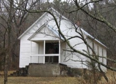 | Lower Parker School | 3.4 miles | 1991 |
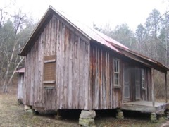 | Nichols Farm District | 3.5 miles | 1989 |
| National Archives record | The nomination case file for reference 85001478 in Record Group 79. |
| Dent County | All 8 listed properties in this county. |