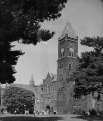
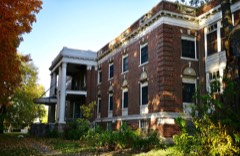
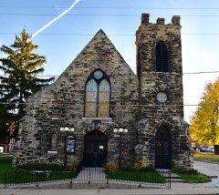
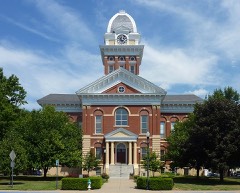
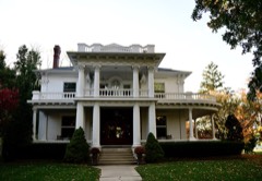
Listed on the National Register of Historic Places in 1988.
From the record
“Free Will Baptist Church of Pennytown is a historic African-American church in Pennytown, a community of unincorporated Saline County, Missouri 8 miles (13 km) south of Marshall. It was built in 1925 and added to the National Register of Historic Places in 1988.”
Wikipedia article Free Will Baptist Church of Pennytown, CC BY-SA 4.0.
One of 26 National Register listings published here for Saline County · listed in 1988 · category: Building.
National Register reference number.88000388- the number the National Park Service assigned this property when it was listed, and the key its nomination file is catalogued under at the National Archives.
The subject of this sketch, one of Saline's most distingushed men, was born in Wayne county, Kentucky, on the 12th day of July, 1807, and died in Saline county, Missouri, April 21st, 1866, being nearly fifty-nine years of age. He was a son of Wm. Bruce, a native of King George county, Virginia, and Sarah Bruce, his wife, whose maiden name was Vandever, and who was a native of Buncomb county. North Carolina. His father saw the army of Washington in its march to the final victory of the revolution at Yorktown. Both his parents lived to a green old age, the father being in his ninety-second, and the mother in her eighty-sixth year of age. The subject of this sketch was the sixth of a family of nine children, all of whom are now dead, except Mrs. Lavina Strother, mother of Hon. John P. Strother, late of Kentucky, but now of Marshall, and at present circuit judge of this circuit. In the year after his birth, his parents moved to Henry county, Kentucky, where they spent the remainder of their lives, dying in 1862, and where Aaron F. Bruce was reared. He was always industrious and energetic, even in boyhood. At that early day, school privileges were not abundant, and when a grammar schoiDl was started in his boyhood, in the neighborhood, his father told him and his brother they could attend. The brother attended, but Aaron told his father that if he would pay him the money that he intended to pay the teacher for his tuition, he would study his grammar at his plow-handle. This was done, and he carried his book with him into the field and cultivated his mind while he cultivated the corn. This serves
On the outbreak of the late civil war he was a large slave-owner, and perhaps the largest hemp-grower in Saline county, his annual crop being from 300 to 400 acres. His sympathies were naturally with the south, and his wealth made him a prey to the avaricious. One day^ as he was returning home from Marshall, a murderous detachment of militia lay in ambush intending to kill him, as one of them afterward confessed, but were prevented by the fact that he was in company with a Union man. Busin:;ss was paralyzed by war, and, not content to risk his life and do nothing- at home, he left his beautiful home on Pilot Knob, four miles northwest of Marshall, and going to Nebraska City, embarked in a lucrative enterprise on a large scale, that of freighting for the government and transporting supplies across the plains to Colorado, whose silver and gold mines were then attracting a large emigration. In this business he employed many men and twelve heavy vv^agons and one hundred and twenty head of work cattle.
Regional context, not property-specific
evidence. The
federal wildfire occurrence database
lists 2 fires within 5 miles of Free Will Baptist Church of Pennytown
between 1994 and 2019, burning about 25 acres in total. None started naturally. None was recorded as arson.
Distance is straight-line from the map coordinates, so a fire counted
here may appear on a neighbouring settlement's page as well.
Reported cause
Fires
Smoking
2
The most recent of
them, most recent first, with the day each was reported and the service
that recorded it.
Regional context, not property-specific
evidence. The federal mineral resources record lists
6 workings within 5 miles of Free Will Baptist Church of Pennytown: 5 past producers, 1 producer.
1 still produces. What was taken out: Stone, Crushed/Broken. Distance is straight-line from the
map coordinates, so a quarry counted here may appear on a neighbouring
settlement's page as well.
Regional context, not property-specific
evidence. The National Weather Service names
Marshall, the town this property stands in, in 79 storm reports between 1993 and 2025: 44 hail, 25 thunderstorm wind, 6 flash flood, 3 tornado.
No death or injury is recorded in these reports. Each account below is quoted exactly as the forecast office
filed it, from the NOAA Storm Events Database, and each date
opens the federal record of that event.
4 to 6 inches of rain produced widespread flash flooding in the Marshall area. Several water rescues and several homes and businesses suffered water damage. Damage to roads and bridges as well. Flowing water was 3 to 4 feet deep on Route YY.
Tornado touched down 6 miles south of Marshall at 2028 CST. It traveled east-northeast and for a time paralleled another tornado to the north before the first one occluded. Little damage was noted along the track until it neared the Howard county line. The tornado merged with another tornado near the Missouri River and quickly produced F3 damage to a farmstead. The tornado then entered Howard county 4 miles north of Arrow Rock at 2046 CST.
A tornado touched down briefly at a farm and tore part of the roof off three machine sheds. One other building was slightly damaged and two silos were bent or dented. A roll of field tile was lifted from its original position and tossed 100 yards to the west, while the storm was moving southeast.
The third and final tornado from this survey formed just north of Marshall, Missouri. While the tornado was very wide, it did not damage any structures that would suggest it was stronger than EF-1. Generally it impacted trees and power lines in the rural areas of Saline County and a few farm structures. The tornado dissipated just east of Marshall, Missouri about 20 minutes after is formed.
A tree was reported to have blown onto a car on Lincoln Avenue. A grain bin was also reported damaged. Thunderstorm wind gusts were estimated up to 70 mph.
Social media report and photos of downed trees and limbs from thunderstorm outflow in Marshall. Time based on social media report and confirmed from radar.
The Marshall Police department reported numerous trees and power lines down as a result of the thunderstorm winds. Marshall PD estimated wind gusts to 60 MPH while a local radio station reported wind gusts to 53 MPH in Marshall.
No historic map-sheet match is published
for this property yet. That does not mean no map exists. This record needs
a coordinate-quality review before it can be joined to a sheet boundary.
Browse the county's mapped places while that work is
pending.
Listed places nearby
6 within 8 miles
Other National Register properties close
enough to walk or drive between, ordered by distance from this one. Both
positions come from the same geocoding pass that matched these properties
to their map sheets.
Listing record. National Park Service National Register of Historic Places, listed-properties dataset, current to 2026-05-22.
Map join. Address geocoded through the United States Census geocoder, then tested against the published boundary of every sheet in the USGS Historical Topographic Map Collection.
How this page is made. Listing fields come from federal records; map-sheet coverage is a labelled coordinate-to-boundary calculation, not a source-field claim.
Wildfire. Short, Karen C. 2022. Spatial wildfire occurrence data for the United States, 1992-2020 [FPA_FOD_20221014]. 6th Edition. Fort Collins, CO: Forest Service Research Data Archive. https://doi.org/10.2737/RDS-2013-0009.6 Collected with United States Government funding and usable without additional permissions or fees.
Mines and quarries. USGS Mineral Resources Data System (MRDS) https://mrdata.usgs.gov/mrds/ A work of the United States government, no copyright under 17 U.S.C. 105.
Storms. NOAA National Centers for Environmental Information, Storm Events Database https://www.ncei.noaa.gov/stormevents/ A work of the United States government, no copyright under 17 U.S.C. 105. Narratives are quoted verbatim from the National Weather Service report and are not edited or summarised.
 Block