BlockBefore

Saline County, Missouri

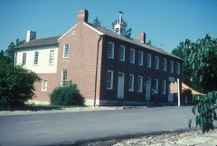
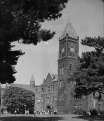
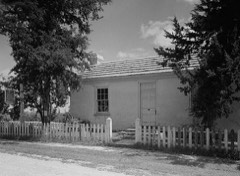
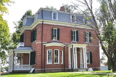
76 topographic sheets cover 38 settlements here, and 26 properties are on the National Register of Historic Places.

Research this county

From the record

26 National Register listings published here, 2 of them National Historic Landmarks · the county-history sources name 6 people · people the book names include The A. C. Bird (Miami Township, 1881) · M. E. Church South (Arrow Rock Township, 1881) (machine-read).

Sources: the county history on the Internet Archive · the National Register database, National Park Service

Missouri within the United States
Saline County within Missouri

What the record shows

  • 664 topographic sheet readings cover the county's settlements.
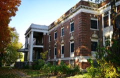
  • 26 properties here are on the National Register of Historic Places: 18 buildings, 4 districts, 2 structures and 2 sites.
  • 7 of the 26 listings were added during the 1970s.
  • The Geographic Names Information System records 38 populated places in this county; 38 are covered by at least one topographic sheet.
  • 2 public-domain county histories, 1881 and 1910, supply 25,032 words of narrative reproduced here.

Places on the National Register

26

Every property in this county listed on the National Register of Historic Places, with the year it was listed and the federal nomination document.

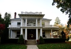
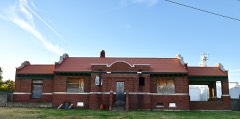
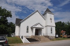
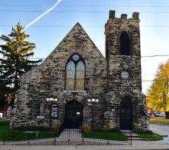
Photograph PropertyType ListedReference
Arrow Rockdistrict196666000422
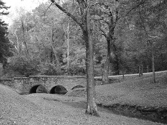
Arrow Rock State Historic Site Bridgestructure198585000516
Arrow Rock State Historic Site Grave Shelterstructure198585000534
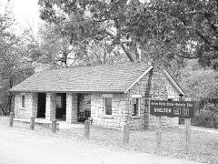
Arrow Rock State Historic Site Lookout Shelterbuilding198585000535
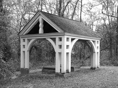
Arrow Rock State Historic Site Open Shelterbuilding198585000536
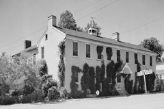
Arrow Rock Tavernbuilding197272000729
Baity Hallbuilding198686001396
George Caleb Bingham Housebuilding196666000423
Henry Blosser Housebuilding197878001675
Buckner Housebuilding198484002581
Chicago and Alton Depotbuilding197979001395
First Christian Churchbuilding198080002394
First Presbyterian Churchbuilding197777000814
Fitzgibbon Hospitalbuilding201212000874
Free Will Baptist Church of Pennytownbuilding198888000388
Mt. Carmel Historic Districtdistrict200909000900
George A. Murrell Housebuilding199797001435
Neff Tavern Smokehousebuilding197878001676
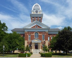
Saline County Courthousebuilding197777000815
Santa Fe Trail-Grand Pass Trail Segmentssite199494000324
Santa Fe Trail-Saline County Trail Segmentssite199494000615
William B. Sappington Housebuilding197070000348
Sweet Springs Historic Districtdistrict199797001485
Sweet Springs Historic District Boundary Decreasedistrict201010000206
Van Meter State Park Combination Buildingbuilding198585000537
Van Meter State Park Shelter Buildingbuilding198585000538

Wildfire, 1993 to 2019

39 fires

Every wildfire the federal occurrence database records inside this county: 39 of them, burning about 494 acres. 2 started naturally and 1 was recorded as arson. Each settlement page carries the fires within five miles of it.

Reported cause Fires
Debris and open burning16
Equipment and vehicle use8
Smoking7
Missing data/not specified/undetermined5
Natural2
Arson/incendiarism1

The five largest, by the area the report gives. None of them was recorded as arson.

DateCause SizeReported by Name on the report
27 October 1999Debris and open burning110 acresMissouri Department of Conservationnot named
11 September 1999Equipment and vehicle use83 acresMissouri Department of Conservationnot named
5 February 1994Debris and open burning33 acresMissouri Department of Conservationnot named
16 March 1999Debris and open burning30 acresMissouri Department of Conservationnot named
4 February 1994Smoking25 acresMissouri Department of Conservationnot named
26 January 2014Equipment and vehicle use25 acresMissouri Department of Conservationnot named
15 February 1994Debris and open burning21 acresMissouri Department of Conservationnot named
18 March 1999Debris and open burning20 acresMissouri Department of Conservationnot named

Every settlement page carries the fires within five miles of it - see the settlement index below.

Storms, 1956 to 2025

60 of 353 shown

The NOAA Storm Events Database holds 353 reports for this county, causing no deaths, 7 injuries and about $6,146,030 in recorded property damage. Each settlement page carries the reports that name it.

Kind of event Reports
Hail142
Thunderstorm Wind123
Flood33
Flash Flood29
Tornado25
Funnel Cloud1

The most serious of them, by death, then injury, then recorded damage. The accounts are quoted exactly as the forecast office filed them.

WhenEvent Place namedHarm What the report says
March 2006Tornado (F2)Sweet Spgs6 hurt, $3,000,000Tornado crossed into Saline county from Pettis county at 2009 CST. The tornado crossed over Interstate 70 at mile marker 71 at 2012 CST. Six people seeking shelter under a highway overpass were injured. Their cars were crushed when a semi was blown over on top of them. The tornado produced F2 damage just northeast of I-70 where several houses lost their roofs and a church was destroyed. The tornado continued northeast over rural areas and dissipated 3 miles east of Marshall at 2035 CST.
June 1994Thunderstorm WindMiami1 hurt, $500,000Large hail produced spotty crop damage across the southern half of the county, lasting about 25 minutes. Widespread wind damaged numerous wooded or tin farm structures in the Miami area. Many lost part or all of their roof, with eight completely destroyed. Power lines were blown down, farm machinery and crops were also damaged. A person was injured when a tree fell onto a car and shattered the windshield.
June 1994Thunderstorm WindSlater$500,000A large cluster of thunderstorms produced widespread wind damage in the Slater area. Numerous farm buildings were destroyed, with farm equipment damaged. Power lines were blown down and trees uprooted or snapped off. The county's agricultural industry reported damage to 20,000 acres of corn and 10,000 acres of wheat.
August 2004Flash FloodMarshall$300,0004 to 6 inches of rain produced widespread flash flooding in the Marshall area. Several water rescues and several homes and businesses suffered water damage. Damage to roads and bridges as well. Flowing water was 3 to 4 feet deep on Route YY.
June 1982Tornado (F1)not stated$250,000no account filed
April 1981Tornado (F1)not stated$250,000no account filed
May 1980Tornado (F2)not stated$250,000no account filed
July 1961Tornado (F2)not stated$250,000no account filed
May 2011Tornado (EF1)Slater$230,000At 1550CST an EF1 tornado touched down around one mile southeast of Slater, and moved east around three and a half miles, before lifting at 1557CST, around a mile south of Gilliam. One home was destroyed near Slater, with one mobile home destroyed and minor outbuilding damage near Gilliam.
March 2006Tornado (F3)Marshall$75,000Tornado touched down 6 miles south of Marshall at 2028 CST. It traveled east-northeast and for a time paralleled another tornado to the north before the first one occluded. Little damage was noted along the track until it neared the Howard county line. The tornado merged with another tornado near the Missouri River and quickly produced F3 damage to a farmstead. The tornado then entered Howard county 4 miles north of Arrow Rock at 2046 CST.
March 2006HailSweet Spgs$75,000no account filed
June 1994Tornado (F0)Marshall$50,000A tornado touched down briefly at a farm and tore part of the roof off three machine sheds. One other building was slightly damaged and two silos were bent or dented. A roll of field tile was lifted from its original position and tossed 100 yards to the west, while the storm was moving southeast.
May 1994HailMiami$50,000Very large hail dented vehicles and produced crop damage to wheat and corn.
May 1994HailSlater$50,000Hail dented several vehicles. Strong wind also snapped large tree limbs and brought down power lines.
June 1999Thunderstorm WindMarshall$25,000Power lines and trees were downed in the town of Marshall.
March 1991Tornado (F0)not stated$25,000no account filed
May 1977Tornado (F1)not stated$25,000no account filed
April 1967Tornado (F2)not stated$25,000no account filed
December 1956Tornado (F2)not stated$25,000no account filed
October 2004Tornado (F1)Sweet Spgs$20,000Pettis county Tornado crossed into Saline county just west of Highway K. Then damaged a house near K Highway and County Road 330 before dissipating.
April 2006HailSlater$15,000no account filed
May 2014Tornado (EF1)Marshall$10,000The third and final tornado from this survey formed just north of Marshall, Missouri. While the tornado was very wide, it did not damage any structures that would suggest it was stronger than EF-1. Generally it impacted trees and power lines in the rural areas of Saline County and a few farm structures. The tornado dissipated just east of Marshall, Missouri about 20 minutes after is formed.
April 2011Thunderstorm WindMarshall$10,000A tree was reported to have blown onto a car on Lincoln Avenue. A grain bin was also reported damaged. Thunderstorm wind gusts were estimated up to 70 mph.
April 1999FloodNew Frankfort$10,000A county commissioner reported that a 10-foot diameter galvanized drainage tube was washed out from under a county road by floodwaters, and a family that lived on the road was stranded.
June 1994Thunderstorm WindMarshall$5,000Large trees and power lines were knocked down on the north side of town.
June 1994Thunderstorm WindArrow Rock$5,000Large trees and power lines were knocked down.
May 1994HailMiami$5,000Very large hail dented vehicles and produced crop damage to wheat and corn.
May 1994HailMiami$5,000Golf ball-size hail dented cars nearby and flattened wheat fields.
May 1994Thunderstorm WindSlater$5,000Hail dented several vehicles. Strong wind also snapped large tree limbs and brought down power lines.
March 1993Thunderstorm WindMarshall Junction$5,000Two tractor-trailer trucks were blown over on Interstate 70.
July 1996Thunderstorm WindMalta Bend$5,000no account filed
April 1993HailMarshall$5,000no account filed
June 1960Tornado (F1)not stated$2,500no account filed
March 2006Thunderstorm WindSweet Spgs$2,000Power poles snapped and trees down.
August 2004Thunderstorm WindSweet Spgs$2,000Tin roof blown off a structure. 21/2 foot diameter trees snapped in half. Power lines down.
July 1995Thunderstorm Windnot stated$2,000Saline County Sheriff's Office reported numerous trees down from thunderstorm winds.
July 2006Thunderstorm WindMarshall$1,000Trees and power lines down.
September 2001Thunderstorm WindMarshall$1,000Numerous trees and power lines reported down.
March 1993HailMarshall Junction$500Two tractor-trailer trucks were blown over on Interstate 70.
June 1958Tornado (F0)not stated$30no account filed
August 2025Thunderstorm WindSweet Spgs-Mping report of 3 inch tree limbs broken in Sweet Springs.
June 2025Thunderstorm WindMarshall-Downed wires and power outages near County Road 111 near Marshall.
June 2025Thunderstorm WindNelson-Social media photo of downed trees in Nelson.
June 2025Thunderstorm WindMarshall-Social media reports and photos of trees down in Marshall.
June 2025Thunderstorm WindSlater-Social media photos of downed trees in Slater.
June 2025Thunderstorm WindSlater-Report of downed and/or uprooted trees on the east side of Slater.
June 2025Thunderstorm WindSlater-Tree damage and power lines down in Slater.
June 2025Thunderstorm WindSweet Spgs-Side and door of machine shed blown off, power pole snapped, and multiple large limbs down.
June 2025Thunderstorm WindSlater-Reports of downed trees in Slater.
June 2025Thunderstorm WindMt Leonard-Private weather sensor measured 59 knot gust.
September 2025Thunderstorm WindMiami-Downed wires and tree limbs near County Road 111. Dispatch also reported strong winds south and east of Miami.
March 2024HailSweet Spgs-Quarter sized hail was reported in Sweet Springs from an mping report.
August 2024Thunderstorm WindMarshall-Social media report and photos of downed trees and limbs from thunderstorm outflow in Marshall. Time based on social media report and confirmed from radar.
March 2023HailNelson-A supercell produced 1.25 hail in Nelson in southeastern Saline County.
March 2023HailMalta Bend-A supercell produced quarter size hail on the southeast side of Malta Bend in Saline County.
March 2023HailNorton-A supercell produced 1.25 hail east of Malta Bend in Saline County.
September 2023HailSweet Spgs-Quarter sized hail reported in Sweet Springs.

Mines and quarries

62 recorded

The Survey's mineral resources record lists 62 workings inside this county. 5 still produce and 57 are closed or unrecorded. Each settlement page carries the workings within five miles of it.

Commodity Workings
Stone, Crushed/Broken47
Sand and Gravel, Construction10
Salt, Sand and Gravel, Construction1
Clay1
Barium-Barite, Lead, Zinc1
Barium-Barite1
Stone, Crushed/Broken, Sand and Gravel, Construction1

The least common of them first, because a county's hundredth gravel pit says nothing its first ten did not.

Where SiteCommodity StatusRecorded
Marmaduke DiggingsBarium-Barite, Lead, ZincPast Producer
Unknown - BariteBarium-BaritePast Producer
Unknown - ClayClayPast Producer
Unknown - Ls-S+GStone, Crushed/Broken, Sand and Gravel, ConstructionPast Producer
Unknown - S+G-SaltSalt, Sand and Gravel, ConstructionPast Producer
Unknown - S+GSand and Gravel, ConstructionPast Producer
Unknown S+GSand and Gravel, ConstructionPast Producer
Arrow Rock QuarryStone, Crushed/BrokenUnknown
Branham QuarryStone, Crushed/BrokenPast Producer
Franklin QuarryStone, Crushed/BrokenProducer
Garner QuarryStone, Crushed/BrokenPast Producer
Gilliam Rock Quarry and MillStone, Crushed/BrokenProducer
Malan QuarryStone, Crushed/BrokenPast Producer
Marshall Jct Qy I-70 QyStone, Crushed/BrokenProducer
Marshall Quarry & PlantStone, Crushed/BrokenProducer
Miami Quarry #34 & PlantStone, Crushed/BrokenProducer
Scott QuarryStone, Crushed/BrokenPast Producer
Unknown - LsStone, Crushed/BrokenPast Producer
Unknown - SsStone, Crushed/BrokenPast Producer
Zarah QuarryStone, Crushed/BrokenPast Producer

The townships, in 1910

25,032 words

Past and Present of Saline County, Missouri devotes a chapter to each township: its boundaries and streams, who settled it and when, the mills, the schools and the churches. All 7 are reproduced here in full. Each row shows the township's own shape and where it lies in the county, drawn from the Census Bureau's boundary. Which settlements belong to which township is computed from that same boundary, not taken from the book.

The county's history books

820,118 words

2 books written about this county, cut here where the book itself is cut, at its printed chapters: 26 chapters in all. Every chapter is public domain, machine-read from the scan and reproduced complete. A chapter already given under one of the county's towns is not repeated in this list.

History of Saline County, Missouri, Carefully Written and Compiled from the Most Authentic Official and Private Sources ... with a Condensed History of Missouri; the State Constitution; a Military Record of Its Volunteers in Either Army of the Great Civil War ... Biographical Sketches of Prominent Men .. (1881)

ChapterLength
The whole text435,116 words in 28 parts

Past and Present of Saline County, Missouri (1910)

The people it describes

6 named

Everyone Past and Present of Saline County, Missouri stops to write about, with the section that describes them. Among them are the men who founded the place and governed the Territory. Each name opens the passage itself, in the words of 1910.

Every populated place in the county

38

Named settlements recorded in the Geographic Names Information System, each with the topographic sheets covering it. Villages, hamlets and abandoned places alike. Each is shown with the nearest named watercourse or landform and the survey quadrangle it falls on.

The vanished settlements of Saline County: the places named above that are no longer on the map.

Provenance

  • Topographic sheets. USGS Historical Topographic Map Collection, county index, measured from the bulk metadata.
  • Fire insurance maps. Library of Congress Sanborn collection, faceted to this county.
  • Photographs. Each place queried individually against the Library of Congress Prints and Photographs search.
  • Wildfire. Short, Karen C. 2022. Spatial wildfire occurrence data for the United States, 1992-2020 [FPA_FOD_20221014]. 6th Edition. Fort Collins, CO: Forest Service Research Data Archive. https://doi.org/10.2737/RDS-2013-0009.6 Collected with United States Government funding and usable without additional permissions or fees.
  • Mines and quarries. USGS Mineral Resources Data System (MRDS) https://mrdata.usgs.gov/mrds/ A work of the United States government, no copyright under 17 U.S.C. 105.
  • Storms. NOAA National Centers for Environmental Information, Storm Events Database https://www.ncei.noaa.gov/stormevents/ A work of the United States government, no copyright under 17 U.S.C. 105. Narratives are quoted verbatim from the National Weather Service report and are not edited or summarised.