 Block
From the record
One of 414 National Register listings published here for Jackson County · listed in 1994 · category: Site.
Sources: the National Register database, National Park Service
Listed on the National Register of Historic Places in 1994.
One of 414 National Register listings published here for Jackson County · listed in 1994 · category: Site.
Sources: the National Register database, National Park Service
The chapter on Fort Osage Township in The History of Jackson County, Missouri, Containing a History of the County, Its Cities, Towns, Etc., Biographical Sketches of Its Citizens, Jackson County in the Late War... History of Missouri, Map of Jackson County .., published 1881 names Independence. This is what it says, exactly as the scans read.
Notice is hereby given that the undersigned petitioners will make application to the County Court of Jackson county, Missouri, at the February term thereof, 1 88 1, to be held on the first Monday in February, 1881, in Kansas City, Mo.,' for the vacation of the following described parts of the following streets and alleys in the unincorporated town of Sibley in said Jackson county, Missouri, as laid out in the plat of said town, executed by Archibald Gamble, June 4; 1836, and recorded in Plat Book i, on page 60, in the recorders office of said Jackson county at Independence, Missouri, to-wit :
Passage source: The History of Jackson County, Missouri, Containing a History of the County, Its Cities, Towns, Etc., Biographical Sketches of Its Citizens, Jackson County in the Late War... History of Missouri, Map of Jackson County .., published 1881.
The post-office was established here in about the year 1840. Among those who have served as post-master are John S. Pryor and the present incumbent, S. S. Neely. Mr. Neely was commissioned post-master in the spring of 1878. Mails from Independence twice a week.
Passage source: The History of Jackson County, Missouri, Containing a History of the County, Its Cities, Towns, Etc., Biographical Sketches of Its Citizens, Jackson County in the Late War... History of Missouri, Map of Jackson County .., published 1881.
Machine-read from a century-old scan, so expect the errors a machine makes: misspelled names, dropped words, stray characters.
Read the whole chapter on Fort Osage Township - 3,445 words on its settlement, mills, schools and churches.
Regional context, not property-specific evidence. The federal wildfire occurrence database lists 20 fires within 5 miles of Blue Mills between 1992 and 2020, burning about 39 acres in total. None started naturally. 1 was recorded as arson. Distance is straight-line from the map coordinates, so a fire counted here may appear on a neighbouring settlement's page as well.
| Reported cause | Fires |
|---|---|
| Debris and open burning | 10 |
| Missing data/not specified/undetermined | 4 |
| Equipment and vehicle use | 3 |
| Recreation and ceremony | 1 |
| Arson/incendiarism | 1 |
| Fireworks | 1 |
The most recent of them, most recent first, with the day each was reported and the service that recorded it.
| Date | Cause | Size | Reported by | Name on the report |
|---|---|---|---|---|
| 12 August 2018 | Debris and open burning | under an acre | Missouri Department of Conservation | 177819-02412-08122018-1657 |
| 1 July 2019 | Fireworks | under an acre | Missouri Department of Conservation | 179267-02412-07012019-2142 |
| 8 April 2020 | Debris and open burning | 4.6 acres | Missouri Department of Conservation | 190395-04828-04082020-1735 |
| 30 April 1992 | Debris and open burning | 1.0 acres | Missouri Department of Conservation | not named |
| 30 April 1992 | Debris and open burning | 1.0 acres | Missouri Department of Conservation | not named |
| 30 April 1992 | Debris and open burning | 1.0 acres | Missouri Department of Conservation | not named |
| 16 April 2019 | Debris and open burning | under an acre | Missouri Department of Conservation | 178717-04828-04162019-1300 |
| 11 April 2020 | Missing data/not specified/undetermined | under an acre | Missouri Department of Conservation | 190428-04828-04112020-2045 |
Regional context, not property-specific evidence. The federal mineral resources record lists 16 workings within 5 miles of Blue Mills: 14 past producers, 2 producers. 2 still produce. What was taken out: Stone, Crushed/Broken, Sand and Gravel, Construction, Silica. Distance is straight-line from the map coordinates, so a quarry counted here may appear on a neighbouring settlement's page as well.
| Where | Site | Commodity | Status | Recorded |
|---|---|---|---|---|
| Liberty Bend Pit & Plant | Silica | Producer | ||
| Unknown | Sand and Gravel, Construction | Past Producer | ||
| Unknown-Sand and Gravel | Sand and Gravel, Construction | Past Producer | ||
| Iowa Point Quarry | Stone, Crushed/Broken | Past Producer | ||
| Parkville Quarry | Stone, Crushed/Broken | Past Producer | ||
| Unknown-Ls | Stone, Crushed/Broken | Past Producer | ||
| Unknown-Ls | Stone, Crushed/Broken | Producer | ||
| Unknown-Ls | Stone, Crushed/Broken | Past Producer | ||
| Unknown-Ls | Stone, Crushed/Broken | Past Producer | ||
| Unknown-Ls | Stone, Crushed/Broken | Past Producer |
Regional context, not property-specific evidence. The National Weather Service names Independence, the town this property stands in, in 63 storm reports between 1993 and 2026: 35 hail, 24 thunderstorm wind, 2 flash flood, 1 heavy rain. No death or injury is recorded in these reports. Each account below is quoted exactly as the forecast office filed it, from the NOAA Storm Events Database, and each date opens the federal record of that event.
| When | Event | Place named | Harm | What the report says |
|---|---|---|---|---|
| April 1993 | Hail | Independence | $5,000,000 | Large hail fell at various locations in the eastern Kansas City suburbs, including along Interstate 435, Highway 350, and near Blue Ridge Mall. Numerous car dealerships along Noland Road in Independence reported substantial damage to automobiles. Many city owned vehicles had damage, including broken windows and dents. |
| May 2007 | Heavy Rain | Independence | $200,000 | Total rainfall since this morning has been 3.79 inches. Many flooded basements and backed up sewers reported throughout Independence. |
| July 1996 | Thunderstorm Wind | Independence | $20,000 | no account filed |
| August 2002 | Thunderstorm Wind | Independence | $10,000 | Numerous power lines and trees down...in an area from 42nd Street to 44th Terrace near Noland Road. |
| July 2000 | Thunderstorm Wind | Independence | $10,000 | A 40 foot tall tree was downed, damaging the roof of a home. |
| September 2001 | Thunderstorm Wind | Independence | $3,000 | Semi trailer truck blown over on I-70. Several power poles reported down along with numerous trees. |
| April 2026 | Hail | Independence | - | Quarter sized hail reported in western Independence. |
| April 2025 | Hail | Independence | - | Half dollar sized hail reported. |
| June 2025 | Thunderstorm Wind | East Independence | - | EM relayed images of multiple trees snapped, downed over roadway, or on homes. This damage was likely tornado damage. |
| June 2025 | Thunderstorm Wind | East Independence | - | Several downed trees near Truman Road east of Route 291. |
| June 2025 | Tornado (EF1) | East Independence | - | Storm survey found evidence of a 3.7 mile long EF-1 tornado in Jackson County in the Independence area. Essentially all of the damage was uprooted trees and large tree branches snapped. |
| June 2025 | Thunderstorm Wind | East Independence | - | Several downed or snapped trees near Lees Summit Road in Independence. |
| June 2025 | Thunderstorm Wind | East Independence | - | Downed tree onto a boat at a residence near Jackson Drive. |
| July 2025 | Thunderstorm Wind | East Independence | - | Downed tree near Route 291 and U.S. Highway 24. |
| April 2024 | Thunderstorm Wind | Independence | - | Estimated 60 mph winds in Independence. |
| May 2024 | Thunderstorm Wind | Independence | - | Measured gust of 80 mph with large oak trees downed just southwest of downtown Independence. |
| December 2021 | Thunderstorm Wind | Independence | - | Several power poles were down in Independence. More than 2500 people were without power. |
| April 2019 | Hail | East Independence | - | This report was received via MPing. |
| June 2019 | Thunderstorm Wind | Independence | - | Power outages across Kansas City were reported via Spotter Network after strong winds passed through. |
| June 2019 | Hail | East Independence | - | This report was received via MPing. |
| June 2019 | Flash Flood | East Independence | - | Water was over the roadway at HWY 291 and Gudgell. |
| July 2017 | Thunderstorm Wind | East Independence | - | Multiple trees fell in this area. At least one tree fell on a power line, knocking out the power. |
| June 2015 | Thunderstorm Wind | Independence | - | A line of strong thunderstorms moved through the Kansas City metro, producing widespread reports of 70 mph winds and much tree damage. |
| August 2011 | Thunderstorm Wind | Independence | - | Thunderstorm wind gusts were estimated up to 60 mph. |
| May 2010 | Thunderstorm Wind | East Independence | - | Large tree was blown down. |
| April 2008 | Hail | East Independence | - | Hail was observed at 31st Street and Blue Ridge. |
| April 2007 | Hail | Independence | - | Hail at the intersection of Interstate 470 and Woods Chapel Road. |
| May 2007 | Flash Flood | Independence | - | Up to 10 inches of water was flowing over intersection of Lee's Summit Road and 39th Street. |
| June 2005 | Thunderstorm Wind | Independence | - | Trees blown down on Noland Road. |
| October 2004 | Thunderstorm Wind | Independence | - | 8 to 12 inch diameter tree downed. |
| June 2001 | Thunderstorm Wind | Independence | - | Thunderstorms produced wind damage, resulting in downed large tree limbs. |
| July 2018 | Hail | Independence | - | no account filed |
| March 2017 | Hail | East Independence | - | no account filed |
| March 2017 | Hail | East Independence | - | no account filed |
| May 2016 | Hail | East Independence | - | no account filed |
| May 2016 | Hail | East Independence | - | no account filed |
| August 2008 | Hail | Independence | - | no account filed |
| February 2007 | Hail | Independence | - | no account filed |
| February 2007 | Hail | Independence | - | no account filed |
| March 2006 | Hail | Independence | - | no account filed |
| April 2006 | Hail | Independence | - | no account filed |
| April 2006 | Hail | Independence | - | no account filed |
| August 2006 | Thunderstorm Wind | Independence | - | no account filed |
| April 2005 | Hail | Independence | - | no account filed |
| May 2005 | Hail | Independence | - | no account filed |
| June 2005 | Thunderstorm Wind | Independence | - | no account filed |
| November 2005 | Hail | Independence | - | no account filed |
| June 2004 | Thunderstorm Wind | Independence | - | no account filed |
| June 2004 | Thunderstorm Wind | Independence | - | no account filed |
| July 2003 | Hail | Independence | - | no account filed |
| July 2003 | Hail | Independence | - | no account filed |
| February 2003 | Hail | Independence | - | no account filed |
| April 2003 | Hail | Independence | - | no account filed |
| May 2003 | Hail | Independence | - | no account filed |
| May 2003 | Hail | Independence | - | no account filed |
| August 2003 | Hail | Independence | - | no account filed |
| August 2003 | Hail | Independence | - | no account filed |
| April 2002 | Hail | Independence | - | no account filed |
| May 2002 | Hail | Independence | - | no account filed |
| April 2001 | Hail | Independence | - | no account filed |
No historic map-sheet match is published for this property yet. That does not mean no map exists. This record needs a coordinate-quality review before it can be joined to a sheet boundary. Browse the county's mapped places while that work is pending.
Other National Register properties close enough to walk or drive between, ordered by distance from this one. Both positions come from the same geocoding pass that matched these properties to their map sheets.
| Photograph | Property | Distance | Listed |
|---|---|---|---|
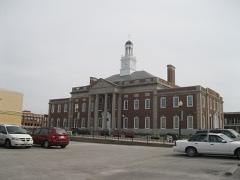 | Jackson County Courthouse | 6.0 miles | 1972 |
 | Fort Osage | 6.6 miles | 1966 |
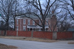 | Lewis Jones House | 6.7 miles | 1994 |
 | Harvey M. Vaile Mansion | 6.7 miles | 1969 |
| Mason Building | 7.0 miles | 2021 | |
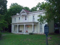 | Lewis-Webb House | 7.1 miles | 1986 |
| National Archives record | The nomination case file for reference 94000323 in Record Group 79. |
| Jackson County | All 414 listed properties in this county. |