 Block
From the record
One of 26 National Register listings published here for Saline County · listed in 1994 · category: Site.
Sources: the National Register database, National Park Service
Listed on the National Register of Historic Places in 1994.
One of 26 National Register listings published here for Saline County · listed in 1994 · category: Site.
Sources: the National Register database, National Park Service
This property stands in Marshall Township. History of Saline County, Missouri, Carefully Written and Compiled from the Most Authentic Official and Private Sources ... with a Condensed History of Missouri; the State Constitution; a Military Record of Its Volunteers in Either Army of the Great Civil War ... Biographical Sketches of Prominent Men .., published 1881 gives that township a chapter of its own.
The chapter covers the township.
Machine-read from a century-old scan, so expect the errors a machine makes: misspelled names, dropped words, stray characters.
Read the whole chapter on Marshall Township - 3,425 words on its settlement, mills, schools and churches.
Regional context, not property-specific evidence. The National Weather Service names Stanhope, the town this property stands in, in 3 storm reports between 2015 and 2021: 3 flash flood. No death or injury is recorded in these reports. Each account below is quoted exactly as the forecast office filed it, from the NOAA Storm Events Database, and each date opens the federal record of that event.
| When | Event | Place named | Harm | What the report says |
|---|---|---|---|---|
| June 2021 | Flash Flood | Stanhope | - | Multiple cars were stuck in running water in Marshall. |
| June 2021 | Flash Flood | Stanhope | - | Several roads across Saline County were overrun with running water. |
| June 2015 | Flash Flood | Stanhope | - | Several roads in and around Marshall were closed due to flash flooding. These roads include Highway 240 near Highway 41 and Odell and Morrow Streets, along with Miami and Morrow Streets in the town of Marshall. |
No historic map-sheet match is published for this property yet. That does not mean no map exists. This record needs a coordinate-quality review before it can be joined to a sheet boundary. Browse the county's mapped places while that work is pending.
Other National Register properties close enough to walk or drive between, ordered by distance from this one. Both positions come from the same geocoding pass that matched these properties to their map sheets.
| Photograph | Property | Distance | Listed |
|---|---|---|---|
| Mt. Carmel Historic District | 2.1 miles | 2009 | |
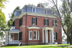 | Henry Blosser House | 2.8 miles | 1978 |
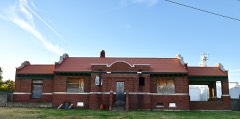 | Chicago and Alton Depot | 4.9 miles | 1979 |
 | Saline County Courthouse | 5.2 miles | 1977 |
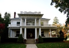 | Buckner House | 5.2 miles | 1984 |
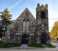 | First Presbyterian Church | 5.2 miles | 1977 |
| National Archives record | The nomination case file for reference 94000615 in Record Group 79. |
| Saline County | All 26 listed properties in this county. |