 Block
From the record
8 National Register listings published here.
Sources: the National Register database, National Park Service
76 topographic sheets cover 43 settlements here, and 8 properties are on the National Register of Historic Places.
8 National Register listings published here.
Sources: the National Register database, National Park Service
Every property in this county listed on the National Register of Historic Places, with the year it was listed and the federal nomination document.
| Photograph | Property | Type | Listed | Reference |
|---|---|---|---|---|
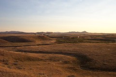 | Chief Joseph Battleground of the Bear's Paw | site | 1970 | 70000355 |
 | Dave's Texaco | building | 1994 | 94000862 |
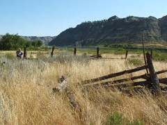 | Ervin Homestead-Gist Bottom Historic District | district | 2016 | 16000410 |
| Lodgepole Community Hall | building | 2000 | 00000148 | |
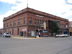 | Lohman Block | building | 1980 | 80002399 |
| Anna Scherlie Homestead Shack | building | 1998 | 98001338 | |
| St. Paul's Mission Church | building | 2020 | 100005403 | |
 | Young Brothers Chevrolet Garage | building | 1994 | 94000867 |
Every wildfire the federal occurrence database records inside this county: 1,107 of them, burning about 92,551 acres. 217 started naturally and 24 were recorded as arson. Each settlement page carries the fires within five miles of it.
| Reported cause | Fires |
|---|---|
| Natural | 217 |
| Debris and open burning | 206 |
| Missing data/not specified/undetermined | 185 |
| Fireworks | 163 |
| Smoking | 90 |
| Misuse of fire by a minor | 73 |
| Equipment and vehicle use | 70 |
| Recreation and ceremony | 57 |
| Arson/incendiarism | 24 |
| Other causes | 10 |
| Power generation/transmission/distribution | 9 |
| Railroad operations and maintenance | 2 |
| Firearms and explosives use | 1 |
The five largest, by the area the report gives. None of them was recorded as arson.
| Date | Cause | Size | Reported by | Name on the report |
|---|---|---|---|---|
| 14 September 2012 | Equipment and vehicle use | 33,318 acres | Fort Belknap Agency | WELDER |
| 30 July 2006 | Natural | 7,963 acres | Northeastern Land Office | MAGGIE FIRE |
| 29 July 2006 | Natural | 5,154 acres | Fort Belknap Agency | HOWARD |
| 13 March 2012 | Railroad operations and maintenance | 4,805 acres | Malta Field Office | OUTHOUSE |
| 19 October 2003 | Equipment and vehicle use | 3,886 acres | Fort Belknap Agency | LAKE17 |
| 1 August 2014 | Natural | 3,670 acres | Malta Field Office | MIDDLE BLACK |
| 9 April 2008 | Debris and open burning | 3,000 acres | Northeastern Land Office | not named |
| 9 December 2015 | Missing data/not specified/undetermined | 2,707 acres | Fort Belknap Agency | VALLEY ROAD |
Every settlement page carries the fires within five miles of it - see the settlement index below.
The NOAA Storm Events Database holds 252 reports for this county, causing no deaths, no injuries and about $4,545,500 in recorded property damage. Each settlement page carries the reports that name it.
| Kind of event | Reports |
|---|---|
| Thunderstorm Wind | 107 |
| Hail | 102 |
| Flood | 17 |
| Tornado | 7 |
| Heavy Rain | 7 |
| Funnel Cloud | 6 |
| Flash Flood | 5 |
| Wildfire | 1 |
The most serious of them, by death, then injury, then recorded damage. The accounts are quoted exactly as the forecast office filed them.
| When | Event | Place named | Harm | What the report says |
|---|---|---|---|---|
| May 2024 | Flood | Ft Belknap Siding | $1,070,000 | MT Department of Emergency services reported $1,071,000 in damages to roads and bridges from the combination of rain and snow melt on the Fort Belknap Reservation in Blaine County. |
| April 2023 | Flood | Chinook | $1,000,000 | Significant flooding occurred along the Milk River across Blaine County. The Rocky Boy SNOTEL station which is the main Milk River basin station peaked later than normal and had over 3.5 times the snow water equivalent that it normally would on April 6 (10.7 of snow water equivalent versus a normal of 3.0). When this thick snowpack melted, virtually the entire Milk River system flooded in a matter of days, as a result. The Milk River near Harlem crested at 23.80 feet on April 12, which as of this entry was the seventh highest river level recorded at this site. Roughly 4,000 aces of irrigation land was flooded. Chinook water plant was surrounded by water. Several roads and homes were impacted. |
| July 2023 | Hail | Chinook | $1,000,000 | Several photos submitted on social media of large hail in Chinook. Insurance company reported at least 11 vehicle hail damage claims and 5 homeowners claims. Number of claims likely increased since preliminary reports. |
| June 1995 | Hail | Chinnok | $1,000,000 | Golf ball-size hail damaged cars at car dealerships in Chinook. Total damage was estimated at upwards of $1 million. |
| July 2022 | Thunderstorm Wind | Savoy | $200,000 | Significant damage to a farm occurred. Two grain bins were destroyed, two roofs heavily damaged, barns heavily damaged, a few windows were reported to be blown out. |
| July 2000 | Thunderstorm Wind | Harlem | $100,000 | Storage shed destroyed with valuable machinary damaged...machine shop severely damaged. |
| July 2002 | Tornado (F1) | Chinook | $50,000 | A severe thunderstorm moved across southern Blaine County during the late afternoon hours on the 8th. This storm produced golf ball sized hail, and wind gusts in excess of 100 mph. A tornado developed shortly after 1600 MST. This tornado was short lived, but it did do some crop damage, along with damage to 3 residences. Several barns were destroyed and a few other structures lost roofs. One vehicle suffered major damage. |
| August 1993 | Hail | Hogeland | $50,000 | One to nearly three inches of rain fell causing crop damage. |
| August 1993 | Hail | Hogeland | $50,000 | One to nearly three inches of rain fell causing crop damage. |
| March 1997 | Flood | Chinook | $25,000 | no account filed |
| June 1996 | Thunderstorm Wind | Chinook | $500 | no account filed |
| May 2025 | Thunderstorm Wind | Bear Paw | - | Ambient weather station DBR HQ measured a 63 mph gust. |
| July 2025 | Hail | Turner | - | Video on social media showed hail size up to 1.75 inches. |
| July 2025 | Flash Flood | Lohman | - | The river gauge Clear Creek near Chinook MT - USGS-06142400 showed water rose quicky rose above bank full due to a thunderstorm beginning late on the 27th. It crested to 8.36ft early on the 28th. The water receded back into it's bank shortly after in the early morning of the 28th. No reported damages from the flood. |
| August 2025 | Thunderstorm Wind | Cherry Ridge | - | BLM Cherry Ridge peak gust. |
| August 2025 | Thunderstorm Wind | Lohman | - | Peak wind gust measured by Ambient station PG Ranch. |
| August 2025 | Thunderstorm Wind | Ft Belknap Agency | - | Mesonet station FBLM8 Fort Belknap RAWS. Time of gust is estimated. |
| July 2024 | Hail | Hogeland Arpt | - | Trained spotter reported 1 inch hail. |
| July 2024 | Hail | Lodgepole | - | Public report on Facebook. Egg to tennis ball sized hail caused damage to windows. Time estimated using radar. |
| July 2024 | Hail | Lodgepole | - | Mixed sized hail with the largest being quarters, which fell for about 10 minutes. |
| July 2024 | Hail | Chinook | - | Trained spotter measured 0.11 inches of rain with the thunderstorm. |
| July 2024 | Hail | North Fork | - | Report from Mping. |
| July 2024 | Hail | Ft Belknap | - | Report from Mping. |
| July 2024 | Hail | Lodgepole | - | Lots of baseball sized hail with a few softball sized hail stones mixed in. Lots of wind was reported with the hail. Time approximated by radar. Reported by a storm chaser. |
| July 2024 | Hail | St Pauls | - | Facebook report with an image. Location estimated using radar. |
| July 2024 | Thunderstorm Wind | Leroy | - | RAWS station LBCM8 Little Bullwhacker Creek RAWS. Time was estimated using radar given the sensor reports one peak gust per hour. |
| June 2024 | Thunderstorm Wind | Ft Belknap Agency | - | RAWS station FBLM8 Fort Belknap RAWS measured a 59 mph gust while lightning was in the area. Time was estimated using radar given this sensor only reports one time per hour. |
| September 2024 | Flood | Chinook | - | Broadcast media reported minor flooding at the Blaine county fairgrounds. Standing water upwards of 6 inches in spots was reported. |
| August 2024 | Thunderstorm Wind | Ft Belknap Agency | - | RAWS sensor FBLM8 Fort Belknap measured a severe gust. Time was estimated given RAWS sensors only report one time per hour. |
| June 2023 | Flood | Lohman | - | Water levels of Clear Creek near Chinook crested at 8.57 feet on June 4th, which is Major Flood Stage. At the time, this crest value was the third highest crest on record for this location. |
| April 2023 | Flood | Lohman | - | Significant snowmelt resulted in flooding along Battle Creek, near Chinook. The creek crested on April 12th at 11.94 feet. Several roads across northern and central Blaine County were impacted as a result. Water was reported over Highway 2, west of Chinook, for a time. Runoff from Cypress Hills in southern Canada may have contributed to the flooding. |
| April 2023 | Flood | Lloyd | - | Significant snowmelt resulted in flooding along Clear Creek. The creek rose approximately four feet over a 24 hour period from April 8th to April 9th, before dramatically subsiding. A nearby reservoir about 3 acres in size filled and flooded within five hours. The river gauge for Clear Creek near Chinook crested at 8.12 feet, with 8.00 feet being the designated beginning of Major Flood Stage. Multiple nearby roads were flooded as a result. |
| July 2023 | Hail | Ft Belknap Agency | - | Co-op observer reported hail of quarter size was covering the ground. |
| July 2023 | Hail | Chinook | - | Photos submitted of hail being measured with a ruler as well as being compared to coins. |
| July 2023 | Hail | Chinook | - | Blaine County Deputy EM reported golf ball size hail at their property. |
| July 2023 | Hail | Harlem | - | Images submitted of large hail in Harlem. |
| August 2022 | Tornado (EF0) | Cleveland | - | Photos submitted to NWS of a tornado on the backside of a single supercell near Ft. Belknap Reservation. Official indicated that the tornado was south of Ft Belknap Agency and near Wild Horse Butte. No known damage was been reported or observed. |
| June 2022 | Heavy Rain | Hogeland | - | Twenty-four hour report from cocorahs. |
| July 2022 | Hail | Hays | - | Pictures relayed via social media of very large hail near Hays. Time of event from radar. |
| July 2022 | Thunderstorm Wind | Chinook Hebbelman Ar | - | Trained spotter reported 61 mph wind gust. |
| July 2022 | Thunderstorm Wind | Harlem | - | Agrimet site HRLM measured peak gust of 58.3 mph. |
| July 2022 | Hail | St Pauls | - | Hail around nickel sized. Time estimated via radar. |
| July 2022 | Hail | Hays | - | Reported half inch to golfball sized hail. mostly just heavy rainfall right now and calm winds. |
| July 2022 | Thunderstorm Wind | Chinook | - | AWOS station KS71 (Chinnok Airport) measured 60 mph wind gust. |
| July 2021 | Hail | Hays | - | A member of the public relayed a report of half dollar sized hail through social media. |
| July 2021 | Hail | Hays | - | A member of the public relayed images of golf ball sized hail through social media. |
| July 2021 | Tornado (EFU) | Hays | - | A supercell moved southeast across Blaine County early Tuesday|evening. This storm produced large hail of nearly two inches in|diameter along its path. As the severe storm approached Hays,|rotation strengthened slightly to where a brief tornado occurred.|The tornado occurred over open ranchland to the west of Montana|Highway 66 and, to our knowledge, no damage occurred. The|supercell then started to weaken as it move southeast between Hays|and Lodge Pole with the tornado likely lifting before it reached|Highway 66. |
| June 2021 | Thunderstorm Wind | Hogeland Arpt | - | Time is approximate. Part of tree was taken down. |
| June 2021 | Hail | Leroy | - | Trained spotter reports 1 inch hail. In addition, 0.5 inches of rain fell with the thunderstorms. |
| June 2021 | Hail | Hays | - | Quarter sized hail reported during the second storm to pass over Hays, MT. |
| June 2021 | Hail | Hays | - | Quarter to ping pong ball sized hail reported in Hays, MT with the third system that tracked through the area. In addition, gusty winds shook the truck the truck. Gusts were estimated to be around 50 MPH. |
| June 2021 | Hail | Hays | - | Public report from Hays, MT of ping pong to tennis ball sized hail when the first system moved through. |
| July 2020 | Thunderstorm Wind | Hogeland | - | Trained spotter reported downed 15 to 20 foot crab apple tree and flag pole due to thunderstorm wind gusts. Nearly an inch of rain fell. |
| July 2020 | Thunderstorm Wind | Turner | - | Trained spotter reported 3 to 4 foot chunks and larger tree branches were blown down due to thunderstorm wind gusts. |
| July 2020 | Hail | Turner | - | Member of public reported quarter size hail and gusty winds. |
| July 2020 | Thunderstorm Wind | Ft Belknap | - | RAWS station FBLM8 Fort Belknap measured a 57 kt (66 mph) thunderstorm wind gust. |
| August 2020 | Thunderstorm Wind | Ft Belknap Agency | - | Fort Belknap raws mesonet station fblm8. |
| June 2019 | Hail | Adams Siding | - | Measured north of Chinook near the Canadian border. Storm is showing signs of rotation with wall cloud, but not dropping anything at the moment. Truck windshield damaged. |
| June 2019 | Thunderstorm Wind | Chinook | - | Spotter reports at least on tree down partially blocking a road south of Chinook. |
| June 2019 | Thunderstorm Wind | Ft Belknap Agency | - | Electricity outage occurred. |
The Survey's mineral resources record lists 40 workings inside this county. 2 still produce and 38 are closed or unrecorded. Each settlement page carries the workings within five miles of it.
| Commodity | Workings |
|---|---|
| Sand and Gravel, Construction | 18 |
| Lead | 5 |
| Abrasive | 5 |
| Silver | 4 |
| Zeolites, Diamond | 4 |
| Clay | 4 |
| Stone, Crushed/Broken | 3 |
| Gold, Silver | 2 |
| Lead, Copper | 1 |
| Zeolites | 1 |
| Diamond, Zeolites | 1 |
| Barium-Barite | 1 |
| Geothermal | 1 |
| Copper | 1 |
The least common of them first, because a county's hundredth gravel pit says nothing its first ten did not.
| Where | Site | Commodity | Status | Recorded |
|---|---|---|---|---|
| Big Warm Springs | Geothermal | Producer | ||
| Black Diamond Claim | Iron | Prospect | ||
| Clay Pit | Clay, Zeolites | Occurrence | ||
| Edith M. Claim | Copper, Gold, Silver | Prospect | ||
| Hal 21/22 | Abrasive, Diamond, Zeolites | Occurrence | ||
| Linda, Etal, O'Hanlon Mine | Lead, Copper | Occurrence | Chalcopyrite, Galena | |
| Rex Claim | Gold, Silver | Occurrence | ||
| Unnamed Lead & Barium | Lead, Barium-Barite | Occurrence | ||
| Bear's Paw Mine | Lead, Gold, Silver | Prospect | ||
| Limestone Quarry | Stone, Crushed/Broken | Past Producer | ||
| Matador Dome | Stone, Crushed/Broken | Occurrence | ||
| Snake Butte Quarry | Stone, Crushed/Broken | Past Producer | ||
| Dike 1 | Abrasive, Zeolites, Diamond | Unknown | ||
| Edison Claim | Silver, Lead | Prospect | ||
| Hal 2, 3 | Abrasive, Zeolites, Diamond | Occurrence | ||
| Hal 23124 | Abrasive, Zeolites, Diamond | Occurrence | ||
| Hal 32 | Abrasive, Zeolites, Diamond | Occurrence | ||
| Linda Mine | Silver, Lead | Past Producer | ||
| Silver King Claim | Silver, Lead | Prospect | ||
| Unnamed Bentonite | Clay | Occurrence | ||
| Unnamed Bentonite | Clay | Occurrence | ||
| Unnamed Bentonite | Clay | Occurrence | ||
| Blaine Sand & Gravel | Sand and Gravel, Construction | Producer | ||
| Gravel Pit | Sand and Gravel, Construction | Unknown | ||
| Gravel Pit | Sand and Gravel, Construction | Unknown | ||
| Gravel Pit | Sand and Gravel, Construction | Unknown | ||
| Gravel Pit | Sand and Gravel, Construction | Unknown | ||
| Gravel Pit | Sand and Gravel, Construction | Unknown | ||
| Gravel Pit | Sand and Gravel, Construction | Unknown | ||
| Gravel Pit | Sand and Gravel, Construction | Unknown | ||
| Gravel Pit | Sand and Gravel, Construction | Unknown | ||
| Gravel Pit | Sand and Gravel, Construction | Unknown | ||
| Gravel Pit | Sand and Gravel, Construction | Past Producer | ||
| Gravel Pit | Sand and Gravel, Construction | Past Producer | ||
| Gravel Pit | Sand and Gravel, Construction | Unknown | ||
| Gravel Pit | Sand and Gravel, Construction | Unknown | ||
| Gravel Pit | Sand and Gravel, Construction | Unknown | ||
| Gravel Pits | Sand and Gravel, Construction | Unknown | ||
| Gravel Pits | Sand and Gravel, Construction | Unknown | ||
| Tilleman Pit and Plant | Sand and Gravel, Construction | Past Producer |
Named settlements recorded in the Geographic Names Information System, each with the topographic sheets covering it. Villages, hamlets and abandoned places alike. Each is shown with the nearest named watercourse or landform and the survey quadrangle it falls on.
Chinook census division · 59523 · Near White Pine Canyon · Big John Butte quadrangle
10 sheets, 1953 to 1993
No longer a settlement
Fort Belknap census division · 59524 · Ball Coulee quadrangle
7 sheets, 1953 to 1984
No longer a settlement
Harlem census division · 59523 · Near Irvins Coulee · Richmond Reservoir NE quadrangle
8 sheets, 1912 to 1984
No longer a settlement
Harlem census division · 59523 · Near Irvins Coulee · Irvins Coulee quadrangle
9 sheets, 1913 to 1984
Chinook census division · 59523 · Near Redrock Coulee · Chinook quadrangle
10 sheets, 1904 to 1984
Chinook census division · 59523 · On Nicholson Bluff Creek · Cleveland quadrangle
10 sheets, 1953 to 1993
Chinook census division · 59535 · On Cow Creek · Cow Island quadrangle
11 sheets, 1943 to 1984
No longer a settlement
Fort Belknap census division · 59526 · On Wayne Creek · Savoy quadrangle
7 sheets, 1953 to 1984
No longer a settlement
Fort Belknap census division · 59527 · Near Mouse Coulee · Stiffarm Coulee quadrangle
7 sheets, 1953 to 1984
Chinook census division · 59523 · North Chinook Reservoir NW quadrangle
8 sheets, 1912 to 1984
No longer a settlement
Fort Belknap census division · 59526 · Fort Belknap Agency quadrangle
7 sheets, 1953 to 1984
Chinook census division · 59535 · Ragland Bench quadrangle
7 sheets, 1954 to 1964
No longer a settlement
Chinook census division · 59501 · Near Woodpile Coulee · North Chinook Reservoir NW quadrangle
8 sheets, 1912 to 1984
Chinook census division · 59523 · Rabbit Hills quadrangle
10 sheets, 1904 to 1984
No longer a settlement
Chinook census division · 59535 · Ragland Bench quadrangle
7 sheets, 1954 to 1964
No longer a settlement
Chinook census division · 59535 · Near Murphy Butte · Maddux quadrangle
8 sheets, 1953 to 1993
No longer a settlement
Chinook census division · 59523 · Near North Fork Chouteau Coulee · Richmond Reservoir quadrangle
8 sheets, 1912 to 1984
No longer a settlement
Fort Belknap census division · 59526 · Fort Belknap Agency quadrangle
7 sheets, 1953 to 1984
Chinook census division · 59501 · North Chinook Reservoir NE quadrangle
8 sheets, 1912 to 1984
No longer a settlement
Chinook census division · 59523 · Near Coal Creek · Zurich quadrangle
10 sheets, 1904 to 1984
Fort Belknap census division · 59527 · Near White Cow Canyon · Hays quadrangle
9 sheets, 1943 to 1984
Chinook census division · 59535 · Baker Monument quadrangle
10 sheets, 1943 to 1984
No longer a settlement
Chinook census division · 59535 · Ragland Bench quadrangle
7 sheets, 1954 to 1964
No longer a settlement
Chinook census division · 59523 · Miles Butte quadrangle
10 sheets, 1953 to 1993
No longer a settlement
Fort Belknap census division · Near Spring Coulee · Rattlesnake quadrangle
10 sheets, 1953 to 1993
Chinook census division · 59535 · Nolan Reservoir quadrangle
7 sheets, 1954 to 1985
No longer a settlement
Harlem census division · 59529 · Hogeland quadrangle
9 sheets, 1913 to 1984
No longer a settlement
Chinook census division · 59535 · Nolan Reservoir quadrangle
7 sheets, 1954 to 1985
No longer a settlement
Harlem census division · 59529 · Hogeland SE quadrangle
9 sheets, 1913 to 1984
No longer a settlement
Chinook census division · 59547 · On Fifteenmile Creek · Zurich quadrangle
10 sheets, 1904 to 1984
The vanished settlements of Blaine County: the places named above that are no longer on the map.