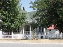
Block
From the record
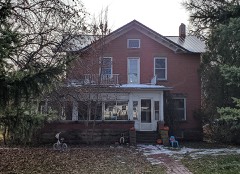
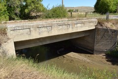
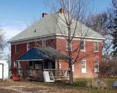
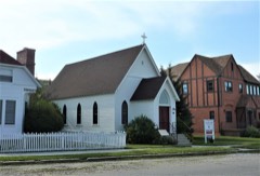
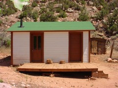
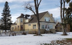
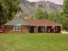
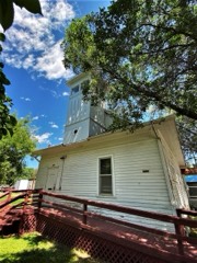
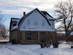
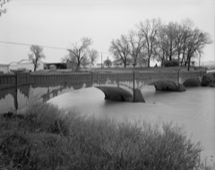
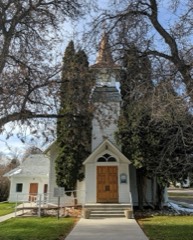
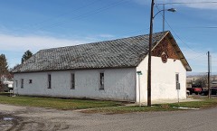
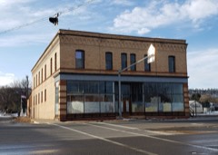
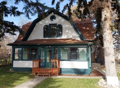
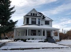
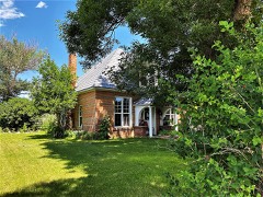
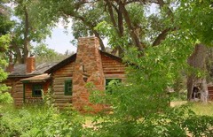
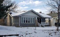
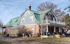
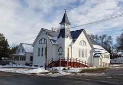
81 National Register listings published here.
Sources: the National Register database, National Park Service
72 topographic sheets cover 38 settlements here, and 81 properties are on the National Register of Historic Places.
81 National Register listings published here.
Sources: the National Register database, National Park Service
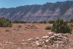
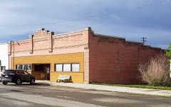
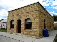
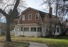
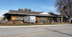
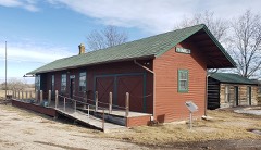
Every property in this county listed on the National Register of Historic Places, with the year it was listed and the federal nomination document.
Every wildfire the federal occurrence database records inside this county: 459 of them, burning about 67,583 acres. 196 started naturally and 1 was recorded as arson. Each settlement page carries the fires within five miles of it.
| Reported cause | Fires |
|---|---|
| Natural | 196 |
| Missing data/not specified/undetermined | 123 |
| Recreation and ceremony | 58 |
| Equipment and vehicle use | 21 |
| Power generation/transmission/distribution | 14 |
| Debris and open burning | 14 |
| Railroad operations and maintenance | 13 |
| Fireworks | 7 |
| Smoking | 5 |
| Other causes | 4 |
| Firearms and explosives use | 2 |
| Arson/incendiarism | 1 |
| Misuse of fire by a minor | 1 |
The five largest, by the area the report gives. None of them was recorded as arson.
| Date | Cause | Size | Reported by | Name on the report |
|---|---|---|---|---|
| 25 August 1996 | Natural | 14,890 acres | Custer Gallatin National Forest | SHEPARD MTN |
| 26 July 2008 | Missing data/not specified/undetermined | 10,173 acres | Custer Gallatin National Forest | CASCADE |
| 14 July 2002 | Missing data/not specified/undetermined | 5,859 acres | Custer Gallatin National Forest | RED WAFFLE |
| 4 September 2002 | Natural | 5,495 acres | Southern Land Office | COW CREEK |
| 17 July 2012 | Natural | 4,680 acres | Southern Land Office | STROUD FIRES |
| 10 August 2003 | Natural | 3,000 acres | Southern Land Office | BUTCHER CREEK |
| 28 August 2012 | Missing data/not specified/undetermined | 2,396 acres | Custer Gallatin National Forest | ROSEBUD |
| 31 October 1999 | Missing data/not specified/undetermined | 2,173 acres | Southern Land Office | EDGAR FIRE |
Every settlement page carries the fires within five miles of it - see the settlement index below.
The NOAA Storm Events Database holds 191 reports for this county, causing 2 deaths, no injuries and about $2,190,250 in recorded property damage. Each settlement page carries the reports that name it.
| Kind of event | Reports |
|---|---|
| Hail | 117 |
| Thunderstorm Wind | 36 |
| Flash Flood | 12 |
| Heavy Rain | 12 |
| Flood | 8 |
| Tornado | 3 |
| Wildfire | 1 |
| Lightning | 1 |
| Funnel Cloud | 1 |
The most serious of them, by death, then injury, then recorded damage. The accounts are quoted exactly as the forecast office filed them.
| When | Event | Place named | Harm | What the report says |
|---|---|---|---|---|
| May 2011 | Flood | Washoe | 1 killed, $1,000,000 | Significant flooding occurred on creeks and streams across Carbon County with numerous county roads flooded, closing roads and resulting in significant damage. Emergency Travel only was advised at one point due to the severity of the flooding. Specifically, Rock Creek flooded, resulting in adjacent lowland flooding and closure of Grape Vine Road near Fromberg. Creeks were running out of their banks from the Beartooth Foothills between McLeod and Red Lodge, as well as tributaries of the Clarks Fork of the Yellowstone River from Belfry to Bridger. Five Mile Creek flooded and washed out the bridge on East Pryor Road between Edgar and Pryor. Blue Water Creek east of Bridger flooded and washed out a county road as well. The heavy rainfall also resulted in water running over the spillway at Cooney Dam. This resulted in several homes flooded along Red Lodge Creek. ||On May 25th, significant flooding was reported in the town of Joliet as debris backed up Rock Creek resulting in evacuations. At the peak of this flooding, Highway 212 was closed from Rockvale to Red Lodge as 18 inches of water was reported on Highway 212 through the town of Joliet. Fifty homes flooded in the area and seven people, mainly elderly, had to leave with the assistance of the fire and sheriffs offices. The Joliet Motel reported a foot of water in each of their rooms. ||In addition, an 84-year-old woman drowned after she fell into a flooded ditch near her house. She was going to get her newspaper when she slipped and fell. The woman was swept a short distance downstream from her house near Boyd, where authorities found her body.||Damage estimates based on FEMA reviews and Individual Assistance approvals. |
| June 2011 | Lightning | Wade | 1 killed | Carbon County officials reported that a rancher was struck and killed by lightning in the Pryor Mountains. The Sheriff's department said a 54-year-old man was rounding up cattle for branding at a ranch about 12 miles east of Bridger when he and his horse were struck about 1:30 pm on June 11th. The man and his horse died at the scene. |
| July 2011 | Flood | Fox | $600,000 | Flooding from June continued into July along Rock Creek near Two Mile Road. Emergency repairs were needed on the Two Mile Bridge(which was closed) north of Red Lodge. Rock Creek was also reported to have cut a new channel and was as high as it has ever been. As a result, residents in 4 to 5 homes were stranded in the Fox area about 6 miles north of Red Lodge. In addition, another 3 homes were under water in the Wagon Wheel Estates which is about 3 miles north of Red Lodge. Western Ranch Estates near Roberts was flooded. In addition, Grapevine and Cottonwood Roads near Silesia were closed. Rock Creek at Red Lodge rose above flood stage on the 5th and continued to run above flood stage through the 7th. The creek crested at 7.54 feet on the 5th and again at 7.69 feet on the 6th. |
| July 1998 | Wildfire | Red Lodge | $525,000 | Dry lightning set off a wildfire which burned 133 acres near the Parkside Campground in the Beartooth National Forest. |
| June 1994 | Thunderstorm Wind | Red Lodge | $50,000 | A chemical storage shed was blown apart. |
| June 2010 | Tornado (EF2) | Warren | $12,000 | The Bowler Flats tornado was on the ground for approximately one mile and lasted for five minutes. The tornado destroyed four transmission structures, damaged a transmission pole, shredded two wooden power poles and damaged some fencing.|Otherwise, it remained over open areas. The EF-2 damage was based on power and transmission poles being shredded with winds estimated from 111-135 mph. |
| June 2010 | Thunderstorm Wind | Warren | $2,000 | Downed tree limbs greater than 3 inches in diameter and siding off houses was reported in Warren. |
| August 1998 | Thunderstorm Wind | Boyd | $1,000 | Two trees were downed around Boyd during a thunderstorm. |
| March 1988 | Tornado (F0) | not stated | $250 | no account filed |
| May 2025 | Thunderstorm Wind | Red Lodge Arpt | - | Mesonet station TT839 Quad Creek at 9774 feet . |
| May 2025 | Thunderstorm Wind | Hillsboro | - | Mesonet hbom8 Hillsboro. |
| August 2025 | Thunderstorm Wind | Bridger | - | Tree damage, 2 large trees uprooted, grain silo destroyed. Very localized damage suggestive of a microburst. Gust estimated via damage information provided. |
| June 2025 | Hail | Roberts | - | One and a half inch hail reported. |
| June 2025 | Hail | Rockvale | - | One and a quarter inch hail reported. |
| June 2025 | Hail | Roberts | - | One and a half inch hail reported. |
| June 2025 | Hail | Rockvale | - | Report from mping. |
| July 2025 | Hail | Joliet | - | Image on Facebook shows hailstone sightly smaller than a tennis ball. |
| June 2025 | Thunderstorm Wind | Red Lodge Arpt | - | Mesonet station Quad Creek. |
| June 2025 | Hail | Red Lodge | - | Mostly pea to half inch hail with a few quarter size hailstones mixed in. |
| June 2025 | Hail | Red Lodge | - | Hail Report. |
| September 2024 | Thunderstorm Wind | Roscoe | - | A wind gust was estimated at 70 mph. |
| June 2023 | Flash Flood | Roberts | - | Cherry Springs road was washed out and was closed between Obert and Selms Road. |
| June 2023 | Flash Flood | Roscoe | - | Red Lodge Creek and Willow Creek were reported flooded. |
| June 2023 | Flash Flood | Red Lodge Arpt | - | Carbon County Emergency Manager reported a debris flow on Grove Creek on the Robertson Draw Burn Scar. |
| July 2023 | Hail | Roberts | - | Pea to quarter size hail was reported. |
| June 2022 | Flood | Red Lodge | - | Please see Episode Narrative for information regarding this multi-county historic flood event. |
| July 2020 | Hail | Roscoe | - | The hail covered the ground. |
| August 2020 | Hail | Red Lodge Arpt | - | Nickel size hail and heavy rain were reported just east of Red Lodge. |
| July 2019 | Thunderstorm Wind | Bridger | - | Multiple pine trees were downed. |
| June 2018 | Thunderstorm Wind | Roberts Bangart Arpt | - | Half of a roof was blown off a home. |
| July 2018 | Hail | Boyd | - | The hail stripped trees of leaves and small limbs. |
| July 2018 | Hail | Bridger | - | Some tree damage was reported. |
| July 2018 | Hail | Bridger Muni Arpt | - | Some windows were broken out by the hail. |
| May 2018 | Flash Flood | Edgar | - | Very heavy thunderstorms produced 2 to 4 inches of rain in a very short time across the area. Flash flooding was reported at several locations. The Department of Transportation reported 10 of water flowing over Highway 310 where a culvert was overwhelmed. Water 10 deep also was reported flowing down a street in Joliet. Several culverts across the area were overwhelmed leading to some roads being washed away. |
| August 2017 | Thunderstorm Wind | Roberts | - | Some trees were blown down, size unknown. |
| June 2015 | Hail | Fox | - | Some of the hail was slightly larger than quarters. |
| May 2014 | Flood | Edgar | - | The Clarks Fork of the Yellowstone crested during the early evening on the 27th when the river was out of its banks. The river took out a tree and power pole and line which landed on the historical USGS measurement site for the river gauge at Edgar. The historical measurement site was smashed, but the electronic gauge was unharmed. |
| March 2014 | Flood | Edgar | - | Some roads were closed due to high water. In addition, ice jam flooding occurred along the Clarks Fork between Bridger and Edgar. |
| March 2014 | Flood | Mason | - | County officials and the Montana Department of Transportation reported small stream and low land flooding. Numerous roads and some highways were reported to have water flowing across them. |
| July 2013 | Thunderstorm Wind | Edgar | - | Tree limbs up to 6 inches in diameter were broken. |
| July 2013 | Flash Flood | Fromberg | - | There was a partial washout on Cherry Springs Road, as well as debris covering Selms Road. |
| July 2013 | Flash Flood | Red Lodge | - | Streets flooded and manholes overflowed in downtown Red Lodge. |
| July 2013 | Flash Flood | Edgar | - | Part of the Joliet to Fromberg road was washed out due to very heavy rain. |
| June 2011 | Flood | Fox | - | County officials reported flooding along Rock Creek near 2 Mile Road which resulted in 2 Mile Road north of Red Lodge being closed. In addition, Rock Creek in Red Lodge rose above flood stage on the 29th and continued above flood stage through the end of the month. The river crested at 7.78 feet on the 29th. |
| July 2011 | Flash Flood | Red Lodge | - | Red Lodge fire chief reported water one foot deep flowing down the streets. |
| July 2010 | Thunderstorm Wind | Fox | - | An estimated wind gust of 60 mph was reported 5 miles NNE of Red Lodge. |
| July 2009 | Flash Flood | Red Lodge Arpt | - | Heavy rain over the Cascade Fire Area of 2008 caused the West Fork of Rock Creek to rise out of its banks. Two debris flows occurred on the south side of the West Fork of Rock Creek covering West Fork Road. In addition, two debris flows occurred on the north side of the West Fork of Rock Creek. The water level on the West Fork of Rock Creek was greater than 4 feet above normal and flowing outside of its banks at the peak of the event. Data shows that 1.85 inches of rain fell within three hours over the burn area with additional rainfall occuring beyond three hours. As a result of the debris flows and landslides, large boulders and downed trees covered West Fork Road. |
| August 2008 | Thunderstorm Wind | Red Lodge | - | An estimated thunderstorm wind gust of 70 mph resulting in damage to a ranger station roof was reported in Red Lodge. |
| June 2008 | Hail | Bridger | - | Some crop damage was reported. |
| June 2007 | Flash Flood | Roberts | - | Several stretches of area roads were under water, including 212 and 78. Homes were flooded in Roberts. |
| June 2007 | Heavy Rain | Belfry | - | Rain totals from the event were 1.85 inches in 24 hours with a storm total of 1.94 inches. |
| June 2007 | Heavy Rain | Red Lodge Arpt | - | Rain total from the event was 3.74 inches in 24 hours. |
| June 2007 | Flash Flood | Roberts | - | Water was over the road on Highway 72 south of Belfry, with the highway closed in Wyoming. Flooding was reported on country roads in the area. |
| July 2006 | Thunderstorm Wind | Bridger | - | South Bridger RAWS |
| June 2006 | Hail | Bridger | - | 10 to 15 minutes of hail |
| May 2005 | Heavy Rain | Roscoe | - | 2.12 inches of rain 6S Roscoe (24-hour total) |
| May 2005 | Heavy Rain | Luther | - | 5 inches of rain in Luther (24-hour total) |
| May 2005 | Heavy Rain | Red Lodge | - | 4.40 inches of rain 5W Red Lodge (Cole Creek Snotel 24-hour total) |
| May 2005 | Heavy Rain | Roscoe | - | 4.40 inches of rain 4S Roscoe (Burnt Mountain Snotel 24-hour total) |
| May 2005 | Heavy Rain | Red Lodge | - | 6.99 inches of rain in Red Lodge |
The Survey's mineral resources record lists 109 workings inside this county. 7 still produce and 102 are closed or unrecorded. Each settlement page carries the workings within five miles of it.
| Commodity | Workings |
|---|---|
| Uranium | 59 |
| Chromium | 14 |
| Gypsum-Anhydrite | 8 |
| Gold | 8 |
| Limestone, General | 5 |
| Silver | 4 |
| Asbestos | 3 |
| Semiprecious Gemstone | 2 |
| Copper | 2 |
| Vanadium | 2 |
| Limestone, Dimension | 2 |
| Vanadium, Uranium | 2 |
| Stone, Crushed/Broken | 2 |
| REE, Uranium | 1 |
The least common of them first, because a county's hundredth gravel pit says nothing its first ten did not.
| Where | Site | Commodity | Status | Recorded |
|---|---|---|---|---|
| Deadman Quarry | Stone | Producer | ||
| Jacob O. Joki | Manganese | Unknown | ||
| Old Glory Mine | Uranium, Fluorine-Fluorite | Occurrence | Vein | |
| Thom Property | REE, Uranium | Occurrence | Vein | |
| Thom Property | REE, Uranium | Occurrence | ||
| Unnamed Bentonite | Clay | Occurrence | ||
| Uranium Prospect | Uranium, Molybdenum, Vanadium | Prospect | ||
| Vijak Quartz Lode | Copper, Silver, Gold | Occurrence | ||
| Big Cave In Nos. 1-18 | Vanadium, Uranium, Limestone, General | Prospect | ||
| Cole Creek Quarry | Limestone, Dimension | Past Producer | ||
| Dryhead Agate Mine | Semiprecious Gemstone | Producer | ||
| Limestone Occurrence | Limestone, Dimension | Occurrence | ||
| Lost Jack | Semiprecious Gemstone | Past Producer | ||
| Midland Empire Nos. 1-14 | Vanadium, Uranium, Limestone, General | Prospect | ||
| Pryor Gap | Stone, Crushed/Broken | Occurrence | ||
| Rearguard | Copper | Occurrence | ||
| Sandra Mine | Uranium, Vanadium | Past Producer | ||
| Unnamed Vanadium | Vanadium | Occurrence | ||
| Warren Quarry | Stone, Crushed/Broken, Limestone, General | Producer | ||
| Ferris Asbestos | Asbestos | Occurrence | ||
| Rosebud Asbestos Claim | Asbestos | Occurrence | ||
| Rosebud, Tommy, Johnny | Asbestos | Occurrence | Asbestos | |
| Lake Mary | Gold, Silver | Prospect | ||
| North Grove Creek Prospect | Gold, Silver | Occurrence | ||
| Silver Run | Gold, Silver | Prospect | ||
| Wapiti Mountain Group | Gold, Silver | Prospect | ||
| Bluebird Nos. 1 & 2 | Uranium, Limestone, General | Prospect | ||
| Warren Quarry | Limestone, General | Producer | Limestone | |
| Big Horn Placer | Gold | Unknown | ||
| Bluewater Gypsum Deposit | Gypsum-Anhydrite | Occurrence | ||
| Bowler Gypsum | Gypsum-Anhydrite | Occurrence | ||
| Clarks Fork Placer | Gold | Unknown | ||
| Clarks Fork Placer | Gold | Occurrence | ||
| Daisy Mine | Gypsum-Anhydrite | Unknown | ||
| Gypsum Creek Deposit | Gypsum-Anhydrite | Occurrence | ||
| Jay Kay Mine | Gypsum-Anhydrite | Unknown | ||
| North Red Dome | Gypsum-Anhydrite | Occurrence | ||
| South Red Dome Deposit | Gypsum-Anhydrite | Occurrence | ||
| Unnamed Gold | Gold | Occurrence | ||
| Unnamed Gypsum | Gypsum-Anhydrite | Occurrence | ||
| Bluebird No. 2 Claim | Chromium | Occurrence | ||
| Drill Claim | Chromium | Past Producer | ||
| Edsel Group | Chromium | Prospect | ||
| Four Chromes | Chromium | Prospect | ||
| Gallon Jug No 4 | Chromium | Past Producer | ||
| Gallon Jug Nos 1 & 2 | Chromium | Past Producer | ||
| Highline Group | Chromium | Past Producer | ||
| Little Nell Group | Chromium | Prospect | ||
| North Star Claim | Chromium | Past Producer | ||
| Pick Mine | Chromium | Past Producer | ||
| Rainbow No 4 Claim | Chromium | Occurrence | ||
| Red Lodge | Chromium | Producer | Chromite, Magnetite | |
| Red Lodge Washoe | Chromium | Past Producer | ||
| Shovel Claim | Chromium | Prospect | ||
| Bice Mine | Uranium | Occurrence | Stratabound | |
| Bice Mine | Uranium | Prospect | ||
| Bridger Creek | Uranium | Occurrence | ||
| C. R. Discovery | Uranium | Prospect | ||
| Drinkard Property | Uranium | Occurrence | ||
| Drinkard Property | Uranium | Occurrence | ||
| East Pryor Mine | Uranium | Occurrence | ||
| East Pryor Mine | Uranium | Past Producer | ||
| Green Lease | Uranium | Occurrence | ||
| Green Lease | Uranium | Occurrence | ||
| Green Streak Claim | Uranium | Occurrence | ||
| Key Mine | Uranium | Occurrence | ||
| Key Mine | Uranium | Occurrence | ||
| Marie Mine | Uranium | Occurrence | ||
| Old Glory Mine | Uranium | Past Producer | ||
| Perc Group | Uranium | Occurrence | ||
| Perc Group | Uranium | Occurrence | ||
| Pryor Mountain Mine | Uranium | Occurrence | ||
| Pryor Mountain Mine | Uranium | Past Producer | ||
| Pryor Mtns | Uranium | Occurrence | Fluorite, Tyuyamunite | |
| Red Dome Area | Uranium | Occurrence | ||
| Royse Claim | Uranium | Occurrence | Vein | |
| Royse Claim | Uranium | Occurrence | ||
| Sandra Group | Uranium | Occurrence | Vein | |
| Sandra Group | Uranium | Occurrence | Tyuyamunite | |
| Sandra Mines | Uranium | Occurrence | ||
| Sunset Claims | Uranium | Occurrence | ||
| Swamp Frog Mine | Uranium | Occurrence | ||
| Swamp Frog Mine | Uranium | Producer | ||
| Unknown | Uranium | Occurrence | Stratabound | |
| Unknown | Uranium | Occurrence | Stratabound | |
| Unknown | Uranium | Occurrence | ||
| Unknown | Uranium | Occurrence | Stratabound | |
| Unknown | Uranium | Occurrence | Stratabound | |
| Unknown | Uranium | Occurrence | Stratabound | |
| Unknown | Uranium | Occurrence | ||
| Unknown | Uranium | Occurrence | ||
| Unknown | Uranium | Occurrence | ||
| Unknown | Uranium | Occurrence | ||
| Unknown | Uranium | Occurrence | ||
| Unknown | Uranium | Producer | Vein | |
| Unnamed Uranium | Uranium | Occurrence | ||
| Unnamed Uranium | Uranium | Occurrence | ||
| Unnamed Uranium | Uranium | Occurrence | ||
| Unnamed Uranium | Uranium | Occurrence | ||
| Unnamed Uranium | Uranium | Occurrence | ||
| Unnamed Uranium | Uranium | Occurrence | ||
| Unnamed Uranium | Uranium | Occurrence | ||
| Unnamed Uranium | Uranium | Occurrence | ||
| Unnamed Uranium | Uranium | Occurrence | ||
| Unnamed Uranium | Uranium | Occurrence | ||
| Weaver Property | Uranium | Occurrence | ||
| Weaver Property | Uranium | Occurrence | ||
| Windmill No. 3 | Uranium | Occurrence | ||
| Windmill Occurrence | Uranium | Occurrence |
Named settlements recorded in the Geographic Names Information System, each with the topographic sheets covering it. Villages, hamlets and abandoned places alike. Each is shown with the nearest named watercourse or landform and the survey quadrangle it falls on.
Red Lodge census division · 59071 · On Armstrong Creek · Alpine quadrangle
14 sheets, 1898 to 1996
Red Lodge census division · 59007 · Near Foster Gulch · Red Lodge East quadrangle
15 sheets, 1944 to 1996
Red Lodge census division · 59008 · On Bear Creek · Belfry quadrangle
12 sheets, 1944 to 1989
East Carbon census division · 59014 · On Bowler Flats · Bowler quadrangle
11 sheets, 1954 to 1996
Fromberg-Bridger census division · 59014 · On Rushwater Creek · Bridger quadrangle
10 sheets, 1954 to 1989
Red Lodge census division · 59007 · Red Lodge East quadrangle
15 sheets, 1944 to 1996
No longer a settlement
Red Lodge census division · 59008 · Near Sand Coulee · Hollenbeck Draw quadrangle
13 sheets, 1944 to 1989
Fromberg-Bridger census division · 59014 · On Cedar Creek · Bridger quadrangle
10 sheets, 1954 to 1989
No longer a settlement
Fromberg-Bridger census division · 59029 · On Bluewater Creek · Fromberg quadrangle
10 sheets, 1954 to 1989
No longer a settlement
East Carbon census division · 59014 · East Pryor Mountain quadrangle
12 sheets, 1954 to 1996
No longer a settlement
Red Lodge census division · 59008 · Near Snake Gulch · Red Lodge East quadrangle
15 sheets, 1944 to 1996
No longer a settlement
Joliet census division · 59026 · On Five Mile Creek · Edgar quadrangle
10 sheets, 1954 to 1989
Fromberg-Bridger census division · 59029 · On Bluewater Creek · Fromberg quadrangle
10 sheets, 1954 to 1989
Roberts census division · 59071 · On Morris Creek · Roscoe quadrangle
13 sheets, 1932 to 1996
Red Lodge census division · 59071 · On Morris Creek · Mackay Ranch quadrangle
14 sheets, 1898 to 1996
No longer a settlement
Fromberg-Bridger census division · 59014 · Hatcher Pass quadrangle
10 sheets, 1954 to 1989
No longer a settlement
East Carbon census division · 59014 · On South Fork Trail Creek · Hillsboro quadrangle
9 sheets, 1954 to 1989
Red Lodge census division · 59068 · Roscoe quadrangle
13 sheets, 1932 to 1996
No longer a settlement
Red Lodge census division · 59068 · On Lake Fork · Mount Maurice quadrangle
15 sheets, 1954 to 1996
Roberts census division · 59070 · Near Church Hill · Roberts quadrangle
10 sheets, 1932 to 1989
Roberts census division · 59071 · On Morris Creek · Roscoe quadrangle
13 sheets, 1932 to 1996
Red Lodge census division · 59007 · Red Lodge East quadrangle
15 sheets, 1944 to 1996
No longer a settlement
Roberts census division · 59070 · On Dry Creek · Cooney Reservoir quadrangle
12 sheets, 1932 to 1989
Joliet census division · 59041 · On Cottonwood Creek · Silesia quadrangle
9 sheets, 1954 to 1989
East Carbon census division · 59014 · Near Cottonwood Coulee · Warren quadrangle
9 sheets, 1954 to 1989
The vanished settlements of Carbon County: the places named above that are no longer on the map.