 Block
From the record
20 National Register listings published here, 1 of them a National Historic Landmark.
Sources: the National Register database, National Park Service
105 topographic sheets cover 45 settlements here, and 20 properties are on the National Register of Historic Places.
20 National Register listings published here, 1 of them a National Historic Landmark.
Sources: the National Register database, National Park Service
Every property in this county listed on the National Register of Historic Places, with the year it was listed and the federal nomination document.
| Photograph | Property | Type | Listed | Reference |
|---|---|---|---|---|
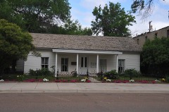 | I. G. Baker House | building | 1980 | 80002403 |
 | Chouteau County Courthouse | building | 1980 | 80002404 |
| Citadel Rock | site | 1974 | 74001095 | |
| Eagle Butte School | building | 2009 | 08001383 | |
 | First National Bank of Geraldine | building | 2008 | 07001363 |
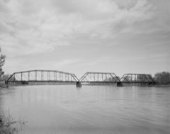 | Fort Benton Bridge | structure | 1980 | 80002406 |
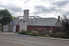 | Fort Benton Engine House | building | 1980 | 80002407 |
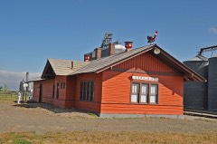 | Geraldine Milwaukee Depot | building | 1997 | 97000254 |
 | Grand Union Hotel | building | 1976 | 76001121 |
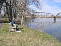 | I.G. Baker House | building | 1966 | 66000431 |
| Lewis and Clark Camp at Slaughter River | site | 1974 | 74001094 | |
| Lonetree | building | 1980 | 80002410 | |
 | Masonic Building | building | 1980 | 80002408 |
| Shonkin Creek Bridge | structure | 2012 | 12000169 | |
| Square Butte Jail | building | 1998 | 98000888 | |
| Square Butte School | building | 2013 | 13000496 | |
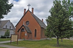 | St. Paul's Episcopal Church | building | 1980 | 80002409 |
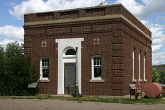 | Virgelle Mercantile and Virgelle State Bank | building | 1997 | 97000315 |
| West Quincy Granite Quarry | site | 2000 | 00000163 |
Every wildfire the federal occurrence database records inside this county: 602 of them, burning about 42,541 acres. 56 started naturally and 145 were recorded as arson. Each settlement page carries the fires within five miles of it.
| Reported cause | Fires |
|---|---|
| Arson/incendiarism | 145 |
| Debris and open burning | 117 |
| Missing data/not specified/undetermined | 103 |
| Misuse of fire by a minor | 62 |
| Natural | 56 |
| Fireworks | 48 |
| Equipment and vehicle use | 44 |
| Smoking | 9 |
| Recreation and ceremony | 7 |
| Other causes | 5 |
| Power generation/transmission/distribution | 3 |
| Railroad operations and maintenance | 2 |
| Firearms and explosives use | 1 |
The five largest, by the area the report gives. None of them was recorded as arson.
| Date | Cause | Size | Reported by | Name on the report |
|---|---|---|---|---|
| 31 January 2009 | Debris and open burning | 14,490 acres | North Central Montana District | MEISSNER |
| 24 March 2008 | Debris and open burning | 5,519 acres | Northeastern Land Office | CHOUTEAU CO COMPLEX |
| 29 March 2012 | Debris and open burning | 2,800 acres | North Central Montana District | ANTELOPE HOPKINS HIL |
| 7 August 2012 | Natural | 1,400 acres | North Central Montana District | ENGELLANT |
| 9 September 2005 | Natural | 1,136 acres | Northeastern Land Office | not named |
| 4 August 2005 | Smoking | 1,136 acres | Northeastern Land Office | not named |
| 2 February 2020 | Power generation/transmission/distribution | 1,041 acres | Chouteau County | LOST LAKE |
| 6 August 2012 | Natural | 1,000 acres | North Central Montana District | LABARE ROAD |
Every settlement page carries the fires within five miles of it - see the settlement index below.
The NOAA Storm Events Database holds 331 reports for this county, causing no deaths, 7 injuries and about $3,115,750 in recorded property damage. Each settlement page carries the reports that name it.
| Kind of event | Reports |
|---|---|
| Hail | 152 |
| Thunderstorm Wind | 142 |
| Tornado | 15 |
| Heavy Rain | 12 |
| Flood | 7 |
| Flash Flood | 2 |
| Funnel Cloud | 1 |
The most serious of them, by death, then injury, then recorded damage. The accounts are quoted exactly as the forecast office filed them.
| When | Event | Place named | Harm | What the report says |
|---|---|---|---|---|
| July 1965 | Tornado | not stated | 5 hurt, $2,500,000 | no account filed |
| July 1988 | Tornado (F3) | not stated | 2 hurt, $250,000 | no account filed |
| May 2024 | Flood | Big Sandy | $194,000 | MT Department of Emergency Services reported $177,000 worth of damages to roads and bridges near the Bears Paw Mountains. Additional damages to utilities totaled $17,000. |
| May 1993 | Thunderstorm Wind | Fort Benton | $50,000 | Trees and power lines down. |
| June 1998 | Tornado (F1) | Shonkin | $50,000 | no account filed |
| July 1988 | Tornado (F3) | not stated | $25,000 | no account filed |
| August 1973 | Tornado (F0) | not stated | $25,000 | no account filed |
| May 1993 | Thunderstorm Wind | Carter | $5,000 | Trees and power lines down. |
| May 1993 | Thunderstorm Wind | Fort Benton | $5,000 | Trees and power lines down. |
| May 1993 | Thunderstorm Wind | Geraldine | $5,000 | Trees and power lines down. |
| July 1988 | Tornado (F3) | not stated | $2,500 | no account filed |
| July 2000 | Thunderstorm Wind | Big Sandy | $2,000 | no account filed |
| July 1999 | Tornado (F0) | Square Butte | $2,000 | no account filed |
| June 1960 | Tornado | not stated | $250 | no account filed |
| May 2025 | Thunderstorm Wind | Verona | - | Montana mesonet station Big Sandy SE (Acebsase) measured a 69 mph wind gust. |
| May 2025 | Thunderstorm Wind | Verona | - | Montana mesonet station Big Sandy SE measured a 59 mph wind gust. |
| April 2025 | Thunderstorm Wind | Big Sandy | - | Landspout. The public relayed a report of a landspout to broadcast media on social media. Time and location is estimated. |
| April 2025 | Thunderstorm Wind | Floweree | - | Landspout. NWS employee relayed a report of a landsput near Floweree. It was brief in nature. Location estimated. |
| August 2025 | Thunderstorm Wind | Verona | - | Big Sandy MT Mesonet peak gust. |
| June 2025 | Hail | Ft Benton Arpt | - | Social media report of one inch diameter hail in Fort Benton. |
| June 2025 | Hail | Big Sag | - | Report from social media. |
| June 2025 | Hail | Highwood | - | Social media image of approximately golf ball sized hail in Highwood. Time estimated using radar. |
| June 2025 | Hail | Geraldine Arpt | - | Report on social media showed golf ball sized hail with estimated 60 mph wind gusts. Time estimated based on radar. |
| July 2025 | Thunderstorm Wind | Montague | - | Ambient weather station Stone windmill measured a 63 mph gust. |
| August 2025 | Thunderstorm Wind | Loma | - | Montana mesonet station Loma N. |
| June 2024 | Hail | Genou | - | A photo submitted from the public showed estimated 2.5 inch hail, along with damage to a vehicle windshield. Time was estimated via radar. |
| August 2024 | Hail | Genou | - | Public reports quarter sized hail. Gusty winds were also observed, which blew around items at the residence. |
| August 2024 | Thunderstorm Wind | Carter | - | A spotter traveling northbound on US-87 noted two snapped power poles near mile marker 31. Power outages were confirmed in the area. |
| August 2024 | Thunderstorm Wind | Warrick | - | Mesonet station GW3862 Loma 18 NW measured a sever caliber gust. |
| August 2024 | Hail | Loma | - | Trained spotter reported hail up to the size of quarters. |
| August 2024 | Thunderstorm Wind | Loma | - | The time and location was estimated. A farmer stated that freshly cut hay was blown by approximately 80 mph winds. |
| April 2023 | Flood | Big Sandy Arpt | - | Chouteau County Sheriff's Office reported flood-related closures in Big Sandy at North Lonesome Lake Road between Ihmsen Well Road and Gardiner Road and from Black Coulee Road to Rudyard Road. |
| July 2022 | Hail | Virgelle | - | Video from Virgelle of hail ranging from half inch to nearly one inch in size. |
| September 2022 | Thunderstorm Wind | Loma | - | Mesonet station MTLOM Loma (MT DOT) reported a 52 knot wind gust. |
| September 2022 | Thunderstorm Wind | Big Sandy | - | Mesonet station MTM90 Big Sandy SW reported 54 knot wind gust. |
| August 2022 | Heavy Rain | Woods Arpt | - | A coop observer reported 1.57 inches of rain fell over 90 minutes during a thunderstorm. |
| June 2022 | Heavy Rain | Eagleton | - | Coop reporter reports 3.18 inches of rain. Time start estimated by radar. |
| June 2022 | Heavy Rain | Eagleton | - | Coop observer updates report to 5.06 inches rain accumulation. |
| May 2022 | Thunderstorm Wind | Ft Benton | - | Fort Benton Co-op observer measured a 54 kt (62 mph) thunderstorm wind gust. |
| July 2022 | Thunderstorm Wind | Warrick | - | Trained spotter reported 72 mph wind gust. Some tree damage. Time estimated via radar. |
| July 2022 | Thunderstorm Wind | Big Sandy | - | An ambient station reported a 70 mph wind gust. |
| July 2022 | Thunderstorm Wind | Big Sandy | - | Sustained 77 gusting 91 mph. Unconfirmed 103mph gust. Recorded pressure drop of 11mb in 5 min. Recorded via ambient weather. |
| July 2022 | Thunderstorm Wind | Geraldine | - | An ambient weather station reported 58 mph wind gust 11 miles NNE of Geraldine. |
| July 2021 | Thunderstorm Wind | Big Sandy | - | Ambient weather station at 13 W Big Sandy measured a 67 kt (77 mph) thunderstorm wind gust. |
| July 2021 | Thunderstorm Wind | Big Sandy | - | Semi blow off of highway 87 at mile marker 78 and power lines blown down in the same area. |
| July 2021 | Thunderstorm Wind | Loma | - | MDT Loma station measured a 53 kt (61 mph) thunderstorm wind gust. |
| July 2021 | Thunderstorm Wind | Ft Benton | - | Mesonet station at 18 E Fort Benton measured a 51 kt (59 mph) thunderstorm wind gust. |
| July 2021 | Thunderstorm Wind | Verona | - | Downed power lines reported along highway 87 near Verona. |
| June 2021 | Hail | Geraldine Arpt | - | Public report of quarter sized hail. Time estimated based on radar. |
| June 2021 | Hail | Big Sandy | - | Social media pictures from social media post showing 1.5 to 2 inch hail near Centennial Mountain. |
| July 2020 | Hail | Loma | - | Trained spotter reported penny size (.75 inch diameter) and some quarter size hail (1 inch diameter) covering the ground. Some crop damage observed. |
| July 2020 | Hail | Loma | - | Trained spotter reported quarter size hail. |
| August 2020 | Thunderstorm Wind | Loma | - | Loma mesonet station mtlom. |
| June 2020 | Thunderstorm Wind | Floweree | - | Corrected time. Reports strong winds brought rain into attic of house and knocked down trees. Also, reports a pile of peas sized hail. Wind speed and gust estimate not reported. |
| June 2020 | Thunderstorm Wind | Floweree | - | Relayed report from trained spotter of trees stripped and power outage from thunderstorm winds gusts. Wind speed and gust estimate not reported. |
| June 2020 | Thunderstorm Wind | Carter | - | Reports some tree branch damage from strong winds. Small hail also observed along with some water on road. Wind speed and gust estimate not reported. |
| June 2020 | Thunderstorm Wind | Floweree | - | Reports strong winds brought rain into attic of house and knocked down trees. Also, reports a pile of pea sized hail. Wind speed and gust estimate not reported. |
| June 2020 | Thunderstorm Wind | Carter | - | Trained spotter reports estimated wind gusts near 60 mph in Carter. |
| June 2020 | Thunderstorm Wind | Floweree | - | Wind and rain reduced visibility to less than 100 feet. Reports 0.80 inches of rain in 15 minutes. Also, reports pea sized hail. |
| May 2019 | Flood | Genou | - | Emergency manager shared video of flooded wheat field adjacent to the Teton River. Estimated time of the event. Exact duration of flooding unknown. |
The Survey's mineral resources record lists 40 workings inside this county. 1 still produces and 39 are closed or unrecorded. Each settlement page carries the workings within five miles of it.
| Commodity | Workings |
|---|---|
| Sand and Gravel, Construction | 30 |
| Uranium | 3 |
| Clay | 3 |
| Niobium (Columbium) | 1 |
| Lead | 1 |
| REE, Thorium, Zinc | 1 |
| Silica | 1 |
| Salt | 1 |
| Potassium | 1 |
| Cobalt, Copper, Manganese, Molybdenum | 1 |
The least common of them first, because a county's hundredth gravel pit says nothing its first ten did not.
| Where | Site | Commodity | Status | Recorded |
|---|---|---|---|---|
| Big Lake Deposits | Potassium, Cobalt, Copper, Manganese, Molybdenum | Occurrence | ||
| Rocky Boy Area | Lead, REE, Thorium, Zinc | Occurrence | ||
| Rocky Boy Stock | Uranium, Niobium (Columbium) | Occurrence | ||
| Virgelle Sandstone | Silica | Unknown | ||
| White Lake | Salt | Occurrence | ||
| Rocky Boy Stock | Uranium | Occurrence | Vein | |
| United Petroleum Good 1 | Uranium | Prospect | ||
| Unnamed Bentonite Deposit | Clay | Prospect | ||
| Unnamed Clay Deposit | Clay | Occurrence | ||
| Unnamed Clay Deposit | Clay | Occurrence | ||
| Naesethe Sand and Gravel Pit | Sand and Gravel, Construction | Producer | ||
| Unnamed Gravel Deposit | Sand and Gravel, Construction | Unknown | ||
| Unnamed Gravel Pit | Sand and Gravel, Construction | Unknown | ||
| Unnamed Gravel Pit | Sand and Gravel, Construction | Unknown | ||
| Unnamed Gravel Pit | Sand and Gravel, Construction | Unknown | ||
| Unnamed Gravel Pit | Sand and Gravel, Construction | Occurrence | ||
| Unnamed Gravel Pit | Sand and Gravel, Construction | Unknown | ||
| Unnamed Gravel Pit | Sand and Gravel, Construction | Unknown | ||
| Unnamed Gravel Pit | Sand and Gravel, Construction | Unknown | ||
| Unnamed Gravel Pit | Sand and Gravel, Construction | Unknown | ||
| Unnamed Gravel Pit | Sand and Gravel, Construction | Unknown | ||
| Unnamed Gravel Pit | Sand and Gravel, Construction | Unknown | ||
| Unnamed Gravel Pit | Sand and Gravel, Construction | Unknown | ||
| Unnamed Gravel Pit | Sand and Gravel, Construction | Unknown | ||
| Unnamed Gravel Pit | Sand and Gravel, Construction | Past Producer | ||
| Unnamed Gravel Pit | Sand and Gravel, Construction | Unknown | ||
| Unnamed Gravel Pit | Sand and Gravel, Construction | Unknown | ||
| Unnamed Gravel Pit | Sand and Gravel, Construction | Unknown | ||
| Unnamed Gravel Pit | Sand and Gravel, Construction | Unknown | ||
| Unnamed Gravel Pit | Sand and Gravel, Construction | Unknown | ||
| Unnamed Gravel Pit | Sand and Gravel, Construction | Unknown | ||
| Unnamed Gravel Pit | Sand and Gravel, Construction | Unknown | ||
| Unnamed Gravel Pit | Sand and Gravel, Construction | Unknown | ||
| Unnamed Gravel Pit | Sand and Gravel, Construction | Unknown | ||
| Unnamed Gravel Pit | Sand and Gravel, Construction | Unknown | ||
| Unnamed Gravel Pit | Sand and Gravel, Construction | Unknown | ||
| Unnamed Gravel Pit | Sand and Gravel, Construction | Unknown | ||
| Unnamed Gravel Pit | Sand and Gravel, Construction | Unknown | ||
| Unnamed Gravel Pit | Sand and Gravel, Construction | Unknown | ||
| Unnamed Gravel Pit | Sand and Gravel, Construction | Unknown |
Named settlements recorded in the Geographic Names Information System, each with the topographic sheets covering it. Villages, hamlets and abandoned places alike. Each is shown with the nearest named watercourse or landform and the survey quadrangle it falls on.
Fort Benton census division · 59416 · Knees quadrangle
6 sheets, 1954 to 1984
No longer a settlement
Fort Benton census division · 59416 · Shannon Bridge quadrangle
14 sheets, 1886 to 1987
No longer a settlement
Big Sandy census division · 59520 · Near Coal Banks Coulee · Verona quadrangle
9 sheets, 1919 to 1984
Big Sandy census division · 59460 · Day School quadrangle
7 sheets, 1954 to 1984
No longer a settlement
Big Sandy census division · 59520 · Pigtail Coulee quadrangle
7 sheets, 1954 to 1964
No longer a settlement
Fort Benton census division · 59442 · Near The Canyon · Fort Benton quadrangle
14 sheets, 1890 to 1984
Fort Benton census division · 59416 · Near East Knee · Knees quadrangle
6 sheets, 1954 to 1984
No longer a settlement
Geraldine census division · 59450 · Near Big Sag · Highwood quadrangle
15 sheets, 1890 to 1984
Big Sandy census division · 59520 · Near Haystack Butte · Eagleton NW quadrangle
7 sheets, 1954 to 1984
No longer a settlement
Big Sandy census division · 59520 · Boggs Island quadrangle
12 sheets, 1906 to 1984
No longer a settlement
Geraldine census division · 59450 · Near Tueverson Coulee · Lander Crossing quadrangle
16 sheets, 1890 to 1984
Big Sandy census division · 59460 · On Teton River · Loma West quadrangle
14 sheets, 1890 to 1984
Big Sandy census division · 59520 · Kenilworth NE quadrangle
10 sheets, 1906 to 1984
No longer a settlement
Geraldine census division · 59446 · Geraldine quadrangle
13 sheets, 1890 to 1984
No longer a settlement
Geraldine census division · 59442 · On Telephone Coulee · Montague quadrangle
13 sheets, 1890 to 1984
Big Sandy census division · 59460 · On Marias River · Loma East quadrangle
14 sheets, 1890 to 1984
No longer a settlement
Geraldine census division · 59450 · Waltham quadrangle
16 sheets, 1890 to 1984
Fort Benton census division · 59450 · Shonkin quadrangle
13 sheets, 1890 to 1984
No longer a settlement
Fort Benton census division · 59442 · Fort Benton NW quadrangle
13 sheets, 1890 to 1984
No longer a settlement
Big Sandy census division · 59520 · Near Lonesome Lake Coulee · Box Elder quadrangle
10 sheets, 1904 to 1984
Fort Benton census division · 59442 · Russell Chapel quadrangle
6 sheets, 1954 to 1984
No longer a settlement
Geraldine census division · 59446 · Near Antelope Butte · Square Butte quadrangle
13 sheets, 1890 to 1984
Big Sandy census division · 59460 · Near Crow Coulee Bar · Stranahan quadrangle
14 sheets, 1890 to 1984
Fort Benton census division · 59442 · Dutch Henry Coulee quadrangle
6 sheets, 1954 to 1984
Fort Benton census division · 59420 · Russell Chapel quadrangle
6 sheets, 1954 to 1984
Big Sandy census division · 59520 · Near Jackson Coulee · Verona quadrangle
10 sheets, 1919 to 1984
Big Sandy census division · 59520 · On Rhue Creek · Warrick quadrangle
10 sheets, 1953 to 1993
Fort Benton census division · 59404 · Near Wolf Coulee · Shannon Bridge quadrangle
14 sheets, 1886 to 1987
The vanished settlements of Chouteau County: the places named above that are no longer on the map.