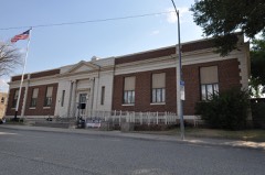
Block
From the record
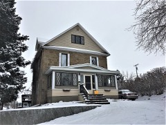
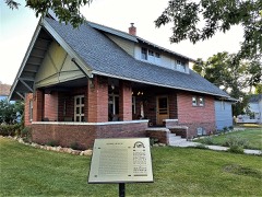
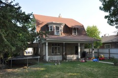
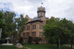
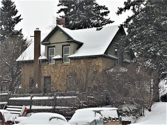
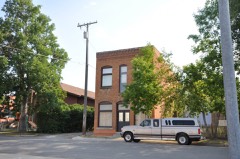
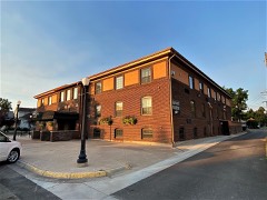
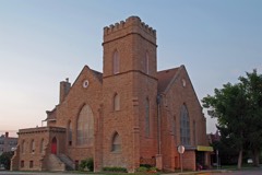
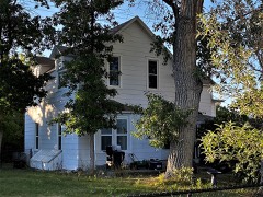
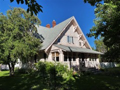
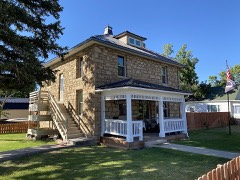
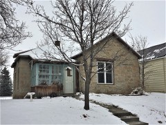
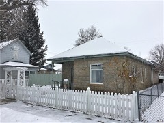
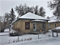
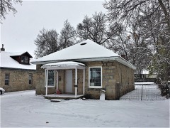
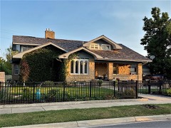
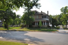
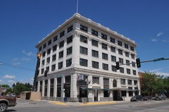
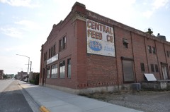
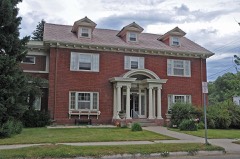
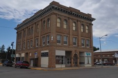
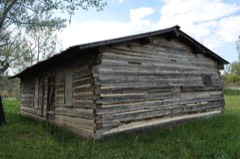
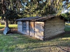
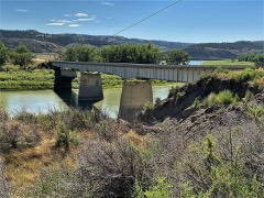
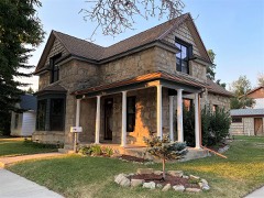
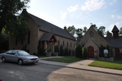
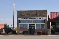
48 National Register listings published here.
Sources: the National Register database, National Park Service
96 topographic sheets cover 81 settlements here, and 48 properties are on the National Register of Historic Places.
48 National Register listings published here.
Sources: the National Register database, National Park Service
Every property in this county listed on the National Register of Historic Places, with the year it was listed and the federal nomination document.
Every wildfire the federal occurrence database records inside this county: 354 of them, burning about 27,520 acres. 253 started naturally and none was recorded as arson. Each settlement page carries the fires within five miles of it.
| Reported cause | Fires |
|---|---|
| Natural | 253 |
| Missing data/not specified/undetermined | 45 |
| Equipment and vehicle use | 27 |
| Recreation and ceremony | 13 |
| Debris and open burning | 11 |
| Power generation/transmission/distribution | 1 |
| Smoking | 1 |
| Railroad operations and maintenance | 1 |
| Other causes | 1 |
| Misuse of fire by a minor | 1 |
The five largest, by the area the report gives. None of them was recorded as arson.
| Date | Cause | Size | Reported by | Name on the report |
|---|---|---|---|---|
| 15 August 2015 | Natural | 4,472 acres | Fergus County | TROPHY RIDGE |
| 8 September 1994 | Missing data/not specified/undetermined | 4,217 acres | Helena - Lewis and Clark National Forest | WINDY POINT |
| 24 July 2006 | Natural | 2,000 acres | North Central Montana District | BOX ELDER |
| 23 July 2005 | Natural | 1,968 acres | North Central Montana District | KNOX |
| 12 November 2007 | Power generation/transmission/distribution | 1,470 acres | North Central Montana District | SOUTH MOCCCASINS |
| 3 September 2018 | Other causes | 1,095 acres | North Central Montana District | ROSE CREEK |
| 7 August 2020 | Natural | 1,036 acres | Fergus County | JUDITH RIVER ROAD 2 |
| 19 August 2014 | Natural | 1,033 acres | North Central Montana District | BLAKESLEE |
Every settlement page carries the fires within five miles of it - see the settlement index below.
The NOAA Storm Events Database holds 515 reports for this county, causing no deaths, 3 injuries and about $4,902,500 in recorded property damage. Each settlement page carries the reports that name it.
| Kind of event | Reports |
|---|---|
| Hail | 251 |
| Thunderstorm Wind | 193 |
| Tornado | 27 |
| Heavy Rain | 21 |
| Flood | 11 |
| Funnel Cloud | 7 |
| Flash Flood | 5 |
The most serious of them, by death, then injury, then recorded damage. The accounts are quoted exactly as the forecast office filed them.
| When | Event | Place named | Harm | What the report says |
|---|---|---|---|---|
| August 1999 | Tornado (F2) | Lewistown | 3 hurt, $4,000,000 | NUMEROUS HAIL REPORTS 1 TO 2 INCHES...ONE WIND ESTIMATE AHEAD OF TORNADO 87KT |
| June 2023 | Flash Flood | (Lwt)Lewiston Muni A | $200,000 | Fergus County Sheriff's Office and Emergency Management reported portions of Casino Creek Road washed out from heavy rain and flooding of the creek. The road was washed out completely in at least two locations, per a later NWS survey. Many cattle fields along the creek were also flooded. |
| May 2011 | Flood | Lewistown Muni Arpt | $125,000 | Wild Rose Road washed out.|Faron Hill Road washed out.|Middle Fork Road washed out.|Giltedge Road washed out.|Highway 87S from mile marker 31 to 32 a dam was breached.|Highway 191N between Roy and Lewistown road damaged due to a sink hole.|Many homes affected and a shelter was set up in Lewistown for flood victims. |
| July 2002 | Tornado (F2) | Hilger | $100,000 | A severe thunderstorm moved across the northern half of Fergus County during the late afternoon hours on the 8th. This storm produced a widespread area of one to two inch hail from Brooks to Roy, with wind gusts over 70 mph. When the storm was just north of Brooks, a tornado developed. This tornado was on the ground for several miles, but remained over rural areas of Fergus County. However, this tornado did hit three residences, causing damage to houses and several barns. A few mobile homes were also damaged and one grain elevator near Moulton was toppled. |
| June 1994 | Hail | Big Sandy | $50,000 | A severe thunderstorm moved from near Gilford southeast into southeast Fergus County. The hail damage was three miles wide and over 26 miles long. |
| June 1994 | Thunderstorm Wind | Big Sandy | $50,000 | A severe thunderstorm moved from near Gilford southeast into southeast Fergus County. The hail damage was three miles wide and over 26 miles long. |
| June 1994 | Thunderstorm Wind | Lewis & Clark | $50,000 | Some trees were blown down and some out building damaged. |
| August 1994 | Thunderstorm Wind | Roy | $50,000 | Thunderstorm winds blew off a large section of shed roof. |
| May 1994 | Hail | Hilger | $50,000 | no account filed |
| May 1994 | Thunderstorm Wind | Hilger | $50,000 | no account filed |
| August 1998 | Tornado (F1) | Moore | $35,000 | no account filed |
| June 2023 | Flash Flood | Glengarry | $25,000 | Fergus County Sheriff's Office reported portions of Cottonwood Creek Road washed out from flooding. |
| June 1996 | Tornado (F2) | Denton | $25,000 | no account filed |
| June 1976 | Tornado (F2) | not stated | $25,000 | no account filed |
| June 2023 | Flood | Lewistown | $10,000 | Big Spring Creek south of Lewistown came out of its banks in several areas, resulting in flooding. Several small parks and boat entrances were closed and underwater as a result. Nearby and surrounding tributaries also flooded. |
| July 2000 | Thunderstorm Wind | Hilger | $10,000 | Barn blown down. |
| July 2000 | Hail | Denton | $5,000 | Windows broken...solar panels destroyed. |
| July 1998 | Thunderstorm Wind | Valentine | $5,000 | GARAGE AND OLD BUILDING BLOWN OVER |
| July 1994 | Thunderstorm Wind | Lewistown | $5,000 | Several trees were blown down. |
| May 1994 | Hail | Lewistown | $5,000 | no account filed |
| August 1998 | Tornado (F0) | Moore | $4,000 | no account filed |
| July 2025 | Thunderstorm Wind | Lewistown | $3,000 | Trees down along the Lewistown Trail System blocking the trail. Time estimated based on radar. |
| June 2004 | Thunderstorm Wind | Grassrange | $3,000 | no account filed |
| June 1999 | Tornado (F0) | Lewistown | $3,000 | no account filed |
| June 1988 | Tornado (F0) | not stated | $2,500 | no account filed |
| June 1971 | Tornado (F1) | not stated | $2,500 | no account filed |
| September 2000 | Hail | Winifred | $2,000 | Damage to house and vehicle. |
| August 2004 | Thunderstorm Wind | Suffolk | $2,000 | no account filed |
| July 1999 | Tornado (F0) | Denton | $2,000 | no account filed |
| July 2025 | Hail | Piper | $1,000 | Spotter reported hail between 2 to 2.5 inches in diameter. The spotter also noted the hail punched a hole into their deck. |
| July 2025 | Thunderstorm Wind | Moore | $1,000 | Spotter reported tree limbs up to 8 inches in diameter blown off of their cottonwood tree. Time estimated by radar. |
| July 2000 | Thunderstorm Wind | Lewistown | $1,000 | 0.75 inch hail and 52kt wind gust...funnel cloud...windows broke out of house. |
| July 2025 | Thunderstorm Wind | Lewistown | $500 | Corrects previous thunderstorm wind dmg report from 1 NW Lewistown. Public reported on social media that an abandoned lumber shop collapsed due to the thunderstorms with photos of debris across the property. Time estimated based on radar. |
| May 2025 | Thunderstorm Wind | Hoosac | - | Montana DOT sensor East of Denton (MTDEN) gusted to 58 mph. |
| May 2025 | Thunderstorm Wind | Suffolk | - | Ambient sensor Hilltop0 measured a 66 mph gust. |
| May 2025 | Thunderstorm Wind | Winifred | - | Montana mesonet station Woodhawk (acewinif) measured a 60 mph gust. |
| May 2025 | Thunderstorm Wind | Roy Jct | - | Mesonet station JPKM8 Judith Peak RAWS measured a 65 mph wind gust. Time of gust estimated given station reports once per hour. |
| May 2025 | Thunderstorm Wind | Lewistown Holland Ar | - | Montana Mesonet station Forestgrove N (acefores) measured a 59 mph wind gust. |
| May 2025 | Thunderstorm Wind | Roy | - | AWOS station K1OM Oscar measured a 68 mph wind gust. |
| May 2025 | Thunderstorm Wind | Roy | - | MT DOT sensor Bohemian Corner (MTBOH) measured a 61 mph wind gust. |
| August 2025 | Thunderstorm Wind | Danvers | - | Ambient weather station. Sustained winds of 47 mph at the time of observation. |
| August 2025 | Thunderstorm Wind | Roy Jct | - | Estimated wind gusts near 60 mph. Apple tree took a hit. |
| August 2025 | Thunderstorm Wind | Lewistown Holland Ar | - | Montana mesonet sensor Forestgrove N. |
| August 2025 | Thunderstorm Wind | Roy | - | Roy E hydromet peak gust. |
| August 2025 | Thunderstorm Wind | Grassrange Clark Arp | - | Weather underground station near Grass Range. |
| August 2025 | Thunderstorm Wind | Roy | - | AWOS station K1OM Oscar. Peak gust for the thunderstorm at this sensor. |
| August 2025 | Hail | Grassrange | - | Spotter estimated hail up to an inch in size. |
| August 2025 | Hail | Grassrange | - | Report received of a wind shield cracked from falling hail. |
| June 2025 | Hail | Ross Fork | - | Trained spotter reports golf ball size hail. |
| June 2025 | Hail | Danvers | - | Report from social media. Ground was almost completely covered with hailstones ranging from quarter to golf ball size. Time estimated based on radar. |
| June 2025 | Hail | Danvers | - | Patrol car traveling along Highway 81 received substantial hail damage. Location and time estimated based on radar. |
| June 2025 | Hail | (Lwt)Lewiston Muni A | - | Trained spotter reports egg to tennis ball size hail. Images were provided. |
| June 2025 | Hail | Forestgrove | - | Time estimated based on radar imagery. |
| June 2025 | Hail | Grassrange Clark Arp | - | Report from mping. |
| June 2025 | Hail | Grassrange | - | Hail ranging from pea size to half dollar size fell for about 5 minutes. |
| June 2025 | Hail | Grassrange | - | Report from mping. |
| June 2025 | Hail | Grassrange | - | Report originated from spotter network. |
| June 2025 | Hail | Garneill | - | Trained spotter reported quarter size hail. |
| June 2025 | Thunderstorm Wind | Suffolk | - | MT Mesonset station Christina W. |
| June 2025 | Thunderstorm Wind | Winifred Arpt | - | Social media image received showing damage to metal roofing. |
The Survey's mineral resources record lists 162 workings inside this county. 16 still produce and 146 are closed or unrecorded. Each settlement page carries the workings within five miles of it.
| Commodity | Workings |
|---|---|
| Gold | 67 |
| Silver | 31 |
| Lead | 22 |
| Gypsum-Anhydrite | 9 |
| Clay | 8 |
| Gold, Silver | 7 |
| Iron | 6 |
| Sand and Gravel, Construction | 6 |
| Copper | 5 |
| Silver, Zinc | 5 |
| Limestone, Dimension | 5 |
| Silver, Gold | 5 |
| Fluorine-Fluorite | 3 |
| Lead, Silver | 3 |
The least common of them first, because a county's hundredth gravel pit says nothing its first ten did not.
| Where | Site | Commodity | Status | Recorded |
|---|---|---|---|---|
| America Mine | Silver, Zinc, Lead | Occurrence | ||
| Armells Producer Claim | Lead, Silver, Zinc, Gold | Past Producer | ||
| Big Grassy Group | Gold, Silver, Tellurium | Prospect | ||
| Black Bull Mine | Silver, Copper, Gold, Lead, Zinc | Producer | 1885 | |
| Blue Goose | Gold, Zinc, Silver | Prospect | ||
| Christensen Barite | Barium-Barite | Prospect | ||
| Depression | Diatomite, Silver | Prospect | ||
| Federal Reserve Group | Silver, Lead, Gold | Past Producer | ||
| Globe | Lead, Zinc, Silver, Gold, Copper | Past Producer | ||
| Horeshoe and Muleshoe | Gold, Silver, Copper | Prospect | ||
| Iron Chancellor Mine | Lead, Zinc, Silver, Copper | Past Producer | ||
| Kendall | Silver, Gold, Tungsten | Plant | 1890, 1988 | |
| Montago Mine | Gold, Copper, Silver | Past Producer | ||
| Mountclair | Copper, Gold, Lead, Silver, Zinc | Prospect | ||
| Myranda Claim | Gold, Silver, Lead | Past Producer | ||
| No. 4 Mine | Gold, Silver, Lead, Zinc, Copper | Past Producer | ||
| Northern Pacific | Lead, Fluorine-Fluorite, Coal, Copper | Prospect | ||
| Old Nelson | Lead, Gold, Silver, Zinc | Past Producer | ||
| S & P Mining | Lead, Silver, Copper, Zinc | Prospect | ||
| Sheep Mountain Mine | Gold, Silver, Lead, Copper | Past Producer | ||
| Spotted Horse Mine | Gold, Silver, Lead, Copper, Tellurium, Zinc | Producer | 1881 | |
| Surprise Stone Quarry | Stone | Producer | ||
| Sutter Mine | Copper, Silver, Iron | Past Producer | 1884, 1916 | |
| Tindall Mines | Vanadium | Occurrence | ||
| Unnamed Limestone Occurrence | Limestone, General | Occurrence | ||
| West Armell's Creek | Iron, Manganese | Occurrence | ||
| White & Gilpatrick Claims | Lead, Zinc, Copper | Prospect | ||
| Whiteware Clay | Kaolin | Occurrence | 1936 | |
| Copper-Lead No. 3 | Copper, Lead, Zinc | Occurrence | ||
| Fergus County Silica Sand Deposit | Silica, Sand and Gravel, Construction | Prospect | ||
| Judith Mtn. Deposits | Gold, Silver, Fluorine-Fluorite | Occurrence | Fluorite, Sylvanite | |
| Paradise Ranch Quarry | Calcium | Past Producer | ||
| Rocky Butte | Calcium | Occurrence | ||
| South Moccasin | Gold, Silver, Fluorine-Fluorite | Occurrence | Fluorite | |
| Unnamed Hot Spring | Geothermal | Producer | ||
| Unnamed Location | Silica | Occurrence | ||
| Warm Spring | Geothermal | Producer | ||
| Big Push Mine | Gold, Lead, Silver | Occurrence | ||
| Fluorspar Deposit | Fluorine-Fluorite | Occurrence | ||
| Geis Mine | Gold, Lead, Silver | Plant | 1985, 1987 | |
| High Hope | Lead, Zinc | Prospect | ||
| Matthews | Gold, Lead, Silver | Past Producer | ||
| North Star Group | Silver, Zinc | Occurrence | ||
| Parsons Lead-Zinc Prospect | Lead, Zinc | Unknown | ||
| Unnamed Location | Fluorine-Fluorite | Occurrence | ||
| Unnamed Location | Fluorine-Fluorite | Occurrence | ||
| Accident | Lead, Silver, Gold | Past Producer | ||
| Castle Butte | Limestone, Dimension | Occurrence | ||
| Copper Elk #5, 6, 7, 8, 9 Group | Silver, Gold | Prospect | ||
| Dexter Gulch Limestone | Limestone, Dimension | Occurrence | ||
| Great Falls and Judith Property | Lead, Silver, Zinc | Prospect | ||
| Hamilton Copper Prospect | Copper, Silver | Prospect | ||
| Hamilton Copper Queen Group | Copper, Gold | Prospect | ||
| Homestake Prospect | Lead, Silver, Gold | Occurrence | ||
| Justice | Lead, Silver, Gold | Prospect | ||
| Lead Chief and Lead Chief No. 2 | Lead, Silver, Zinc | Past Producer | ||
| Limestone Occurrence | Limestone, Dimension | Occurrence | ||
| Limestone Occurrence | Limestone, Dimension | Occurrence | ||
| Limestone Occurrence | Limestone, Dimension | Occurrence | ||
| Republic Mine | Lead, Silver, Zinc | Past Producer | ||
| Slag Dump | Lead, Silver, Zinc | Unknown | ||
| Urbana | Copper | Prospect | ||
| War Eagle Mine | Lead, Silver, Zinc | Past Producer | ||
| Casino Creek Concrete | Sand and Gravel, Construction | Producer | ||
| Independents Nos. 3 & 4 | Iron | Occurrence | ||
| Iron King | Iron | Prospect | ||
| Konitz #1 | Sand and Gravel, Construction | Producer | ||
| Little Meadow Gulch Deposit | Iron | Unknown | ||
| Maxwell Pit | Sand and Gravel, Construction | Past Producer | ||
| Mcdonald Sand and Gravel Pit | Sand and Gravel, Construction | Past Producer | ||
| North Moccasin Mt | Iron | Occurrence | ||
| Plum Creek Deposit | Iron | Occurrence | ||
| Welkers Sand & Gravel | Sand and Gravel, Construction | Producer | ||
| Blue Bell | Lead, Gold, Silver | Prospect | ||
| Bonanza Group | Gold, Silver | Prospect | ||
| Cumberland Mine | Gold, Silver | Past Producer | 1885 | |
| Jay Dee No. 3 | Gold, Silver | Prospect | ||
| Two Lady No. 7 | Gold, Silver | Occurrence | ||
| Warm Springs | Gold, Silver | Producer | Chalcopyrite, Fluorite, Galena, Sphalerite | |
| Kootenai Formation Clays | Clay | Occurrence | ||
| Lewiston Pit | Clay | Producer | ||
| Lewistown Brick & Tile Co. | Clay | Past Producer | ||
| Unnamed Location | Clay | Occurrence | ||
| Unnamed Location | Clay | Occurrence | ||
| Unnamed Location | Clay | Occurrence | ||
| Unnamed Location | Clay | Occurrence | ||
| Whiteware Clay Deposit | Clay | Prospect | ||
| Gyp Basin | Gypsum-Anhydrite | Occurrence | ||
| Hanover Gypsum Plant | Gypsum-Anhydrite | Past Producer | ||
| Hanover Mine | Gypsum-Anhydrite | Past Producer | 1916 | |
| Hanover Mine | Gypsum-Anhydrite | Occurrence | ||
| Piper Deposit | Gypsum-Anhydrite | Occurrence | ||
| Shoemaker Mine | Gypsum-Anhydrite | Producer | 1905, 1916 | |
| U.S. Gypsum Co. Mine | Gypsum-Anhydrite | Producer | ||
| United States Gypsum's Property | Gypsum-Anhydrite | Past Producer | ||
| Unnamed Location | Gypsum-Anhydrite | Occurrence | ||
| Big Spring | Lead, Silver | Prospect | ||
| Birmingham Prospect | Silver, Lead | Occurrence | ||
| Cave | Silver, Lead | Prospect | ||
| Copper Elk Mine | Lead, Silver | Past Producer | ||
| Allen Silver Claims | Silver, Gold | Prospect | ||
| Bay Horse | Silver, Gold | Prospect | ||
| Black Hawk | Gold, Silver | Prospect | ||
| Boulder | Silver | Prospect | ||
| Collar | Silver | Prospect | ||
| Cumberland | Gold, Silver | Past Producer | ||
| Edwards Mine | Gold, Silver | Past Producer | ||
| Gilt Edge Mine | Gold, Silver | Past Producer | 1883 | |
| Golden and Dawes Lode Claims | Gold, Silver | Prospect | ||
| Lucky Strike | Silver, Gold | Prospect | ||
| Maginnis Mine | Gold, Silver | Past Producer | 1880, 1881 | |
| Old Glory | Gold, Silver | Prospect | ||
| Pilgrim Prospect | Silver | Prospect | ||
| Silver Bullion | Silver, Gold | Prospect | ||
| Silver Queen | Silver | Occurrence | ||
| Tail Holt Mine | Gold, Silver | Past Producer | ||
| The Get Even Claim | Silver, Gold | Prospect | ||
| Thomas Claims | Gold, Silver | Prospect | ||
| Voltaire Mine | Gold, Silver | Prospect | ||
| Vulcan and Erie | Gold, Silver | Occurrence | ||
| Western Mines Corp. | Silver | Past Producer | ||
| Wocasek | Silver | Unknown | ||
| Abby Mine | Gold | Prospect | ||
| Alpine Gulch Placer | Gold | Unknown | ||
| Armells Creek Placer | Gold | Prospect | ||
| Barnes-King | Gold | Past Producer | ||
| Big Six | Gold | Prospect | ||
| Big Six Mine | Gold | Past Producer | ||
| Black Diamond | Gold | Occurrence | ||
| Butcher Knife Mine | Gold | Prospect | ||
| Chicago Gulch | Gold | Prospect | ||
| Clara May and Ella | Gold | Prospect | ||
| Dog Creek Placer | Gold | Prospect | ||
| First National Mine | Gold | Occurrence | ||
| Golden Armells and Armells Bonanza | Gold | Prospect | ||
| Golden Discovery | Gold | Prospect | ||
| Golden Jack | Gold | Prospect | ||
| Goodwin | Gold | Occurrence | ||
| H and H | Gold | Prospect | ||
| Hardscramble | Gold | Occurrence | ||
| Hazzard | Gold | Occurrence | ||
| Hilger Mill | Gold | Past Producer | ||
| Horseshoe | Gold | Occurrence | ||
| Iron Gulch Placer | Gold | Prospect | ||
| Last Chance | Gold | Prospect | ||
| Linster | Gold | Prospect | ||
| Maiden Creek Placer | Gold | Prospect | ||
| Mammoth | Gold | Prospect | ||
| Mcclure Gulch and Bed Rock Gulch | Gold | Occurrence | ||
| New Year | Gold | Past Producer | ||
| North Moccasin | Gold | Producer | Chalcopyrite, Galena, Limonite, Malachite, Pyrite, Smithsonite, Sphalerite | |
| North Moccasin Mine | Gold | Past Producer | ||
| North Moccasin Project | Gold | Producer | ||
| P. K. Mine | Gold | Prospect | ||
| Peerless Claim | Gold | Prospect | ||
| Plum Creek Placer | Gold | Prospect | ||
| Red Rock Mine | Gold | Occurrence | ||
| Ruby Gulch | Gold | Prospect | ||
| Santiago | Gold | Past Producer | ||
| She | Gold | Prospect | ||
| Whisky Gulch | Gold | Past Producer | ||
| White Elephant | Gold | Prospect |
Named settlements recorded in the Geographic Names Information System, each with the topographic sheets covering it. Villages, hamlets and abandoned places alike. Each is shown with the nearest named watercourse or landform and the survey quadrangle it falls on.
Lewistown census division · 59457 · On Little Casino Creek · Lewistown quadrangle
13 sheets, 1941 to 1985
No longer a settlement
Hanover census division · 59457 · On North Fork Warm Spring Creek · New Year quadrangle
13 sheets, 1941 to 1985
No longer a settlement
Roy census division · 59471 · On East Fork Armells Creek · Armells quadrangle
8 sheets, 1954 to 1985
No longer a settlement
Grass Range census division · 59032 · On Alkali Creek · Fish Dam quadrangle
8 sheets, 1954 to 1986
Grass Range census division · 59032 · Milk Springs quadrangle
6 sheets, 1954 to 1993
No longer a settlement
Lewistown census division · 59457 · West Fork Beaver Creek quadrangle
11 sheets, 1889 to 1993
Grass Range census division · 59441 · On Athern Creek · Becket quadrangle
6 sheets, 1954 to 1993
Roy census division · 59471 · Roy quadrangle
8 sheets, 1954 to 1986
No longer a settlement
Lewistown census division · 59457 · On Hansen Creek · Pike Creek quadrangle
13 sheets, 1941 to 1985
No longer a settlement
Lewistown census division · 59457 · Near Gold Hill · Judith Peak quadrangle
13 sheets, 1941 to 1985
No longer a settlement
Roy census division · 59471 · On Carroll Coulee · Hanson Flat quadrangle
8 sheets, 1954 to 1984
No longer a settlement
Lewistown census division · 59457 · On Parr Creek · Horsethief Coulee West quadrangle
13 sheets, 1941 to 1985
No longer a settlement
Grass Range census division · 59032 · Fish Dam quadrangle
8 sheets, 1954 to 1986
No longer a settlement
Hanover census division · 59451 · Hilger NW quadrangle
8 sheets, 1954 to 1985
No longer a settlement
Lewistown census division · 59457 · Pike Creek quadrangle
13 sheets, 1941 to 1985
No longer a settlement
Grass Range census division · 59032 · Pike Creek Hills West quadrangle
6 sheets, 1954 to 1993
No longer a settlement
Hanover census division · 59457 · On Alkali Creek · Toney Bench quadrangle
8 sheets, 1954 to 1978
Grass Range census division · 59441 · Fish Dam quadrangle
8 sheets, 1954 to 1986
No longer a settlement
Denton census division · 59430 · Near The Peak · Spring Coulee quadrangle
8 sheets, 1954 to 1964
No longer a settlement
Roy census division · 59471 · On East Fork Box Elder Creek · Fergus quadrangle
8 sheets, 1954 to 1985
Grass Range census division · 59032 · Grass Range NW quadrangle
8 sheets, 1954 to 1986
Grass Range census division · 59457 · On Surenough Creek · Forestgrove quadrangle
12 sheets, 1889 to 1993
Lewistown census division · 59453 · On Meadow Creek · Buffalo quadrangle
11 sheets, 1889 to 1993
Lewistown census division · 59457 · Near Whisky Gulch · Judith Peak quadrangle
13 sheets, 1941 to 1985
Lewistown census division · 59457 · Near Crow Coulee · Glengarry quadrangle
8 sheets, 1954 to 1978
Grass Range census division · 59032 · On North Fork McDonald Creek · Grass Range quadrangle
8 sheets, 1954 to 1986
Hanover census division · 59457 · On Coyote Creek · Glengarry quadrangle
8 sheets, 1954 to 1978
Hanover census division · 59451 · On East Fork Bull Creek · Hilger quadrangle
8 sheets, 1954 to 1985
Denton census division · 59430 · Near Pacer Coulee · Hoosac quadrangle
8 sheets, 1954 to 1978
Winifred census division · 59489 · On Judith River · P N Ranch quadrangle
8 sheets, 1954 to 1959
No longer a settlement
Hanover census division · 59457 · Near Mason Canyon · Kendall quadrangle
8 sheets, 1954 to 1985
No longer a settlement
Lewistown census division · 59457 · Near King Coulee · Ross Fork quadrangle
8 sheets, 1954 to 1978
Hanover census division · 59457 · On Cottonwood Creek · Spring Creek Junction quadrangle
8 sheets, 1954 to 1978
Lewistown census division · 59457 · On Little Casino Creek · Lewistown quadrangle
13 sheets, 1941 to 1985
Lewistown census division · 59457 · On Breed Creek · Lewistown quadrangle
13 sheets, 1941 to 1985
Lewistown census division · 59457 · On Casino Creek · Lewistown quadrangle
13 sheets, 1941 to 1985
Roy census division · 59471 · Carter Coulee quadrangle
10 sheets, 1943 to 1984
No longer a settlement
Lewistown census division · 59457 · Near Gold Hill · Judith Peak quadrangle
13 sheets, 1941 to 1985
Lewistown census division · 59418 · On Dry Creek · Buffalo quadrangle
11 sheets, 1889 to 1993
Winifred census division · 59471 · On Armells Creek · Hessler Ridge quadrangle
11 sheets, 1943 to 1984
No longer a settlement
Lewistown census division · 59457 · Near Flat Mountain · Horsethief Coulee West quadrangle
13 sheets, 1941 to 1985
No longer a settlement
Lewistown census division · 59457 · Near Devils Canyon · New Year quadrangle
13 sheets, 1941 to 1985
Grass Range census division · 59032 · Horsethief Coulee East quadrangle
13 sheets, 1941 to 1985
No longer a settlement
Lewistown census division · 59464 · West Fork Beaver Creek quadrangle
11 sheets, 1889 to 1993
No longer a settlement
Roy census division · 59471 · Kepple Bottoms quadrangle
8 sheets, 1954 to 1984
No longer a settlement
Lewistown census division · 59457 · On Ross Fork Creek · Ross Fork quadrangle
8 sheets, 1954 to 1978
Lewistown census division · 59457 · On Breed Creek · Lewistown quadrangle
13 sheets, 1941 to 1985
Lewistown census division · 59457 · In Ruby Gulch · Pike Creek quadrangle
13 sheets, 1941 to 1985
No longer a settlement
Winifred census division · 59489 · Winifred West quadrangle
7 sheets, 1954 to 1985
No longer a settlement
Hanover census division · 59457 · Near Big Grassy Peak · Judith Peak quadrangle
13 sheets, 1941 to 1985
No longer a settlement
Hanover census division · 59451 · On Middle Fork Salt Creek · Hilger NW quadrangle
8 sheets, 1954 to 1985
No longer a settlement
Denton census division · 59457 · On Sage Creek · Toney Bench quadrangle
8 sheets, 1954 to 1978
Lewistown census division · 59464 · Moore quadrangle
11 sheets, 1889 to 1993
No longer a settlement
Lewistown census division · 59457 · Horsethief Coulee West quadrangle
13 sheets, 1941 to 1985
No longer a settlement
Hanover census division · 59457 · Spring Creek Junction quadrangle
8 sheets, 1954 to 1978
Hanover census division · 59457 · On Cottonwood Creek · Spring Creek Junction quadrangle
8 sheets, 1954 to 1978
Lewistown census division · 59464 · On Buffalo Creek · Buffalo quadrangle
11 sheets, 1889 to 1993
Lewistown census division · 59457 · On North Fork Warm Spring Creek · New Year quadrangle
13 sheets, 1941 to 1985
Grass Range census division · 59032 · Tyler quadrangle
6 sheets, 1954 to 1993
No longer a settlement
Hanover census division · 59457 · On Burnette Creek · Lewistown quadrangle
13 sheets, 1941 to 1985
Winifred census division · 59489 · Near Sig Larson Coulee · Winifred East quadrangle
7 sheets, 1954 to 1985
Winifred census division · 59489 · Woodhawk Hill quadrangle
7 sheets, 1954 to 1985
No longer a settlement
The vanished settlements of Fergus County: the places named above that are no longer on the map.