 Block
From the record
104 National Register listings published here, 1 of them a National Historic Landmark.
Sources: the National Register database, National Park Service
146 topographic sheets cover 90 settlements here, and 104 properties are on the National Register of Historic Places.
104 National Register listings published here, 1 of them a National Historic Landmark.
Sources: the National Register database, National Park Service
Every property in this county listed on the National Register of Historic Places, with the year it was listed and the federal nomination document.
| Photograph | Property | Type | Listed | Reference |
|---|---|---|---|---|
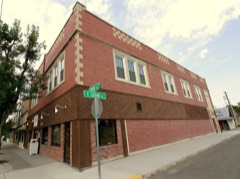 | Adams Block | building | 1999 | 99000597 |
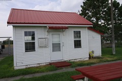 | Airway Radio Station | building | 1998 | 98001340 |
| Anderson School | building | 1981 | 81000354 | |
| B-K Ranch | district | 2006 | 06001185 | |
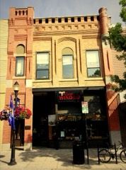 | Barnett, R. T., and Company Building | building | 1980 | 80002416 |
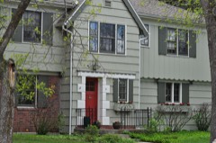 | Jack Bartlett House | building | 2000 | 00000046 |
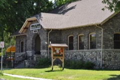 | Beall Park Community Center | building | 1987 | 87001807 |
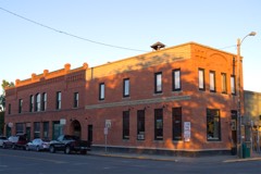 | Belgrade City Hall and Jail | building | 1982 | 82000592 |
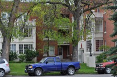 | Blackmore Apartments | building | 1983 | 83001062 |
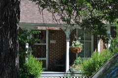 | Bohart House | building | 1987 | 87001810 |
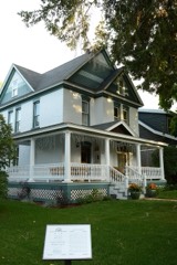 | Bon Ton Historic District | district | 1987 | 87001816 |
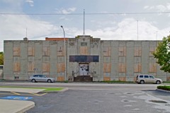 | Bozeman Armory | building | 1987 | 87001800 |
| Bozeman Brewery Historic District | district | 1987 | 87001844 | |
 | Bozeman Carnegie Library | building | 1979 | 79001402 |
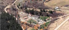 | Bozeman National Fish Hatchery | building | 1983 | 83001063 |
| Bozeman Sheet Metal Works | building | 1987 | 87001836 | |
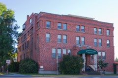 | Bozeman YMCA | building | 1987 | 87001819 |
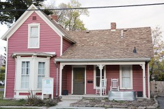 | Brandenburg House | building | 1987 | 87001804 |
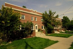 | Bridger Arms Apartments | building | 1987 | 87001799 |
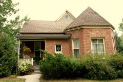 | Busch House | building | 1987 | 87001805 |
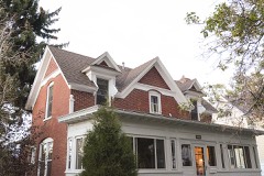 | Colburn House | building | 1987 | 87001813 |
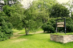 | Cooper Park Historic District | district | 1987 | 87001845 |
| Cottonwood School | building | 1981 | 81000356 | |
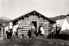 | Crail Ranch Buildings | building | 1982 | 82003167 |
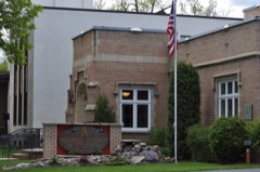 | Dokken-Nelson Funeral Home | building | 1987 | 87001833 |
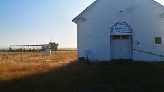 | Dry Creek School | building | 1981 | 81000360 |
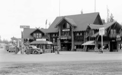 | Eagle's Store | building | 1986 | 86002957 |
| Elkhorn Ranch Historic District | district | 2016 | 16000142 | |
 | Emerson School | building | 1990 | 90001212 |
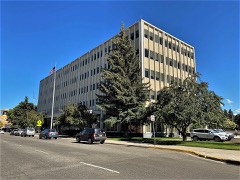 | Federal Building and US Post Office-Bozeman | building | 2018 | 100002362 |
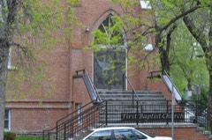 | First Baptist Church | building | 1987 | 87001803 |
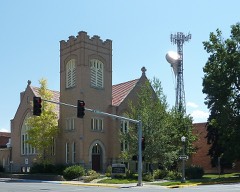 | First Presbyterian Church | building | 1987 | 87001820 |
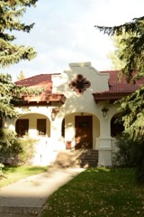 | Burr Fisher House | building | 1985 | 85000643 |
| Flaming Arrow Lodge | building | 1994 | 94000784 | |
| Flaming Arrow Ranch House and Office | building | 1998 | 98000229 | |
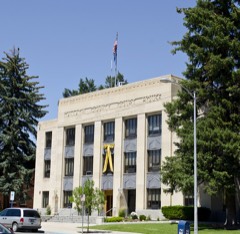 | Gallatin County Courthouse | building | 1987 | 87001794 |
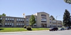 | Gallatin County High School | building | 1988 | 87002309 |
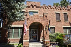 | Gallatin County Jail | building | 1983 | 83001064 |
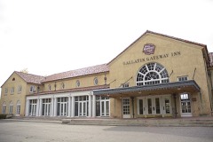 | Gallatin Gateway Inn | building | 1980 | 80002417 |
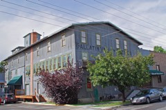 | Gallatin Valley Seed Company | building | 1987 | 87001830 |
| Gifford House | building | 1987 | 87001802 | |
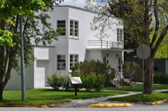 | Graf Building | building | 1987 | 87001811 |
| Jesse R. Green Homestead | building | 1992 | 91001939 | |
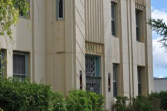 | Hamill Apartments | building | 1987 | 87001817 |
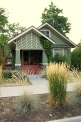 | Hamill House | building | 1987 | 87001814 |
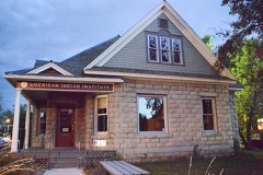 | Harris House | building | 1988 | 87002310 |
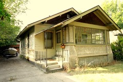 | Hines House | building | 1988 | 87002311 |
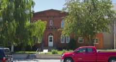 | Holy Rosary Church Rectory | building | 1987 | 87001801 |
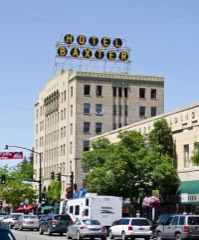 | Hotel Baxter | building | 1984 | 84002469 |
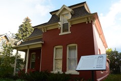 | House at 22 West Lamme | building | 1987 | 87001806 |
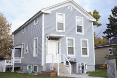 | House at 714 North Tracy | building | 1988 | 87002315 |
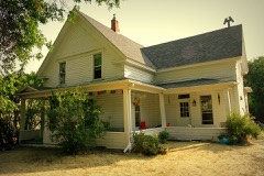 | House at 818 South Eighth | building | 1988 | 87002318 |
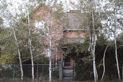 | Johnson House | building | 1988 | 87002321 |
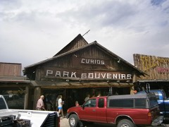 | Kennedy Building | building | 1983 | 83001065 |
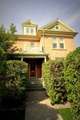 | Emil Ketterer House | building | 1983 | 83001066 |
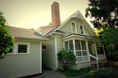 | Kolble House | building | 1987 | 87001812 |
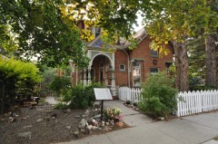 | Samuel Lewis House | building | 1999 | 99000342 |
| Lindley Place Historic District | district | 1987 | 87001842 | |
| Litening Gas | building | 1987 | 87001843 | |
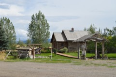 | Little Bear School | building | 1982 | 82003168 |
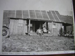 | Lonesomehurst Cabin | building | 2011 | 11000541 |
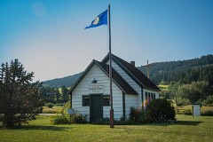 | Lower Bridger School | building | 1981 | 81000347 |
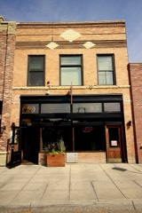 | Charles Lundwall Building | building | 2001 | 00001611 |
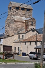 | MISCO Grain Elevator | structure | 1987 | 87001831 |
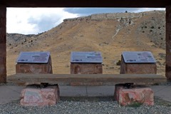 | Madison Buffalo Jump State Monument | site | 1970 | 70000356 |
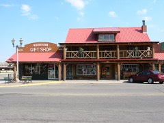 | Madison Hotel and Cafe | building | 1983 | 83001067 |
| Main Street Historic District | district | 1987 | 87001848 | |
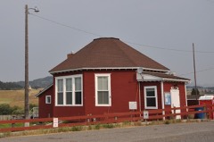 | Malmborg School | building | 1981 | 81000349 |
| Maudlow School | building | 1982 | 82003164 | |
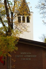 | Methodist Episcopal Church | building | 1987 | 87001839 |
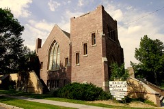 | Methodist Episcopal Church | building | 2000 | 00001566 |
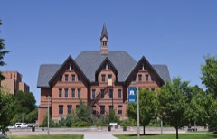 | Montana State University Historic District | district | 2013 | 13000972 |
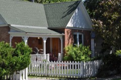 | Newman House | building | 1987 | 87001835 |
| North Tracy Avenue Historic District | district | 1987 | 87001846 | |
| Northern Pacific-Story Mill Historic District | district | 1996 | 96000479 | |
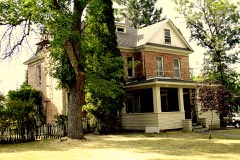 | Panton House | building | 1987 | 87001828 |
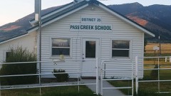 | Pass Creek School | building | 1981 | 81000341 |
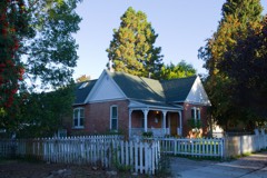 | Peterson House | building | 1988 | 87002350 |
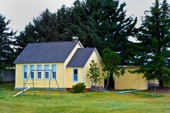 | Pine Butte School | building | 1981 | 81000351 |
| Thomas Quaw House | building | 1991 | 91000217 | |
| Rea School | building | 1981 | 81000346 | |
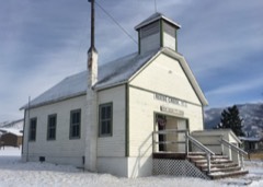 | Reese Creek School | building | 1981 | 81000342 |
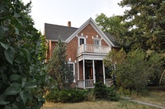 | Rouse House | building | 1987 | 87001832 |
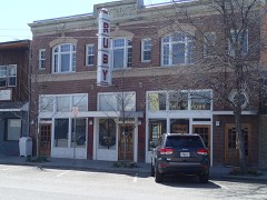 | Ruby Theatre | building | 1982 | 82003169 |
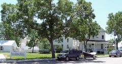 | Sacajawea Hotel | building | 1980 | 80002418 |
| Sedan School | building | 1981 | 81000344 | |
| Shenango Work Station | district | 2022 | 100008100 | |
| South Tracy Avenue Historic District | district | 1987 | 87001847 | |
| South Tracy-South Black Historic District | district | 1987 | 87001840 | |
| Spanish Creek School | building | 1981 | 81000358 | |
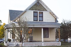 | Spieth Houses | building | 1987 | 87001838 |
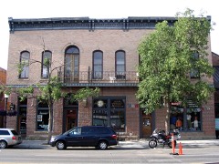 | Spieth and Krug Brewery | building | 1984 | 84002473 |
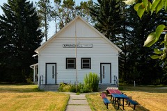 | Springhill School | building | 1981 | 81000345 |
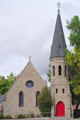 | St. James Episcopal Church and Rectory | building | 1987 | 87001841 |
| Stateler Memorial Methodist Church | building | 2008 | 08000757 | |
| Story Mansion | building | 1978 | 78001687 | |
| Story Motor Company | building | 1987 | 87001837 | |
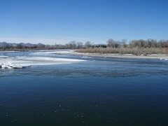 | Three Forks of the Missouri | building | 1966 | 66000433 |
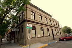 | Three Valleys State Bank | building | 2005 | 05000256 |
| Trident School | building | 1981 | 81000364 | |
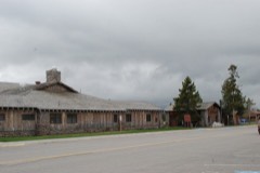 | Union Pacific Dining Lodge | building | 1983 | 83001069 |
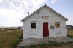 | Upper Madison School | building | 1983 | 83001068 |
| Watkins Creek Ranch | district | 2006 | 06001180 | |
| Westgate Village Shopping Center | building | 2024 | 100010714 |
Every wildfire the federal occurrence database records inside this county: 871 of them, burning about 66,031 acres. 276 started naturally and 9 were recorded as arson. Each settlement page carries the fires within five miles of it.
| Reported cause | Fires |
|---|---|
| Natural | 276 |
| Recreation and ceremony | 221 |
| Missing data/not specified/undetermined | 200 |
| Debris and open burning | 59 |
| Equipment and vehicle use | 34 |
| Power generation/transmission/distribution | 23 |
| Smoking | 19 |
| Fireworks | 13 |
| Arson/incendiarism | 9 |
| Railroad operations and maintenance | 8 |
| Misuse of fire by a minor | 5 |
| Other causes | 3 |
| Firearms and explosives use | 1 |
The five largest, by the area the report gives. None of them was recorded as arson.
| Date | Cause | Size | Reported by | Name on the report |
|---|---|---|---|---|
| 11 August 2000 | Natural | 10,800 acres | Custer Gallatin National Forest | BEAVER CREEK |
| 28 August 2012 | Natural | 10,515 acres | Custer Gallatin National Forest | MILLIE |
| 11 October 2015 | Missing data/not specified/undetermined | 8,300 acres | Central Land Office | COTTONWOOD GULCH |
| 4 September 2020 | Natural | 8,224 acres | Custer Gallatin National Forest | BRIDGER FOOTHILLS |
| 20 July 2018 | Natural | 5,232 acres | Custer Gallatin National Forest | BACON RIND |
| 26 September 2001 | Natural | 4,950 acres | Custer Gallatin National Forest | PURDY CREEK |
| 10 September 2012 | Natural | 4,325 acres | Central Land Office | BEAN CANYON |
| 27 June 2007 | Equipment and vehicle use | 3,660 acres | Custer Gallatin National Forest | MADISON ARM |
Every settlement page carries the fires within five miles of it - see the settlement index below.
The NOAA Storm Events Database holds 237 reports for this county, causing 1 death, 6 injuries and about $61,403,500 in recorded property damage. Each settlement page carries the reports that name it.
| Kind of event | Reports |
|---|---|
| Thunderstorm Wind | 115 |
| Hail | 94 |
| Flood | 10 |
| Funnel Cloud | 6 |
| Tornado | 4 |
| Wildfire | 4 |
| Flash Flood | 2 |
| Lightning | 1 |
| Dust Devil | 1 |
The most serious of them, by death, then injury, then recorded damage. The accounts are quoted exactly as the forecast office filed them.
| When | Event | Place named | Harm | What the report says |
|---|---|---|---|---|
| June 1999 | Lightning | Bozeman | 1 killed | no account filed |
| September 2000 | Wildfire | Belgrade | 3 hurt, $160,000 | Maudlow/Toston fire - included Broadwater County, 81687 acres burned, 1 resident destroyed, 1 outbuilding destroyed, human caused, continued from August. |
| August 2000 | Wildfire | Belgrade | 3 hurt, $160,000 | Maudlow/Toston fire - included southeast Broadwater County, 81687 acres burned, 1 resident destroyed, 1 outbuilding destroyed, human caused, continued past August 31. |
| June 2010 | Hail | Bozeman | $60,000,000 | A thunderstorm dropped 1 inch diameter hail at Bozeman. |
| April 2023 | Flood | Chestnut | $1,000,000 | Churchill area saw pretty good runoff occur. Several locations around Amsterdam (Camp and Godfrey Creeks) had water up against houses. The Highline Canal near Gallatin Gateway overtopped in several locations due to runoff. One house and Axtell Anceny Road were affected. Residents on Dry Creek Road and Swamp Creek Road had flood water around houses. This caused the evacuation of the Bootstrap Ranch. County Roads had several roads closed with water on them. |
| July 1994 | Thunderstorm Wind | Bozemene | $50,000 | Several trees knocked down around town. |
| July 2000 | Thunderstorm Wind | Maudlow | $25,000 | 1.75 inch hail...wind gust 52 kt. |
| June 2007 | Thunderstorm Wind | Bozeman | $3,000 | Trees and powerlines down in parts of Bozeman. Damage to a shed. |
| September 2003 | Dust Devil | West Yellowstone | $3,000 | no account filed |
| June 1960 | Tornado (F1) | not stated | $2,500 | no account filed |
| July 2025 | Thunderstorm Wind | Bozeman | - | Corrects previous thunderstorm wind dmg report from 2 NW Bozeman. Trained spotter reports 4 inch diameter tree limb broken with leaves and debris on roadway in the vicinity of East Baxter Lane and North 19th Avenue in Bozeman. Time of event is estimated. |
| July 2025 | Thunderstorm Wind | Belgrade | - | ASOS station KBZN Bozeman Yellowstone Airport measured a 62 mph wind gust. |
| July 2025 | Thunderstorm Wind | Belgrade | - | ASOS station KBZN Bozeman Yellowstone Airport measured a 60 mph wind gust. |
| July 2025 | Thunderstorm Wind | Belgrade | - | ASOS station KBZN Bozeman Yellowstone Airport measured a 66 mph wind gust. |
| July 2025 | Thunderstorm Wind | Chestnut | - | Mesonet station MTBZH Bozeman Pass measured a 59 mph wind gust. |
| November 2025 | Thunderstorm Wind | Belgrade | - | ASOS station KBZN Bozeman Yellowstone Airport measured a 59 mph wind gust. |
| November 2025 | Thunderstorm Wind | Belgrade | - | ASOS station KBZN Bozeman Yellowstone Airport measured a 59 mph wind gust. |
| July 2024 | Hail | Bozeman | - | Trained spotter reports a few 1 inch hail stone mixed in with primarily one-half to three-quarters of an inch hail stones. |
| July 2024 | Hail | Bozeman Hot Spgs | - | Public report of 1 inch hail from MPing. |
| June 2024 | Hail | Matthews | - | Mostly dime sized hail was observed, with a few quarter sized hail stones mixed in. Hail was beginning to accumulate at the time of the report. |
| June 2024 | Hail | Bozeman | - | The public estimated quarter sized hail in central Bozeman. |
| April 2024 | Thunderstorm Wind | Bozeman | - | A weak shower moved over Bozeman overnight on the 5th, which resulted in a heat burst in town. A personal weather device on Sourdough Ridge Rd (Ambient Wx station) measured a gust in excess of 60 mph, with temperatures nearby rising by nearly 10 degrees over 10 minutes overnight. Broadcast media reported tree damage in Bozeman from the heat burst. |
| September 2024 | Thunderstorm Wind | Belgrade | - | ASOS station KBZN Bozeman Yellowstone Airport measured a severe gust. |
| September 2024 | Thunderstorm Wind | Bozeman Hot Spgs | - | Public report of trees and power lines down across roads in far southern Bozeman. Time and location was estimated. |
| September 2024 | Thunderstorm Wind | Belgrade | - | ASOS station KBZN Bozeman Yellowstone Airport measured a 62 kt gust. Blowing dust was also reported. |
| September 2024 | Thunderstorm Wind | Amsterdam | - | Trained spotter reports damage to tree limbs. |
| August 2024 | Hail | Bozeman Hot Spgs | - | Trained spotter reported 1 inch diameter hail. |
| August 2024 | Hail | Bozeman | - | Social media post, which included a photo, from the Cooper Park area in Bozeman showed 1 inch diameter hail. |
| August 2024 | Hail | Manhattan | - | Public report of quarter sized hail 2 ENE of Manhattan. Wheat fields were damaged by the hail. Time and location was estimated. |
| August 2024 | Thunderstorm Wind | Bozeman | - | An Ambient weather sensor in Bozeman measured a severe caliber gust. |
| August 2024 | Thunderstorm Wind | Chestnut | - | The DOT sensor at Bozeman Pass MTBZH measured a severe caliber gust. |
| May 2023 | Hail | Bozeman Hot Spgs | - | Social media video and photos submitted of hail along the Gallatin River. Hail lasted several minutes. Minor defoliation of vegetation noted in video audio. Time of event estimated from radar. |
| May 2023 | Hail | Bozeman Hot Spgs | - | Spotter reported golfball size hail. |
| May 2023 | Funnel Cloud | Belgrade | - | Funnel cloud reported near Belgrade Softball Complex. Time and location estimated. |
| June 2023 | Funnel Cloud | Logan | - | Broadcast media relayed photos of a funnel cloud near Logan. |
| July 2023 | Hail | Sedan | - | Several reports of hail ranging from dime size to golf ball. Hail accumulated on MT Highway 86, resulting in some impacts to drivers. |
| July 2023 | Thunderstorm Wind | Bozeman | - | Numerous reports of 60 mph wind gusts from Ambient Weather Station just east of the city of Bozeman. |
| July 2023 | Thunderstorm Wind | Chestnut | - | Measured by mesonet station MTBZH (Bozeman Pass). |
| July 2023 | Hail | Sedan | - | Spotter northwest of Wilsall reported golf ball size hail and estimated wind gusts of 70 mph. |
| August 2023 | Thunderstorm Wind | Patterson | - | Measured via Ambient Weather site. |
| August 2023 | Thunderstorm Wind | Bozeman Hot Spgs | - | Measured via Ambient Weather site. |
| August 2023 | Thunderstorm Wind | Belgrade | - | Prolonged severe convective wind event recorded at KBZN ASOS. Severe wind gusts lasted for nearly 20 minutes. |
| August 2023 | Thunderstorm Wind | Chestnut | - | Mesonet station MTBZH Bozeman Pass measured a severe caliber wind gust. |
| August 2023 | Thunderstorm Wind | Bozeman | - | Two sensors along Triple Tree Road, and located about 1/4 mile apart from each other, recorded gusts of 65 mph. |
| August 2023 | Thunderstorm Wind | Amsterdam Arpt | - | Peak gust measured by Ambient Weather site. |
| May 2022 | Thunderstorm Wind | Patterson | - | An ambient weather sensor recorded a wind gust of 52 knots. Air temperature dropped from 67 F to 42 F. |
| June 2022 | Thunderstorm Wind | Patterson | - | Gust measured an Ambient weather station. |
| June 2022 | Thunderstorm Wind | Matthews | - | Ambient weather station measured the gust. |
| August 2022 | Thunderstorm Wind | Belgrade | - | Asos kbzn Bozeman Yellowstone Airport. |
| May 2021 | Thunderstorm Wind | (Bzn)Gallatin Fld Bo | - | KBZN measured a 50 kt (58 mph) thunderstorm wind gust. |
| July 2021 | Thunderstorm Wind | (Bzn)Gallatin Fld Bo | - | KBZN measures a 53 kt (61 mph) thunderstorm wind gust. |
| July 2021 | Thunderstorm Wind | Bozeman Hot Spgs | - | Trained spotter at 3 ENE Bozeman Hot Springs measured a 52 kt (60 mph) thunderstorm wind gust. Pea size hail was also reported. |
| July 2021 | Hail | Belgrade | - | Trained spotter at 5 SE Belgrade reported 3/4 inch diameter hail. |
| July 2021 | Thunderstorm Wind | Belgrade | - | A medium sized out building was flipped over by thunderstorm wind gusts, some tree damage was reported as well. |
| July 2021 | Thunderstorm Wind | Belgrade | - | Trained spotter measured a 52 kt (60 mph) thunderstorm wind gust. |
| July 2021 | Thunderstorm Wind | (Bzn)Gallatin Fld Bo | - | KBZN measured a 50 kt (58 mph) thunderstorm wind gust. |
| July 2021 | Thunderstorm Wind | Bozeman | - | Trained spotter measured a 53 kt (61 mph) thunderstorm wind gust. |
| July 2021 | Thunderstorm Wind | Bozeman | - | Trained spotter measured a 50 kt (58 mph) thunderstorm wind gust. |
| May 2021 | Thunderstorm Wind | Bozeman | - | Numerous trees down in city of Bozeman. Tress also fell on and damaged vehicles. Some fences also blown down. |
| July 2021 | Thunderstorm Wind | (Bzn)Gallatin Fld Bo | - | KBZN measured a 59 kt (68 mph) thunderstorm wind gust. |
The Survey's mineral resources record lists 137 workings inside this county. 17 still produce and 120 are closed or unrecorded. Each settlement page carries the workings within five miles of it.
| Commodity | Workings |
|---|---|
| Phosphorus-Phosphates | 19 |
| Sand and Gravel, Construction | 16 |
| Gold | 13 |
| Copper | 12 |
| Asbestos | 12 |
| Silver | 9 |
| Lead | 8 |
| Corundum | 7 |
| Limestone, General | 5 |
| Stone, Crushed/Broken | 5 |
| Pumice | 5 |
| Zinc | 4 |
| Kyanite | 4 |
| Uranium, Fluorine-Fluorite | 4 |
The least common of them first, because a county's hundredth gravel pit says nothing its first ten did not.
| Where | Site | Commodity | Status | Recorded |
|---|---|---|---|---|
| Buck Creek Phosphate | Phosphorus-Phosphates, Fluorine-Fluorite, Uranium | Occurrence | ||
| Copper Pit Adit Mine | Copper, Lead, Zinc | Prospect | ||
| Deer Creek Prospect | Copper, Nickel | Occurrence | Chalcopyrite | |
| Deer Creek Prospect | Copper, Nickel | Prospect | ||
| Indian Cr-Taylor Cr Synclinal Area | Phosphorus-Phosphates, Chromium, Nickel, REE, Uranium, Vanadium, Fluorine-Fluorite | Prospect | ||
| Kanta Pit | Stone, Crushed/Broken, Aluminum | Producer | ||
| Last Chance Prospect | Copper, Gold, Silver | Occurrence | ||
| Last Chance Prospect | Iron | Prospect | ||
| Manhattan Onyx Marble Deposit | Marble, Dimension | Prospect | ||
| Mill Creek Canyuon Barite | Barium-Barite | Occurrence | ||
| Mkb #7 Adit | Copper, Zinc, Lead | Prospect | ||
| Moon Lake Kyanite | Kyanite, Garnet | Occurrence | ||
| Pass Creek Mine | Lead, Zinc, Molybdenum | Occurrence | Galena, Molybdenite, Sphalerite | |
| Picture Flagstone Quarry | Flagstone | Past Producer | ||
| Sappington Limestone Quarry | Limestone, Ultra Pure | Past Producer | Limestone | |
| September Morn Mine | Lead, Silver, Molybdenum, Zinc, Barium-Barite | Past Producer | Vein | |
| Sheridan | Lead, Zinc, Silver | Prospect | ||
| Spanish Creek Res. Study | Gold, Titanium | Prospect | ||
| Sunshine Mine | Gold, Silver, Lead, Zinc | Past Producer | Vein | |
| Table Mountain Prospect | Chromium, Asbestos | Occurrence | Vein | |
| Table Mountain Prospect | Chromium, Asbestos | Prospect | ||
| Thumper Lode Mica Mine | Mica, Quartz, Feldspar | Past Producer | Muscovite | |
| Trident Cement Quarry | Limestone, General, Clay | Plant | ||
| W. Fork Gallatin River Synclinal Ar | Phosphorus-Phosphates, REE, Chromium, Fluorine-Fluorite, Nickel, Uranium, Vanadium | Prospect | ||
| Walton Prospect | Gold, Silver, Calcium | Prospect | ||
| Beaver Creek Gypsum | Gypsum-Anhydrite | Unknown | ||
| Beaver Creek Gypsum Deposit | Gypsum-Anhydrite | Occurrence | ||
| Lava Lake Pyrite | Gold, Silver | Occurrence | ||
| Mica Creek Deposit | Vermiculite | Occurrence | ||
| Mica. Creek Deposit | Vermiculite | Occurrence | Vermiculite | |
| Montana Talc Company | Talc-Soapstone | Plant | ||
| Mountain Goat No. 5 Claim | Gold, Silver | Occurrence | 1949 | |
| Three Forks Mill | Talc-Soapstone | Producer | ||
| Cazier Quarry | Stone | Producer | ||
| Corbly Gulch | Uranium | Prospect | ||
| Knudson | Uranium | Prospect | ||
| Porcupine Ridge | Stone | Past Producer | ||
| Silica Quarry | Stone | Producer | ||
| Thompson #1 | Mica | Occurrence | ||
| Thumper Lode #1 | Mica | Producer | ||
| Unnamed Uranium Deposit | Uranium | Occurrence | ||
| Bakers Hole Well | Geothermal | Producer | ||
| Bozeman Corundum Deposit | Corundum, Kyanite | Past Producer | 1902 | |
| Bozeman Hot Springs | Geothermal | Producer | ||
| Bridger Canyon Warm Springs | Geothermal | Producer | ||
| Cinnamon Creek Phosphate | Phosphorus-Phosphates, Uranium, Fluorine-Fluorite | Occurrence | ||
| Elk Creek Corundom Deposit | Corundum, Kyanite | Past Producer | 1901 | |
| Hebgen Dam Phosphate | Phosphorus-Phosphates, Uranium, Fluorine-Fluorite | Occurrence | ||
| Lava Lake Kyanite | Kyanite | Occurrence | ||
| Lower Cooper Adit | Lead, Zinc | Prospect | ||
| Sage Peak Phosphate | Phosphorus-Phosphates, Uranium, Fluorine-Fluorite | Occurrence | ||
| Targhee Sulfur Warm Springs | Geothermal | Producer | ||
| Unnamed Phosphate Outcrop | Phosphorus-Phosphates, Uranium, Fluorine-Fluorite | Occurrence | ||
| Upper Cooper Adit Mines | Lead, Zinc | Past Producer | ||
| Xmas Tree Pits | Lead, Zinc | Prospect | ||
| Bear Creek Pumicite | Pumice | Occurrence | ||
| Bridger Creek Limestone Deposit | Limestone, General | Occurrence | ||
| High Flat Pumicite | Pumice | Occurrence | ||
| Ingleside Quarry | Limestone, General | Past Producer | Limestone | |
| Ingleside Quarry | Stone, Crushed/Broken | Past Producer | ||
| Kanta Pit | Stone, Crushed/Broken | Past Producer | Sedimentary | |
| Logan-Madison River Ash | Pumice | Occurrence | ||
| Meadow Creek Limestone Deposit | Limestone, General | Occurrence | ||
| Trident Brown Shale | Stone, Crushed/Broken | Occurrence | ||
| Trident Quarry | Limestone, General | Producer | Limestone | |
| Unnamed Pumicite Deposit | Pumice | Occurrence | ||
| Unnamed Pumicite Deposit | Pumice | Occurrence | ||
| Yellowstone Obsidian Outcrop | Stone, Crushed/Broken | Occurrence | ||
| Beaver Creek | Corundum | Occurrence | Corundum | |
| Bozeman Corundum Deposit | Corundum | Prospect | ||
| Elk Creek Corundum Deposit | Corundum | Prospect | ||
| Gallatin Corundum Deposit | Corundum | Unknown | ||
| Goose Creek Corundum | Corundum | Occurrence | ||
| Nellie H. Mine | Silver, Lead | Occurrence | ||
| September Morn Mine | Lead, Silver | Past Producer | ||
| Sunshine Mine | Lead | Occurrence | ||
| Fairy Lake | Silver | Prospect | ||
| Highland Mary | Copper, Silver | Prospect | ||
| Mountain Goat No. 5 Claim | Gold, Silver | Prospect | ||
| Silver Occurrence | Silver | Prospect | ||
| Sunshine Group | Copper, Silver | Prospect | ||
| Unnamed | Copper, Silver | Occurrence | ||
| Apex Group | Copper | Prospect | ||
| Buck Lode | Asbestos | Prospect | 1927 | |
| Buck Lode | Asbestos | Prospect | ||
| Copper Occurrence | Copper | Occurrence | ||
| Karat Lode | Asbestos | Prospect | 1926 | |
| Karst Asbestos Deposit | Asbestos | Past Producer | 1900 | |
| Karst Mine | Asbestos | Prospect | ||
| Moon Lake Asbestos | Asbestos | Prospect | ||
| Moon Lake Asbestos Deposit | Asbestos | Occurrence | 1892 | |
| Six Bits Lode | Asbestos | Prospect | 1926 | |
| Unidentified Asbestos Occurrence | Asbestos | Occurrence | ||
| Unidentified Asbestos Occurrence | Asbestos | Occurrence | Vein | |
| Unidentified Copper Occurrence | Copper | Occurrence | Vein | |
| Unidentified Occurance | Copper | Occurrence | Malachite | |
| Unnamed Location | Copper | Occurrence | ||
| Unnamed Location | Copper | Occurrence | ||
| Wilson Creek Asbestos | Asbestos | Occurrence | ||
| Gallatin River Placers | Gold | Prospect | ||
| Jefferson River Placers | Gold | Prospect | ||
| Jewell Property | Gold | Past Producer | ||
| Lava Lake Pyrite | Gold | Occurrence | ||
| Levinski Creek Prospect | Gold | Prospect | ||
| Michener Property | Gold | Occurrence | ||
| Ridge Prospect | Gold | Prospect | ||
| Three Forks Placer | Gold | Prospect | ||
| Unnamed Location | Gold | Occurrence | ||
| West Fork Gallatin River Placers | Gold | Past Producer | ||
| Balke Pit | Sand and Gravel, Construction | Producer | ||
| Bar Land Pit | Sand and Gravel, Construction | Producer | ||
| Bozeman Sand and Gravel | Sand and Gravel, Construction | Past Producer | ||
| Gabriel | Sand and Gravel, Construction | Producer | ||
| Gallatin Sand and Gravel | Sand and Gravel, Construction | Producer | ||
| Gardner Construction Gravel Pit | Sand and Gravel, Construction | Producer | ||
| Gravel Pit | Sand and Gravel, Construction | Past Producer | ||
| Gravel Pit | Sand and Gravel, Construction | Past Producer | ||
| Gravel Pit | Sand and Gravel, Construction | Past Producer | ||
| Gravel Pit | Sand and Gravel, Construction | Past Producer | ||
| Gravel Pit | Sand and Gravel, Construction | Past Producer | ||
| Gravel Pit | Sand and Gravel, Construction | Past Producer | ||
| Gravel Pit | Sand and Gravel, Construction | Past Producer | ||
| Gravel Pit | Sand and Gravel, Construction | Past Producer | ||
| Gravel Pit | Sand and Gravel, Construction | Past Producer | ||
| Gravel Pit | Sand and Gravel, Construction | Past Producer | ||
| Buck Creek | Phosphorus-Phosphates | Unknown | ||
| Elkhorn Creek Phosphate | Phosphorus-Phosphates | Occurrence | ||
| Gallatin River Phosphate | Phosphorus-Phosphates | Occurrence | ||
| Grouse Mountain Phosphate | Phosphorus-Phosphates | Occurrence | ||
| Phosphate Occurrence | Phosphorus-Phosphates | Prospect | ||
| Porcupine Creek Phosphate | Phosphorus-Phosphates | Occurrence | ||
| Pulpit Rock | Phosphorus-Phosphates | Prospect | ||
| Sage Creek Phosphate | Phosphorus-Phosphates | Occurrence | ||
| Sunshine Point Phosphate | Phosphorus-Phosphates | Occurrence | ||
| Taylor Creek Phsophate | Phosphorus-Phosphates | Occurrence | ||
| Tepee Creek Phosphate | Phosphorus-Phosphates | Occurrence | ||
| W. Fork-Gallatin River Phosphate | Phosphorus-Phosphates | Occurrence |
Named settlements recorded in the Geographic Names Information System, each with the topographic sheets covering it. Villages, hamlets and abandoned places alike. Each is shown with the nearest named watercourse or landform and the survey quadrangle it falls on.
Belgrade census division · 59714 · On Pass Creek · Horseshoe Creek quadrangle
22 sheets, 1888 to 1992
Manhattan census division · 59741 · Near Godfrey Canyon · Manhattan quadrangle
20 sheets, 1888 to 1992
Gallatin Gateway census division · 59718 · On Fish Creek · Gallatin Gateway quadrangle
22 sheets, 1888 to 2000
Manhattan census division · 59741 · On Godfrey Creek · Manhattan quadrangle
20 sheets, 1888 to 1992
Big Sky census division · 59730 · On West Fork Gallatin River · Gallatin Peak quadrangle
21 sheets, 1888 to 1989
Big Sky census division · 59716 · On Crail Creek · Gallatin Peak quadrangle
21 sheets, 1888 to 1989
Gallatin Gateway census division · 59718 · Bozeman Hot Springs quadrangle
21 sheets, 1888 to 1992
Bozeman census division · 59715 · On Spring Creek · Bozeman quadrangle
22 sheets, 1888 to 1992
Belgrade census division · 59714 · On Schafer Creek · Miser Creek quadrangle
23 sheets, 1888 to 2000
Belgrade census division · 59715 · On Schafer Creek · Miser Creek quadrangle
23 sheets, 1888 to 2000
Three Forks census division · 59752 · Near Cottonwood Gulch · Logan quadrangle
21 sheets, 1888 to 1992
Bozeman census division · 59715 · On Meadow Creek · Kelly Creek quadrangle
22 sheets, 1891 to 2000
Manhattan census division · 59741 · Near Godfrey Canyon · Manhattan quadrangle
20 sheets, 1888 to 1992
Three Forks census division · 59752 · Near Home Gulch · Lombard quadrangle
14 sheets, 1886 to 1986
Gallatin Gateway census division · 59718 · On South Cottonwood Creek · Gallatin Gateway quadrangle
22 sheets, 1888 to 2000
Belgrade census division · 59714 · Near Quarry Gulch · Deer Park quadrangle
15 sheets, 1886 to 2001
Bozeman census division · 59718 · On South Dry Creek · Bozeman Hot Springs quadrangle
21 sheets, 1888 to 1992
No longer a settlement
Belgrade census division · 59714 · On Smith Creek · Horseshoe Creek quadrangle
22 sheets, 1888 to 1992
Big Sky census division · 59730 · On Buffalo Horn Creek · Sunshine Point quadrangle
23 sheets, 1888 to 2000
No longer a settlement
Gallatin Gateway census division · 59718 · On Fish Creek · Bozeman Hot Springs quadrangle
21 sheets, 1888 to 1992
Belgrade census division · 59714 · On Middle Fork Sixteenmile Creek · Francis quadrangle
17 sheets, 1886 to 1986
Three Forks census division · 59752 · On Spring Creek · Logan quadrangle
21 sheets, 1888 to 1992
No longer a settlement
Gallatin Gateway census division · 59730 · On South Cottonwood Creek · Gallatin Gateway quadrangle
22 sheets, 1888 to 2000
Gallatin Gateway census division · 59730 · On South Cottonwood Creek · Gallatin Gateway quadrangle
22 sheets, 1888 to 2000
Belgrade census division · 59714 · On Gallop Creek · Flathead Pass quadrangle
24 sheets, 1888 to 2000
No longer a settlement
Gallatin Gateway census division · 59718 · Bozeman Hot Springs quadrangle
21 sheets, 1888 to 1992
West Yellowstone census division · 59758 · On Red Canyon Creek · Mount Hebgen quadrangle
12 sheets, 1955 to 2000
Manhattan census division · 59718 · Bozeman Hot Springs quadrangle
21 sheets, 1888 to 1992
Belgrade census division · 59714 · On Reynolds Creek · Horseshoe Creek quadrangle
22 sheets, 1888 to 1992
Manhattan census division · 59718 · On Yellow Dog Creek · Bozeman Hot Springs quadrangle
21 sheets, 1888 to 1992
Three Forks census division · 59752 · Three Forks quadrangle
20 sheets, 1888 to 1992
No longer a settlement
Bozeman census division · 59718 · On McDonald Creek · Bozeman Hot Springs quadrangle
21 sheets, 1888 to 1992
Belgrade census division · 59718 · On South Dry Creek · Bozeman Hot Springs quadrangle
21 sheets, 1888 to 1992
West Yellowstone census division · 59758 · Near Madison Valley · Madison Arm quadrangle
14 sheets, 1955 to 2000
West Yellowstone census division · 59758 · On Dave Johnson Creek · Mount Hebgen quadrangle
12 sheets, 1955 to 2000
Gallatin Gateway census division · 59718 · Gallatin Gateway quadrangle
22 sheets, 1888 to 2000
No longer a settlement
Gallatin Gateway census division · 59730 · On Little Bear Creek · Gallatin Gateway quadrangle
22 sheets, 1888 to 2000
No longer a settlement
West Yellowstone census division · 59758 · On South Fork Madison River · Madison Arm quadrangle
14 sheets, 1955 to 2000
Bozeman census division · 59715 · On Place Creek · Kelly Creek quadrangle
22 sheets, 1891 to 2000
No longer a settlement
Three Forks census division · 59752 · Manhattan SW quadrangle
20 sheets, 1888 to 1992
No longer a settlement
Three Forks census division · 59714 · On Bremmer Creek · Maudlow quadrangle
17 sheets, 1886 to 1986
Belgrade census division · 59714 · Near Chipmunk Gulch · Horseshoe Creek quadrangle
22 sheets, 1888 to 1992
Belgrade census division · 59714 · Near Chipmunk Gulch · Horseshoe Creek quadrangle
22 sheets, 1888 to 1992
Bozeman census division · 59718 · On South Dry Creek · Bozeman Hot Springs quadrangle
21 sheets, 1888 to 1992
No longer a settlement
Bozeman census division · 59718 · On South Dry Creek · Bozeman Hot Springs quadrangle
21 sheets, 1888 to 1992
No longer a settlement
Belgrade census division · 59714 · Manhattan quadrangle
20 sheets, 1888 to 1992
No longer a settlement
Bozeman census division · 59715 · On Limestone Creek · Bozeman quadrangle
22 sheets, 1888 to 1992
Belgrade census division · 59714 · On Jones Creek · Saddle Peak quadrangle
20 sheets, 1891 to 2000
No longer a settlement
West Yellowstone census division · 59758 · Madison Arm quadrangle
14 sheets, 1955 to 2000
Bozeman census division · 59718 · Bozeman quadrangle
22 sheets, 1888 to 1992
No longer a settlement
Belgrade census division · 59714 · On Limestone Creek · Miser Creek quadrangle
23 sheets, 1888 to 2000
No longer a settlement
Yellowstone National Park census division · 59758 · West Yellowstone quadrangle
13 sheets, 1955 to 2000
West Yellowstone census division · 59758 · On South Fork Madison River · Madison Arm quadrangle
14 sheets, 1955 to 2000
Belgrade census division · 59718 · Bozeman Hot Springs quadrangle
21 sheets, 1888 to 1992
No longer a settlement
Belgrade census division · 59714 · Near Limestone Canyon · Miser Creek quadrangle
23 sheets, 1888 to 2000
Bozeman census division · 59715 · On Sypes Creek · Bozeman quadrangle
22 sheets, 1888 to 1992
Bozeman census division · 59715 · On Goose Creek · Bozeman Pass quadrangle
22 sheets, 1891 to 2000
No longer a settlement
Belgrade census division · 59718 · On Churn Creek · Bozeman quadrangle
22 sheets, 1888 to 1992
Belgrade census division · 59714 · Miser Creek quadrangle
23 sheets, 1888 to 2000
No longer a settlement
Three Forks census division · 59752 · On Gallatin River · Logan quadrangle
21 sheets, 1888 to 1992
Bozeman census division · 59715 · On Spring Creek · Kelly Creek quadrangle
22 sheets, 1891 to 2000
No longer a settlement
Belgrade census division · 59715 · On Walton Creek · Miser Creek quadrangle
23 sheets, 1888 to 2000
No longer a settlement
Bozeman census division · 59715 · On Jackson Creek · Bozeman Pass quadrangle
22 sheets, 1891 to 2000
Manhattan census division · 59718 · Bozeman Hot Springs quadrangle
21 sheets, 1888 to 1992
West Yellowstone census division · 59758 · West Yellowstone quadrangle
13 sheets, 1955 to 2000
Manhattan census division · 59741 · On Baker Creek · Manhattan quadrangle
20 sheets, 1888 to 1992
Three Forks census division · 59760 · On Willow Creek · Willow Creek quadrangle
21 sheets, 1888 to 1992
Belgrade census division · 59714 · On Schafer Creek · Miser Creek quadrangle
23 sheets, 1888 to 2000
The vanished settlements of Gallatin County: the places named above that are no longer on the map.