 Block
Bozeman, Montana
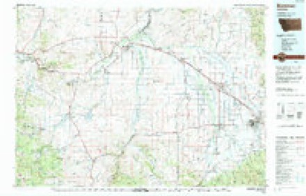
22 topographic sheets cover this place, the earliest surveyed in 1888 and the latest in 1992. It stands in the Bozeman census division. It lies in ZIP code area 59715. It stands on Spring Creek. The Survey maps it on the Bozeman quadrangle. 53,293 people lived here at the 2020 count. It stands 4,793 feet above sea level.
Research this city
On record in Bozeman
Buildings and businesses the archive holds for this place. Each opens its own page, with the source record it came from.
On the National Register 12 of 69 shown
 Barnett, R. T., and Company Buildinglisted 1980
 Jack Bartlett Houselisted 2000
 Beall Park Community Centerlisted 1987
 Blackmore Apartmentslisted 1983
 Bohart Houselisted 1987
 Bon Ton Historic Districtlisted 1987
 Bozeman Armorylisted 1987
 Bozeman Carnegie Librarylisted 1979
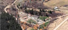 Bozeman National Fish Hatcherylisted 1983
 Bozeman YMCAlisted 1987
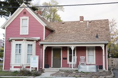 Brandenburg Houselisted 1987
 Bridger Arms Apartmentslisted 1987
Population over time
7 figuresBozeman grew from 168 to 53,293 between 1870 and 2020. These are the recorded population figures Wikidata holds for this place, reached through the Geographic Names Information System number this page is keyed on rather than by name, so they belong to this place and not to another of the same name. Most are census counts, but not all are: an early figure may be a founding or settlement estimate, and an estimate published within five years of a census is left out. The change column is computed, and is left blank where more than 20 years separate a figure from the one before it, because a gap that long is not a change between two counts.
| Year | People | Change |
|---|---|---|
| 1870 | 168 | |
| 1880 | 894 | +726 (+432%) |
| 1890 | 2,143 | +1,249 (+140%) |
| 1900 | 3,419 | +1,276 (+60%) |
| 1910 | 5,187 | +1,768 (+52%) |
| 2010 | 37,280 | |
| 2020 | 53,293 | +16,013 (+43%) |
Topographic sheets covering this place
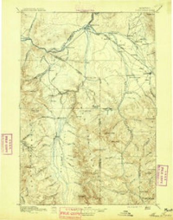
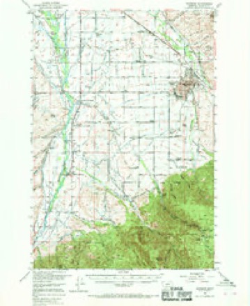
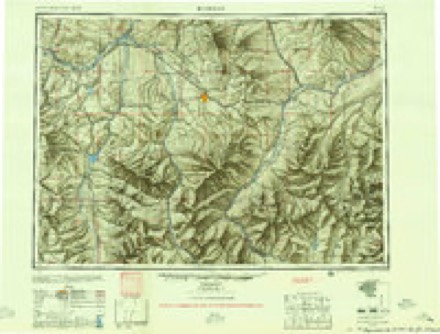
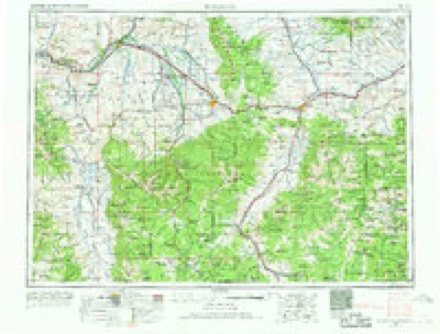
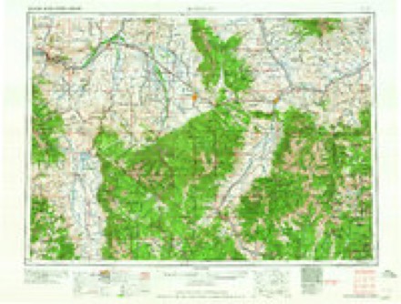
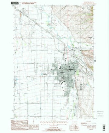
11 surveys from 22 printed sheetsMatched by testing this settlement's coordinate against the published boundary of every sheet in the United States Geological Survey's historical collection. Each opens the scanned sheet at the Survey.
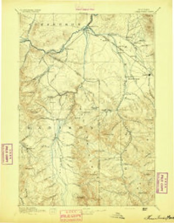
- 1888 USGS Three Forks quadrangle1:250000
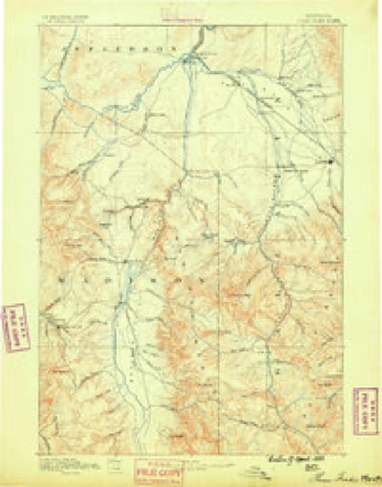
- 1894 USGS Three Forks quadrangle1:250000
- 1895 USGS Three Forks quadrangle1:250000, 5 printings
- 1947 USGS Bozeman quadrangle1:250000
- 1948 USGS Bozeman quadrangle1:250000
- 1953 USGS Bozeman quadrangle1:62500, 5 printings
- 1955 USGS Bozeman quadrangle1:250000
- 1958 USGS Bozeman quadrangle1:250000, 3 printings
- 1965 USGS Bozeman quadrangle1:250000
- 1987 USGS Bozeman quadrangle1:24000, 2 printings
- 1992 USGS Bozeman quadrangle1:100000
Fires near this place
52 since 2003Regional context, not property-specific evidence. The federal wildfire occurrence database lists 52 fires within 5 miles of Bozeman between 2003 and 2020, burning about 8,232 acres in total. 2 started naturally. None was recorded as arson. Distance is straight-line from the map coordinates, so a fire counted here may appear on a neighbouring settlement's page as well.
| Reported cause | Fires |
|---|---|
| Missing data/not specified/undetermined | 30 |
| Debris and open burning | 11 |
| Recreation and ceremony | 5 |
| Power generation/transmission/distribution | 3 |
| Natural | 2 |
| Railroad operations and maintenance | 1 |
The most recent of them, most recent first, with the day each was reported and the service that recorded it.
| Date | Cause | Size | Reported by | Name on the report |
|---|---|---|---|---|
| 4 September 2020 | Natural | 8,224 acres | Custer Gallatin National Forest | BRIDGER FOOTHILLS |
| 29 September 2012 | Recreation and ceremony | under an acre | Custer Gallatin National Forest | RIDGE |
| 22 September 2018 | Missing data/not specified/undetermined | under an acre | Central Land Office | not named |
| 21 September 2018 | Debris and open burning | under an acre | Central Land Office | not named |
| 20 September 2019 | Debris and open burning | under an acre | Gallatin County | not named |
| 18 September 2018 | Debris and open burning | under an acre | Central Land Office | not named |
| 15 September 2020 | Missing data/not specified/undetermined | under an acre | RavaIIi County | 201061 |
| 15 September 2018 | Debris and open burning | under an acre | Central Land Office | not named |
Settlements close enough to share some of these fires:
Mines and quarries near this place
7 within 5 milesRegional context, not property-specific evidence. The federal mineral resources record lists 7 workings within 5 miles of Bozeman: 3 producers, 3 past producers, 1 occurrence. 3 still produce. What was taken out: Sand and Gravel, Construction, Limestone, General, Geothermal. Distance is straight-line from the map coordinates, so a quarry counted here may appear on a neighbouring settlement's page as well.
| Where | Site | Commodity | Status | Recorded |
|---|---|---|---|---|
| Bridger Canyon Warm Springs | Geothermal | Producer | ||
| Bridger Creek Limestone Deposit | Limestone, General | Occurrence | ||
| Bozeman Sand and Gravel | Sand and Gravel, Construction | Past Producer | ||
| Gabriel | Sand and Gravel, Construction | Producer | ||
| Gallatin Sand and Gravel | Sand and Gravel, Construction | Producer | ||
| Gravel Pit | Sand and Gravel, Construction | Past Producer | ||
| Gravel Pit | Sand and Gravel, Construction | Past Producer |
Storms near this place
60 of 77 shownRegional context, not property-specific evidence. The National Weather Service names Bozeman in 77 storm reports between 1995 and 2025: 38 hail, 28 thunderstorm wind, 4 flood, 2 tornado. The reports record 1 death. Each account below is quoted exactly as the forecast office filed it, from the NOAA Storm Events Database, and each date opens the federal record of that event.
| When | Event | Place named | Harm | What the report says |
|---|---|---|---|---|
| June 1999 | Lightning | Bozeman | 1 killed | no account filed |
| June 2010 | Hail | Bozeman | $60,000,000 | A thunderstorm dropped 1 inch diameter hail at Bozeman. |
| June 2007 | Thunderstorm Wind | Bozeman | $3,000 | Trees and powerlines down in parts of Bozeman. Damage to a shed. |
| July 2025 | Thunderstorm Wind | Bozeman | - | Corrects previous thunderstorm wind dmg report from 2 NW Bozeman. Trained spotter reports 4 inch diameter tree limb broken with leaves and debris on roadway in the vicinity of East Baxter Lane and North 19th Avenue in Bozeman. Time of event is estimated. |
| July 2024 | Hail | Bozeman | - | Trained spotter reports a few 1 inch hail stone mixed in with primarily one-half to three-quarters of an inch hail stones. |
| June 2024 | Hail | Bozeman | - | The public estimated quarter sized hail in central Bozeman. |
| April 2024 | Thunderstorm Wind | Bozeman | - | A weak shower moved over Bozeman overnight on the 5th, which resulted in a heat burst in town. A personal weather device on Sourdough Ridge Rd (Ambient Wx station) measured a gust in excess of 60 mph, with temperatures nearby rising by nearly 10 degrees over 10 minutes overnight. Broadcast media reported tree damage in Bozeman from the heat burst. |
| August 2024 | Hail | Bozeman | - | Social media post, which included a photo, from the Cooper Park area in Bozeman showed 1 inch diameter hail. |
| August 2024 | Thunderstorm Wind | Bozeman | - | An Ambient weather sensor in Bozeman measured a severe caliber gust. |
| July 2023 | Thunderstorm Wind | Bozeman | - | Numerous reports of 60 mph wind gusts from Ambient Weather Station just east of the city of Bozeman. |
| August 2023 | Thunderstorm Wind | Bozeman | - | Two sensors along Triple Tree Road, and located about 1/4 mile apart from each other, recorded gusts of 65 mph. |
| July 2021 | Thunderstorm Wind | Bozeman | - | Trained spotter measured a 53 kt (61 mph) thunderstorm wind gust. |
| July 2021 | Thunderstorm Wind | Bozeman | - | Trained spotter measured a 50 kt (58 mph) thunderstorm wind gust. |
| May 2021 | Thunderstorm Wind | Bozeman | - | Numerous trees down in city of Bozeman. Tress also fell on and damaged vehicles. Some fences also blown down. |
| August 2021 | Flash Flood | Bozeman | - | Several social media reports of flash flooding in Downtown Bozeman, including swiftly flowing water from south to north in the downtown area. Additional flooding reported on the south side of town near 19th and Graf. |
| July 2020 | Thunderstorm Wind | Bozeman | - | MDT Bozeman Pass station measured a 53 kt (61 mph) thunderstorm wind gust. |
| July 2020 | Hail | Bozeman | - | Member of public reported quarter size hail. |
| July 2020 | Hail | Bozeman | - | Trained spotter reported golf ball size (1.75 inch diameter) hail. |
| July 2020 | Hail | Bozeman | - | Member of public reports quarter size hail. |
| July 2020 | Hail | Bozeman | - | COCRAHS reported quarter size hail. |
| July 2020 | Hail | Bozeman | - | Member of public reported half dollar size (1.25 inch diameter) hail via mPing. |
| July 2020 | Hail | Bozeman | - | Member of public reported quarter size hail. |
| June 2020 | Thunderstorm Wind | Bozeman | - | Metal fence panels blown over at Catamount Street and Blackbird Drive. Branches broken in the city of Bozeman. Wind speed and gust estimate not reported. |
| June 2019 | Funnel Cloud | Bozeman | - | Received multiple reports and pictures from spotters, 911 dispatch and the public of at least one funnel cloud that moved over the Bozeman area, persisting for 15 to 20 minutes. Based upon pictures shared, this was most likely a cold air funnel. |
| August 2019 | Hail | Bozeman | - | A member of the public estimated hail size of 1.25 inches in diameter. Time was estimated by radar. Report was posted to NBC Montana's Facebook page. |
| July 2018 | Thunderstorm Wind | Bozeman | - | Sourdough Ridge mesonet station recorded 68 mph peak gust from thunderstorm 2-miles SSE of Bozeman. |
| August 2017 | Thunderstorm Wind | Bozeman | - | Mesonet station BBAS, Bridger Bowl - Base reported a measured wind gust of 59 mph. |
| April 2016 | Thunderstorm Wind | Bozeman | - | A thunderstorm gust to 65 mph was reported at Bozeman 3SSE. |
| August 2013 | Thunderstorm Wind | Bozeman | - | Strong winds measuring 53KT (61MPH) and nickel sized hail were reported 1 mile WSW of Bozeman, MT . |
| August 2013 | Hail | Bozeman | - | Hail measuring 1.50 inches (ping pong ball sized) was reported near the MSU campus in Bozeman, MT. |
| August 2013 | Thunderstorm Wind | Bozeman | - | High winds estimated at 50KT (58MPH) were seen in Bozeman where a tree was blown over hitting a power line. |
| August 2013 | Thunderstorm Wind | Bozeman | - | High winds measuring 55KT (63MPH) were reported 11 miles E of Bozeman at the Bozeman Pass DOT sensor. |
| July 2012 | Thunderstorm Wind | Bozeman | - | Outflow winds gusted to 51KT (59MPH) 11 miles E of Bozeman. |
| June 2011 | Hail | Bozeman | - | A thunderstorm dropped 1 inch diameter hail at Bozeman 3S. |
| August 2010 | Thunderstorm Wind | Bozeman | - | A thunderstorm gust to 60 mph was reported at Bozeman 11NNE (the Bridger Bowl Ski Resort). |
| June 2010 | Hail | Bozeman | - | A thunderstorm dropped 1 inch diameter hail at Bozeman 7W. |
| June 2010 | Hail | Bozeman | - | A thunderstorm dropped 1.75 inch diameter hail at Bozeman 6W. |
| June 2010 | Hail | Bozeman | - | A thunderstorm dropped 2 inch diameter hail at Bozeman 5W. Shattered home windows were reported. |
| June 2010 | Hail | Bozeman | - | A thunderstorm dropped 1.5 inch diameter hail at Bozeman 3S. |
| June 2010 | Hail | Bozeman | - | A thunderstorm dropped 1.75 inch diameter hail at Bozeman 1E. |
| May 2008 | Flood | Bozeman | - | Several days of heavy rain, combined with snow melt from 15 to 20 inches of snow that fell earlier in the mountains, resulted in the East Gallatin River to leave its banks. The flood waters resulted in at least two dozen homes being evacuated in the Springhill Park subdivision as well as a boil-water order for an additional 90 homes. |
| July 2008 | Hail | Bozeman | - | A severe thunderstorm dropped 1 inch diameter hail at Bozeman 5W. |
| July 2008 | Hail | Bozeman | - | A severe thunderstorm dropped 1.75 inch diameter hail at Bozeman, just south of the Montana state University campus. |
| July 2008 | Flash Flood | Bozeman | - | Heavy rain from thunderstorms caused several streets to become flooded in Bozeman. Several homes also reported standing water in their basements. |
| July 2008 | Hail | Bozeman | - | A severe thunderstorm dropped 1 inch diameter hail at Bozeman 6S. |
| July 2008 | Hail | Bozeman | - | A severe thunderstorm dropped .75 inch diameter hail at Bozeman. |
| July 2008 | Hail | Bozeman | - | A severe thunderstorm dropped .75 inch diameter hail at Bozeman, near the downtown area. Power was reported out throughout the city. |
| July 2008 | Hail | Bozeman | - | A severe thunderstorm dropped 1.75 inch diameter hail at Bozeman. Numerous homes on the south side of the city had broken windows. |
| July 2008 | Thunderstorm Wind | Bozeman | - | A severe thunderstorm produced a wind gust to 67 mph at Bozeman 20N. The anemometer broke at 67 mph. |
| July 2008 | Hail | Bozeman | - | A severe thunderstorm dropped .75 inch diameter hail at Bozeman 1E. |
| July 2008 | Hail | Bozeman | - | A severe thunderstorm dropped .75 inch diameter hail in the city of Bozeman. |
| May 2008 | Flood | Bozeman | - | Numerous small creeks running at or just above bankful including Bridger, Bozeman, Middle, Sourdough and Beasley Creeks. One paved private road was washed out in this region. |
| June 2008 | Hail | Bozeman | - | A severe thunderstorm dropped .88 inch diameter hail at Bozeman 6S. |
| August 2007 | Thunderstorm Wind | Bozeman | - | A severe thunderstorm produced a wind gust to 68 mph at Bozeman 11E (Bozeman Hill DOT site). |
| February 2007 | Flood | Bozeman | - | A combination of snowmelt and frozen creeks led water to flow into low spots and poor drainage areas, flooding some rural roads and threatening homes. |
| May 2007 | Funnel Cloud | Bozeman | - | Several witnesses reported and took photos of a funnel cloud on a cold-air funnel type of day (showery, convective, cool). No damage a funnel did not touch down. |
| March 2007 | Flood | Bozeman | - | Unseasonably warm temperatures produced unexpectedly high levels of runoff of many streams from melting snow from the Bridger Mountains. Ten to eighteen inches of water was reported in the backyards of several homes. Reports of many intersections in the city of Bozeman almost completely underwater were common. Many irrigation ditches across the county were overflowing and running across roadways. No serious damages were reported. |
| May 2007 | Hail | Bozeman | - | A severe thunderstorm dropped .88 inch diameter hail at Bozeman 5S. |
| May 2007 | Hail | Bozeman | - | A severe thunderstorm dropped 1.25 inch diameter hail at Bozeman 5S. |
| May 2007 | Hail | Bozeman | - | A severe thunderstorm dropped 1.25 inch diameter hail at Bozeman 6SW. |
Nearest settlements
The eight closest, with where each one stands in the county. Distances are straight-line, computed from the Geographic Names Information System coordinates.
| Map | Place | Distance | Sheets |
|---|---|---|---|
| West College Park | 1.7 miles | 22 | |
| Catron | 1.9 miles | 22 | |
| Bisel | 3.0 miles | 22 | |
| Patterson | 3.6 miles | 22 | |
| Springhill Park | 3.9 miles | 22 | |
| Story | 4.0 miles | 22 | |
| Lux | 4.1 miles | 22 | |
| Matthews | 4.3 miles | 22 |
Elsewhere
Matched on this settlement's Geographic Names Information System number rather than its name, so it cannot be a different place of the same name in another state.
| Wikipedia article on Bozeman | An encyclopaedic summary. Its text is share-alike, so it is linked here rather than copied. |
| Wikidata item Q569678 | The structured record the population and elevation above come from. Public domain (CC0). |
Provenance
This settlement is recorded in the Geographic Names Information System as feature 769173. The sheet list is computed by point-in-boundary test against the United States Geological Survey's historical topographic inventory. Both are works of the United States government and carry no copyright under 17 U.S.C. 105.
Wildfire. Short, Karen C. 2022. Spatial wildfire occurrence data for the United States, 1992-2020 [FPA_FOD_20221014]. 6th Edition. Fort Collins, CO: Forest Service Research Data Archive. https://doi.org/10.2737/RDS-2013-0009.6 Collected with United States Government funding and usable without additional permissions or fees.
Mines and quarries. USGS Mineral Resources Data System (MRDS) https://mrdata.usgs.gov/mrds/ A work of the United States government, no copyright under 17 U.S.C. 105.
Storms. NOAA National Centers for Environmental Information, Storm Events Database https://www.ncei.noaa.gov/stormevents/ A work of the United States government, no copyright under 17 U.S.C. 105. Narratives are quoted verbatim from the National Weather Service report and are not edited or summarised.