 Block
From the record
3 National Register listings published here.
Sources: the National Register database, National Park Service
73 topographic sheets cover 26 settlements here, and 3 properties are on the National Register of Historic Places.
3 National Register listings published here.
Sources: the National Register database, National Park Service
Every property in this county listed on the National Register of Historic Places, with the year it was listed and the federal nomination document.
| Photograph | Property | Type | Listed | Reference |
|---|---|---|---|---|
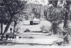 | Judith River Ranger Station | district | 1992 | 92000333 |
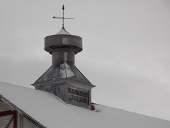 | Meadowbrook Stock Farm | building | 1992 | 91001938 |
| Wood Lawn Farm | building | 1993 | 92001762 |
Every wildfire the federal occurrence database records inside this county: 138 of them, burning about 21,141 acres. 84 started naturally and 1 was recorded as arson. Each settlement page carries the fires within five miles of it.
| Reported cause | Fires |
|---|---|
| Natural | 84 |
| Recreation and ceremony | 19 |
| Missing data/not specified/undetermined | 16 |
| Equipment and vehicle use | 9 |
| Debris and open burning | 4 |
| Smoking | 2 |
| Power generation/transmission/distribution | 2 |
| Arson/incendiarism | 1 |
| Railroad operations and maintenance | 1 |
The five largest, by the area the report gives. None of them was recorded as arson.
| Date | Cause | Size | Reported by | Name on the report |
|---|---|---|---|---|
| 2 September 2020 | Equipment and vehicle use | 5,642 acres | Judith Basin County | LOUSE CREEK |
| 3 October 2020 | Missing data/not specified/undetermined | 5,309 acres | Helena - Lewis and Clark National Forest | YOGO |
| 5 October 2020 | Missing data/not specified/undetermined | 2,858 acres | Cascade County | TOWER FIRE |
| 2 February 2020 | Power generation/transmission/distribution | 2,700 acres | Judith Basin County | EAGLE ROCK ROAD |
| 2 August 2000 | Natural | 1,300 acres | Helena - Lewis and Clark National Forest | LOST FORK RIDGE |
| 21 June 2007 | Natural | 1,146 acres | Helena - Lewis and Clark National Forest | MIDDLE FORK |
| 2 August 2008 | Natural | 743 acres | Helena - Lewis and Clark National Forest | RUSSIAN FLATS |
| 28 July 1999 | Natural | 564 acres | Helena - Lewis and Clark National Forest | SPRING CREEK |
Every settlement page carries the fires within five miles of it - see the settlement index below.
The NOAA Storm Events Database holds 247 reports for this county, causing no deaths, 1 injury and about $905,250 in recorded property damage. Each settlement page carries the reports that name it.
| Kind of event | Reports |
|---|---|
| Hail | 149 |
| Thunderstorm Wind | 57 |
| Tornado | 16 |
| Heavy Rain | 9 |
| Funnel Cloud | 6 |
| Flood | 5 |
| Wildfire | 4 |
| Flash Flood | 1 |
The most serious of them, by death, then injury, then recorded damage. The accounts are quoted exactly as the forecast office filed them.
| When | Event | Place named | Harm | What the report says |
|---|---|---|---|---|
| July 1965 | Tornado (F2) | not stated | 1 hurt, $25,000 | no account filed |
| April 1994 | Tornado (F2) | Stanford | $500,000 | The Bill Skelton ranch was hit by two tornadoes. Damage was extensive. A barn roof made from 8 to 12 inch logs was carried away. A two foot in diameter cottonwood tree was snapped five feet above the ground. A 24-foot horse trailer was picked up and carried 65 yards landing on its top and it hit and damaged a tractor enroute. A 1.5 ton truck was tipped over and an out building made from heavy beams and spiked down was twisted and moved. A mobile home was lifted and a large fuel tank was deposited under it. Several one ton hay bales were moved 20-30 yards. Golf ball-sized hail fell ahead of the tornadoes and covered the ground to a depth of five inches. |
| May 1977 | Tornado | not stated | $250,000 | no account filed |
| May 2011 | Flood | Raynesford | $50,000 | Several roads were washed out including the Utica area and areas south of Stanford and Hobson. |
| April 1994 | Tornado (F2) | Stanford | $50,000 | The Bill Skelton ranch was hit by two tornadoes. Damage was extensive. A barn roof made from 8 to 12 inch logs was carried away. A two foot in diameter cottonwood tree was snapped five feet above the ground. A 24-foot horse trailer was picked up and carried 65 yards landing on its top and it hit and damaged a tractor enroute. A 1.5 ton truck was tipped over and an out building made from heavy beams and spiked down was twisted and moved. A mobile home was lifted and a large fuel tank was deposited under it. Several one ton hay bales were moved 20-30 yards. Golf ball-sized hail fell ahead of the tornadoes and covered the ground to a depth of five inches. |
| May 1977 | Tornado | not stated | $25,000 | no account filed |
| July 2000 | Hail | Raynesford | $5,000 | Damaged cars. |
| July 1957 | Tornado (F1) | not stated | $250 | no account filed |
| June 2025 | Thunderstorm Wind | Geyser | - | Mesonet station MTGYS Geyser measured a 50 kt gust. |
| June 2025 | Hail | Hobson | - | Spotter reports golf ball to egg size hail. Tree damage was also observed. |
| June 2025 | Hail | Hobson | - | Golf ball to egg size hail reported. Additionally, hail damage to vehicle and campers was reported. |
| June 2025 | Hail | Moccasin | - | Report from social media showed golf ball sized hail as well as significant damage to outdoor play equipment and shattered skylights and windows. Time estimated from radar. |
| June 2025 | Hail | Utica | - | Post event report received via social media. Size estimated from photo of hail in the palm of a hand. |
| June 2025 | Hail | Benchland | - | Public report of quarter sized hail around Benchland. |
| June 2025 | Hail | Benchland | - | Public caller updated with golf ball sized hail a few minutes after initial call. |
| June 2025 | Hail | Benchland | - | Trained spotter reports hail of quarter size to half dollar size along US-87 between Moccasin and Windham. Damage to automobiles reported as well. |
| July 2025 | Thunderstorm Wind | Moccasin | - | Mesonet station MTM09 2.1 W Moccasin measured a 60 mph wind gust. |
| July 2025 | Thunderstorm Wind | Sipple | - | Montana mesonet sensor Judith Gap measured a 63 mph wind gust. |
| September 2025 | Thunderstorm Wind | Sipple | - | Report via media: Funnel cloud was observed picking up dust for about 45 seconds and believed to have touched the ground. Location was about 6 mi south of Buffalo and 2 mi west of Garneill. No damages were reported with the landspout. |
| June 2024 | Hail | Hobson | - | Trained spotter reported 1 to 2 inch hail with torrential rainfall. The hail completely covered the ground, making it white. |
| June 2024 | Hail | Moccasin | - | Quarter-sized hail fell for approximately 20 minutes. Damage to crops observed. |
| June 2024 | Hail | Hobson | - | Trained spotter reports golf ball sized hail. |
| June 2024 | Hail | Benchland | - | Trained spotter reports 1 inch hail. |
| August 2024 | Thunderstorm Wind | Geyser | - | MDT sensor MTGYS Geyser measured a severe wind gust. |
| August 2024 | Thunderstorm Wind | Merino | - | AWOS station K1BM Bravo measured a severe gust. |
| August 2024 | Thunderstorm Wind | Merino | - | AWOS sensor K1CM Charlie near Geyser measured a 60 mph gust. |
| June 2023 | Thunderstorm Wind | Geyser | - | Measured at site MTGYS near Geyser. |
| August 2023 | Thunderstorm Wind | Windham | - | Measured by military AWOS site k1cm Charlie. |
| August 2022 | Thunderstorm Wind | Windham | - | Awos k1cm Charlie. |
| July 2022 | Funnel Cloud | Windham | - | Funnel cloud observed halfway to the ground to the northwest of the observers locations (5 miles SW of Windham). |
| July 2022 | Heavy Rain | Hobson | - | Trained spotter reported heavy rainfall from thunderstorms. |
| July 2022 | Tornado (EF0) | Stanford | - | A brief and non impactful tornado was observed across Skull Butte. Very low funnel cloud well photographed and documented by spotter. Multiple photos show funnel nearly on the ground. Time of event, path length, and duration derived from spotter information and radar. |
| July 2022 | Thunderstorm Wind | Geyser | - | Mesonet station MTGYS (Geyser) measured a 58 mph wind gust. |
| July 2022 | Funnel Cloud | Raynesford | - | Trained spotter driving from Lewistown to Great Falls, indicated the funnel cloud just ESE of Raynesford. |
| July 2022 | Funnel Cloud | Stanford | - | In addition to quarter size hail, funnel cloud was observed due west of spotters locations (5 miles SW of Stanford). |
| July 2022 | Hail | Moccasin | - | Pictures submitted via social media of golf ball to egg size hail near Moccasin. |
| July 2022 | Hail | Hobson | - | Hail around quarter size falling near Hobson. Report from a storm chaser. |
| July 2022 | Hail | Hobson | - | Trained spotter reported hail up to golf ball size falling in Hobson. |
| July 2022 | Hail | Stanford | - | Trained spotter reported 1 inch hail 5 miles SW near Stanford. |
| June 2021 | Thunderstorm Wind | Hobson | - | Strong wind gusts estimated around 60mph with sustained winds around 30 to 40 MPH. |
| June 2021 | Hail | Hobson | - | Spotter reports 1 to 1.25 inch hail south of Hobson near Black Bull RD. |
| May 2020 | Thunderstorm Wind | Geyser | - | MDT station at Geyser reports a 52 kt (60 mph) thunderstorm wind gust. |
| May 2020 | Hail | Moccasin | - | Public reports 1.25 inch diameter hail. |
| July 2020 | Thunderstorm Wind | Hobson | - | Trained spotter estimates 52 kt (60 mph) thunderstorm wind gust by sway of trees, dense blowing dust along with near visibility was also observed. |
| July 2020 | Hail | Stanford | - | Photo of quarter size hail was sent via twitter. |
| August 2020 | Hail | Raynesford | - | Posted on Twitter. |
| August 2020 | Hail | Raynesford | - | During a period of time from 450 PM to 500 PM, dime to quarter-size hail fell, along with torrential downpour of large rain drops. Spotter reports the ground partially covered with hail. |
| August 2020 | Hail | Geyser | - | Quarter-size hail in Geyser for 10 min. |
| May 2019 | Flood | Utica | - | Fergus County Sheriff reported flooding near Utica. Exact duration of flooding unknown. |
| June 2019 | Hail | Hobson | - | One inch hail measured by trained spotter. |
| June 2019 | Hail | Benchland | - | One inch hail measured. |
| June 2019 | Tornado (EF0) | Benchland | - | Tornado near Benchland at 510 PM. Classified as an EF0 Tornado with a peak wind estimated between 75 and 85 MPH. It was 400 yards wide and was on the ground for about a quarter of a mile. The tornado lifted near 515 PM. |
| June 2019 | Thunderstorm Wind | Merino | - | K1BM bravo awos station. |
| July 2019 | Flood | Sipple | - | Floodwater was flowing across property on West Buffalo Creek. The Floodwaters were up to four feet deep and the floodwater channel was about 100 yards wide. |
| July 2019 | Hail | Hobson | - | Trained spotter reported 1 inch sized hail. |
| July 2019 | Heavy Rain | Hobson | - | Trained spotter reported .74 inches of rain in about 20 minutes. |
| July 2018 | Hail | Utica | - | Spotter 9-miles southwest of Utica reported quarter-size hail and strong winds. |
| May 2018 | Tornado (EF0) | Sipple | - | KRTV received multiple photos of a tornado six-miles southwest of Moore, MT. Tornado moved southward and lasted about five-minutes per observer. Path length and maximum path width were estimated. |
| June 2018 | Hail | Benchland | - | Spotter reported ping pong ball-size hail 2-miles NW of Benchland. |
| June 2018 | Hail | Geyser | - | Storm chaser estimated quarter-size hail in Geyser. Vehicle had minor hail damage. |
The Survey's mineral resources record lists 144 workings inside this county. 7 still produce and 137 are closed or unrecorded. Each settlement page carries the workings within five miles of it.
| Commodity | Workings |
|---|---|
| Silver | 67 |
| Lead | 23 |
| Zinc, Lead | 20 |
| Lead, Zinc | 17 |
| Iron | 13 |
| Clay | 12 |
| Gold | 11 |
| Gypsum-Anhydrite | 11 |
| Copper | 8 |
| Silver, Lead, Zinc | 3 |
| Gold, Copper | 3 |
| Sapphire | 3 |
| Stone, Crushed/Broken | 3 |
| Gold, Zinc | 2 |
The least common of them first, because a county's hundredth gravel pit says nothing its first ten did not.
| Where | Site | Commodity | Status | Recorded |
|---|---|---|---|---|
| Barker | Lead, Zinc, Silver | Producer | Galena, Marmatite, Pyrite, Sphalerite | |
| Bell and Southern Bell | Silver, Cadmium, Lead, Zinc | Past Producer | ||
| Ben Franklin,Sarsfield,Sheridan C | Copper, Gold, Iron, Silver, Tungsten | Past Producer | 1882 | |
| Bessie | Sulfur, Lead, Silver | Prospect | ||
| Block P Mine | Silver, Lead, Zinc, Gold, Copper, Tungsten, Molybdenum | Past Producer | 1879, 1880 | |
| Blue Dick Mine | Tungsten, Silver, Molybdenum, Iron, Gold, Copper | Past Producer | 1878, 1893 | |
| Doktor Kalloch Mine | Zinc, Silver, Gold, Lead, Copper | Past Producer | 1887, 1888 | |
| Hughesville | Silver, Copper, Zinc, Lead | Occurrence | Stockwork | |
| Leonard | Silver, Lead, Copper | Unknown | ||
| Leonard Ii | Copper, Gold, Iron, Lead, Silver, Zinc | Prospect | ||
| Liberty Group | Silver, Lead, Zinc, Gold, Copper, Molybdenum, Tungsten, Cadmium, Arsenic, Antimony | Past Producer | 1875, 1897 | |
| Liberty Mine | Silver, Lead, Gold, Zinc | Past Producer | ||
| M&M Mines | Manganese | Prospect | ||
| May & Edna | Lead, Zinc, Gold | Past Producer | ||
| Middle Fork | Silica | Prospect | ||
| Nancy Lou Mine | Iron, Gold, Silver, Copper | Occurrence | ||
| New Deal | Copper, Gold, Iron | Past Producer | ||
| Our Only Chance | Gold, Zinc, Silver, Lead, Copper | Unknown | ||
| Running Wolf Deposit | Titanium, Metal, Copper, Iron | Prospect | 1887 | |
| Running Wolf Iron Deposits | Titanium, Iron | Past Producer | 1883, 1956 | |
| San Miguel Mine | Silver, Zinc, Lead, Gold | Prospect | ||
| Sand Coulee Siderite Deposits | Iron, Coal | Past Producer | ||
| St. Louis Mine | Lead, Silver, Zinc | Past Producer | ||
| Tiger, Moulton, and T.W. Mines | Lead, Zinc, Silver | Past Producer | ||
| Unnamed Pumice | Pumice | Occurrence | ||
| Weatherwax and King Claims | Copper, Gold, Iron, Lead, Silver | Past Producer | 1879 | |
| Yogo No. 10 Claim | Silver, Barium-Barite | Unknown | ||
| Yogo Peak Deposits | Tungsten | Occurrence | Scheelite | |
| Yogo Peak Mine | Lead, Iron, Zinc | Past Producer | ||
| Yogo Pk | Tungsten, Gemstone, Gold | Producer | ||
| Yogo Sapphire Mine | Gemstone | Producer | 1880, 1895 | |
| California | Lead, Gold, Zinc | Past Producer | ||
| Iroquois Prospect | Iron, Gold, Zinc | Prospect | ||
| American Yogo Sapphire Mine | Sapphire | Producer | 1896 | |
| Blacktail Hills | Stone, Crushed/Broken | Occurrence | ||
| Iron Cap Claim | Iron, Gold, Copper | Prospect | ||
| Lone Tree Dome | Stone, Crushed/Broken | Occurrence | ||
| New Mine Saphire Syndicate Mine | Sapphire | Producer | 1894, 1895 | |
| Ruby | Silver, Stone, Crushed/Broken | Unknown | ||
| Tiger, Moulton, and Tw Group | Silver, Lead, Zinc, Gold, Copper | Past Producer | 1884, 1890 | |
| Vortex | Sapphire | Producer | ||
| Finlander | Copper, Iron | Prospect | ||
| Hill Side No. 3 Claim | Copper | Unknown | ||
| Lone Star | Silver, Copper | Unknown | ||
| Ole Grendal Et | Silver, Copper | Unknown | ||
| Vancor Group | Silver, Copper | Unknown | ||
| Yogo No. 11 | Copper | Unknown | ||
| Bourke-Larson | Gold | Past Producer | ||
| Della and Quaker City | Gold, Lead | Past Producer | ||
| Disson Deposit | Gypsum-Anhydrite | Occurrence | ||
| Goldbug | Gold, Silver | Past Producer | ||
| Hughesville Project | Gold, Silver | Past Producer | ||
| J.W. Sisson Gypsum Deposit | Gypsum-Anhydrite | Prospect | ||
| Kibbey Deposit | Gypsum-Anhydrite | Occurrence | ||
| King Creek Mines | Gold, Silver | Unknown | ||
| Little Emma | Gold | Past Producer | ||
| Mary Mountain Gypsum Mine | Gypsum-Anhydrite | Producer | ||
| Pig Eye Basin Gypsum | Gypsum-Anhydrite | Prospect | ||
| Remington Deposit | Gypsum-Anhydrite | Occurrence | ||
| South Fork Placer | Gold | Unknown | ||
| T.C. Power | Gold | Past Producer | ||
| Tiger Mine | Gold, Silver | Past Producer | ||
| Unnamed Gypsum | Gypsum-Anhydrite | Occurrence | ||
| Unnamed Gypsum Occurrence | Gypsum-Anhydrite | Occurrence | ||
| Unnamed Gypsum Occurrence | Gypsum-Anhydrite | Occurrence | ||
| Unnamed Gypsum Occurrence | Gypsum-Anhydrite | Occurrence | ||
| Wolf Butte Deposit | Gypsum-Anhydrite | Occurrence | ||
| Yogo Creek Placer | Gold | Unknown | ||
| Kolar & Sons Bentonite Deposit | Clay | Past Producer | ||
| Kolar Bentonite | Clay | Prospect | ||
| Unnamed Clay | Clay | Unknown | ||
| Unnamed Clay | Clay | Unknown | ||
| Unnamed Clay | Clay | Unknown | ||
| Unnamed Clay | Clay | Unknown | ||
| Unnamed Clay | Clay | Unknown | ||
| Unnamed Clay Occurerence | Clay | Occurrence | ||
| Unnamed Clay Occurrence | Clay | Occurrence | ||
| Unnamed Clay Occurrence | Clay | Occurrence | ||
| Unnamed Clay Occurrence | Clay | Occurrence | ||
| Unnamed Clay Occurrence | Clay | Occurrence | ||
| Dewey | Iron | Occurrence | ||
| Hell Creek Claims | Iron | Occurrence | ||
| Iron Occurrence | Iron | Occurrence | ||
| Iron Ore Deposits Near Yogo Peak | Iron | Occurrence | ||
| Sage Creek Iron Deposit | Iron | Prospect | 1949 | |
| Skunk Creek Deposit | Iron | Occurrence | ||
| Whittaker Ridge | Iron | Prospect | ||
| Willow Creek Deposit | Iron | Past Producer | 1956 | |
| Annie E Tunnel of Liberty Mine | Silver, Lead, Zinc | Prospect | ||
| Chesapeake Tunnel | Silver, Lead, Zinc | Prospect | ||
| Danny T Tunnel of Liberty Mine | Silver, Lead, Zinc | Prospect | ||
| Dockter Kalloch | Silver, Lead, Zinc | Past Producer | ||
| Harrison | Silver, Lead, Zinc | Past Producer | ||
| Last Chance Tunnel of Liberty Mine | Silver, Lead, Zinc | Prospect | ||
| Magnolia Mine | Silver, Lead, Zinc | Prospect | ||
| Marcelline Tunnel No. 2 of Liberty | Silver, Lead, Zinc | Prospect | ||
| Mayflower Tunnel | Silver, Lead, Zinc | Prospect | ||
| Mcveda | Silver, Lead, Zinc | Prospect | ||
| Middle Tunnel of May and Edna | Silver, Lead, Zinc | Prospect | ||
| Oasis | Silver, Lead, Zinc | Prospect | ||
| Spruce Tunnel | Silver, Lead, Zinc | Prospect | ||
| St. Charles | Silver, Lead, Zinc | Prospect | ||
| St. Partick | Silver, Lead, Zinc | Prospect | ||
| Tiger Mine | Silver, Lead, Zinc | Past Producer | ||
| August No. 2 Tunnel of Liberty Mine | Silver, Zinc, Lead | Prospect | ||
| Cape Nome Mine | Silver, Zinc, Lead | Past Producer | ||
| Carter Shaft | Silver, Zinc, Lead | Prospect | ||
| Double Eff | Silver, Zinc, Lead | Prospect | ||
| Frances Tunnel of Liberty Mine | Silver, Zinc, Lead | Prospect | ||
| Lucky Strike | Silver, Zinc, Lead | Prospect | ||
| Main Tunnel of Liberty Mine | Silver, Zinc, Lead | Prospect | ||
| Marcelline Tunnel No. 1 of Liberty | Silver, Zinc, Lead | Prospect | ||
| McKinley | Silver, Zinc, Lead | Prospect | ||
| Moulton Mine | Silver, Zinc, Lead | Past Producer | ||
| Myrtle-Navy | Silver, Zinc, Lead | Prospect | ||
| Paragon | Silver, Zinc, Lead | Past Producer | ||
| Paragon Tunnel | Silver, Zinc, Lead | Prospect | ||
| Philharmonic | Silver, Zinc, Lead | Prospect | ||
| Phoenix | Silver, Zinc, Lead | Prospect | ||
| Plymouth Rock | Silver, Zinc, Lead | Prospect | ||
| Queen of the Hills | Silver, Zinc, Lead | Prospect | ||
| Shaft of May and Edna | Silver, Zinc, Lead | Prospect | ||
| Sinclair | Silver, Zinc, Lead | Prospect | ||
| Snow Drift Tunnel | Silver, Zinc, Lead | Prospect | ||
| Blankenship Mine | Lead, Silver | Prospect | ||
| Carter | Lead, Silver | Past Producer | ||
| Christopher Columbus | Lead, Silver | Prospect | ||
| Forest Lode | Silver, Lead | Prospect | ||
| Galena | Silver, Lead | Unknown | ||
| Mountainside and Last Chance | Silver, Lead | Prospect | ||
| Oscar Helsing | Silver, Lead | Prospect | ||
| Pierce-Higbee | Silver, Lead | Past Producer | ||
| Pride of the West | Lead | Past Producer | ||
| Queen Esther Claim | Lead | Past Producer | ||
| Setter Mine | Silver, Lead | Past Producer | ||
| Silver Gulch Mine | Lead, Silver | Past Producer | ||
| Sir Walter Scott & Mystery | Lead, Silver | Past Producer | ||
| Sweepstakes | Silver, Lead | Occurrence | ||
| Top Hand | Lead, Silver | Past Producer | ||
| Woodhurst & Mortson | Lead, Silver | Past Producer | ||
| Yankee Girl | Lead, Silver | Past Producer | ||
| Eagle Eye Claim | Silver | Unknown | ||
| Old Mack | Silver | Unknown | ||
| Overlook Claim | Silver | Unknown |
Named settlements recorded in the Geographic Names Information System, each with the topographic sheets covering it. Villages, hamlets and abandoned places alike. Each is shown with the nearest named watercourse or landform and the survey quadrangle it falls on.
Geyser census division · 59463 · On Bend Gulch Creek · Barker quadrangle
16 sheets, 1890 to 1995
Hobson census division · 59479 · Near Bear Gulch · Bandbox Mountain quadrangle
18 sheets, 1886 to 1995
No longer a settlement
Geyser census division · 59447 · Near Crow Coulee · Geyser quadrangle
13 sheets, 1890 to 1984
Geyser census division · 59463 · On Daisy Creek · Barker quadrangle
16 sheets, 1890 to 1995
Geyser census division · 59469 · Near Peterson Coulee · Limestone Butte quadrangle
16 sheets, 1890 to 1995
No longer a settlement
Stanford census division · 59479 · On Spring Branch · Windham quadrangle
13 sheets, 1890 to 1984
Geyser census division · 59469 · On Little Otter Creek · Raynesford quadrangle
13 sheets, 1890 to 1995
No longer a settlement
Hobson census division · 59452 · Ackley Lake quadrangle
11 sheets, 1889 to 1993
No longer a settlement
Geyser census division · 59469 · On Little Otter Creek · Raynesford quadrangle
13 sheets, 1890 to 1995
Hobson census division · 59452 · Near Missouri Coulee · Woodhurst Mountain quadrangle
18 sheets, 1886 to 1995
Stanford census division · 59479 · On Spring Branch · Windham quadrangle
13 sheets, 1890 to 1984
Hobson census division · 59464 · On Little Trout Creek · Sipple quadrangle
11 sheets, 1889 to 1993
Geyser census division · 59479 · On North Fork Surprise Creek · Merino quadrangle
13 sheets, 1890 to 1984
Hobson census division · 59452 · Near Heiserman Coulee · Utica quadrangle
16 sheets, 1886 to 1984
Hobson census division · 59452 · On Yogo Creek · Indian Hill quadrangle
17 sheets, 1886 to 1995
The vanished settlements of Judith Basin County: the places named above that are no longer on the map.