 Block
From the record
9 National Register listings published here.
Sources: the National Register database, National Park Service
73 topographic sheets cover 39 settlements here, and 9 properties are on the National Register of Historic Places.
9 National Register listings published here.
Sources: the National Register database, National Park Service
Every property in this county listed on the National Register of Historic Places, with the year it was listed and the federal nomination document.
| Photograph | Property | Type | Listed | Reference |
|---|---|---|---|---|
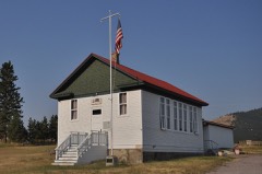 | Big Arm School | building | 2007 | 07000816 |
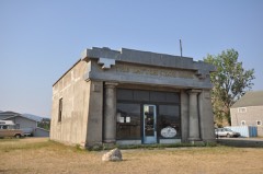 | Dayton State Bank | building | 2012 | 12000829 |
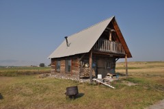 | Fort Connah Site | building | 1982 | 82003173 |
| Kootenai Lodge Historic District | district | 1984 | 84002476 | |
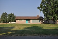 | Don E. Olsson House and Garage | building | 2009 | 08001325 |
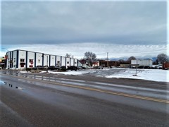 | Polson Feed Mill | building | 1980 | 80002423 |
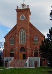 | St. Ignatius Mission | building | 1973 | 73001053 |
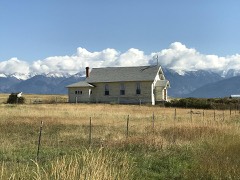 | St. Joseph's Catholic Church | building | 1999 | 99000345 |
| Swan Lake Rock House Historic District | district | 1984 | 84002485 |
Every wildfire the federal occurrence database records inside this county: 1,738 of them, burning about 46,064 acres. 513 started naturally and 70 were recorded as arson. Each settlement page carries the fires within five miles of it.
| Reported cause | Fires |
|---|---|
| Recreation and ceremony | 549 |
| Natural | 513 |
| Debris and open burning | 217 |
| Missing data/not specified/undetermined | 156 |
| Equipment and vehicle use | 101 |
| Arson/incendiarism | 70 |
| Fireworks | 55 |
| Power generation/transmission/distribution | 34 |
| Smoking | 17 |
| Misuse of fire by a minor | 12 |
| Other causes | 7 |
| Railroad operations and maintenance | 6 |
| Firearms and explosives use | 1 |
The five largest, by the area the report gives. Three of them were set deliberately.
| Date | Cause | Size | Reported by | Name on the report |
|---|---|---|---|---|
| 13 August 2012 | Equipment and vehicle use | 9,864 acres | Flathead Agency | WEST GARCEAU |
| 2 September 1998 | Arson/incendiarism | 7,038 acres | Lolo National Forest | BOYER |
| 28 July 2012 | Natural | 5,500 acres | Flathead National Forest | CONDON MOUNTAIN |
| 9 August 2006 | Natural | 3,800 acres | Flathead Agency | ASHLEY LAKE |
| 24 July 2007 | Natural | 3,045 acres | Flathead Agency | GARCEAU |
| 13 August 2011 | Missing data/not specified/undetermined | 2,160 acres | Flathead National Forest | SOUTH FORK LOST CK |
| 27 July 2013 | Arson/incendiarism | 1,570 acres | Flathead Agency | FIRESTONE |
| 30 August 2018 | Arson/incendiarism | 1,375 acres | Flathead Agency | RATTLESNAKE |
Every settlement page carries the fires within five miles of it - see the settlement index below.
The NOAA Storm Events Database holds 111 reports for this county, causing no deaths, no injuries and about $894,800 in recorded property damage. Each settlement page carries the reports that name it.
| Kind of event | Reports |
|---|---|
| Hail | 48 |
| Thunderstorm Wind | 46 |
| Heavy Rain | 6 |
| Tornado | 4 |
| Lightning | 2 |
| Flood | 2 |
| Funnel Cloud | 1 |
| Storm Surge/Tide | 1 |
| Waterspout | 1 |
The most serious of them, by death, then injury, then recorded damage. The accounts are quoted exactly as the forecast office filed them.
| When | Event | Place named | Harm | What the report says |
|---|---|---|---|---|
| May 1993 | Thunderstorm Wind | Swan Lake | $500,000 | Many trees were blown down with the loss of power and telephone. |
| July 2009 | Lightning | St Ignatius | $140,000 | A home in St. Ignatius was completely burned down and destroyed by a lightning strike. |
| June 2022 | Thunderstorm Wind | Moiese | $50,000 | Multiple large, mature Colorado spruce and ponderosa pine trees were blown down along with smaller deciduous trees across the Mission Valley. Shingle damage also occurred on several homes with power outages in Pablo. |
| May 1994 | Thunderstorm Wind | Swan Lake | $50,000 | no account filed |
| July 2007 | Thunderstorm Wind | Pablo | $30,000 | National Weather Service storm survey crew saw numerous trees and several power poles down along the storm's track. Two structures received roof damage. The damage observed was indicative of straight line winds. A flag pole was bent in half southwest of Polson. Based upon the damage observed, winds were estimated to be between 80 to 100 mph. |
| March 1991 | Tornado (F0) | not stated | $25,000 | no account filed |
| March 2003 | Thunderstorm Wind | Ronan | $20,000 | no account filed |
| May 2020 | Thunderstorm Wind | Big Arm | $10,000 | Numerous tree damage led to power outages and blocked roadways. Damage was noted on both sides of Flathead Lake, but damage was most concentrated near Polson, Dayton, and Finley Point. |
| March 2013 | Thunderstorm Wind | Polson | $8,300 | A 72 foot, 26 inch diameter Douglas Fir fell down from very strong thunderstorm winds and crashed onto owners' house. Soil moisture was relatively dry, but as seen in photo much of the branches on the trunk except at the top had already been cut off before this event. A forester examined the tree and found that its roots had been cut on the west side of the tree before the event. |
| July 2008 | Thunderstorm Wind | Swan Lake | $8,000 | Sheriff reported 30 trees blown down over Highway 83 10 miles northwest of Condon. |
| July 2007 | Tornado (EF0) | Pablo | $8,000 | The public reported a tornado 10 miles west northwest of Pablo and also a waterspout over Flathead Lake north of Polson. In addition, a sail boat (located on the Flathead County/Lake County line) was spun around at least once in a counterclockwise direction and then sank. |
| July 2010 | Thunderstorm Wind | Swan Lake | $6,000 | The Lake County Emergency Manager reported trees blown down on Highway 35 near Blue Bay along Flathead Lake. |
| July 2010 | Hail | Charlo | $6,000 | A trained spotter relayed that their neighbor received golf ball sized hail that left dents in their car and caused damage to their corn crop. |
| August 2024 | Thunderstorm Wind | St Ignatius | $5,000 | A lot of trees down around St. Ignatius. The wind picked up a turkey pen and flipped it upside down. Trees and power lines were also downed in Kicking Horse and Polson. |
| August 2022 | Hail | Moiese | $5,000 | Ping pong size hail, very heavy rain, and gusty winds were reported at the National Bison Range. A hay crop was destroyed near St. Ignatius. Hail damaged an RV roof. |
| June 2021 | Thunderstorm Wind | Ronan | $5,000 | Several live trees were uprooted as thunderstorm outflow winds moved from southwest to northeast across the Mission Valley. Power outages and one report of minor vehicle damage from a falling tree branch were reported. |
| July 2008 | Hail | Charlo | $5,000 | Car dealership 5 miles south of Ronan reported 0.88 inch hail and damage to vehicles in the car lot. |
| July 2008 | Thunderstorm Wind | Swan Lake | $5,000 | Public reported widespread tree damage near Lion Creek northeast of Condon. Many spruce trees 1.5 feet in diameter snapped. |
| May 2023 | Tornado (EF0) | St Ignatius Arpt | $2,000 | A thunderstorm moved through the Mission Valley, near St. Ignatius and produced a tornado as confirmed by multiple public reports and social media pictures. It briefly touched down and caused some minor property damage. Metal roofing was torn off a farm outbuilding, and minor shingle damage occurred at a house. |
| June 2016 | Thunderstorm Wind | Charlo | $2,000 | A 25 foot power pole was snapped by the wind in Charlo, MT. The wind was strong enough to make it difficult for resident to open his front door. |
| July 2022 | Hail | Rollins | $1,000 | A spotter in Bigfork, MT sent in a photo showing 1 1/2 inch hail. Near Lakeside on Flathead Lake a cherry orchard reported a total loss of their cherry and apple crop from 125 trees, and they had to replace all their screens on one side of the house and a larger cherry producer in Bigfork reported a total loss. |
| August 2019 | Thunderstorm Wind | Dayton | $1,000 | Estimated winds to 60 mph caused waves to 4 feet on Flathead Lake and power outages in the Dayton area. |
| June 2016 | Heavy Rain | Charlo | $1,000 | A resident in Charlo, MT reported 0.80 inches of rain in 10 min with minor street flooding. |
| August 2015 | Thunderstorm Wind | St Ignatius | $1,000 | Power lines and trees were downed by the wind. One of the trees that was knocked over was 18 inches in diameter. |
| August 2013 | Thunderstorm Wind | Rollins | $500 | A trained spotter from Woods Bay reported power outages with at least one tree snapped in half. |
| August 2024 | Hail | Moiese | - | The public reported two rounds of hail in and around the Bison Range. They reported wind gusts to 53 mph with the first round of hail. |
| August 2024 | Hail | Swan Lake | - | The public measured 1.5 inch hail near Ferndale east of Big Fork. |
| July 2024 | Thunderstorm Wind | Arlee | - | A person from the public reported that there were dozens of trees down on forest service roads east and northeast of Arlee. |
| July 2022 | Hail | Elmo | - | There was a report of 1.25 hail from a storm that traversed the southern portions of Flathead Lake. Two greenhouse businesses in Jette, MT reported nickel size hail, or 7/8. A greenhouse received significant damage. |
| July 2022 | Hail | Rollins | - | This storm that moved generally from Lakeside northeast to the Flathead Valley just north of Echo Lake produced two reports of 1 inch hail. One of those reports was from Somers and the other along HWY-35 just north of Bigfork, MT. |
| July 2022 | Hail | Charlo | - | One inch hail was reported in Charlo, MT. |
| July 2022 | Hail | Ravalli | - | Two reports of large hail were received, one of .88 around Ravalli ,MT and the second of 1 just south of Ninepipes Reservoir. |
| July 2022 | Hail | Polson Arpt | - | Both the Flathead Bio Station and a spotter 13 mi northeast of Polson reported 1/2 inch hail, resulting in unknown quantity of plant and leaf damage. |
| June 2022 | Hail | Southern Cross | - | A Facebook report of 1.00 inch hail in Arlee. |
| June 2020 | Hail | Big Arm | - | A photo on social media showed several hailstones that were a little larger than a quarter. Also hail was reported to have accumulated several inches in the storm's path. |
| September 2019 | Heavy Rain | Polson | - | General rainfall of 1 to 2 inches fell across parts of the Flathead and Mission valleys eastward to the Continental Divide. Heavier amounts of 3 to 4 inches fell locally on the east side of Flathead Lake and in the Mission Mountains, which were near record 2-day totals for the month of September. Also, minor debris flows were noted on Hwy 35 between Bigfork and Polson with some water into the Bigfork after-school building. |
| March 2014 | Flood | Round Butte | - | A driveway was completely washed out by a flood, presumably caused by snowmelt and very warm temperatures. |
| July 2013 | Hail | Rollins | - | A trained spotter on the east side of Flathead Lake reported an estimated 1 hail with no damage to cherry trees. |
| July 2013 | Hail | Moiese | - | A thunderstorm outflow boundary triggered another cell that grew in strength over higher terrain west of Moiese. This thunderstorm produced hail one inch in diameter, as reported by personnel at the National Bison Range. |
| August 2013 | Thunderstorm Wind | Dayton | - | A NWS employee reported trees bending with one large tree blown down. The waves on Flathead lake were the highest she had ever seen. |
| June 2012 | Thunderstorm Wind | Swan Lake | - | The highway department reported several trees blown down across highway MT-83 near mile marker 48. |
| October 2012 | Heavy Rain | Swan Lake | - | A spotter measured 0.34 inch rainfall in 1 hour. |
| October 2011 | Heavy Rain | Ronan | - | Equipment at Ronan reported 0.89 inches of rainfall in 12 hours. |
| October 2011 | Heavy Rain | St Ignatius | - | Rainfall of 0.91 inches was reported by a trained spotter. |
| July 2011 | Hail | Rollins | - | Ping pong ball sized hail was measured at Yellow Bay. |
| July 2011 | Hail | Rollins | - | The public reported 2 inch diameter hail that occurred for about three minutes at Yellow Bay. |
| July 2011 | Hail | Arlee | - | A trained spotter NNW of Arlee measured 0.88 inch hail. |
| July 2011 | Hail | St Ignatius | - | The public estimated 1.00 inch hail in Saint Ignatius. |
| July 2011 | Hail | Big Arm | - | The public measured 1.00 inch hail that covered the ground. |
| September 2011 | Tornado (EF0) | Polson Arpt | - | A waterspout formed over Skidoo Bay and remained over water. No damage was reported. |
| July 2010 | Thunderstorm Wind | Elmo | - | The public reported four trees blown down from thunderstorm winds at Lake Mary Ronan State Park. |
| May 2009 | Hail | Polson | - | Public reported nickel size hail and heavy rain from thunderstorm over the Irvine Flats area. |
| July 2008 | Hail | Ronan | - | Spotter reported 1.50 inch hail 7 miles south of Ronan. |
| June 2007 | Thunderstorm Wind | Polson | - | The lodge owner in Wood's Bay reported an estimated wind gust to 60 mph about 1 mile east of town. |
| June 2007 | Thunderstorm Wind | St Ignatius | - | An agrimet weather station reported a wind gust of 73 mph. In addition, numerous trees were blown down near McDonald Lake road. St. Ignatius experienced power outages. |
| June 2007 | Hail | St Ignatius | - | A weather spotter reported hail stones up to one inch in diameter 6 miles north of St. Ignatius. |
| June 2007 | Hail | St Ignatius | - | A weather spotter reported penny sized hail near St. Ignatius. |
| June 2007 | Thunderstorm Wind | Ronan | - | Thunderstorm winds were reported to have blown down several trees and large limbs down onto power lines. |
| July 2007 | Thunderstorm Wind | Ravalli | - | Severe thunderstorm winds blew down a large tree and several large branches in Ravalli. |
| September 2000 | Storm Surge/Tide | Elmo | - | An arctic front from the north moved over Flathead Lake generating strong gusty winds to 50 mph. Winds over the lake generated waves from 6 to 10 feet high, which damaged docks and piers along the lake shore. Several boats also sank from high waves. |
The Survey's mineral resources record lists 61 workings inside this county. 2 still produce and 59 are closed or unrecorded. Each settlement page carries the workings within five miles of it.
| Commodity | Workings |
|---|---|
| Sand and Gravel, Construction | 41 |
| Silver | 6 |
| Lead | 3 |
| Copper | 3 |
| Copper, Silver | 2 |
| Stone | 2 |
| Silver, Lead | 1 |
| Gold, Copper | 1 |
| Lead, Silver | 1 |
| Lead, Silver, Copper | 1 |
| Copper, Lead, Zinc, Silver | 1 |
| Copper, Gold, Silver | 1 |
| Lead, Copper, Silver | 1 |
| Barium-Barite | 1 |
The least common of them first, because a county's hundredth gravel pit says nothing its first ten did not.
| Where | Site | Commodity | Status | Recorded |
|---|---|---|---|---|
| Chief Cliff Mine | Lead, Silver | Occurrence | Vein | |
| Jumbo | Silver, Lead, Copper | Past Producer | ||
| Jumbo Mine | Silver, Lead, Gold, Copper | Occurrence | 1914 | |
| Silverstone Mine | Copper, Lead, Zinc, Silver | Occurrence | Vein | |
| Unamed Prospect | Lead, Silver, Copper, Quartz | Prospect | ||
| Unnamed Barite | Barium-Barite | Occurrence | ||
| Unnamed Building Stone | Stone, Dimension | Occurrence | ||
| Unnamed Prospect | Lead, Silver, Copper | Occurrence | ||
| Unnamed Prospects | Copper, Gold, Silver | Prospect | ||
| Unnamed Prospects | Lead, Copper, Silver | Prospect | ||
| Mosher Prospect | Copper, Silver | Occurrence | 1910 | |
| Quarry | Stone | Unknown | ||
| Quarry | Stone | Unknown | ||
| Swan Lake Copper - Silver Occurrence | Copper, Silver | Occurrence | Malachite | |
| Chief Cliff Mine | Lead, Silver | Occurrence | ||
| Mosher Prospect | Copper | Past Producer | ||
| Silverstone Mine | Silver, Lead | Occurrence | ||
| Unamed Location | Copper, Silver | Occurrence | ||
| Unnamed Prospect | Copper, Silver | Prospect | ||
| Flathead Mines Inc. | Silver | Past Producer | ||
| Gravel Pit | Sand and Gravel, Construction | Unknown | ||
| Gravel Pit | Sand and Gravel, Construction | Unknown | ||
| Gravel Pit | Sand and Gravel, Construction | Unknown | ||
| Gravel Pit | Sand and Gravel, Construction | Unknown | ||
| Gravel Pit | Sand and Gravel, Construction | Unknown | ||
| Gravel Pit | Sand and Gravel, Construction | Unknown | ||
| Gravel Pit | Sand and Gravel, Construction | Unknown | ||
| Gravel Pit | Sand and Gravel, Construction | Unknown | ||
| Gravel Pit | Sand and Gravel, Construction | Unknown | ||
| Gravel Pit | Sand and Gravel, Construction | Unknown | ||
| Gravel Pit | Sand and Gravel, Construction | Unknown | ||
| Gravel Pit | Sand and Gravel, Construction | Unknown | ||
| Gravel Pit | Sand and Gravel, Construction | Unknown | ||
| Gravel Pit | Sand and Gravel, Construction | Unknown | ||
| Gravel Pit | Sand and Gravel, Construction | Unknown | ||
| Gravel Pit | Sand and Gravel, Construction | Unknown | ||
| Gravel Pit | Sand and Gravel, Construction | Unknown | ||
| Gravel Pit | Sand and Gravel, Construction | Unknown | ||
| Gravel Pit | Sand and Gravel, Construction | Unknown | ||
| Gravel Pit | Sand and Gravel, Construction | Unknown | ||
| Gravel Pit | Sand and Gravel, Construction | Unknown | ||
| Gravel Pit | Sand and Gravel, Construction | Unknown | ||
| Gravel Pit | Sand and Gravel, Construction | Unknown | ||
| Gravel Pit | Sand and Gravel, Construction | Unknown | ||
| Gravel Pit | Sand and Gravel, Construction | Unknown | ||
| Gravel Pit | Sand and Gravel, Construction | Unknown | ||
| Gravel Pit | Sand and Gravel, Construction | Unknown | ||
| Gravel Pit | Sand and Gravel, Construction | Unknown | ||
| Gravel Pit | Sand and Gravel, Construction | Unknown | ||
| Gravel Pit | Sand and Gravel, Construction | Unknown | ||
| Gravel Pit | Sand and Gravel, Construction | Unknown | ||
| Gravel Pit | Sand and Gravel, Construction | Unknown | ||
| Gravel Pits | Sand and Gravel, Construction | Unknown | ||
| Gravel Pits | Sand and Gravel, Construction | Unknown | ||
| Gravel Pits | Sand and Gravel, Construction | Unknown | ||
| Gravel Pits | Sand and Gravel, Construction | Unknown | ||
| Gravel Pits | Sand and Gravel, Construction | Unknown | ||
| Gravel Pits | Sand and Gravel, Construction | Unknown | ||
| Mission Valley Concrete | Sand and Gravel, Construction | Producer | ||
| Polson Gravel Service | Sand and Gravel, Construction | Past Producer | ||
| Redi Mix Concrete Co. | Sand and Gravel, Construction | Producer |
Named settlements recorded in the Geographic Names Information System, each with the topographic sheets covering it. Villages, hamlets and abandoned places alike. Each is shown with the nearest named watercourse or landform and the survey quadrangle it falls on.
Flathead Reservation census division · 59860 · On Skidoo Creek · East Bay quadrangle
9 sheets, 1920 to 1988
No longer a settlement
Flathead Reservation census division · 59824 · Fort Connah quadrangle
6 sheets, 1956 to 1988
Flathead Reservation census division · 59821 · On Agency Creek · Arlee quadrangle
9 sheets, 1956 to 1984
Woods Bay-Rollins census division · 59911 · On Henry Creek · Woods Bay quadrangle
8 sheets, 1920 to 1994
Flathead Reservation census division · 59860 · Polson quadrangle
7 sheets, 1920 to 1980
Flathead Reservation census division · 59914 · On Proctor Creek · Elmo quadrangle
9 sheets, 1920 to 1988
Woods Bay-Rollins census division · 59911 · On Carney Creek · Bigfork quadrangle
12 sheets, 1943 to 1994
Flathead Reservation census division · 59860 · East Bay quadrangle
9 sheets, 1920 to 1988
Woods Bay-Rollins census division · 59911 · Bigfork quadrangle
12 sheets, 1943 to 1994
Flathead Reservation census division · 59824 · Fort Connah quadrangle
6 sheets, 1956 to 1988
Flathead Reservation census division · 59860 · Near Little Bull Island · Wild Horse Island quadrangle
7 sheets, 1920 to 1980
Woods Bay-Rollins census division · 59929 · On Donaldson Creek · Lake Mary Ronan quadrangle
10 sheets, 1920 to 1994
Flathead Reservation census division · 59860 · Near Dream Island · Wild Horse Island quadrangle
7 sheets, 1920 to 1980
Woods Bay-Rollins census division · 59929 · On Donaldson Creek · Lake Mary Ronan quadrangle
10 sheets, 1920 to 1994
Flathead Reservation census division · 59824 · On Mission Creek · Dixon quadrangle
6 sheets, 1956 to 1987
Flathead Reservation census division · 59860 · East Bay quadrangle
9 sheets, 1920 to 1988
No longer a settlement
Flathead Reservation census division · 59865 · On Ashley Creek · Fort Connah quadrangle
6 sheets, 1956 to 1988
Woods Bay-Rollins census division · 59929 · On Spring Creek · Proctor quadrangle
9 sheets, 1920 to 1994
Flathead Reservation census division · 59863 · Near Telephone Draw · Ravalli quadrangle
6 sheets, 1956 to 1964
Woods Bay-Rollins census division · 59931 · On Big Lodge Creek · Rollins quadrangle
8 sheets, 1920 to 1994
Flathead Reservation census division · 59864 · On Round Butte · Round Butte quadrangle
8 sheets, 1920 to 1980
Flathead Reservation census division · 59865 · Saint Ignatius quadrangle
7 sheets, 1956 to 1964
Woods Bay-Rollins census division · 59911 · On Pony Creek · Salmon Prairie quadrangle
11 sheets, 1955 to 1994
Woods Bay-Rollins census division · 59929 · On Donaldson Creek · Lake Mary Ronan quadrangle
10 sheets, 1920 to 1994
Flathead Reservation census division · 59910 · Elmo quadrangle
9 sheets, 1920 to 1988
Flathead Reservation census division · 59860 · Near Irvine Flats · Buffalo Bridge quadrangle
8 sheets, 1920 to 1980
No longer a settlement
Woods Bay-Rollins census division · 59911 · On Groom Creek · Swan Lake quadrangle
10 sheets, 1955 to 1994
Flathead Reservation census division · 59860 · On Centipede Creek · East Bay quadrangle
9 sheets, 1920 to 1988
Woods Bay-Rollins census division · 59911 · On Hunger Creek · Bigfork quadrangle
12 sheets, 1943 to 1994
The vanished settlements of Lake County: the places named above that are no longer on the map.