 Block
From the record
9 National Register listings published here.
Sources: the National Register database, National Park Service
92 topographic sheets cover 35 settlements here, and 9 properties are on the National Register of Historic Places.
9 National Register listings published here.
Sources: the National Register database, National Park Service
Every property in this county listed on the National Register of Historic Places, with the year it was listed and the federal nomination document.
| Photograph | Property | Type | Listed | Reference |
|---|---|---|---|---|
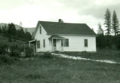 | Ant Flat Ranger Station | building | 1996 | 94001021 |
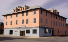 | Coram Hotel, The | building | 2012 | 12000593 |
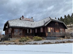 | Eureka Community Hall | building | 1985 | 85003236 |
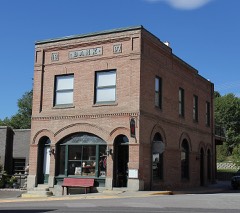 | Farmers and Merchants State Bank | building | 1995 | 95001062 |
| Fortin Ranch House | building | 2025 | 100011583 | |
| Heritage Museum, The | building | 2020 | 100005148 | |
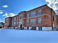 | Libby High School | building | 2008 | 08000823 |
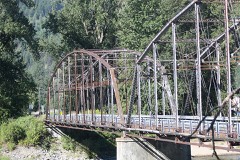 | Theodore Roosevelt Memorial Bridge | structure | 2006 | 06001178 |
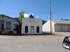 | Troy Jail | building | 2006 | 06001179 |
Every wildfire the federal occurrence database records inside this county: 4,130 of them, burning about 226,940 acres. 2,243 started naturally and 90 were recorded as arson. Each settlement page carries the fires within five miles of it.
| Reported cause | Fires |
|---|---|
| Natural | 2243 |
| Recreation and ceremony | 554 |
| Missing data/not specified/undetermined | 473 |
| Debris and open burning | 377 |
| Arson/incendiarism | 90 |
| Equipment and vehicle use | 87 |
| Power generation/transmission/distribution | 84 |
| Smoking | 81 |
| Railroad operations and maintenance | 58 |
| Fireworks | 46 |
| Misuse of fire by a minor | 28 |
| Other causes | 9 |
The five largest, by the area the report gives. None of them was recorded as arson.
| Date | Cause | Size | Reported by | Name on the report |
|---|---|---|---|---|
| 27 July 2007 | Natural | 29,921 acres | Flathead National Forest | BRUSH CREEK |
| 11 August 2017 | Natural | 24,752 acres | Kootenai National Forest | CARIBOU |
| 30 August 2017 | Natural | 20,032 acres | Kootenai National Forest | WEST FORK |
| 7 August 2017 | Natural | 12,938 acres | Kootenai National Forest | GIBRALTER RIDGE |
| 11 August 2000 | Natural | 11,115 acres | Kootenai National Forest | STONE HILL |
| 11 August 2000 | Natural | 9,423 acres | Kootenai National Forest | UPPER BEAVER |
| 15 August 1994 | Natural | 9,000 acres | Kootenai National Forest | NORTH FORK BIG CREEK |
| 11 August 2015 | Natural | 7,000 acres | Kootenai National Forest | MARSTON |
Every settlement page carries the fires within five miles of it - see the settlement index below.
The NOAA Storm Events Database holds 70 reports for this county, causing no deaths, 7 injuries and about $32,652,200 in recorded property damage. Each settlement page carries the reports that name it.
| Kind of event | Reports |
|---|---|
| Thunderstorm Wind | 37 |
| Hail | 14 |
| Flood | 8 |
| Heavy Rain | 8 |
| Funnel Cloud | 2 |
| Dust Devil | 1 |
The most serious of them, by death, then injury, then recorded damage. The accounts are quoted exactly as the forecast office filed them.
| When | Event | Place named | Harm | What the report says |
|---|---|---|---|---|
| July 1997 | Thunderstorm Wind | Libby | 2 hurt, $1,500,000 | no account filed |
| June 2007 | Thunderstorm Wind | Libby | 1 hurt, $30,000 | Straight line winds blew numerous large trees down onto power lines, buildings, vehicles and roads in and around Yaak. Power was out to the entire community. Several large trees were blown down onto power lines in Libby from straight line winds. From Eureka to Port of Roosville, straight line winds blew numerous large trees and limbs down onto power lines and vehicles. One carport was blown into a field, and roof damage was reported. |
| June 2007 | Thunderstorm Wind | Libby | 1 hurt | Numerous large trees and large limbs were blown down in and around Libby and Troy. In addition, a large tree was blown down on a hiker on the Cedar Creek trail 4 miles southwest of Libby. The rescue team reported that numerous trees were blown down over the trail. |
| August 2006 | Thunderstorm Wind | Troy | 1 hurt | A tree blew over and knocked a man off a ladder while he was doing construction on his home. He was taken to the hospital with minor injuries. |
| May 2002 | Thunderstorm Wind | Central Portion | 1 hurt | no account filed |
| May 1998 | Thunderstorm Wind | Libby | 1 hurt | no account filed |
| December 2025 | Flood | Yakt | $31,000,000 | Notable infrastructure losses included the Farm-to-Market Road state bridge over Libby Creek, the Granite Creek county bridge, Ramsey Creek Bridge at milepost 8.9, Old Town/Libby Creek Bridge 8.1 miles up Libby Creek Road(NFS Road Number 231), West Fisher Road bridge over Lake Creek at about the 5.5 milepost, the Lower Granite Creek Bridge at milepost 2.5 on National Forest Service(NFS) Road 4791, Whoopie Creek Bridge(NFS Road 384) near Spar Lake in the Troy District, and Keeler Creek took out the Lake Creek Road county bridge(NFS Road 473) and the county levee in Troy. Additional washouts occurred on Libby Creek Road (NFS Road 231) at mileposts 0.9 and and about 25.0 and along NFS Road 384 where it was washed out due to a landslide past the Whoopie Creek Bridge. The Hiatt Creek Bridge(NFS Road 384) near Spar Lake sustained damage. While the Ross Creek bridge survived the flood, the creek bed beneath it rose significantly. Floodwaters deposited so much rock and gravel that the space under the bridge was reduced from 8 feet to 6 inches, leaving no room for water to pass. The West Fisher Road lost about 600 feet of road at milepost 25.5, and the Poorman Creek culvert washout on NFS Road 278/Bear Creek Road. The Upper Young Creek Road, NFS Road number 7202, located northwest of West Kootenai, was made impassable between milepost 3.5 and 3.6 due to a landslide. The Kootenai National Forest Service remarked that there were other bridges that incurred minor damage and they will have to repair some of the abutments. ||In the Ross Creek Cedars recreation area, the newly reconstructed facilities and trailscompleted just months prior at a cost of approximately $1.9 millionsustained major damage. The access route, NFS Road 398, was compromised by multiple landslides and debris deposits, including a large slide that taken half the road and a compromised bridge where Ross Creek Road crosses Ross Creek. ||In Libby, Cherry Creek jumped its banks to flood subdivisions along Cherry Creek Drive and Claire Avenue, while Libby Creek inundated homes near Champion Haul Road and Riverdale Drive, cutting off residents and submerging properties under nearly a foot of water on Vicks Lane. The Lower Flower Creek Diversion Dam was nearly compromised by debris and high sediment, resulting in a long-term boil water advisory for the City of Libby. For a time, the 5th Street Bridge in Libby was under water. Water was also across the road on West 2nd Street Extension by Parmenter Creek. ||In Troy, Callahan Creek washed away a 15-foot rock barrier, and Iron Creek caused flooding in multiple residences. Road 427/Callahan Road had 2 washouts (3.4 mile and 6 mile). Washout on road 473/Keeler Road. The Poorman Creek SNOTEL, located in the Cabinet Mountains south of Libby, reported 5.10 inches of rainfall in 24 hours. This marked the wettest 24-hour period within the month of December, and the third highest for any time of the year. The Yaak River near Troy crested at 8.3 feet(7,940 cubic feet per second) at 1130MST on December 11, while the Fisher River near Libby reached 7.67 feet(4,710 cubic feet per second) at 2115MST. |
| July 2007 | Thunderstorm Wind | Libby | $35,000 | Estimated thunderstorm wind gusts to 70 mph produced substantial structural damage to the drive-in theater and the town ball park. Numerous large trees were also blown down. |
| June 2020 | Thunderstorm Wind | Eureka | $20,000 | Significant power line and power pole damage was reported by the power company, due to multiple, downed trees. A photo on social media showed a large pine tree on top of a car. Power was out in the area for almost 24 hours. |
| March 2017 | Heavy Rain | Libby | $20,000 | At least four trailer homes in Troy were directly impacted by water that had flowed over US-2 from an unauthorized channel that had overflowed. In Libby, a home cellar was flooded, the Libby Elementary School saw minor issues and Education Way was closed due to flooding caused by a clogged drainage. Silver Butte Creek south of Libby filled with debris causing it to re-route and surround a house with water during the early morning hours of the 19th. Several culverts had to be replaced due to washouts. |
| July 2013 | Thunderstorm Wind | Roosville | $10,500 | As a right-moving supercell approached the Eureka airport, it unleashed severe downdraft winds as reported by the AWOS sensor from the southwest direction for at least 12 minutes. The observer at the airport reported that one airplane flipped over, steel siding was torn off from a hanger, a telephone booth blew over, and an awning structure blew off. |
| July 2013 | Hail | Roosville | $6,000 | On the afternoon of Wednesday July 17th 2013, a right-moving supercell thunderstorm produced up to one inch hail with estimated winds near 80 mph just north of the Eureka airport in Montana. According to homeowners in the area, the mostly marble-sized hail flew sideways due to the hurricane force wind damaging roof shingles, siding, windows, paint and vehicles, and shredding vegetation. Trees toppled over in a northeast direction implying that winds could have been from the southwest. |
| July 2013 | Thunderstorm Wind | Roosville | $4,700 | On the afternoon of Wednesday July 17th 2013, a right-moving supercell thunderstorm produced up to one inch hail with estimated winds near 80 mph just north of the Eureka airport in Montana. According to homeowners in the area, the mostly marble-sized hail flew sideways due to the hurricane force wind damaging roof shingles, siding, windows, paint and vehicles, and shredding vegetation. Trees toppled over in a northeast direction implying that winds could have been from the southwest. |
| August 2014 | Thunderstorm Wind | Troy | $4,000 | The Lincoln County Emergency Manager reported that thunderstorm winds downed numerous trees and power lines in the Troy area. |
| August 2014 | Thunderstorm Wind | Libby | $4,000 | The emergency manager from Lincoln County reported that numerous trees and power lines were down with roads blocked in the Libby area. The Zonolite RAWS located at 4,200 feet MSL reported a 51 mph wind gust at the 21:06 MST observation time. |
| August 2009 | Hail | Eureka | $4,000 | Hail caused significant damage to two vehicles and broke small tree limbs off nearby trees 2 miles southeast of Eureka. |
| August 2014 | Thunderstorm Wind | Troy | $2,500 | A trained spotter estimated thunderstorm winds between 50 to 60 mph that caused tree damage and power outages in the area. The wind developed 10 to 12 minutes before brief heavy rain fell. They reported that the wind caused 4 big healthy fir and one yellow pine tree with a diameter of up to 2 feet to fall over. They also observed a few cottonwood trees with their tops blown off. A 200 person awning from a wedding was damaged while a part of the roof trim from the Bull Lake Fire Department blew off as a result of the wind. Timing is based on reports and post-radar analysis. |
| May 2023 | Thunderstorm Wind | Yakt | $2,000 | A few thunderstorm cells formed in northwest Montana, producing gusty outflow winds. There were multiple reports of trees down northwest of Troy along US Highway 2, near mile marker 5, including a large tree that blocked the highway. Around 2300MST, a car ran into a tree blocking part of Highway 2. |
| July 2013 | Dust Devil | Gateway | $2,000 | A member of the public in West Kootenai observed a strong and long-lived dust devil that caused roof damage to the Amish school and cut power momentarily at a warehouse. They said this was the strongest one they had ever experienced there in decades. |
| July 2013 | Thunderstorm Wind | Roosville | $2,000 | Local businesses located north of Eureka reported damage to outside equipment due to the wind and hail. Several 4 inch trees broke in half laying down pointing east-northeast. Two fir trees with a base diameter of 16 inches were lost: one fell over while the other broke in half. The wind ripped tin siding off of the buildings. |
| July 2013 | Hail | Rexford | $2,000 | On the afternoon of Wednesday July 17th 2013, a right-moving supercell thunderstorm developed near Troy and tracked north and east across Rexford. A local business in Rexford reported structure and vehicle damage due to the estimated half-dollar hail. Several teenagers received bruises from the hail when they were on the shore of Lake Kookanusa. They estimated the thunderstorm wind gusts to 50 mph. |
| July 2008 | Thunderstorm Wind | Libby | $2,000 | Ten inch diameter trees were blown over along Montana Highway 37. Hail 0.5 to 0.75 inches in diameter was also reported. |
| July 2013 | Thunderstorm Wind | Eureka Arpt | $1,000 | On the afternoon of Wednesday July 17th 2013, a right-moving supercell thunderstorm moved across the region causing severe wind and hail. A local business northwest of Eureka reported at least 30 trees toppled due to the strong wind. Also the combination of wind and hail damaged the greens at a nearby golf course. |
| July 2013 | Hail | Eureka Arpt | $500 | A resident reported damage to window screens and 150 fruit trees by the combination of hail and strong wind. They reported that the estimated one inch hail had a disc-shaped appearance. |
| February 2025 | Heavy Rain | Kootenai Falls | - | Up to 2.00 inches of rain fell from Bull Lake to Noxon, heaviest on the evening of the 23rd. |
| June 2022 | Flood | Libby | - | The Yaak River near Troy reached minor flood stage with limited impact noted. More significant impacts occurred along Hwy 508 between US Highway 2 and Yaak, as debris and water across the road resulted in a closure for much of June 14. |
| June 2021 | Hail | Libby | - | Reports of dime to quarter sized hail in Libby. Some trees lost leaves but no other damage was noted. |
| May 2018 | Flood | Yakt | - | The Yaak River reached minor flood stage and affected low lying areas adjacent to the river. |
| March 2017 | Flood | Happys Inn | - | The Fisher River gauge peaked at 7.8 feet for 8 hours. |
| July 2016 | Hail | Troy Usfs Arpt | - | A member of the public in Troy reported one inch hail at around 4:46 pm. |
| July 2014 | Thunderstorm Wind | Troy | - | A spotter reported multiple power poles down, along with power outages. |
| August 2014 | Thunderstorm Wind | Kootenai Falls | - | Law enforcement reported a tree down which blocked the south bound lane of highway 56 between mile marker 23 and 24 for a period of time. |
| March 2014 | Heavy Rain | Libby | - | Several days of moderate to heavy rainfall contributed to rock slides across northwest Montana. One in particular blocked a lane on Montana 37 north of the Libby Dam for a few hours. |
| July 2014 | Thunderstorm Wind | Rexford | - | The forest service located in Rexford reported that multiple trees had fallen down or snapped off. |
| July 2013 | Hail | Roosville | - | Local businesses north of Eureka reported damage to outside equipment due to the wind and hail estimated at one inch. |
| May 2013 | Flood | Yaak | - | A forest service employee reported minor flooding on the Yaak River at the Whitetail campground. |
| October 2012 | Heavy Rain | Kootenai Falls | - | The rainfall total for 24 hours was 2.10 inches. This was measured 13 miles north northeast of Heron. |
| October 2011 | Heavy Rain | Ripley | - | Spotter at Hawkins Lake reported 0.70 inches of rain in 12 hours. |
| October 2011 | Heavy Rain | Jennings | - | Libby Dam reported 0.87 inches of rain in 12 hours. |
| October 2011 | Heavy Rain | Happys Inn | - | Rainfall of 0.71 inches was reported near the Fisher River. |
| July 2011 | Heavy Rain | Libby | - | A trained spotter reported one inch of rain in 30 minutes. |
| May 2008 | Funnel Cloud | Rexford | - | Northwest Montana Border Patrol and public reported funnel cloud between Rexford and Eureka, MT. |
| August 2007 | Thunderstorm Wind | Fortine | - | The CO-OP Observer in Fortine reported several large trees blown down from thunderstorm winds. |
| June 2007 | Thunderstorm Wind | Yaak | - | A severe thunderstorm blew down 30-40 pine trees over an 2-3 acre area near Yaak. The largest trees had a diameter of 18 inches. |
| November 2006 | Flood | Eureka | - | Lincoln County Sheriff reported bridge washouts, small stream flooding county wide with residents sandbagging property to protect homes. Flooding was reported near Libby from Libby Creek over topping its bands and flood waters lapping onto a home. |
| May 1998 | Thunderstorm Wind | Yaak | - | Wind blew many trees down causing power outages in Yaak. |
| July 1995 | Thunderstorm Wind | not stated | - | Thunderstorm winds blew roofs off of homes and blew large trees down. |
| July 1995 | Thunderstorm Wind | Billings | - | Thunderstorm winds blew roofs off of homes and blew large trees down. |
| July 2006 | Hail | Troy | - | no account filed |
| July 2006 | Thunderstorm Wind | Libby | - | no account filed |
| July 2006 | Thunderstorm Wind | Libby | - | no account filed |
| May 2006 | Hail | Troy | - | no account filed |
| April 2002 | Flood | Libby | - | no account filed |
| June 2001 | Thunderstorm Wind | Central Portion | - | no account filed |
| May 1998 | Hail | Libby | - | no account filed |
| May 1998 | Thunderstorm Wind | Troy | - | no account filed |
| July 1997 | Funnel Cloud | Libby | - | no account filed |
| August 1997 | Hail | Trego | - | no account filed |
| May 1997 | Thunderstorm Wind | Troy | - | no account filed |
| September 1997 | Hail | Libby | - | no account filed |
The Survey's mineral resources record lists 279 workings inside this county. 9 still produce and 270 are closed or unrecorded. Each settlement page carries the workings within five miles of it.
| Commodity | Workings |
|---|---|
| Gold | 80 |
| Lead | 53 |
| Copper | 46 |
| Silver | 33 |
| Barium-Barite | 15 |
| Lead, Silver | 8 |
| Silver, Lead | 8 |
| Lead, Zinc | 7 |
| Iron | 7 |
| Zinc | 7 |
| Zinc, Silver, Lead | 6 |
| Gold, Silver | 6 |
| Tungsten | 5 |
| Vermiculite | 5 |
The least common of them first, because a county's hundredth gravel pit says nothing its first ten did not.
| Where | Site | Commodity | Status | Recorded |
|---|---|---|---|---|
| American Kootenai | Sulfur, Gold | Past Producer | ||
| Big Creek | Silver, Zinc, Lead | Prospect | ||
| Big Eight Mine | Lead, Zinc, Silver, Copper, Gold, Cobalt | Past Producer | 1925 | |
| Branagan Mine | Gold, Silver, Lead, Copper | Past Producer | ||
| Callahan Creek Deposits | Tungsten, Lead, Silver | Occurrence | Scheelite | |
| Copper-Lead-Iron-Manganese Occur. | Copper, Iron, Lead, Manganese, Zinc | Occurrence | ||
| Copper-Silver-Iron Occurrence | Copper, Gold, Iron, Silver, Zinc | Occurrence | ||
| Denver No. 1 & 2 | Lead, Tungsten, Silver | Unknown | ||
| Diamond John | Lead, Gold, Silver, Zinc | Prospect | ||
| Esther May Mine | Asbestos, Uranium | Occurrence | Anthophyllite, Tremolite | |
| Gold Hill Nos. 1,2, and 3 | Gold, Lead, Copper, Zinc | Producer | Vein | |
| Great Northern Property | Lead, Zinc, Iron, Copper | Occurrence | ||
| Hand Mine | Lead, Copper, Gold, Silver, Zinc | Occurrence | ||
| Hansen Prospect | Copper, Beryllium, Gold, Silver | Unknown | ||
| Hathaway | Copper, Zinc, Iron, Lead, Silver | Prospect | ||
| Heintz R A Construction | Stone, Dimension | Past Producer | ||
| Indian Head Tungsten | Molybdenum, Tungsten | Unknown | ||
| Iron-Phosphate Occurrence | Iron, Phosphorus-Phosphates, Fluorine-Fluorite, Sodium, Zeolites | Occurrence | ||
| Kennedy | Copper, Silver, Zinc | Prospect | ||
| King Mine | Zinc, Lead, Silver, Gold, Copper | Producer | 1887 | |
| Libby, Snowshoe | Gold, Silver, Lead | Producer | Galena | |
| Manganese-Lead-Copper-Iron Occur. | Manganese, Copper, Iron, Lead | Occurrence | ||
| Midas Mine | Gold, Tungsten, Lead, Silver | Past Producer | Chalcopyrite, Gold, Scheelite | |
| Napoleon Prospect | Lead, Copper, Vanadium, Zinc, Strontium | Past Producer | ||
| Oro Mine | Lead, Silver, Gold, Zinc, Uranium, Copper | Occurrence | Vein | |
| Silver King | Gold, Lead, Silver, Zinc | Past Producer | ||
| Snowshoe | Gold, Zinc, Silver, Lead | Past Producer | Underground | |
| Snowshoe Mine | Lead, Silver, Gold, Copper, Zinc | Producer | 1889, 1890 | |
| Snowstorm Mine | Silver, Lead, Zinc, Gold | Past Producer | 1925 | |
| Strodtbeck | Copper, Gold, Lead, Silver | Past Producer | ||
| Sylvanite | Silver, Gold | Occurrence | Vein | |
| Troy Area | Platinum | Occurrence | Unknown | |
| Union | Copper, Zinc, Lead | Prospect | ||
| Unnamed Aluminum | Aluminum | Occurrence | ||
| Unnamed Clay | Clay | Occurrence | ||
| Unnamed Quartz-Limonite Occurrence | Sulfides, Iron | Occurrence | Vein | |
| Viking Mine | Gold, Lead, Silver, Copper | Past Producer | ||
| Wollastonite Veins | Silica | Prospect | ||
| Woods Mine | Lead, Diatomite, Silver, Zinc | Prospect | ||
| Yaak Falls | Gold, Copper, Silver, Zinc, Lead | Prospect | ||
| Bull Lake Prospect | Nickel | Unknown | ||
| Gloria | Gold, Copper, Silver, Lead | Past Producer | ||
| Gold Flint-Key Stone | Gold, Lead, Zinc, Silver | Past Producer | ||
| Granite Concrete Pit and Plant | Sand and Gravel, Construction | Producer | ||
| Grouse Mtn., Troy | Silver, Lead, Gold | Occurrence | Vein | |
| Herbert Group | Gold, Lead, Zinc, Silver | Past Producer | ||
| Libby Sand and Gravel Pit | Sand and Gravel, Construction | Past Producer | ||
| Lynx Creek | Talc-Soapstone | Occurrence | ||
| Mc Guire Prospect | Silver, Copper, Lead | Unknown | ||
| Metallic Minerals Occurrence | Silver, Copper, Iron, Lead | Occurrence | ||
| Milton Group | Gold, Copper, Lead, Silver | Unknown | ||
| Second Chance | Copper, Silver, Lead | Occurrence | ||
| Silver Mountain | Silver, Lead, Gold | Past Producer | ||
| Spar Lake | Quartz | Occurrence | ||
| Troy Dike | Nickel | Unknown | ||
| Unnamed Barite & Calcite | Barium-Barite, Calcium | Prospect | ||
| Unnamed Calcite | Calcium | Occurrence | ||
| Unnamed Chlorite & Sericite | Mica | Occurrence | ||
| Unnamed Feldspar & Mica | Feldspar, Mica | Occurrence | ||
| Unnamed Quartz | Quartz | Occurrence | ||
| Unnamed Silver, Lead & Copper | Silver, Copper, Lead | Occurrence | ||
| Unnamed Talc | Talc-Soapstone | Occurrence | ||
| Vermiculite Mountain Mine | Vermiculite, Feldspar | Producer | 1915, 1925 | |
| Viking Mine | Gold, Copper, Lead, Silver | Past Producer | 1934 | |
| Big Sky | Tungsten, Copper, Lead, Zinc | Past Producer | ||
| Black Diamond | Gold, Lead, Copper | Past Producer | ||
| Cableway Group | Gold, Lead, Silver | Occurrence | ||
| Canuck Copper | Lead, Copper | Occurrence | ||
| Copper Reward | Copper, Lead, Zinc | Prospect | ||
| Esther May Asbestos | Asbestos | Occurrence | ||
| Gold Hill | Lead, Copper | Past Producer | ||
| Kennedy Group | Uranium | Occurrence | ||
| Kirkpatrick | Gold, Lead, Silver | Occurrence | ||
| Larue-Cripe | Asbestos | Prospect | ||
| Mastodon | Zinc, Gold, Lead, Silver | Unknown | ||
| Montana Silver-Lead | Lead, Copper, Gold | Past Producer | ||
| Seattle | Copper, Lead, Zinc | Prospect | ||
| Snowfall Prospect | Silver, Copper, Gold | Prospect | ||
| Unknown | Uranium | Occurrence | ||
| Unnamed Asbestos | Asbestos | Occurrence | ||
| Unnamed Silver, Gold, & Copper | Silver, Copper, Gold | Occurrence | ||
| Unnamed Uranium | Uranium | Occurrence | ||
| Big Eight | Zinc, Silver, Lead, Gold | Past Producer | ||
| Glacier Silver-Lead | Zinc, Silver, Lead, Gold | Past Producer | ||
| Hoerner | Gold, Copper, Silver | Prospect | ||
| Iron Mask | Zinc, Silver, Lead, Gold | Past Producer | ||
| J.F. Claims | Copper, Silver | Prospect | ||
| Lucky Mac Group | Lead, Copper, Silver | Unknown | ||
| Raven | Lead, Silver, Copper | Prospect | ||
| Snowfall Prospect | Silver, Copper, Gold | Occurrence | Chalcopyrite | |
| St Paul | Zinc, Silver, Lead, Gold | Past Producer | ||
| Swansea Rosa Lode Claim | Barium-Barite, Copper, Silver | Occurrence | ||
| Troy | Silver, Copper, Lead | Producer | 1963, 1981 | |
| Unnamed Galena, Copper, & Silver | Lead, Silver, Copper | Occurrence | ||
| Bear | Lead, Silver, Zinc | Occurrence | ||
| Duplex | Lead, Silver, Zinc | Past Producer | ||
| Iron Occurrence | Iron, Lead, Silver, Zinc | Occurrence | ||
| Last Chance Group | Vermiculite | Occurrence | ||
| Limestone Occurrence | Limestone, Dimension | Occurrence | ||
| Limestone Occurrence | Limestone, Dimension | Occurrence | ||
| Limestone Occurrence | Limestone, Dimension | Occurrence | ||
| Limestone Occurrence | Limestone, Dimension | Occurrence | ||
| Midas Mine | Gold, Tungsten | Past Producer | ||
| Miller Creek Deposits | Tungsten | Occurrence | Scheelite | |
| Silver Cable | Lead, Silver, Zinc | Prospect | ||
| Statesman | Lead, Silver, Zinc | Prospect | ||
| Universal Zonolite Corp. Property | Vermiculite | Past Producer | ||
| Unnamed Limestone | Limestone, Dimension | Occurrence | ||
| Vermiculite Mountain Mine | Vermiculite | Producer | ||
| Waylett Group | Tungsten | Prospect | ||
| Zonolite Mine | Vermiculite | Past Producer | ||
| Betty Mae | Copper, Gold, Silver | Prospect | ||
| Copper Mountain | Copper, Gold, Silver | Occurrence | ||
| Double Mac | Gold, Zinc, Silver, Lead | Past Producer | ||
| Giant Sunrise | Zinc, Silver, Lead | Past Producer | ||
| Grouse Mountain | Zinc, Silver, Lead | Prospect | ||
| Last Chance | Zinc, Silver, Lead | Prospect | ||
| Liberty Metals | Zinc, Silver, Lead | Past Producer | ||
| Nancy | Copper, Gold, Silver | Prospect | ||
| Princess Ethne | Gold, Silver | Past Producer | ||
| Silver Butte Mine | Gold, Zinc, Silver, Lead | Past Producer | ||
| Unnamed Copper | Copper, Gold, Silver | Occurrence | ||
| Unnamed Copper, Gold & Silver | Copper, Gold, Silver | Occurrence | ||
| B&B Mine | Lead, Zinc | Past Producer | ||
| Cabinet | Zinc, Lead, Silver | Past Producer | ||
| Callahan Creek Deposits | Lead, Zinc | Occurrence | Vein | |
| Copper-Iron Occurrence | Copper, Iron | Occurrence | ||
| Iron Occurrence | Iron | Occurrence | ||
| Iron Occurrence | Iron | Occurrence | ||
| Iron-Copper Occurrence | Iron, Copper | Occurrence | ||
| L-B Lemire-Bartlett Lead Cliff | Lead, Zinc | Past Producer | ||
| Lost Cause Mine | Zinc, Silver, Lead | Past Producer | ||
| Potter | Copper, Iron | Past Producer | ||
| Silver King Claims | Lead, Zinc | Occurrence | Galena, Sphalerite | |
| Snowstorm | Lead, Zinc, Silver | Past Producer | 1911 | |
| Unnamed Copper | Copper, Lead, Zinc | Prospect | ||
| Unnamed Copper | Copper, Lead, Zinc | Prospect | ||
| Unnamed Lead & Zinc | Lead, Zinc | Occurrence | ||
| Valley View Claim | Lead, Zinc | Occurrence | ||
| Zollars | Silver, Lead, Zinc | Prospect | ||
| Big Creek Extension | Gold, Lead, Silver | Prospect | ||
| Christmas Tree Mine | Gold, Lead, Silver | Past Producer | ||
| Golden West Mine | Gold, Silver, Lead | Past Producer | ||
| Hannegan | Silver, Lead | Occurrence | ||
| John Bull-Uncle Sam Mine | Gold, Lead, Silver | Prospect | ||
| King | Silver, Lead | Past Producer | ||
| Montezuma | Lead, Silver | Occurrence | ||
| Oro-Highland | Silver, Lead | Prospect | ||
| Remp | Silver, Lead | Prospect | ||
| Silver Grouse | Silver, Lead | Prospect | ||
| Unnamed Copper, Lead, & Silver | Copper, Silver, Lead | Occurrence | ||
| Victor-Empire | Gold, Lead, Silver | Past Producer | ||
| Williams | Lead, Silver | Prospect | ||
| Barite Prospect | Barium-Barite | Prospect | ||
| Bonnett-Hoerner | Barium-Barite | Prospect | ||
| Copper Mountain Mine | Barium-Barite | Past Producer | ||
| Copper Mtn | Barium-Barite | Occurrence | Barite | |
| Kenelty Barite Deposit | Barium-Barite | Past Producer | 1960, 1962 | |
| Kenelty Mine | Barium-Barite | Past Producer | ||
| Kotschevar Barite | Barium-Barite | Occurrence | ||
| Kotschevar Barite Deposit | Barium-Barite | Occurrence | Barite | |
| Moen | Barium-Barite | Occurrence | ||
| Montana Premier Mine | Copper, Barium-Barite | Prospect | ||
| Unnamed Barite | Barium-Barite | Occurrence | ||
| Unnamed Barium | Barium-Barite | Occurrence | ||
| Unnamed Barium | Barium-Barite | Occurrence | ||
| Bee and Zee | Gold, Silver | Unknown | ||
| Blue Bird Mine | Silver | Prospect | ||
| Boulder Hill | Gold, Silver | Past Producer | ||
| Cabinet Queen Prospect | Gold, Silver | Unknown | ||
| Callahan Creek Deposits | Lead, Silver | Occurrence | ||
| Ferrel | Gold, Silver | Occurrence | ||
| Fisher River Quarry | Gold, Silver | Past Producer | ||
| Green Mountain | Copper, Silver | Prospect | ||
| Haywire | Gold, Silver | Unknown | ||
| Horse Hill | Gold, Silver | Past Producer | ||
| Irish Boy | Silver, Gold | Prospect | ||
| Jumbo Mine | Gold, Silver | Past Producer | ||
| Keeler Mountain | Lead, Silver | Prospect | ||
| Kenelty | Silver | Prospect | ||
| Kentucky Vermillion | Lead, Silver | Past Producer | ||
| New Morning Glory | Gold, Silver | Past Producer | ||
| Peterson Twin Peaks Mine | Copper, Silver | Prospect | ||
| Phillips | Gold, Silver | Prospect | ||
| Rankin | Gold, Silver | Prospect | ||
| Unnamed Gold & Silver | Gold, Silver | Occurrence | ||
| Unnamed Gold & Silver | Gold, Silver | Occurrence | ||
| Unnamed Gold & Silver | Gold, Silver | Occurrence | ||
| Unnamed Gold & Silver | Gold, Silver | Occurrence | ||
| Unnamed Gold & Silver | Gold, Silver | Occurrence | ||
| Unnamed Silver | Silver | Occurrence | ||
| Wayup Mine | Gold, Silver | Past Producer | ||
| Ada Prospect | Copper, Lead | Unknown | ||
| American Eagle | Lead, Copper | Prospect | ||
| Big Four | Lead, Copper | Prospect | ||
| Black Horse | Copper | Prospect | ||
| Blacktail | Lead, Copper | Prospect | ||
| Bluebird | Copper | Unknown | ||
| Bonus Claim | Lead, Copper | Unknown | ||
| Daniel Lee | Lead, Copper | Prospect | ||
| Gold Hill | Lead, Copper | Past Producer | ||
| Independence | Copper | Past Producer | ||
| John Francis Claims | Copper | Prospect | ||
| Joseph Prospect | Copper | Occurrence | ||
| Leigh Creek | Copper, Lead | Unknown | ||
| Missouri | Lead, Copper | Prospect | ||
| Mountain Rose | Lead, Copper | Prospect | ||
| Spar Lake Prospect | Copper | Prospect | Sedimentary | |
| Sunrise Mine | Copper | Occurrence | Vein | |
| Tetrault | Copper | Prospect | ||
| Texas Ranger Group | Lead, Copper | Prospect | ||
| Trio | Lead, Copper | Prospect | ||
| Twin Peaks Prospect | Copper | Occurrence | ||
| Universal | Lead, Copper | Prospect | ||
| Unnamed Copper | Copper | Occurrence | ||
| Unnamed Copper | Copper | Occurrence | ||
| Unnamed Galena & Copper | Lead, Copper | Occurrence | ||
| Weyerhaeuser | Lead, Copper | Prospect | ||
| Bimetallic | Lead | Prospect | ||
| Crater | Lead | Prospect | ||
| D. & W. Group | Lead | Prospect | ||
| Demonstrator | Lead | Prospect | ||
| Fairbault | Lead | Prospect | ||
| Fourth of July | Lead | Prospect | ||
| Granite Creek | Lead | Past Producer | ||
| Grizzly | Lead | Prospect | ||
| Hiawatha | Lead | Prospect | ||
| Illinois-Mountana Group | Lead | Prospect | 1902 | |
| Little Spokane | Lead | Prospect | ||
| Loyal | Lead | Prospect | ||
| Montana Morning | Lead | Past Producer | ||
| Mustang | Lead | Prospect | ||
| Olsen&Switzer | Lead | Occurrence | ||
| Rex Mine | Lead | Past Producer | ||
| Silver Strike | Lead | Prospect | ||
| Silver Tip | Lead | Prospect | ||
| Silvertip | Lead | Prospect | ||
| Unnamed Galena | Lead | Occurrence | ||
| Alpine Placer | Gold | Past Producer | ||
| Big Chance Placer | Gold | Past Producer | ||
| Big Cherry Creek Placer | Gold | Past Producer | ||
| Big Eight Placer | Gold | Past Producer | ||
| Bolyard Placer | Gold | Unknown | ||
| Callahan Creek Placer | Gold | Past Producer | ||
| China Creek | Gold | Past Producer | ||
| Comet Placer | Gold | Past Producer | ||
| Condor Mining & Leasing | Gold | Unknown | ||
| Copeland | Gold | Occurrence | ||
| Cow Creek | Gold | Past Producer | ||
| Darling Placer | Gold | Past Producer | ||
| Dome Mine | Gold | Unknown | ||
| Fisher River Property | Gold | Producer | Placer | |
| Fisher River Property | Gold | Unknown | ||
| Ford Placer | Gold | Unknown | ||
| Getner Placer | Gold | Unknown | ||
| Golden Bear | Gold | Past Producer | ||
| Harry Howard Placer | Gold | Past Producer | ||
| Howard Creek Claim | Gold | Occurrence | ||
| Hoyt | Gold | Unknown | ||
| Libby Creek Gold Mining Co. | Gold | Past Producer | ||
| Libby Creek Placer | Gold | Past Producer | ||
| Libby Prospect | Gold | Unknown | Unclassified | |
| Miller Placer | Gold | Past Producer | ||
| Montana Placer | Gold | Past Producer | ||
| Mustang Mine | Gold | Past Producer | ||
| Nugget Placer | Gold | Past Producer | ||
| Red Gulch Placer | Gold | Past Producer | ||
| Snipetown Placer | Gold | Unknown | ||
| Solo Joe | Gold | Occurrence | ||
| Stonehill Placer | Gold | Unknown | ||
| Sunrise | Gold | Past Producer | ||
| Sutton Creek Placer | Gold | Unknown | ||
| Tideman Placer | Gold | Prospect | ||
| Tobacco River Placer | Gold | Prospect | ||
| Unnamed Gold | Gold | Occurrence | ||
| Unnamed Gold | Gold | Occurrence | ||
| Unnamed Gold | Gold | Occurrence | ||
| Wolf Creek Placer | Gold | Past Producer | ||
| Zootenai River Placer | Gold | Past Producer |
Named settlements recorded in the Geographic Names Information System, each with the topographic sheets covering it. Villages, hamlets and abandoned places alike. Each is shown with the nearest named watercourse or landform and the survey quadrangle it falls on.
Eureka census division · 59934 · On Dickey Creek · Edna Mountain quadrangle
13 sheets, 1913 to 1997
Troy census division · 59935 · On Payne Creek · Ibex Peak quadrangle
14 sheets, 1920 to 1997
Troy census division · Near Red Mountain · Red Mountain quadrangle
9 sheets, 1957 to 1997
Eureka census division · 59918 · On Deep Creek · Fortine quadrangle
13 sheets, 1913 to 1997
Eureka census division · 59917 · On Sinclair Creek · Eureka North quadrangle
10 sheets, 1957 to 1997
Eureka census division · 59933 · On Hellroaring Creek · Bull Lake quadrangle
13 sheets, 1913 to 1997
No longer a settlement
Eureka census division · 59930 · Rexford quadrangle
11 sheets, 1957 to 1997
No longer a settlement
Libby census division · 59923 · On Flower Creek · Libby quadrangle
14 sheets, 1920 to 1997
Libby census division · 59923 · On Wabuno Creek · Loon Lake quadrangle
15 sheets, 1920 to 1997
Libby census division · 59923 · Near Canoe Gulch · Tony Peak quadrangle
15 sheets, 1920 to 1997
Troy census division · 59935 · On Kool Creek · Kootenai Falls quadrangle
14 sheets, 1920 to 1997
Libby census division · 59923 · On McGinnis Creek · Kenelty Mountain quadrangle
15 sheets, 1920 to 1997
No longer a settlement
Eureka census division · 59917 · On Sinclair Creek · Eureka North quadrangle
10 sheets, 1957 to 1997
Eureka census division · 59917 · Eureka North quadrangle
10 sheets, 1957 to 1997
No longer a settlement
Libby census division · 59923 · On Prospect Creek · Little Hoodoo Mountain quadrangle
14 sheets, 1920 to 1997
Eureka census division · 59930 · On Tobacco River · Rexford quadrangle
11 sheets, 1957 to 1997
Libby census division · 59923 · Near Kennedy Gulch · Vermiculite Mountain quadrangle
16 sheets, 1920 to 1997
Eureka census division · 59930 · On Tobacco River · Rexford quadrangle
11 sheets, 1957 to 1997
No longer a settlement
Libby census division · 59923 · On Alder Creek · Tony Peak quadrangle
15 sheets, 1920 to 1997
No longer a settlement
Eureka census division · On Big Creek · Inch Mountain quadrangle
9 sheets, 1957 to 1997
No longer a settlement
Troy census division · 59935 · On Crawford Creek · Sylvanite quadrangle
8 sheets, 1957 to 1997
Eureka census division · 59917 · On Therriault Creek · Fortine quadrangle
13 sheets, 1913 to 1997
Eureka census division · 59917 · On DeRozier Creek · Eureka North quadrangle
10 sheets, 1957 to 1997
No longer a settlement
Eureka census division · 59934 · On Cripple Creek · Stryker quadrangle
14 sheets, 1913 to 1997
Libby census division · On Ural Creek · Ural Creek quadrangle
9 sheets, 1957 to 1997
No longer a settlement
Libby census division · On Fivemile Creek · Volcour Gulch quadrangle
9 sheets, 1957 to 1997
No longer a settlement
Libby census division · On Barron Creek · Ural Creek quadrangle
9 sheets, 1957 to 1997
No longer a settlement
Libby census division · 59923 · On Prospect Creek · Little Hoodoo Mountain quadrangle
14 sheets, 1920 to 1997
Troy census division · 59935 · On South Fork Yaak River · Yaak quadrangle
8 sheets, 1957 to 1997
Troy census division · 59935 · On Star Creek · Kilbrennan Lake quadrangle
9 sheets, 1957 to 1997
The vanished settlements of Lincoln County: the places named above that are no longer on the map.