 Block
Yakt, Montana
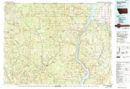
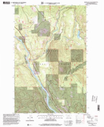
9 topographic sheets cover this place, the earliest surveyed in 1957 and the latest in 1997. It stands in the Troy census division. It lies in ZIP code area 59935. It stands on Star Creek. The Survey maps it on the Kilbrennan Lake quadrangle.
Topographic sheets covering this place
6 surveys from 9 printed sheetsMatched by testing this settlement's coordinate against the published boundary of every sheet in the United States Geological Survey's historical collection. Each opens the scanned sheet at the Survey.
- 1957 USGS Kalispell quadrangle1:250000, 3 printings
- 1960 USGS Kalispell quadrangle1:250000
- 1961 USGS Kalispell quadrangle1:250000
- 1963 USGS Kilbrennan Lake quadrangle1:24000, 2 printings
- 1979 USGS Yaak River quadrangle1:100000
- 1997 USGS Kilbrennan Lake quadrangle1:24000
Fires near this place
135 since 1992Regional context, not property-specific evidence. The federal wildfire occurrence database lists 135 fires within 5 miles of Yakt between 1992 and 2020, burning about 49 acres in total. 58 started naturally. 14 were recorded as arson. Distance is straight-line from the map coordinates, so a fire counted here may appear on a neighbouring settlement's page as well.
| Reported cause | Fires |
|---|---|
| Natural | 58 |
| Debris and open burning | 14 |
| Arson/incendiarism | 14 |
| Recreation and ceremony | 13 |
| Missing data/not specified/undetermined | 13 |
| Power generation/transmission/distribution | 7 |
| Smoking | 7 |
| Equipment and vehicle use | 3 |
| Railroad operations and maintenance | 3 |
| Misuse of fire by a minor | 2 |
| Fireworks | 1 |
The most recent of them, most recent first, with the day each was reported and the service that recorded it.
| Date | Cause | Size | Reported by | Name on the report |
|---|---|---|---|---|
| 8 September 2013 | Natural | under an acre | Kootenai National Forest | ROBERTS MTN |
| 8 September 2010 | Arson/incendiarism | under an acre | Kootenai National Forest | WHITE PINE |
| 8 September 1995 | Natural | under an acre | Kootenai National Forest | LITTLE MAN |
| 27 September 2008 | Missing data/not specified/undetermined | under an acre | Kootenai National Forest | YAAK MOUNTAIN |
| 22 September 2017 | Natural | under an acre | Kootenai National Forest | SOUTHSIDE |
| 2 September 2019 | Missing data/not specified/undetermined | under an acre | Kootenai National Forest | YAAK TRASH |
| 17 September 1995 | Equipment and vehicle use | under an acre | Kootenai National Forest | PINE CREEK |
| 13 September 1996 | Natural | under an acre | Kootenai National Forest | KILBRENEN |
Settlements close enough to share some of these fires:
Mines and quarries near this place
9 within 5 milesRegional context, not property-specific evidence. The federal mineral resources record lists 9 workings within 5 miles of Yakt: 4 occurrences, 2 prospects, 2 past producers, 1 unknown. None of them still produces. What was taken out: Limestone, Dimension, Lead, Gold, Lead, Silver, Gold, Zinc, Uranium, Copper. Distance is straight-line from the map coordinates, so a quarry counted here may appear on a neighbouring settlement's page as well.
| Where | Site | Commodity | Status | Recorded |
|---|---|---|---|---|
| Duplex | Lead, Silver, Zinc | Past Producer | ||
| L-B Lemire-Bartlett Lead Cliff | Lead, Zinc | Past Producer | ||
| Oro Mine | Lead, Silver, Gold, Zinc, Uranium, Copper | Occurrence | Vein | |
| Rankin | Gold, Silver | Prospect | ||
| Weyerhaeuser | Lead, Copper | Prospect | ||
| Snipetown Placer | Gold | Unknown | ||
| Limestone Occurrence | Limestone, Dimension | Occurrence | ||
| Limestone Occurrence | Limestone, Dimension | Occurrence | ||
| Unnamed Limestone | Limestone, Dimension | Occurrence |
Storms near this place
3 since 2018Regional context, not property-specific evidence. The National Weather Service names Yakt in 3 storm reports between 2018 and 2025: 2 flood, 1 thunderstorm wind. No death or injury is recorded in these reports. Each account below is quoted exactly as the forecast office filed it, from the NOAA Storm Events Database, and each date opens the federal record of that event.
| When | Event | Place named | Harm | What the report says |
|---|---|---|---|---|
| December 2025 | Flood | Yakt | $31,000,000 | Notable infrastructure losses included the Farm-to-Market Road state bridge over Libby Creek, the Granite Creek county bridge, Ramsey Creek Bridge at milepost 8.9, Old Town/Libby Creek Bridge 8.1 miles up Libby Creek Road(NFS Road Number 231), West Fisher Road bridge over Lake Creek at about the 5.5 milepost, the Lower Granite Creek Bridge at milepost 2.5 on National Forest Service(NFS) Road 4791, Whoopie Creek Bridge(NFS Road 384) near Spar Lake in the Troy District, and Keeler Creek took out the Lake Creek Road county bridge(NFS Road 473) and the county levee in Troy. Additional washouts occurred on Libby Creek Road (NFS Road 231) at mileposts 0.9 and and about 25.0 and along NFS Road 384 where it was washed out due to a landslide past the Whoopie Creek Bridge. The Hiatt Creek Bridge(NFS Road 384) near Spar Lake sustained damage. While the Ross Creek bridge survived the flood, the creek bed beneath it rose significantly. Floodwaters deposited so much rock and gravel that the space under the bridge was reduced from 8 feet to 6 inches, leaving no room for water to pass. The West Fisher Road lost about 600 feet of road at milepost 25.5, and the Poorman Creek culvert washout on NFS Road 278/Bear Creek Road. The Upper Young Creek Road, NFS Road number 7202, located northwest of West Kootenai, was made impassable between milepost 3.5 and 3.6 due to a landslide. The Kootenai National Forest Service remarked that there were other bridges that incurred minor damage and they will have to repair some of the abutments. ||In the Ross Creek Cedars recreation area, the newly reconstructed facilities and trailscompleted just months prior at a cost of approximately $1.9 millionsustained major damage. The access route, NFS Road 398, was compromised by multiple landslides and debris deposits, including a large slide that taken half the road and a compromised bridge where Ross Creek Road crosses Ross Creek. ||In Libby, Cherry Creek jumped its banks to flood subdivisions along Cherry Creek Drive and Claire Avenue, while Libby Creek inundated homes near Champion Haul Road and Riverdale Drive, cutting off residents and submerging properties under nearly a foot of water on Vicks Lane. The Lower Flower Creek Diversion Dam was nearly compromised by debris and high sediment, resulting in a long-term boil water advisory for the City of Libby. For a time, the 5th Street Bridge in Libby was under water. Water was also across the road on West 2nd Street Extension by Parmenter Creek. ||In Troy, Callahan Creek washed away a 15-foot rock barrier, and Iron Creek caused flooding in multiple residences. Road 427/Callahan Road had 2 washouts (3.4 mile and 6 mile). Washout on road 473/Keeler Road. The Poorman Creek SNOTEL, located in the Cabinet Mountains south of Libby, reported 5.10 inches of rainfall in 24 hours. This marked the wettest 24-hour period within the month of December, and the third highest for any time of the year. The Yaak River near Troy crested at 8.3 feet(7,940 cubic feet per second) at 1130MST on December 11, while the Fisher River near Libby reached 7.67 feet(4,710 cubic feet per second) at 2115MST. |
| May 2023 | Thunderstorm Wind | Yakt | $2,000 | A few thunderstorm cells formed in northwest Montana, producing gusty outflow winds. There were multiple reports of trees down northwest of Troy along US Highway 2, near mile marker 5, including a large tree that blocked the highway. Around 2300MST, a car ran into a tree blocking part of Highway 2. |
| May 2018 | Flood | Yakt | - | The Yaak River reached minor flood stage and affected low lying areas adjacent to the river. |
Nearest settlements
The eight closest, with where each one stands in the county. Distances are straight-line, computed from the Geographic Names Information System coordinates.
| Map | Place | Distance | Sheets |
|---|---|---|---|
| Troy | 7.1 miles | 14 | |
| Kootenai Falls | 11.9 miles | 14 | |
| Sylvanite | 12.8 miles | 8 | |
| Bull Lake | 21.6 miles | 14 | |
| Green Acres | 23.6 miles | 14 | |
| Yaak | 24.2 miles | 8 | |
| Libby | 24.4 miles | 14 | |
| White Haven | 27.6 miles | 14 |
Provenance
This settlement is recorded in the Geographic Names Information System as feature 793587. The sheet list is computed by point-in-boundary test against the United States Geological Survey's historical topographic inventory. Both are works of the United States government and carry no copyright under 17 U.S.C. 105.
Wildfire. Short, Karen C. 2022. Spatial wildfire occurrence data for the United States, 1992-2020 [FPA_FOD_20221014]. 6th Edition. Fort Collins, CO: Forest Service Research Data Archive. https://doi.org/10.2737/RDS-2013-0009.6 Collected with United States Government funding and usable without additional permissions or fees.
Mines and quarries. USGS Mineral Resources Data System (MRDS) https://mrdata.usgs.gov/mrds/ A work of the United States government, no copyright under 17 U.S.C. 105.
Storms. NOAA National Centers for Environmental Information, Storm Events Database https://www.ncei.noaa.gov/stormevents/ A work of the United States government, no copyright under 17 U.S.C. 105. Narratives are quoted verbatim from the National Weather Service report and are not edited or summarised.