 Block
From the record
92 National Register listings published here.
Sources: the National Register database, National Park Service
104 topographic sheets cover 43 settlements here, and 92 properties are on the National Register of Historic Places.
92 National Register listings published here.
Sources: the National Register database, National Park Service
Every property in this county listed on the National Register of Historic Places, with the year it was listed and the federal nomination document.
| Photograph | Property | Type | Listed | Reference |
|---|---|---|---|---|
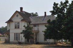 | Allison-Reinkeh House | building | 1988 | 88001280 |
| Alta Ranger Station | building | 1974 | 74001099 | |
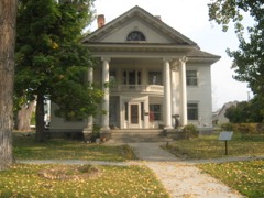 | Bass Mansion | building | 1978 | 78001691 |
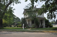 | Daniel V. Bean House | building | 1988 | 88001288 |
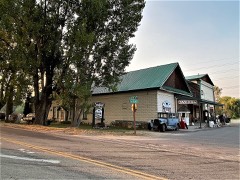 | Bitter Root Cooperative Creamery | building | 1991 | 91000726 |
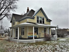 | Oliver Blood House | building | 1988 | 88001279 |
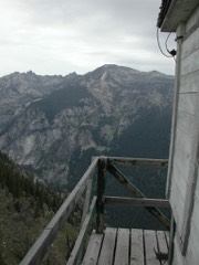 | Boulder Point Lookout | building | 2018 | 100002044 |
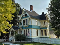 | Brooks Hotel | building | 1980 | 80002430 |
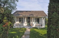 | Charles Amos Buck House | building | 1991 | 91000727 |
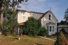 | Fred Buck House | building | 1991 | 91000729 |
| Canyon Creek Laboratory of the U.S. Public Health Service | building | 1970 | 70000362 | |
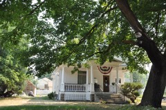 | W. T. Caple House | building | 1991 | 91000730 |
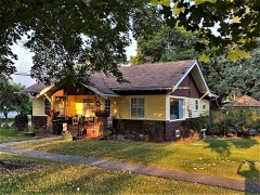 | Jennie Clark House | building | 1991 | 91000731 |
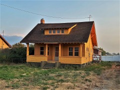 | William Cochran House | building | 1991 | 91000732 |
| Como School | building | 2022 | 100008424 | |
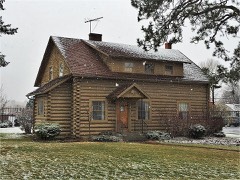 | Conway House | building | 1988 | 88001291 |
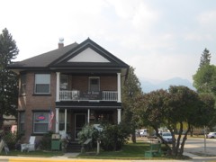 | Calvin and Maggie Cook House | building | 1991 | 91000734 |
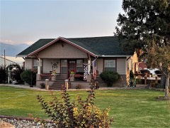 | Wilbur Cook House | building | 1991 | 91000733 |
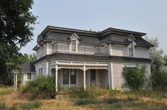 | Martin Cramer House | building | 1987 | 87001259 |
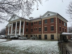 | Marcus Daly Memorial Hospital | building | 1978 | 78001690 |
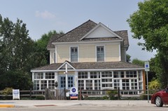 | DeNayer House | building | 1994 | 94000782 |
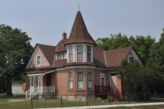 | F. H. Drinkenberg's First Home | building | 1988 | 88001289 |
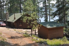 | El Capitan Lodge | building | 1990 | 90001792 |
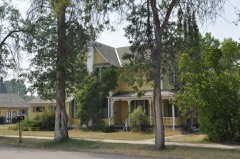 | E. G. Ellis House | building | 1988 | 88001281 |
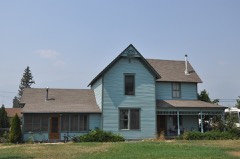 | Emhoff House | building | 1991 | 91000736 |
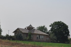 | Etna School | building | 1997 | 97000504 |
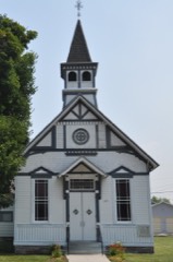 | First Baptist Church | building | 1991 | 91000737 |
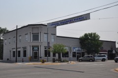 | First State Bank, Dowling and Emhoff Buildings | building | 1991 | 91000738 |
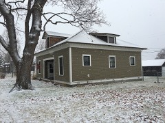 | Joseph Fisher House | building | 1991 | 91000739 |
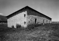 | Fort Owen | building | 1970 | 70000363 |
| Perry Foust House | building | 1991 | 91000740 | |
| Foye Rental Houses | building | 1988 | 88001292 | |
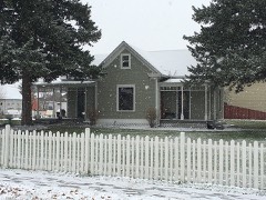 | Charles Fulton House | building | 1991 | 91000742 |
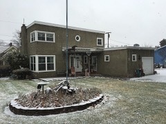 | Gavin House | building | 1991 | 91000743 |
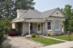 | Sherman Gill House | building | 1988 | 88001282 |
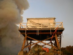 | Gird Point Lookout | building | 2018 | 100002297 |
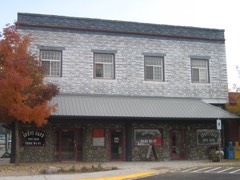 | Gleason Building | building | 1991 | 91000744 |
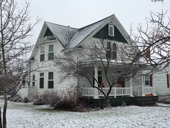 | Goff House | building | 1988 | 88001283 |
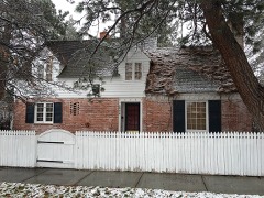 | Gordon House | building | 1988 | 88001294 |
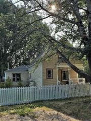 | Charles Granke House | building | 1988 | 88001278 |
| Hamilton Commercial Historic District | district | 1988 | 88001273 | |
| Hamilton Southside Residential Historic District | district | 1988 | 88001272 | |
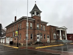 | Hamilton Town Hall | building | 1980 | 80002431 |
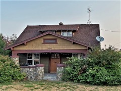 | Rose Harrington House | building | 1991 | 91000745 |
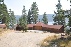 | Hayward Lodge | building | 2015 | 15000216 |
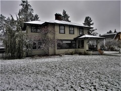 | Charles Hoffman House | building | 1988 | 88001277 |
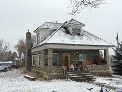 | John G. Howe House | building | 1991 | 91000746 |
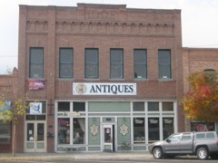 | IOOF Hall | building | 1991 | 91000747 |
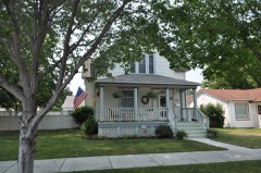 | John Lagerquist House | building | 1988 | 88001284 |
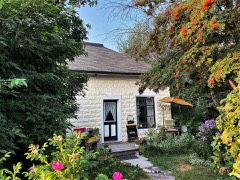 | Lancaster House | building | 1991 | 91000748 |
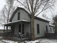 | John A. Landram House | building | 1996 | 91000749 |
| Lockridge House | building | 1991 | 91000750 | |
| Lost Horse Fireman's Cabin (24RA197) | building | 1989 | 88003437 | |
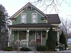 | Albert May House | building | 1991 | 91000751 |
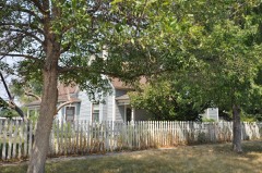 | Charles May House | building | 1991 | 91000753 |
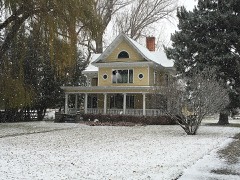 | George May House | building | 1982 | 82000596 |
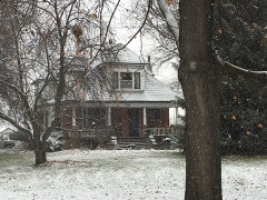 | Harry May House | building | 1991 | 91000752 |
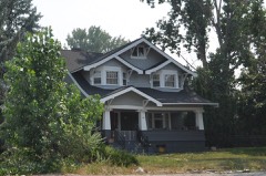 | Louis May House | building | 1991 | 91000754 |
| McCart Fire Lookout | structure | 1996 | 96000660 | |
| James McCrossin Cabin | building | 2019 | 100004710 | |
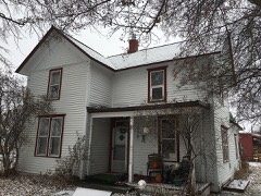 | McFarlane House | building | 1991 | 91000755 |
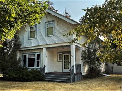 | McGlauflin House | building | 1988 | 88001276 |
| John McLaughlin House | building | 1991 | 91000757 | |
| Medicine Point Lookout | building | 2018 | 100002298 | |
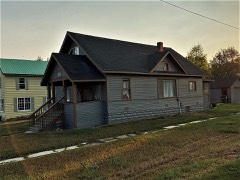 | Metcalf House | building | 1991 | 91000758 |
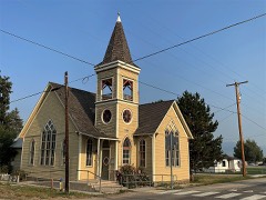 | Methodist Episcopal Church South | building | 1997 | 97001453 |
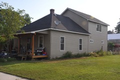 | Philip and Ella Morr House | building | 1991 | 91000760 |
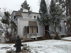 | Pine Apartments | building | 1988 | 88001295 |
 | Popham Ranch | building | 1989 | 88003141 |
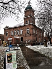 | Ravalli County Courthouse | building | 1979 | 79001424 |
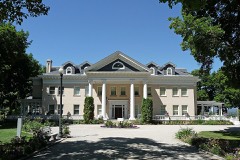 | Riverside | building | 1987 | 87001235 |
| Rocky Mountain Laboratory Historic District | district | 1988 | 88001274 | |
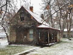 | John Sharp House | building | 1991 | 91000761 |
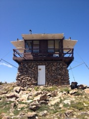 | St. Mary Peak Lookout | building | 2018 | 100002299 |
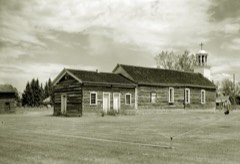 | St. Mary's Church and Pharmacy | building | 1970 | 70000364 |
| St. Mary's Mission Historic District (Boundary Increase) | district | 2010 | 10000552 | |
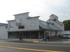 | Stevensville Feed Mill | building | 1991 | 91000762 |
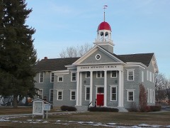 | Stevensville Grade School-United Methodist Church | building | 1991 | 91000764 |
| Stevensville Mercantile Company Oil Storage Building | building | 1991 | 91000763 | |
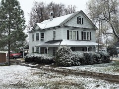 | John Stout House | building | 1988 | 88001290 |
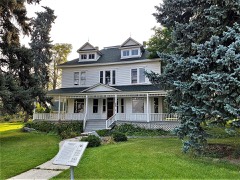 | Summers-Quast Farmstead | building | 1997 | 97001590 |
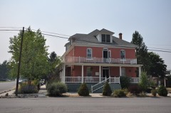 | Thornton Hospital | building | 1991 | 91000765 |
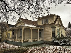 | Erick Trosdahl House | building | 1988 | 88001275 |
| University Heights Historic District | district | 2012 | 12000501 | |
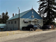 | VFW Club | building | 1988 | 88001287 |
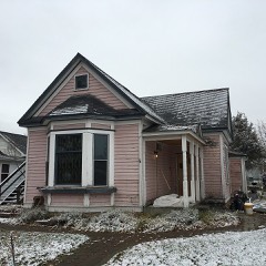 | Frank Wallin House | building | 1988 | 88001293 |
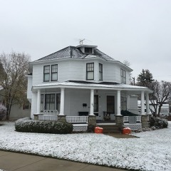 | Other C. Wamsley House | building | 1988 | 88001285 |
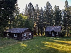 | West Fork Ranger Station | district | 2023 | 100009135 |
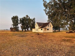 | Whaley Homestead | building | 1992 | 91000442 |
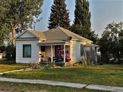 | Williams House | building | 1991 | 91000766 |
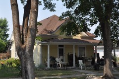 | John and Ann Williams House | building | 1991 | 91000735 |
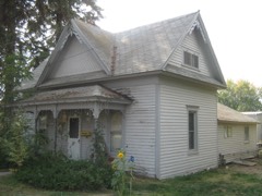 | Benjamin Young House | building | 1991 | 91000741 |
Every wildfire the federal occurrence database records inside this county: 2,535 of them, burning about 470,550 acres. 1,876 started naturally and 16 were recorded as arson. Each settlement page carries the fires within five miles of it.
| Reported cause | Fires |
|---|---|
| Natural | 1876 |
| Recreation and ceremony | 284 |
| Debris and open burning | 131 |
| Missing data/not specified/undetermined | 123 |
| Equipment and vehicle use | 39 |
| Smoking | 22 |
| Misuse of fire by a minor | 22 |
| Arson/incendiarism | 16 |
| Power generation/transmission/distribution | 13 |
| Fireworks | 5 |
| Firearms and explosives use | 2 |
| Railroad operations and maintenance | 1 |
| Other causes | 1 |
The five largest, by the area the report gives. None of them was recorded as arson.
| Date | Cause | Size | Reported by | Name on the report |
|---|---|---|---|---|
| 31 July 2000 | Natural | 145,040 acres | Bitterroot National Forest | BEAR |
| 31 July 2000 | Natural | 48,300 acres | Bitterroot National Forest | MAYNARD |
| 31 July 2007 | Natural | 29,062 acres | Bitterroot National Forest | ROMBO |
| 8 August 2003 | Natural | 25,680 acres | Southwestern Land Office | COONEY RIDGE |
| 31 July 2000 | Natural | 21,998 acres | Bitterroot National Forest | COYOTE |
| 31 July 2000 | Natural | 21,487 acres | Bitterroot National Forest | TAYLOR SPRINGS |
| 9 August 2005 | Natural | 13,327 acres | Bitterroot National Forest | SIGNAL ROCK |
| 28 August 2011 | Natural | 13,261 acres | Bitterroot National Forest | UP TOP |
Every settlement page carries the fires within five miles of it - see the settlement index below.
The NOAA Storm Events Database holds 181 reports for this county, causing 1 death, 2 injuries and about $2,717,350 in recorded property damage. Each settlement page carries the reports that name it.
| Kind of event | Reports |
|---|---|
| Hail | 85 |
| Thunderstorm Wind | 52 |
| Flood | 13 |
| Heavy Rain | 10 |
| Flash Flood | 9 |
| Lightning | 4 |
| Tornado | 3 |
| Debris Flow | 3 |
| Wildfire | 2 |
The most serious of them, by death, then injury, then recorded damage. The accounts are quoted exactly as the forecast office filed them.
| When | Event | Place named | Harm | What the report says |
|---|---|---|---|---|
| May 1996 | Flood | Antrim Creek | 1 killed | no account filed |
| June 1975 | Tornado (F2) | not stated | 1 hurt, $25,000 | no account filed |
| May 2013 | Lightning | Florence | 1 hurt | A 22 year old male was struck by lightning while changing an irrigation pipe. Injuries were reported as second degree burns. |
| August 2002 | Hail | Stevensville | $2,000,000 | no account filed |
| May 2010 | Lightning | Corvallis | $250,000 | A home near Corvallis was hit by lightning and burned. |
| July 2014 | Lightning | Darby | $100,000 | A single lightning bolt struck small crab-apple trees at a ranch located on Tin Cup Road, killing all 45 cattle crowded together. The Black Angus cattle consisted of cows, calves and a prize bull that died. A conservative damage estimate calculated by the NWS Missoula office is around $100,000. |
| July 2023 | Lightning | Darby | $70,000 | A lightning caused fire consumed hay stored for winter cattle feeding at the Double K Ranch. More than 400 bales each weighting 1000 pounds were lost, which is a year's worth of feed for this ranch. Fencing was also lost in the fire. |
| November 2006 | Flood | Stevensville | $60,000 | Kootenai Creek flooded from heavy rain and snow melt washing a bridge out. Minor small stream flooding was reported elsewhere in the county. |
| June 2017 | Flood | Hamilton Rvlli Co Ar | $30,000 | The heavy rain had widespread impacts in Ravalli county. RAWS sensors reported between 1 to 3 inches overnight from June 12 to June 13, with Gird Point RAWS receiving 3.67 inches over the 2-day event. Spotters reported water flowing over driveways and local roads near Stevensville, MT. Victor, MT fire department reported flooding at Middle Bear Creek. Water overwhelmed culverts and washed over roads east of Stevensville causing $15,000 of damage for the road department. Homeowners on the east side of the Bitterroot Valley reported damages to garages, driveways, and gardens, with many public roads seeing water over roads. Skalkaho Highway, MT-38, was closed June 13th due to water on roadways. |
| July 2024 | Thunderstorm Wind | Stevensville | $25,000 | A weather station at the Stevensville Airport reported the gust to 66 mph originating out of the northwest. Multiple power line and pole issues were reported in the northern Ravalli County due to the winds. It appears that the Stevensville area was the furthest south extent of the derecho winds, while the Missoula area took a direct hit. |
| May 2018 | Hail | Hamilton | $20,000 | This storm produced enough hail to cover the ground several inches in the Hamilton area. There were multiple reports of one inch hail. A lady reported that she would have to replace her roof due to the hail damage. She remarked that she knew of several others who had to get their roofs repaired. |
| August 2007 | Thunderstorm Wind | Stevensville | $20,000 | A severe thunderstorm moved across the Burnt Fork area near Stevensville during the evening hours and blew the roof off of a building. |
| March 2014 | Flood | Florence | $16,000 | Above normal snowfall in February resulted in an unusually high snowpack across the Bitterroot Valley at the beginning of March. The Hamilton COOP reported a snow depth of 16 on March 2 which disappeared by March 9. Weather spotters in the Florence area reported well over a foot of snow at the beginning of March. This snowpack combined with 0.50 to 1 of mild rainfall and temperatures well into the 50's caused rapid snowmelt and subsequently overland flooding in the Bitterroot Valley. A person from the public in Florence off Hidden Valley Rd. reported a damaged fence, multiple homes with water damage and several windows broken. The MT DOT reported heavy water on the roadways S-203 2 miles east of Florence, near the junction with US-93. They also reported heavy amounts of water on S-203 10 miles north of the Stevensville Junction with S-269. The Ravalli County DES coordinator remarked that this was the worst flooding he had seen in 41 years in these areas. |
| July 2021 | Flash Flood | Southern Cross | $15,000 | A local apple orchard owner reported that 'a massive amount of flood water', overflowed the Bitterroot irrigation canal after heavy rain. This flood water carved 18 ditches through about 3 rows of his orchard. In addition, hail shredded some leaves of trees and strong winds toppled a 20-year old pine tree. After assessing the damage he felt there would be no crop of apples in 2021. |
| July 2012 | Thunderstorm Wind | Stevensville | $15,000 | A strong thunderstorm moved through Ravalli County, snapping numerous trees four to eight feet above the ground. The trees were willows, poplars, and cottonwoods. |
| August 2008 | Thunderstorm Wind | Hamilton | $12,000 | Ravalli County dispatch received several reports of downed trees due to thunderstorm winds in the Bitterroot Valley from Florence to Hamilton. |
| August 2025 | Debris Flow | Sula | $10,000 | The Bitterroot National Forest has issued a safety alert for a debris flow across Forest Road 724 near the East Fork Trailhead. The debris flow occurred within the 2024 Johnson Wildfire burn scar after a short, intense storm dropped a radar-estimated 0.41 inches of rain in just 15 minutes, and around 0.51 inches in less than an hour. |
| July 2017 | Thunderstorm Wind | Florence | $10,000 | Multiple trees fell due to the severe wind in the Florence area with up to 6 inch diameter bases. One large tree fell onto a house and broke the sky light. Another tree hit a power line on Ambrose Creek causing a fire. Over three thousand customers were without power for four hours after the thunderstorm went through. |
| July 2022 | Hail | Stevensville Co Arpt | $6,000 | Local reports between Stevensville and Florence, MT varied between 1 to 1.50 for hail size, with damage to cars, trees, and at least one garden. Damage to trees, and a barn blown over in Stevensville, suggested estimated wind gusts to near 70 mph emanating from the storm. |
| November 2008 | Flash Flood | Hamilton | $5,800 | Ravalli County Road Department reported wash-outs on West Side Rd. (SW of Hamilton), West Hills Way (NW of Hamilton), and Camas Creek Loop (SW of Hamilton). |
| November 2008 | Flash Flood | Victor | $5,800 | Ravalli County Road Department reported wash-outs on Middle Bear Creek Rd. (SW of Victor), Pleasant View Dr. (W of Victor), and Red Crow Rd. (SW of Victor). |
| August 2025 | Debris Flow | Hamilton Rvlli Co Ar | $5,000 | Multiple debris flows blocked Skalkaho Highway (Highway 38) in three locations. Two slides occurred south of Skalkaho Falls, with an additional flow reported west of the winter gate. |
| May 1993 | Hail | Hamilton | $5,000 | Lightning struck a house and set it on fire. |
| August 2013 | Thunderstorm Wind | Hamilton | $3,000 | The Ravalli County emergency manager reported that multiple power lines were down around Hamilton. |
| August 1990 | Tornado (F0) | not stated | $2,500 | no account filed |
| August 2024 | Thunderstorm Wind | Kenspur | $1,000 | Thunderstorm winds pushed over a 20 foot tall tree along Eastside Highway. |
| August 2024 | Thunderstorm Wind | Victor | $1,000 | A severe storm knocked over several trees along Highway 93 from south of Hamilton through Victor. The Soft Rock mesonet station in Corvallis recorded a gust of 72 mph. The power company reported about 2800 without power. |
| May 2024 | Thunderstorm Wind | Charlos Hgts | $1,000 | The Ravalli County Sheriff's Office reported U.S. Highway 93 south of Hamilton between mile marker 38 and mile marker 39 was closed due to downed power lines. |
| May 2018 | Flood | Pinesdale | $1,000 | The Bitterroot River reached minor flood stage causing the Spring Gulch campground and low lying areas adjacent to the river to flood. |
| May 2018 | Flood | Kenspur | $1,000 | With both the Bitterroot River and Burnt Fork Creek running high, damage to the Lee Metcalf Wildlife Refuge and Whitetail Golf Course occurred. Much of the damage included scouring of pavement in these areas. |
| July 2025 | Debris Flow | Sula | $500 | Radar-estimated rainfall of 1.77 inches fell in one and a half hours and triggered a debris flow that covered the East Fork Road, east of Sula, at Mile-marker 4. |
| September 2025 | Thunderstorm Wind | Grantsdale | $500 | Thunderstorm outflow winds marched northward through the Bitterroot Valley, resulting in about 20 utility customers losing power. General gusts were 35 to 45 mph topping out near 50 mph. |
| October 1988 | Tornado (F0) | not stated | $250 | no account filed |
| July 2025 | Heavy Rain | Hamilton Rvlli Co Ar | - | Radar estimated 1.41 inches of rain had fallen over the western portion of the Daly burn scar, located west of Skalkaho Pass. A few days later, a rock slide was reported in the vicinity. |
| September 2024 | Thunderstorm Wind | Corvallis | - | Gusty outflow occurred throughout the Bitterroot Valley but a localized area from just south of Corvallis to near Quast Lane experienced damaging winds. A few downed trees and numerous downed branches were noted. A peak gusts of 63 mph occurred at Soft Rock RAWS which was supported by radar velocities with 2000-3000 customers losing power. |
| September 2024 | Thunderstorm Wind | Sula | - | Thunderstorm outflow winds were observed, with a radar estimated time of 2:47 pm MDT. Minor structural damage to the Incident Command Post for the Johnson Fire but no injuries. |
| June 2023 | Heavy Rain | Bell Crossing | - | Fields were flooded east of Victor near the Home Acres Road area. The radar estimated rainfall showed 2.60 inches fell in only 1.5 hours. |
| August 2023 | Thunderstorm Wind | Florence | - | Reports of large trees down near Lolo Pass were received. Radar velocity data indicated winds over 60 mph. |
| July 2022 | Hail | Conner | - | A person from Conner mentioned that quarter size hail ruined their garden. |
| July 2022 | Hail | Sula | - | A report of 1 diameter hail was received just east of Sula, MT. |
| July 2022 | Hail | Darby | - | Although the largest public report of hail was 3/4 on Deer Mountain east of Darby, MT, radar did estimate 1.25 hail with a reflectivity core of 70 dbz at 33,000 feet. |
| July 2022 | Hail | Corvallis | - | A member of the public reported 1 inch hail near Corvalis. |
| June 2022 | Hail | Stevensville | - | Several reports of 1.00 inch hail. |
| May 2020 | Flood | Victor | - | Swollen small streams brought flooding to fields and low-lying areas in the Bitterroot Valley. A few homes were surrounded by water and reported water in basements. Local and county roads, along with a small section of Eastside Highway north of Stevensville, experienced water flowing across roadways. A Forest Service campground south of Darby was also closed because of the stream flooding. In addition, the Bitterroot River rose enough to flood ranch fields around Lolo. |
| August 2020 | Hail | Sula | - | A strong thunderstorm dropped large hail on U.S. Highway 93 between Conner and Sula. Quarter to half dollar size hail was reported near Sula, MT. |
| June 2019 | Hail | Darby | - | Hail stones from penny to nickle size still on the ground a day after the thunderstorm passed through. Minor damage to tree leaves and plants also noted. |
| June 2019 | Hail | Grantsdale | - | Hail drifted up to two feet deep off of roofs with some minor vegetation damage. |
| July 2019 | Hail | Victor | - | Ping-pong-sized hail was reported in Victor as a thunderstorm moved off the Bitterroot divide and into the valley. |
| July 2019 | Hail | Hamilton | - | Quarter to ping-pong-sized hail was reported in Hamilton. Quarter-sized hail was also reported in Corvallis. |
| May 2018 | Flood | Florence | - | The Bitterroot River near Missoula reached minor flood stage which caused field flooding on the east side of Highway 93 both north and south of Lolo. Ground water adjacent to the Bitterroot River flooded the Linda Vista Golf course and nearby homeowner's backyards. |
| May 2018 | Hail | Hamilton | - | Hailstones reported varied from marble up to ping pong size during the storm. |
| May 2017 | Thunderstorm Wind | Sula | - | A RAWS station east of Sula recorded 66 mph winds. |
| May 2017 | Hail | Sula | - | Resident reported mostly nickel-sized hailstones, with a few quarter-sized hailstones mixed in. No evidence of damage to property was seen. Resident estimated wind speeds with the storm outflow at 40 to 50 mph. Frequent lightning was also reported. |
| February 2017 | Heavy Rain | Florence | - | An NWS Employee reported extensive ponding in fields and near property in Corvallis, MT. The exceptionally high amount of valley snow-pack allowed for periods of moderate rain combined with relatively warm temperatures to cause unusually extensive areal flooding on Feb. 9 & 10. |
| August 2016 | Hail | Charlos Hgts | - | Penny size hail reported on the south side of the Roaring Lion Fire. |
| August 2016 | Hail | Grantsdale | - | A trained spotter estimated that some hailstones were bigger than quarters. |
| July 2016 | Hail | Florence | - | A co-workers friend reports quarter size hail. |
| July 2016 | Hail | Florence | - | NWS employee reports quarter size hail. |
| June 2015 | Hail | Bell Crossing | - | A person from the public reported persistent rain and hail between 6:30pm to 7:30pm. They estimated the largest hail were quarter size. |
| August 2015 | Thunderstorm Wind | Stevensville | - | A fence with 5 x 5 inch posts was blown down. Wind estimates near 60 mph. |
The Survey's mineral resources record lists 220 workings inside this county. 19 still produce and 201 are closed or unrecorded. Each settlement page carries the workings within five miles of it.
| Commodity | Workings |
|---|---|
| Gold | 41 |
| Silver | 20 |
| Titanium | 15 |
| Copper | 13 |
| Niobium (Columbium) | 12 |
| Pumice | 11 |
| Barium-Barite | 9 |
| Quartz | 8 |
| Uranium | 8 |
| Fluorine-Fluorite | 8 |
| Molybdenum | 6 |
| Iron | 6 |
| REE | 6 |
| Vermiculite | 6 |
The least common of them first, because a county's hundredth gravel pit says nothing its first ten did not.
| Where | Site | Commodity | Status | Recorded |
|---|---|---|---|---|
| Ambrose Creek | Titanium, Thorium, Iron | Unknown | ||
| Bass Creek Sillimanite | Kyanite | Occurrence | ||
| Bitterroot Valley Stone Quarry | Marble, Dimension | Producer | ||
| Bush Place | Kaolin | Unknown | ||
| Cameron Creek Placer | Titanium, Metal, Iron, REE, Zirconium | Occurrence | Placer | |
| Cameron Creek Placer | Thorium, Iron, Uranium | Unknown | ||
| Canyon Creek | Titanium, Thorium, Zirconium, Iron | Unknown | ||
| Cleveland | Zinc, Silver, Lead, Copper | Prospect | ||
| Cliff Mine | Lead, Silver | Occurrence | Underground | |
| Clipper | Aluminum | Occurrence | ||
| Crystal Mountain Fluorspar Mine | Fluorine-Fluorite, Cobalt, Nickel, REE, Uranium | Producer | 1937, 1952 | |
| Curlew | Gold, Silver, Copper, Lead, Zinc | Producer | Pyrite | |
| Curlew | Silver, Lead, Zinc | Past Producer | ||
| Curlew Mine | Silver, Lead, Zinc, Copper, Gold | Past Producer | 1887, 1891 | |
| Eight Mile District | Gold, Silver, Copper, REE, Molybdenum | Past Producer | FISSURE VEINS, PLACER | |
| Gold Leaf Mine | Gold, Silver, Lead, Copper | Past Producer | Galena, Gold, Lead | |
| Hidden Lake Prospect | Copper, Gold, Tungsten | Occurrence | Replacement | |
| Highland Mine | Copper, Gold, Silver, Lead | Occurrence | ||
| Iron Cap | Silica, Iron | Occurrence | 1952 | |
| Lbj, Pic and Per Group | Gold, PGE, Silver | Unknown | ||
| Logger Bugle Ridge Group | Silver, Beryllium, Copper | Past Producer | ||
| Logger Claims Group | Gold, Silver, Beryllium, Molybdenum, Copper, Lead | Occurrence | Vein | |
| Logger No. 1 Claim | Gold, Molybdenum, Silver | Unknown | ||
| Mace Prospect | Tantalum, Mica | Prospect | ||
| Main River Valley | Iron, Titanium, Zirconium, Thorium | Unknown | ||
| Mccalla Creek | Titanium, Iron, Zirconium | Unknown | ||
| Mccalla Creek Placer Area | Garnet, Titanium, Metal, Thorium, Zirconium, Iron | Occurrence | Garnet, Ilmenite, Magnetite, Monazite, Zircon | |
| Meadow Creek | Iron, Titanium, Metal, Zirconium | Occurrence | Placer | |
| Mineral Point District | Niobium (Columbium), REE, Strontium, Cerium, Silver, Copper, Gold | Prospect | 1954 | |
| Montana Star Mine | Lead, Zinc, Copper | Prospect | ||
| Murry Grant Claims | Lead, Gold, Silver, Copper | Prospect | ||
| Nez Pearce #1 | Fluorine-Fluorite, REE, Titanium | Prospect | ||
| One Horse | Zinc, Silver, Lead | Prospect | ||
| Ore Finder Group | Silver, Copper, Gold | Prospect | ||
| Rye Creek | Thorium, Titanium, Uranium | Unknown | ||
| Sawtooth Creek | Titanium, Iron, Thorium | Unknown | ||
| Sheep Creek | REE, Thorium | Producer | Metamorphic | |
| Sheep Creek Deposits | Niobium (Columbium), Tantalum | Occurrence | ||
| Silverthorn Creek | Titanium, Zirconium, Iron, Thorium | Unknown | ||
| Sleeping Child Quarry | Stone, Dimension | Past Producer | ||
| Smith Mine | Silver, Lead, Copper, Zinc | Prospect | Vein | |
| Smith Mine | Silver, Copper, Zinc, Lead, Gold | Occurrence | ||
| Titanium Occurrence | REE, Thorium, Titanium, Barium-Barite, Niobium (Columbium) | Occurrence | ||
| Titanium Occurrence | REE, Niobium (Columbium), Titanium, Thorium, Barium-Barite | Occurrence | ||
| Titanium Occurrence | REE, Barium-Barite, Niobium (Columbium), Titanium, Thorium | Occurrence | ||
| Unknown | REE, Niobium (Columbium), Uranium, Thorium | Occurrence | ||
| Unnamed Location | Niobium (Columbium), REE, Strontium | Occurrence | ||
| Unnamed Location | Niobium (Columbium), Barium-Barite, REE | Occurrence | ||
| Unnamed Location | Niobium (Columbium), REE, Thorium, Uranium | Occurrence | ||
| Unnamed Sample Location | Calcium, Niobium (Columbium) | Occurrence | ||
| Victor Placer Area | Titanium, Metal, Thorium, Garnet, Zirconium, Iron | Occurrence | Garnet, Ilmenite, Magnetite, Monazite, Zircon | |
| Victor Placer Area | Titanium, Metal, Thorium, Iron | Occurrence | ||
| Violet Group | Molybdenum, Tungsten, Gold, Silver | Occurrence | ||
| Violet Group | Molybdenum, Gold, Silver, Tungsten | Prospect | ||
| Watchtower 1-9 | Lead, Zinc, Silver | Prospect | ||
| Whipperwill Mine | Gold, Lead, Silver, Zinc | Past Producer | ||
| Woods Creek Deposits | REE, Niobium (Columbium), Barium-Barite | Occurrence | Barite, Columbite, Monazite | |
| Woods Creek Iron Deposit | Iron, Silica | Prospect | 1940 | |
| Cliff | Zinc, Lead | Occurrence | ||
| Copper Canyon Mine | Gold, Copper, Silver | Past Producer | ||
| Dominic Group Antimony | Antimony | Producer | ||
| Dorothy Lee | Antimony | Occurrence | ||
| Highland Mine | Copper, Gold, Lead, Silver | Past Producer | ||
| Jackie Mine | Tin, Tantalum | Prospect | ||
| Montana Prince Mine | Silver, Gold, Zinc | Occurrence | Sphalerite | |
| Red Rock Creek | Gold, Copper, Silver | Past Producer | ||
| Sleeping Child | Tungsten, Zirconium | Occurrence | ||
| Wild Maple | Zinc, Gold, Lead, Silver | Prospect | ||
| Windyridge | Zinc, Lead | Prospect | ||
| Woods Creek Copper Mine | Copper, Gold, Silver | Past Producer | ||
| Gallogly Hot Spring | Geothermal | Producer | ||
| Hughes Creek Placers | Gold, Silver, Tin | Producer | 1870 | |
| Hughs Creek Placer | Gold, Tin | Past Producer | ||
| Lucky Strike Shaft | Copper, Silver, Gold | Unknown | ||
| Ripple Lake Prospect | Silver, Copper | Occurrence | Vein | |
| Slate Creek Prospect | Tungsten, Silver, Copper | Occurrence | ||
| Unnamed Warm Springs | Geothermal | Producer | ||
| Weeping Child Hot Springs | Geothermal | Producer | ||
| Woods Creek Copper Mine | Copper, Silver, Gold | Occurrence | Bornite, Chalcopyrite | |
| Donaldson Pit | Sand and Gravel, Construction | Producer | ||
| Palmen Sand and Gravel Pit | Sand and Gravel, Construction | Producer | ||
| Ravalli County Crusher | Sand and Gravel, Construction | Producer | ||
| Slate Creek Mine | Lead | Occurrence | Vein | |
| Unnamed Location | Silver, Lead | Occurrence | ||
| Woodside Pit and Plant | Sand and Gravel, Construction | Producer | ||
| Art L. Wildey | Beryllium | Occurrence | ||
| Broken File Prospect | Beryllium | Occurrence | ||
| Clay Pit | Clay | Unknown | ||
| Clay Pit | Clay | Unknown | ||
| Clay Pit | Clay | Unknown | ||
| Hidden Lake Tungsten | Tungsten | Occurrence | ||
| Lucky Strike | Beryllium | Producer | Beryl | |
| Lucky Strike | Beryllium | Prospect | ||
| Pine Tree | Tungsten | Occurrence | ||
| Strife Prospect | Tungsten | Occurrence | ||
| Unnamed Be Occ | Beryllium | Occurrence | 1954 | |
| Unnamed Location | Clay | Occurrence | ||
| Unnamed Location | Clay | Occurrence | ||
| Blodgett Creek | Titanium, Iron, Thorium, Zirconium | Unknown | ||
| Blue Nose Mine | Molybdenum | Occurrence | Molybdenite | |
| Blue Nose Mine | Molybdenum | Past Producer | ||
| Btm | Iron | Unknown | ||
| Dark Star Group | Niobium (Columbium), REE | Unknown | ||
| Ellade | Vermiculite | Prospect | ||
| Gird Creek | Titanium, Thorium | Unknown | ||
| Gird's Creek Vermiculite | Vermiculite | Occurrence | ||
| Hamilton Vermiculite Deposit | Vermiculite | Occurrence | 1930 | |
| Iron Cap Mine | Iron | Occurrence | Vein | |
| Lost Horse Creek | Titanium, Thorium | Unknown | ||
| Mill Creek | Titanium, Iron, Thorium, Zirconium | Unknown | ||
| Molly 1, 2, 3, 4 and 5 Mine | Molybdenum | Producer | ||
| Puff Ball No. 1-17 | REE | Prospect | ||
| Roaring Lion Creek | Titanium, Iron, Thorium, Zirconium | Unknown | ||
| Rye Creek Prospect | Niobium (Columbium), REE | Occurrence | Columbite | |
| Sargent Ranch | Uranium, Thorium | Occurrence | ||
| Shalkaho Creek | Titanium, Iron, Thorium, Zirconium | Unknown | ||
| Sharrot Creek | Titanium, Thorium | Unknown | ||
| Sheafman Creek | Titanium, Iron, Thorium, Zirconium | Unknown | ||
| Skalkaho Vermiculite Deposit | Vermiculite | Prospect | ||
| Unknown | Iron | Occurrence | Hematite, Magnetite | |
| Unnamed Location | Vermiculite | Occurrence | ||
| Unnamed Location | Molybdenum | Occurrence | ||
| Vermiculite | Vermiculite | Occurrence | ||
| Victor Deposit | Titanium, Iron, Thorium, Zirconium | Prospect | ||
| White Cloud | Iron, Gold | Unknown | ||
| Woods Creek Iron Mine | Iron | Occurrence | Hematite, Magnetite | |
| Ambrose Creek | Quartz | Past Producer | Quartz | |
| Crystal Mountain | Fluorine-Fluorite | Producer | 1951 | |
| Eagle Rock Mining Co. | Quartz | Producer | ||
| Gold Creek | Fluorine-Fluorite | Unknown | ||
| Little Joe Prospect | Uranium | Occurrence | ||
| Little Joe Prospect | Uranium | Occurrence | ||
| Lucky Joe Mine | Uranium | Occurrence | ||
| Lucky Joe Mine | Uranium | Occurrence | ||
| Lucky Strike | Quartz | Prospect | ||
| Lumberjack Group | Fluorine-Fluorite | Prospect | ||
| Marion Mine Nos. 1,2,3,4,5 | Fluorine-Fluorite | Producer | ||
| Montana Prince | Quartz | Unknown | ||
| Retirement Claims | Fluorine-Fluorite | Prospect | ||
| Sleeping Child A | Quartz | Occurrence | Quartz | |
| Sleeping Child A | Quartz | Occurrence | ||
| Sleeping Child B | Quartz | Occurrence | Quartz | |
| Sleeping Child B | Quartz | Occurrence | ||
| Trapper Ck Claims | Uranium | Prospect | ||
| Unknown | Uranium | Occurrence | ||
| Unnamed Location | Fluorine-Fluorite | Unknown | ||
| Unnamed Location | Uranium | Occurrence | ||
| Miller Mine | Barium-Barite | Unknown | ||
| Rocky Point No. 5 | Barium-Barite | Occurrence | ||
| Shook | Copper, Barium-Barite | Occurrence | ||
| Slocum Gulch Barite Deposit | Barium-Barite | Occurrence | Barite | |
| Stevensville Barite Deposit | Barium-Barite | Occurrence | Vein | |
| Unnamed Location | Barium-Barite | Occurrence | ||
| Unnamed Location | Barium-Barite | Occurrence | ||
| W Fork-Bitteroot River | Barium-Barite | Unknown | ||
| Woods Creek Barite No. 1 | Barium-Barite | Unknown | ||
| Ambrose Creek Pumice Deposit | Pumice | Occurrence | Pumice | |
| Bitteroot Valley | Pumice | Unknown | ||
| Corvallis Pumicite | Pumice | Occurrence | ||
| Dry Gulch Pumice Deposit | Pumice | Occurrence | Pumice | |
| Spooner Creek Ash | Pumice | Occurrence | ||
| Unnamed Location | Pumice | Occurrence | ||
| Unnamed Location | Pumice | Occurrence | ||
| Unnamed Location | Pumice | Occurrence | ||
| Unnamed Pubmice Occurrence | Pumice | Occurrence | ||
| Victor Pumicite | Pumice | Occurrence | ||
| Willoughby Creek Ash | Pumice | Occurrence | ||
| Beaver Creek | Niobium (Columbium) | Occurrence | 1954 | |
| Beaver Creek Columbite Deposit | Niobium (Columbium) | Prospect | ||
| Columbite | Niobium (Columbium) | Occurrence | ||
| Sheep Creek Columbite Deposits | Niobium (Columbium) | Prospect | ||
| Tirebiter #5 & #6 | Niobium (Columbium) | Prospect | ||
| Unnamed Carbonate Bands | Niobium (Columbium) | Occurrence | ||
| Claremont | Copper | Unknown | ||
| Claremont Mine | Copper | Occurrence | Unknown | |
| Copper Queen | Copper | Occurrence | Malachite | |
| Copper Queen | Copper | Unknown | ||
| Green Goose and Sunset | Copper, Gold | Prospect | ||
| New Discovery | Copper | Occurrence | ||
| Pleasant View | Silver, Copper | Past Producer | 1871 | |
| Unnamed Location | Copper, Silver | Occurrence | ||
| Titanium Occurrence | Titanium | Occurrence | ||
| Ace Mine | Silver | Occurrence | ||
| Ace Mine | Silver | Occurrence | ||
| Bitterroot Prince | Silver | Past Producer | ||
| Bluebird | Silver | Prospect | ||
| Bugle | Silver | Prospect | ||
| Cleveland Mine | Gold, Silver | Unknown | ||
| Dsck Mine | Gold, Silver | Past Producer | ||
| Gold Leaf | Gold, Silver | Prospect | ||
| Hughes Gulch Placer | Gold, Silver | Past Producer | ||
| Lucky Star Claim | Gold, Silver | Unknown | ||
| Pleasant View | Silver | Prospect | ||
| White Cloud Mine | Gold, Silver | Past Producer | 1866 | |
| Blue Joint Placer | Gold | Prospect | ||
| Castle Rock | Gold | Unknown | ||
| Chicago Placer | Gold | Unknown | ||
| Cleveland Mine | Gold | Past Producer | Unknown | |
| Crandall Creek | Gold | Occurrence | ||
| Gold Bar Placer | Gold | Unknown | ||
| High-Level Placers Hughes Creek | Gold | Past Producer | ||
| High-Level Placers Hughes Creek | Gold | Past Producer | ||
| Hughes Creek Placer | Gold | Past Producer | ||
| Larrigon Mine | Gold | Producer | ||
| Larrigon Mine | Gold | Past Producer | ||
| Last Chance | Gold | Unknown | ||
| Placer | Gold | Occurrence | ||
| Placer | Gold | Occurrence | ||
| Placer Mine | Gold | Unknown | ||
| Placer Mine | Gold | Unknown | ||
| Placer Mine | Gold | Unknown | ||
| Schooner Gulch | Gold | Unknown | ||
| Star | Gold | Past Producer | ||
| Starr | Gold | Occurrence | ||
| Three Mile Creek Placer | Gold | Past Producer | Placer | |
| Three Mile District | Gold | Past Producer | PLACER | |
| Unnamed Location | Gold | Occurrence | ||
| Washington | Gold | Past Producer | ||
| Woods Creek Iron Mine | Gold | Past Producer | ||
| Woodtick No.1 | Gold | Occurrence |
Named settlements recorded in the Geographic Names Information System, each with the topographic sheets covering it. Villages, hamlets and abandoned places alike. Each is shown with the nearest named watercourse or landform and the survey quadrangle it falls on.
Stevensville census division · 59870 · On North Swamp Creek · Stevensville quadrangle
14 sheets, 1912 to 1998
Victor census division · 59875 · On Sweathouse Creek · Bing quadrangle
17 sheets, 1901 to 1998
Stevensville census division · 59870 · On South Willoughby Creek · Bing quadrangle
17 sheets, 1901 to 1998
Stevensville census division · 59870 · On Ambrose Creek · Stevensville quadrangle
14 sheets, 1912 to 1998
No longer a settlement
Stevensville census division · 59870 · On Spring Creek · Stevensville quadrangle
14 sheets, 1912 to 1998
Stevensville census division · 59833 · On Tie Chute Creek · Florence quadrangle
13 sheets, 1912 to 1998
Stevensville census division · 59870 · On Burnt Fork Bitterroot River · Corley Gulch quadrangle
15 sheets, 1909 to 1998
No longer a settlement
Hamilton census division · 59840 · On Hayes Creek · Hamilton South quadrangle
16 sheets, 1901 to 1998
Stevensville census division · 59870 · On Willoughby Creek · Bing quadrangle
17 sheets, 1901 to 1998
Sula census division · 59827 · On Whitsell Creek · Robbins Gulch quadrangle
8 sheets, 1956 to 1998
Hamilton census division · 59828 · On Coalpit Creek · Corvallis quadrangle
16 sheets, 1901 to 1998
Hamilton census division · 59840 · On Skalkaho Creek · Hamilton South quadrangle
16 sheets, 1901 to 1998
Hamilton census division · 59840 · On Dutch Hill · Hamilton North quadrangle
17 sheets, 1901 to 1998
No longer a settlement
Stevensville census division · 59833 · On Granite Creek · Davis Point quadrangle
18 sheets, 1903 to 1999
No longer a settlement
Stevensville census division · 59870 · On South Willoughby Creek · Bing quadrangle
17 sheets, 1901 to 1998
No longer a settlement
Stevensville census division · 59833 · On One Horse Creek · Florence quadrangle
13 sheets, 1912 to 1998
Hamilton census division · 59840 · On Skalkaho Creek · Hamilton South quadrangle
16 sheets, 1901 to 1998
Hamilton census division · 59840 · On Canyon Creek · Hamilton South quadrangle
16 sheets, 1901 to 1998
Darby census division · 59829 · Near Burke Gulch · Darby quadrangle
17 sheets, 1901 to 1998
Stevensville census division · 59833 · On Larry Creek · Stevensville quadrangle
14 sheets, 1912 to 1998
Hamilton census division · 59840 · On Canyon Creek · Hamilton South quadrangle
16 sheets, 1901 to 1998
Sula census division · 59827 · Near Lord Draw · Medicine Hot Springs quadrangle
9 sheets, 1956 to 1998
Stevensville census division · 59870 · On South Swamp Creek · Bing quadrangle
17 sheets, 1901 to 1998
Darby census division · 59829 · On Chaffin Creek · Burnt Ridge quadrangle
10 sheets, 1956 to 1998
Hamilton census division · 59841 · Near Sheridan Gulch · Hamilton North quadrangle
17 sheets, 1901 to 1998
Hamilton census division · 59828 · On Coalpit Creek · Corvallis quadrangle
16 sheets, 1901 to 1998
Hamilton census division · 59840 · On Blodgett Creek · Hamilton North quadrangle
17 sheets, 1901 to 1998
Stevensville census division · 59870 · On North Swamp Creek · Stevensville quadrangle
14 sheets, 1912 to 1998
Stevensville census division · 59833 · On Larry Creek · Stevensville quadrangle
14 sheets, 1912 to 1998
No longer a settlement
Victor census division · 59875 · On Fred Burr Creek · Hamilton North quadrangle
17 sheets, 1901 to 1998
Darby census division · 59829 · On Clear Creek · Darby quadrangle
17 sheets, 1901 to 1998
Victor census division · 59875 · On Little Smith Creek · Victor quadrangle
15 sheets, 1901 to 1998
Victor census division · 59875 · On North Channel Bear Creek · Bing quadrangle
17 sheets, 1901 to 1998
Hamilton census division · 59840 · On Camas Creek · Hamilton South quadrangle
16 sheets, 1901 to 1998
Hamilton census division · 59875 · On Cow Creek · Hamilton North quadrangle
17 sheets, 1901 to 1998
Hamilton census division · 59828 · On Cow Creek · Hamilton North quadrangle
17 sheets, 1901 to 1998
The vanished settlements of Ravalli County: the places named above that are no longer on the map.