 Block
From the record
One of 92 National Register listings published here for Ravalli County · listed in 2012 · category: District.
Sources: the case file at the National Archives · the National Register database, National Park Service
Listed on the National Register of Historic Places in 2012.
One of 92 National Register listings published here for Ravalli County · listed in 2012 · category: District.
Sources: the case file at the National Archives · the National Register database, National Park Service
Regional context, not property-specific evidence. The federal wildfire occurrence database lists 146 fires within 5 miles of University Heights Historic District between 1992 and 2020, burning about 2,436 acres in total. 60 started naturally. 2 were recorded as arson. Distance is straight-line from the map coordinates, so a fire counted here may appear on a neighbouring settlement's page as well.
| Reported cause | Fires |
|---|---|
| Natural | 60 |
| Recreation and ceremony | 42 |
| Missing data/not specified/undetermined | 13 |
| Equipment and vehicle use | 8 |
| Smoking | 7 |
| Misuse of fire by a minor | 5 |
| Debris and open burning | 5 |
| Arson/incendiarism | 2 |
| Railroad operations and maintenance | 1 |
| Firearms and explosives use | 1 |
| Power generation/transmission/distribution | 1 |
| Fireworks | 1 |
The most recent of them, most recent first, with the day each was reported and the service that recorded it.
| Date | Cause | Size | Reported by | Name on the report |
|---|---|---|---|---|
| 7 September 2020 | Power generation/transmission/distribution | under an acre | RavaIIi County | D2 - MUTUAL AID - COAL MINE RD |
| 7 September 2003 | Natural | under an acre | Bitterroot National Forest | TIN CUP RIDGE |
| 6 September 2018 | Natural | 1.0 acres | Bitterroot National Forest | TIN CUP 2 |
| 5 September 2013 | Natural | under an acre | Bitterroot National Forest | GOLF BALL |
| 5 September 2010 | Natural | under an acre | Bitterroot National Forest | STELLA |
| 5 September 2010 | Natural | under an acre | Bitterroot National Forest | JERRY FIRE |
| 5 September 2009 | Recreation and ceremony | under an acre | Bitterroot National Forest | TIN CUP PARTY |
| 4 September 2019 | Missing data/not specified/undetermined | under an acre | RavaIIi County | E MILES AVE |
Regional context, not property-specific evidence. The federal mineral resources record lists 1 working within 5 miles of University Heights Historic District: 1 unknown. None of them still produces. What was taken out: Titanium, Thorium. Distance is straight-line from the map coordinates, so a quarry counted here may appear on a neighbouring settlement's page as well.
| Where | Site | Commodity | Status | Recorded |
|---|---|---|---|---|
| Lost Horse Creek | Titanium, Thorium | Unknown |
Regional context, not property-specific evidence. The National Weather Service names Darby, the town this property stands in, in 14 storm reports between 1996 and 2023: 9 hail, 2 thunderstorm wind, 2 lightning, 1 flash flood. No death or injury is recorded in these reports. Each account below is quoted exactly as the forecast office filed it, from the NOAA Storm Events Database, and each date opens the federal record of that event.
| When | Event | Place named | Harm | What the report says |
|---|---|---|---|---|
| July 2014 | Lightning | Darby | $100,000 | A single lightning bolt struck small crab-apple trees at a ranch located on Tin Cup Road, killing all 45 cattle crowded together. The Black Angus cattle consisted of cows, calves and a prize bull that died. A conservative damage estimate calculated by the NWS Missoula office is around $100,000. |
| July 2023 | Lightning | Darby | $70,000 | A lightning caused fire consumed hay stored for winter cattle feeding at the Double K Ranch. More than 400 bales each weighting 1000 pounds were lost, which is a year's worth of feed for this ranch. Fencing was also lost in the fire. |
| July 2022 | Hail | Darby | - | Although the largest public report of hail was 3/4 on Deer Mountain east of Darby, MT, radar did estimate 1.25 hail with a reflectivity core of 70 dbz at 33,000 feet. |
| June 2019 | Hail | Darby | - | Hail stones from penny to nickle size still on the ground a day after the thunderstorm passed through. Minor damage to tree leaves and plants also noted. |
| July 2014 | Hail | Darby | - | A person from the public reported dime to nickel size hail along with heavy rain. Pea-size hail was reported in Philipsburg. |
| August 2010 | Hail | Darby | - | A spotter at the Deer Mountain lookout reported dime to quarter size hail and heavy rain. |
| August 2010 | Hail | Darby | - | Broadcast media forwarded on a picture they received from a viewer of hail measuring 1.25 inches in diameter. |
| June 2006 | Hail | Darby | - | no account filed |
| July 2006 | Hail | Darby | - | no account filed |
| June 2005 | Thunderstorm Wind | Darby | - | no account filed |
| June 2004 | Hail | Darby | - | no account filed |
| July 2001 | Flash Flood | Darby | - | no account filed |
| July 1998 | Thunderstorm Wind | Darby | - | no account filed |
| August 1996 | Hail | Darby | - | no account filed |
No historic map-sheet match is published for this property yet. That does not mean no map exists. This record needs a coordinate-quality review before it can be joined to a sheet boundary. Browse the county's mapped places while that work is pending.
Other National Register properties close enough to walk or drive between, ordered by distance from this one. Both positions come from the same geocoding pass that matched these properties to their map sheets.
| Photograph | Property | Distance | Listed |
|---|---|---|---|
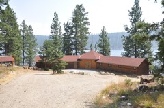 | Hayward Lodge | 2.7 miles | 2015 |
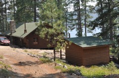 | El Capitan Lodge | 2.7 miles | 1990 |
| Como School | 4.4 miles | 2022 |
| National Archives record | The nomination case file for reference 12000501 in Record Group 79. |
| Ravalli County | All 92 listed properties in this county. |