 Block
Capitol, Montana
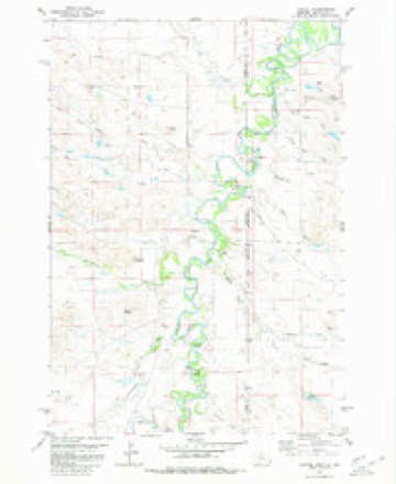
9 topographic sheets cover this place, the earliest surveyed in 1954 and the latest in 1981. It stands in the Alzada-Boyes census division. It lies in ZIP code area 59319. It stands on Fortyeight Mile Creek. The Survey maps it on the Capitol quadrangle.
Topographic sheets covering this place
6 surveys from 9 printed sheetsMatched by testing this settlement's coordinate against the published boundary of every sheet in the United States Geological Survey's historical collection. Each opens the scanned sheet at the Survey.
- 1954 USGS Ekalaka quadrangle1:250000, 3 printings
- 1956 USGS Ekalaka quadrangle1:250000
- 1958 USGS Ekalaka quadrangle1:250000
- 1965 USGS Ekalaka quadrangle1:250000
- 1980 USGS Capitol quadrangle1:24000, 2 printings
- 1981 USGS Alzada quadrangle1:100000
Fires near this place
11 since 1997Regional context, not property-specific evidence. The federal wildfire occurrence database lists 11 fires within 5 miles of Capitol between 1997 and 2014, burning about 161 acres in total. 7 started naturally. None was recorded as arson. Distance is straight-line from the map coordinates, so a fire counted here may appear on a neighbouring settlement's page as well.
| Reported cause | Fires |
|---|---|
| Natural | 7 |
| Missing data/not specified/undetermined | 1 |
| Equipment and vehicle use | 1 |
| Debris and open burning | 1 |
| Misuse of fire by a minor | 1 |
The most recent of them, most recent first, with the day each was reported and the service that recorded it.
| Date | Cause | Size | Reported by | Name on the report |
|---|---|---|---|---|
| 30 September 1998 | Misuse of fire by a minor | under an acre | Rapid City Fire Department | 98-3262 |
| 1 September 2009 | Natural | 14 acres | South Dakota Wildland Fire Suppression | not named |
| 3 August 2014 | Equipment and vehicle use | 6.8 acres | Miles City Field Office | MUD BUTTE |
| 25 August 2002 | Natural | 1.0 acres | Miles City Field Office | MUD BUTTE |
| 23 August 2002 | Natural | 3.0 acres | Miles City Field Office | SAGE BRUSH |
| 3 July 2000 | Natural | under an acre | Miles City Field Office | SKY RANCH |
| 24 July 1997 | Natural | 2.0 acres | Miles City Field Office | MELUM |
| 12 July 2006 | Natural | 125 acres | Miles City Field Office | ATTERBURY |
Mines and quarries near this place
1 within 5 milesRegional context, not property-specific evidence. The federal mineral resources record lists 1 working within 5 miles of Capitol: 1 producer. All of them still produce. What was taken out: Sand and Gravel, Construction. Distance is straight-line from the map coordinates, so a quarry counted here may appear on a neighbouring settlement's page as well.
| Where | Site | Commodity | Status | Recorded |
|---|---|---|---|---|
| Mackey Pit | Sand and Gravel, Construction | Producer |
Storms near this place
13 since 2002Regional context, not property-specific evidence. The National Weather Service names Capitol in 13 storm reports between 2002 and 2024: 5 hail, 4 tornado, 3 thunderstorm wind, 1 flash flood. No death or injury is recorded in these reports. Each account below is quoted exactly as the forecast office filed it, from the NOAA Storm Events Database, and each date opens the federal record of that event.
| When | Event | Place named | Harm | What the report says |
|---|---|---|---|---|
| July 2019 | Flash Flood | Capitol | - | Flooding was reported on small creeks including Hackberry Creek. A large amount of hail was also reported. |
| June 2018 | Tornado (EF2) | Capitol | - | The tornado was on the ground for 7 miles (approximately 24 minutes) from south of Capitol, Montana northeast into South Dakota. In Montana, the tornado path was 3 miles long with a width of 200 yards. Damage ranged from EF-1 at the initial touchdown, increasing to EF-2 just before the South Dakota border. Large tree limbs were downed and trees snapped. The damage became more widespread as the path approached the Little Missouri River. |The maximum wind speed during the life of the tornado was 136 mph (EF-3). The tornado ranged from 200 yards wide in Montana to a half mile wide in South Dakota. |
| June 2018 | Tornado (EF0) | Capitol | - | The tornado briefly touched down and reports indicated there was anti-cyclonic rotation. There were no reports of damage. |
| June 2018 | Tornado (EF0) | Capitol | - | The tornado was on the ground across rural areas for four miles. There were no reports of damage with this tornado. |
| June 2014 | Tornado (EF3) | Capitol | - | A supercell thunderstorm developed very quickly in Eastern Carter County around 2:15 pm. The thunderstorm produced the first ever EF-3 rated tornado in southern Montana. The tornado first touched down at 2:27 pm around 13 miles southwest of Camp Crook, South Dakota, or about 10 miles southwest of Capitol, Montana. The tornado formed in the Sheep Mountains and eventually crossed Tie Creek Road as it moved slowly north. People lost site of the tornado as it entered Custer National Forest around 3:30 pm. ||The tornado was on the ground for an hour and traveled 10 miles and was reported to be a half mile wide at times. The tornado completely destroyed a trailer home, twisting and throwing debris over a mile. A small and old A-frame school house was completely destroyed, with debris blown 100 yards away, leaving only the basement behind. Six vehicles were picked up and tossed up to 200 yards. Around 20 power poles were snapped off with one pulled up out of the ground. In addition, 20 hay bales, weighing 3/4 ton a piece, were blown so far away that they were not recovered. A swath of trees on the north end of the track into the Custer National Forest was flattened by the tornado. There were no injuries or deaths from the tornado but two horses were killed. ||This was the strongest tornado ever recorded in the Billings National Weather Service area of responsibility. |
| August 2013 | Thunderstorm Wind | Capitol | - | A thunderstorm wind gust of 75 mph was estimated just southwest of Capitol. |
| June 2009 | Hail | Capitol | - | There was also a report from wildfire fighters of a funnel cloud at 219 PM MDT. |
| August 2024 | Thunderstorm Wind | Capitol | - | no account filed |
| July 2019 | Hail | Capitol | - | no account filed |
| July 2019 | Hail | Capitol | - | no account filed |
| August 2013 | Hail | Capitol | - | no account filed |
| August 2004 | Hail | Capitol | - | no account filed |
| June 2002 | Thunderstorm Wind | Capitol | - | no account filed |
Nearest settlements
The eight closest, with where each one stands in the county. Distances are straight-line, computed from the Geographic Names Information System coordinates.
| Map | Place | Distance | Sheets |
|---|---|---|---|
| Midland (historical) | 16.6 miles | 11 | |
| Albion | 20.5 miles | 8 | |
| Belltower | 21.6 miles | 8 | |
| Ridgeway | 23.9 miles | 8 | |
| Elgin (historical) | 28.9 miles | 10 | |
| Prairie Dale (historical) | 29.4 miles | 8 | |
| Mill Iron | 29.9 miles | 9 | |
| Pershing (historical) | 33.8 miles | 8 |
Provenance
This settlement is recorded in the Geographic Names Information System as feature 806910. The sheet list is computed by point-in-boundary test against the United States Geological Survey's historical topographic inventory. Both are works of the United States government and carry no copyright under 17 U.S.C. 105.
Wildfire. Short, Karen C. 2022. Spatial wildfire occurrence data for the United States, 1992-2020 [FPA_FOD_20221014]. 6th Edition. Fort Collins, CO: Forest Service Research Data Archive. https://doi.org/10.2737/RDS-2013-0009.6 Collected with United States Government funding and usable without additional permissions or fees.
Mines and quarries. USGS Mineral Resources Data System (MRDS) https://mrdata.usgs.gov/mrds/ A work of the United States government, no copyright under 17 U.S.C. 105.
Storms. NOAA National Centers for Environmental Information, Storm Events Database https://www.ncei.noaa.gov/stormevents/ A work of the United States government, no copyright under 17 U.S.C. 105. Narratives are quoted verbatim from the National Weather Service report and are not edited or summarised.