 Block
Elso, Montana
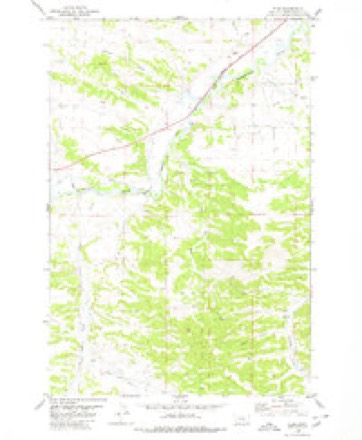
6 topographic sheets cover this place, the earliest surveyed in 1954 and the latest in 1979. It stands in the Roundup census division. It lies in ZIP code area 59072. It stands on Stanley Creek. The Survey maps it on the Elso quadrangle.
Topographic sheets covering this place
4 surveys from 6 printed sheetsMatched by testing this settlement's coordinate against the published boundary of every sheet in the United States Geological Survey's historical collection. Each opens the scanned sheet at the Survey.
- 1954 USGS Roundup quadrangle1:250000, 2 printings
- 1958 USGS Roundup quadrangle1:250000, 2 printings
- 1979 USGS Elso quadrangle1:24000
- 1979 USGS Roundup quadrangle1:100000
Fires near this place
9 since 2003Regional context, not property-specific evidence. The federal wildfire occurrence database lists 9 fires within 5 miles of Elso between 2003 and 2020, burning about 22,686 acres in total. 7 started naturally. None was recorded as arson. Distance is straight-line from the map coordinates, so a fire counted here may appear on a neighbouring settlement's page as well.
| Reported cause | Fires |
|---|---|
| Natural | 7 |
| Missing data/not specified/undetermined | 1 |
| Equipment and vehicle use | 1 |
The most recent of them, most recent first, with the day each was reported and the service that recorded it.
| Date | Cause | Size | Reported by | Name on the report |
|---|---|---|---|---|
| 7 August 2003 | Natural | 280 acres | Miles City Field Office | COTTONWOOD |
| 4 August 2008 | Natural | 27 acres | Billings Field Office | JOHNSON ROAD FIRE |
| 27 August 2017 | Equipment and vehicle use | under an acre | Southern Land Office | FLAT TIRE |
| 25 August 2019 | Natural | 4.6 acres | Billings Field Office | JOHNSON ROAD |
| 16 August 2014 | Natural | 5.4 acres | Billings Field Office | JOHNSON |
| 23 July 2006 | Natural | 317 acres | Southern Land Office | JUNIPER |
| 21 July 2020 | Missing data/not specified/undetermined | under an acre | Musselshell County | 98 HARPER COULEE |
| 15 July 2007 | Natural | 6.0 acres | Billings Field Office | WELL |
Settlements close enough to share some of these fires:
Storms near this place
29 since 2007Regional context, not property-specific evidence. The National Weather Service names Elso in 29 storm reports between 2007 and 2021: 16 hail, 5 flash flood, 4 thunderstorm wind, 3 flood. No death or injury is recorded in these reports. Each account below is quoted exactly as the forecast office filed it, from the NOAA Storm Events Database, and each date opens the federal record of that event.
| When | Event | Place named | Harm | What the report says |
|---|---|---|---|---|
| July 2020 | Hail | Elso | - | Golf ball size hail fell from 410-420pm. |
| May 2018 | Hail | Elso | - | The hail was 2 inches deep on a deck. |
| May 2018 | Hail | Elso | - | The hail was 2 inches deep on a deck. |
| March 2014 | Flood | Elso | - | County officials and the Montana Department of Transportation reported significant flooding of streams and low lying areas across the area. The combination of rapid snow melt and ice resulted in high water levels along the Musselshell River from Harlowton to Shawmut...Ryegate and Lavina. In addition, some county roads were reported to be impassable. |
| May 2013 | Flash Flood | Elso | - | There were numerous reports of flash flooding affecting all of the drainage's within the Dahl Fire burn scar area. Most of the private roads in the burn scar were reported as rivers and had severe erosion as most were over-topped. |
| June 2013 | Flash Flood | Elso | - | Flash flooding occurred along Buckskin Road near Harper Coulee in the Dahl Fire burn scar area. |
| June 2013 | Flash Flood | Elso | - | Significant flooding occurred on Dean Creek along the Golden Valley/Musselshell County line. Driveways and fences were destroyed. |
| June 2013 | Flood | Elso | - | Emergency Managers and trained spotters reported flooding and significant debris flows over and near the Dahl, Delphia and Wilson Burn Scar areas. The city of Roundup experienced street flooding. Many secondary roads in the area were washed out. Flooding also occurred on Dean Creek just southwest of Roundup resulting in damage to driveways and fences. |
| September 2013 | Flash Flood | Elso | - | Flash flooding was reported on the Dahl Burn Scar area with water running across numerous roads. |
| September 2013 | Flash Flood | Elso | - | Water was reported running across county and private roads within the Dahl, Delphia, and Wilson Burn Scar areas. |
| July 2013 | Thunderstorm Wind | Elso | - | A wind gust of 60 mph was estimated southeast of Lavina. |
| August 2011 | Thunderstorm Wind | Elso | - | An estimated wind gust of 60 mph was reported 15 miles SW of Roundup. |
| June 2011 | Flood | Elso | - | High flows along the Musselshell River from receding floodwaters from May quickly returned to flood as more heavy rainfall moved through the region. Additional rainfall amounts of 2 to 4 inches fell across much of Musselshell County during the 6th and 7th of June. This caused rapid water runoff and similar flooding that had just occurred in May. County officials indicated flooding in the town of Roundup. Several roads were washed out and many others closed due to the flooding. Highways 87 and 12 leading into Roundup were inundated and closed. Evacuations of about 30 homes occurred in Roundup. About eight feet of standing water surrounded the Busy Bee Cafe, a local landmark in Roundup. Many houses and businesses in Roundup were under several feet of water. An estimated 50 structures were inundated with water, some up to their rooftops. In addition, four teenagers had to be rescued from the high waters after disobeying orders to stay out of the area and then became stranded. |
| June 2007 | Hail | Elso | - | The hail was reported to be lens shaped. |
| June 2007 | Hail | Elso | - | Hail produced holes in a roof. |
| July 2021 | Thunderstorm Wind | Elso | - | no account filed |
| July 2020 | Hail | Elso | - | no account filed |
| July 2020 | Hail | Elso | - | no account filed |
| July 2020 | Hail | Elso | - | no account filed |
| July 2017 | Thunderstorm Wind | Elso | - | no account filed |
| June 2013 | Hail | Elso | - | no account filed |
| June 2013 | Hail | Elso | - | no account filed |
| June 2011 | Hail | Elso | - | no account filed |
| June 2011 | Funnel Cloud | Elso | - | no account filed |
| June 2010 | Hail | Elso | - | no account filed |
| July 2010 | Hail | Elso | - | no account filed |
| July 2010 | Hail | Elso | - | no account filed |
| July 2010 | Hail | Elso | - | no account filed |
| August 2009 | Hail | Elso | - | no account filed |
Nearest settlements
The eight closest, with where each one stands in the county. Distances are straight-line, computed from the Geographic Names Information System coordinates.
| Map | Place | Distance | Sheets |
|---|---|---|---|
| Bundy | 6.6 miles | 6 | |
| Farralltown | 7.6 miles | 6 | |
| Klein | 7.8 miles | 6 | |
| Gibbtown | 7.9 miles | 6 | |
| Riverside | 8.0 miles | 6 | |
| Republic (historical) | 8.3 miles | 6 | |
| Camp Three | 8.7 miles | 6 | |
| Roundup | 9.8 miles | 6 |
Provenance
This settlement is recorded in the Geographic Names Information System as feature 771212. The sheet list is computed by point-in-boundary test against the United States Geological Survey's historical topographic inventory. Both are works of the United States government and carry no copyright under 17 U.S.C. 105.
Wildfire. Short, Karen C. 2022. Spatial wildfire occurrence data for the United States, 1992-2020 [FPA_FOD_20221014]. 6th Edition. Fort Collins, CO: Forest Service Research Data Archive. https://doi.org/10.2737/RDS-2013-0009.6 Collected with United States Government funding and usable without additional permissions or fees.
Storms. NOAA National Centers for Environmental Information, Storm Events Database https://www.ncei.noaa.gov/stormevents/ A work of the United States government, no copyright under 17 U.S.C. 105. Narratives are quoted verbatim from the National Weather Service report and are not edited or summarised.