 Block
Four Buttes, Montana
5 topographic sheets cover this place, the earliest surveyed in 1954 and the latest in 1983. It stands in the Scobey census division. It lies in ZIP code area 59263. It stands on Spring Creek. The Survey maps it on the Four Buttes quadrangle.
Topographic sheets covering this place
4 surveys from 5 printed sheetsMatched by testing this settlement's coordinate against the published boundary of every sheet in the United States Geological Survey's historical collection. Each opens the scanned sheet at the Survey.
- 1954 USGS Wolf Point quadrangle1:250000, 2 printings
- 1958 USGS Wolf Point quadrangle1:250000
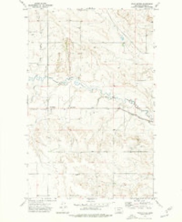
- 1973 USGS Four Buttes quadrangle1:24000
- 1983 USGS Scobey quadrangle1:100000
Fires near this place
3 since 2018Regional context, not property-specific evidence. The federal wildfire occurrence database lists 3 fires within 5 miles of Four Buttes between 2018 and 2020, burning about 16 acres in total. None started naturally. None was recorded as arson. Distance is straight-line from the map coordinates, so a fire counted here may appear on a neighbouring settlement's page as well.
| Reported cause | Fires |
|---|---|
| Missing data/not specified/undetermined | 2 |
| Equipment and vehicle use | 1 |
The most recent of them, most recent first, with the day each was reported and the service that recorded it.
| Date | Cause | Size | Reported by | Name on the report |
|---|---|---|---|---|
| 20 July 2018 | Equipment and vehicle use | 7.3 acres | Northeastern Land Office | not named |
| 8 May 2020 | Missing data/not specified/undetermined | 8.0 acres | Daniels County | FDH-MTLG37-56 |
| 27 April 2018 | Missing data/not specified/undetermined | 1.0 acres | Northeastern Land Office | not named |
Storms near this place
30 since 1997Regional context, not property-specific evidence. The National Weather Service names Four Buttes in 30 storm reports between 1997 and 2026: 15 hail, 8 thunderstorm wind, 4 flood, 2 flash flood. No death or injury is recorded in these reports. Each account below is quoted exactly as the forecast office filed it, from the NOAA Storm Events Database, and each date opens the federal record of that event.
| When | Event | Place named | Harm | What the report says |
|---|---|---|---|---|
| July 2005 | Thunderstorm Wind | Four Buttes | $29,000 | A 15,000 bushel steel grain bin at the Four Buttes Farmer's Elevator was completely destroyed. |
| August 1997 | Thunderstorm Wind | Four Buttes | $20,000 | Thunderstorm winds destoryed a house trailer and flattened soon to be combined wheat. One field of corn was completely stripped of its leaves. |
| May 2006 | Hail | Four Buttes | $1,000 | The hail was jagged in shape and accompanied by 30 mph wind, and broke out the back window of a truck. |
| July 2015 | Thunderstorm Wind | Four Buttes | $500 | Daniels County dispatch relayed a public report of a large picture window blown out by 60 mph winds. |
| April 2026 | Thunderstorm Wind | Four Buttes | - | The Scobey NW Montana Climate Office mesonet site (SCYM8) recorded a 58 mph wind gust. |
| March 2025 | Flood | Four Buttes | - | The USGS river gauge on the Poplar River at the International Border reported minor flooding. |
| August 2024 | Hail | Four Buttes | - | Public reported hail up to the size of quarters. |
| June 2023 | Flash Flood | Four Buttes | - | A trained spotter reported 2.3 inches of rainfall in a short period of time. Numerous fields were reported as flooding. |
| July 2023 | Hail | Four Buttes | - | The public reported hail up to the size of golf balls. |
| July 2019 | Hail | Four Buttes | - | Trained spotter reported hail up to the size of quarters. |
| June 2018 | Hail | Four Buttes | - | Multiple reports from the public, all confirming golf ball size hail. Time estimated by radar. |
| June 2018 | Hail | Four Buttes | - | Public reported golf ball size hail, leaving drifts up to 2 feet deep overnight. |
| March 2017 | Flood | Four Buttes | - | Daniels County emergency manager reported water from Butte Creek running over North Four Buttes Road, just north of the town of Four Buttes. Times are estimated. |
| March 2017 | Flood | Four Buttes | - | The water level at the Poplar River gauge, near the international border (PPRM8), rose above its flood stage of 6 feet at 7:27 PM local time on the 16th, quickly crested at 8.92 feet at 12:28 AM local time on the 17th, then eventually dropped and remained below flood stage at 6:30 AM local time on the 19th. |
| July 2013 | Hail | Four Buttes | - | Public reported golf ball sized hail. |
| August 2012 | Hail | Four Buttes | - | Spotter reported plentiful amounts of penny-sized hail stones. |
| August 2012 | Hail | Four Buttes | - | Public reported up to quarter-sized hail stones. |
| August 2011 | Hail | Four Buttes | - | Public estimated half dollar-sized hail stones and 40 mph winds. |
| August 2011 | Hail | Four Buttes | - | Public estimated quarter-sized hail stones and 40 mph winds. |
| May 2011 | Flood | Four Buttes | - | Small streams rose out their banks due to heavy rains and above normal wet spring. |
| July 2010 | Thunderstorm Wind | Four Buttes | - | Observer witnessed estimated 60 mph gusts for 10 minutes. |
| June 2008 | Flash Flood | Four Buttes | - | Flooding was observed along South Four Buttes Road. |
| July 2008 | Hail | Four Buttes | - | The hail ranged from half inch to penny size. Winds were estimated at 40 mph. |
| July 2008 | Hail | Four Buttes | - | The hail covered the ground. |
| May 2006 | Heavy Rain | Four Buttes | - | 3 inches of rain fell over a 12 hour period. |
| July 2005 | Thunderstorm Wind | Four Buttes | - | The strong wind broke many tree branches 8-9 inches thick. The tops of very large poplar trees were broken off, and a grain bin was blown approximately 100 feet and was destroyed. |
| May 2006 | Hail | Four Buttes | - | no account filed |
| August 2005 | Thunderstorm Wind | Four Buttes | - | no account filed |
| August 2000 | Hail | Four Buttes | - | no account filed |
| August 1997 | Thunderstorm Wind | Four Buttes | - | no account filed |
Nearest settlements
The eight closest, with where each one stands in the county. Distances are straight-line, computed from the Geographic Names Information System coordinates.
| Map | Place | Distance | Sheets |
|---|---|---|---|
| Scobey | 9.9 miles | 5 | |
| Peerless | 12.1 miles | 5 | |
| Butte Creek | 13.8 miles | 5 | |
| Carbert | 15.8 miles | 5 | |
| Julian (historical) | 16.0 miles | 5 | |
| Madoc | 17.0 miles | 5 | |
| Kahle (historical) | 17.4 miles | 5 | |
| West Fork | 18.3 miles | 5 |
Provenance
This settlement is recorded in the Geographic Names Information System as feature 771546. The sheet list is computed by point-in-boundary test against the United States Geological Survey's historical topographic inventory. Both are works of the United States government and carry no copyright under 17 U.S.C. 105.
Wildfire. Short, Karen C. 2022. Spatial wildfire occurrence data for the United States, 1992-2020 [FPA_FOD_20221014]. 6th Edition. Fort Collins, CO: Forest Service Research Data Archive. https://doi.org/10.2737/RDS-2013-0009.6 Collected with United States Government funding and usable without additional permissions or fees.
Storms. NOAA National Centers for Environmental Information, Storm Events Database https://www.ncei.noaa.gov/stormevents/ A work of the United States government, no copyright under 17 U.S.C. 105. Narratives are quoted verbatim from the National Weather Service report and are not edited or summarised.