 Block
Hinsdale, Montana
9 topographic sheets cover this place, the earliest surveyed in 1906 and the latest in 1984. It stands in the Hinsdale census division. It lies in ZIP code area 59241. It lies near Tank Coulee. The Survey maps it on the Hinsdale quadrangle. 193 people lived here at the 2020 count. It stands 2,169 feet above sea level.
Population over time
2 figuresHinsdale fell from 217 to 193 between 2010 and 2020. These are the recorded population figures Wikidata holds for this place, reached through the Geographic Names Information System number this page is keyed on rather than by name, so they belong to this place and not to another of the same name. Most are census counts, but not all are: an early figure may be a founding or settlement estimate, and an estimate published within five years of a census is left out. The change column is computed, and is left blank where more than 20 years separate a figure from the one before it, because a gap that long is not a change between two counts.
| Year | People | Change |
|---|---|---|
| 2010 | 217 | |
| 2020 | 193 | -24 (-11%) |
Topographic sheets covering this place
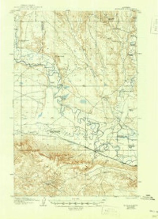
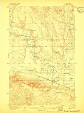
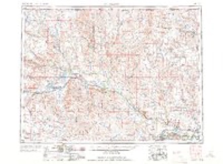
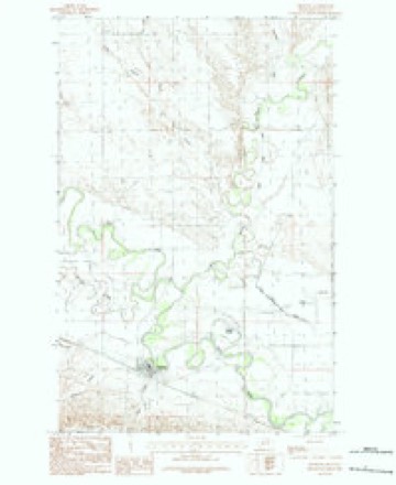
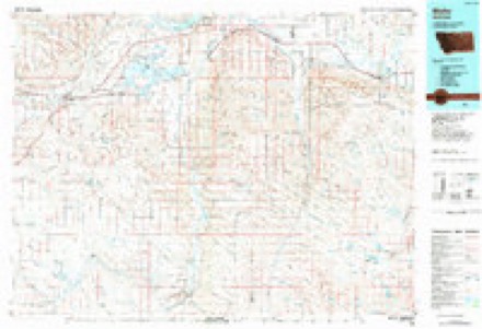
7 surveys from 9 printed sheetsMatched by testing this settlement's coordinate against the published boundary of every sheet in the United States Geological Survey's historical collection. Each opens the scanned sheet at the Survey.
- 1906 USGS Hinsdale quadrangle1:62500
- 1906 USGS Hinsdale Special Map quadrangle1:62500
- 1954 USGS Glasgow quadrangle1:250000, 2 printings
- 1957 USGS Glasgow quadrangle1:250000
- 1958 USGS Glasgow quadrangle1:250000, 2 printings
- 1984 USGS Hinsdale quadrangle1:24000
- 1984 USGS Malta quadrangle1:100000
Fires near this place
2 since 2014Regional context, not property-specific evidence. The federal wildfire occurrence database lists 2 fires within 5 miles of Hinsdale between 2014 and 2018, burning about 656 acres in total. None started naturally. None was recorded as arson. Distance is straight-line from the map coordinates, so a fire counted here may appear on a neighbouring settlement's page as well.
| Reported cause | Fires |
|---|---|
| Missing data/not specified/undetermined | 2 |
The most recent of them, most recent first, with the day each was reported and the service that recorded it.
| Date | Cause | Size | Reported by | Name on the report |
|---|---|---|---|---|
| 22 July 2018 | Missing data/not specified/undetermined | 1.0 acres | Northeastern Land Office | not named |
| 9 June 2014 | Missing data/not specified/undetermined | 655 acres | Malta Field Office | MEISDALEN |
Storms near this place
60 of 171 shownRegional context, not property-specific evidence. The National Weather Service names Hinsdale in 171 storm reports between 1996 and 2023: 67 hail, 64 thunderstorm wind, 23 flood, 8 flash flood. No death or injury is recorded in these reports. Each account below is quoted exactly as the forecast office filed it, from the NOAA Storm Events Database, and each date opens the federal record of that event.
| When | Event | Place named | Harm | What the report says |
|---|---|---|---|---|
| June 2005 | Flash Flood | Hinsdale | $75,000 | US Highway 2 was underwater in the vicinity of Hinsdale for a short time. Highway 537 about 1/4 mile north of Hinsdale was covered with about 3 inches of water. One home suffered a flooded basement in Hinsdale. |
| July 2002 | Thunderstorm Wind | Hinsdale | $75,000 | Several roofs were blown off houses and several trees downed by thunderstorm winds in Hinsdale. |
| July 2002 | Thunderstorm Wind | Hinsdale | $50,000 | Thunderstorm wind gust damaged several sheds and outbuildings 2 miles west of Hinsdale, lifted pickup truck 2 feet off the ground 1 miles west of Hinsdale and blew off the roof on the Nemontel building and downed power lines in Hinsdale. |
| July 2002 | Tornado (F0) | Hinsdale | $10,000 | A small tornado damaged a shed and metal livestock stall on a ranch 5 miles west of Hinsdale. |
| July 2000 | Hail | Hinsdale | $10,000 | no account filed |
| June 2007 | Hail | Hinsdale | $5,000 | Golf ball sized hail covered the ground. Several windows were destroyed on a home. |
| July 1997 | Thunderstorm Wind | Hinsdale | $3,000 | Damaging thunderstorms winds rolled a small mobile home. |
| June 2010 | Heavy Rain | Hinsdale | $2,000 | Five miles west of Hinsdale received 0.99 in about 17 minutes, through 9 pm MST. 11 miles west of Glasgow along the Tampico Road, two older power poles were snapped and down due to heavy rain and a wind gust to 45 mph. At 2130 MST, 1.6 of rainfall fell during this event. Through 11 pm MST, 10 miles west of Glasgow 2.09 of rain fell. |
| May 2023 | Heavy Rain | Hinsdale | - | A trained spotter reported 1-1/2 inches of rain falling within 25 minutes. |
| May 2023 | Heavy Rain | Hinsdale | - | A trained spotter estimated about 1 inch of rain within 30 minutes with lots of standing water on a nearby farm. |
| April 2023 | Flood | Hinsdale | - | Beaver Creek at Hinsdale (BCHM8) rose above its flood stage of 14 feet at 12:50 AM on April 10th. The river then crested at 18.17 feet at 5:15 PM on April 10th. The river would fall below flood stage at 5:40 PM on April 13th. |
| June 2023 | Flash Flood | Hinsdale | - | A BNSF Railroad track inspector reported multiple locations of track subgrade material completely washed out along a half mile stretch of railroad in Hinsdale. Subgrade material was washed onto US Highway 2, closing the highway for a time. Train traffic was suspended until repairs could be made. |
| June 2023 | Flash Flood | Hinsdale | - | A trained spotter reported water over gravel roads in several locations west of Hinsdale. |
| June 2023 | Flash Flood | Hinsdale | - | Public reported water running down numerous streets and area roads. |
| June 2023 | Tornado (EFU) | Hinsdale | - | Multiple trained spotters confirmed seeing funnel clouds, one of which was observed touching the ground and lofting a dirt cloud at its base. The tornado lasted for less than 1 minute. |
| June 2022 | Hail | Hinsdale | - | A trained spotter reported hail up to the size of half dollars along with heavy rainfall. |
| July 2022 | Thunderstorm Wind | Hinsdale | - | A trained spotter estimated thunderstorm wind gusts of 70 mph. Some tree limbs were knocked down. |
| July 2022 | Thunderstorm Wind | Hinsdale | - | The BLM Vandalia N mesonet site (MTM34) measured a thunderstorm wind gust of 66 mph. |
| July 2021 | Thunderstorm Wind | Hinsdale | - | Mesonet Station (MTM34) measured a wind gust of 64mph. |
| March 2020 | Flood | Hinsdale | - | Excessive snow melt caused flooding at the river gauge on Beaver Creek near Hinsdale (BCHM8) two separate times through the first week of March. First, the gauge recorded creek levels rising above flood stage of 14.0 feet at 9:49 PM MST on March 1st. The creek crested at 15.8 feet at 3:28 PM MST on March 2nd. The creek level dropped back down below flood stage at 6:49 PM MST on March 3rd. Second, the gauge recorded creek levels rising again above flood stage of 14.0 feet at 10:29 PM MST on March 5th. The creek crested at 14.04 feet at 11:58 PM MST on March 5th, then crested again at 14.04 feet at 2:00 AM MST on March 6th. The creek level finally dropped back down below flood stage to end this event at 4:15 AM MST on March 6th. |
| May 2020 | Heavy Rain | Hinsdale | - | Public measured a storm total rainfall amount of 2.86 inches. |
| July 2020 | Thunderstorm Wind | Hinsdale | - | Trained spotter reported a 30 by 60 foot shed destroyed. Wind speed estimated. |
| July 2020 | Thunderstorm Wind | Hinsdale | - | Public recorded a 70 mph wind gust on their personal home weather station, and measured 0.7 inch of rain. |
| August 2020 | Thunderstorm Wind | Hinsdale | - | At the Saco US-2 DOT site (MTSCO), a 62 mph wind gust was recorded. |
| March 2019 | Flood | Hinsdale | - | During the early morning of March 23rd, at the Saco forecast point (SACM8) along the Milk River, recent snow melt and a possible ice jams caused the river level to quickly rise above the flood stage of 20.0 feet at 4:35 AM MST. Between multiple ice jams, the river level dropped back down below flood stage for just a few hours the next day before rising above flood stage again. The river crested at 21.97 feet at 1:54 PM MST on the 25th. As the ice jam gradually cleared, the river fell back down below flood stage at 11:00 PM MST on the 27th. |
| March 2019 | Flood | Hinsdale | - | During the afternoon of March 21st, at the Hinsdale forecast point (BCHM8) along Beaver Creek, recent snow melt and an ice jam caused the river level to suddenly rise above the flood stage of 14.0 feet at 4:47 PM MST. The creek crested at 17.15 feet at 12:12 AM MST on the 23rd. As the ice jam gradually cleared, the creek fell back down below flood stage temporarily during the afternoon of the 24th, then rose again above flood stage near mid day on the 25th. The creek finally fell below flood stage to end this flood event at 10:13 AM MST on the 27th. |
| June 2019 | Hail | Hinsdale | - | Valley County dispatch reported hail up to the size of quarters, along with at least one inch of estimated rainfall. |
| June 2019 | Thunderstorm Wind | Hinsdale | - | A 59 mph wind gust was measured at the Saco US-2 DOT site. |
| June 2019 | Thunderstorm Wind | Hinsdale | - | Trained spotter reported wind gusts up to 60 mph. |
| April 2018 | Flood | Hinsdale | - | Excessive snow melt caused flooding at the stream gauge at Beaver Creek near Hinsdale (BCHM8). The gauge recorded stream levels reaching flood stage at 2:45 AM MST on April 16th. The river crested at 17.42 feet at 3:30 AM MST on April 18th, then fell steadily, dropping below flood stage at 6:00 PM MST on April 20th. |
| April 2018 | Flood | Hinsdale | - | The river gage along Beaver Creek near Saco (GSCM8) first entered flood stage at 8:15 PM MST on April 3rd due to ice jamming along the creek. The gage recorded periods of flooding before the ice began to break up and continue downstream. The river crested at 12.35 feet at 8:30 PM MST on April 6th. The river fell below flood stage for the final time at 4:00 AM MST on April 7th. |
| April 2018 | Flood | Hinsdale | - | Excessive snow melt caused flooding at the stream gauge at Beaver Creek near Saco (GSCM8). The gauge recorded stream levels reaching flood stage at 1:45 AM MST on April 17th. The river crested at 11.3 feet at 9:30 PM MST on April 20th, then fell steadily, dropping below flood stage at 1:45 PM MST on April 22th. |
| July 2018 | Thunderstorm Wind | Hinsdale | - | Trained spotter reported damage to a large rodeo arena and some outbuildings blown down. |
| July 2018 | Thunderstorm Wind | Hinsdale | - | Trained spotter estimated wind gusts up to 70 mph. |
| July 2018 | Hail | Hinsdale | - | Trained spotter estimated hail up to the size of quarters. |
| July 2018 | Thunderstorm Wind | Hinsdale | - | Saco US-2 DOT site measured wind gusts of 60 mph from 4:32 PM MST to 4:37 PM MST. |
| May 2018 | Flood | Hinsdale | - | Excessive snow melt raised river levels along the Milk River near Saco (SACM8) to above flood stage on April 18th. The river crested at 24.22 feet on April 23. River levels slowly dropped afterward, but flooding continued into May. The river level dropped below flood stage on May 2nd at 12:15 PM. |
| June 2017 | Thunderstorm Wind | Hinsdale | - | The Saco US-2 DOT site measured a 58 mph wind gust. |
| May 2016 | Thunderstorm Wind | Hinsdale | - | Public estimated 60 mph wind gusts with heavy rain and visibility less than 50 feet. |
| May 2016 | Hail | Hinsdale | - | Public reported quarter sized hail. |
| May 2016 | Thunderstorm Wind | Hinsdale | - | Public reported a tin roof torn off a building and tree branches downed. |
| May 2016 | Hail | Hinsdale | - | Trained spotter reported nickel sized hail. |
| May 2016 | Hail | Hinsdale | - | Trained Spotter reported half dollar sized hail. |
| May 2016 | Thunderstorm Wind | Hinsdale | - | Trained spotter reported a 20-foot section of roof blown off a shed. |
| May 2016 | Thunderstorm Wind | Hinsdale | - | Trained spotter estimated wind gusts of 80-90 mph. |
| June 2016 | Thunderstorm Wind | Hinsdale | - | A 70 mph wind gust was measured by the Saco US-2 DOT site. |
| June 2016 | Thunderstorm Wind | Hinsdale | - | Cooperative observer reported wind gusts up to 60 mph along with heavy rain and visibility around 100 yards. |
| October 2016 | Flood | Hinsdale | - | Beaver Creek near Hinsdale (BCHM8) rose above its minor flood stage of 14 feet at 12:24 AM MST on October 5th, then rose above its moderate flood stage of 16 feet at 5:48 AM MST on October 5th. It crested at 18.50 feet at 4:42 AM MST on October 6th, then fell back down below minor flood stage at 7:08 AM MST on October 8th. |
| May 2016 | Thunderstorm Wind | Hinsdale | - | Trained spotter reported 60 mph wind gusts. |
| July 2016 | Thunderstorm Wind | Hinsdale | - | Trained spotter reported some small trees bent over. Winds estimated at 58 mph. |
| July 2016 | Thunderstorm Wind | Hinsdale | - | Public reported 60 mph wind gusts. |
| July 2016 | Thunderstorm Wind | Hinsdale | - | Trained spotter reported 60 mph winds and pea sized hail. |
| July 2015 | Hail | Hinsdale | - | Co-operative observer reported ground covered with mainly nickel-sized hail and some quarter-sized hail, along with heavy rain and winds up to 40 mph. |
| July 2015 | Hail | Hinsdale | - | Trained spotter reported hail up to the size of golf balls, heavy rain, and wind gusts up to 40 mph. |
| July 2015 | Hail | Hinsdale | - | Public reported quarter sized hail, lasting for 20 minutes, accumulating up to a depth of 3 inches on the ground. |
| April 2014 | Thunderstorm Wind | Hinsdale | - | Trained spotter estimated 60 mph winds while driving near Hinsdale. |
| June 2014 | Hail | Hinsdale | - | Public reported hail up to the size of quarters in western Valley County. |
| June 2014 | Hail | Hinsdale | - | Trained spotter reported up to penny-sized hail and heavy rain. |
| August 2014 | Thunderstorm Wind | Hinsdale | - | Trained spotter reported wind damage including: numerous tree limbs down and some small trees down. |
| August 2014 | Thunderstorm Wind | Hinsdale | - | Public reported wind damage including: several tree branches down ranging from 1 to 4 inches in diameter. Longest tree branch down measured 8 feet in length. |
Nearest settlements
The eight closest, with where each one stands in the county. Distances are straight-line, computed from the Geographic Names Information System coordinates.
| Map | Place | Distance | Sheets |
|---|---|---|---|
| Miles Crossing | 7.0 miles | 9 | |
| Beaverton | 9.2 miles | 9 | |
| Vandalia | 9.7 miles | 8 | |
| Tampico | 15.0 miles | 9 | |
| Larb (historical) | 16.8 miles | 7 | |
| Riverside (historical) | 20.5 miles | 9 | |
| Genevieve (historical) | 23.3 miles | 6 | |
| Barr (historical) | 23.8 miles | 6 |
Elsewhere
Matched on this settlement's Geographic Names Information System number rather than its name, so it cannot be a different place of the same name in another state.
| Wikipedia article on Hinsdale | An encyclopaedic summary. Its text is share-alike, so it is linked here rather than copied. |
| Wikidata item Q5898219 | The structured record the population and elevation above come from. Public domain (CC0). |
Provenance
This settlement is recorded in the Geographic Names Information System as feature 772431. The sheet list is computed by point-in-boundary test against the United States Geological Survey's historical topographic inventory. Both are works of the United States government and carry no copyright under 17 U.S.C. 105.
Wildfire. Short, Karen C. 2022. Spatial wildfire occurrence data for the United States, 1992-2020 [FPA_FOD_20221014]. 6th Edition. Fort Collins, CO: Forest Service Research Data Archive. https://doi.org/10.2737/RDS-2013-0009.6 Collected with United States Government funding and usable without additional permissions or fees.
Storms. NOAA National Centers for Environmental Information, Storm Events Database https://www.ncei.noaa.gov/stormevents/ A work of the United States government, no copyright under 17 U.S.C. 105. Narratives are quoted verbatim from the National Weather Service report and are not edited or summarised.