 Block
From the record
15 National Register listings published here.
Sources: the National Register database, National Park Service
85 topographic sheets cover 44 settlements here, and 15 properties are on the National Register of Historic Places.
15 National Register listings published here.
Sources: the National Register database, National Park Service
Every property in this county listed on the National Register of Historic Places, with the year it was listed and the federal nomination document.
| Photograph | Property | Type | Listed | Reference |
|---|---|---|---|---|
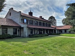 | Administration Building | building | 1986 | 86002058 |
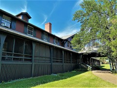 | Employee's Hotel and Garage | building | 1986 | 86002060 |
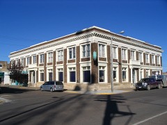 | First National Bank of Glasgow | building | 2002 | 02000698 |
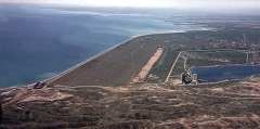 | Fort Peck Dam | structure | 1986 | 86002061 |
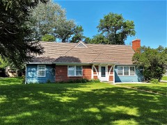 | Fort Peck Original Houses Historic District | district | 1986 | 86002067 |
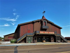 | Fort Peck Theatre | building | 1983 | 83001077 |
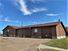 | Garage and Fire Station | building | 1986 | 86002063 |
| Glasgow Army Airfield Norden Bombsight Storage Vault | structure | 2011 | 11000824 | |
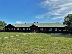 | Hospital | building | 1986 | 86002054 |
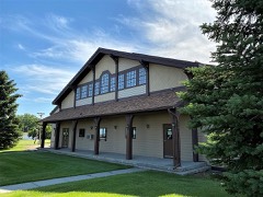 | Recreation Hall | building | 1986 | 86002066 |
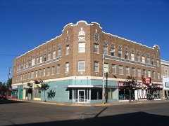 | Rundle Building | building | 2006 | 06001092 |
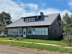 | Charles C. Sargent House | building | 1982 | 82003180 |
| School | building | 1986 | 86002065 | |
 | US Post Office and Courthouse-Glasgow Main | building | 1986 | 86000679 |
Every wildfire the federal occurrence database records inside this county: 371 of them, burning about 55,896 acres. 76 started naturally and 19 were recorded as arson. Each settlement page carries the fires within five miles of it.
| Reported cause | Fires |
|---|---|
| Missing data/not specified/undetermined | 84 |
| Natural | 76 |
| Equipment and vehicle use | 58 |
| Debris and open burning | 43 |
| Fireworks | 29 |
| Arson/incendiarism | 19 |
| Recreation and ceremony | 14 |
| Smoking | 14 |
| Power generation/transmission/distribution | 11 |
| Misuse of fire by a minor | 10 |
| Railroad operations and maintenance | 10 |
| Other causes | 3 |
The five largest, by the area the report gives. None of them was recorded as arson.
| Date | Cause | Size | Reported by | Name on the report |
|---|---|---|---|---|
| 16 July 2006 | Natural | 18,585 acres | Charles M. Russell National Wildlife Refuge | FLAT TIRE |
| 26 September 1995 | Debris and open burning | 3,506 acres | North Central Montana District | GRANT COUL |
| 21 August 2020 | Natural | 3,275 acres | North Central Montana District | HILL |
| 27 July 2001 | Natural | 2,640 acres | North Central Montana District | CASTLE |
| 24 August 2020 | Equipment and vehicle use | 2,509 acres | Fort Peck Agency | SAGE |
| 26 August 2012 | Railroad operations and maintenance | 1,624 acres | Fort Peck Agency | OSWEGO |
| 26 July 2006 | Natural | 1,435 acres | Fort Peck Agency | TOAVS |
| 3 August 2003 | Equipment and vehicle use | 1,265 acres | Fort Peck Agency | PORCUPINEC |
Every settlement page carries the fires within five miles of it - see the settlement index below.
The NOAA Storm Events Database holds 1,247 reports for this county, causing no deaths, 2 injuries and about $18,673,350 in recorded property damage. Each settlement page carries the reports that name it.
| Kind of event | Reports |
|---|---|
| Thunderstorm Wind | 575 |
| Hail | 470 |
| Flood | 78 |
| Tornado | 44 |
| Flash Flood | 38 |
| Heavy Rain | 23 |
| Funnel Cloud | 13 |
| Lightning | 5 |
| Wildfire | 1 |
The most serious of them, by death, then injury, then recorded damage. The accounts are quoted exactly as the forecast office filed them.
| When | Event | Place named | Harm | What the report says |
|---|---|---|---|---|
| July 2006 | Lightning | Saint Marie | 1 hurt | A man was indirectly struck by lightning while repaving a runway. He was holding onto the chute of a cement truck when lightning struck a generator nearby, then jumped over to the truck. He fell to the ground and for 10 seconds lost speech and movement. He was taken to the hospital and released later the same morning. |
| August 2003 | Hail | Glasgow | 1 hurt | A hailstone hit a women on the hand and injured her finger. |
| June 2007 | Hail | Glasgow | $8,000,000 | Hail up to three inches in size accompanied by winds around 70 mph caused significant damage throughout the city of Glasgow and outlying areas to the west, south and east. See entire episode narrative for full details. |
| June 2007 | Hail | Nashua | $3,000,000 | One hundred percent of the businesses and homes in the town were damaged from the combination of large hail and damaging winds. Many vehicles also had significant damage. Damages included roofing, windows, gutters, siding, trees and gardens. See entire episode narrative for full details. |
| July 1999 | Hail | Glasgow | $1,500,000 | no account filed |
| August 2014 | Flood | Glasgow | $1,120,000 | Heavy rainfall in the basin with amounts ranging from 4 to 10 inches over a four day period caused significant flooding in all the streams in the basin, and eventually the rivers. Willow Creek, Antelope Creek, Cherry Creek, Larb Creek, Brazil Creek all flooded during this time frame, blocking off many gravel roads around the county. Valley County had at least 36 locations with damages and DES reported to FEMA the totals were $1.2 million. Willow Creek Road from Fort Peck to the Pines had a very large area completely wiped out with a large culvert gone. |
| June 2005 | Hail | Ft Peck | $900,000 | The hail caused extensive damage to roofs, siding, windows, gutters, and screens in the town of Fort Peck. Many vehicles also had hail damage. |
| August 1993 | Thunderstorm Wind | Glasgow | $500,000 | There was lots of wind damage across Valley County. Several homes and trailers were damaged. A flash flood near Hinsdale washed out Highway 2 and the railroad. |
| May 1994 | Hail | Glasgow | $500,000 | no account filed |
| May 1994 | Hail | Richland | $500,000 | no account filed |
| July 2000 | Thunderstorm Wind | Glasgow Intl Arpt | $250,000 | Severe thunderstorm winds in excess of 80 mph knocked down power lines and trees and caused roof damage. A double wide trailer 8 miles north of Glasgow was almost completely destroyed by the winds. The occupants were saved by taking shelter in an interior bathroom. Over 50 power poles were blown down around Glasgow leaving residents in the dark some longer than 24 hours. The roof of the Cottonwood Inn Restaurant was blown off. A new record wind gust of 82 mph was set at the Glasgow International Airport. |
| June 1999 | Tornado (F1) | Opheim | $250,000 | no account filed |
| August 1962 | Tornado (F2) | not stated | $250,000 | no account filed |
| June 2005 | Flash Flood | South Portion | $200,000 | Flooding was reported along Antelope Creek approximately 9.5 miles west-nothwest of Glasgow. Antelope Creek went from being dry to running out of its banks, and flooded Billingsly Road and caused severe damage to a ranch. Water flowing across Billingsly road was as up to 5 feet deep in spots. A basement was flooded and three vehicles were damaged. All fences around the property were wiped out, and one sheep was drown. Water flooded the ranch up to 6 feet deep, and did not recede for 8 hours. |
| August 2014 | Flash Flood | Glasgow Intl Airport (Kggw) | $150,000 | The initial report of flash flooding came from an NWS employee who reported that Cherry Creek on the northwest side of Glasgow has risen out of its banks and is flooding with several inches of water over Skylark Road at Martin Coulee. The Creek was actually flooding in the area about 4 miles north of Glasgow westward and then southward to the Milk River. Many homeowners evacuated and had to move livestock and trailers out of the flooded waters. This is the second highest the river has been in at least 4 decades (2011 was higher). There were over a dozen homes with water in the basements and crawl spaces, and the water was so high, many people were unable to leave their homes because the driveways were flooded over with swift moving water. |
| June 2005 | Hail | Duck Creek | $150,000 | The hail caused extensive damage to roofs, siding, windows, gutters, and screens in Duck Creek. |
| July 2002 | Tornado (F0) | Park Grove | $100,000 | A small tornado along the edge of a gust front damaged two modular homes and downed several trees in Park Grove. Many homes had some damage to awnings, and gutters and roofs. |
| August 1997 | Thunderstorm Wind | Glasgow | $100,000 | Thunderstorm winds downed power lines, peeled a roof off of a local lumber yard, twisted road signs and blew down large trees. Some residents north of Glasgow were without power for two days. |
| June 2005 | Flash Flood | Hinsdale | $75,000 | US Highway 2 was underwater in the vicinity of Hinsdale for a short time. Highway 537 about 1/4 mile north of Hinsdale was covered with about 3 inches of water. One home suffered a flooded basement in Hinsdale. |
| June 2005 | Flash Flood | South Portion | $75,000 | Flooding was reported along Willow Creek Road approximately 14 miles south of Glasgow. The flooding led to a wash out on Willow Creek Road that was 15 feet deep and 12 feet wide. |
| July 2002 | Thunderstorm Wind | Hinsdale | $75,000 | Several roofs were blown off houses and several trees downed by thunderstorm winds in Hinsdale. |
| June 2007 | Flash Flood | Glasgow | $50,000 | Two to seven inches of rain fell in the Antelope, Brazil and Willow Creek Basins and caused the worst flood on record on the Antelope Creek. A portion of Billingsly road was inaccessible and completely under water for 3 days. Flash flooding occurred for approximately 12 hours, but was followed by significant overland flooding for the following few to several days. |
| July 2002 | Thunderstorm Wind | Hinsdale | $50,000 | Thunderstorm wind gust damaged several sheds and outbuildings 2 miles west of Hinsdale, lifted pickup truck 2 feet off the ground 1 miles west of Hinsdale and blew off the roof on the Nemontel building and downed power lines in Hinsdale. |
| August 2000 | Hail | Glentana | $50,000 | no account filed |
| June 1999 | Thunderstorm Wind | Ft Peck | $50,000 | no account filed |
| August 1997 | Hail | Ft Peck | $50,000 | no account filed |
| June 1996 | Thunderstorm Wind | Glasgow | $50,000 | no account filed |
| May 1994 | Hail | not stated | $50,000 | no account filed |
| May 1994 | Hail | Nashua | $50,000 | no account filed |
| May 1994 | Thunderstorm Wind | Nashua | $50,000 | no account filed |
| August 1993 | Hail | Glasgow | $50,000 | no account filed |
| July 2001 | Hail | Glasgow | $45,000 | Large hail broke out windows from homes and dented vehicles at The Pines Recreation area. |
| June 2016 | Thunderstorm Wind | Saint Marie | $25,000 | Public reported 7 power poles blown down along MT Highway 24. |
| July 2010 | Thunderstorm Wind | Glasgow | $25,000 | At 1938, 2 miles northwest of Glasgow, numerous large tree branches of 6 inches plus in diameter and 15 to 25 feet long were snapped off of trees with severe winds and one inch hail. The winds and hail lasted for 12 minutes. Minor damage was reported in the area with some siding, windows and shingle damage to homes. The home of the NWS employee received new shingles and sky lights. Another NWS employee nearby had the seals on their windows broken. |
| June 2005 | Thunderstorm Wind | Lustre | $25,000 | Roofs were blown off buildings and a hanger collapsed. An airplane that was in the hanger suffered damage. Several wind breaks were also destroyed. A power line was blown down, and pieces of roofing were in the power lines that were still standing. |
| June 1975 | Tornado (F2) | not stated | $25,000 | no account filed |
| July 2010 | Thunderstorm Wind | Glasgow Intl Airport (Kggw) | $20,000 | A shelf cloud came through Glasgow producing brief winds of 55 to 60 mph. A forty foot section of metal roof off of an airport hanger building was peeled back and blown approximately 75 yards to the north. A large highway sign was blown off and shredded along Highway 2 east of Glasgow. |
| July 1997 | Thunderstorm Wind | Glasgow | $20,000 | A wind gust measured at 94 miles an hour destroyed an airplane hanger and the airplane inside. |
| August 2002 | Flash Flood | South Portion | $20,000 | no account filed |
| March 1999 | Flood | Countywide | $20,000 | no account filed |
| August 2011 | Thunderstorm Wind | Opheim | $17,000 | Public reported a 60-foot radio tower bent in half and 4-inch diameter tree limbs broken. Wind gusts of 85 mph estimated from EF-scale toolkit. |
| July 1995 | Thunderstorm Wind | Livingston | $15,000 | Wind gusts as high as 90 mph tore a roof of a shed, downed trees and power lines, and snapped a power pole in half. A field of wheat was flattened. |
| June 2007 | Thunderstorm Wind | Ft Peck | $10,000 | A power outage caused by a tree branch falling across a power line during a severe thunderstorm caused the death of 110,000 Chinook salmon fingerlings at the Fort Peck Fish Hatchery. |
| August 2007 | Tornado (EF1) | Opheim | $10,000 | A fully loaded grain truck weighing 40,000 to 45,000 pounds was in the path of this tornado. A bolted down upper portion of the truck's grain bin, which weighed 400 pounds, was lifted straight into the air causing minimal damage to the rest of the truck bin. It then spun overhead and slammed into the ground twice at a distance of about 80 feet from the vehicle. A witness reported a rotating wall cloud and a rain wrapped tornado. A damage survey was conducted by the NWS and the tornado was rated in the low EF1 range. |
| July 2005 | Thunderstorm Wind | Glasgow | $10,000 | Some roofs west of town with shingle damage and large tree limbs down. |
| July 2002 | Thunderstorm Wind | Park Grove | $10,000 | A strong thunderstorm gust front uprooted cottonwood trees, and damaged roofs and siding on several modular homes in the Park Grove area. One car was destroyed when a portion of a trailer roof was blown on top of it. |
| July 2002 | Tornado (F0) | Hinsdale | $10,000 | A small tornado damaged a shed and metal livestock stall on a ranch 5 miles west of Hinsdale. |
| July 2001 | Thunderstorm Wind | Glasgow | $10,000 | Downburst winds snapped 10 power poles south of Glasgow, causing a power outage for much of the area for several hours. |
| July 2000 | Hail | Glasgow Intl Arpt | $10,000 | Windows were broken out by hail and wind at the Glasgow Intl Airport. |
| July 1998 | Thunderstorm Wind | Ft Peck | $10,000 | Shingles were ripped off of a roof in Fort Peck. |
| August 1997 | Thunderstorm Wind | Lustre | $10,000 | A roof sustained damage due to the severe thunderstorm winds. |
| July 1997 | Thunderstorm Wind | Glasgow | $10,000 | Trees were toppled onto parked cars. |
| August 1997 | Thunderstorm Wind | Glasgow | $10,000 | Thunderstorm winds to 91 miles an hour blew out windows in a house. |
| July 2000 | Hail | Hinsdale | $10,000 | no account filed |
| June 1999 | Thunderstorm Wind | Ft Peck | $8,000 | no account filed |
| August 1995 | Hail | Fort Peck | $6,000 | A sheriff's department vehicle had it's windshield broken when a hailstone ripped through it. Two other department vehicles were damaged by hail. Damage was estimated at $6000. |
| June 2015 | Thunderstorm Wind | Baylor | $5,000 | Public reported 5 power poles snapped by thunderstorm winds. Time based on radar velocity data at this location. |
| June 2007 | Hail | Hinsdale | $5,000 | Golf ball sized hail covered the ground. Several windows were destroyed on a home. |
| June 2007 | Thunderstorm Wind | Vandalia | $5,000 | Windows were blown out on the west, north, and east side of the post office. Glass found later embedded in wood banisters leading up to the post office entrance. |
| June 2007 | Hail | Tampico | $5,000 | Windows broken out on the west side of a house. |
The Survey's mineral resources record lists 37 workings inside this county. 5 still produce and 32 are closed or unrecorded. Each settlement page carries the workings within five miles of it.
| Commodity | Workings |
|---|---|
| Sand and Gravel, Construction | 34 |
| Bentonite | 2 |
| Pumice | 1 |
The least common of them first, because a county's hundredth gravel pit says nothing its first ten did not.
| Where | Site | Commodity | Status | Recorded |
|---|---|---|---|---|
| Richland Pumicite | Pumice | Occurrence | ||
| Brazil Creek Pit | Bentonite | Past Producer | ||
| Glasgow Works | Bentonite | Prospect | ||
| Fossum Ready-Mix | Sand and Gravel, Construction | Producer | ||
| Garden Pit and Plant | Sand and Gravel, Construction | Producer | ||
| Glassglow Mine and Mill | Sand and Gravel, Construction | Producer | ||
| Gravel Pit | Sand and Gravel, Construction | Unknown | ||
| Gravel Pit | Sand and Gravel, Construction | Unknown | ||
| Gravel Pit | Sand and Gravel, Construction | Unknown | ||
| Gravel Pit | Sand and Gravel, Construction | Unknown | ||
| Gravel Pit | Sand and Gravel, Construction | Unknown | ||
| Gravel Pit | Sand and Gravel, Construction | Unknown | ||
| Gravel Pit | Sand and Gravel, Construction | Unknown | ||
| Gravel Pit | Sand and Gravel, Construction | Unknown | ||
| Gravel Pit | Sand and Gravel, Construction | Unknown | ||
| Gravel Pit | Sand and Gravel, Construction | Unknown | ||
| Gravel Pit | Sand and Gravel, Construction | Unknown | ||
| Gravel Pit | Sand and Gravel, Construction | Unknown | ||
| Gravel Pit | Sand and Gravel, Construction | Unknown | ||
| Gravel Pit | Sand and Gravel, Construction | Unknown | ||
| Gravel Pit | Sand and Gravel, Construction | Producer | ||
| Gravel Pit | Sand and Gravel, Construction | Unknown | ||
| Gravel Pit | Sand and Gravel, Construction | Unknown | ||
| Gravel Pit | Sand and Gravel, Construction | Unknown | ||
| Gravel Pit | Sand and Gravel, Construction | Unknown | ||
| Gravel Pit | Sand and Gravel, Construction | Unknown | ||
| Gravel Pit | Sand and Gravel, Construction | Unknown | ||
| Gravel Pit | Sand and Gravel, Construction | Unknown | ||
| Gravel Pit | Sand and Gravel, Construction | Unknown | ||
| Gravel Pit | Sand and Gravel, Construction | Unknown | ||
| Gravel Pit | Sand and Gravel, Construction | Unknown | ||
| Gravel Pit | Sand and Gravel, Construction | Unknown | ||
| Gravel Pits | Sand and Gravel, Construction | Unknown | ||
| Gravel Pits | Sand and Gravel, Construction | Unknown | ||
| Gravel Pits | Sand and Gravel, Construction | Unknown | ||
| Unnamed Gravel Pit | Sand and Gravel, Construction | Unknown | ||
| Wolf Point Ready Mix | Sand and Gravel, Construction | Producer |
Named settlements recorded in the Geographic Names Information System, each with the topographic sheets covering it. Villages, hamlets and abandoned places alike. Each is shown with the nearest named watercourse or landform and the survey quadrangle it falls on.
Opheim census division · 59244 · Larslan NW quadrangle
7 sheets, 1954 to 1984
No longer a settlement
Fort Peck Reservation census division · 59225 · Near Thiessen Coulee · Todd Lakes quadrangle
8 sheets, 1910 to 1983
No longer a settlement
Hinsdale census division · 59241 · On Snake Creek · Papoose Hills quadrangle
6 sheets, 1954 to 1984
No longer a settlement
Hinsdale census division · 59241 · On Snake Creek · Papoose Hills quadrangle
6 sheets, 1954 to 1984
No longer a settlement
Hinsdale census division · 59261 · On First Creek · Saco quadrangle
9 sheets, 1905 to 1984
South Valley census division · 59230 · Fort Peck quadrangle
11 sheets, 1914 to 1984
No longer a settlement
South Valley census division · 59248 · On Duck Creek · Fort Peck quadrangle
11 sheets, 1914 to 1984
Fort Peck Reservation census division · 59225 · On Charley Creek · Frazer quadrangle
10 sheets, 1915 to 1984
South Valley census division · 59248 · Near Scout Island · Fort Peck quadrangle
11 sheets, 1914 to 1984
No longer a settlement
Hinsdale census division · 59241 · Genevieve quadrangle
6 sheets, 1954 to 1984
No longer a settlement
Glasgow census division · 59230 · On Cherry Creek · Glasgow quadrangle
10 sheets, 1943 to 1984
Hinsdale census division · 59241 · Near Tank Coulee · Hinsdale quadrangle
9 sheets, 1906 to 1984
South Valley census division · 59248 · Near Scout Island · Fort Peck quadrangle
11 sheets, 1914 to 1984
No longer a settlement
Fort Peck Reservation census division · 59248 · On Sargent Creek · Uhlan Coulee quadrangle
9 sheets, 1918 to 1984
No longer a settlement
Hinsdale census division · 59250 · Near Kansas Flats · Wards Dam quadrangle
8 sheets, 1919 to 1984
No longer a settlement
South Valley census division · 59230 · Fort Peck quadrangle
11 sheets, 1914 to 1984
No longer a settlement
South Valley census division · 59241 · Near Dead Mans Hill · Flat Coulee quadrangle
7 sheets, 1954 to 1984
No longer a settlement
South Valley census division · 59230 · Skunk Coulee quadrangle
8 sheets, 1954 to 1978
No longer a settlement
Fort Peck Reservation census division · 59244 · Cameron Point quadrangle
7 sheets, 1954 to 1984
No longer a settlement
Fort Peck Reservation census division · 59244 · Cameron Point quadrangle
7 sheets, 1954 to 1984
No longer a settlement
Hinsdale census division · 59241 · Near Farmer Coulee · Hinsdale NW quadrangle
9 sheets, 1906 to 1984
South Valley census division · 59230 · On Wheeler Coulee · Wheeler quadrangle
9 sheets, 1943 to 1984
No longer a settlement
South Valley census division · 59230 · Near Murray Hill · Murray Hill quadrangle
8 sheets, 1954 to 1978
Glasgow census division · 59248 · On Porcupine Creek Overflow · Nashua quadrangle
11 sheets, 1914 to 1984
South Valley census division · 59248 · On Galpin Coulee · Fort Peck quadrangle
11 sheets, 1914 to 1984
No longer a settlement
Fort Peck Reservation census division · 59201 · On East Fork Oswego Creek · Oswego quadrangle
6 sheets, 1915 to 1972
South Valley census division · 59248 · Near Scout Island · Fort Peck quadrangle
11 sheets, 1914 to 1984
No longer a settlement
South Valley census division · 59248 · Near Scout Island · Fort Peck quadrangle
11 sheets, 1914 to 1984
Opheim census division · 59260 · Near Dolson Coulee · Richland quadrangle
7 sheets, 1954 to 1984
Glasgow census division · 59230 · Near Chapman Coulee · Chapman Coulee quadrangle
9 sheets, 1943 to 1984
No longer a settlement
Glasgow census division · 59230 · Hawk Coulee quadrangle
9 sheets, 1943 to 1984
No longer a settlement
South Valley census division · 59248 · On Galpin Coulee · Fort Peck quadrangle
11 sheets, 1914 to 1984
No longer a settlement
Hinsdale census division · 59230 · On Buggy Creek · Tampico quadrangle
9 sheets, 1943 to 1984
Hinsdale census division · 59241 · Near Starbuck Coulee · Thoeny quadrangle
8 sheets, 1919 to 1984
Hinsdale census division · 59273 · Near Long Coulee · Vandalia quadrangle
8 sheets, 1943 to 1984
Glasgow census division · 59248 · In Whately Coulee · Whately quadrangle
10 sheets, 1943 to 1984
Opheim census division · 59244 · Baylor NE quadrangle
7 sheets, 1954 to 1984
No longer a settlement
Fort Peck Reservation census division · 59248 · Near Milk River Coulee · Milk River Hills quadrangle
11 sheets, 1914 to 1984
No longer a settlement
The vanished settlements of Valley County: the places named above that are no longer on the map.