 Block
Malta, Montana
8 topographic sheets cover this place, the earliest surveyed in 1954 and the latest in 1984. It stands in the Malta census division. It lies in ZIP code area 59538. The Survey maps it on the Malta East quadrangle. 1,860 people lived here at the 2020 count. It stands 2,254 feet above sea level.
On record in Malta
Buildings and businesses the archive holds for this place. Each opens its own page, with the source record it came from.
On the National Register 3 records
 Phillips County Carnegie Librarylisted 1980
- Edwards & McLellan Blocklisted 2022
- Milk River Bridgelisted 2025
Population over time
2 figuresMalta fell from 1,997 to 1,860 between 2010 and 2020. These are the recorded population figures Wikidata holds for this place, reached through the Geographic Names Information System number this page is keyed on rather than by name, so they belong to this place and not to another of the same name. Most are census counts, but not all are: an early figure may be a founding or settlement estimate, and an estimate published within five years of a census is left out. The change column is computed, and is left blank where more than 20 years separate a figure from the one before it, because a gap that long is not a change between two counts.
| Year | People | Change |
|---|---|---|
| 2010 | 1,997 | |
| 2020 | 1,860 | -137 (-7%) |
Topographic sheets covering this place
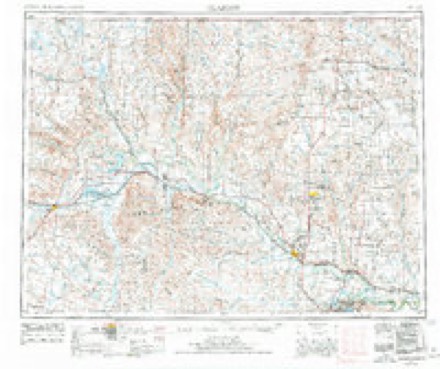
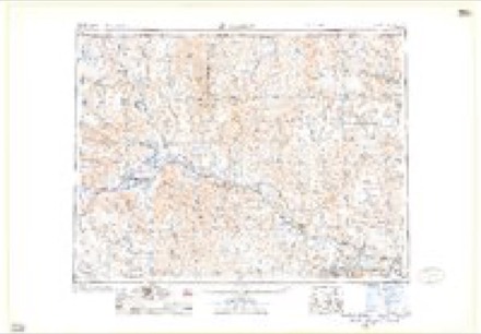
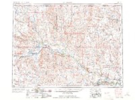
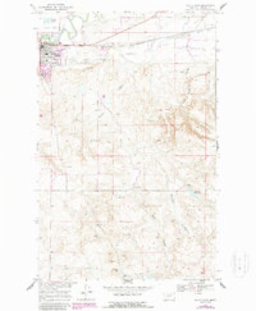
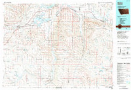
5 surveys from 8 printed sheetsMatched by testing this settlement's coordinate against the published boundary of every sheet in the United States Geological Survey's historical collection. Each opens the scanned sheet at the Survey.
- 1954 USGS Glasgow quadrangle1:250000, 2 printings
- 1957 USGS Glasgow quadrangle1:250000
- 1958 USGS Glasgow quadrangle1:250000, 2 printings
- 1968 USGS Malta East quadrangle1:24000, 2 printings
- 1984 USGS Malta quadrangle1:100000
Fires near this place
1 since 2017Regional context, not property-specific evidence. The federal wildfire occurrence database lists 1 fire within 5 miles of Malta in 2017, burning about 6,500 acres in total. None started naturally. None was recorded as arson. Distance is straight-line from the map coordinates, so a fire counted here may appear on a neighbouring settlement's page as well.
| Reported cause | Fires |
|---|---|
| Missing data/not specified/undetermined | 1 |
The most recent of them, most recent first, with the day each was reported and the service that recorded it.
| Date | Cause | Size | Reported by | Name on the report |
|---|---|---|---|---|
| 23 November 2017 | Missing data/not specified/undetermined | 6,500 acres | Phillips County | LOWER BLACK COULEE |
Mines and quarries near this place
1 within 5 milesRegional context, not property-specific evidence. The federal mineral resources record lists 1 working within 5 miles of Malta: 1 producer. All of them still produce. What was taken out: Fire Clay (Refractory). Distance is straight-line from the map coordinates, so a quarry counted here may appear on a neighbouring settlement's page as well.
| Where | Site | Commodity | Status | Recorded |
|---|---|---|---|---|
| Malta Plant | Fire Clay (Refractory) | Producer |
Storms near this place
60 of 107 shownRegional context, not property-specific evidence. The National Weather Service names Malta in 107 storm reports between 1994 and 2023: 55 hail, 40 thunderstorm wind, 3 flash flood, 3 funnel cloud. No death or injury is recorded in these reports. Each account below is quoted exactly as the forecast office filed it, from the NOAA Storm Events Database, and each date opens the federal record of that event.
| When | Event | Place named | Harm | What the report says |
|---|---|---|---|---|
| June 2005 | Hail | Malta | $100,000 | The large hail caused roof, siding, window, and gutter damage to eight houses. |
| July 1999 | Hail | Malta | $30,000 | no account filed |
| August 2007 | Tornado (EF1) | Malta | $25,000 | Several outbuildings on the property were leaning to the east, and shingles were found at least 100 yards away. A refrigerator was flipped off the front porch of a house, and water was sucked up out of a four foot tall pool in the back yard. A windmill was also twisted and a steer barn collapsed. Based on the NWS damage survey the damage was estimated as EF1 where the steer barn collapsed, and the remainder of the damage was estimated at EF0. |
| July 2000 | Thunderstorm Wind | Malta | $25,000 | Ranch lost new 40' by 60' building as well as having 1400 pound hay bales blown around and equipment blown over. |
| June 2005 | Thunderstorm Wind | Malta | $20,000 | A mobile home was tossed upside down and onto a barbed wire fence. |
| June 2005 | Hail | Malta | $7,000 | Significant car damage with the back window of a vehicle smashed out. |
| June 2005 | Thunderstorm Wind | Malta | $5,000 | Wind gusts of up to 87 mph downed several trees in Malta and caused some damage to fences and to a horse trailer. A tree branch fell against one house tearing the power leads loose and cutting electricty to a couple of homes. |
| May 1994 | Thunderstorm Wind | Malta | $5,000 | Several trees were blown down. |
| July 2007 | Thunderstorm Wind | Malta | $1,000 | A shed roof was blown off a distance of 100 yards, and the north door of the shed was blown off. There were numerous tree limbs down. A cottonwood limb was ignited by lightning, but did not start a fire. |
| June 1996 | Thunderstorm Wind | Malta | $1,000 | no account filed |
| September 2023 | Hail | Malta | - | A trained spotter reported hail up to the size of quarters. |
| February 2022 | Thunderstorm Wind | Malta | - | The Malta Airport ASOS site recorded a 59 mph wind gust from a convective shower. |
| July 2022 | Hail | Malta | - | A trained spotter reported hail up to the size of quarters. |
| July 2020 | Thunderstorm Wind | Malta | - | Public reported, via Facebook, several trees blown over in the Malta Cemetery. |
| June 2019 | Thunderstorm Wind | Malta | - | The AWOS site at the Malta airport recorded a 68 mph wind gust. |
| April 2018 | Flood | Malta | - | Excessive snow melt caused flooding at the river gauge on the Milk River at Malta (MALM8). The gauge recorded river levels reaching flood stage at 12:15 PM MST on April 20th. The river crested at 18.13 feet at 3:50 PM MST on April 26th, then slowly declined, dropping below flood stage at 6:30 PM MST on April 30th. |
| June 2016 | Thunderstorm Wind | Malta | - | Trained spotter reported a semi-trailer toppled over by strong wind gusts. |
| June 2016 | Thunderstorm Wind | Malta | - | Trained spotter reported tree limbs up to 5 inches in diameter downed by strong winds. |
| August 2013 | Flash Flood | Malta | - | Phillips County dispatch reported standing water on the US Highway 191 underpass and street flooding in the town of Malta. |
| June 2013 | Hail | Malta | - | Trained spotter reported quarter-sized hail with heavy rain. |
| June 2011 | Hail | Malta | - | Dime- to quarter-sized hail fell for at least 10 minutes along this path about 1 mile south of Malta and began to accumulate. |
| May 2010 | Heavy Rain | Malta | - | Spotters reported 1.9 inches storm total in Malta, 1.75 inches total 16 miles south-southwest of Saco, both reports occurring between 0300 and 0500 MST. Harb Creek was reported flooding. |
| August 2010 | Hail | Malta | - | Lightning from the storm also started fires in the area. |
| June 2009 | Hail | Malta | - | County sheriff reported one inch hail between Malta and Whitewater on Highway 191. |
| July 2009 | Thunderstorm Wind | Malta | - | Wind damaged a three foot diameter cottonwood tree. Heavy rain mixed with pea-sized hail. |
| July 2008 | Hail | Malta | - | Some crop damage was observed. The hail also piled up on the house's deck. |
| August 2007 | Thunderstorm Wind | Malta | - | Cottonwood branches up to 4 inches in diameter snapped off. |
| June 2007 | Thunderstorm Wind | Malta | - | Small branches were down. |
| June 2007 | Hail | Malta | - | The hail was accompanied by 40 to 50 mph wind. |
| June 2005 | Hail | Malta | - | The hail was accompanied by 2.7 inches of rain in 45 minutes. |
| June 2005 | Funnel Cloud | Malta | - | Dust reported coming up at mile marker 147 along Highway 191. |
| June 2005 | Flash Flood | Malta | - | Alkali Creek came out of its banks on some gravel roads in the area with many fields flooded along Highway 191. The area of flash flooding was from 12 miles southwest of Malta to 12 miles southeast of Malta. Rainfall of 2.7 inches fell in just 45 minutes at one location. A lots of debris swept into the fencing. |
| June 2005 | Funnel Cloud | Malta | - | Pea sized hail along with 40 mph winds. |
| September 2005 | Heavy Rain | Malta | - | Approximately 3 to 3.5 inches of rain fell in about 90 minutes late in the morning. The heavy rainfall led to minor street flooding. |
| June 2002 | Thunderstorm Wind | Malta | - | 60 mph wind gust reported at Malta handar site. |
| July 2002 | Thunderstorm Wind | Malta | - | Thunderstorm wind gust downed 2 to 3 feet diameter trees in Malta. |
| August 2002 | Thunderstorm Wind | Malta | - | 65 mph wind reported by spotter 27 miles southsoutheast of Malta. |
| September 2002 | Thunderstorm Wind | Malta | - | 60 mph wind reported 25 miles south of Malta. |
| July 2000 | Flash Flood | Malta | - | Heavy rain caused rapidly rising water in downtown Malta. Streets were flooded included the town underpass. Several business had parking lots flooded. |
| June 1995 | Hail | Malta | - | One inch hail was reported at the Sand Creek Wildlife Station. |
| May 1994 | Thunderstorm Wind | Malta | - | Several trees were blown down. |
| June 2011 | Hail | Malta | - | no account filed |
| June 2011 | Thunderstorm Wind | Malta | - | no account filed |
| July 2011 | Hail | Malta | - | no account filed |
| July 2011 | Hail | Malta | - | no account filed |
| July 2011 | Hail | Malta | - | no account filed |
| July 2011 | Hail | Malta | - | no account filed |
| July 2011 | Hail | Malta | - | no account filed |
| July 2011 | Hail | Malta | - | no account filed |
| July 2011 | Hail | Malta | - | no account filed |
| July 2011 | Hail | Malta | - | no account filed |
| July 2011 | Hail | Malta | - | no account filed |
| July 2008 | Thunderstorm Wind | Malta | - | no account filed |
| July 2008 | Thunderstorm Wind | Malta | - | no account filed |
| July 2008 | Hail | Malta | - | no account filed |
| August 2008 | Hail | Malta | - | no account filed |
| June 2006 | Hail | Malta | - | no account filed |
| August 2006 | Thunderstorm Wind | Malta | - | no account filed |
| June 2006 | Hail | Malta | - | no account filed |
| June 2005 | Funnel Cloud | Malta | - | no account filed |
Nearest settlements
The eight closest, with where each one stands in the county. Distances are straight-line, computed from the Geographic Names Information System coordinates.
| Map | Place | Distance | Sheets |
|---|---|---|---|
| Wagner | 10.8 miles | 7 | |
| East Malta Colony | 14.2 miles | 9 | |
| Bowdoin | 14.4 miles | 10 | |
| Dodson | 19.8 miles | 7 | |
| Sleeping Buffalo | 20.2 miles | 10 | |
| Ashfield | 22.4 miles | 9 | |
| Cree Crossing | 22.6 miles | 7 | |
| Phillips | 23.9 miles | 7 |
Elsewhere
Matched on this settlement's Geographic Names Information System number rather than its name, so it cannot be a different place of the same name in another state.
| Wikipedia article on Malta | An encyclopaedic summary. Its text is share-alike, so it is linked here rather than copied. |
| Wikidata item Q963370 | The structured record the population and elevation above come from. Public domain (CC0). |
Provenance
This settlement is recorded in the Geographic Names Information System as feature 773850. The sheet list is computed by point-in-boundary test against the United States Geological Survey's historical topographic inventory. Both are works of the United States government and carry no copyright under 17 U.S.C. 105.
Wildfire. Short, Karen C. 2022. Spatial wildfire occurrence data for the United States, 1992-2020 [FPA_FOD_20221014]. 6th Edition. Fort Collins, CO: Forest Service Research Data Archive. https://doi.org/10.2737/RDS-2013-0009.6 Collected with United States Government funding and usable without additional permissions or fees.
Mines and quarries. USGS Mineral Resources Data System (MRDS) https://mrdata.usgs.gov/mrds/ A work of the United States government, no copyright under 17 U.S.C. 105.
Storms. NOAA National Centers for Environmental Information, Storm Events Database https://www.ncei.noaa.gov/stormevents/ A work of the United States government, no copyright under 17 U.S.C. 105. Narratives are quoted verbatim from the National Weather Service report and are not edited or summarised.