 Block
From the record
7 National Register listings published here.
Sources: the National Register database, National Park Service
79 topographic sheets cover 44 settlements here, and 7 properties are on the National Register of Historic Places.
7 National Register listings published here.
Sources: the National Register database, National Park Service
Every property in this county listed on the National Register of Historic Places, with the year it was listed and the federal nomination document.
| Photograph | Property | Type | Listed | Reference |
|---|---|---|---|---|
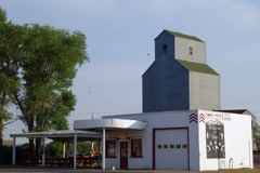 | H. Earl Clack Service Station | building | 1994 | 94000863 |
| Edwards & McLellan Block | building | 2022 | 100007498 | |
| Milk River Bridge | structure | 2025 | 100012497 | |
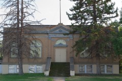 | Phillips County Carnegie Library | building | 1980 | 80002428 |
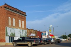 | Saco Mercantile | building | 1997 | 97001452 |
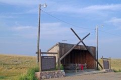 | Sleeping Buffalo Rock | object | 1996 | 96000548 |
| Zortman Ranger Station Historic District | district | 2025 | 100011723 |
Every wildfire the federal occurrence database records inside this county: 321 of them, burning about 113,845 acres. 189 started naturally and 5 were recorded as arson. Each settlement page carries the fires within five miles of it.
| Reported cause | Fires |
|---|---|
| Natural | 189 |
| Missing data/not specified/undetermined | 51 |
| Equipment and vehicle use | 29 |
| Recreation and ceremony | 16 |
| Debris and open burning | 16 |
| Smoking | 6 |
| Arson/incendiarism | 5 |
| Fireworks | 3 |
| Power generation/transmission/distribution | 3 |
| Railroad operations and maintenance | 3 |
The five largest, by the area the report gives. One of them was set deliberately.
| Date | Cause | Size | Reported by | Name on the report |
|---|---|---|---|---|
| 3 July 2017 | Missing data/not specified/undetermined | 11,172 acres | North Central Montana District | JULY |
| 3 August 1994 | Natural | 11,067 acres | Charles M. Russell National Wildlife Refuge | CK CREEK |
| 24 August 2012 | Arson/incendiarism | 10,924 acres | Malta Field Office | ESTER LAKE |
| 31 July 2012 | Natural | 9,468 acres | Charles M. Russell National Wildlife Refuge | WELLS |
| 9 September 2005 | Natural | 6,778 acres | Charles M. Russell National Wildlife Refuge | SHEEP |
| 9 September 2005 | Natural | 6,689 acres | Charles M. Russell National Wildlife Refuge | HEARTLAND |
| 18 July 2006 | Natural | 6,580 acres | Malta Field Office | LARB CREEK |
| 23 November 2017 | Missing data/not specified/undetermined | 6,500 acres | Phillips County | LOWER BLACK COULEE |
Every settlement page carries the fires within five miles of it - see the settlement index below.
The NOAA Storm Events Database holds 610 reports for this county, causing no deaths, no injuries and about $1,568,000 in recorded property damage. Each settlement page carries the reports that name it.
| Kind of event | Reports |
|---|---|
| Hail | 276 |
| Thunderstorm Wind | 247 |
| Flood | 38 |
| Tornado | 14 |
| Heavy Rain | 14 |
| Flash Flood | 13 |
| Funnel Cloud | 6 |
| Wildfire | 2 |
The most serious of them, by death, then injury, then recorded damage. The accounts are quoted exactly as the forecast office filed them.
| When | Event | Place named | Harm | What the report says |
|---|---|---|---|---|
| June 2011 | Tornado (EF1) | Saco | $300,000 | A farm/ranch was significantly damaged by a tornado and damaging downburst winds. The storm stripped trees bare, four car garages were either destroyed or damaged. A 1000 gallon fuel tank that was filled that day was blown off it's stand. The houses received significant damage from hail and the high winds,and the majority of the windows on the two homes were busted out by the wind and hail. A 2x6 piece of lumber was blown and implanted into the side of one of the houses. The majority of the damage was downstream with the storm system. The peak gust was recorded at 86 mph before the sensor was destroyed. Quarter size hail fell with the storm as well, wiping out nearby field. The NWS did not receive the tornado report until a month after the event, but radar data verified the possibility of a tornado, and the property owner verified seeing a funnel cloud come from the sky prior to seeking shelter. |
| May 1980 | Tornado (F1) | not stated | $250,000 | no account filed |
| June 1979 | Tornado (F0) | not stated | $250,000 | no account filed |
| June 2005 | Hail | Malta | $100,000 | The large hail caused roof, siding, window, and gutter damage to eight houses. |
| July 2015 | Thunderstorm Wind | Phillips | $80,000 | A total of 19 three-phase poles and 11 single phase were reported damaged. This included poles broken at ground level, as well as cross arms broken and wires snapped. The radar indicated a bow echo through the area and wind speeds are estimated. Damage is estimated at $75k to 80k. |
| July 2004 | Hail | Saco | $75,000 | The hail broke vehicle windows and caused damage to several roofs. Crop damage was also reported. |
| May 2002 | Thunderstorm Wind | Zortman | $75,000 | A line of thunderstorms produced severe winds across southern Phillips County. The damaging winds were generally less than 70 mph, but one RAWS site at Zortman did measure a 74 mph gust. A group of researchers just north of the UL Bend had significant damage to trailer they were using to stay in while conducting research. Three trailers were completely toppled, and another had the side caved in. |
| July 2007 | Thunderstorm Wind | Zortman | $50,000 | Outflow from thunderstorms 10 to 15 miles south produced wind damage. The strong wind lasted about 30 to 40 seconds. A camper was blown approximately 30 yards and destroyed. Branches were twisted off of trees and power lines were downed by the wind. The roofs were blown off of two barns. |
| July 2002 | Thunderstorm Wind | Zortman | $50,000 | A thunderstorm wind gust blew a Ford Bronco SUV into a house and downed 5 power poles in Zortman. Several trees and a sign were also blown down by the wind. |
| July 2002 | Thunderstorm Wind | Landusky | $50,000 | Thunderstorm wind gusts in Landusky blew away 2 grain bins and blew down a wooden building and 20 acres of hay. There was also a roof blown off a building in Landusky. |
| July 1999 | Hail | Malta | $30,000 | no account filed |
| August 2007 | Tornado (EF1) | Malta | $25,000 | Several outbuildings on the property were leaning to the east, and shingles were found at least 100 yards away. A refrigerator was flipped off the front porch of a house, and water was sucked up out of a four foot tall pool in the back yard. A windmill was also twisted and a steer barn collapsed. Based on the NWS damage survey the damage was estimated as EF1 where the steer barn collapsed, and the remainder of the damage was estimated at EF0. |
| July 2000 | Thunderstorm Wind | Malta | $25,000 | Ranch lost new 40' by 60' building as well as having 1400 pound hay bales blown around and equipment blown over. |
| June 1991 | Tornado (F0) | not stated | $25,000 | no account filed |
| July 1991 | Tornado (F1) | not stated | $25,000 | no account filed |
| July 1991 | Tornado (F1) | not stated | $25,000 | no account filed |
| June 2005 | Thunderstorm Wind | Malta | $20,000 | A mobile home was tossed upside down and onto a barbed wire fence. |
| June 2002 | Thunderstorm Wind | Content | $20,000 | 60 mph wind gust blew roof off barn 15 miles south of Content. |
| July 2002 | Thunderstorm Wind | Zortman | $20,000 | A thunderstorm wind gust 4 miles north of the Manning Corral RAWS site blew a roof off of a barn and blew down 2 power poles. |
| June 1996 | Thunderstorm Wind | Dodson | $15,000 | no account filed |
| August 1999 | Flash Flood | Southwest Portion | $10,000 | Four to six inches of rain fell rapidly over southwest Phillips county along the Missouri River. The heavy rain caused copious amounts of runoff along the Missouri Breaks. Water rapidly running down the hill toward Fred Robinson Bridge caused washouts along Hwy 191. |
| June 2005 | Hail | Malta | $7,000 | Significant car damage with the back window of a vehicle smashed out. |
| June 2005 | Thunderstorm Wind | Malta | $5,000 | Wind gusts of up to 87 mph downed several trees in Malta and caused some damage to fences and to a horse trailer. A tree branch fell against one house tearing the power leads loose and cutting electricty to a couple of homes. |
| June 2005 | Hail | Dodson | $5,000 | Large hail caused damage to a vehicle |
| July 1998 | Flash Flood | Content | $5,000 | Coop observer and trained spotter in Content could not make it home the night of July 3rd due to the road being washed out from water running across it. When the observer arrived home, she found that 1400 pound hay bales had been moved by flowing water and a bundle of 200 wood fence posts had been swept away. |
| July 1995 | Thunderstorm Wind | Livingston | $5,000 | A weather spotter reported 60-70 mph winds. Shingles were blown off of his roof. |
| May 1994 | Thunderstorm Wind | Malta | $5,000 | Several trees were blown down. |
| August 1998 | Thunderstorm Wind | Saco | $3,000 | A spotter north of Saco reported winds to 75 miles an hour. The microburst uprooted cottonwood trees and moved a pick up topper 100 yards. |
| June 1999 | Thunderstorm Wind | Saco | $3,000 | no account filed |
| July 1999 | Thunderstorm Wind | Saco | $3,000 | no account filed |
| July 2014 | Thunderstorm Wind | Sun Prairie | $2,000 | Local newspaper reported two power poles were knocked down. Power failure continued for two hours. |
| May 2008 | Flood | Zortman | $1,000 | Flooding was observed on a few area dirt roads resulting in portions of the road surfaces washing out. |
| July 2008 | Thunderstorm Wind | Sun Prairie | $1,000 | A roof was blown off a shed. |
| July 2007 | Thunderstorm Wind | Malta | $1,000 | A shed roof was blown off a distance of 100 yards, and the north door of the shed was blown off. There were numerous tree limbs down. A cottonwood limb was ignited by lightning, but did not start a fire. |
| June 2006 | Hail | Whitewater | $1,000 | The hail was accompanied by 30 to 35 mph wind and it caused damage to the siding on a house. |
| June 1996 | Thunderstorm Wind | Malta | $1,000 | no account filed |
| April 2026 | Thunderstorm Wind | Malta South Dot | - | The Malta South US-191 DOT site (MTMAL) measured a 60 mph wind gust. |
| May 2025 | Thunderstorm Wind | Loring | - | Occurred at the Loring SW Hydromet site. |
| May 2025 | Thunderstorm Wind | Harb | - | Occurred at the Saco South Hydromet site. |
| May 2025 | Thunderstorm Wind | Malta South Dot | - | Occurred at the Malta South DOT sensor. |
| June 2025 | Thunderstorm Wind | Saco | - | Wind gust occurred at Montana DOT near Saco. |
| June 2025 | Heavy Rain | Saco | - | Penny size hail (0.75 inch) accompanied the heavy rain. One gauge recorded 1.25 inches, the second gauge recorded 1.50 inches, with standing water in driveway. |
| June 2025 | Thunderstorm Wind | Wagner | - | Spotter reported pea sized hail, heavy rain, and estimated winds winds of 50 to 60 mph. |
| July 2025 | Hail | Malta South Dot | - | Quarter size hail estimated from webcam imagery from the Malta South US-191 DOT site. |
| July 2025 | Thunderstorm Wind | Sun Prairie | - | Trained spotter reported multiple 6-inch diameter tree limbs broken off, in addition to heavy rain. Wind speed estimated at 60 mph. |
| July 2025 | Thunderstorm Wind | Sun Prairie | - | Cooperative observer reported limb damage from multiple cottonwood trees, intense lightning, heavy rain, and estimated winds gusts of 55-60 mph. |
| July 2025 | Thunderstorm Wind | Manning Corral Raws | - | A wind gust of 63 mph was recorded at the Manning Corral Dogtown RAWS site. |
| July 2025 | Thunderstorm Wind | Harb | - | A wind gust of 60 mph was measured at the Saco S HydroMet site (Montana Climate Office Mesonet). |
| August 2025 | Heavy Rain | Loring | - | The HydroMet station Loring SW (LORM8) from the Montana Climate office measured 1.85 inches of rain, mainly during a few hours in the afternoon. |
| August 2025 | Thunderstorm Wind | Malta South Dot | - | The Malta South US-191 DOT site (MTMAL) measured a 59 mph wind gust. |
| June 2024 | Thunderstorm Wind | Hays Dot | - | The Hays MT-66 DOT site (MTHAY) measured a 69 mph thunderstorm wind gust. |
| August 2024 | Thunderstorm Wind | Malta South Dot | - | The BLM Zortman E mesonet station (MTM38) measured a 61 mph thunderstorm wind gust. |
| May 2024 | Thunderstorm Wind | Malta Arpt | - | A 62 mph thunderstorm wind gust was measured at the Malta Airport AWOS site (KM75). |
| May 2024 | Tornado (EFU) | Whitewater | - | The public sent a video of a short lived landspout tornado. Path dimensions and times are estimated. |
| July 2024 | Thunderstorm Wind | Manning Corral Raws | - | The Manning Corral Dogtown RAWS site (MCDM8) measured a 61 mph thunderstorm wind gust. |
| July 2024 | Thunderstorm Wind | Saco | - | The Saco US-2 DOT site (MTSCO) measured a 69 mph thunderstorm wind gust. |
| July 2024 | Thunderstorm Wind | Harb | - | The Saco S. Montana mesonet site measured a 58 mph thunderstorm wind gust. |
| July 2024 | Thunderstorm Wind | Hays Dot | - | The MT-66 Hays DOT site (MTHAY) measured a 58 mph thunderstorm wind gust. |
| July 2024 | Hail | Malta South Dot | - | Public reported hail up to the size of golf balls. |
| April 2023 | Flood | Dodson | - | The Milk River at Dodson (DMRM8) rose above its flood stage of 23 feet at 5:45 PM on April 12th. The river then crested at 23.47 feet at 7:15PM on April 12th. The river would go below flood stage at 8:30 PM on April 12th before rising back above flood stage at 3:00 PM on April 14th. The river would fall below flood stage at 4:20 PM on April 14th. |
The Survey's mineral resources record lists 76 workings inside this county. 8 still produce and 68 are closed or unrecorded. Each settlement page carries the workings within five miles of it.
| Commodity | Workings |
|---|---|
| Gold | 34 |
| Clay | 16 |
| Silver | 15 |
| Sand and Gravel, Construction | 9 |
| Abrasive | 4 |
| Fluorine-Fluorite | 3 |
| Zeolites, Diamond | 3 |
| Fire Clay (Refractory) | 3 |
| Gold, Silver | 2 |
| Bentonite | 2 |
| Stone, Crushed/Broken | 2 |
| Copper, Zinc | 1 |
| Iron, Manganese, Fluorine-Fluorite | 1 |
| Lead | 1 |
The least common of them first, because a county's hundredth gravel pit says nothing its first ten did not.
| Where | Site | Commodity | Status | Recorded |
|---|---|---|---|---|
| Antone Peak | Fluorine-Fluorite, Gold, Lead, Silver | Occurrence | ||
| Badger King | Gold, Tellurium, Fluorine-Fluorite | Prospect | ||
| Bailey Group | Gold, Silver, Lead | Unknown | ||
| Camp Prospect | Lead, Zinc, Silver, Gold, Copper | Prospect | ||
| Frank Mine | Gold, Silver, Lead, Zinc | Unknown | ||
| Gold Bug Mine | Gold, Silver, Copper, Zinc | Past Producer | 1893, 1894 | |
| Gold Bug Mine | Gold, Silver, Iron, Manganese, Fluorine-Fluorite | Past Producer | Gold, Limonite, Sylvanite | |
| Hal 1 | Abrasive, Diamond, Zeolites | Occurrence | ||
| Jack Deuce | Silver, Gold, Lead | Past Producer | ||
| Little Warm Springs | Geothermal | Producer | ||
| Lucky Maud | Gold, Copper, Lead, Silver | Past Producer | ||
| Surprise Mine | Gold, Silver, Tellurium | Occurrence | ||
| Unnamed Molybdenum | Molybdenum | Occurrence | ||
| C. M. Russell Game Range Mill Site | Bentonite | Unknown | ||
| Cow Creek Clays | Clay, Bentonite | Occurrence | ||
| Limestone Occurrence | Stone, Crushed/Broken | Occurrence | ||
| Ruby Gulch Group | Gold, Silver, Fluorine-Fluorite | Producer | 1897, 1903 | |
| Unnamed Limestone | Stone, Crushed/Broken | Occurrence | ||
| August Mine | Gold, Silver, Fluorine-Fluorite | Past Producer | 1893 | |
| Dike 2 | Abrasive, Zeolites, Diamond | Unknown | ||
| Hal 18/19 | Abrasive, Zeolites, Diamond | Occurrence | ||
| Hal 40 | Abrasive, Zeolites, Diamond | Occurrence | ||
| Malta Mine | Fire Clay (Refractory) | Producer | ||
| Malta Plant | Fire Clay (Refractory) | Producer | ||
| West Mine | Fire Clay (Refractory) | Producer | ||
| Gravel Pit | Sand and Gravel, Construction | Unknown | ||
| Gravel Pit | Sand and Gravel, Construction | Unknown | ||
| Gravel Pit | Sand and Gravel, Construction | Unknown | ||
| Gravel Pit | Sand and Gravel, Construction | Unknown | ||
| Gravel Pit | Sand and Gravel, Construction | Unknown | ||
| Gravel Pit | Sand and Gravel, Construction | Unknown | ||
| Gravel Pit | Sand and Gravel, Construction | Unknown | ||
| Gravel Pit | Sand and Gravel, Construction | Unknown | ||
| Gravel Pits | Sand and Gravel, Construction | Unknown | ||
| Alder Mine | Gold, Silver | Past Producer | ||
| Hawkeye | Gold, Silver | Unknown | ||
| Humbolt Mine | Gold, Silver | Unknown | ||
| Independent | Gold, Silver | Occurrence | ||
| Linda Kay Mine | Gold, Silver | Past Producer | ||
| Little Rockies Mining Co | Gold, Silver | Unknown | ||
| Pinkeye | Gold, Silver | Occurrence | ||
| Ruby Gulch Mine | Gold, Silver | Producer | ||
| U.S. Exploration Group | Gold, Silver | Prospect | ||
| Unnamed Mine | Gold, Silver | Unknown | ||
| War Eagle | Gold, Silver | Occurrence | ||
| Zortman Mine | Gold, Silver | Past Producer | 1975, 1979 | |
| Brazil Creek Pit | Clay | Producer | ||
| Clay Pit | Clay | Occurrence | ||
| Unnamed Bentonite | Clay | Prospect | ||
| Unnamed Bentonite | Clay | Prospect | ||
| Unnamed Bentonite | Clay | Prospect | ||
| Unnamed Bentonite | Clay | Occurrence | ||
| Unnamed Bentonite | Clay | Prospect | ||
| Unnamed Bentonite | Clay | Occurrence | ||
| Unnamed Bentonite | Clay | Prospect | ||
| Unnamed Bentonite | Clay | Occurrence | ||
| Unnamed Bentonite | Clay | Prospect | ||
| Unnamed Bentonite | Clay | Prospect | ||
| Unnamed Clay | Clay | Occurrence | ||
| Unnamed Clay | Clay | Occurrence | ||
| Unnamed Clay | Clay | Occurrence | ||
| Alabama | Gold | Prospect | ||
| Alder Gulch | Gold | Past Producer | ||
| August Mine | Gold | Past Producer | ||
| Beaver Mine | Gold | Occurrence | ||
| Blue Rock Placer | Gold | Unknown | ||
| Camp Creek Placer | Gold | Unknown | ||
| Cow Creek Placers | Gold | Occurrence | ||
| Grouse Gulch | Gold | Unknown | ||
| Little Ben | Gold | Unknown | ||
| Lodgepole Creek | Gold | Unknown | ||
| Rock Creek | Gold | Unknown | ||
| Ruby Creek Placer | Gold | Unknown | ||
| South Fork of Peoples Creek | Gold | Unknown | ||
| Sullivan Creek | Gold | Unknown | ||
| Zortman - Landusky | Gold | Producer | Fluorite, Sylvanite |
Named settlements recorded in the Geographic Names Information System, each with the topographic sheets covering it. Villages, hamlets and abandoned places alike. Each is shown with the nearest named watercourse or landform and the survey quadrangle it falls on.
South Phillips census division · 59538 · In Box Elder Coulee · Sheep Coulee quadrangle
9 sheets, 1954 to 1978
No longer a settlement
Malta census division · 59524 · Ester Lake quadrangle
7 sheets, 1953 to 1984
No longer a settlement
South Phillips census division · 59538 · On Spring Creek · Content quadrangle
7 sheets, 1954 to 1984
Malta census division · 59261 · Near Alkali Coulee · Hewitt Lake quadrangle
7 sheets, 1920 to 1968
South Phillips census division · 59538 · Schuyler Butte quadrangle
9 sheets, 1954 to 1978
South Phillips census division · 59538 · Dione Reservoir quadrangle
8 sheets, 1954 to 1978
No longer a settlement
South Phillips census division · 59538 · Near Hardpan Coulee · Pea Ridge quadrangle
9 sheets, 1954 to 1978
No longer a settlement
Whitewater census division · 59544 · Thoeny Hills West quadrangle
6 sheets, 1954 to 1984
No longer a settlement
Whitewater census division · 59261 · Double S Hill quadrangle
8 sheets, 1905 to 1984
South Phillips census division · 59546 · Near Mill Gulch · Zortman quadrangle
9 sheets, 1943 to 1984
South Phillips census division · 59538 · On Kill Woman Creek · Schuyler Butte quadrangle
9 sheets, 1954 to 1978
No longer a settlement
South Phillips census division · 59538 · Near Hawley Flat · Locke Ranch quadrangle
9 sheets, 1954 to 1978
No longer a settlement
Malta census division · 59524 · Down Reservoir NE quadrangle
7 sheets, 1920 to 1984
No longer a settlement
Whitewater census division · 59537 · Near Big Coulee · Morgan quadrangle
7 sheets, 1920 to 1984
No longer a settlement
South Phillips census division · 59538 · Near Lonesome Coulee · Emond Ranch quadrangle
9 sheets, 1954 to 1978
Malta census division · 59538 · On Little Warm Creek · Phillips quadrangle
7 sheets, 1953 to 1984
South Phillips census division · 59538 · Emond Ranch quadrangle
9 sheets, 1954 to 1978
No longer a settlement
Whitewater census division · 59261 · Near Joe Bell Coulee · Tattnall quadrangle
7 sheets, 1920 to 1968
South Phillips census division · 59524 · Bison Bone Reservoir quadrangle
8 sheets, 1954 to 1984
No longer a settlement
Whitewater census division · 59261 · Near Ash Coulee · Genevieve quadrangle
6 sheets, 1954 to 1984
South Phillips census division · 59546 · Near Shell Butte · Zortman quadrangle
9 sheets, 1943 to 1984
No longer a settlement
Whitewater census division · 59544 · On East Fork Whitewater Creek · Whitewater West quadrangle
7 sheets, 1920 to 1984
South Phillips census division · 59538 · On Telegraph Creek · Indian Lake quadrangle
9 sheets, 1954 to 1978
Whitewater census division · 59544 · Whitewater West quadrangle
7 sheets, 1920 to 1984
No longer a settlement
South Phillips census division · 59546 · Near Whitcomb Butte · Zortman quadrangle
9 sheets, 1943 to 1984
The vanished settlements of Phillips County: the places named above that are no longer on the map.