 Block
Nashua, Montana
11 topographic sheets cover this place, the earliest surveyed in 1914 and the latest in 1984. It stands in the Glasgow census division. It lies in ZIP code area 59248. It stands on Porcupine Creek Overflow. The Survey maps it on the Nashua quadrangle. 301 people lived here at the 2020 count. It stands 2,064 feet above sea level.
Research this city
On record in Nashua
Buildings and businesses the archive holds for this place. Each opens its own page, with the source record it came from.
On the National Register 1 record
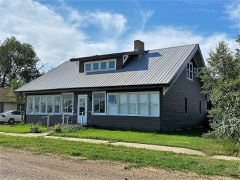 Charles C. Sargent Houselisted 1982
Population over time
2 figuresNashua grew from 290 to 301 between 2010 and 2020. These are the recorded population figures Wikidata holds for this place, reached through the Geographic Names Information System number this page is keyed on rather than by name, so they belong to this place and not to another of the same name. Most are census counts, but not all are: an early figure may be a founding or settlement estimate, and an estimate published within five years of a census is left out. The change column is computed, and is left blank where more than 20 years separate a figure from the one before it, because a gap that long is not a change between two counts.
| Year | People | Change |
|---|---|---|
| 2010 | 290 | |
| 2020 | 301 | +11 (+4%) |
Topographic sheets covering this place
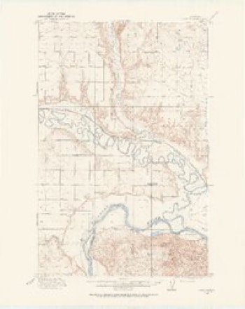
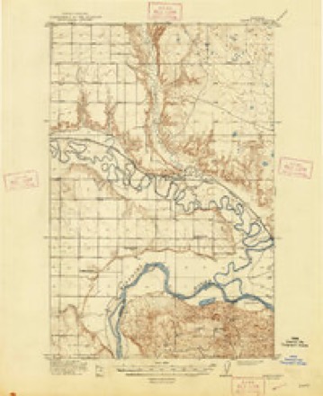
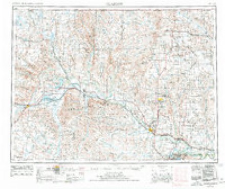
7 surveys from 11 printed sheetsMatched by testing this settlement's coordinate against the published boundary of every sheet in the United States Geological Survey's historical collection. Each opens the scanned sheet at the Survey.
- 1914 USGS Nashua quadrangle1:62500
- 1916 USGS Nashua quadrangle1:62500, 3 printings
- 1954 USGS Glasgow quadrangle1:250000, 2 printings
- 1957 USGS Glasgow quadrangle1:250000
- 1958 USGS Glasgow quadrangle1:250000, 2 printings
- 1972 USGS Nashua quadrangle1:24000
- 1984 USGS Glasgow quadrangle1:100000
Fires near this place
15 since 1996Regional context, not property-specific evidence. The federal wildfire occurrence database lists 15 fires within 5 miles of Nashua between 1996 and 2018, burning about 754 acres in total. 2 started naturally. 1 was recorded as arson. Distance is straight-line from the map coordinates, so a fire counted here may appear on a neighbouring settlement's page as well.
| Reported cause | Fires |
|---|---|
| Debris and open burning | 4 |
| Missing data/not specified/undetermined | 3 |
| Natural | 2 |
| Equipment and vehicle use | 2 |
| Recreation and ceremony | 1 |
| Smoking | 1 |
| Misuse of fire by a minor | 1 |
| Arson/incendiarism | 1 |
The most recent of them, most recent first, with the day each was reported and the service that recorded it.
| Date | Cause | Size | Reported by | Name on the report |
|---|---|---|---|---|
| 16 September 2012 | Equipment and vehicle use | 2.4 acres | Fort Peck Agency | 3 E NASHUA |
| 16 September 1998 | Natural | 8.6 acres | Fort Peck Agency | WIOTA 2 |
| 7 August 2010 | Natural | under an acre | Fort Peck Agency | MARK NEILS RES |
| 16 August 2018 | Equipment and vehicle use | under an acre | Fort Peck Agency | WHEAT |
| 10 August 2018 | Arson/incendiarism | under an acre | Fort Peck Agency | HEADER |
| 28 July 2010 | Debris and open burning | 248 acres | Fort Peck Agency | N. GLENTANA |
| 26 July 1997 | Smoking | 16 acres | Fort Peck Agency | WIOTA |
| 24 July 2018 | Missing data/not specified/undetermined | 1.0 acres | Northeastern Land Office | not named |
Settlements close enough to share some of these fires:
Mines and quarries near this place
6 within 5 milesRegional context, not property-specific evidence. The federal mineral resources record lists 6 workings within 5 miles of Nashua: 6 unknowns. None of them still produces. What was taken out: Sand and Gravel, Construction. Distance is straight-line from the map coordinates, so a quarry counted here may appear on a neighbouring settlement's page as well.
| Where | Site | Commodity | Status | Recorded |
|---|---|---|---|---|
| Gravel Pit | Sand and Gravel, Construction | Unknown | ||
| Gravel Pit | Sand and Gravel, Construction | Unknown | ||
| Gravel Pit | Sand and Gravel, Construction | Unknown | ||
| Gravel Pit | Sand and Gravel, Construction | Unknown | ||
| Gravel Pit | Sand and Gravel, Construction | Unknown | ||
| Gravel Pits | Sand and Gravel, Construction | Unknown |
Storms near this place
60 of 75 shownRegional context, not property-specific evidence. The National Weather Service names Nashua in 75 storm reports between 1994 and 2025: 35 hail, 20 thunderstorm wind, 13 flood, 4 heavy rain. No death or injury is recorded in these reports. Each account below is quoted exactly as the forecast office filed it, from the NOAA Storm Events Database, and each date opens the federal record of that event.
| When | Event | Place named | Harm | What the report says |
|---|---|---|---|---|
| June 2007 | Hail | Nashua | $3,000,000 | One hundred percent of the businesses and homes in the town were damaged from the combination of large hail and damaging winds. Many vehicles also had significant damage. Damages included roofing, windows, gutters, siding, trees and gardens. See entire episode narrative for full details. |
| May 1994 | Hail | Nashua | $50,000 | no account filed |
| May 1994 | Thunderstorm Wind | Nashua | $50,000 | no account filed |
| June 2025 | Thunderstorm Wind | Nashua | - | Wind gust measured by observation equipment 5 miles north-northeast of Nashua. |
| July 2024 | Thunderstorm Wind | Nashua | - | A trained spotter estimated 60 mph thunderstorm wind gusts. |
| April 2023 | Flood | Nashua | - | The Milk River at Nashua (NSHM8) rose above its flood stage of 20 feet at 9:50 PM on April 12th. The river then crested at 26.47 feet at 11:00 AM on April 18th. The river would fall below flood stage at 9:40 AM on April 25th. |
| April 2023 | Flood | Nashua | - | The Milk River at Nashua (NSHM8) rose above its flood stage of 20 feet at 1:05 PM on April 11th. The river then crested at 20.39 feet at 1:15 PM on April 11th. The river would fall below flood stage at 3:00 PM on April 11th. |
| July 2022 | Thunderstorm Wind | Nashua | - | A trained spotter measured a thunderstorm wind gust of 70 mph. |
| March 2020 | Flood | Nashua | - | Excessive snow melt caused flooding at the river gauge on the Milk River near Nashua (NSHM8). The gauge recorded river levels rising above the flood stage of 20.0 feet at 12:16 PM MST on March 7th. The river crested at 21.75 feet at 10:00 PM MST on March 8th. River levels dropped back down below flood stage at 9:38 AM MST on March 12th. |
| May 2020 | Thunderstorm Wind | Nashua | - | Public reported, via Facebook, a tree was blown down, knocking a fence over. Time estimated by radar. |
| May 2020 | Thunderstorm Wind | Nashua | - | Public reported, via Facebook, that several trees were blown down. |
| May 2020 | Funnel Cloud | Nashua | - | Trained spotter reported a funnel cloud located just east of the town of Whatley. |
| May 2020 | Tornado (EF0) | Nashua | - | NWS employees conducted a storm survey, which showed evidence of a brief tornado near the town of Whatley, traveling north across US Highway 2. Damage included: the doors blown in and part of the roof blown off of a metal barn with metal roofing scattered around for 100 yards, a cottonwood tree was snapped, the metal roof of a house was peeled back, a carport roof was completely ripped off, and an aluminum boat was blown 100 feet. Peak winds speeds were estimated at 80 mph. Tornado was rated an EF-0. |
| July 2020 | Hail | Nashua | - | Public reported plentiful hail up to the size of golf balls, near covering the ground. |
| July 2020 | Hail | Nashua | - | Public reported hail up to the size of quarters. |
| April 2019 | Flood | Nashua | - | Continuing the flooding from the end of March, recent melting of the larger snowpack allowed the Nashua river gauge reading (NSHM8) along the Milk River to remain above the flood stage of 20.0 into the first week of April. The river dropped back down below flood stage at 6:24 AM MST on the 5th. |
| March 2019 | Flood | Nashua | - | During the morning of March 24th, at the Nashua forecast point (NSHM8) along the Milk River, recent snow melt caused the river level to rise above the flood stage of 20.0 feet at 10:29 AM MST. The river crested at 27.47 feet at 4:43 PM MST on the 26th. The river level remained high and flooding continued through the end of the month. |
| July 2019 | Thunderstorm Wind | Nashua | - | Public reported damage to a grain bin. |
| August 2019 | Heavy Rain | Nashua | - | Public reported, via social media, a 24-hour rainfall total of 3.00 inches. |
| August 2019 | Heavy Rain | Nashua | - | Public reported, via social media, a 24-hour rainfall total of 3.10 inches. |
| April 2018 | Flood | Nashua | - | Excessive snow melt caused flooding at the river gauge on the Milk River near Nashua (NSHM8). The gauge recorded river levels reaching flood stage at 8:30 PM MST on April 25th. The river crested at 22.35 feet at 2:15 PM MST on April 30th. River levels remained at or above flood stage into May. |
| July 2018 | Thunderstorm Wind | Nashua | - | Public reported damage to a tin roof and some playground equipment. Tin and wood debris was scattered across the property. The damaging winds lasted at least 25 minutes. |
| May 2018 | Flood | Nashua | - | The Milk River at Nashua (NSHM8) began flooding on April 25th due to excessive snowmelt. This flooding continued into May, cresting at 22.35 feet at 2:15 PM MST on April 30th, with a second crest of 22.33 feet on May 1st at 4:15 AM MST. The river levels then began to drop, finally dropping below flood stage on May 6th at 9:30 AM MST. |
| June 2016 | Hail | Nashua | - | Public reported quarter sized hail. |
| June 2016 | Hail | Nashua | - | Trained spotter reported golf ball sized hail. |
| June 2016 | Hail | Nashua | - | Trained spotter reported golf ball sized hail and 10 broken windows among various buildings. Time estimated from radar. |
| June 2016 | Hail | Nashua | - | Public reported penny sized hail and wind gusts up to 50 mph. |
| June 2016 | Hail | Nashua | - | Trained spotter reported half dollar sized hail. |
| July 2014 | Thunderstorm Wind | Nashua | - | Trained spotter reported roof blown off a barn. |
| July 2014 | Thunderstorm Wind | Nashua | - | Trained spotter reported a roof blew off a barn. |
| July 2014 | Thunderstorm Wind | Nashua | - | Winds estimated to 80 mph and blew shingles off a roof, and broke a window. Duration of very strong winds was at least 20 minutes. |
| August 2014 | Flood | Nashua | - | The Milk River at Nashua (NSHM8) rose above its flood stage of 20 feet at 6:40 AM MST on August 26th, crested in minor flooding at 22.97 feet at 1:59 PM MST on August 27th, then fell back down below flood stage at 9:50 AM MST on August 31st. |
| May 2014 | Hail | Nashua | - | Trained spotter reported quarter-sized to half dollar-sized hail. |
| July 2014 | Thunderstorm Wind | Nashua | - | Public estimated 80 mph winds which blew shingles off a roof and broke a window. |
| July 2013 | Hail | Nashua | - | Public reported quarter-sized hail covering the ground and heavy rain. Duration of hail was 10 minutes. |
| July 2013 | Hail | Nashua | - | Trained spotter reported mostly pea-sized hail with a few hail stones the size of half dollars. |
| August 2013 | Hail | Nashua | - | Public reported hail up the size of half dollars. |
| July 2013 | Hail | Nashua | - | Trained spotter reported quarter-sized hail covering the road. |
| June 2012 | Hail | Nashua | - | Dime to quarter sized hail was reported by the public and lasted 7 minutes about 2 miles northwest of Nashua in Valley County. |
| April 2011 | Flood | Nashua | - | The USGS River Gauge at Nashua rose above flood stage, cresting on the 17th above moderate flood stage. |
| June 2011 | Heavy Rain | Nashua | - | Rain accumulation of 1/2 an inch in 20 minutes. |
| June 2011 | Hail | Nashua | - | Estimated golfball size hail. |
| June 2011 | Hail | Nashua | - | Estimated 1/2 inch to 3/4 inch hail. Also, heavy rain reducing visibility. |
| June 2011 | Flood | Nashua | - | Two to three inches of new rainfall on saturated soils resulted in flooding in places such as the Porcupine Creek. |
| June 2011 | Flood | Nashua | - | The river gauge near Nashua rose above Flood Stage on May 23rd, cresting at 29.52 feet on the 8th. The river fell below Flood Stage on the 27th. |
| July 2011 | Hail | Nashua | - | Hail still visible on the ground 4 hours after the event. Some crop damage noted. |
| May 2011 | Flood | Nashua | - | Gage reading at the Nashua gage rose to 23.12 feet on May 31st. Flood stage is 20 feet. |
| May 2011 | Flood | Nashua | - | The USGS River Gauge at Nashua showed falling levels to below the flood stage on May 1st. |
| July 2010 | Thunderstorm Wind | Nashua | - | Severe winds blowing through town with yard and garbage debris blowing throughout the city. |
| August 2010 | Thunderstorm Wind | Nashua | - | A macroburst occurred where damage consisted of one doublewide manufactured home with the roof blown off, one empty storage building blown apart, and about 3 miles of downed power lines (approximately 44 poles all together) starting near mile marker 10 north of Nashua on the Nashua Road (State Highway 438). The power poles were snapped cleanly, mostly at ground level. As the poles were around 10 years old and relatively strong looking, and there were 3 miles of snapped poles, the NWS officials estimated the winds to be around 120 mph. The house and storage building had less wind, since nearby poles were not snapped at those locations. This also was the origination point to where a combined swath of hail and wind damaged 70 to 100 percent of the crops east southeast to the Roosevelt County border. This storm continued into extreme southwest Roosevelt County.||According to the USDA Hazard Risk Assessment indemnity figures, approximately $750,000 worth of crop damage occurred with this storm (as of October 12, 2010). |
| May 2009 | Heavy Rain | Nashua | - | Rainfall 0.45 in 15 minutes. |
| June 2009 | Thunderstorm Wind | Nashua | - | Took a stainless steal BBQ grill off the deck and rolled it over across the yard. |
| June 2009 | Thunderstorm Wind | Nashua | - | Four large cottonwood trees damaged. One tree snapped at base, one about six feet up, and the other two had very large branches/trunks blown down. |
| August 2007 | Thunderstorm Wind | Nashua | - | Wind estimated at 60 to 70 mph. |
| June 2007 | Thunderstorm Wind | Nashua | - | One hundred percent of the businesses and homes in the town were damaged from the combination of large hail and damaging winds. Many vehicles also had significant damage. Damages included roofing, windows, gutters, siding, trees and gardens. Damage amounts in Nashua to property are estimated at 3 millions dollars. See entire episode narrative for full details. |
| June 2005 | Thunderstorm Wind | Nashua | - | Sheet metal torn off of a barn |
| June 2005 | Flash Flood | Nashua | - | Fields were flooded along both sides of US Highway 2. |
| July 2011 | Hail | Nashua | - | no account filed |
| July 2011 | Hail | Nashua | - | no account filed |
| June 2011 | Hail | Nashua | - | no account filed |
Nearest settlements
The eight closest, with where each one stands in the county. Distances are straight-line, computed from the Geographic Names Information System coordinates.
| Map | Place | Distance | Sheets |
|---|---|---|---|
| Wiota (historical) | 5.6 miles | 11 | |
| Idlewile (historical) | 7.2 miles | 11 | |
| Park Dale (historical) | 7.6 miles | 11 | |
| Free Deal (historical) | 7.8 miles | 11 | |
| Park Grove | 8.5 miles | 11 | |
| Whately | 8.5 miles | 10 | |
| Square Deal (historical) | 8.7 miles | 11 | |
| New Deal (historical) | 9.4 miles | 11 |
Elsewhere
Matched on this settlement's Geographic Names Information System number rather than its name, so it cannot be a different place of the same name in another state.
| Wikipedia article on Nashua | An encyclopaedic summary. Its text is share-alike, so it is linked here rather than copied. |
| Wikidata item Q961104 | The structured record the population and elevation above come from. Public domain (CC0). |
Provenance
This settlement is recorded in the Geographic Names Information System as feature 774553. The sheet list is computed by point-in-boundary test against the United States Geological Survey's historical topographic inventory. Both are works of the United States government and carry no copyright under 17 U.S.C. 105.
Wildfire. Short, Karen C. 2022. Spatial wildfire occurrence data for the United States, 1992-2020 [FPA_FOD_20221014]. 6th Edition. Fort Collins, CO: Forest Service Research Data Archive. https://doi.org/10.2737/RDS-2013-0009.6 Collected with United States Government funding and usable without additional permissions or fees.
Mines and quarries. USGS Mineral Resources Data System (MRDS) https://mrdata.usgs.gov/mrds/ A work of the United States government, no copyright under 17 U.S.C. 105.
Storms. NOAA National Centers for Environmental Information, Storm Events Database https://www.ncei.noaa.gov/stormevents/ A work of the United States government, no copyright under 17 U.S.C. 105. Narratives are quoted verbatim from the National Weather Service report and are not edited or summarised.