 Block
Saco, Montana
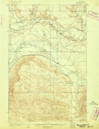
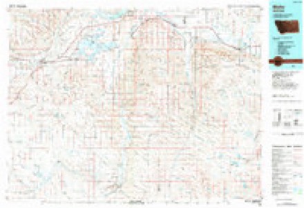
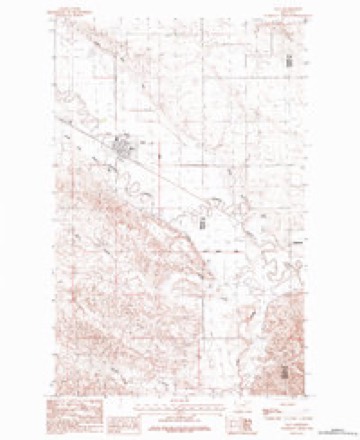
9 topographic sheets cover this place, the earliest surveyed in 1905 and the latest in 1984. It stands in the Malta census division. It lies in ZIP code area 59261. The Survey maps it on the Saco quadrangle. 159 people lived here at the 2020 count. It stands 2,182 feet above sea level.
On record in Saco
Buildings and businesses the archive holds for this place. Each opens its own page, with the source record it came from.
On the National Register 3 records
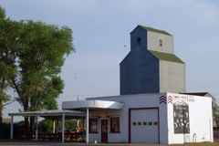 H. Earl Clack Service Stationlisted 1994
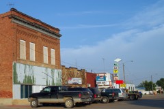 Saco Mercantilelisted 1997
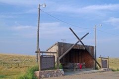 Sleeping Buffalo Rocklisted 1996
Population over time
2 figuresSaco fell from 197 to 159 between 2010 and 2020. These are the recorded population figures Wikidata holds for this place, reached through the Geographic Names Information System number this page is keyed on rather than by name, so they belong to this place and not to another of the same name. Most are census counts, but not all are: an early figure may be a founding or settlement estimate, and an estimate published within five years of a census is left out. The change column is computed, and is left blank where more than 20 years separate a figure from the one before it, because a gap that long is not a change between two counts.
| Year | People | Change |
|---|---|---|
| 2010 | 197 | |
| 2020 | 159 | -38 (-19%) |
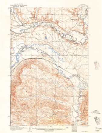
Topographic sheets covering this place
7 surveys from 9 printed sheetsMatched by testing this settlement's coordinate against the published boundary of every sheet in the United States Geological Survey's historical collection. Each opens the scanned sheet at the Survey.
- 1905 USGS Saco quadrangle1:62500
- 1905 USGS Saco Special quadrangle1:62500
- 1954 USGS Glasgow quadrangle1:250000, 2 printings
- 1957 USGS Glasgow quadrangle1:250000
- 1958 USGS Glasgow quadrangle1:250000, 2 printings
- 1984 USGS Malta quadrangle1:100000
- 1984 USGS Saco quadrangle1:24000
Fires near this place
3 since 2002Regional context, not property-specific evidence. The federal wildfire occurrence database lists 3 fires within 5 miles of Saco between 2002 and 2018, burning about 2 acres in total. None started naturally. None was recorded as arson. Distance is straight-line from the map coordinates, so a fire counted here may appear on a neighbouring settlement's page as well.
| Reported cause | Fires |
|---|---|
| Equipment and vehicle use | 1 |
| Missing data/not specified/undetermined | 1 |
| Railroad operations and maintenance | 1 |
The most recent of them, most recent first, with the day each was reported and the service that recorded it.
| Date | Cause | Size | Reported by | Name on the report |
|---|---|---|---|---|
| 3 September 2002 | Railroad operations and maintenance | under an acre | Bowdoin National Wildlife Refuge | BEAVER CK |
| 8 August 2018 | Equipment and vehicle use | 1.0 acres | Northeastern Land Office | not named |
| 15 July 2017 | Missing data/not specified/undetermined | 1.0 acres | Northeastern Land Office | not named |
Settlements close enough to share some of these fires:
Storms near this place
60 of 112 shownRegional context, not property-specific evidence. The National Weather Service names Saco in 112 storm reports between 1994 and 2025: 52 hail, 39 thunderstorm wind, 16 flood, 2 tornado. No death or injury is recorded in these reports. Each account below is quoted exactly as the forecast office filed it, from the NOAA Storm Events Database, and each date opens the federal record of that event.
| When | Event | Place named | Harm | What the report says |
|---|---|---|---|---|
| June 2011 | Tornado (EF1) | Saco | $300,000 | A farm/ranch was significantly damaged by a tornado and damaging downburst winds. The storm stripped trees bare, four car garages were either destroyed or damaged. A 1000 gallon fuel tank that was filled that day was blown off it's stand. The houses received significant damage from hail and the high winds,and the majority of the windows on the two homes were busted out by the wind and hail. A 2x6 piece of lumber was blown and implanted into the side of one of the houses. The majority of the damage was downstream with the storm system. The peak gust was recorded at 86 mph before the sensor was destroyed. Quarter size hail fell with the storm as well, wiping out nearby field. The NWS did not receive the tornado report until a month after the event, but radar data verified the possibility of a tornado, and the property owner verified seeing a funnel cloud come from the sky prior to seeking shelter. |
| July 2004 | Hail | Saco | $75,000 | The hail broke vehicle windows and caused damage to several roofs. Crop damage was also reported. |
| August 1998 | Thunderstorm Wind | Saco | $3,000 | A spotter north of Saco reported winds to 75 miles an hour. The microburst uprooted cottonwood trees and moved a pick up topper 100 yards. |
| June 1999 | Thunderstorm Wind | Saco | $3,000 | no account filed |
| July 1999 | Thunderstorm Wind | Saco | $3,000 | no account filed |
| June 2025 | Thunderstorm Wind | Saco | - | Wind gust occurred at Montana DOT near Saco. |
| June 2025 | Heavy Rain | Saco | - | Penny size hail (0.75 inch) accompanied the heavy rain. One gauge recorded 1.25 inches, the second gauge recorded 1.50 inches, with standing water in driveway. |
| July 2024 | Thunderstorm Wind | Saco | - | The Saco US-2 DOT site (MTSCO) measured a 69 mph thunderstorm wind gust. |
| April 2023 | Flood | Saco | - | The Milk River at Saco (SACM8) rose above its flood stage of 20 feet at 12:18 AM on April 12th. The river then crested at 26.24 feet at 5:15 AM on April 15th. The river would fall below flood stage at 3:14 AM on April 20th. |
| July 2022 | Thunderstorm Wind | Saco | - | The Saco US-2 DOT site (MTSCO) measured a thunderstorm wind gust of 66 mph. |
| June 2021 | Thunderstorm Wind | Saco | - | Trained spotter reported 60 mph wind and pea size hail. |
| July 2021 | Hail | Saco | - | Public reported, via Facebook, quarter size hail. Time estimated from radar. |
| June 2021 | Thunderstorm Wind | Saco | - | Trained spotter reported 70 mph wind and up to 0.70 inch rainfall. |
| July 2021 | Hail | Saco | - | A cooperative observer reported quarter size hail. |
| July 2021 | Hail | Saco | - | A trained spotter reported quarter size hail. |
| July 2021 | Hail | Saco | - | Public reported, via Facebook, ping-pong ball size hail. Time estimated from radar. |
| June 2020 | Thunderstorm Wind | Saco | - | Public reported, via Facebook, that some fences were blown away by strong/severe winds. Wind speed estimated. The nearby Saco US-2 DOT sensor reported a wind gust of 55 mph. |
| July 2020 | Thunderstorm Wind | Saco | - | Cooperative observer reported downed tree branches, two inches in diameter. |
| July 2020 | Thunderstorm Wind | Saco | - | Public reported extensive roof, siding, gutter, and tree damage from severe winds. In addition, a harrow was pushed a distance of 200 feet; a grain bin was lofted up and over a wind break; some other buildings, a few bulls, and a junk pile were all carried a distance of 300 yards to a nearby lake. |
| July 2020 | Thunderstorm Wind | Saco | - | Trained spotter reported siding and shingles peeled off a house. |
| July 2020 | Thunderstorm Wind | Saco | - | At the Saco US-2 DOT site (MTSCO), a 63 mph wind gust was recorded. |
| July 2019 | Hail | Saco | - | Trained spotter estimated quarter size hail, along with heavy rain. |
| June 2019 | Thunderstorm Wind | Saco | - | A NWS employee reported multiple 6 inch diameter tree limbs broken off, along with 3 inches of rain in just 30 minutes. |
| April 2018 | Flood | Saco | - | Excessive snow melt caused flooding at the stream gauge at Beaver Creek near Saco (GSCM8). The gauge recorded stream levels reaching flood stage at 1:45 AM MST on April 17th. The river crested at 11.3 feet at 9:30 PM MST on April 20th, then fell steadily, dropping below flood stage at 1:45 PM MST on April 22th. |
| April 2018 | Flood | Saco | - | The river gage along Beaver Creek near Saco (GSCM8) first entered flood stage at 8:15 PM MST on April 3rd due to ice jamming along the creek. The gage recorded periods of flooding before the ice began to break up and continue downstream. The river crested at 12.35 feet at 8:30 PM MST on April 6th. The river fell below flood stage for the final time at 4:00 AM MST on April 7th. |
| April 2018 | Flood | Saco | - | Excessive snow melt caused flooding at the river gauge on the Milk River near Saco (SACM8). The gauge recorded river levels reaching flood stage at 9:30 PM MST on April 17th. The river crested at 24.22 feet at 3:00 PM MST on April 23th. River levels then gradually declined, but stayed at or above flood stage into early May. |
| May 2018 | Flood | Saco | - | Excessive snow melt raised river levels along the Milk River near Saco (SACM8) to above flood stage on April 18th. The river crested at 24.22 feet on April 23. River levels slowly dropped afterward, but flooding continued into May. The river level dropped below flood stage on May 2nd at 12:15 PM. |
| June 2016 | Thunderstorm Wind | Saco | - | Trained spotter estimated 80 mph wind gusts. |
| June 2016 | Thunderstorm Wind | Saco | - | Trained spotter reported large tree braches, up to 10 inches in diameter, broken off from high winds. |
| June 2016 | Thunderstorm Wind | Saco | - | Trained spotter estimated 60 mph wind gusts. |
| June 2016 | Hail | Saco | - | Trained spotter reported golf ball sized hail. |
| June 2016 | Thunderstorm Wind | Saco | - | Trained spotter reported some siding was blown off his house from very strong winds. |
| October 2016 | Flood | Saco | - | The Milk River near Saco (SACM8) rose above its flood stage of 20 feet at 8:14 PM MST on October 6th, crested at 21.61 feet at 3:27 PM MST on October 8th, then fell back down below flood stage at 4:55 PM MST on October 9th. |
| May 2016 | Flood | Saco | - | Two to four inches of rainfall as well as 2 to 3 feet of snow that eventually melted contributed to flooding in the southern portions of Phillips County. Beaver Creek remained in it's banks south of Saco, but as it got closer to Saco the water left it's banks, and at least 100 yards of the Beaverton Road was underwater. Peoples Creek near Dodson was flooded out of it's banks in the Dodson area. |
| June 2015 | Hail | Saco | - | Trained spotter reported dime-sized hail, 30-40 mph winds, brief wind gusts of 50 mph along with heavy rain. |
| July 2014 | Hail | Saco | - | Public reported quarter-sized hail with heavy rain. |
| June 2014 | Hail | Saco | - | Public reported nickel-sized hail and heavy rain at the Bjornberg bridge. |
| August 2014 | Hail | Saco | - | Public reported hail ranging from quarter- to ping pong ball-sized. |
| August 2014 | Flash Flood | Saco | - | Public reported flooding across Highway 2 and other streets in the town of Saco with 2 to 3 inches of standing water. City flood drain valves had been closed due to ongoing long-fused flooding along the Milk River and nearby tributaries. City runoff could not flow out of town when needed. |
| June 2013 | Thunderstorm Wind | Saco | - | Public estimated wind gusts between 65 and 70 mph and reported a roof blown off of a shed and thrown about 75 yards into a field northeast of the shed location. The shed was open-faced towards the south and side walls were left standing. |
| June 2013 | Thunderstorm Wind | Saco | - | Trained spotter reported wind gusts of 60 mph. |
| August 2011 | Thunderstorm Wind | Saco | - | Spotter estimated gusts up to 60 mph. |
| March 2011 | Flood | Saco | - | On March 23rd, Beaver Creek was out of its banks and the Gauge at Guston Coulee on Beaver Creek was 12.28 feet and continuing to rise. On March 25th, the gauge at Guston Coulee at Beaver Creek spreading out of the creek channel and across the fields and ditches and over a few roads in the region. |
| April 2011 | Flood | Saco | - | The river gauge at the Bjornberg Bridge rose to above flood stage from April 9th and remained there until April 27th. It crested on the 14th above moderate flood stage. |
| April 2011 | Flood | Saco | - | Beaver and Larb creeks flooded. Saco Flats flooded, surrounding Saco with water. |
| April 2011 | Flood | Saco | - | Many creeks, mainly the Beaver and the Frenchmen continue to flood. Saco Flats flooding continues to surround Saco with flood waters. |
| March 2011 | Flood | Saco | - | On the afternoon of the 20th, the Beaver Creek has risen rapidly and lowland flooding has occurred between Highway 2 and Harb Road. On the 22nd, the Beaver Creek is out of its banks and flooding the fields east of Content. To the north 12 miles southwest of Saco, Beaver Creek is at bankful and at the gauge near Guston Coulee. The river is at 11.58 feet, which is the second highest recorded stage at that location. |
| June 2011 | Hail | Saco | - | A farm/ranch was significantly damaged by a tornado and damaging downburst winds. The storm stripped trees bare, four car garages were either destroyed or damaged. A 1000 gallon fuel tank that was filled that day was blown off it's stand. The houses received significant damage from hail and the high winds,and the majority of the windows on the two homes were busted out by the wind and hail. A 2x6 piece of lumber was blown and implanted into the side of one of the houses. The majority of the damage was downstream with the storm system. The peak gust was recorded at 86 mph before the sensor was destroyed. Quarter size hail fell with the storm as well, wiping out nearby field. The NWS did not receive the tornado report until a month after the event, but radar data verified the possibility of a tornado, and the property owner verified seeing a funnel cloud come from the sky prior to seeking shelter. |
| June 2011 | Thunderstorm Wind | Saco | - | Combined with quarter inch hail and heavy rain, visibility was less than 50 feet. |
| June 2011 | Hail | Saco | - | Estimated quarter sized hail. Combined with 70 mph winds and heavy rain, visibility was less than 50 feet. |
| June 2011 | Flood | Saco | - | Heavy rain and saturated soils lead to a slow improvement of flooding across the area. Beaver Creek was the main creek that flooded in Phillips County during this time. |
| June 2011 | Thunderstorm Wind | Saco | - | Spotter estimated 60 to 65 mph winds along with half an inch of rain. |
| June 2011 | Thunderstorm Wind | Saco | - | Storm also produced 0.50 inches of rain. |
| June 2011 | Thunderstorm Wind | Saco | - | A farm/ranch was significantly damaged by a tornado and damaging downburst winds. The storm stripped trees bare, four car garages were either destroyed or damaged. A 1000 gallon fuel tank that was filled that day was blown off it's stand. The houses received significant damage from hail and the high winds,and the majority of the windows on the two homes were busted out by the wind and hail. A 2x6 piece of lumber was blown and implanted into the side of one of the houses. The majority of the damage was downstream with the storm system. The peak gust was recorded at 86 mph before the sensor was destroyed. Quarter size hail fell with the storm as well, wiping out nearby field. The NWS did not receive the tornado report until a month after the event, but radar data verified the possibility of a tornado, and the property owner verified seeing a funnel cloud come from the sky prior to seeking shelter. |
| May 2011 | Flood | Saco | - | The gage reading at the Bjornberg Bridge (Saco) crested on May 27th at 20.8 feet. Flood stage is 20 feet. |
| June 2011 | Flood | Saco | - | The river gauge near Saco rose above Flood Stage on the 8th, cresting at 21.53 feet on the 9th. The river fell below Flood Stage on the 14th. |
| April 2011 | Flood | Saco | - | USGS River gauges on the Beaver Creek reported flooding, with abundant flooding on the Saco Flats. |
| July 2010 | Hail | Saco | - | Penny size hail reported by Frenchman Dam caretakers. |
| August 2010 | Thunderstorm Wind | Saco | - | Wind gust was estimated. |
| August 2010 | Hail | Saco | - | Hail fell with heavy rain and wind gusts to 50 mph. |
Nearest settlements
The eight closest, with where each one stands in the county. Distances are straight-line, computed from the Geographic Names Information System coordinates.
| Map | Place | Distance | Sheets |
|---|---|---|---|
| Bone Crossing | 4.5 miles | 8 | |
| Jordan Crossing | 4.5 miles | 8 | |
| Ashfield | 7.0 miles | 9 | |
| Cole | 8.8 miles | 8 | |
| Sleeping Buffalo | 10.0 miles | 10 | |
| Cree Crossing | 11.0 miles | 7 | |
| Bowdoin | 14.7 miles | 10 | |
| Tattnall | 15.8 miles | 7 |
Elsewhere
Matched on this settlement's Geographic Names Information System number rather than its name, so it cannot be a different place of the same name in another state.
| Wikipedia article on Saco | An encyclopaedic summary. Its text is share-alike, so it is linked here rather than copied. |
| Wikidata item Q963277 | The structured record the population and elevation above come from. Public domain (CC0). |
Provenance
This settlement is recorded in the Geographic Names Information System as feature 776059. The sheet list is computed by point-in-boundary test against the United States Geological Survey's historical topographic inventory. Both are works of the United States government and carry no copyright under 17 U.S.C. 105.
Wildfire. Short, Karen C. 2022. Spatial wildfire occurrence data for the United States, 1992-2020 [FPA_FOD_20221014]. 6th Edition. Fort Collins, CO: Forest Service Research Data Archive. https://doi.org/10.2737/RDS-2013-0009.6 Collected with United States Government funding and usable without additional permissions or fees.
Storms. NOAA National Centers for Environmental Information, Storm Events Database https://www.ncei.noaa.gov/stormevents/ A work of the United States government, no copyright under 17 U.S.C. 105. Narratives are quoted verbatim from the National Weather Service report and are not edited or summarised.