 Block
Winnett, Montana
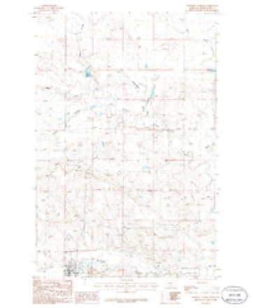
8 topographic sheets cover this place, the earliest surveyed in 1954 and the latest in 1986. It stands in the Winnett South census division. It lies in ZIP code area 59087. The Survey maps it on the Winnett North quadrangle. 188 people lived here at the 2020 count. It stands 2,953 feet above sea level.
Research this city
On record in Winnett
Buildings and businesses the archive holds for this place. Each opens its own page, with the source record it came from.
On the National Register 3 records
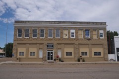 Winnett Blocklisted 2009
- Lewistown Satellite Airfield Historic District (Boundary Increase III)listed 2010
- Winnett Schoollisted 1995
Population over time
2 figuresWinnett grew from 182 to 188 between 2010 and 2020. These are the recorded population figures Wikidata holds for this place, reached through the Geographic Names Information System number this page is keyed on rather than by name, so they belong to this place and not to another of the same name. Most are census counts, but not all are: an early figure may be a founding or settlement estimate, and an estimate published within five years of a census is left out. The change column is computed, and is left blank where more than 20 years separate a figure from the one before it, because a gap that long is not a change between two counts.
| Year | People | Change |
|---|---|---|
| 2010 | 182 | |
| 2020 | 188 | +6 (+3%) |
Topographic sheets covering this place
4 surveys from 8 printed sheetsMatched by testing this settlement's coordinate against the published boundary of every sheet in the United States Geological Survey's historical collection. Each opens the scanned sheet at the Survey.
- 1954 USGS Lewistown quadrangle1:250000, 3 printings
- 1959 USGS Lewistown quadrangle1:250000, 3 printings
- 1986 USGS Winnett quadrangle1:100000
- 1986 USGS Winnett North quadrangle1:24000
Fires near this place
5 since 2012Regional context, not property-specific evidence. The federal wildfire occurrence database lists 5 fires within 5 miles of Winnett between 2012 and 2020, burning about 3,302 acres in total. None started naturally. None was recorded as arson. Distance is straight-line from the map coordinates, so a fire counted here may appear on a neighbouring settlement's page as well.
| Reported cause | Fires |
|---|---|
| Equipment and vehicle use | 3 |
| Missing data/not specified/undetermined | 2 |
The most recent of them, most recent first, with the day each was reported and the service that recorded it.
| Date | Cause | Size | Reported by | Name on the report |
|---|---|---|---|---|
| 7 August 2018 | Equipment and vehicle use | under an acre | Northeastern Land Office | not named |
| 28 August 2012 | Equipment and vehicle use | 3,300 acres | North Central Montana District | SKINNER |
| 2 July 2020 | Equipment and vehicle use | under an acre | Petroleum County | FDH-MTLG55-103 |
| 2 May 2019 | Missing data/not specified/undetermined | under an acre | Petroleum County | FDH-MTLG55-17 |
| 11 February 2020 | Missing data/not specified/undetermined | 1.0 acres | Petroleum County | FDH-MTLG55-54 |
Settlements close enough to share some of these fires:
Storms near this place
60 of 142 shownRegional context, not property-specific evidence. The National Weather Service names Winnett in 142 storm reports between 1994 and 2026: 70 hail, 50 thunderstorm wind, 10 flood, 4 tornado. The reports record 1 death and 1 injury. Each account below is quoted exactly as the forecast office filed it, from the NOAA Storm Events Database, and each date opens the federal record of that event.
| When | Event | Place named | Harm | What the report says |
|---|---|---|---|---|
| September 1998 | Lightning | Winnett | 1 killed, 1 hurt | One man died after lightning struck him and a friend while the two were bow hunting. The two were hunting between Crooked Creek and Barrel Springs when a thunderstorm moved overhead. The two took cover under a tree. Lightning struck the pair knocking both unconscious. When the one man awoke he tried to revive his friend and then went for help. Help arrived in the remote area about two hours after the strike. The second man was pronounced dead at 9:50 p.m. |
| August 2014 | Flood | Winnett | $515,000 | Over 5 to 10 inches of rainfall fell in a four day period. This caused massive flooding in area creeks and streams. The most significant damage was from Flatwillow Creek into the Musselshell River. Cooperative weather observers noted it was the highest they had ever seen the water on Flatwillow Creek, including the 2011 flood season. It was high enough that the USGS gage on Flatwillow Creek was washed out and is gone, and the Flatwillow Road bridge was also washed out. The County DES coordinator reported over 30 locations with damages to culverts, roads and bridges with damages of at least $515,000. |
| June 2016 | Hail | Winnett | $500,000 | Petroleum County Emergency Manager reported hen egg sized hail, wind gusts to 50 mph, trees downed, roofs and siding damaged, and power outages. Event also resulted in 1 injury: A man was blown off his horse and later transported with injuries to Billings, MT. |
| July 1999 | Thunderstorm Wind | Winnett | $20,000 | no account filed |
| July 2008 | Thunderstorm Wind | Winnett | $200 | Eight inch diameter tree limbs were found snapped off and scattered on a nearby road. |
| April 2026 | Thunderstorm Wind | Winnett | - | The Winnett MT-200 DOT site (MTWIN) measured a 64 mph wind gust. |
| May 2025 | Thunderstorm Wind | Winnett | - | Occurred at the Mosby NW site. |
| June 2025 | Hail | Winnett | - | Quarter-sized hail, heavy rain and 70 mph wind gusts caused considerable tree damage in Winnett. |
| June 2025 | Thunderstorm Wind | Winnett | - | Quarter-sized hail, heavy rain and 70 mph wind gusts caused considerable tree damage in Winnett. |
| June 2025 | Hail | Winnett | - | Hail up to the size of golf balls fell with winds of 30-40 mph. |
| June 2025 | Hail | Winnett | - | Golfball size hail was reported by Public. |
| June 2025 | Hail | Winnett | - | Large hail about 3.5 inches in diameter, lasted for about 15 mins. |
| June 2025 | Hail | Winnett | - | Ping pong ball size hail broke windows and damaged vehicles. |
| June 2025 | Hail | Winnett | - | A storm chaser measured multiple hailstones of 2.5 inches in diameter (tennis ball size) with a ruler. Report relayed through social media. |
| July 2025 | Thunderstorm Wind | Winnett | - | Trained spotter measured a 60 mph wind gust. |
| July 2025 | Thunderstorm Wind | Winnett | - | A wind gust of 63 mph was measured by the Winnett MT-200 DOT site. |
| July 2025 | Hail | Winnett | - | Trained spotter reported golf ball size hail. |
| July 2025 | Thunderstorm Wind | Winnett | - | Trained spotter reported a 60 mph wind gust. |
| August 2025 | Thunderstorm Wind | Winnett | - | Trained spotter reported trees swaying significantly and estimated wind gusts of 50 to 60 mph along with pea sized hail. |
| August 2025 | Thunderstorm Wind | Winnett | - | The Winnett MT-200 DOT site (MTWIN) recorded a 59 mph wind gust. |
| August 2025 | Thunderstorm Wind | Winnett | - | The Mosby NW HydroMet site (MOBM8) from the Montana Climate Office Mesonet recorded a 60 mph wind gust. |
| June 2024 | Thunderstorm Wind | Winnett | - | The Mosby NW mesonet site (MOBM8) measured a 58 mph thunderstorm wind gust. |
| July 2023 | Hail | Winnett | - | The public reported hail up to the size of quarters. |
| June 2022 | Thunderstorm Wind | Winnett | - | Law enforcement reported trees up to 36 inches in diameter being blown down. |
| July 2022 | Hail | Winnett | - | Public reported hail up to the size of quarters. |
| July 2022 | Flood | Winnett | - | Petroleum County Sheriff reported water covered roads and fields around and in the town of Winnett. |
| July 2022 | Thunderstorm Wind | Winnett | - | A trained spotter estimated a thunderstorm wind gust of 60 mph. Heavy rainfall and pea size hail covering the ground was also observed. |
| July 2022 | Hail | Winnett | - | Petroleum County Sheriff reported hail up to the size of quarters, blown into drifts. |
| August 2021 | Hail | Winnett | - | Public reported, via Facebook, quarter size hail. |
| August 2021 | Hail | Winnett | - | Law enforcement reported quarter size hail on Montana Highway 200, 2 miles east of Winnett. |
| August 2021 | Flood | Winnett | - | Petroleum County Dispatch reported some water coming out of a coulee 2 miles east of Winnett. |
| May 2020 | Hail | Winnett | - | The Petroleum County Emergency Manager reported hail stones up to the size of golf balls. |
| July 2020 | Hail | Winnett | - | Petroleum County Emergency Manager reported hail up to the size of half dollars. |
| July 2020 | Tornado (EF0) | Winnett | - | Petroleum County dispatch relayed a public report of a brief, weak gustnado spun up out of severe thunderstorm outflow winds southwest of Winnett. Time estimated from radar. |
| August 2019 | Hail | Winnett | - | Trained spotter reported, via social media, tea cup size hail stones (3 inches in diameter). |
| July 2019 | Thunderstorm Wind | Winnett | - | Trained spotter reported wind damage in the town of Winnett, including power lines and trees blown down, and a roof ripped off a house. Time estimated by radar. |
| July 2019 | Thunderstorm Wind | Winnett | - | A 78 mph wind gust was measured at the Winnett Handar site (GGWWT). |
| May 2019 | Flood | Winnett | - | In response to the heavy rain from the previous few days, Petroleum County DES Coordinator reported that many creeks and streams across most of southern Petroleum County were running out of their banks and crossing multiple county roads. Times are estimated. |
| March 2018 | Flood | Winnett | - | During the evening of March 12st, at the Mosby river forecast point (MSBM8) along the Musselshell River, an ice jam suddenly caused the river level to briefly rise above the flood stage of 10 feet at 5:24 PM MST. Even though the river fell back down below 10 feet just 9 minutes later, at 5:33 PM MST, it quickly rose above 10 feet again at 6:14 PM MST. The river crested at 11.53 feet at 6:59 PM MST. As the ice jam cleared, the river fell back down below flood stage at 7:20 PM MST. |
| June 2018 | Flood | Winnett | - | The Musselshell River at Mosby (MSBM8) rose above the flood stage of 10 feet at 12:05 pm MST on June 1st, crested at 11.1 feet at 3:55 pm MST that same day, then fell back down below 10 feet at 7:07 am MST on June 2nd. |
| June 2018 | Hail | Winnett | - | Petroleum County Emergency Manager reported quarter size hail and wind gusts up to 45 mph. |
| August 2017 | Hail | Winnett | - | The hail was accompanied by little rain or wind. The length of the event is based on the spotter report and corroborated by radar. |
| August 2017 | Hail | Winnett | - | Hail the size of nickels and quarters fell from a thunderstorm with no rain accompanying it. Enough hail had fallen that it was piling up. |
| June 2016 | Hail | Winnett | - | Public reported quarter sized hail. |
| July 2016 | Hail | Winnett | - | Trained spotter reported quarter sized hail. |
| June 2013 | Hail | Winnett | - | Trained spotter reported quarter-sized hail and estimated wind gusts up to 60 mph. |
| June 2013 | Flood | Winnett | - | The Musselshell River at Mosby (MSBM8) rose above its flood stage of 10 feet at 11:10 PM MST on June 3rd, crested at 11.72 feet at 7:50 AM MST on June 3rd, then feel back down below flood stage at 1:10 AM MST on June 6th. |
| August 2013 | Hail | Winnett | - | Trained spotter reported tennis ball sized hail, broken windows and skylights, and 0.62 inches of rain. |
| August 2013 | Thunderstorm Wind | Winnett | - | Public estimated wind gusts up to 60 mph. |
| August 2013 | Hail | Winnett | - | Public estimated penny-sized hail resulting in total crop loss. |
| June 2012 | Hail | Winnett | - | Golf ball sized hail was reported by the public about 6 miles south of Winnett in Petroleum County. |
| July 2011 | Hail | Winnett | - | Most pea-sized to penny-sized hail stones were reported, with a few quarter-sized stones. |
| February 2011 | Flood | Winnett | - | Snowmelt and ice jams contributed to unusually high levels on the Musselshell River. The river flooded homes and closed roads for several weeks. The Musselshell River at Mosby was above flood stage between February 13 and 19 peaking at 13.37 feet on the 15th. It was the highest stage recorded at the site since March 1994. |
| July 2011 | Thunderstorm Wind | Winnett | - | Commercial semi-truck was blown over. |
| May 2011 | Flood | Winnett | - | Many gravel roads became impassible due to the extremely wet conditions. |
| April 2010 | Hail | Winnett | - | Trained spotter reported nickel-size hail. |
| June 2010 | Heavy Rain | Winnett | - | The heavy rain of 0.75 inches fell in 45 to 60 minutes. |
| July 2009 | Thunderstorm Wind | Winnett | - | Spotter estimated wind gusts to be about 60 mph. |
| May 2008 | Flood | Winnett | - | Flatwillow Creek was observed running over its banks five miles west of Petrolia Lake. |
| May 2008 | Heavy Rain | Winnett | - | A trained spotter measured a total of 4.70 inches of rain. |
Nearest settlements
The eight closest, with where each one stands in the county. Distances are straight-line, computed from the Geographic Names Information System coordinates.
| Map | Place | Distance | Sheets |
|---|---|---|---|
| Hoyle (historical) | 9.9 miles | 8 | |
| Shay (historical) | 11.5 miles | 8 | |
| Flatwillow | 12.1 miles | 6 | |
| Teigen | 13.2 miles | 8 | |
| Jitney (historical) | 17.3 miles | 9 | |
| Wallview (historical) | 17.6 miles | 6 | |
| Cat Creek | 18.8 miles | 9 | |
| Kelley | 18.9 miles | 6 |
Elsewhere
Matched on this settlement's Geographic Names Information System number rather than its name, so it cannot be a different place of the same name in another state.
| Wikipedia article on Winnett | An encyclopaedic summary. Its text is share-alike, so it is linked here rather than copied. |
| Wikidata item Q968779 | The structured record the population and elevation above come from. Public domain (CC0). |
Provenance
This settlement is recorded in the Geographic Names Information System as feature 806828. The sheet list is computed by point-in-boundary test against the United States Geological Survey's historical topographic inventory. Both are works of the United States government and carry no copyright under 17 U.S.C. 105.
Wildfire. Short, Karen C. 2022. Spatial wildfire occurrence data for the United States, 1992-2020 [FPA_FOD_20221014]. 6th Edition. Fort Collins, CO: Forest Service Research Data Archive. https://doi.org/10.2737/RDS-2013-0009.6 Collected with United States Government funding and usable without additional permissions or fees.
Storms. NOAA National Centers for Environmental Information, Storm Events Database https://www.ncei.noaa.gov/stormevents/ A work of the United States government, no copyright under 17 U.S.C. 105. Narratives are quoted verbatim from the National Weather Service report and are not edited or summarised.