 Block
From the record
One of 38 National Register listings published here for Big Horn County · listed in 1985 · category: District.
Sources: the case file at the National Archives · the National Register database, National Park Service
Listed on the National Register of Historic Places in 1985.
One of 38 National Register listings published here for Big Horn County · listed in 1985 · category: District.
Sources: the case file at the National Archives · the National Register database, National Park Service
Regional context, not property-specific evidence. The federal wildfire occurrence database lists 174 fires within 5 miles of Residential District between 1992 and 2020, burning about 2,605 acres in total. 3 started naturally. 17 were recorded as arson. Distance is straight-line from the map coordinates, so a fire counted here may appear on a neighbouring settlement's page as well.
| Reported cause | Fires |
|---|---|
| Missing data/not specified/undetermined | 59 |
| Debris and open burning | 27 |
| Equipment and vehicle use | 24 |
| Arson/incendiarism | 17 |
| Fireworks | 15 |
| Railroad operations and maintenance | 8 |
| Smoking | 8 |
| Misuse of fire by a minor | 5 |
| Recreation and ceremony | 4 |
| Natural | 3 |
| Other causes | 3 |
| Power generation/transmission/distribution | 1 |
The most recent of them, most recent first, with the day each was reported and the service that recorded it.
| Date | Cause | Size | Reported by | Name on the report |
|---|---|---|---|---|
| 8 September 1998 | Railroad operations and maintenance | under an acre | Crow Agency | RAILROAD |
| 6 September 1996 | Missing data/not specified/undetermined | under an acre | Crow Agency | FIRE BROOM |
| 5 September 2005 | Recreation and ceremony | 2.0 acres | Crow Agency | GOOD BYE |
| 3 September 2001 | Misuse of fire by a minor | under an acre | Crow Agency | PIT |
| 29 September 2017 | Equipment and vehicle use | under an acre | Crow Agency | DUST |
| 29 September 2016 | Missing data/not specified/undetermined | under an acre | Southern Land Office | 850 HWY 87 E |
| 28 September 2003 | Misuse of fire by a minor | 1.5 acres | Crow Agency | BIG |
| 21 September 1999 | Debris and open burning | 1.5 acres | Crow Agency | BUCK |
Regional context, not property-specific evidence. The federal mineral resources record lists 8 workings within 5 miles of Residential District: 6 unknowns, 1 past producer, 1 producer. 1 still produces. What was taken out: Sand and Gravel, Construction, Bentonite. Distance is straight-line from the map coordinates, so a quarry counted here may appear on a neighbouring settlement's page as well.
| Where | Site | Commodity | Status | Recorded |
|---|---|---|---|---|
| Hardin Bentonite | Bentonite | Past Producer | ||
| Melville Sand and Gravel | Sand and Gravel, Construction | Producer | ||
| Torski Pit and Plant | Sand and Gravel, Construction | Unknown | ||
| Unnamed Gravel Pit | Sand and Gravel, Construction | Unknown | ||
| Unnamed Gravel Pit | Sand and Gravel, Construction | Unknown | ||
| Unnamed Gravel Pit | Sand and Gravel, Construction | Unknown | ||
| Unnamed Gravel Pit | Sand and Gravel, Construction | Unknown | ||
| Unnamed Gravel Pits | Sand and Gravel, Construction | Unknown |
Regional context, not property-specific evidence. The National Weather Service names Hardin, the town this property stands in, in 121 storm reports between 1996 and 2025: 73 hail, 42 thunderstorm wind, 3 flash flood, 1 tornado. The reports record 1 death and 6 injuries. Each account below is quoted exactly as the forecast office filed it, from the NOAA Storm Events Database, and each date opens the federal record of that event.
| When | Event | Place named | Harm | What the report says |
|---|---|---|---|---|
| July 2022 | Thunderstorm Wind | Hardin | 1 killed, 6 hurt | Around 4:15 PM MDT, a thunderstorm outflow moved through the Hardin area. It produced a wind gust of 62 mph in the 4:35 PM MDT observations from the Big Horn County Airport. Along with the outflow winds, blowing dust reduced visibility to less than a quarter mile on the AWOS. This resulted in a 20 to 30 vehicle pile up along Interstate 90 around mile marker 493 reported at 4:30 PM MDT, very close to the airport. Prior to this, the Montana DOT RWIS station at Arrow Creek Hill, 25 miles west of Hardin, reported a peak wind gust of 48 mph about 15 minutes prior. This accident resulted in 6 deaths and multiple injuries. |
| July 1998 | Hail | Hardin | $100,000 | Baseball sized hail damaged numerous vehicles and broke several windows and yard lights. |
| July 2000 | Thunderstorm Wind | Hardin | $10,000 | Wind damage. Large tree downed. Roof damaged. |
| July 2000 | Thunderstorm Wind | Hardin | $3,000 | Wind damage with 60-70 mile per hour winds. Large trees downed. |
| July 2000 | Thunderstorm Wind | Hardin | $2,000 | 58 mph thunderstorm wind gust. Tree limbs down. |
| August 2025 | Hail | Hardin | - | From phone call. |
| June 2025 | Hail | Hardin | - | One inch hail reported. |
| June 2025 | Thunderstorm Wind | Hardin | - | AWOS station 2 west northwest Hardin. |
| July 2025 | Thunderstorm Wind | Hardin | - | Blowing debris caused car damages at campground. |
| July 2025 | Thunderstorm Wind | Hardin | - | Big Horn County Airport awos. |
| August 2024 | Thunderstorm Wind | Hardin | - | Large tree limbs were reported to be broken. |
| June 2022 | Thunderstorm Wind | Hardin | - | Winds of at least 84 mph produced damage in Hardin. An 84 mph wind gust was reported 8 miles west of Hardin. Several trees were blown down. In addition, semi trailers were flipped, while damage to buildings occurred, and power poles snapped. |
| August 2022 | Thunderstorm Wind | Hardin | - | Visibility was reported to be 1/2 mile from blowing dust. |
| July 2022 | Hail | Hardin | - | Quarter size hail along with 50 to 60 mph winds were reported. |
| July 2022 | Thunderstorm Wind | Hardin | - | Visibility was under a quarter mile due to blowing dust. |
| August 2017 | Thunderstorm Wind | Hardin | - | A wind gust estimated at 70 mph resulted in a downed tree. |
| June 2015 | Flood | Hardin | - | Streets and sewers were flooded throughout town. The EMS station was evacuated due to flooding. In addition, water was reported in the Sheriffs office flooding cell blocks and the squad room. |
| July 2013 | Thunderstorm Wind | Hardin | - | Power outages occurred due to falling tree limbs taking out power lines, as well as a power pole being snapped. |
| August 2011 | Thunderstorm Wind | Hardin | - | A large tree was downed in town. |
| August 2011 | Thunderstorm Wind | Hardin | - | Winds were estimated at 75 mph and were accompanied by dime size hail. One home had several windows broken due to flying debris and hail. Several large tree limbs, as well as three power poles were downed. In addition, 300 acres of sugar beet crop were destroyed. There were also numerous vehicles on the highway that had broken windows. |
| June 2011 | Thunderstorm Wind | Hardin | - | Tops of trees and 8 inch limbs were broken. |
| June 2011 | Thunderstorm Wind | Hardin | - | Severe thunderstorms developed over Billings, MT at approximately 730pm on Wednesday, June 15th. These thunderstorms progressed east across South Central Montana, basically tracking just north of Interstate 90 from Billings to Hardin. The southern flank of the storm produced persistent winds in excess of 60 mph. ||At 830 pm, the severe winds enhanced over Hardin, MT. National Weather Service officials conducted a survey of the damage and determined that the damage was the result of microburst winds that surged well south of the associated thunderstorm. Local wind speeds were estimated to have reached speeds of 90 mph. The hardest hit area was the southwest side of Hardin. Several businesses experienced at least partial roof damage. This same area saw numerous trees either snapped off or uprooted and homes with shingles blown off them. |
| July 2008 | Thunderstorm Wind | Hardin | - | The public reported three inch tree limbs down as a result of estimated winds of 70 mph. |
| August 2008 | Thunderstorm Wind | Hardin | - | A semi-trailer was blown over on Interstate 90 at mile marker 492. |
| July 2008 | Thunderstorm Wind | Hardin | - | Several power line poles were down along Highway 47 from mile markers 4 through 9. This was a result of an estimated thunderstorm wind gust of 80 mph 5 miles north of Hardin. |
| July 2008 | Thunderstorm Wind | Hardin | - | Power lines were down with fire starts in the area as a result of an estimated thunderstorm wind gust of 75 mph in Hardin. |
| June 2008 | Hail | Hardin | - | Quarter to golf ball size hail was reported on Highway 495 at the exit to Hardin. |
| May 2007 | Thunderstorm Wind | Hardin | - | Six to eight inch diameter Cottonwood tree branches were broken. |
| May 2007 | Thunderstorm Wind | Hardin | - | A large sign was blown over at a Shell station. |
| July 2006 | Thunderstorm Wind | Hardin | - | 4 inch Cottonwood tree branches broken. |
| June 2006 | Thunderstorm Wind | Hardin | - | 2 inch diameter tree limbs broken |
| June 2006 | Thunderstorm Wind | Hardin | - | 1 inch diameter size tree branches broken |
| June 2006 | Thunderstorm Wind | Hardin | - | Power outage |
| July 2002 | Funnel Cloud | Hardin | - | Public reported a possible funnel cloud |
| July 2001 | Thunderstorm Wind | Hardin | - | 100 mph thunderstorm wind gust. Several 5 to 6 foot diameter trees blown down. |
| July 2001 | Thunderstorm Wind | Hardin | - | 60 mph thunderstorm wind gust estimated by spotter. |
| July 2001 | Thunderstorm Wind | Hardin | - | 60 mph thunderstorm wind gust estimated by spotter. |
| June 2001 | Thunderstorm Wind | Hardin | - | 80 mph thunderstorm wind gust...hay shed destroyed on Fly Creek Road |
| July 2001 | Flash Flood | Hardin | - | 5 inches of water over I-90 |
| July 2001 | Flash Flood | Hardin | - | 3 feet of water covering Custer Street and 7th and 8th Streets. Widespread downtown flooding. |
| July 2001 | Flash Flood | Hardin | - | Flooding in town. 2 to 3 feet of water is common |
| April 2001 | Thunderstorm Wind | Hardin | - | 61 mph thunderstorm wind gust at the Pryor Mountain RAWS site. |
| July 2001 | Hail | Hardin | - | Hail covered the ground |
| July 2000 | Thunderstorm Wind | Hardin | - | Wind damage with 60 mph wind gust. Power outage. |
| August 1999 | Hail | Hardin | - | Spotter report of nickel size hail. |
| July 1999 | Hail | Hardin | - | Spotter report of dime size hail. |
| July 1998 | Hail | Hardin | - | Several reports of nickel to dime sized hail and heavy rains in Hardin. |
| June 2024 | Thunderstorm Wind | Hardin | - | no account filed |
| August 2024 | Thunderstorm Wind | Hardin | - | no account filed |
| August 2024 | Thunderstorm Wind | Hardin | - | no account filed |
| June 2023 | Hail | Hardin | - | no account filed |
| June 2023 | Hail | Hardin | - | no account filed |
| June 2022 | Thunderstorm Wind | Hardin | - | no account filed |
| July 2022 | Thunderstorm Wind | Hardin | - | no account filed |
| July 2022 | Thunderstorm Wind | Hardin | - | no account filed |
| July 2020 | Thunderstorm Wind | Hardin | - | no account filed |
| May 2018 | Hail | Hardin | - | no account filed |
| May 2018 | Hail | Hardin | - | no account filed |
| June 2018 | Hail | Hardin | - | no account filed |
| June 2018 | Hail | Hardin | - | no account filed |
No historic map-sheet match is published for this property yet. That does not mean no map exists. This record needs a coordinate-quality review before it can be joined to a sheet boundary. Browse the county's mapped places while that work is pending.
Other National Register properties close enough to walk or drive between, ordered by distance from this one. Both positions come from the same geocoding pass that matched these properties to their map sheets.
| Photograph | Property | Distance | Listed |
|---|---|---|---|
 | James J. Sullivan House | 0.1 miles | 1991 |
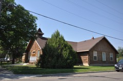 | First Baptist Church | 0.1 miles | 1991 |
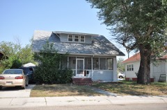 | J. J. Ping House | 0.2 miles | 1991 |
 | Commercial District | 0.2 miles | 1985 |
 | Sullivan Rooming House | 0.2 miles | 1991 |
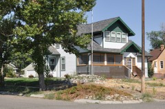 | Thomas H. Burke House | 0.2 miles | 1991 |
| National Archives record | The nomination case file for reference 85001846 in Record Group 79. |
| Big Horn County | All 38 listed properties in this county. |