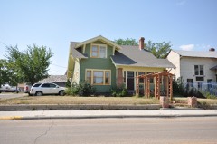
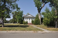
Block
From the record
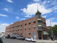
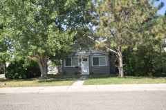
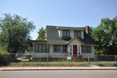
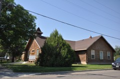
38 National Register listings published here, 2 of them National Historic Landmarks.
Sources: the National Register database, National Park Service
68 topographic sheets cover 27 settlements here, and 38 properties are on the National Register of Historic Places.
38 National Register listings published here, 2 of them National Historic Landmarks.
Sources: the National Register database, National Park Service
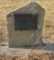
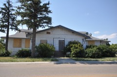
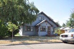
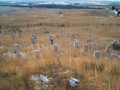
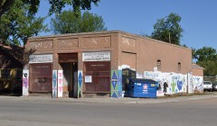
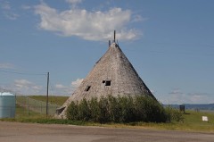
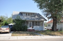
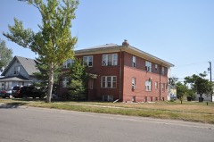
Every property in this county listed on the National Register of Historic Places, with the year it was listed and the federal nomination document.
Every wildfire the federal occurrence database records inside this county: 4,681 of them, burning about 589,145 acres. 1,013 started naturally and 373 were recorded as arson. Each settlement page carries the fires within five miles of it.
| Reported cause | Fires |
|---|---|
| Missing data/not specified/undetermined | 1080 |
| Natural | 1013 |
| Debris and open burning | 751 |
| Fireworks | 430 |
| Arson/incendiarism | 373 |
| Equipment and vehicle use | 360 |
| Misuse of fire by a minor | 217 |
| Railroad operations and maintenance | 159 |
| Smoking | 152 |
| Recreation and ceremony | 82 |
| Other causes | 32 |
| Power generation/transmission/distribution | 29 |
| Firearms and explosives use | 3 |
The five largest, by the area the report gives. One of them was set deliberately.
| Date | Cause | Size | Reported by | Name on the report |
|---|---|---|---|---|
| 12 July 2006 | Natural | 121,687 acres | Southern Land Office | PINE RIDGE COMPLEX |
| 1 August 2012 | Natural | 82,127 acres | Crow Agency | EAST SARPY |
| 8 September 1994 | Arson/incendiarism | 60,300 acres | Northern Cheyenne Agency | BABY DEAN |
| 2 September 2020 | Natural | 52,010 acres | Crow Agency | SARPY |
| 31 August 2017 | Natural | 39,387 acres | Miles City Field Office | BRUSH FLAT |
| 12 August 2003 | Natural | 25,490 acres | Northern Cheyenne Agency | LITTLEHAWK |
| 22 August 2011 | Natural | 18,970 acres | Northern Cheyenne Agency | WATER HOLE |
| 30 August 2017 | Natural | 11,285 acres | Miles City Field Office | TIDWELL |
Every settlement page carries the fires within five miles of it - see the settlement index below.
The NOAA Storm Events Database holds 442 reports for this county, causing 6 deaths, 10 injuries and about $4,662,250 in recorded property damage. Each settlement page carries the reports that name it.
| Kind of event | Reports |
|---|---|
| Hail | 247 |
| Thunderstorm Wind | 151 |
| Flash Flood | 13 |
| Flood | 11 |
| Tornado | 10 |
| Heavy Rain | 5 |
| Funnel Cloud | 3 |
| Lightning | 1 |
| Wildfire | 1 |
The most serious of them, by death, then injury, then recorded damage. The accounts are quoted exactly as the forecast office filed them.
| When | Event | Place named | Harm | What the report says |
|---|---|---|---|---|
| July 2008 | Thunderstorm Wind | Decker | 2 killed | Two fatalities, both drownings, occurred from a severe thunderstorm that moved across the Tongue River Reservoir. A man fell from a dock and a woman drowned when her small boat capsized as a result of very strong thunderstorm winds. |
| July 2022 | Thunderstorm Wind | Hardin | 1 killed, 6 hurt | Around 4:15 PM MDT, a thunderstorm outflow moved through the Hardin area. It produced a wind gust of 62 mph in the 4:35 PM MDT observations from the Big Horn County Airport. Along with the outflow winds, blowing dust reduced visibility to less than a quarter mile on the AWOS. This resulted in a 20 to 30 vehicle pile up along Interstate 90 around mile marker 493 reported at 4:30 PM MDT, very close to the airport. Prior to this, the Montana DOT RWIS station at Arrow Creek Hill, 25 miles west of Hardin, reported a peak wind gust of 48 mph about 15 minutes prior. This accident resulted in 6 deaths and multiple injuries. |
| August 2021 | Thunderstorm Wind | Crow Agency | 1 killed | A strong thunderstorm outflow passed over Crow Agency around 630pm with winds to 55 mph. A couple hours later, a shower with up to 20dbz moved over Crow Agency around 830pm, producing winds to 64 mph across a small area. A roof blew off an arbor, throwing it across the street, striking a camper in the head and throat. |
| May 2011 | Flash Flood | St Xavier | 1 killed | Water was reported to be flowing over Highway 313 near Soap Creek. Heavy rainfall impacted streams draining into the St Xavier area. In addition, a body was found in a flooded vehicle at the Koyamas Pond recreation area near the Big Horn River. |
| July 1999 | Lightning | Decker | 1 killed | A 13 year old girl was stuck and killed by lightning on the Tongue River Reservoir. |
| September 1989 | Thunderstorm Wind | not stated | 3 hurt | no account filed |
| March 2013 | Thunderstorm Wind | Crow Agency | 1 hurt | Strong winds flipped over a semi-trailer on Highway 212 at mile marker 10 near Hardin resulting in one injury. |
| May 2011 | Flood | Big Horn Wye | $4,000,000 | From May 21st and even continuing into the month of June, extensive severe flooding occurred across Big Horn County from the Little Bighorn and Bighorn Rivers, as well as creeks and streams. An Incident Command Center was set up in Crow Agency where the Crow Tribal Chairman declared a disaster. At the height of the flooding, the Big Horn County Sheriffs office is quoted as saying, there is water everywhere. Hundreds of people were evacuated as flooding affected every community on the Crow Reservation. Fifteen to twenty homes were heavily impacted by the flooding. Interstate 90 south of Hardin to the Wyoming State line was closed for five days (May 21-26). Water rescues were required on the I-90 frontage road south of Crow Agency. Highway 212 was also closed for a period of time and at one point had water 3 feet deep overtopping the roadway. Railroad tracks and numerous rural roads were washed out in the area. In addition, flooding near Hardin brought down telephone equipment that handles 911 and long-distance calls for major cities and towns in eastern Montana. ||The Bighorn River above Tullock Creek crested at a record 10.86 feet on May 23rd. The Little Bighorn River at Hardin rose above flood stage from May 22nd through May 27th and crested at a record 12.32 feet on May 23rd.||Damage estimates based on FEMA reviews and Individual Assistance approvals. |
| June 1991 | Tornado (F1) | not stated | $250,000 | no account filed |
| June 1984 | Tornado (F1) | not stated | $250,000 | no account filed |
| July 1998 | Hail | Hardin | $100,000 | Baseball sized hail damaged numerous vehicles and broke several windows and yard lights. |
| July 1991 | Tornado (F1) | not stated | $25,000 | no account filed |
| July 2000 | Thunderstorm Wind | Hardin | $10,000 | Wind damage. Large tree downed. Roof damaged. |
| April 1994 | Hail | Near Hardin | $5,000 | no account filed |
| August 1993 | Hail | Near Yellowtail | $5,000 | no account filed |
| August 1993 | Hail | Lodge Grass | $5,000 | no account filed |
| July 2000 | Thunderstorm Wind | Decker | $4,000 | Roof damage at Decker with thunderstorm winds. |
| July 2000 | Thunderstorm Wind | Hardin | $3,000 | Wind damage with 60-70 mile per hour winds. Large trees downed. |
| July 2000 | Thunderstorm Wind | Busby | $3,000 | Wind damage with 60 mph winds. Trees downed. |
| July 2000 | Thunderstorm Wind | Hardin | $2,000 | 58 mph thunderstorm wind gust. Tree limbs down. |
| June 1968 | Tornado (F0) | not stated | $250 | no account filed |
| August 2025 | Hail | Hardin Airpark | - | Reported from local spotter. |
| August 2025 | Hail | Hardin | - | From phone call. |
| June 2025 | Hail | Pryor | - | Two and a half inch hail reported. |
| June 2025 | Hail | Pryor | - | Two and 3 quarters inch hail reported. |
| June 2025 | Hail | Hardin | - | One inch hail reported. |
| June 2025 | Hail | Pryor | - | Report from mping. |
| June 2025 | Hail | Pryor | - | Two inch hail reported. |
| June 2025 | Hail | Kirby | - | One and a half inch hail reported. |
| June 2025 | Thunderstorm Wind | Hardin | - | AWOS station 2 west northwest Hardin. |
| June 2025 | Hail | Kirby | - | Hail report. |
| July 2025 | Thunderstorm Wind | Hardin | - | Blowing debris caused car damages at campground. |
| July 2025 | Thunderstorm Wind | Hardin | - | Big Horn County Airport awos. |
| July 2025 | Hail | St Xavier | - | Hail reported by mping. |
| July 2025 | Hail | Crow Agency | - | Hail 1.5 inches in diameter. |
| August 2024 | Thunderstorm Wind | Hardin | - | Large tree limbs were reported to be broken. |
| August 2024 | Thunderstorm Wind | Hardin Airpark | - | Numerous grain bins were destroyed, along with other structural damage. |
| June 2023 | Flash Flood | St Xavier | - | The Department of Transportation reported that S-313 from mile post 18 to 19 had surface water hazards in all lanes. |
| June 2022 | Thunderstorm Wind | Hardin | - | Winds of at least 84 mph produced damage in Hardin. An 84 mph wind gust was reported 8 miles west of Hardin. Several trees were blown down. In addition, semi trailers were flipped, while damage to buildings occurred, and power poles snapped. |
| August 2022 | Thunderstorm Wind | Hardin | - | Visibility was reported to be 1/2 mile from blowing dust. |
| July 2022 | Hail | Hardin | - | Quarter size hail along with 50 to 60 mph winds were reported. |
| July 2022 | Thunderstorm Wind | Hardin Airpark | - | A mobile home lost its roof. |
| July 2022 | Thunderstorm Wind | Hardin | - | Visibility was under a quarter mile due to blowing dust. |
| July 2022 | Thunderstorm Wind | Kirby | - | Several tree limbs were downed. |
| May 2021 | Hail | Ft Smith | - | Tree leaves were shredded. Car dents and broken car windows also occurred. |
| July 2019 | Hail | Lodge Grass | - | The hail covered the ground. |
| July 2019 | Thunderstorm Wind | Lodge Grass | - | Tree limbs 1 to 1 1/2 inch in diameter were broken off trees. |
| June 2019 | Thunderstorm Wind | Lodge Grass | - | A wind gust of 58 mph was reported 9 miles east of Lodge Grass. |
| May 2019 | Flood | Hardin Airpark | - | Emergency management reported that the Big Horn River flowed at bank full or just out of its banks from Two Leggins Bridge into the Hardin vicinity. Heavy rain and snow melt from the northern Big Horn Mountains from the 24th through the 28th resulted in water rises on a number of creeks, streams and rivers which feed into the Big Horn River. This was also compounded by a flash flood event on the 27th that sent around a 10,000 cfs surge of water down the Big Horn River. Some flooding of rural fields was reported. Otherwise, no major impacts were reported. |
| May 2019 | Flash Flood | Pryor | - | A nearly stationary thunderstorm was situated over portions of western Big Horn County during the late evening hours on the 26th into the early morning hours of the 27th. Several inches of rain fell across this area within just a few hours. Flash flooding occurred on Pryor, Fly and Woody Creeks which resulted in damage to roads and bridges. Culverts were also displaced. Damage to trap and skeet field buildings at a fishing and shooting club was also reported. |
| March 2019 | Flood | Crow Agency | - | Significant impacts occurred across portions of Big Horn County due to a deep snow cover melting on frozen ground, as well as an ice jam on the Little Big Horn River. Due to the ground being frozen, the water from the melting snow could not soak into the ground. This resulted in many areas flooding. Although most of the flooding occurred across open range land, some flooding did impact roads, some homes, and commerce. |Impacts occurred mainly from the ice jam on the Little Big Horn River and its tributaries which resulted in stranding some people in their homes. In addition, flooding from the Little Big Horn River inundated Interstate 90 at exit 510 at Crow Agency across both the east and west bound lanes. The interstate was closed from Hardin to the Wyoming line for several days. Highway 212 had water over it as well. These closures resulted in significant impacts to commerce. The Crow Tribe Executive Branch declared a State of Emergency. The Red Cross set up a shelter in Hardin for those affected by the Little Big Horn River flooding. |
| July 2018 | Thunderstorm Wind | Hardin Airpark | - | Eight inch diameter tree limbs were broken. |
| August 2018 | Thunderstorm Wind | Yellowtail | - | Branches and small limbs were broken. |
| June 2018 | Tornado (EF1) | Kirby | - | The tornado damaged a 20 foot diameter grain bin and tossed it 250 yards. A trailer was also damaged and blown across a driveway. There was also minor damage to a house as the gutters were ripped off and some of the metal roofing torn off. In addition, numerous large trees were uprooted or snapped in half. |
| August 2017 | Thunderstorm Wind | Hardin | - | A wind gust estimated at 70 mph resulted in a downed tree. |
| June 2015 | Flood | Hardin | - | Streets and sewers were flooded throughout town. The EMS station was evacuated due to flooding. In addition, water was reported in the Sheriffs office flooding cell blocks and the squad room. |
| June 2015 | Thunderstorm Wind | Lodge Grass | - | A semi-trailer was flipped on I-90. |
| July 2015 | Thunderstorm Wind | Garryowen | - | Strong winds and heavy rain lasted for 30 minutes. |
| March 2014 | Flood | Pryor | - | Low land flooding occurred near Wyola as some houses were flooded. |
| June 2014 | Thunderstorm Wind | Decker | - | A wind gust blew a camper off a pickup truck. |
The Survey's mineral resources record lists 128 workings inside this county. 2 still produce and 126 are closed or unrecorded. Each settlement page carries the workings within five miles of it.
| Commodity | Workings |
|---|---|
| Sand and Gravel, Construction | 55 |
| Clay | 36 |
| Bentonite | 18 |
| Pumice | 6 |
| Gypsum-Anhydrite | 5 |
| Uranium | 3 |
| Flagstone | 2 |
| Calcium | 1 |
| Limestone, Dimension | 1 |
| Silica | 1 |
The least common of them first, because a county's hundredth gravel pit says nothing its first ten did not.
| Where | Site | Commodity | Status | Recorded |
|---|---|---|---|---|
| Lime Deposit | Calcium | Past Producer | ||
| Limestone Occurrence | Limestone, Dimension | Occurrence | ||
| Silica Sand Occurrence | Silica | Occurrence | ||
| Unnamed Quarry | Flagstone | Past Producer | ||
| Unnamed Quarry | Flagstone | Past Producer | ||
| Unknown | Uranium | Occurrence | Stratabound | |
| Unknown | Uranium | Occurrence | Stratabound | |
| Unnamed Location | Uranium | Occurrence | ||
| Lodge Grass Creek Deposit | Gypsum-Anhydrite | Occurrence | ||
| Shively Dome Deposit | Gypsum-Anhydrite | Occurrence | ||
| Unnamed Location | Gypsum-Anhydrite | Occurrence | ||
| Unnamed Location | Gypsum-Anhydrite | Occurrence | ||
| Unnamed Location | Gypsum-Anhydrite | Occurrence | ||
| Beauvais Creek Pumice | Pumice | Occurrence | ||
| Crow Reservation Ash | Pumice | Occurrence | ||
| Pumice Occurrence | Pumice | Occurrence | ||
| Pumicite Occurrence | Pumice | Prospect | ||
| Pumicite Prospect | Pumice | Prospect | ||
| Yellowtail Dam Pumicite | Pumice | Occurrence | ||
| Bentonite Occurrence | Bentonite | Occurrence | ||
| Bentonite Prospect | Bentonite | Occurrence | ||
| Hardin Bentonite | Bentonite | Past Producer | ||
| Unnamed Bentonite Occurrence | Bentonite | Occurrence | ||
| Unnamed Bentonite Occurrence | Bentonite | Occurrence | ||
| Unnamed Bentonite Occurrence | Bentonite | Occurrence | ||
| Unnamed Bentonite Occurrence | Bentonite | Occurrence | ||
| Unnamed Bentonite Occurrence | Bentonite | Occurrence | ||
| Unnamed Bentonite Occurrence | Bentonite | Occurrence | ||
| Unnamed Bentonite Occurrence | Bentonite | Occurrence | ||
| Unnamed Bentonite Occurrence | Bentonite | Occurrence | ||
| Unnamed Bentonite Occurrence | Bentonite | Occurrence | ||
| Unnamed Bentonite Occurrence | Bentonite | Occurrence | ||
| Unnamed Bentonite Occurrence | Bentonite | Occurrence | ||
| Unnamed Bentonite Occurrence | Bentonite | Occurrence | ||
| Unnamed Bentonite Occurrence | Bentonite | Occurrence | ||
| Unnamed Coal Mine | Bentonite | Prospect | ||
| Wyotona Mining Co. Property | Bentonite | Prospect | ||
| Clay and Shale Occurrence | Clay | Occurrence | ||
| Clay and Shale Occurrence | Clay | Occurrence | ||
| Clay and Shale Occurrences | Clay | Occurrence | ||
| Soap Creek Bentonite | Clay | Occurrence | ||
| Unnamed Bentonite | Clay | Occurrence | ||
| Unnamed Bentonite | Clay | Occurrence | ||
| Unnamed Bentonite | Clay | Occurrence | ||
| Unnamed Bentonite | Clay | Occurrence | ||
| Unnamed Bentonite | Clay | Occurrence | ||
| Unnamed Bentonite | Clay | Occurrence | ||
| Unnamed Bentonite | Clay | Occurrence | ||
| Unnamed Bentonite | Clay | Occurrence | ||
| Unnamed Bentonite | Clay | Occurrence | ||
| Unnamed Bentonite | Clay | Occurrence | ||
| Unnamed Bentonite | Clay | Occurrence | ||
| Unnamed Bentonite | Clay | Occurrence | ||
| Unnamed Bentonite | Clay | Occurrence | ||
| Unnamed Bentonite | Clay | Occurrence | ||
| Unnamed Bentonite | Clay | Occurrence | ||
| Unnamed Bentonite | Clay | Occurrence | ||
| Unnamed Bentonite | Clay | Occurrence | ||
| Unnamed Bentonite | Clay | Occurrence | ||
| Unnamed Bentonite | Clay | Occurrence | ||
| Unnamed Bentonite | Clay | Occurrence | ||
| Unnamed Bentonite | Clay | Occurrence | ||
| Unnamed Bentonite | Clay | Occurrence | ||
| Unnamed Bentonite | Clay | Occurrence | ||
| Unnamed Bentonite | Clay | Occurrence | ||
| Unnamed Bentonite | Clay | Occurrence | ||
| Unnamed Bentonite Occurrence | Clay | Occurrence | ||
| Unnamed Bentonite Occurrence | Clay | Occurrence | ||
| Unnamed Bentonite Occurrence | Clay | Occurrence | ||
| Unnamed Clay and Shale Occurrence | Clay | Occurrence | ||
| Unnamed Location | Clay | Occurrence | ||
| Unnamed Location | Clay | Occurrence | ||
| Unnamed Location | Clay | Occurrence | ||
| Foss Pit | Sand and Gravel, Construction | Producer | ||
| Gravel Pit | Sand and Gravel, Construction | Unknown | ||
| Gravel Pit | Sand and Gravel, Construction | Unknown | ||
| Gravel Pit | Sand and Gravel, Construction | Unknown | ||
| Gravel Pit | Sand and Gravel, Construction | Unknown | ||
| Gravel Pit | Sand and Gravel, Construction | Unknown | ||
| Gravel Pit | Sand and Gravel, Construction | Unknown | ||
| Gravel Pit | Sand and Gravel, Construction | Unknown | ||
| Gravel Pit | Sand and Gravel, Construction | Unknown | ||
| Gravel Pit | Sand and Gravel, Construction | Unknown | ||
| Gravel Pit | Sand and Gravel, Construction | Unknown | ||
| Gravel Pit | Sand and Gravel, Construction | Unknown | ||
| Gravel Pit | Sand and Gravel, Construction | Unknown | ||
| Gravel Pit | Sand and Gravel, Construction | Unknown | ||
| Gravel Pit | Sand and Gravel, Construction | Unknown | ||
| Gravel Pit | Sand and Gravel, Construction | Unknown | ||
| Gravel Pit | Sand and Gravel, Construction | Unknown | ||
| Gravel Pit | Sand and Gravel, Construction | Unknown | ||
| Gravel Pit | Sand and Gravel, Construction | Unknown | ||
| Gravel Pit | Sand and Gravel, Construction | Unknown | ||
| Gravel Pit | Sand and Gravel, Construction | Unknown | ||
| Gravel Pit | Sand and Gravel, Construction | Unknown | ||
| Gravel Pit | Sand and Gravel, Construction | Unknown | ||
| Gravel Pit | Sand and Gravel, Construction | Unknown | ||
| Gravel Pit | Sand and Gravel, Construction | Unknown | ||
| Gravel Pits | Sand and Gravel, Construction | Unknown | ||
| Gravel Pits | Sand and Gravel, Construction | Unknown | ||
| Gravel Pits | Sand and Gravel, Construction | Unknown | ||
| Gravel Pits | Sand and Gravel, Construction | Unknown | ||
| Gravel Pits | Sand and Gravel, Construction | Unknown | ||
| Gravel Pits | Sand and Gravel, Construction | Unknown | ||
| Gravel Pits | Sand and Gravel, Construction | Unknown | ||
| Gravel Pits | Sand and Gravel, Construction | Unknown | ||
| Koebbe Sand and Gravel | Sand and Gravel, Construction | Past Producer | ||
| Melville Sand and Gravel | Sand and Gravel, Construction | Producer | ||
| Torski Pit and Plant | Sand and Gravel, Construction | Unknown | ||
| Unnamed Gravel Pit | Sand and Gravel, Construction | Unknown | ||
| Unnamed Gravel Pit | Sand and Gravel, Construction | Unknown | ||
| Unnamed Gravel Pit | Sand and Gravel, Construction | Unknown | ||
| Unnamed Gravel Pit | Sand and Gravel, Construction | Unknown | ||
| Unnamed Gravel Pit | Sand and Gravel, Construction | Unknown | ||
| Unnamed Gravel Pit | Sand and Gravel, Construction | Unknown | ||
| Unnamed Gravel Pit | Sand and Gravel, Construction | Unknown | ||
| Unnamed Gravel Pit | Sand and Gravel, Construction | Unknown | ||
| Unnamed Gravel Pit | Sand and Gravel, Construction | Unknown | ||
| Unnamed Gravel Pit | Sand and Gravel, Construction | Unknown | ||
| Unnamed Gravel Pit | Sand and Gravel, Construction | Unknown | ||
| Unnamed Gravel Pit | Sand and Gravel, Construction | Unknown | ||
| Unnamed Gravel Pits | Sand and Gravel, Construction | Unknown | ||
| Unnamed Gravel Pits | Sand and Gravel, Construction | Unknown | ||
| Unnamed Gravel Pits | Sand and Gravel, Construction | Unknown | ||
| Unnamed Gravel Pits | Sand and Gravel, Construction | Unknown | ||
| Unnamed Gravel Pits | Sand and Gravel, Construction | Unknown | ||
| Unnamed Gravel Pits | Sand and Gravel, Construction | Unknown | ||
| Unnamed Gravel Pits | Sand and Gravel, Construction | Unknown |
Named settlements recorded in the Geographic Names Information System, each with the topographic sheets covering it. Villages, hamlets and abandoned places alike. Each is shown with the nearest named watercourse or landform and the survey quadrangle it falls on.
Crow Reservation census division · 59089 · Pass Creek East quadrangle
12 sheets, 1894 to 1980
Crow Reservation census division · 59031 · On Long Otter Creek · Benteen quadrangle
13 sheets, 1894 to 1980
Northern Cheyenne Reservation census division · 59016 · On Busby Creek · Busby quadrangle
8 sheets, 1954 to 1980
Hardin census division · 59034 · On Chimney Creek · Ninemile Point quadrangle
11 sheets, 1894 to 1981
No longer a settlement
Hardin census division · 59064 · On Tenmile Creek · Corinth quadrangle
11 sheets, 1894 to 1981
Crow Reservation census division · 59022 · On Custer Creek · Crow Agency quadrangle
7 sheets, 1954 to 1981
Decker census division · 82801 · On Squirrel Creek · Decker quadrangle
7 sheets, 1954 to 1980
Crow Reservation census division · 59035 · Near Bighorn Canyon · Yellowtail Dam quadrangle
13 sheets, 1894 to 1980
Crow Reservation census division · 59050 · On Owl Creek · Lodge Grass quadrangle
13 sheets, 1894 to 1980
Hardin census division · 59034 · Near Cotters Coulee · Foster quadrangle
11 sheets, 1894 to 1981
Crow Reservation census division · 59031 · Near Medicine Tail Coulee · Crow Agency quadrangle
7 sheets, 1954 to 1981
Hardin census division · 59034 · Near Robs Coulee · Foster quadrangle
11 sheets, 1894 to 1981
Crow Reservation census division · 59050 · On Lodge Grass Creek · Lodge Grass quadrangle
13 sheets, 1894 to 1980
Hardin census division · 59038 · On East Fork Sarpy Creek · Minnehaha Creek South quadrangle
6 sheets, 1954 to 1981
No longer a settlement
Northern Cheyenne Reservation census division · 59043 · On Black Spring Coulee · Painted Hill quadrangle
7 sheets, 1954 to 1980
Crow Reservation census division · 59066 · On Lost Creek · Pryor quadrangle
10 sheets, 1954 to 1989
Crow Reservation census division · 59075 · In Saint Xavier Coulee · Saint Xavier quadrangle
13 sheets, 1894 to 1980
Hardin census division · 59038 · Sarpy School quadrangle
6 sheets, 1954 to 1980
No longer a settlement
Crow Reservation census division · 59050 · On Halfway Creek · Wyola quadrangle
12 sheets, 1894 to 1980
Crow Reservation census division · 59089 · On Wyola Creek · Wyola quadrangle
12 sheets, 1894 to 1980
The vanished settlements of Big Horn County: the places named above that are no longer on the map.