 Block
From the record
5 National Register listings published here.
Sources: the National Register database, National Park Service
19 topographic sheets cover 7 settlements here, and 5 properties are on the National Register of Historic Places.
5 National Register listings published here.
Sources: the National Register database, National Park Service
Every property in this county listed on the National Register of Historic Places, with the year it was listed and the federal nomination document.
| Photograph | Property | Type | Listed | Reference |
|---|---|---|---|---|
| Ashley Jewish Homesteaders Cemetery | site | 2015 | 15000807 | |
 | McIntosh County Courthouse | building | 1980 | 80002918 |
| St. Andrews Evangelical German Lutheran Church | district | 1990 | 90001027 | |
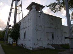 | Wishek City Hall, Old | building | 05001141 | |
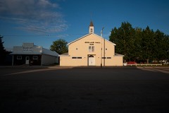 | Zeeland Hall | building | 2016 | 16000368 |
Every wildfire the federal occurrence database records inside this county: 36 of them, burning about 691 acres. 4 started naturally and 1 was recorded as arson. Each settlement page carries the fires within five miles of it.
| Reported cause | Fires |
|---|---|
| Debris and open burning | 12 |
| Missing data/not specified/undetermined | 10 |
| Equipment and vehicle use | 5 |
| Natural | 4 |
| Power generation/transmission/distribution | 3 |
| Other causes | 1 |
| Arson/incendiarism | 1 |
The five largest, by the area the report gives. None of them was recorded as arson.
| Date | Cause | Size | Reported by | Name on the report |
|---|---|---|---|---|
| 27 April 2004 | Missing data/not specified/undetermined | 400 acres | North Dakota State Forest Service | MCINTOSH |
| 2 March 2016 | Equipment and vehicle use | 80 acres | North Dakota State Forest Service | FIELD |
| 4 July 2016 | Equipment and vehicle use | 60 acres | North Dakota State Forest Service | SW WISHEK |
| 4 December 2006 | Debris and open burning | 55 acres | Kulm Wetlands Management District | WEISZ WPA WILDFIRE |
| 27 July 2015 | Missing data/not specified/undetermined | 15 acres | North Dakota State Forest Service | ESLINGER |
| 23 July 2016 | Equipment and vehicle use | 15 acres | North Dakota State Forest Service | DEAN ULMER |
| 31 October 2015 | Debris and open burning | 10 acres | North Dakota State Forest Service | EAST OF TOWN 1 MILE |
| 17 June 2017 | Missing data/not specified/undetermined | 8.0 acres | North Dakota State Forest Service | HERMAN KAUK JR. |
Every settlement page carries the fires within five miles of it - see the settlement index below.
The NOAA Storm Events Database holds 265 reports for this county, causing no deaths, no injuries and about $3,803,100 in recorded property damage. Each settlement page carries the reports that name it.
| Kind of event | Reports |
|---|---|
| Hail | 146 |
| Thunderstorm Wind | 92 |
| Tornado | 21 |
| Funnel Cloud | 2 |
| Flood | 2 |
| Flash Flood | 2 |
The most serious of them, by death, then injury, then recorded damage. The accounts are quoted exactly as the forecast office filed them.
| When | Event | Place named | Harm | What the report says |
|---|---|---|---|---|
| August 1993 | Hail | Wishek | $500,000 | no account filed |
| August 1993 | Hail | Ashley | $500,000 | no account filed |
| June 2015 | Thunderstorm Wind | Zeeland | $400,000 | Strong winds were reported from three miles north of Zeeland to 10 miles north of Zeeland. Law enforcement reported multiple downed power poles. A camper was rolled, and damage occurred at a farmstead approximately six miles north of Zeeland, with a grain auger blown over and a temporary grain enclosure ruined. A house was also shifted off of its foundation. Multiple mature trees were uprooted and others snapped. |
| September 2007 | Thunderstorm Wind | Zeeland | $300,000 | Non-tornadic thunderstorm winds estimated up to 85 mph caused significant damage along a 27 mile path in McIntosh County. Damage was sustained to crops and farm outbuildings, and large trees were uprooted. Specifically, 4 miles east of Zeeland the roof was torn from a farm outbuilding, large trees were uprooted, a camper trailer was moved, and damage was done to sunflower crops. 5 miles east of Zeeland a farm outbuilding roof was torn off. 7 miles east of Zeeland to 4 west Venturia, tree limbs were down, quonsets damaged, and a large outbuilding was nearly collapsed. Along Danzig Road tree limbs were broken, trees uprooted, large barn wall pushed 2 inches off foundation, and large outbuilding roofs torn off and walls collapsed. Finally, 3 miles south of Lehr, a cattle barn was completely destroyed, tree limbs were broken, and wooden and metal fences were blown over. |
| June 2020 | Thunderstorm Wind | Ashley | $250,000 | Six structures on a farmstead were either damaged or destroyed by severe thunderstorm winds. The structures were mainly pole barns, but one was a cinder block silo which may have been stuck by other debris. The debris was spread for one-quarter mile to the northeast. |
| June 2014 | Thunderstorm Wind | Ashley | $250,000 | Severe thunderstorm winds resulted in a swath of damage around Ashley. Five miles northeast of Ashley on a ranch, the roof of a cattle barn was torn off and several cottonwood trees were snapped. Seven miles north of Ashley, several outbuildings were damaged on a ranch, including shingles torn off of a home and a trailer tipped over by the winds. Along the entire path of the damage, many tree branches were broken along with tree trunks snapped. There was also crop damage in the area north and east of Ashley. |
| June 1991 | Tornado (F1) | not stated | $250,000 | no account filed |
| May 2010 | Flash Flood | Ashley | $225,000 | Heavy rainfall near two inches in less than one hour resulted in flash flood conditions in the city of Ashley. Many homes had water in their basements, resulting in severe carpet damage and other moisture related damages. Dollar amount is estimated based on reports from the McIntosh County Emergency Manager. |
| September 2013 | Thunderstorm Wind | Ventura | $100,000 | Several farm outbuildings were damaged or destroyed. A barn was blown off of its foundation, wind breaks were destroyed, and a grain bin and pig barn were destroyed. Many tree branches were blown down. |
| June 2001 | Hail | Ashley | $100,000 | Vehicle lot severely damaged. Widespread auto and roof damage throughout the city. |
| March 2009 | Flood | Wishek | $94,000 | Significant overland flooding damaged county and township roads. One home was flooded. Flooding continued into April. |
| July 2011 | Thunderstorm Wind | Ashley | $75,000 | Strong thunderstorm winds resulted in damage to buildings on a farmstead, and damage to hay bales. |
| July 2011 | Thunderstorm Wind | Zeeland | $65,000 | Strong thunderstorm winds occurred north of Zeeland. A quonset and pole barn were destroyed, shingle and siding damage was sustained to a home, and two trees were blown down. |
| May 1996 | Hail | Ashley | $55,000 | no account filed |
| May 2010 | Thunderstorm Wind | Ashley | $50,000 | Strong straight line winds associated with a severe thunderstorm resulted in damage to farm outbuildings. |
| July 2013 | Thunderstorm Wind | Wishek | $45,000 | The severe thunderstorm winds blew two empty grain bins into a house causing damage, and destroyed a small wooden building. |
| July 2012 | Thunderstorm Wind | Wishek | $35,000 | The strong winds blew down several trees and blew the roof off of a large building. |
| August 2006 | Hail | Ashley | $35,000 | Hail swath 1/2 mile long and 1/4 mile wide through Ashley. Wind gust to 65 mph estimated. Windows broken in town. |
| April 2009 | Flood | Wishek | $33,000 | A second round of overland flooding due to snowmelt resulted in additional damages to several county and local roads. |
| June 2021 | Thunderstorm Wind | Ashley | $30,000 | Large trees were blown down. |
| August 2006 | Hail | Wishek | $30,000 | Many windows were broken in town. |
| August 2006 | Hail | Ashley | $30,000 | Broken windows plus shingle and siding damage were reported on three farms. In one case, broken glass was imbedded in a wall 25 feet away. Hail was 5 inches deep, and was described by one farmer as a sea of white as far as the eye could see. |
| June 2014 | Thunderstorm Wind | Ashley | $25,000 | Two buildings on a farm were damaged. |
| July 2011 | Thunderstorm Wind | Wishek | $25,000 | Strong thunderstorm winds resulted in several large trees and numerous branches blown down in Wishek. |
| June 2006 | Thunderstorm Wind | Ashley | $25,000 | Damage to quonset. Door blown in and roof damaged. |
| July 2004 | Thunderstorm Wind | Wishek | $25,000 | no account filed |
| August 1987 | Tornado (F0) | not stated | $25,000 | no account filed |
| May 1980 | Tornado (F1) | not stated | $25,000 | no account filed |
| April 1973 | Tornado (F0) | not stated | $25,000 | no account filed |
| July 1966 | Tornado (F3) | not stated | $25,000 | no account filed |
| July 1962 | Tornado (F2) | not stated | $25,000 | no account filed |
| August 2025 | Flash Flood | Ashley | $20,000 | Over three inches of rain fell during a short period of time to result in water filling low lying areas and overflowing some rural roads. |
| August 1994 | Tornado (F0) | S of Wishek | $20,000 | no account filed |
| June 2014 | Thunderstorm Wind | Ashley | $10,000 | The strong thunderstorm winds resulted in roof damage to a pole barn. |
| May 2012 | Hail | Wishek | $10,000 | The hail resulted in damage to vehicles. |
| June 2008 | Thunderstorm Wind | Ashley | $10,000 | Estimated thunderstorm wind speed gusts up to 70 mile per hour resulted in trees being blown down and shingles blown off of a house five miles northeast of Ashley. |
| July 2011 | Thunderstorm Wind | Ashley | $7,000 | Strong thunderstorm winds blew shingles off of a roof. |
| June 2021 | Thunderstorm Wind | Danzig | $5,000 | One-inch diameter tree limbs were broken, and some shingles were blown off a structure. |
| August 2016 | Thunderstorm Wind | Ashley | $5,000 | Tree branches around four inches in diameter were snapped. |
| July 2008 | Thunderstorm Wind | Ashley Muni Arpt | $5,000 | Several reports of tree damage and minor structural damage due to severe thunderstorm wind gusts were reported. |
| August 1993 | Thunderstorm Wind | not stated | $5,000 | A wind and hail storm damaged crops along a path, 4 to 7 miles wide, through southern Emmons and McIntosh Counties. The crops were near harvest. Large hail broke windows while the wind uprooted trees. |
| August 1996 | Thunderstorm Wind | Wishek | $5,000 | no account filed |
| August 1996 | Thunderstorm Wind | Wishek | $5,000 | no account filed |
| June 2021 | Thunderstorm Wind | Wishek | $3,000 | A power pole was snapped. |
| June 1971 | Tornado (F0) | not stated | $2,500 | no account filed |
| May 2024 | Thunderstorm Wind | Wishek | $2,000 | Three to five inch tree limbs were blown down. |
| June 2022 | Thunderstorm Wind | Wishek | $2,000 | A large tree blew down. |
| July 2021 | Thunderstorm Wind | Danzig | $2,000 | A large cottonwood tree broke over onto a road. |
| July 2012 | Thunderstorm Wind | Zeeland | $2,000 | The strong winds blew down a few tree branches in Zeeland. |
| July 2012 | Thunderstorm Wind | Ashley | $2,000 | Tree branches were blown down by the strong thunderstorm winds. |
| June 2006 | Thunderstorm Wind | Ashley | $2,000 | Also had 1.00 inch diameter hail. Large tree blown over. Windows broken. |
| July 2008 | Thunderstorm Wind | Danzig | $1,000 | Thunderstorm wind gusts broke three inch in diameter tree branches. |
| May 2006 | Hail | Ashley | $500 | Windshield of sheriff patrol car broken. |
| May 2012 | Thunderstorm Wind | Ashley | $100 | The strong thunderstorm winds blew over a basketball pole cemented in the ground. |
| May 2024 | Thunderstorm Wind | Zeeland | - | A trained spotter estimated the thunderstorm wind gusts. |
| July 2023 | Tornado (EFU) | Ashley | - | The tornado touched down in an open field southwest of Kulm and impacted no structures. There was no damage to evaluate. By National Weather Service policy the tornado is rated EF Unknown. |
| July 2022 | Thunderstorm Wind | Zeeland | - | Thunderstorm wind gusts were estimated by the public. |
| July 2022 | Hail | Ashley | - | Extensive crop damage occurred. |
| July 2021 | Thunderstorm Wind | Ashley | - | A COOP Observer estimated thunderstorm wind gusts to 60 mph. |
| June 2020 | Tornado (EFU) | Ashley | - | The tornado touched down in a field just west-northwest of Ashley. There was no damage to evaluate and so by National Weather Service policy the tornado is rated EF Unknown. |
Named settlements recorded in the Geographic Names Information System, each with the topographic sheets covering it. Villages, hamlets and abandoned places alike. Each is shown with the nearest named watercourse or landform and the survey quadrangle it falls on.