 Block
Ashley, North Dakota
7 topographic sheets cover this place, the earliest surveyed in 1953 and the latest in 1986. It stands in Ashley City. It lies in ZIP code area 58413. The Survey maps it on the Ashley East quadrangle. 613 people lived here at the 2020 count. It stands 2,014 feet above sea level.
Research this city
On record in Ashley
Buildings and businesses the archive holds for this place. Each opens its own page, with the source record it came from.
On the National Register 2 records
 McIntosh County Courthouselisted 1980
- Ashley Jewish Homesteaders Cemeterylisted 2015
Population over time
2 figuresAshley fell from 749 to 613 between 2010 and 2020. These are the recorded population figures Wikidata holds for this place, reached through the Geographic Names Information System number this page is keyed on rather than by name, so they belong to this place and not to another of the same name. Most are census counts, but not all are: an early figure may be a founding or settlement estimate, and an estimate published within five years of a census is left out. The change column is computed, and is left blank where more than 20 years separate a figure from the one before it, because a gap that long is not a change between two counts.
| Year | People | Change |
|---|---|---|
| 2010 | 749 | |
| 2020 | 613 | -136 (-18%) |
Topographic sheets covering this place
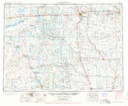
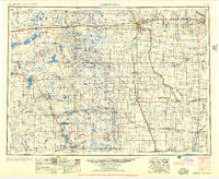
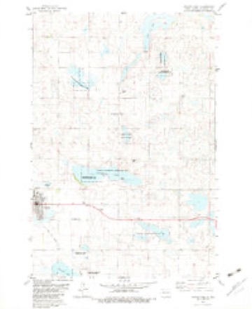
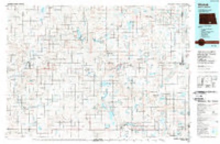
4 surveys from 7 printed sheetsMatched by testing this settlement's coordinate against the published boundary of every sheet in the United States Geological Survey's historical collection. Each opens the scanned sheet at the Survey.
- 1953 USGS Jamestown quadrangle1:250000, 3 printings
- 1956 USGS Jamestown quadrangle1:250000
- 1982 USGS Ashley East quadrangle1:24000
- 1986 USGS Wishek quadrangle1:100000, 2 printings
Fires near this place
1 since 2006Regional context, not property-specific evidence. The federal wildfire occurrence database lists 1 fire within 5 miles of Ashley in 2006, burning about 55 acres in total. None started naturally. None was recorded as arson. Distance is straight-line from the map coordinates, so a fire counted here may appear on a neighbouring settlement's page as well.
| Reported cause | Fires |
|---|---|
| Debris and open burning | 1 |
The most recent of them, most recent first, with the day each was reported and the service that recorded it.
| Date | Cause | Size | Reported by | Name on the report |
|---|---|---|---|---|
| 4 December 2006 | Debris and open burning | 55 acres | Kulm Wetlands Management District | WEISZ WPA WILDFIRE |
Settlements close enough to share some of these fires:
Storms near this place
60 of 104 shownRegional context, not property-specific evidence. The National Weather Service names Ashley in 104 storm reports between 1993 and 2025: 62 hail, 30 thunderstorm wind, 9 tornado, 2 flash flood. No death or injury is recorded in these reports. Each account below is quoted exactly as the forecast office filed it, from the NOAA Storm Events Database, and each date opens the federal record of that event.
| When | Event | Place named | Harm | What the report says |
|---|---|---|---|---|
| August 1993 | Hail | Ashley | $500,000 | no account filed |
| June 2020 | Thunderstorm Wind | Ashley | $250,000 | Six structures on a farmstead were either damaged or destroyed by severe thunderstorm winds. The structures were mainly pole barns, but one was a cinder block silo which may have been stuck by other debris. The debris was spread for one-quarter mile to the northeast. |
| June 2014 | Thunderstorm Wind | Ashley | $250,000 | Severe thunderstorm winds resulted in a swath of damage around Ashley. Five miles northeast of Ashley on a ranch, the roof of a cattle barn was torn off and several cottonwood trees were snapped. Seven miles north of Ashley, several outbuildings were damaged on a ranch, including shingles torn off of a home and a trailer tipped over by the winds. Along the entire path of the damage, many tree branches were broken along with tree trunks snapped. There was also crop damage in the area north and east of Ashley. |
| May 2010 | Flash Flood | Ashley | $225,000 | Heavy rainfall near two inches in less than one hour resulted in flash flood conditions in the city of Ashley. Many homes had water in their basements, resulting in severe carpet damage and other moisture related damages. Dollar amount is estimated based on reports from the McIntosh County Emergency Manager. |
| June 2001 | Hail | Ashley | $100,000 | Vehicle lot severely damaged. Widespread auto and roof damage throughout the city. |
| July 2011 | Thunderstorm Wind | Ashley | $75,000 | Strong thunderstorm winds resulted in damage to buildings on a farmstead, and damage to hay bales. |
| May 1996 | Hail | Ashley | $55,000 | no account filed |
| May 2010 | Thunderstorm Wind | Ashley | $50,000 | Strong straight line winds associated with a severe thunderstorm resulted in damage to farm outbuildings. |
| August 2006 | Hail | Ashley | $35,000 | Hail swath 1/2 mile long and 1/4 mile wide through Ashley. Wind gust to 65 mph estimated. Windows broken in town. |
| June 2021 | Thunderstorm Wind | Ashley | $30,000 | Large trees were blown down. |
| August 2006 | Hail | Ashley | $30,000 | Broken windows plus shingle and siding damage were reported on three farms. In one case, broken glass was imbedded in a wall 25 feet away. Hail was 5 inches deep, and was described by one farmer as a sea of white as far as the eye could see. |
| June 2014 | Thunderstorm Wind | Ashley | $25,000 | Two buildings on a farm were damaged. |
| June 2006 | Thunderstorm Wind | Ashley | $25,000 | Damage to quonset. Door blown in and roof damaged. |
| August 2025 | Flash Flood | Ashley | $20,000 | Over three inches of rain fell during a short period of time to result in water filling low lying areas and overflowing some rural roads. |
| June 2014 | Thunderstorm Wind | Ashley | $10,000 | The strong thunderstorm winds resulted in roof damage to a pole barn. |
| June 2008 | Thunderstorm Wind | Ashley | $10,000 | Estimated thunderstorm wind speed gusts up to 70 mile per hour resulted in trees being blown down and shingles blown off of a house five miles northeast of Ashley. |
| July 2011 | Thunderstorm Wind | Ashley | $7,000 | Strong thunderstorm winds blew shingles off of a roof. |
| August 2016 | Thunderstorm Wind | Ashley | $5,000 | Tree branches around four inches in diameter were snapped. |
| July 2012 | Thunderstorm Wind | Ashley | $2,000 | Tree branches were blown down by the strong thunderstorm winds. |
| June 2006 | Thunderstorm Wind | Ashley | $2,000 | Also had 1.00 inch diameter hail. Large tree blown over. Windows broken. |
| May 2006 | Hail | Ashley | $500 | Windshield of sheriff patrol car broken. |
| May 2012 | Thunderstorm Wind | Ashley | $100 | The strong thunderstorm winds blew over a basketball pole cemented in the ground. |
| July 2023 | Tornado (EFU) | Ashley | - | The tornado touched down in an open field southwest of Kulm and impacted no structures. There was no damage to evaluate. By National Weather Service policy the tornado is rated EF Unknown. |
| July 2022 | Hail | Ashley | - | Extensive crop damage occurred. |
| July 2021 | Thunderstorm Wind | Ashley | - | A COOP Observer estimated thunderstorm wind gusts to 60 mph. |
| June 2020 | Tornado (EFU) | Ashley | - | The tornado touched down in a field just west-northwest of Ashley. There was no damage to evaluate and so by National Weather Service policy the tornado is rated EF Unknown. |
| June 2020 | Hail | Ashley | - | The hail combined with wind gusts to 50 mph to damage crops. |
| August 2017 | Hail | Ashley | - | Soybean crops suffered damage. |
| June 2015 | Thunderstorm Wind | Ashley | - | A member of the public in Ashley reported strong thunderstorm wind gusts. |
| June 2014 | Tornado (EF0) | Ashley | - | This tornado touched down briefly in open country just off of North Dakota Highway 3 south of Ashley. There was no damage so this tornado was rated EF0. |
| July 2012 | Thunderstorm Wind | Ashley | - | Heavy rain accompanied the strong winds. |
| March 2012 | Hail | Ashley | - | No damage reported. |
| July 2011 | Tornado (EF0) | Ashley | - | A tornado touched down in a field near Ashley. No damage was reported with this tornado. |
| July 2008 | Thunderstorm Wind | Ashley | - | Report at Venturia. |
| July 2008 | Hail | Ashley | - | Hail up to golf ball size fell in Ashley for around fifteen minutes. |
| June 2007 | Hail | Ashley | - | Hail fell from 430 AM CDT to 455 AM CDT and covered the ground. The largest stone was penny size. |
| May 2006 | Hail | Ashley | - | Rainfall of 1.3 inches. |
| August 2006 | Tornado (F0) | Ashley | - | Report by McIntosh County Sheriff deputy just north of the North Dakota and South Dakota border. Tornado briefly touched down. No structures impacted and no damage. |
| August 2006 | Hail | Ashley | - | Hail was accompanied by 60+ mph winds and heavy rain. No damage was reported. |
| July 2005 | Thunderstorm Wind | Ashley | - | A sturdy wooden machine shed destroyed. A 4500 pound Bobcat skid-steer loader flipped over. A mixer mill, fishing boat and motor tossed in a pile of rubble. Marble size hail accompanied the wind. |
| May 2004 | Tornado (F0) | Ashley | - | A tornado briefly touched down in rural country and then completely lifted. |
| May 2004 | Tornado (F1) | Ashley | - | This tornado remained in rural country. It was produced by the same thunderstorm that produced the tornado minutes earlier in the same county (McIntosh). |
| July 2002 | Tornado (F0) | Ashley | - | Tornado briefly touched down in open country. Rainfall from the storm measured at 2.50 inches. Crops on 3 seperate farms reported wiped out. |
| August 2002 | Thunderstorm Wind | Ashley | - | Trees blown over by the wind. |
| August 2001 | Thunderstorm Wind | Ashley | - | Cooperative observer reported doors ripped off barn, heavy equipment rolled over. Numerous branches down. |
| July 2001 | Hail | Ashley | - | Reported by an cooperative observer. |
| July 2001 | Thunderstorm Wind | Ashley | - | Reported by an cooperative observer. |
| June 1998 | Tornado (F0) | Ashley | - | Nearly stationary, numerous reports from all directions. |
| June 1998 | Hail | Ashley | - | Locations is also 12 west of Forbes (Dickey county), person reported ground white with hail. |
| June 2025 | Thunderstorm Wind | Ashley | - | no account filed |
| July 2024 | Thunderstorm Wind | Ashley | - | no account filed |
| June 2023 | Hail | Ashley | - | no account filed |
| July 2023 | Hail | Ashley | - | no account filed |
| July 2023 | Hail | Ashley | - | no account filed |
| July 2023 | Hail | Ashley | - | no account filed |
| June 2021 | Hail | Ashley | - | no account filed |
| July 2020 | Hail | Ashley | - | no account filed |
| June 2020 | Hail | Ashley | - | no account filed |
| May 2018 | Hail | Ashley | - | no account filed |
| July 2016 | Hail | Ashley | - | no account filed |
Nearest settlements
The eight closest, with where each one stands in the county. Distances are straight-line, computed from the Geographic Names Information System coordinates.
Elsewhere
Matched on this settlement's Geographic Names Information System number rather than its name, so it cannot be a different place of the same name in another state.
| Wikipedia article on Ashley | An encyclopaedic summary. Its text is share-alike, so it is linked here rather than copied. |
| Wikidata item Q725727 | The structured record the population and elevation above come from. Public domain (CC0). |
Provenance
This settlement is recorded in the Geographic Names Information System as feature 1027755. The sheet list is computed by point-in-boundary test against the United States Geological Survey's historical topographic inventory. Both are works of the United States government and carry no copyright under 17 U.S.C. 105.
Wildfire. Short, Karen C. 2022. Spatial wildfire occurrence data for the United States, 1992-2020 [FPA_FOD_20221014]. 6th Edition. Fort Collins, CO: Forest Service Research Data Archive. https://doi.org/10.2737/RDS-2013-0009.6 Collected with United States Government funding and usable without additional permissions or fees.
Storms. NOAA National Centers for Environmental Information, Storm Events Database https://www.ncei.noaa.gov/stormevents/ A work of the United States government, no copyright under 17 U.S.C. 105. Narratives are quoted verbatim from the National Weather Service report and are not edited or summarised.