 Block
From the record
15 National Register listings published here.
Sources: the National Register database, National Park Service
50 topographic sheets cover 25 settlements here, and 15 properties are on the National Register of Historic Places.
15 National Register listings published here.
Sources: the National Register database, National Park Service
Every property in this county listed on the National Register of Historic Places, with the year it was listed and the federal nomination document.
| Photograph | Property | Type | Listed | Reference |
|---|---|---|---|---|
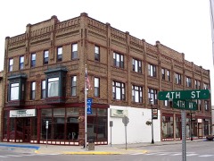 | Bangs-Wineman Block | building | 1985 | 85002797 |
 | Central High School | building | 2003 | 03000871 |
 | Devils Lake Carnegie Library | building | 2002 | 02000132 |
| Devils Lake Commercial District | district | 1989 | 89001675 | |
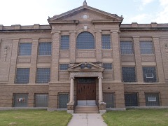 | Devils Lake Masonic Temple | building | 2001 | 01000923 |
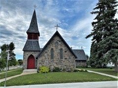 | Episcopal Church of the Advent-Guild Hall | building | 2002 | 02000669 |
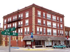 | Locke Block | building | 1986 | 86001915 |
| Methodist Episcopal Church | building | 2008 | 08000680 | |
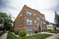 | Newport Apartments | building | 1988 | 88000985 |
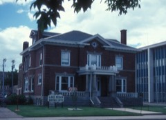 | Ramsey County Sheriff's House | building | 1978 | 78003452 |
 | Sons of Jacob Cemetery | site | 2017 | 100001035 |
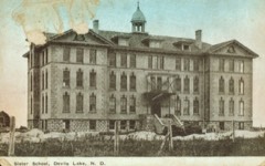 | St. Mary's Academy | building | 1983 | 83001939 |
| St. Olaf Lutheran Church | building | 2015 | 15000106 | |
 | US Post Office and Courthouse | building | 1978 | 78001993 |
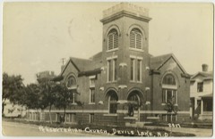 | Westminster Presbyterian Church | building | 2008 | 08000679 |
Every wildfire the federal occurrence database records inside this county: 256 of them, burning about 11,449 acres. 1 started naturally and 129 were recorded as arson. Each settlement page carries the fires within five miles of it.
| Reported cause | Fires |
|---|---|
| Arson/incendiarism | 129 |
| Debris and open burning | 102 |
| Missing data/not specified/undetermined | 16 |
| Fireworks | 2 |
| Recreation and ceremony | 2 |
| Misuse of fire by a minor | 1 |
| Railroad operations and maintenance | 1 |
| Smoking | 1 |
| Natural | 1 |
| Power generation/transmission/distribution | 1 |
The five largest, by the area the report gives. Three of them were set deliberately.
| Date | Cause | Size | Reported by | Name on the report |
|---|---|---|---|---|
| 4 May 2018 | Missing data/not specified/undetermined | 1,772 acres | Devil's Lake Wetland Management District | SORA |
| 12 May 2018 | Debris and open burning | 1,600 acres | North Dakota State Forest Service | PENN FIRE |
| 12 May 2018 | Arson/incendiarism | 1,081 acres | Devil's Lake Wetland Management District | MARTINSON |
| 16 April 1998 | Arson/incendiarism | 660 acres | Devil's Lake Wetland Management District | MARTINS1 |
| 20 May 2019 | Debris and open burning | 573 acres | Devil's Lake Wetland Management District | TARVESTAD |
| 18 October 2017 | Debris and open burning | 513 acres | Devil's Lake Wetland Management District | PHIL AUS |
| 6 May 1998 | Arson/incendiarism | 480 acres | Devil's Lake Wetland Management District | PHILAUS |
| 14 May 2013 | Missing data/not specified/undetermined | 384 acres | Devil's Lake Wetland Management District | MARTINSON |
Every settlement page carries the fires within five miles of it - see the settlement index below.
The NOAA Storm Events Database holds 492 reports for this county, causing no deaths, 17 injuries and about $23,972,510 in recorded property damage. Each settlement page carries the reports that name it.
| Kind of event | Reports |
|---|---|
| Hail | 219 |
| Thunderstorm Wind | 176 |
| Tornado | 50 |
| Flood | 25 |
| Flash Flood | 17 |
| Funnel Cloud | 4 |
| Lightning | 1 |
The most serious of them, by death, then injury, then recorded damage. The accounts are quoted exactly as the forecast office filed them.
| When | Event | Place named | Harm | What the report says |
|---|---|---|---|---|
| June 1986 | Thunderstorm Wind | not stated | 12 hurt | no account filed |
| August 2000 | Thunderstorm Wind | Devils Lake | 2 hurt, $10,000,000 | Strong winds hit the city of Devils Lake, toppling power poles, trees, signs, and light signals. Debris from a roof struck and injured a pedestrian. The 96 knot wind gust was measured at the Law Enforcement Center. A 40x60 foot steel building was thrown 150 feet onto a passing vehicle. The motorist inside was not discovered until 12 hours later. It took an additional hour to free the 48 year-old man from the vehicle. A mobile home was also overturned. 250 homes in the city were damaged, leading the governor to declare a state of emergency. |
| May 1991 | Thunderstorm Wind | not stated | 2 hurt | no account filed |
| August 1966 | Tornado (F2) | not stated | 1 hurt, $250,000 | no account filed |
| August 2000 | Thunderstorm Wind | Devils Lake | $7,000,000 | 68 consecutive power poles were damaged by the high winds across the Devils Lake area. This amounted to about 8 miles of line. Some of the damaged poles ended up on the bottom of Devils Lake, as the lines cut across several bays. |
| June 2009 | Flood | St Joe | $2,000,000 | no account filed |
| July 2009 | Flood | St Joe | $2,000,000 | no account filed |
| September 2019 | Flash Flood | Churchs Ferry | $250,000 | Fields and farm access roads were flooded across eastern Coulee and western Dry Lake townships. |
| July 2011 | Flood | St Joe | $250,000 | no account filed |
| August 2011 | Flood | St Joe | $250,000 | no account filed |
| July 1971 | Tornado (F1) | not stated | $250,000 | no account filed |
| August 1966 | Tornado | not stated | $250,000 | no account filed |
| August 1966 | Tornado (F1) | not stated | $250,000 | no account filed |
| July 2018 | Tornado (EF1) | Lawton | $200,000 | An old barn was peeled open and sections of its walls and roof were flung to the north. Timbers from the barn penetrated into a home located 80 yards to the north. A Davis wind sensor located just west of the main tornado path registered a 68 mph south wind followed by a rapid shift to a 66 mph west wind. One older power pole located a half mile north-northeast of the farmstead was also cracked. Peak winds were estimated at 105 mph. |
| June 2011 | Flood | St Joe | $200,000 | no account filed |
| July 2003 | Thunderstorm Wind | Edmore | $150,000 | Trees were uprooted in Edmore, several blocking Main Street. A grain dryer mounted on the elevator was ripped off. There were also reports of shingle and vehicle damage. |
| August 2002 | Thunderstorm Wind | Churchs Ferry | $100,000 | Strong winds destroyed a 45,000 bushel grain bin and deposited it on the adjacent railroad tracks. An AMTRAK train was delayed for two hours while the debris was cleaned up. |
| August 2000 | Thunderstorm Wind | Devils Lake | $100,000 | A large storage building was destroyed by the strong winds. A 16 ton semi truck was pushed 30 feet sideways into a pole. |
| July 2000 | Tornado (F0) | Penn | $50,000 | A tornado destroyed the attached garage of a house, damaged a semi truck, and destroyed a grain dryer. |
| June 1998 | Flood | Starkweather | $50,000 | Heavy rain caused basement flooding in Starkweather. |
| July 1994 | Thunderstorm Wind | not stated | $50,000 | Strong winds damaged buildings and blew over power lines and trees. |
| August 1994 | Thunderstorm Wind | Near Stark- | $40,000 | no account filed |
| June 2010 | Flash Flood | Essex | $25,000 | Basement flooding was reported and water was ponded all around the farm yard. |
| June 2010 | Flash Flood | Penn | $25,000 | Water covered Highway 2 near Penn. |
| July 1986 | Tornado (F0) | not stated | $25,000 | no account filed |
| May 1978 | Tornado (F0) | not stated | $25,000 | no account filed |
| August 1966 | Tornado (F1) | not stated | $25,000 | no account filed |
| July 2008 | Thunderstorm Wind | Crary | $20,000 | Several large 12 to 14 inch diameter trees were blown down along East Bay and Black Tiger Bay of Devils Lake. |
| August 1994 | Thunderstorm Wind | Devils Lake | $20,000 | Two airplanes were blown into each other and a 60-foot communications tower was destroyed. |
| August 2000 | Thunderstorm Wind | Devils Lake | $15,000 | Numerous power poles and billboards were damaged by the wind. |
| June 2008 | Thunderstorm Wind | Devils Lake Arpt | $10,000 | The wind gust was measured at the Devils Lake Airport. |
| July 1999 | Thunderstorm Wind | Penn | $10,000 | Large trees were blown down and several roofs had damage. |
| July 1997 | Thunderstorm Wind | Edmore | $10,000 | Many large trees in Edmore were blown down, snapping power lines and damaging one vehicle. |
| May 1996 | Thunderstorm Wind | Lawton | $10,000 | no account filed |
| July 2001 | Thunderstorm Wind | Devils Lake | $5,000 | A tree branch was blown down onto a car, breaking its windshield. Another tree fell on a garage and another tree fell on a house, knocking out its power. |
| August 2000 | Thunderstorm Wind | Penn | $5,000 | Trees were uprooted and a barn was damaged. |
| March 2009 | Flood | Churchs Ferry | $5,000 | no account filed |
| April 2009 | Flood | St Joe | $5,000 | no account filed |
| May 2009 | Flood | St Joe | $5,000 | no account filed |
| July 2008 | Hail | Hampden | $5,000 | no account filed |
| August 2008 | Hail | Hampden | $5,000 | no account filed |
| September 1996 | Thunderstorm Wind | Edmore | $5,000 | no account filed |
| September 1993 | Thunderstorm Wind | Devils Lake | $5,000 | no account filed |
| June 1999 | Thunderstorm Wind | Devils Lake | $3,000 | A tree was blown down on a car. |
| September 1997 | Thunderstorm Wind | Devils Lake | $3,000 | Several large tree limbs were blown down and some crop damage was reported. |
| June 1971 | Tornado (F2) | not stated | $2,500 | no account filed |
| July 1997 | Thunderstorm Wind | Edmore | $2,000 | 20 large trees were blown over in the strong wind. |
| July 2008 | Thunderstorm Wind | Starkweather | $1,000 | A mailbox was blown down. |
| August 2000 | Thunderstorm Wind | Lawton | $1,000 | Large tree branches were snapped. |
| July 1999 | Thunderstorm Wind | Brocket | $1,000 | Several large trees were blown over. |
| September 1996 | Thunderstorm Wind | Starkweather | $1,000 | no account filed |
| August 2016 | Flash Flood | Devils Lake | $500 | Ditches and streets across the southern portion of town were flooded. One underpass was also flooded. |
| July 2001 | Thunderstorm Wind | Crary | $500 | Tree branches were blown down. |
| August 2000 | Thunderstorm Wind | Brocket | $500 | Several tree branches were snapped by the strong wind. |
| August 2000 | Thunderstorm Wind | Doyon | $500 | Tree branches were blown down over the extreme southeast corner of Ramsey county. |
| July 1999 | Thunderstorm Wind | Devils Lake | $500 | Several large trees were uprooted. |
| July 1981 | Tornado (F1) | not stated | $250 | no account filed |
| August 2002 | Thunderstorm Wind | Starkweather | $200 | Tree branches were blown down. |
| July 1983 | Tornado (F0) | not stated | $30 | no account filed |
| July 1982 | Tornado (F0) | not stated | $30 | no account filed |
The Survey's mineral resources record lists 1 working inside this county. It still produces. Each settlement page carries the workings within five miles of it.
| Commodity | Workings |
|---|---|
| Sand and Gravel, Construction | 1 |
The least common of them first, because a county's hundredth gravel pit says nothing its first ten did not.
| Where | Site | Commodity | Status | Recorded |
|---|---|---|---|---|
| Strong Excavating Pit | Sand and Gravel, Construction | Producer |
Named settlements recorded in the Geographic Names Information System, each with the topographic sheets covering it. Villages, hamlets and abandoned places alike. Each is shown with the nearest named watercourse or landform and the survey quadrangle it falls on.