 Block
Devils Lake, North Dakota
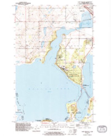
14 topographic sheets cover this place, the earliest surveyed in 1931 and the latest in 1994. It stands in Devils Lake City. It lies in ZIP code area 58301. The Survey maps it on the Camp Grafton quadrangle. 7,192 people lived here at the 2020 count. It stands 1,447 feet above sea level.
Research this city
On record in Devils Lake
Buildings and businesses the archive holds for this place. Each opens its own page, with the source record it came from.
On the National Register 12 of 14 shown
 Bangs-Wineman Blocklisted 1985
 Central High Schoollisted 2003
 Devils Lake Carnegie Librarylisted 2002
 Devils Lake Masonic Templelisted 2001
 Episcopal Church of the Advent-Guild Halllisted 2002
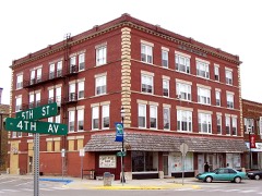 Locke Blocklisted 1986
 Newport Apartmentslisted 1988
 Ramsey County Sheriff's Houselisted 1978
 St. Mary's Academylisted 1983
 US Post Office and Courthouselisted 1978
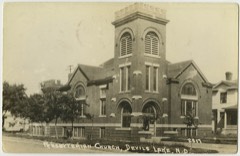 Westminster Presbyterian Churchlisted 2008
- Devils Lake Commercial Districtlisted 1989
Population over time
2 figuresDevils Lake grew from 7,141 to 7,192 between 2010 and 2020. These are the recorded population figures Wikidata holds for this place, reached through the Geographic Names Information System number this page is keyed on rather than by name, so they belong to this place and not to another of the same name. Most are census counts, but not all are: an early figure may be a founding or settlement estimate, and an estimate published within five years of a census is left out. The change column is computed, and is left blank where more than 20 years separate a figure from the one before it, because a gap that long is not a change between two counts.
| Year | People | Change |
|---|---|---|
| 2010 | 7,141 | |
| 2020 | 7,192 | +51 (+1%) |
Topographic sheets covering this place
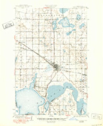
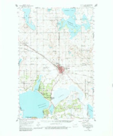
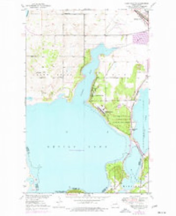
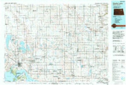
8 surveys from 14 printed sheetsMatched by testing this settlement's coordinate against the published boundary of every sheet in the United States Geological Survey's historical collection. Each opens the scanned sheet at the Survey.
- 1931 USGS Devils Lake quadrangle1:62500, 3 printings
- 1950 USGS Devils Lake quadrangle1:62500, 2 printings
- 1951 USGS Camp Grafton quadrangle1:24000, 2 printings
- 1953 USGS Devils Lake quadrangle1:250000, 3 printings
- 1956 USGS Devils Lake quadrangle1:250000
- 1985 USGS Devils Lake quadrangle1:100000
- 1993 USGS Devils Lake quadrangle1:100000
- 1994 USGS Camp Grafton quadrangle1:24000
Fires near this place
63 since 1993Regional context, not property-specific evidence. The federal wildfire occurrence database lists 63 fires within 5 miles of Devils Lake between 1993 and 2020, burning about 523 acres in total. None started naturally. 19 were recorded as arson. Distance is straight-line from the map coordinates, so a fire counted here may appear on a neighbouring settlement's page as well.
| Reported cause | Fires |
|---|---|
| Debris and open burning | 38 |
| Arson/incendiarism | 19 |
| Fireworks | 2 |
| Missing data/not specified/undetermined | 2 |
| Recreation and ceremony | 1 |
| Smoking | 1 |
The most recent of them, most recent first, with the day each was reported and the service that recorded it.
| Date | Cause | Size | Reported by | Name on the report |
|---|---|---|---|---|
| 7 September 2017 | Debris and open burning | 25 acres | North Dakota State Forest Service | WANG |
| 19 September 2012 | Arson/incendiarism | under an acre | Fort Totten Agency | CASINO |
| 16 September 2012 | Arson/incendiarism | 1.0 acres | Fort Totten Agency | TOWER |
| 8 August 2017 | Debris and open burning | 4.0 acres | North Dakota State Forest Service | ACKERMAN |
| 8 August 2017 | Debris and open burning | 2.0 acres | North Dakota State Forest Service | THISTLE |
| 5 August 2018 | Debris and open burning | 1.0 acres | North Dakota State Forest Service | FALSE |
| 4 August 2015 | Arson/incendiarism | under an acre | Fort Totten Agency | BARRELS |
| 31 August 2017 | Debris and open burning | 2.0 acres | North Dakota State Forest Service | ACKERMAN |
Settlements close enough to share some of these fires:
Mines and quarries near this place
2 within 5 milesRegional context, not property-specific evidence. The federal mineral resources record lists 2 workings within 5 miles of Devils Lake: 2 producers. All of them still produce. What was taken out: Sand and Gravel, Construction. Distance is straight-line from the map coordinates, so a quarry counted here may appear on a neighbouring settlement's page as well.
| Where | Site | Commodity | Status | Recorded |
|---|---|---|---|---|
| Soper Brothers Const Pit | Sand and Gravel, Construction | Producer | ||
| Strong Excavating Pit | Sand and Gravel, Construction | Producer |
Storms near this place
60 of 91 shownRegional context, not property-specific evidence. The National Weather Service names Devils Lake in 91 storm reports between 1993 and 2025: 49 hail, 31 thunderstorm wind, 7 flash flood, 3 tornado. The reports record 2 injuries. Each account below is quoted exactly as the forecast office filed it, from the NOAA Storm Events Database, and each date opens the federal record of that event.
| When | Event | Place named | Harm | What the report says |
|---|---|---|---|---|
| August 2000 | Thunderstorm Wind | Devils Lake | 2 hurt, $10,000,000 | Strong winds hit the city of Devils Lake, toppling power poles, trees, signs, and light signals. Debris from a roof struck and injured a pedestrian. The 96 knot wind gust was measured at the Law Enforcement Center. A 40x60 foot steel building was thrown 150 feet onto a passing vehicle. The motorist inside was not discovered until 12 hours later. It took an additional hour to free the 48 year-old man from the vehicle. A mobile home was also overturned. 250 homes in the city were damaged, leading the governor to declare a state of emergency. |
| August 2000 | Thunderstorm Wind | Devils Lake | $7,000,000 | 68 consecutive power poles were damaged by the high winds across the Devils Lake area. This amounted to about 8 miles of line. Some of the damaged poles ended up on the bottom of Devils Lake, as the lines cut across several bays. |
| August 2000 | Thunderstorm Wind | Devils Lake | $100,000 | A large storage building was destroyed by the strong winds. A 16 ton semi truck was pushed 30 feet sideways into a pole. |
| August 1994 | Thunderstorm Wind | Devils Lake | $20,000 | Two airplanes were blown into each other and a 60-foot communications tower was destroyed. |
| August 2000 | Thunderstorm Wind | Devils Lake | $15,000 | Numerous power poles and billboards were damaged by the wind. |
| July 2001 | Thunderstorm Wind | Devils Lake | $5,000 | A tree branch was blown down onto a car, breaking its windshield. Another tree fell on a garage and another tree fell on a house, knocking out its power. |
| September 1993 | Thunderstorm Wind | Devils Lake | $5,000 | no account filed |
| June 1999 | Thunderstorm Wind | Devils Lake | $3,000 | A tree was blown down on a car. |
| September 1997 | Thunderstorm Wind | Devils Lake | $3,000 | Several large tree limbs were blown down and some crop damage was reported. |
| August 2016 | Flash Flood | Devils Lake | $500 | Ditches and streets across the southern portion of town were flooded. One underpass was also flooded. |
| July 1999 | Thunderstorm Wind | Devils Lake | $500 | Several large trees were uprooted. |
| September 2025 | Thunderstorm Wind | Devils Lake | - | Tree reported on house, time estimated from radar. |
| October 2023 | Hail | Devils Lake | - | Trained spotter reports quarter sized hail in downtown Devils Lake, ND. |
| July 2022 | Thunderstorm Wind | Devils Lake | - | A large tree was blown down in the Frison Addition. Timing is derived from radar and nearby wind sensors. |
| July 2021 | Hail | Devils Lake | - | Report and photo posted via social media. |
| July 2021 | Hail | Devils Lake | - | Report of 1 inch hail submitted via social media. |
| July 2020 | Thunderstorm Wind | Devils Lake | - | The wind gust was measured at the Devils Lake airport. |
| June 2019 | Hail | Devils Lake | - | Dime to quarter size hail fell. |
| June 2017 | Thunderstorm Wind | Devils Lake | - | The wind gust was measured by a ND DOT RWIS station. |
| June 2017 | Thunderstorm Wind | Devils Lake | - | The peak wind was measured by a ND DOT RWIS station near Devils Lake. |
| July 2016 | Hail | Devils Lake | - | Nickel to quarter sized hail fell. |
| July 2015 | Thunderstorm Wind | Devils Lake | - | Large tree limbs and branches were blown down by the strong wind gusts. |
| June 2014 | Tornado (EF0) | Devils Lake | - | The tornado tracked north to south in open country approximately parallel to 85th avenue northeast. No damage was reported to any structures. |
| September 2008 | Flash Flood | Devils Lake | - | Street flooding occurred in the city of Devils Lake. |
| July 2007 | Hail | Devils Lake | - | The hail was reported by a motorist along U.S. Highway 2. |
| April 2006 | Lightning | Devils Lake | - | A lightning strike caused power outages to sections of Devils Lake. Some of the electrical outages continued into the next morning. |
| July 2006 | Thunderstorm Wind | Devils Lake | - | A 72 mph wind gust was measured by the Devils Lake airport AWOS. |
| June 2005 | Flash Flood | Devils Lake | - | City streets were flooded. |
| June 2005 | Thunderstorm Wind | Devils Lake | - | About 50 trees were snapped off or uprooted in the Lakewood Subdivision playground area. Power lines were also torn down. |
| June 2005 | Thunderstorm Wind | Devils Lake | - | Trees were uprooted in Devils Lake by the strong wind, with some falling on power lines. Scattered power outages were reported. A semi-trailer, not attached to a cab, was flipped over. Several city signs were twisted or broken off. The strong wind broke off a large tree branch next to a gas station, which fell on the store and punctured a hole through its roof. This also cut some of the station's electricity. |
| June 2005 | Thunderstorm Wind | Devils Lake | - | A 2 to 3 foot diameter tree fell on a house. Trees and branches were blown down all over town. |
| June 2005 | Thunderstorm Wind | Devils Lake | - | A ND DOT RWIS sensor along highway 20 measured the wind gust. |
| June 2005 | Flash Flood | Devils Lake | - | Street flooding occurred due to heavy rainfall and power outages at sewer lift stations. |
| June 2005 | Thunderstorm Wind | Devils Lake | - | 50 trees were blown down at the Graham's Island State Park, damaging several cars. |
| June 2005 | Thunderstorm Wind | Devils Lake | - | A ND DOT RWIS site measured a 58 mph wind gust. |
| July 2005 | Tornado (F0) | Devils Lake | - | The tornado originated in Benson county 5 miles northeast of Minnewaukan. After crossing Big Coulee just south of highway 19, the tornado continued tracking to the east. |
| July 2005 | Thunderstorm Wind | Devils Lake | - | The wind gust was measured at a ND DOT RWIS site. |
| July 2003 | Thunderstorm Wind | Devils Lake | - | The Devils Lake AWOS measured a 62 mph wind gust. |
| June 2003 | Thunderstorm Wind | Devils Lake | - | Power outages were reported by law enforcement. |
| June 2002 | Flash Flood | Devils Lake | - | Roads were flooded in Devils Lake and 2 homes had partial basement collapses. The level of Devils Lake rose two-tenths of a foot. |
| June 2002 | Hail | Devils Lake | - | The large hail broke lawn ornaments, caused roof damage, and dented cars. Two large car dealerships sustained heavy damage. |
| July 2002 | Hail | Devils Lake | - | A funnel cloud was also reported. |
| July 2002 | Hail | Devils Lake | - | A wall cloud was observed. |
| July 2001 | Flash Flood | Devils Lake | - | Heavy rains flooded underpasses, and several cars stalled in the water. |
| July 2000 | Tornado (F0) | Devils Lake | - | A brief touchdown was reported by a state patrol officer. |
| June 1999 | Flash Flood | Devils Lake | - | Some streets in town were covered with 3 feet of water. |
| July 2020 | Hail | Devils Lake | - | no account filed |
| September 2018 | Hail | Devils Lake | - | no account filed |
| June 2017 | Hail | Devils Lake | - | no account filed |
| June 2010 | Hail | Devils Lake | - | no account filed |
| June 2009 | Hail | Devils Lake | - | no account filed |
| August 2009 | Hail | Devils Lake | - | no account filed |
| June 2008 | Hail | Devils Lake | - | no account filed |
| May 2007 | Hail | Devils Lake | - | no account filed |
| July 2007 | Hail | Devils Lake | - | no account filed |
| May 2006 | Hail | Devils Lake | - | no account filed |
| August 2006 | Hail | Devils Lake | - | no account filed |
| August 2006 | Hail | Devils Lake | - | no account filed |
| June 2005 | Hail | Devils Lake | - | no account filed |
| June 2005 | Hail | Devils Lake | - | no account filed |
Nearest settlements
The eight closest, with where each one stands in the county. Distances are straight-line, computed from the Geographic Names Information System coordinates.
| Map | Place | Distance | Sheets |
|---|---|---|---|
| Lakewood Park | 4.0 miles | 14 | |
| Camp Grafton | 4.5 miles | 14 | |
| Darby | 5.6 miles | 14 | |
| Keith | 6.7 miles | 14 | |
| Essex | 6.9 miles | 8 | |
| Grand Harbor | 7.0 miles | 14 | |
| Sweetwater | 7.2 miles | 14 | |
| Rohrville | 11.6 miles | 7 |
Elsewhere
Matched on this settlement's Geographic Names Information System number rather than its name, so it cannot be a different place of the same name in another state.
| Wikipedia article on Devils Lake | An encyclopaedic summary. Its text is share-alike, so it is linked here rather than copied. |
| Wikidata item Q1772496 | The structured record the population and elevation above come from. Public domain (CC0). |
Provenance
This settlement is recorded in the Geographic Names Information System as feature 1028672. The sheet list is computed by point-in-boundary test against the United States Geological Survey's historical topographic inventory. Both are works of the United States government and carry no copyright under 17 U.S.C. 105.
Wildfire. Short, Karen C. 2022. Spatial wildfire occurrence data for the United States, 1992-2020 [FPA_FOD_20221014]. 6th Edition. Fort Collins, CO: Forest Service Research Data Archive. https://doi.org/10.2737/RDS-2013-0009.6 Collected with United States Government funding and usable without additional permissions or fees.
Mines and quarries. USGS Mineral Resources Data System (MRDS) https://mrdata.usgs.gov/mrds/ A work of the United States government, no copyright under 17 U.S.C. 105.
Storms. NOAA National Centers for Environmental Information, Storm Events Database https://www.ncei.noaa.gov/stormevents/ A work of the United States government, no copyright under 17 U.S.C. 105. Narratives are quoted verbatim from the National Weather Service report and are not edited or summarised.