 Block
Bismarck, North Dakota
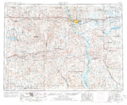
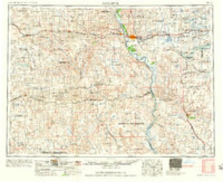
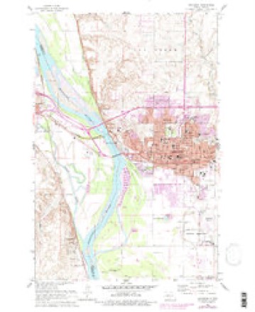
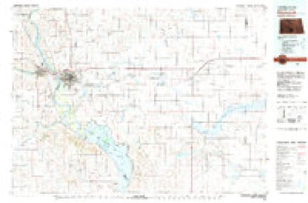
11 topographic sheets cover this place, the earliest surveyed in 1907 and the latest in 1979. It stands in Bismarck City. It lies in ZIP code area 58501. The Survey maps it on the Bismarck quadrangle. 73,622 people lived here at the 2020 count. It stands 1,686 feet above sea level.
Research this city
On record in Bismarck
Buildings and businesses the archive holds for this place. Each opens its own page, with the source record it came from.
On the National Register 12 of 28 shown
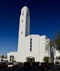 Bismarck Cathedral Area Historic Districtlisted 1980
 Bismarck Civic Auditoriumlisted 1976
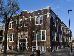 Bismarck Tribune Buildinglisted 1982
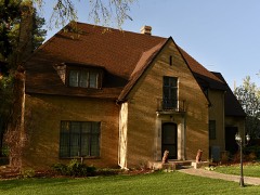 Dr. Albert M. and Evelyn M. Brandt Houselisted 2000
 Burleigh County Courthouselisted 1985
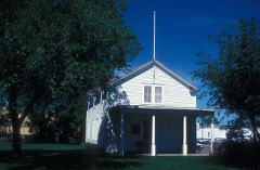 Camp Hancock Sitelisted 1972
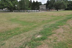 Chief Looking's Village site (32BL3)listed 1978
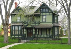 Former North Dakota Executive Mansionlisted 1975
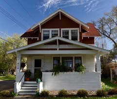 Fred and Gladys Grady Houselisted 2006
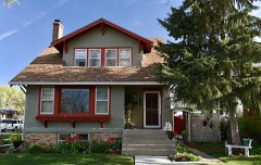 Oliver and Gertrude Lundquist Houselisted 2006
 Northern Pacific Railway Depotlisted 1977
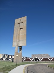 Our Lady of the Annunciation Chapel at Annunciation Priorylisted 2020
Population over time
3 figuresBismarck grew from 4,913 to 73,622 between 1910 and 2020. These are the recorded population figures Wikidata holds for this place, reached through the Geographic Names Information System number this page is keyed on rather than by name, so they belong to this place and not to another of the same name. Most are census counts, but not all are: an early figure may be a founding or settlement estimate, and an estimate published within five years of a census is left out. The change column is computed, and is left blank where more than 20 years separate a figure from the one before it, because a gap that long is not a change between two counts.
| Year | People | Change |
|---|---|---|
| 1910 | 4,913 | |
| 2010 | 61,272 | |
| 2020 | 73,622 | +12,350 (+20%) |
Topographic sheets covering this place
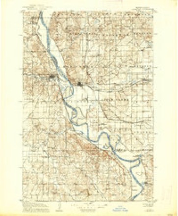
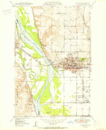
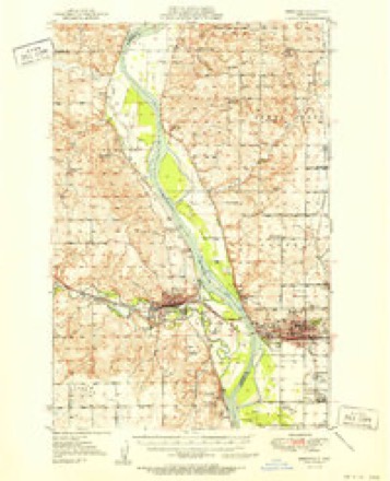
7 surveys from 11 printed sheetsMatched by testing this settlement's coordinate against the published boundary of every sheet in the United States Geological Survey's historical collection. Each opens the scanned sheet at the Survey.
- 1907 USGS Bismarck quadrangle1:125000, 2 printings
- 1950 USGS Bismarck quadrangle1:24000
- 1951 USGS Bismarck quadrangle1:62500
- 1954 USGS Bismarck quadrangle1:250000, 2 printings
- 1958 USGS Bismarck quadrangle1:250000
- 1962 USGS Bismarck quadrangle1:24000, 3 printings
- 1979 USGS Bismarck quadrangle1:100000
Fires near this place
48 since 2004Regional context, not property-specific evidence. The federal wildfire occurrence database lists 48 fires within 5 miles of Bismarck between 2004 and 2020, burning about 444 acres in total. 2 started naturally. 2 were recorded as arson. Distance is straight-line from the map coordinates, so a fire counted here may appear on a neighbouring settlement's page as well.
| Reported cause | Fires |
|---|---|
| Missing data/not specified/undetermined | 17 |
| Debris and open burning | 10 |
| Fireworks | 6 |
| Equipment and vehicle use | 3 |
| Smoking | 3 |
| Arson/incendiarism | 2 |
| Recreation and ceremony | 2 |
| Natural | 2 |
| Power generation/transmission/distribution | 2 |
| Misuse of fire by a minor | 1 |
The most recent of them, most recent first, with the day each was reported and the service that recorded it.
| Date | Cause | Size | Reported by | Name on the report |
|---|---|---|---|---|
| 6 September 2020 | Missing data/not specified/undetermined | 10 acres | North Dakota State Forest Service | CRESTWOOD FIRE |
| 21 September 2020 | Smoking | under an acre | North Dakota State Forest Service | RIVER RD |
| 16 September 2020 | Debris and open burning | 10 acres | North Dakota State Forest Service | HAMILTON |
| 7 August 2020 | Equipment and vehicle use | 5.0 acres | North Dakota State Forest Service | 57TH STREET FIRE |
| 13 August 2018 | Recreation and ceremony | 3.0 acres | North Dakota State Forest Service | APPLE CREEK FIRE |
| 12 August 2019 | Natural | 1.0 acres | North Dakota State Forest Service | DOLL BALE FIRE |
| 1 August 2020 | Missing data/not specified/undetermined | under an acre | North Dakota State Forest Service | 354 |
| 9 July 2017 | Missing data/not specified/undetermined | 2.0 acres | North Dakota State Forest Service | 66TH ST SE |
Settlements close enough to share some of these fires:
Mines and quarries near this place
7 within 5 milesRegional context, not property-specific evidence. The federal mineral resources record lists 7 workings within 5 miles of Bismarck: 6 producers, 1 past producer. 6 still produce. What was taken out: Sand and Gravel, Construction. Distance is straight-line from the map coordinates, so a quarry counted here may appear on a neighbouring settlement's page as well.
| Where | Site | Commodity | Status | Recorded |
|---|---|---|---|---|
| Airport Pit | Sand and Gravel, Construction | Producer | ||
| Bismarck State Pit | Sand and Gravel, Construction | Producer | ||
| Dakota Plant | Sand and Gravel, Construction | Producer | ||
| Dakota Plant | Sand and Gravel, Construction | Producer | ||
| Hot Plant Site Falconer | Sand and Gravel, Construction | Producer | ||
| Macdonald S. Pit & Plant | Sand and Gravel, Construction | Past Producer | ||
| Wetch Pit | Sand and Gravel, Construction | Producer |
Storms near this place
60 of 193 shownRegional context, not property-specific evidence. The National Weather Service names Bismarck in 193 storm reports between 1994 and 2025: 95 hail, 65 thunderstorm wind, 11 flash flood, 7 heavy rain. The reports record 1 death and 3 injuries. Each account below is quoted exactly as the forecast office filed it, from the NOAA Storm Events Database, and each date opens the federal record of that event.
| When | Event | Place named | Harm | What the report says |
|---|---|---|---|---|
| July 1996 | Heavy Rain | Bismarck | 1 killed | no account filed |
| November 2000 | Tornado (F1) | Bismarck | 2 hurt | Tornado touched down near highway 83 in north Bismarck and traveled in a west..northwest direction. Forty two homes sustained minor to moderate damage and injuring two people. |
| April 2003 | Wildfire | Bismarck | 1 hurt | no account filed |
| July 2005 | Hail | Bismarck | $93,000,000 | Nickel size to tennis ball size hail combined with 70 mph winds caused extensive and widespread damage in Bismarck. The larger hail fell on the north side of the city where most of the damage occurred. Numerous homes and vehicles damaged. There was damage to siding and roofs, and windows were broken. Property damage estimates were provided by the North Dakota Insurance Commissioner. |
| June 2016 | Hail | Bismarck | $50,000,000 | A severe thunderstorm struck northern portions of the city of Bismarck around 4:30 AM CDT. Large hail combined with strong wind gusts to cause substantial damage. The largest hail with a diameter of 3.25 inches fell near Legacy High School. Winds of 75 mph combined with large hail to cause a swath of substantial damage from along Divide Avenue in north Bismarck to approximately five miles north of the city of Bismarck. Siding, roofs, and windows were damaged on homes. Multiple car dealerships sustained hail damage, which included the largest dealership in the city. |
| July 2024 | Hail | Bismarck | $10,000,000 | A slow moving thunderstorm developed to the south of Mandan and rapidly strengthened as it moved into Burleigh County. The storm then gradually moved to the east-southeast passing over Lincoln. This storm caused extensive damage to developments to the south of Bismarck and throughout the Lincoln area. Most locations initially experienced hail ranging from one to two inches in diameter, but as the storm approached Lincoln hail increased to baseball size. In addition, one mile to the south of Lincoln a hailstone was measured at 4.5 inches in diameter. |
| August 2024 | Flash Flood | Bismarck | $8,000,000 | Torrential downpours with between two and five inches of rain moved through the Bismarck area as a very slow moving thunderstorm passed over. Storm sewer and drainage systems in the city were overwhelmed by the intense rain rates. Many downtown businesses took on water, resulting in damaged inventory along with business losses due to inaccessibility and time taken to recover. One of the primary medical centers in the downtown area had water pouring in from two side streets that damaged an MRI machine. The city of Bismarck government services also suffered significant damage. Many homes and apartment complexes sustained water damage, particularly in basements. |
| May 1996 | Thunderstorm Wind | Bismarck | $3,200,000 | no account filed |
| June 1999 | Thunderstorm Wind | Bismarck | $2,000,000 | Widespread damage to buildings, downed power lines, uprooted trees, street flooding and water damage to homes. |
| July 2022 | Hail | Bismarck | $1,200,000 | This was the first of two storms that produced severe hail over the Bismarck and Lincoln areas of Burleigh County. Initially, quarter to ping pong ball size hail fell just to the northwest of Bismarck, but hail size increased as the storm moved through the city. Many roofs and vehicles were damaged, along with recreational vehicles at dealerships. |
| May 2023 | Hail | Bismarck | $500,000 | A supercell thunderstorm over Mandan, Morton County, moved into Bismarck, Burleigh County. Initially, the storm continued to produce golf ball size hail near Bismarck State College, but hail size decreased to around one-inch in diameter as it moved through the city. Vehicles and homes were damaged, mainly on the western side of Bismarck. |
| July 2022 | Hail | Bismarck | $400,000 | This is the second of two storms that moved through the Bismarck and Lincoln areas. Additional damage to roofs and vehicles occurred with this storm. |
| August 2019 | Hail | Bismarck | $400,000 | A thunderstorm moved through Bismarck producing hail up to two inches in diameter, damaging many roofs and gutters. |
| August 2022 | Flash Flood | Bismarck | $250,000 | Flash flooding occurred primarily in and around the city of Bismarck. Vehicles were stranded in flood waters to the south of the North Dakota State Capitol Grounds, and in the 7th Street underpass. Storm sewers were overwhelmed, with manhole covers being pushed off and flood waters escaping. |
| June 2016 | Thunderstorm Wind | Bismarck | $250,000 | Multiple trees were reported down in the Hoge Island area north of Bismarck with this storm. This caused substantial damage to many homes. Boat damage also occurred. |
| July 2011 | Lightning | Bismarck | $190,000 | A lightning strike to a rural north Bismarck home caused a fire that destroyed the home several hours later. |
| June 2013 | Flash Flood | Bismarck | $90,000 | Torrential rain, an inch in ten minutes reported from south Bismarck, fell across Bismarck late in the evening of June 22nd. Numerous reports of flash flooding were received from across the city, including the intersection of Washington and Divide, 26th and Rosser, and at points along Bismarck Expressway including at Washington. These intersections had the worst flooding with up to a foot of water flowing across the road, over the curb, and in some cases into homes and businesses. Underpasses were flooded with several feet of water, and one road was closed due to fast flowing deep water. Vehicles were stalled at various locations in the city. |
| September 2023 | Thunderstorm Wind | Bismarck | $60,000 | Several tree branches, along with a few trees, were knocked down in and around the Bismarck area. Two vehicles were totaled as a tree fell on them at Skyway Park Village. |
| November 2000 | Tornado (F2) | Bismarck | $55,000 | Tornado touched down in a sparsely developed area in open country along highway 1804. The tornado skipped in a west..northwest direction. One home was heavily damaged. Several bales of hay were destroyed. The tornado crossed the Missouri River into Morton county. |
| July 2019 | Flash Flood | Bismarck | $50,000 | Heavy rain occurred in Bismarck, with up to two inches of rain falling in parts of the city in 30 minutes. Water was flowing over curbs in many locations, and in parts of south Bismarck buildings in lower lying areas took on water in their basements. Two feet of rushing water through some streets caused dangerous driving conditions. |
| July 2011 | Flash Flood | Bismarck | $50,000 | Multiple reports were received from across Bismarck of water up to 18 inches deep flowing over roads. Mainly the flash flooding was in low lying and poor drainage areas of the city. In some cases water washed up to the foundation of homes and into window wells. Rain amounts were around two inches. |
| June 2010 | Thunderstorm Wind | Bismarck | $50,000 | The Automated Surface Observing System site at the Bismarck airport recording strong thunderstorm winds up to 78 miles per hour for around one hour. Numerous tree damage was reported throughout and surrounding the city of Bismarck. |
| June 1994 | Thunderstorm Wind | Bismarck | $50,000 | no account filed |
| June 2013 | Thunderstorm Wind | Bismarck | $40,000 | The strong winds took the roof off of a partially built building. Debris from the roof damaged a parked car. |
| July 2011 | Thunderstorm Wind | Bismarck | $35,000 | The strong thunderstorm winds snapped off two four inch in diameter trees. An 8,000 pound fifth wheel camper was flipped over and destroyed. |
| July 2011 | Thunderstorm Wind | Bismarck | $35,000 | Winds were also estimated this high by law enforcement and Amateur Radio Operators. A trampoline was picked up by the strong winds and thrown into the side of a home in rural north Bismarck. Two 65 foot tall trees were snapped. Power flashes were occurring with the storm. |
| June 2013 | Thunderstorm Wind | Bismarck | $30,000 | Several trees up to fifty feet tall were uprooted along South Washington Street in Bismarck. |
| August 2024 | Flash Flood | Bismarck | $25,000 | Between 1.5 and 2.5 inches of rain fell. |
| August 2024 | Thunderstorm Wind | Bismarck | $20,000 | A large tree branch broke off a tree and damaged a house. |
| June 2016 | Thunderstorm Wind | Bismarck | $20,000 | A camper was severely damaged by the strong wind gusts. |
| June 2013 | Thunderstorm Wind | Bismarck | $20,000 | Several trees were damaged in the city of Bismarck. |
| March 2009 | Flash Flood | Bismarck | $20,000 | An ice jam on the Missouri River at Bismarck, and recent melting snow, caused a drainage canal to back up and overflow into south Bismarck. This occurred in the vicinity of University Drive and Wachter Avenue, and for several blocks around there. Damage was mostly confined to a mobile home park, which was lower in elevation than the surrounding terrain. The homes were elevated within the park and so damage was minimal. Bismarck city crews took action that resulted in the flood waters receding. |
| June 2009 | Thunderstorm Wind | Bismarck | $17,000 | A camper was blown over at a camp site eight miles north-northwest of Bismarck. |
| July 2011 | Thunderstorm Wind | Bismarck | $15,000 | Large tree branches were blown down. |
| July 1997 | Thunderstorm Wind | Bismarck | $10,000 | strong winds blew a 10" diameter branch down onto a Jeep. Power was also lost to 500 homes. |
| August 2011 | Flash Flood | Bismarck | $5,000 | Numerous roads were reported to have over one foot of water on them. |
| July 2009 | Thunderstorm Wind | Bismarck | $5,000 | Estimated severe thunderstorm winds of 60 mph damaged the soffits on a home. |
| June 1994 | Thunderstorm Wind | Bismarck | $5,000 | no account filed |
| June 2025 | Thunderstorm Wind | Bismarck | $2,000 | Large evergreen tree blown over. |
| June 2025 | Thunderstorm Wind | Bismarck | $2,000 | Large tree damaged. |
| August 1996 | Lightning | Bismarck | $2,000 | no account filed |
| June 2024 | Thunderstorm Wind | Bismarck | $1,000 | Large tree limbs were blown down. |
| July 2018 | Thunderstorm Wind | Bismarck | $1,000 | A medium size tree blew over. |
| June 2025 | Thunderstorm Wind | Bismarck | - | Tree limbs were blown down. |
| July 2024 | Hail | Bismarck | - | This hail report was from the third storm to pass over the Bismarck area. |
| June 2022 | Thunderstorm Wind | Bismarck | - | Thunderstorm wind gusts were estimated by a NWS Employee. |
| June 2018 | Thunderstorm Wind | Bismarck | - | The Broadcast Media estimated thunderstorm wind gusts of 75 mph. |
| June 2018 | Thunderstorm Wind | Bismarck | - | A fence was damaged and parts of an eight inch diameter tree broke off. |
| July 2015 | Thunderstorm Wind | Bismarck | - | The strong thunderstorm wind gusts were reported by a broadcast media partner. |
| June 2013 | Heavy Rain | Bismarck | - | Torrential rain of one inch fell in 10 minutes. See the flash flood entry from this date for this area. |
| June 2013 | Thunderstorm Wind | Bismarck | - | Very heavy rain and nickel size hail accompanied the strong winds. |
| August 2013 | Thunderstorm Wind | Bismarck | - | Quarter size hail accompanied the strong winds. |
| July 2013 | Thunderstorm Wind | Bismarck | - | Heavy rain accompanied the strong winds. |
| July 2013 | Thunderstorm Wind | Bismarck | - | Strong winds reduced visibilities to less than one mile along north Bismarck Expressway. |
| July 2013 | Hail | Bismarck | - | Public report of large hail. |
| June 2012 | Thunderstorm Wind | Bismarck | - | Severe winds were reported north of Bismarck. |
| June 2012 | Thunderstorm Wind | Bismarck | - | Strong winds were reported in the city of Bismarck. |
| July 2012 | Thunderstorm Wind | Bismarck | - | Estimated peak gusts. |
| July 2012 | Thunderstorm Wind | Bismarck | - | Estimated peak winds rural north Bismarck. |
| June 2012 | Thunderstorm Wind | Bismarck | - | Estimated severe thunderstorm winds were reported north of Bismarck. |
Nearest settlements
The eight closest, with where each one stands in the county. Distances are straight-line, computed from the Geographic Names Information System coordinates.
| Map | Place | Distance | Sheets |
|---|---|---|---|
| Holiday Park | 0.6 miles | 11 | |
| Parkview Estates | 0.9 miles | 11 | |
| Stardust Terrace | 0.9 miles | 11 | |
| Colonial Estates | 1.3 miles | 11 | |
| Tatley Meadows | 2.3 miles | 11 | |
| North Valley Park | 3.0 miles | 11 | |
| Hay Creek Court | 3.2 miles | 11 | |
| Mister Bs Estates | 3.2 miles | 11 |
Elsewhere
Matched on this settlement's Geographic Names Information System number rather than its name, so it cannot be a different place of the same name in another state.
| Wikipedia article on Bismarck | An encyclopaedic summary. Its text is share-alike, so it is linked here rather than copied. |
| Wikidata item Q37066 | The structured record the population and elevation above come from. Public domain (CC0). |
Provenance
This settlement is recorded in the Geographic Names Information System as feature 1035849. The sheet list is computed by point-in-boundary test against the United States Geological Survey's historical topographic inventory. Both are works of the United States government and carry no copyright under 17 U.S.C. 105.
Wildfire. Short, Karen C. 2022. Spatial wildfire occurrence data for the United States, 1992-2020 [FPA_FOD_20221014]. 6th Edition. Fort Collins, CO: Forest Service Research Data Archive. https://doi.org/10.2737/RDS-2013-0009.6 Collected with United States Government funding and usable without additional permissions or fees.
Mines and quarries. USGS Mineral Resources Data System (MRDS) https://mrdata.usgs.gov/mrds/ A work of the United States government, no copyright under 17 U.S.C. 105.
Storms. NOAA National Centers for Environmental Information, Storm Events Database https://www.ncei.noaa.gov/stormevents/ A work of the United States government, no copyright under 17 U.S.C. 105. Narratives are quoted verbatim from the National Weather Service report and are not edited or summarised.